Archiv - Nach Datum
Peakbookfreunde


Lieblingstouren
Lieblingsgipfel


Fitjakollen
- Datum:
- 18.08.2021
- Tourcharakter:
- Jogging
- Entfernung:
- 3,5km
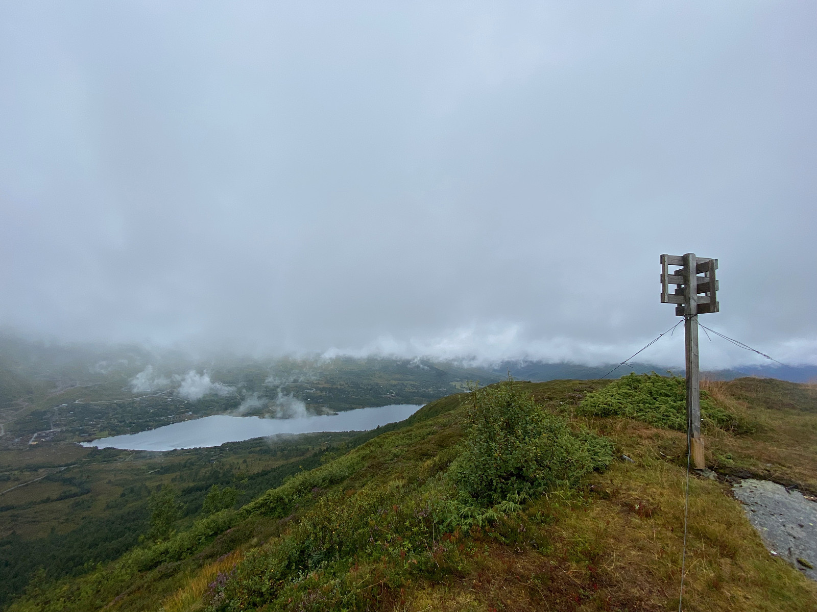 My 100th ascent in Norway.
Morning run at Fjellsætra to Fitjakollen. A bit rainy morning, wet and slippery trail. Easy to follow. Fortunately I just had the quick window for views before clouds came back blocking the view.
My 100th ascent in Norway.
Morning run at Fjellsætra to Fitjakollen. A bit rainy morning, wet and slippery trail. Easy to follow. Fortunately I just had the quick window for views before clouds came back blocking the view.
Saksa
- Datum:
- 16.08.2021
 Trip article in finnish and shortly in english.
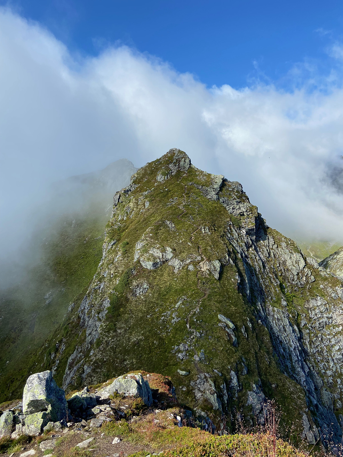
Amazing views in the middle of Sunnmøre alps. Pretty steep but well-marked route. I have no problem with heights as long as there is something to hold / lean against and it is not truly exposed or airy. Only the last section just before summit got me a bit umcomfortable for a moment when ascending, descending was way easier. Popular route, popular day.
Tätä haikkausta tai huiputusta olen kuolannut ja odottanut monta vuotta ja reissu kyllä täytti odotukset täysin.
Reitti on todella suosittu, joten alkupisteeseen on helppo löytää. Parkkitilaa runsaasti, pieni parkkimaksu VIPPSillä.
Reitti on merkattu punaiseksi ja idea on hyvin selvä; suoraan Saksan eteläisemmälle huipulle. Näin suomalaisin lasein reitin voisi merkata myös mustaksi, jos >>>
Trip article in finnish and shortly in english.
Amazing views in the middle of Sunnmøre alps. Pretty steep but well-marked route. I have no problem with heights as long as there is something to hold / lean against and it is not truly exposed or airy. Only the last section just before summit got me a bit umcomfortable for a moment when ascending, descending was way easier. Popular route, popular day.
Tätä haikkausta tai huiputusta olen kuolannut ja odottanut monta vuotta ja reissu kyllä täytti odotukset täysin.
Reitti on todella suosittu, joten alkupisteeseen on helppo löytää. Parkkitilaa runsaasti, pieni parkkimaksu VIPPSillä.
Reitti on merkattu punaiseksi ja idea on hyvin selvä; suoraan Saksan eteläisemmälle huipulle. Näin suomalaisin lasein reitin voisi merkata myös mustaksi, jos >>>
Skåla Opp 2021
- Datum:
- 14.08.2021
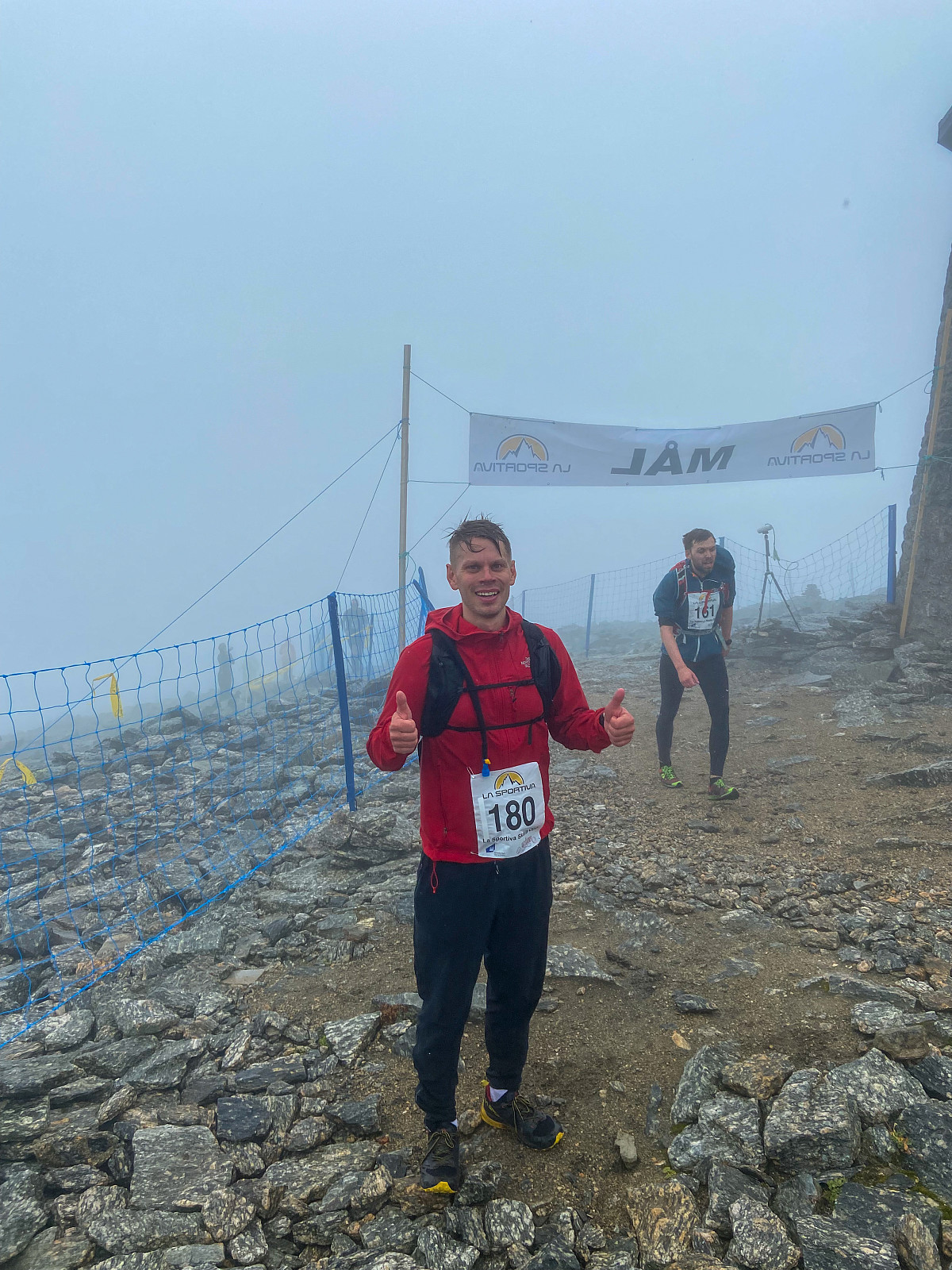 Skåla Opp 2021
Plus 14 and a bit rainy at the start and lower temperatures and possible sleet/snow at the top. My biggest dilemma was clothing. Two years ago it was a bit warmer down at the start but really cold and windy at the top. This time I decided to skip shorts and run with pants & light jacket. And man oh my I was sweating the first 30mins. It was like hell and I felt pretty exhausted already at the bridge over the river (650m). Then in the more open landscape wind started to blow a bit more and it felt silghtly better. When passing Skålavatnet I was still pretty sure I couldn't beat my own record (1:53). After the steep part from Skaret I noticed surprisingly that I was ahead of my own record. I finished with 1:48, beating my personal record by 5mins. Really, really satisfied.
Skåla Opp 2021
Plus 14 and a bit rainy at the start and lower temperatures and possible sleet/snow at the top. My biggest dilemma was clothing. Two years ago it was a bit warmer down at the start but really cold and windy at the top. This time I decided to skip shorts and run with pants & light jacket. And man oh my I was sweating the first 30mins. It was like hell and I felt pretty exhausted already at the bridge over the river (650m). Then in the more open landscape wind started to blow a bit more and it felt silghtly better. When passing Skålavatnet I was still pretty sure I couldn't beat my own record (1:53). After the steep part from Skaret I noticed surprisingly that I was ahead of my own record. I finished with 1:48, beating my personal record by 5mins. Really, really satisfied.
Gulkoppen / 1st day in Norway 2021
- Datum:
- 12.08.2021
 Trip article (shortly) in english & finnish
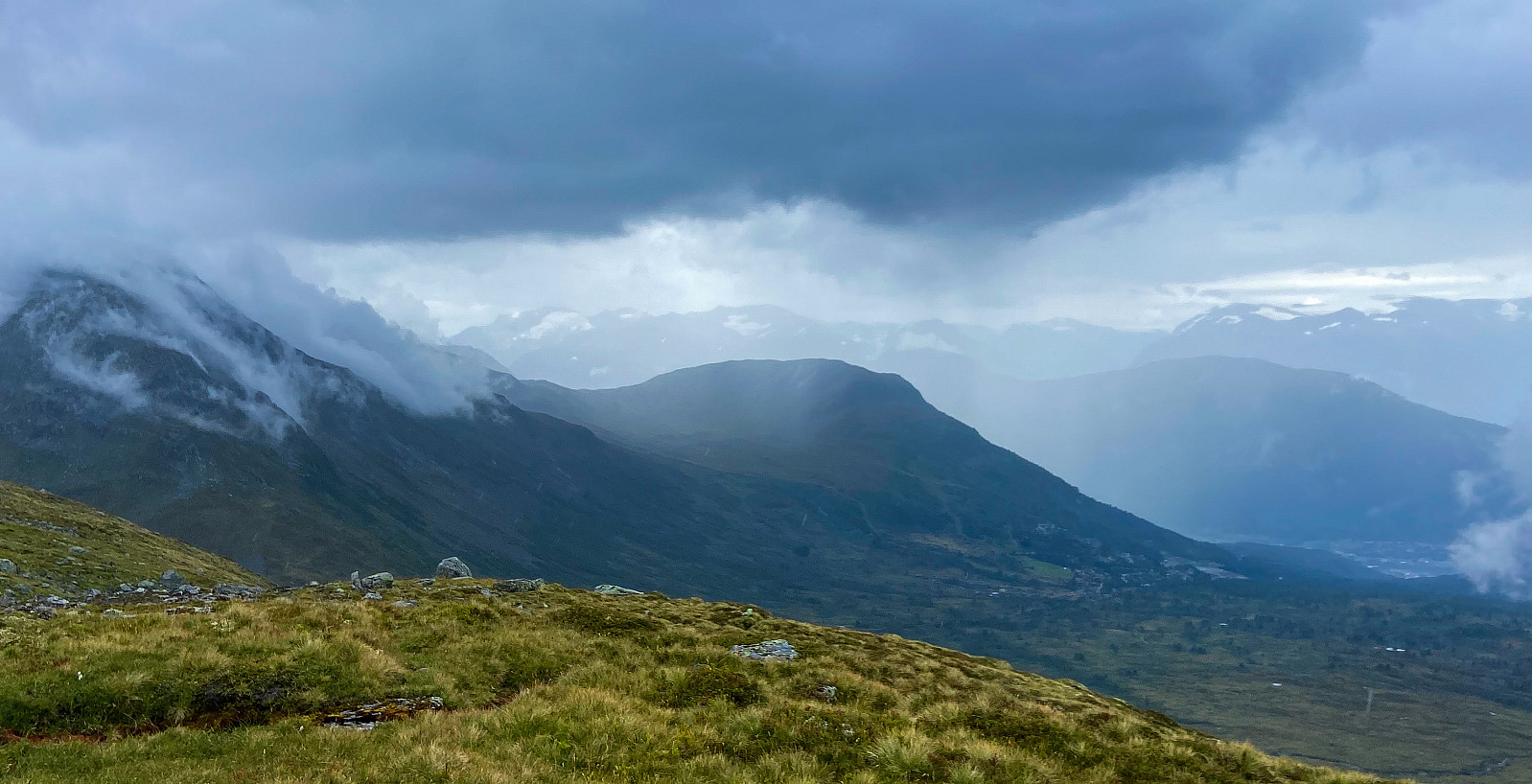
First hike of my annual 2-week summer trip to Norway. Gulkoppen offers good views towards Hornindal & Hornindalsvatnet, Stryn and the skisenter valley. Route is marked as red, but nothing too hard or steep. Path goes sometimes a bit straight up, sometimes easier with hairpins. Long-ish trip with almost 1000m vertical gain.
Ensimmäinen haikkaus kesän 2021 Norjareissulla. Gulkoppen valikoitui kohteeksi sijainnin perusteella (lähellä Strynin keskustaa) sekä potentiaalisten maisemien vuoksi (Hornindalin & Hornindalsvatnetin suuntaan). Ei liian rankkaa, koska itsellä kahden päivän päästä rankka Skåla Opp -kisa.
Reitille pääsee hyvin yksinkertaisesti autolla Strynin keskustasta ajamalla (talvi) laskettelukeskukseen ja seuraamalla >>>
Trip article (shortly) in english & finnish
First hike of my annual 2-week summer trip to Norway. Gulkoppen offers good views towards Hornindal & Hornindalsvatnet, Stryn and the skisenter valley. Route is marked as red, but nothing too hard or steep. Path goes sometimes a bit straight up, sometimes easier with hairpins. Long-ish trip with almost 1000m vertical gain.
Ensimmäinen haikkaus kesän 2021 Norjareissulla. Gulkoppen valikoitui kohteeksi sijainnin perusteella (lähellä Strynin keskustaa) sekä potentiaalisten maisemien vuoksi (Hornindalin & Hornindalsvatnetin suuntaan). Ei liian rankkaa, koska itsellä kahden päivän päästä rankka Skåla Opp -kisa.
Reitille pääsee hyvin yksinkertaisesti autolla Strynin keskustasta ajamalla (talvi) laskettelukeskukseen ja seuraamalla >>>

