
Sørtinden & Brosmetinden (07.10.2012)


Skrevet av hmsv1 (Hannah Vickers)
| Startsted | Gløshaugen |
|---|---|
| Turtype | Fjelltur |
| Turlengde | 3t 30min |
| Kart |
|
| Bestigninger | Brosmortinden (525moh) | 07.10.2012 |
|---|---|---|
| Sørtinden (724moh) | 07.10.2012 |

A somewhat impulsive trip today. Yr.no had forecasted some pretty nice weather for the daytime, and I already had my rucksack and lunch packed and ready to go the night before. But when I woke up on this sunday morning, all I saw outside was grey skies and absolutely no indication of sunshine whatsoever. Slightly disappointed by the weather, I had almost changed my mind and decided to use my time to do something else instead of hiking. But then, while I was eating lunch at home, I spotted a small, but significant patch of blue sky amongst the cloud, and through the course of only 15 minutes, it had soon increased in size and spread over the whole of Tromsøya. Suddenly the thoughts of giving up on a trip had gone and I was in a very excited mood for getting into the car as soon as possible and back out into the hills. The only problem was that I was starting a bit later than I had originally planned, so the trip would also have to be shorter if I was going to get up and down a hill before the darkness set in at around 6pm. So, the destination for today was Sørtinden; a hill which I'd seen on other trips to Skamtinden and Storstolpan, and the most southerly of a chain of three peaks at the edge of Sessøyfjorden on Kvaløya. This little corner of Kvaløya is exceptionally beautiful, and even though it is a relatively long drive on not-so-well-surfaced roads, it is I think, worth the extra effort especially when it is an afternoon trip with lots of sunshine!
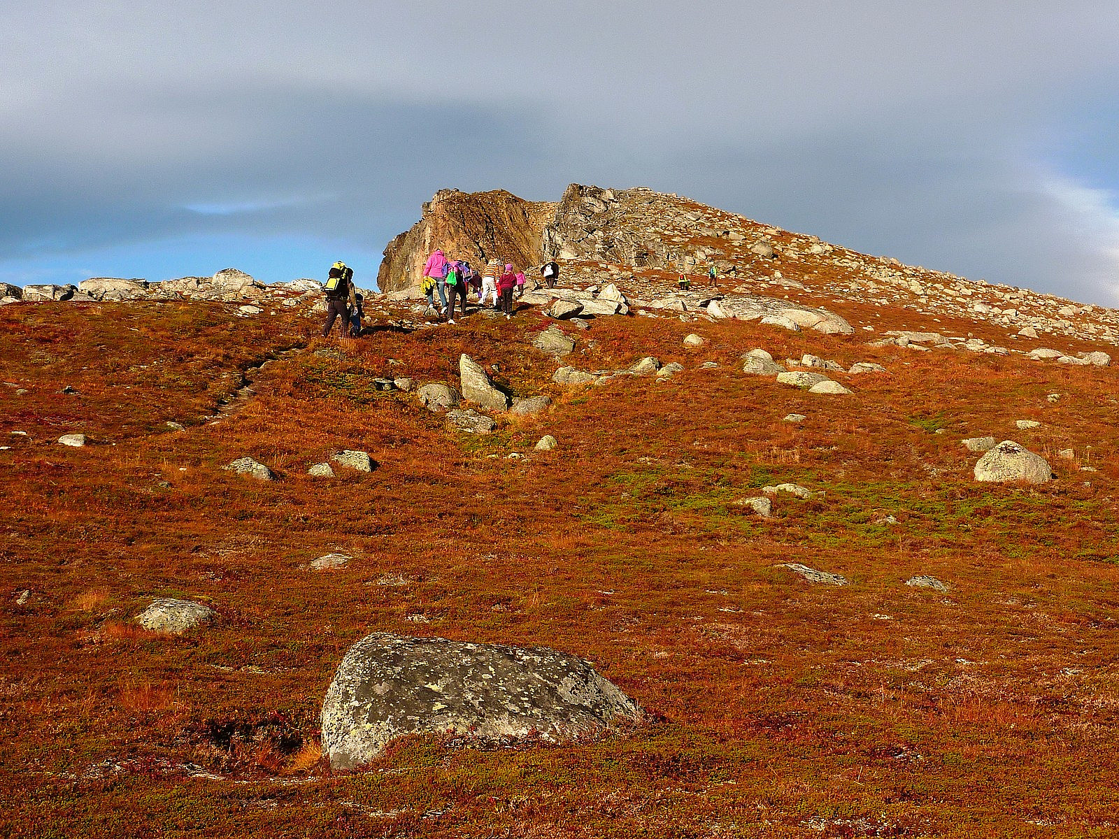
Actually, I was quite pleasantly surprised on the journey over to Tromvik, because some sections of the road around Grøtfjorden had had some very good resurfacing work done to it since my last visit here only a few weeks earlier, so it was no longer the pot-holed bumpy drive which I (and mostly my car) usually dread. After reaching Tromvik, it was a slightly less nice drive up the gravel toad to the parking space at the top of the pass between Tromvik and Rekvik, but nevertheless not too long to endure. By the time I reached the car park it was already after 13.30, and from the number of cars already parked up it was clear that I would not be alone in the hills today! Right beside the car park was an obvious, well trodden footpath leading all the way up to Brosmetinden, and instead of heading straight over to Sørtinden, I decided I would make use of such a good quality path, and take a detour over Brosmetinden to make the route ever so slightly longer. This was definitely a lett tur today though, probably the easiest of the year so far - the distance was only 5.5km and probably only 600m of height to climb in total! Despite being easy going, the views were fantastic, and I actually quite enjoyed being in the company of several groups of families who were taking only the trip to Brosmetinden with their young kids. I can't remember the last time I have seen so many people on one hill!
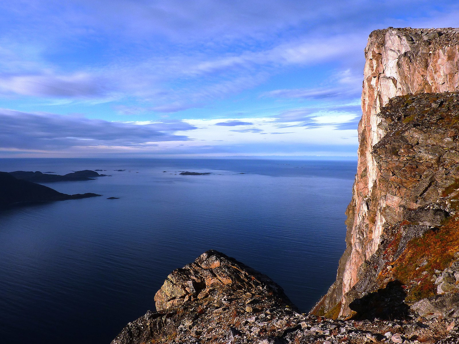
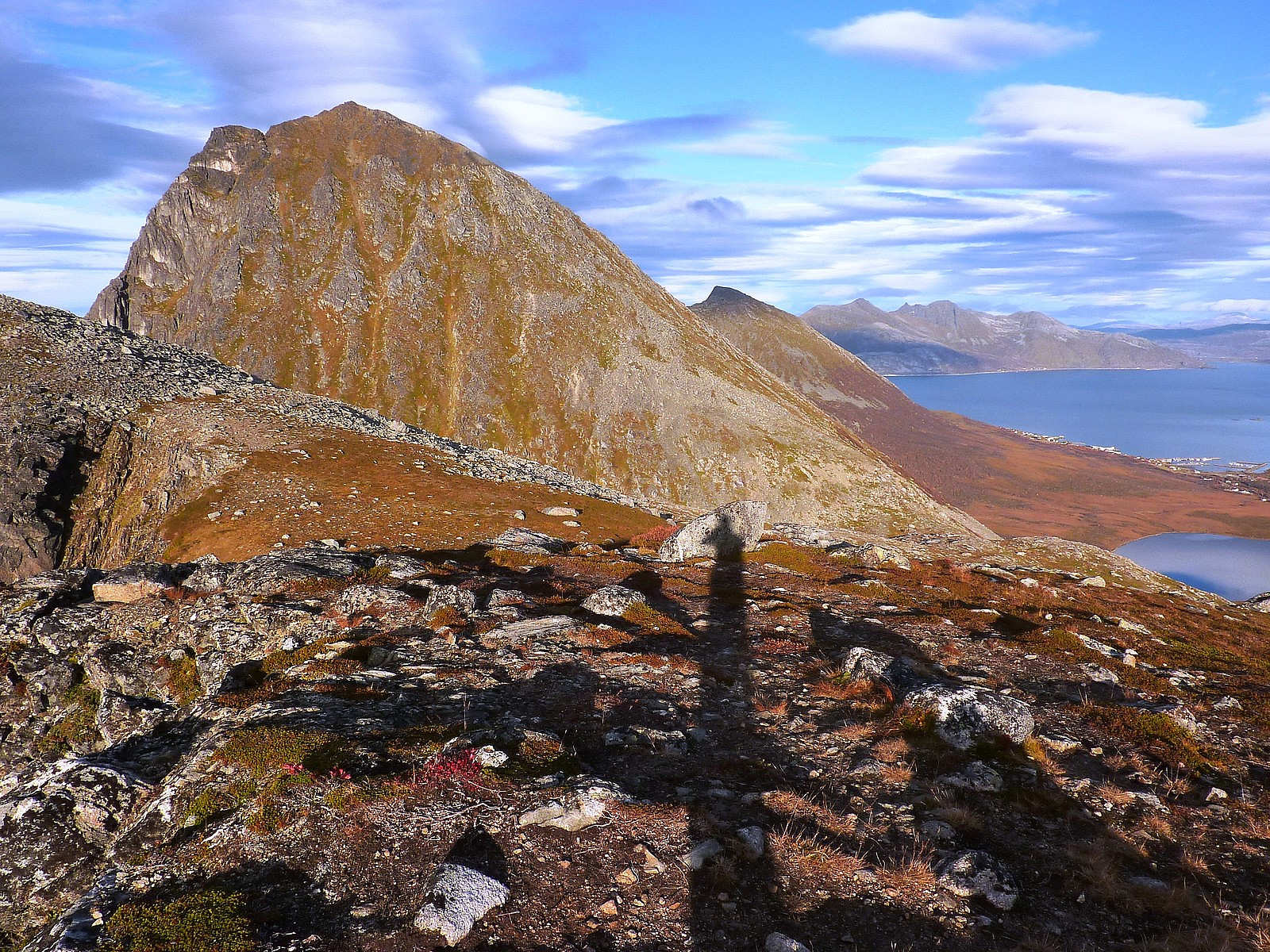
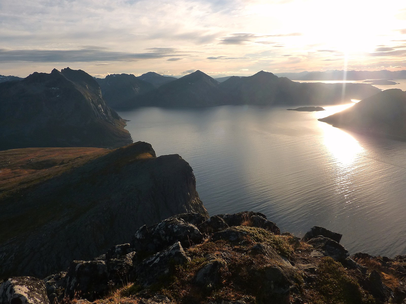
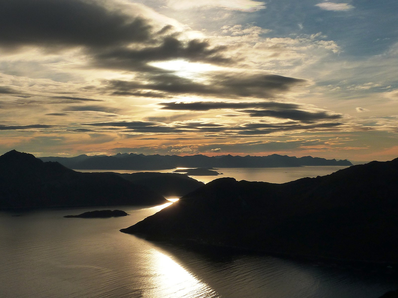
The beauty of this route too, is that it follows very close to the fjord-side of the mountain, so for the whole route up to Brosmetinden, you have a great view out across the fjord to Sessøya and Senja further to the south. I love being so close to the mountains and the fjords at the same time - it's something that can really only be appreciated in only a few places in the world! With the sun beaming down as well it was very warm, and for the first time in a while, I could enjoy walking only with a vest top on again without feeling too hot. From Brosmetinden, Sørtinden does seem a little daunting, and looks very steep for just a hike. But I actually found it was not nearly as steep as it appeared. The ascent up it's southern slopes is surprisingly easy to walk up, being a mixture of stable boulders and vegetation. You can pretty much pick and choose which part to walk on. In comparison to some hills, the gradient was quite steep and required a bit of lung power, but had the advantage that the height was gained quickly. In less than 1.5 hours since leaving the car, I was on top of Sørtinden with really amazing 360-degree views to marvel at. At that point I was feeling very satisfied that I'd not stayed at home - it would have been a very bad use of a very beautiful afternoon!
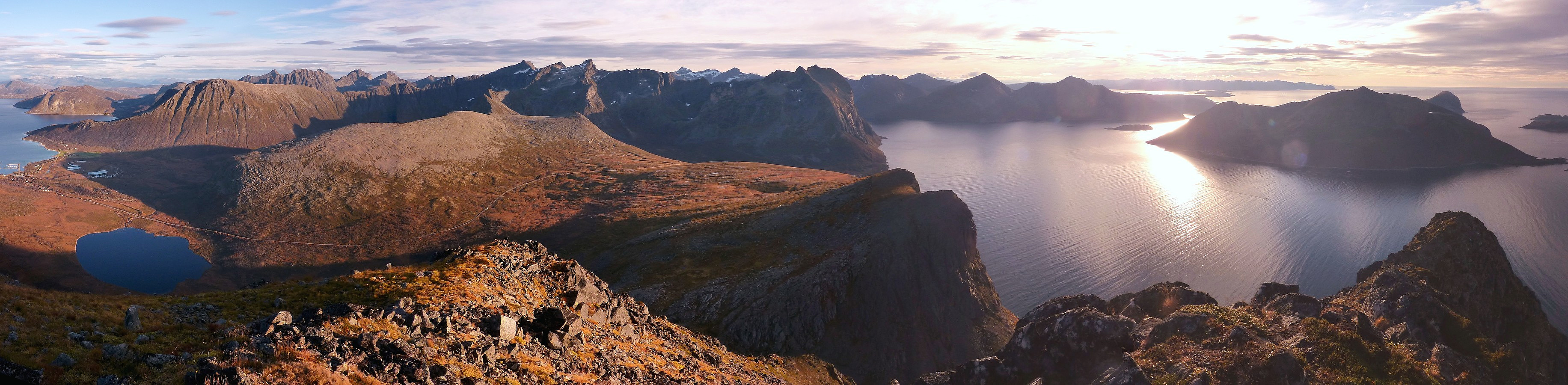
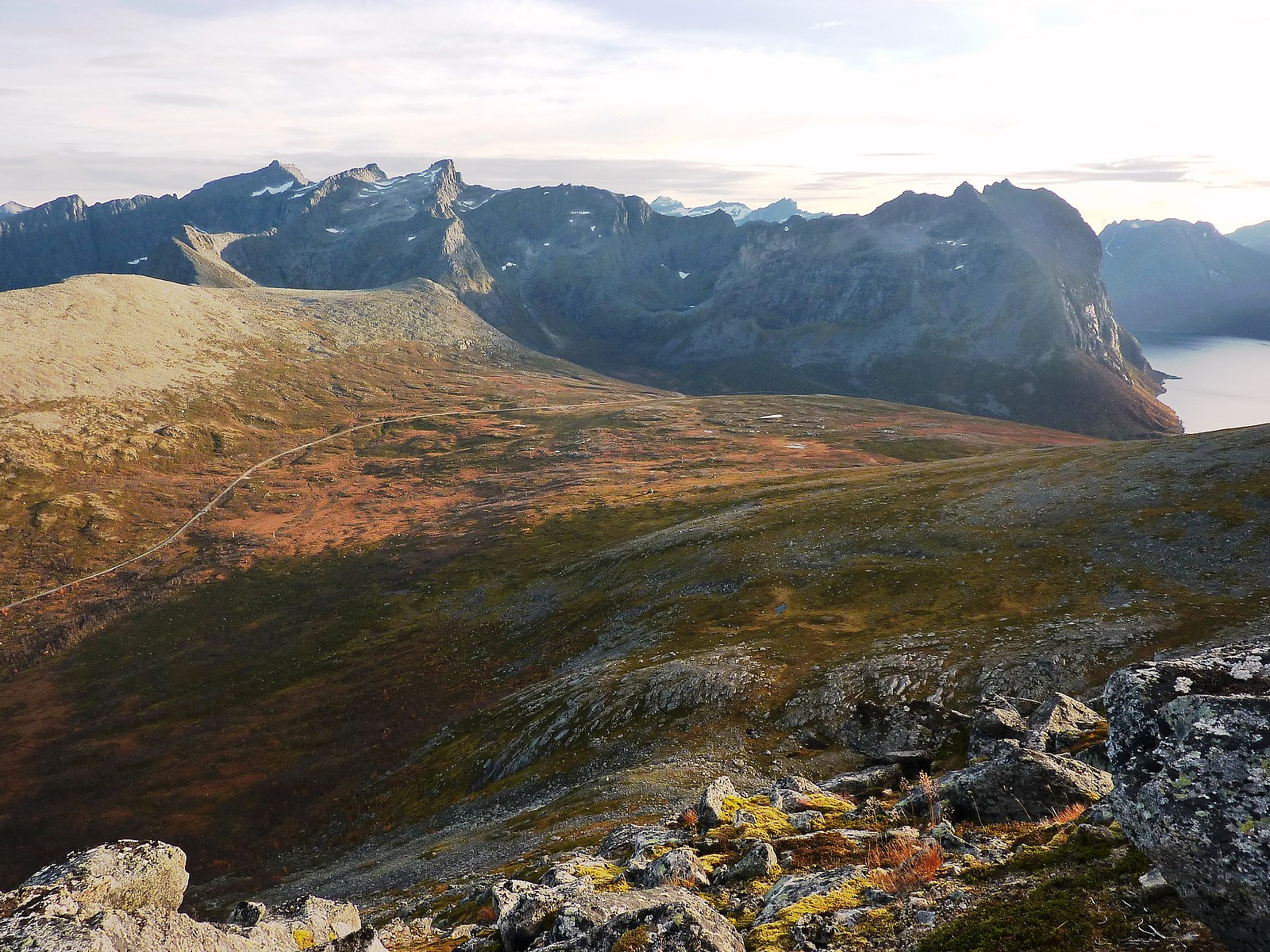
Needless to say, I think this panorama sums up the highlight of this short but very sweet trip. Next time I will come back and try to do a longer route which traverses all three peaks from Tromtinden in the north and over to Sørtinden, but that will probably require a little more thought on the choice of route and which ridge lines to follow. I used the best part of half an hour for sitting and standing on the top, before heading straight back down again, but this time not going back over Brosmetinden. The ground was not too marshy to walk across, so it wasn't important to get onto a marked footpath again. And the big bonus of this trip was that there absolutely no forests to bash my way through. It was uninterrupted views for the whole time! Admittedly this trip was on the short side of being a top quality hike, but simply for the views, the gorgeous weather and pleasant paths to follow I'm rating it high :-)


Kommentarer