
Uranostind (16.07.2025)


| Startsted | Koldedalsvatnet (1200moh) |
|---|---|
| Sluttsted | Koldedalsvatnet (1200moh) |
| Turtype | Bretur |
| Turlengde | 6t 00min |
| Distanse | 17,0km |
| Høydemeter | 1100m |
| GPS |
|
| Bestigninger | Uranostinden (2157moh) | 16.07.2025 |
|---|
Coming from the U.K., neither Alice nor I have experience traversing glaciers. Given the two of us want to explore more of Norway, we decided to book a guide across one: so why not use this as an opportunity to climb one of Jotunheimen's most iconic peaks!
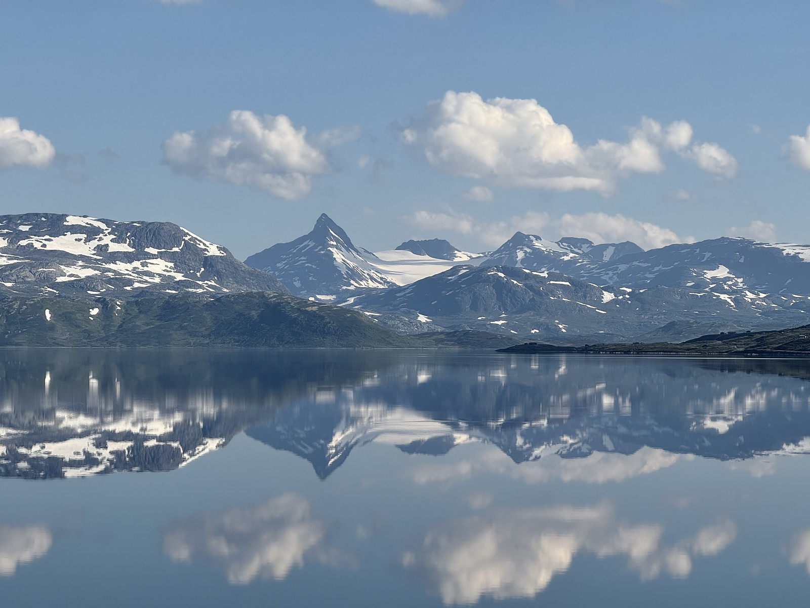
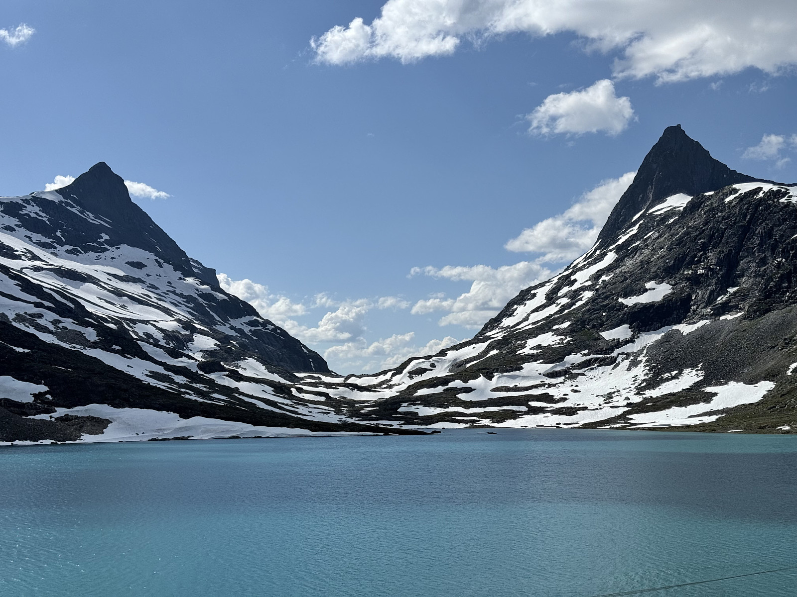
We woke near Otrovatnet and took the scenic drive along Tyin towards Tyinholmen Høyfjellsstuer, where we were scheduled to meet with our guide. The sky was clear, wind was light and Uranostind was glimmering, mirrored on the lake.
We met our guide, acquired our helmet, harness and ice axe and were introduced to a lovely Norwegian couple with whom we'd be sharing this tour. Alice gauged that they looked fit and active- a relief as we worried about how slow-going it could be in a guided group. Returning to our car, the guide escorted us down the gnarly road that lead to Koldedalsvatnet. Since we'd be traversing a glacier, we'd decided to ditch our usual trail runners and wear our B2 mountain boots for this outing. Prior to this, we'd only used the mountain boots for snowshoeing the hills around Tromsø, preferring the ankle mobility and speed that came with trail runners.
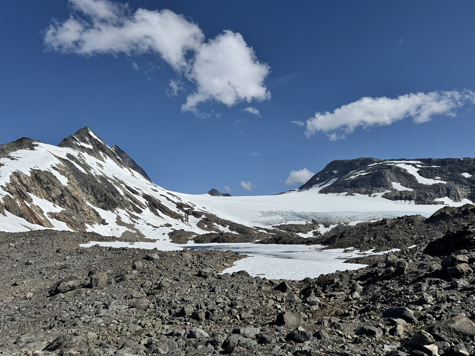
We began 5km or so hike to the glacier. The pace was certainly slower than what we'd become accustomed to, but served as a comfortable means to talk to our guide and the other couple in our group. The surrounding mountains appeared as though their received significantly more snowfall in the winter than compared to where we'd spent the previous few weeks. Many lakes were still partially frozen, patches of snow large and there were excellent views across to Falketind. I probed the guide with questions about guided routes that might equip us with some roped climbing experience and quickly deduced that a guided trip up Pionerruta to Falketind was a suitable trip for next time. We hydrated ourselves with fresh Jotunheimen water, tip-toed across a icy lake and soon arrived at the glacier's edge.
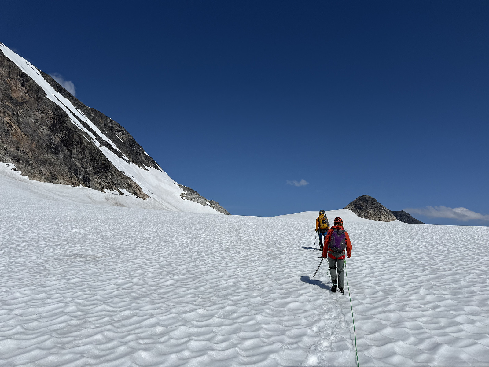
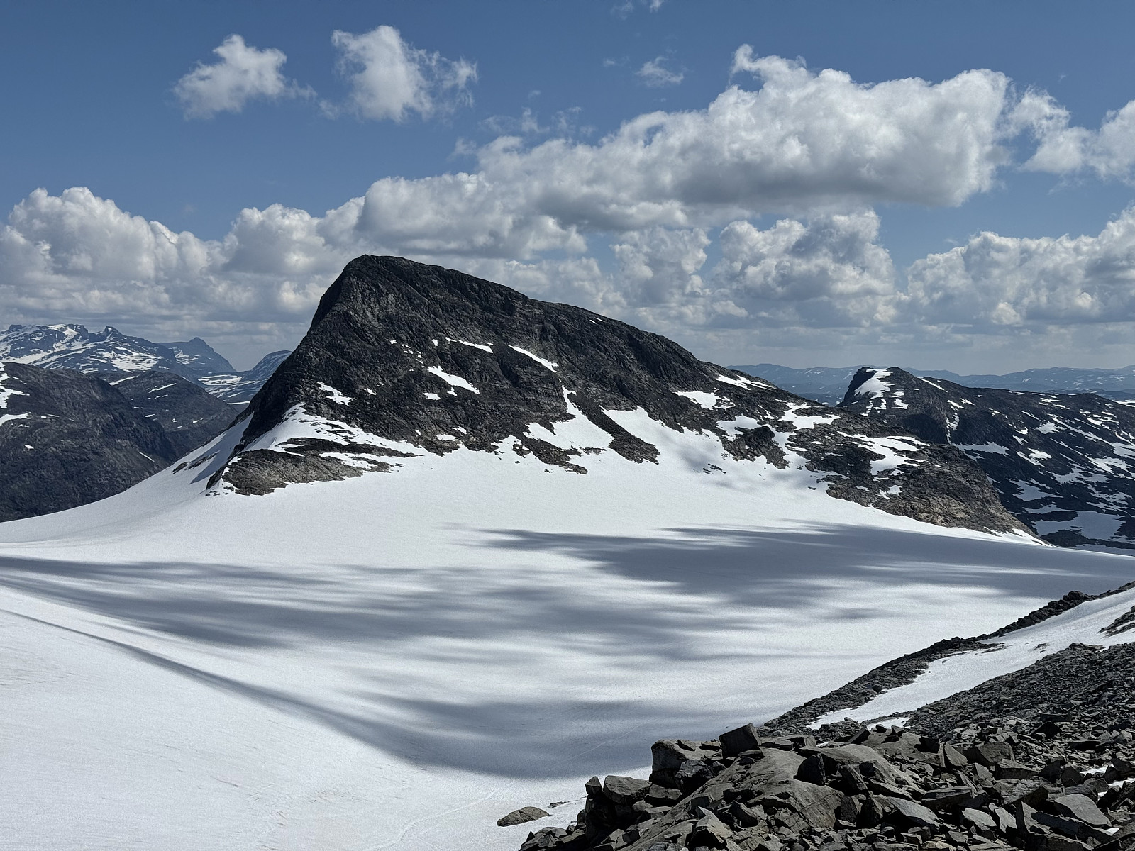
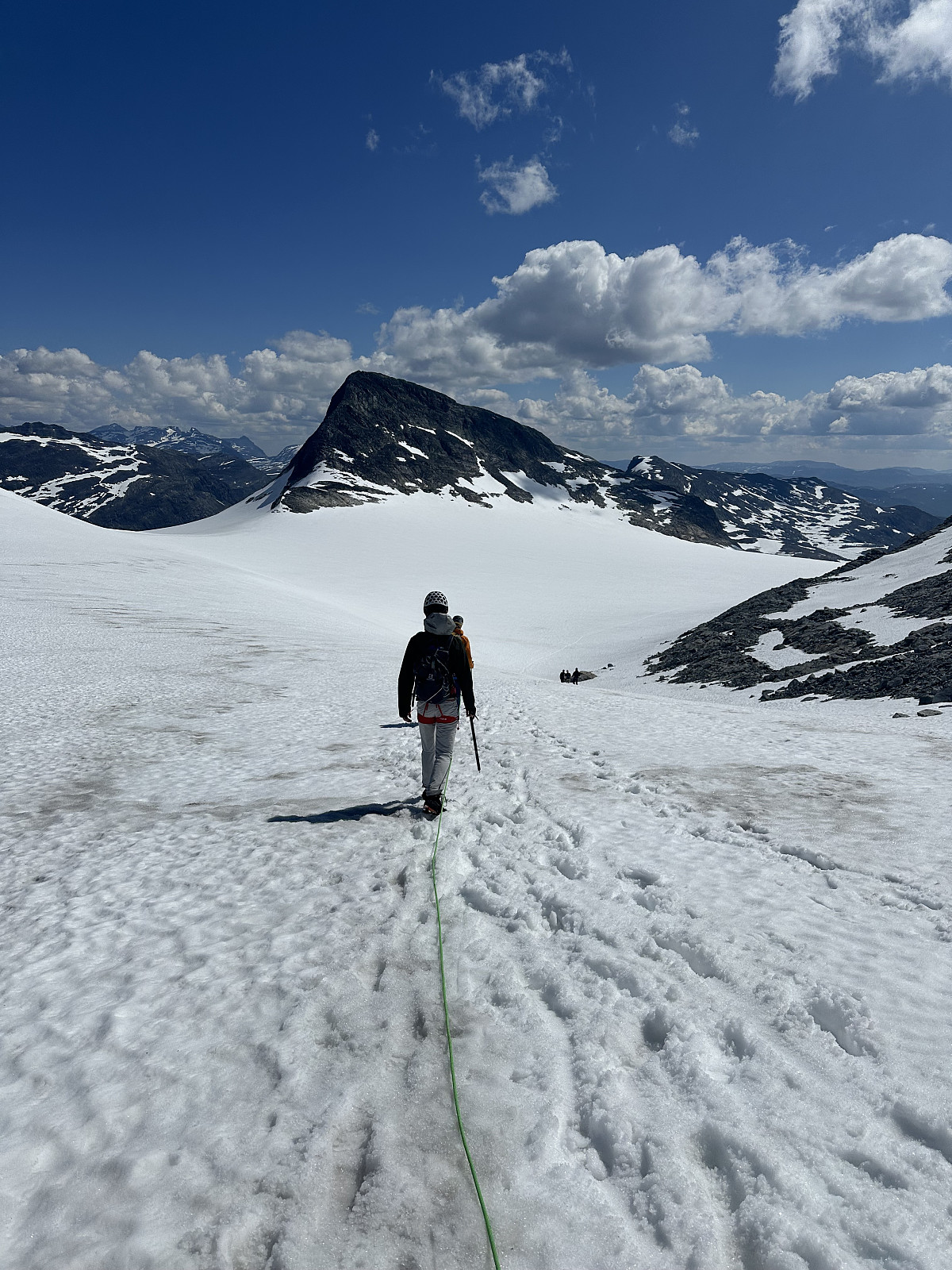
Helmet on, harness on, roped in line and ice-axe at the ready, we stepped onto Uranosbreen and steadily plodded north and upwards. The glacier was still mostly covered in snow, meaning crevasses were not so visible: our guide had told us that the snow bridges across them were still very strong, but this does not negate the importance of glacial safety. Alice remarked how interesting it would be to see the glacier snow-free. We hiked 2km along the glacier, walking parallel to the Uranostind, looking up towards the climbers making the traverse. As we approached the col north of Uranostinden we even spotted a group of reindeer on the ice.
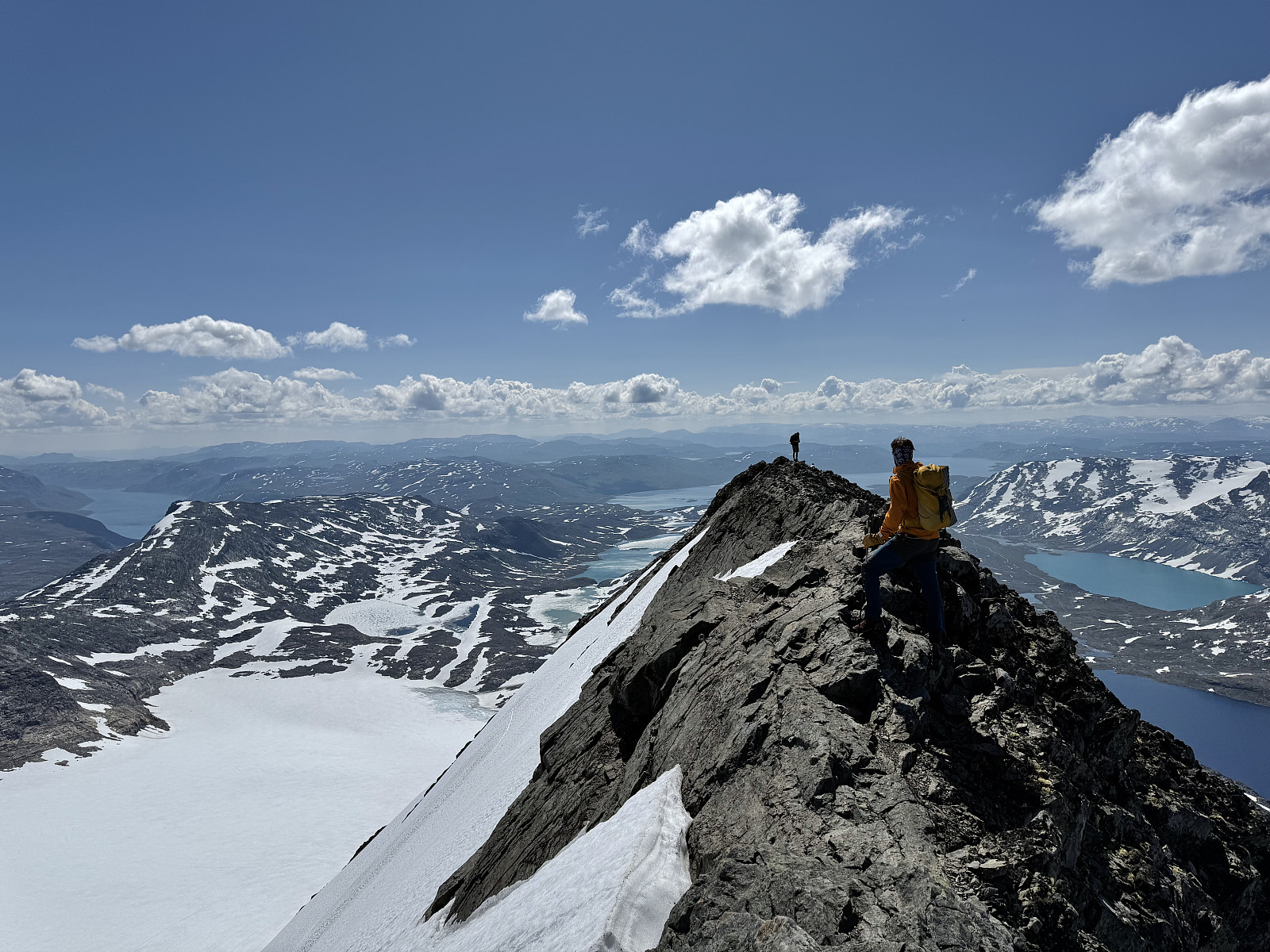
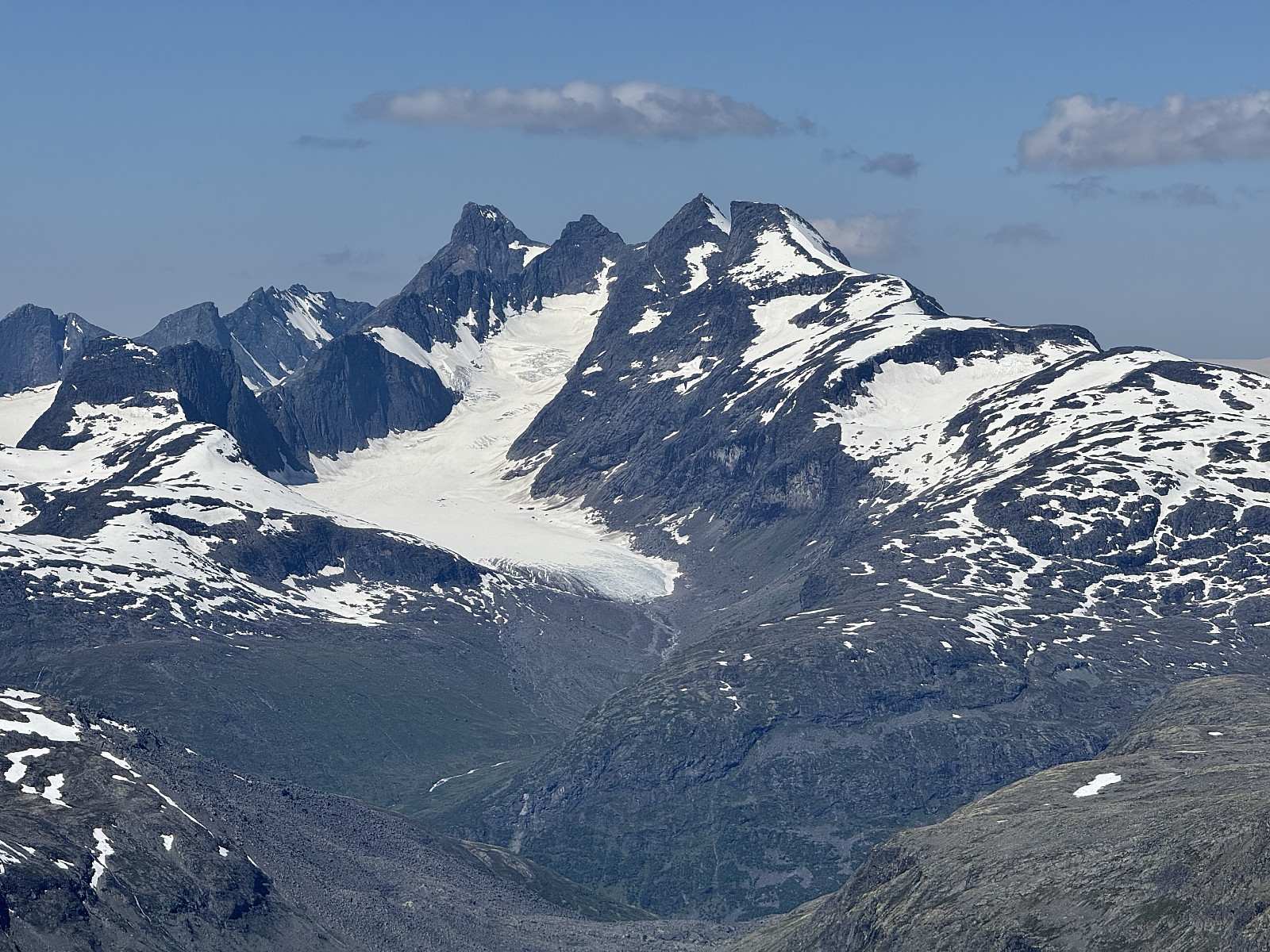
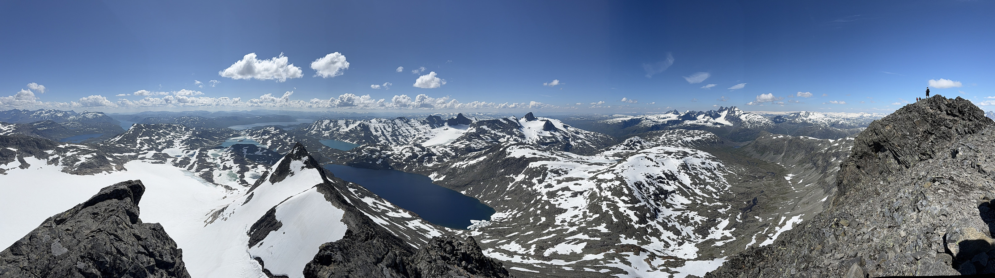
Off the glacier, we departed with our equipment and hiked up the north edge. This was straightforward and we quickly reached the summit ridge. We were told the last 50m were exposed, and the other couple on the trip decided to stay behind as we followed behind the guide to the true summit. This section is certainly airy and narrow with steep drops on both sides, but it is also very, very short and non-technical (for British context, think Sharp Edge on Blencathra). We arrived at the summit to panoramic views: you can see the Hurrungane and its alpine peaks, Jostedalsbreen and Lodalskåpa, and our guide pointed out Galdhøpiggen! The summit was also a busy place with groups arriving from the exciting south ridge...
We returned to the other couple and ate our lunch, admiring the stunning vista. Our feet complained on the descent, feeling constrained in their stiff boots. The others in our group wore B0 boots as the snow negated any need for crampons. We crossed the glacier again before retracing our way down the trail back towards the car. Our guide recommended a nice, accessible yet exciting peak for us to try in the Hurrungane. An exciting adventure on new terrain.


Kommentarer