
Kattanakken (13.07.2025)


| Startpunkt | Birksdalen (180m) |
|---|---|
| Endpunkt | Birksdalen (180m) |
| Tourcharakter | Bergtour |
| Tourlänge | 6h 00min |
| Entfernung | 15,0km |
| Höhenmeter | 1.400m |
| GPS |
|
| Besteigungen | Kattanakken (1.445m) | 13.07.2025 |
|---|
Since we first visited the region last September, Alice and I have felt a sense of awe around the Jostedalsbreen glacier. Back then we had hiked to Flatbrehytta and had looked down upon the cascading Flatbreen glacier, where we had spent at least two hours admiring its frightening beauty; even watching from afar as a large chunk crumbled down the icefall. We'd fancied getting close to Jostedalsbreen again, and bookmarked Kattanakken for our next visit.
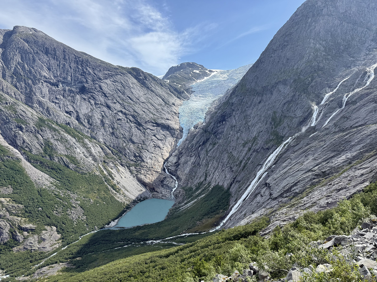
We had arrived in Stryn the evening before and were set to enjoy two full days in the area. A heatwave had arrived, bringing daytime highs to the high-twenties in the valley- quite a contrast to where we were heading. Setting off from the huge carpark in Briksdalen, we skirted around the many tourists taking the short walk/buggy ride(!?) up to view Briksdalsbreen. A large British cruise ship had docked in Olden and we amused about hearing the many anglophones. Despite its place on the tourist circuit, Briksdalsbreen and the trails leading towards it tell a potent story about the last ice age and the changing climate since. You can read about the 'Little Ice Age' a few hundred years ago, tracking the moraines as they distend into the valley, then rapidly retreating more recently.
After a few km we left the other Brits behind and began the steep path up towards Kattanakken. Almost immediately we were treated to fantastic views of Briksdalsbreen but minus the heaves tourists. The trail is very steep but well-marked, but fortunately some hazy cloud had blocked the sun and reduced my rate of perspiration. After about 700m of climbing, the path turns and the 'cat's neck' is reached.
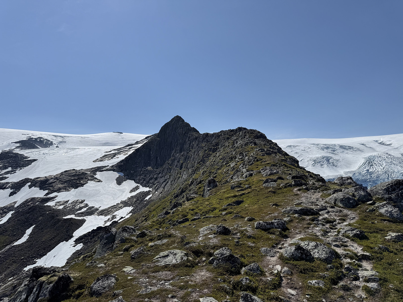
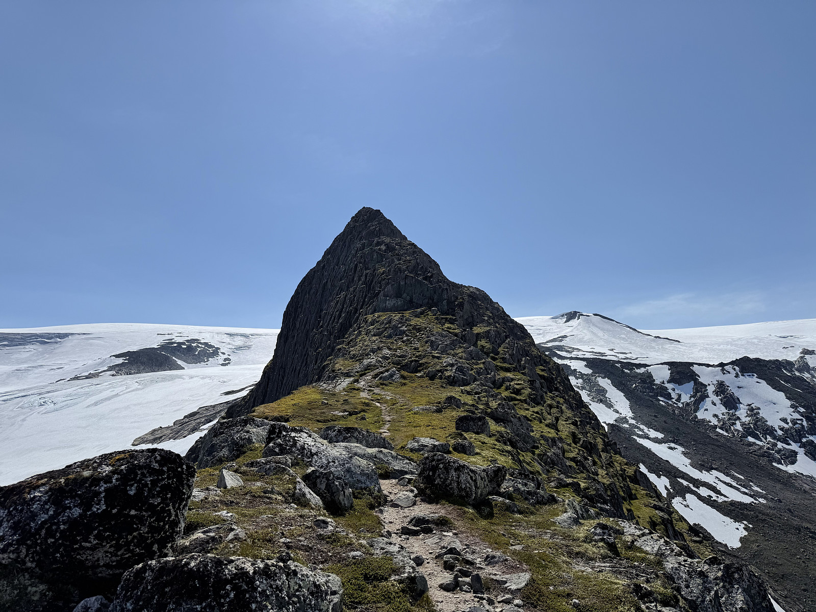
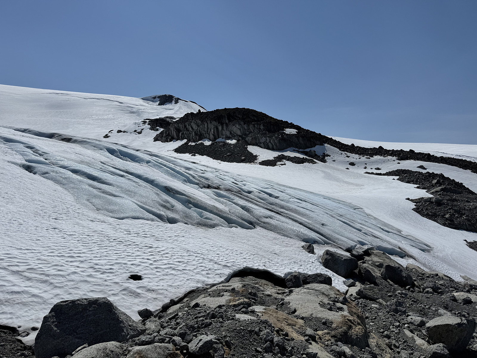
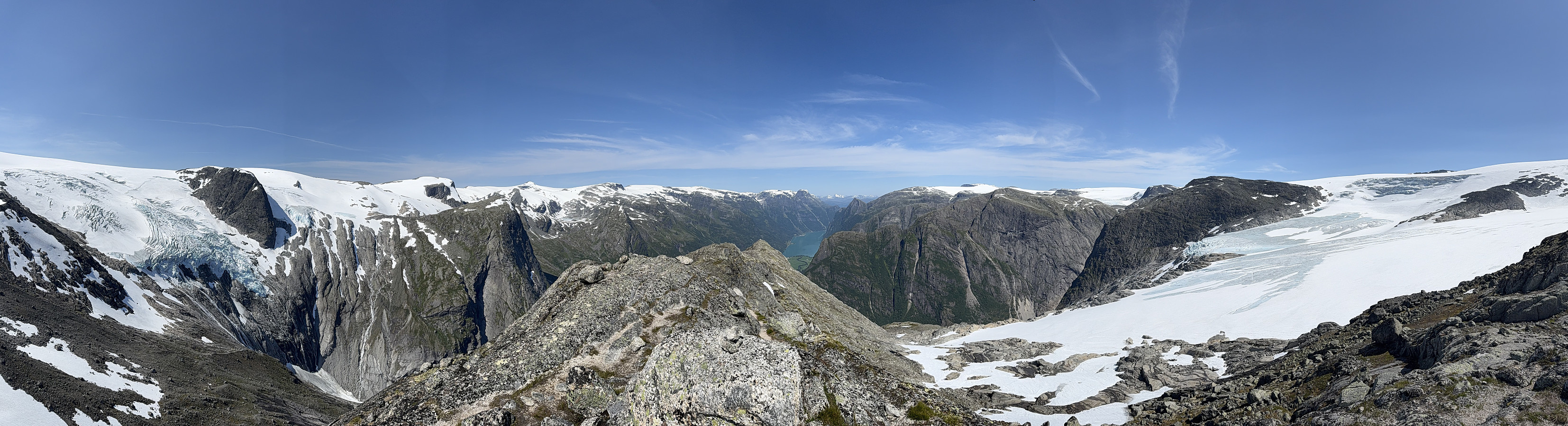
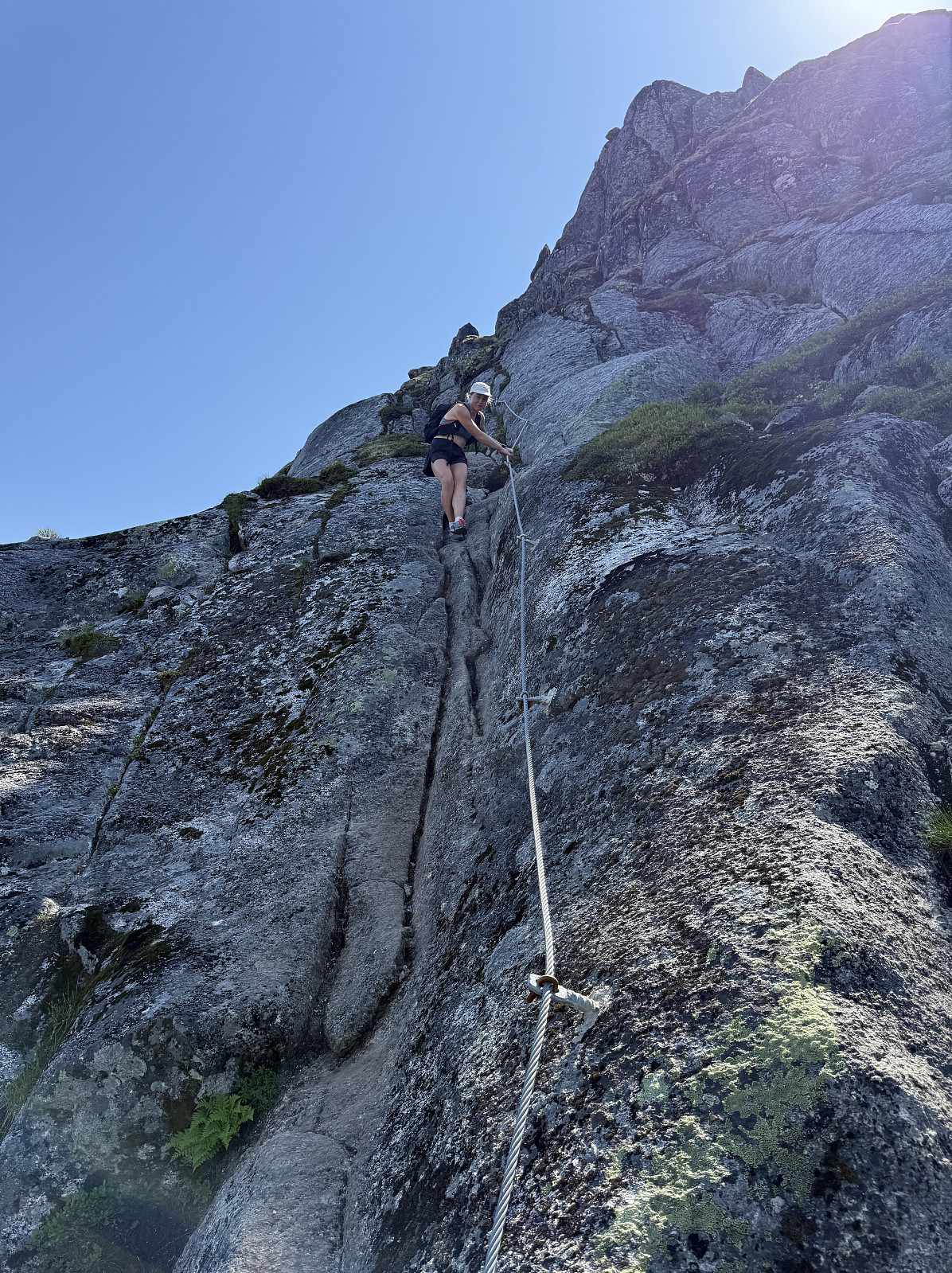
Once on the ridge, the trail alternates between steep hiking and easy scrambles. One or two cables have even been installed for support. I had read about the 'crux' of the route being a scramble onto a small ledge, and that this would be difficult with a large bag, though I can report that this is now chained as well, reducing any difficulty. It is an exciting climb, as each step brings you closer to the colossal sheet of ice and the glacial arms that surround you come into view. Behind (to the north) is a rather charming view down to Oldevatnet. Eventually a letterbox is reached, although not the true summit, this serves as a rather nice viewpoint.
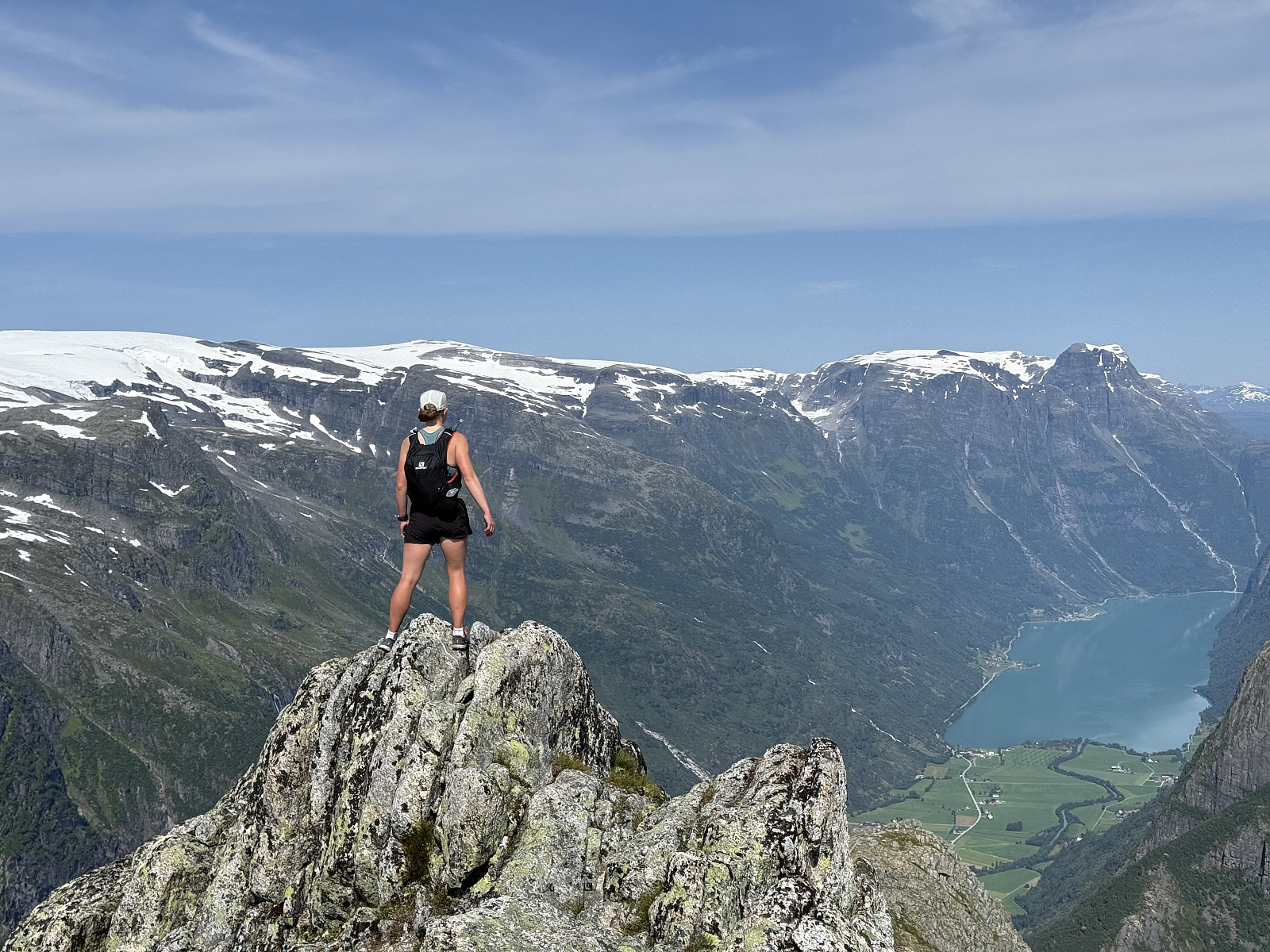
Continuing on to the highest point of the ridge, we felt the air cool as icy wind blustered off the glacier. Up until this point we had been dressed for summer, me even having to take my shirt off, but now we were changing into our coats and waterproof leggings to stay warm. We sheltered somewhat from the wind at the summit and enjoyed our lunch as we surveyed the glacial arms below us.
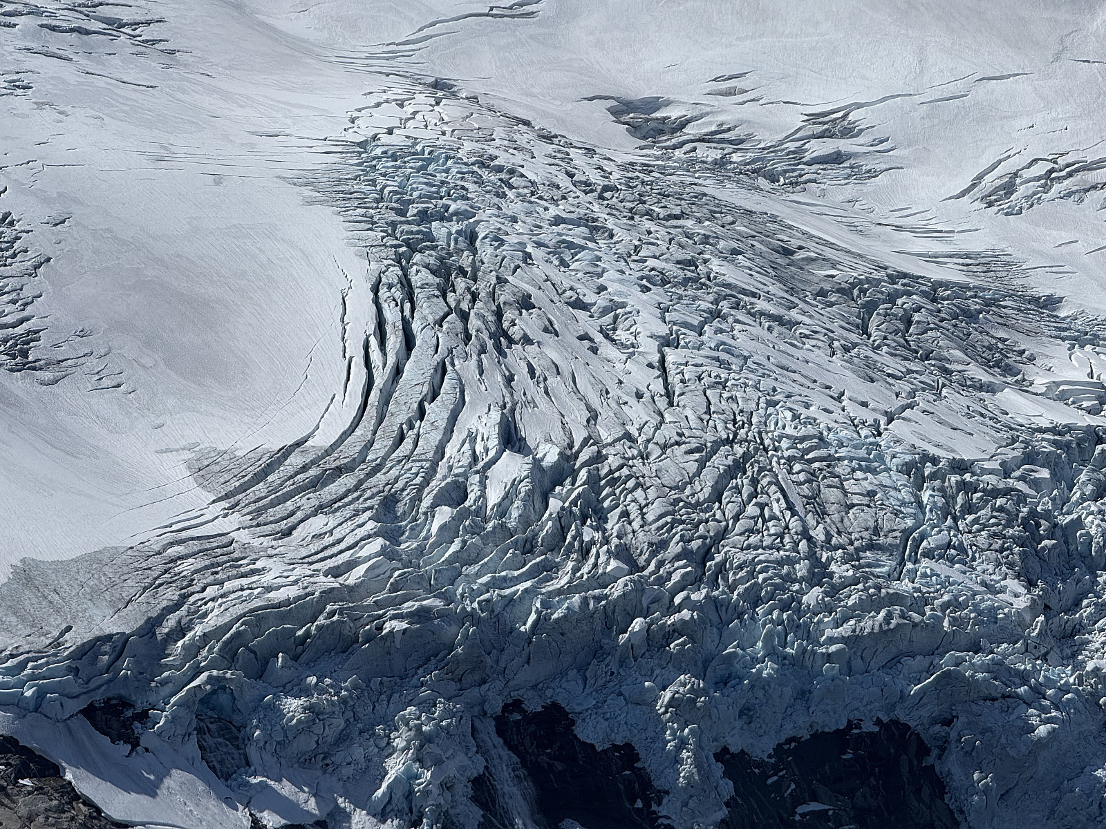
Still enraptured, we decided to take the short walk towards the edge of the glacier, stopping at the boundary between rock and ice. The wind was strong and even made walking tough. We peered into crevasses and awed at the scale of the continent's largest ice sheet.
After some time, we began retracing our steps and the descent towards Birksdalen. The daytime temperature was creeping up, so we changed back into summer clothing as we lost the glacial wind. Our quads taking a thorough pounding, we agreed that we prefer ascents.
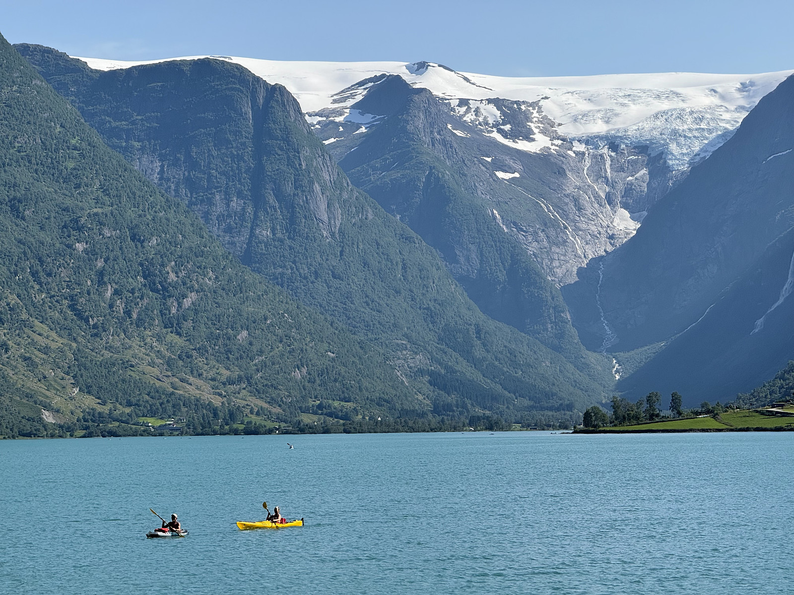
Hot in the July sun, we both stopped by Oldevatnet on the drive back to Stryn. The water was cold (relatively... we are British, after all) but after some deep breathing left us feeling refreshened and revitalised.
I now feel an even greater attraction towards Jostedalsbreen, and will definitely return soon for a greater adventure onto the ice: perhaps a guided trip to Lodalskåpa, or a ski tour across the ice sheet (this a long term goal, I need to work on my skiing first).


Benutzerkommentare