
Besshøe (and back via Besseggen) (11.07.2025)


| Start point | Bessheim (965m) |
|---|---|
| Endpoint | Bessheim (965m) |
| Characteristic | Hike |
| Duration | 7h 00min |
| Distance | 26.0km |
| Vertical meters | 1,800m |
| Map |
|
| Ascents | Besshøe (2,258m) | 11.07.2025 |
|---|---|---|
| Veslfjellet (1,745m) | 11.07.2025 | |
| Visits of other PBEs | Besseggen (1,500m) | 11.07.2025 |
Alice and I first visited Norway in September of 2024, during which we hiked the infamous Besseggen hike, opting to save money by hiking around Bessvatnet, joining the tourist route half-way and following it back to Gjendesheim. At the time we had looked up Besshøe and made a mental note to return one day. Then, during this trip, we had taken the Gjendebåtene to Memurubu to hike Surtningssue and were reminded of this pledge. A few days later were arrived at Bessheim, with the idea of hiking Besshøe and returning via Besseggen.
It was another glorious day in Vågå with clear blue skies and light winds (I’m increasingly being told that this July was very out of the ordinary). We began from Bessheim at around 12:00, sweating it out up the 300m or so to Bessvatnet in the already intense heat. We proceeded to jog around the north shore of the lake until we reached the Grotåe stream, approximately 60 minutes after leaving Bessheim. This is where the path splits and the climb up Besshøe begins.
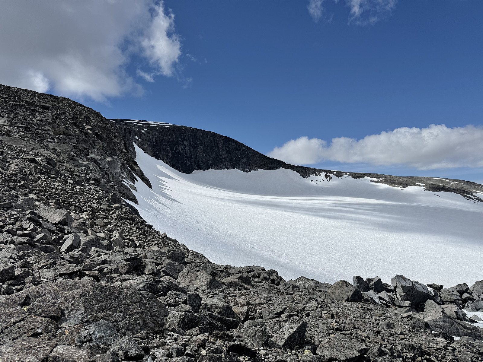
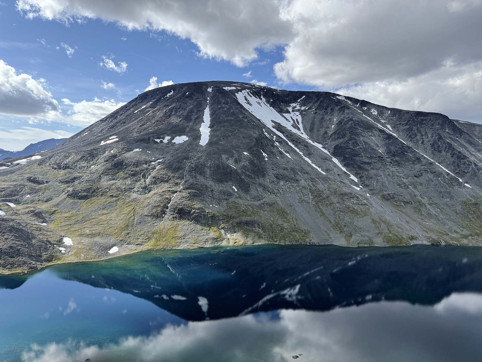
The climb up Besshøe is clear, straightforward and not very steep., comprising mostly of large boulders characteristic of Jotunheimen terrain. At around 2000m above sea level, you can veer slightly north and view Besshøbrean, where Alice spotted some reindeer dotted on the snow.
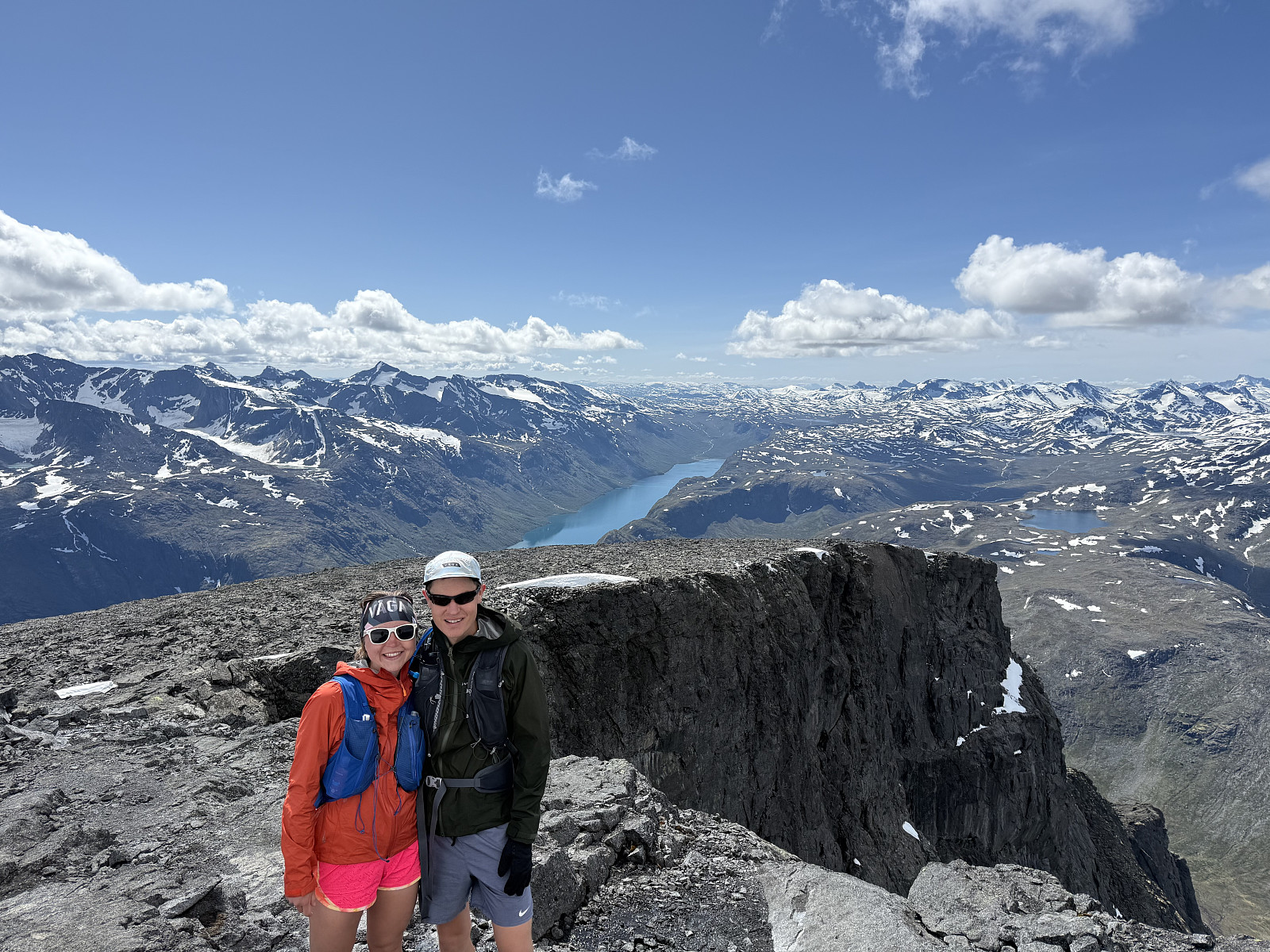
We made light work of the climb, arriving at the summit 2h15m after starting from Bessheim, overtaking several groups along the way and asking (in English) which way they had planned to descend. We had yet to decide on a descent route off Besshøe, and some preliminary research revealed three possible options:- Retrace our steps and return the via way we came up.
- Aim for a snow chute / stream on the (steep!) south-east face.
- Descend via the (not so steep but very loose!) south-west face towards Memurubu.
Wanting to take a more direct line towards Besshøe, we did not want to retrace our steps. Fortunately managed to find a family who had planned to take a linear route from Bessheim to Memurubu, descending via the south-west side. They warned us against any snow chutes, and so we made the decision to go down via the south-western route.
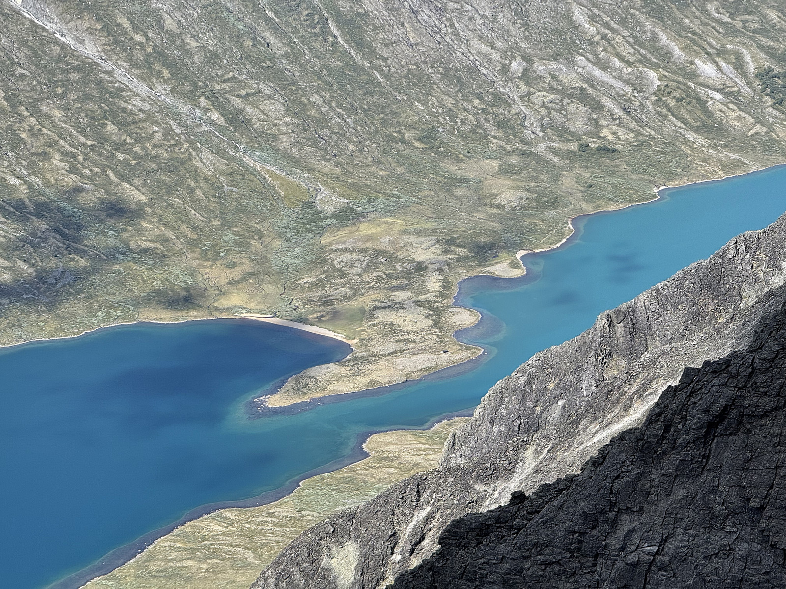
The summit of Besshøe grants panoramic views into Jotunheimen. We found it particularly intriguing how Russvatnet was half blue, half turquoise with a distinct boundary, presumably because glaciers feed only the eastern half of the lake. Taking advantage of the high temperatures and light winds, we ate our lunch on the summit; by the time we had finished, the family heading towards Memurubu had arrived. We asked them what they knew of the route and they assured us with some humour that they had read about a 70 year old using the route. With this in our minds, we began the descent.
For 600m or so there are numerous cairns in the south-western direction and pathfinding is easy. Eventually, though, the terrain steepens and the scree loosens. From this point there cairns were more scarce, and there seems to be little evidence of foot-traffic. Unable to link together cairns we opted to stay just south of the south-western ridge, aiming towards the 1474 lake. The descent was unpleasant, requiring lots of focus and care not to dislodge the loose rocks (even some larger rocks seemed to move). After more than an hour under the afternoon sun, we arrived at the 1474 lake, where we regrouped. From here we could see the family from earlier moving very, very slowly down the mountainside. The thought of the fabled 70 year old was now even more amusing (though given our interactions with Norwegians, we have no reason to doubt the authenticity of the story).
I would not recommend this descent route to anyone who is not comfortable on large, loose scree, and certainly not for larger groups.
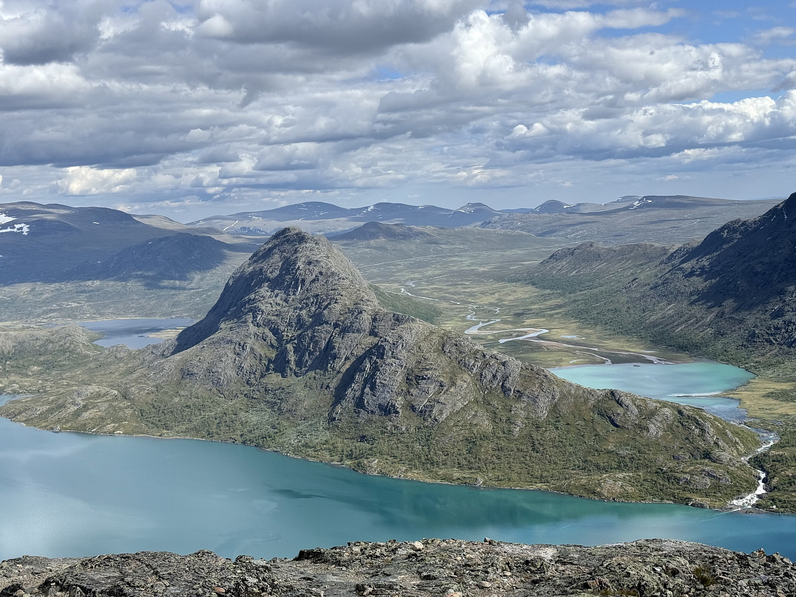
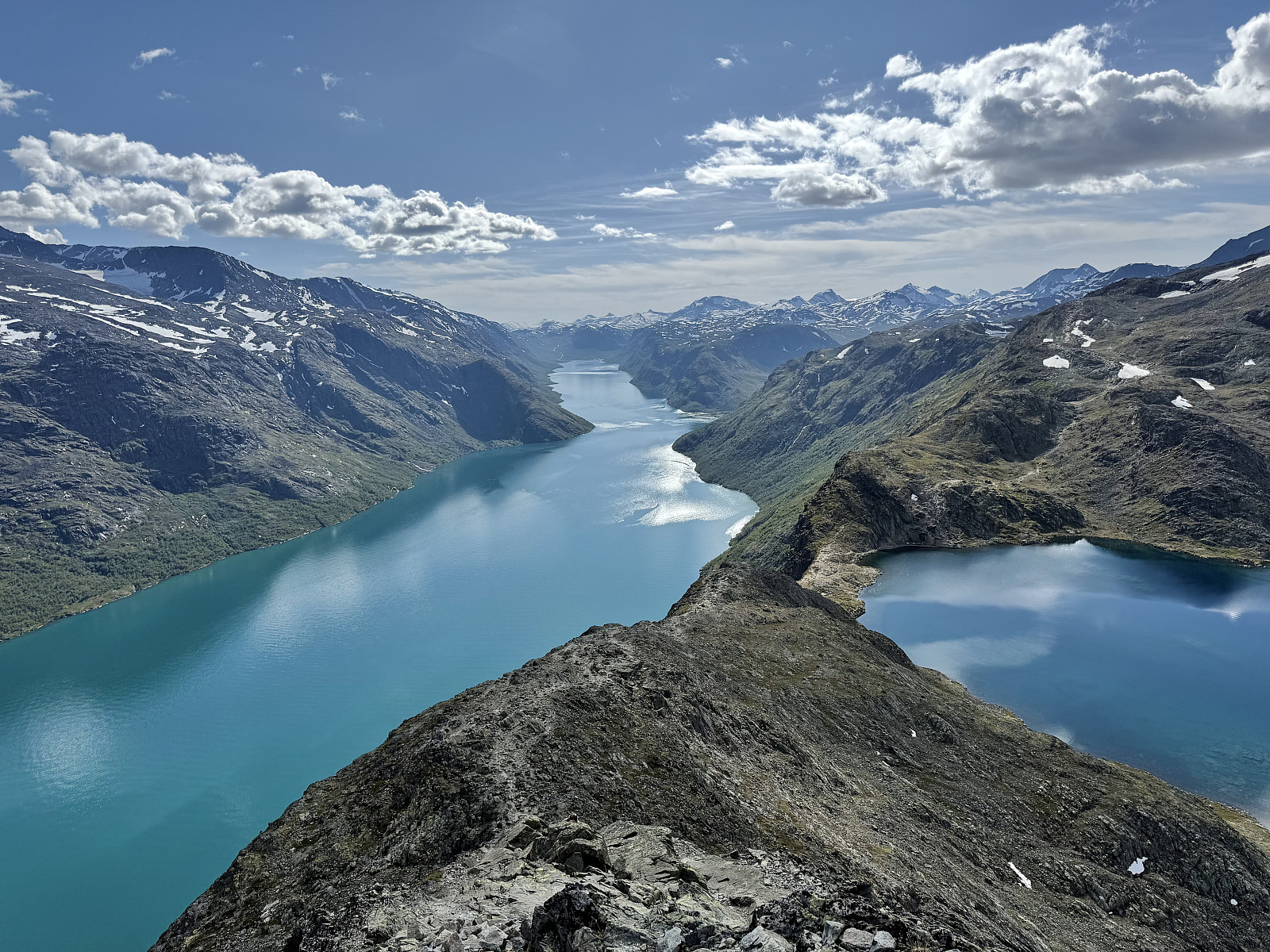
We joined the Besseggen tourist trail and jogged down to the col just west of the ‘eggen’. It was late in the day and very quiet on the ridge, and so we could fully immerse ourselves in spectacular landscape. The contrast between the blue Bessvatnet and the turquoise of Gjende justifies this route’s popularity. We encountered another runner along the ridge and told him about our day so far, and our increasing love for Norway. He strongly recommended that we explore the peaks on the southern side of Gjende, traversing Bukkehåmåren, Kvassryggen and Hødgebrotet (noted!).
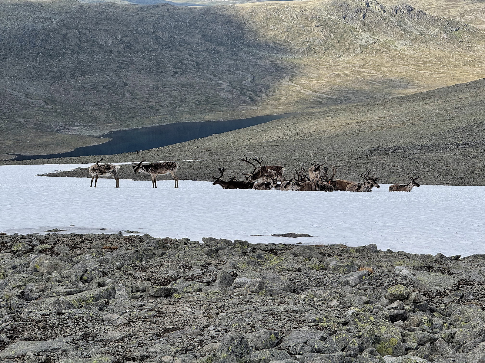
At the summit of Veslfjellet, we encountered a group of reindeer, presumably cooling themselves on a residual patch of snow, indifferent to the hikers passing close by. From here we took the north-east path down towards Bessvatnet, jogging down the more sturdy terrain. Scorched, we’d somehow found ourselves dehydrated, despite drinking all of the 7L of water we had between us. Hindsight, we could have drank from the Jotunheimen streams, but a dodgy experience doing so on Skåla, Vestland was still in our minds… cold water from the bar in Bessheim was divine, and we felt satisfied having pulled off our circuit.


User comments