Archiv - Nach Datum
Archiv - Nach Geografie
Peakbookfreunde


Gesammelte Listen
-
Sukkertoppen topper
(90/112)
 80%
80% -
Møre og Romsdal ≥ 500m pf.
(105/161)
65%
-
Møre og Romsdal kommunetopper
(14/24)
58%
-
Sunnmøre ≥ 100m pf.
(298/531)
56%
-
2000m 30m pf. fastlandet
(99/227)
43%


Riedbergerhorn
- Datum:
- 30.07.2024
- Tourcharakter:
- Wanderung
- Tourlänge:
- 2:08h
- Entfernung:
- 5,0km
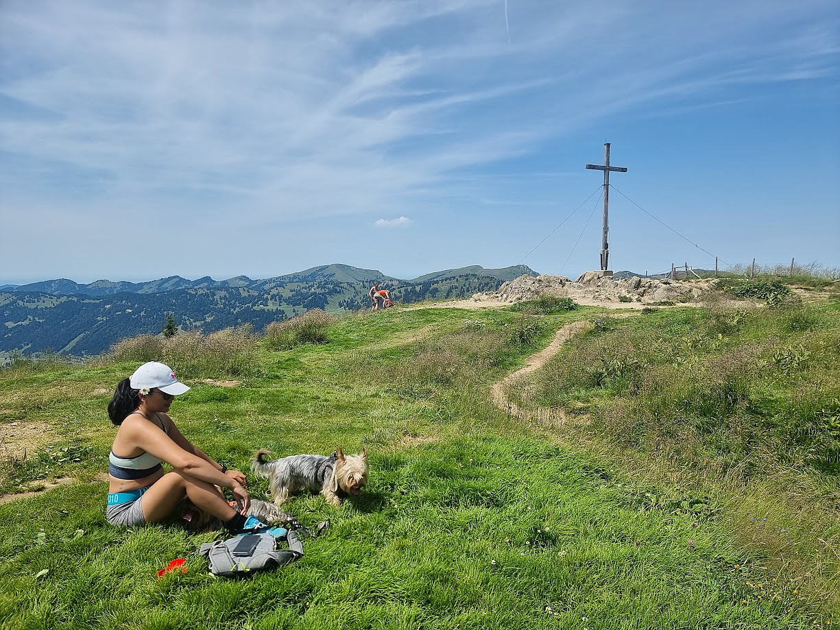 m/Emily, Heron og Simba
Brocken
- Datum:
- 02.08.2018
- Tourcharakter:
- Fahrradtour Straße
- Tourlänge:
- 1:51h
- Entfernung:
- 26,0km
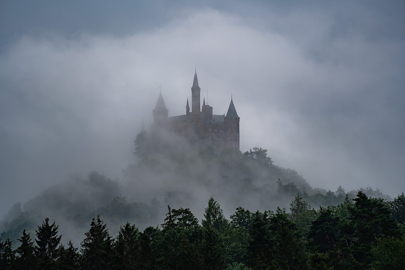
Via ferrata to highest top in Germany
- Datum:
- 13.08.2003
- Tourcharakter:
- Klettersteig
I arrived Ehrwald (Austria) late in the day and I drove directly to the base of the cable car station. There I was informed about the fire, and that the cable car station had been closed for many months. In fact I didn’t care, because my plan was to scale the peak by fair means (using my own legs). According to the map posted on a big board outside of the visitor centre, there was a rather easy but exposed route to the summit. I also read it was a 1700m vertical gain in altitude, a demanding ascent by any standards. The campsite, conveniently situated opposite to the cable car station, seemed to include all basic facilities, thus I decided to stay there for the night. The next day I started to hike early in the morning, and the first part of the trail went through a green forest. After a while >>>
