Archivo - fecha
Archivo - por geografía
Amigos de Peakbook


Listas obtenidas
-
Sukkertoppen topper
(90/112)
 80%
80% -
Møre og Romsdal ≥ 500m pf.
(105/161)
65%
-
Møre og Romsdal kommunetopper
(14/24)
58%
-
Sunnmøre ≥ 100m pf.
(298/531)
56%
-
2000m 30m pf. fastlandet
(99/227)
43%


Mount Rinjani
- Fecha:
- 16.07.2013
- Tipo de excursión:
- Senderismo
- Duración:
- 28:43h
- Distancia:
- 37.3km
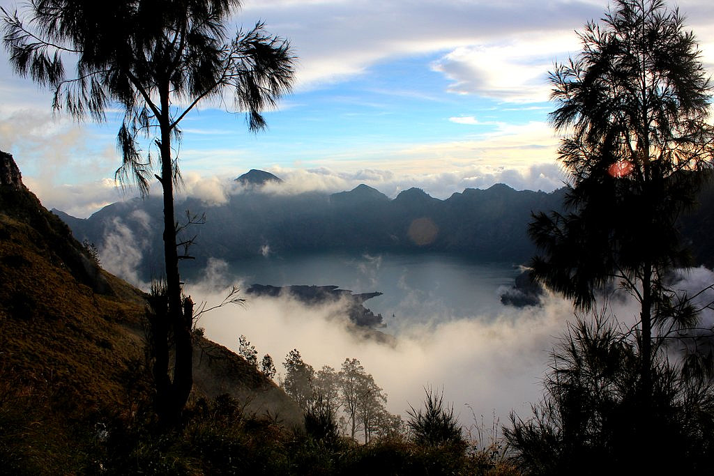 Gunung Rinjani (3726m) is the tallest mountain in Lombok and the second highest volcano in Indonesia. It takes 3 long days to do the full traverse of Rinjani including the crater lake, and we enjoyed every moment of this wonderful trek and the spectacular scenery.
See my offsite trip-report, photos and gps-track at distantpeak.blogspot.com/2013/07/gunung-rinjani.html
Gunung Rinjani (3726m) is the tallest mountain in Lombok and the second highest volcano in Indonesia. It takes 3 long days to do the full traverse of Rinjani including the crater lake, and we enjoyed every moment of this wonderful trek and the spectacular scenery.
See my offsite trip-report, photos and gps-track at distantpeak.blogspot.com/2013/07/gunung-rinjani.html
Gunung Agung
- Fecha:
- 13.07.2013
- Tipo de excursión:
- Senderismo
- Duración:
- 6:44h
- Distancia:
- 12.6km
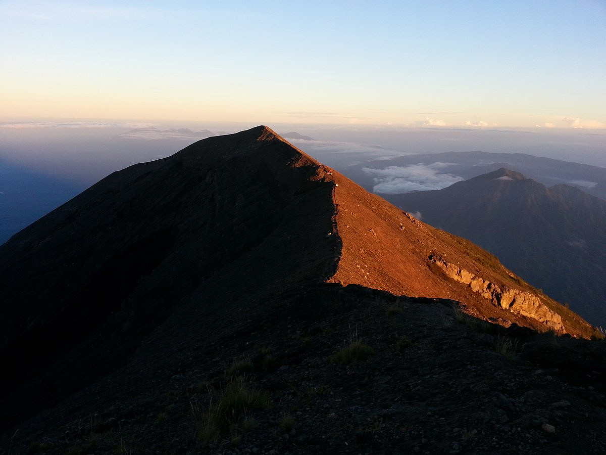 I've actually been to Bali and Gunung Agung before, sometime back in 2001. But then I only reached the false summit on the wrong side of the crater rim. 12 years later I came back to finnish the business.
See my offsite trip-report, photos and gps-track at distantpeak.blogspot.com/2013/07/gunung-agung.html
I've actually been to Bali and Gunung Agung before, sometime back in 2001. But then I only reached the false summit on the wrong side of the crater rim. 12 years later I came back to finnish the business.
See my offsite trip-report, photos and gps-track at distantpeak.blogspot.com/2013/07/gunung-agung.html
Pico do Ramelau
- Fecha:
- 08.07.2013
- Tipo de excursión:
- Senderismo
- Duración:
- 4:13h
- Distancia:
- 14.1km
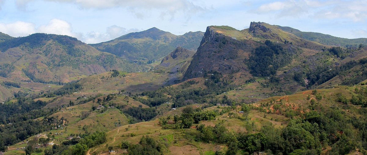 Mount Ramelau (2986m), sometimes referred to as Foho Tatamailau, is the highest peak in the new sovereign state of East Timor (Timor Leste) as well as Timor Island. The hike itself is very straightforward. The biggest challenge is to get to the foot of this mountain.
See my offsite trip-report, photos and gps-track at distantpeak.blogspot.com/2013/07/mount-ramelau.html
Mount Ramelau (2986m), sometimes referred to as Foho Tatamailau, is the highest peak in the new sovereign state of East Timor (Timor Leste) as well as Timor Island. The hike itself is very straightforward. The biggest challenge is to get to the foot of this mountain.
See my offsite trip-report, photos and gps-track at distantpeak.blogspot.com/2013/07/mount-ramelau.html
