Arkiv - dato
Arkiv - Etter geografi
"Peakbookvenner"


Lister jeg samler etter
-
Sukkertoppen topper ≥ 100m pf.
(90/112)
 80%
80% -
Møre og Romsdal ≥ 500m pf.
(104/161)
64%
-
Møre og Romsdal kommunetopper
(14/24)
58%
-
Sunnmøre ≥ 100m pf.
(294/531)
55%
-
2000m 30m pf. fastlandet
(99/227)
43%


Mount Pulag
- Dato:
- 29.12.2010
- Turtype:
- Fottur
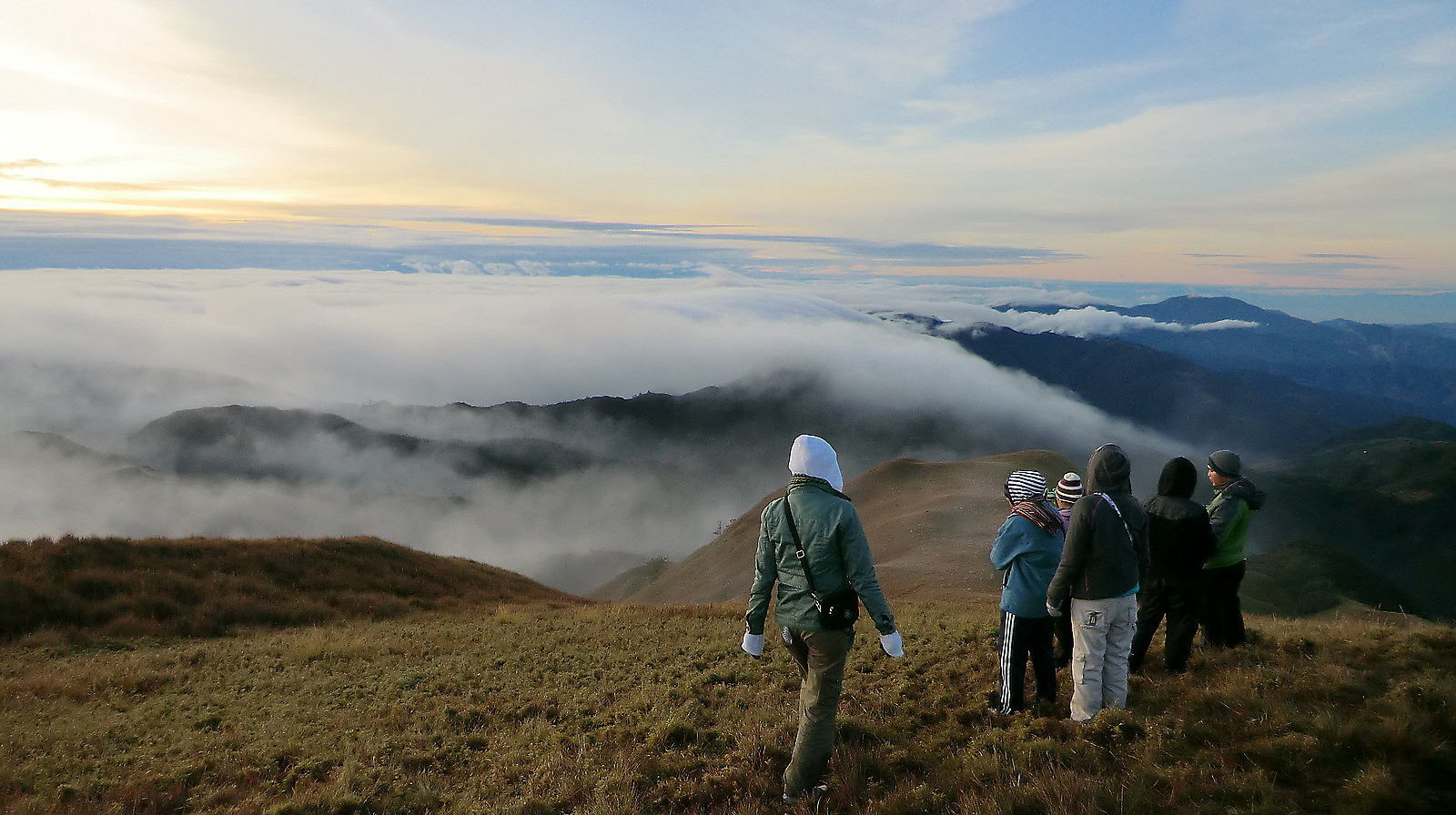 We signed on a guided trip to Mount Pulag with www.trailadventours.com, because that was actually cheaper than trying to do it by ourselves. Cheaper because of the shared transportation to the trailhead and also the share of guide. Having a local guide on the mountain is mandatory to get a permit anyway....
It was a big surprise to find out that more than 50 hikers had signed up for this trip. We joined at the Victory Liner bus station in Pasay (Manila) in the evening Dec 27. From there we took the 6-hours nightbus to Baguio City, which we arrived before sunrise. Here the three chartered jeepneys waited for us, so the second leg of the journey along the scenic Halsema Highway could start almost immediately. We had breakfast halfway along this beautiful winding road in the middle of the Cordilleras, >>>
We signed on a guided trip to Mount Pulag with www.trailadventours.com, because that was actually cheaper than trying to do it by ourselves. Cheaper because of the shared transportation to the trailhead and also the share of guide. Having a local guide on the mountain is mandatory to get a permit anyway....
It was a big surprise to find out that more than 50 hikers had signed up for this trip. We joined at the Victory Liner bus station in Pasay (Manila) in the evening Dec 27. From there we took the 6-hours nightbus to Baguio City, which we arrived before sunrise. Here the three chartered jeepneys waited for us, so the second leg of the journey along the scenic Halsema Highway could start almost immediately. We had breakfast halfway along this beautiful winding road in the middle of the Cordilleras, >>>
Kanlaon
- Dato:
- 22.12.2010
- Turtype:
- Fottur
Kanlaon is the highest active volcano in the Philippines, and since we were not far away, we decided to go for it. First we visited the DENR office in Bacolod and got a permit after 1-2 hours (the rules say you should apply 3 months in advance though). The permit fee is 300 pesos per person. The DENR office also arranged a local guide. This is mandatory to get a permit, and the guide fee is 500 pesos per day. Next morning we took a local bus from Bacolod to La Carlota (30 pesos), then a local jeepney from La Carlota to Guintubdan (30 pesos). Here we met the guide and shortly after we started on the 5-6 hours hike from 900 meters elevation to saddle camp at 2300 meter. It was hot and humid in the rainforest, partly very steep too. We stayed a rather cold night in our beach-tent at saddle camp >>>
