Archive - Date
Archive - Activity
-
Climbing (43)
- Alpine climbing (31)
- Ice climbing (3)
- Mixed climbing (1)
- Sport climbing (3)
- Via ferrata (1)
-
Other trip (5)
- Expedition (5)
-
Other winter trip (5)
- Snowshoe trip (5)
-
Ski trip (441)
- Backcountry skiing (4)
- Cross-country skiing (2)
- Randonnée/Telemark (433)
-
Trip by foot (506)
- Alpine trip (47)
- Hike (195)
- Hillwalk (205)
- Jogging (4)
- Walk (55)
Peakbook-Friends


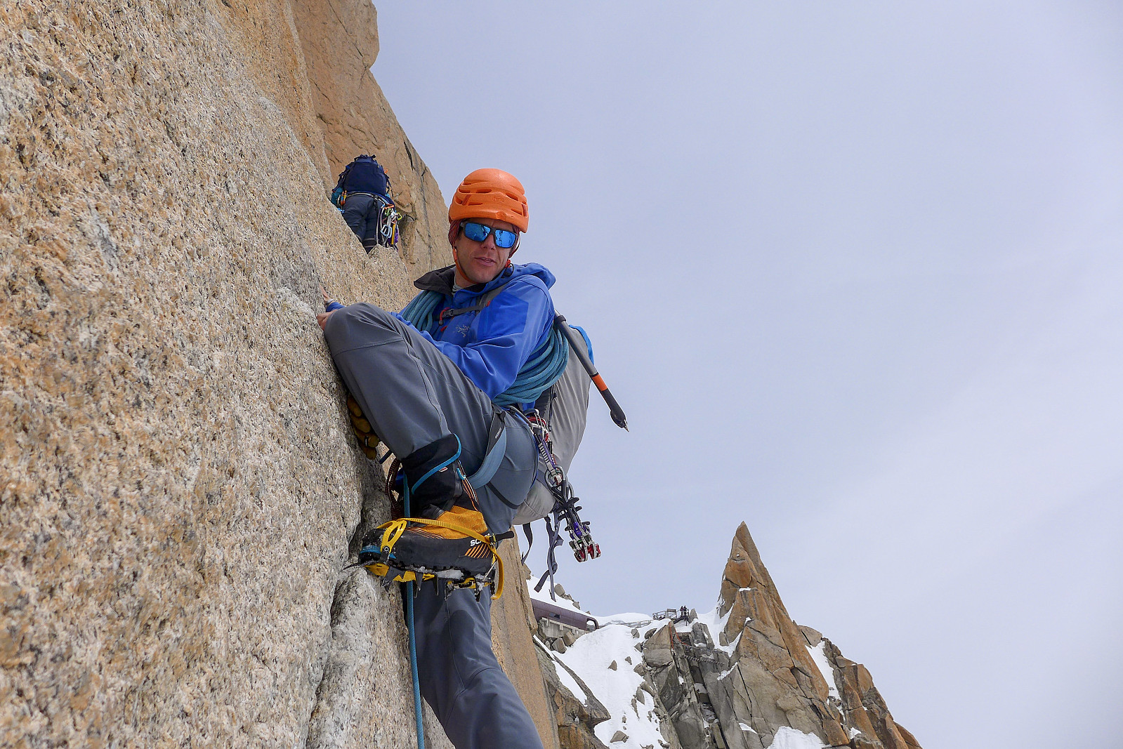
Mont Blanc du Tacul - Contamine Grisolle
- Date:
- 29.06.2023
- Characteristic:
- Alpine climbing
- Duration:
- 6:45h
- Distance:
- 7.5km
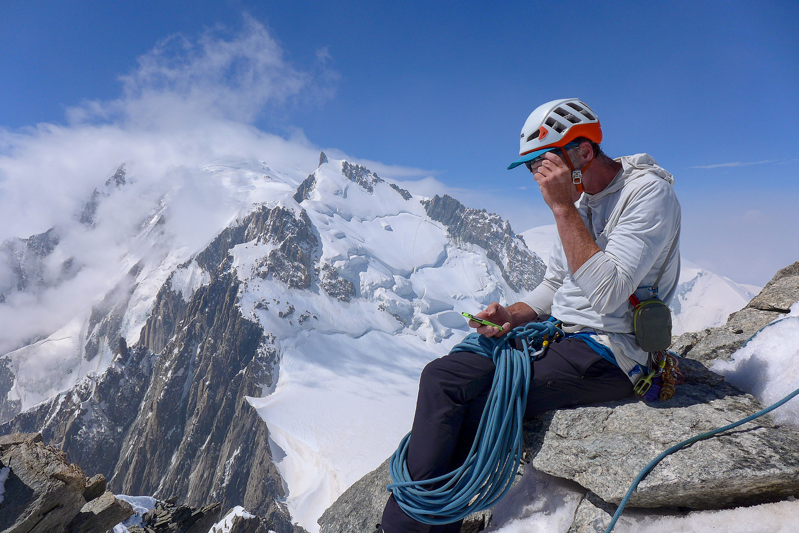 I’d originally thought that Mont Blanc du Tacul could be easily tagged on the way back from doing the Kuffner Ridge on Mont Maudit, but we ended up binning that idea as I was pretty exhausted and couldn’t face any more unnecessary uphills than we needed to do... And since there are nicer ways to tag the summit than slogging up from the Col Maudit it seemed like a much better idea to come back with fresh legs after having a few days rest and climb one of the more interesting routes on the Triangle du Tacul. After two days rest I felt ready to climb a mountain again but by this time the stable summer weather we’d had for nearly a week was starting to break down, and so for the thursday we really only had until midday to climb the mountain and get back before the forecasted thunderstorms >>>
Mont Maudit - Kuffner Arete
- Date:
- 26.06.2023
- Characteristic:
- Alpine climbing
- Duration:
- 12:15h
- Distance:
- 13.9km
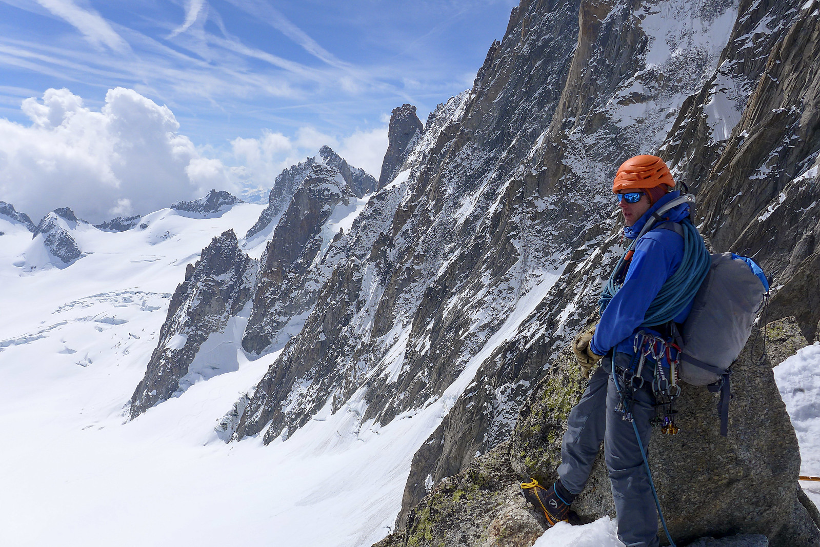
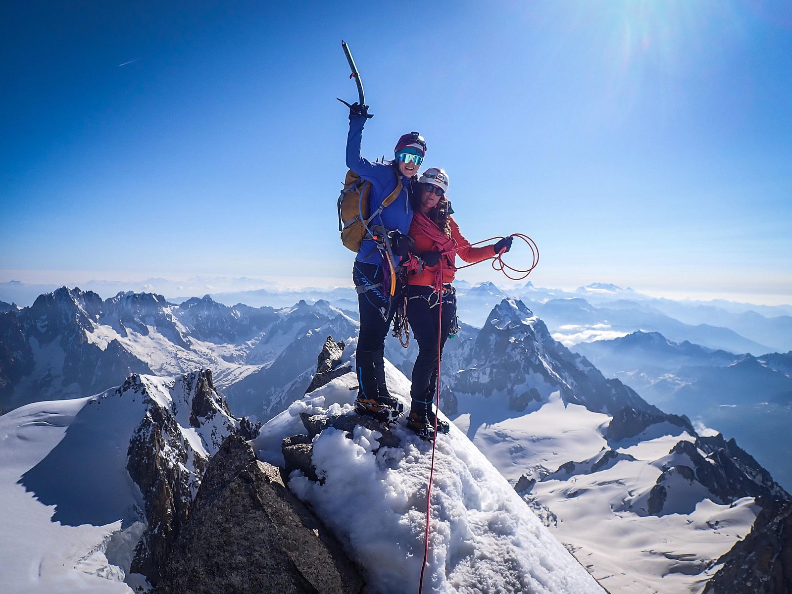 The Kuffner ridge on Mont Maudit has been sitting on my “wishlist” for a number of years; not just because Mont Maudit is also on the 4000m list, but because of what I’d heard from other people and seen cool pictures from the route. Moreover, the route description opens with “This is one of the finest ridge climbs in the Alps, combining snow aretes with interesting mixed sections and unfolds amongst scenery of the highest order....”. After a binned attempt in June 2022 (we only got as far as Cirque Maudit after a night with no decent refreeze) I was super keen to make the most of any opportunity with good weather and snow conditions this year. Since the Col de la Fourche bivouac hut got swept down off the ridge and destroyed last summer by rockfall, our only options were to start >>>
Aiguille Verte - Whymper Couloir
- Date:
- 18.06.2023
- Characteristic:
- Alpine climbing
- Duration:
- 11:00h
- Distance:
- 9.0km
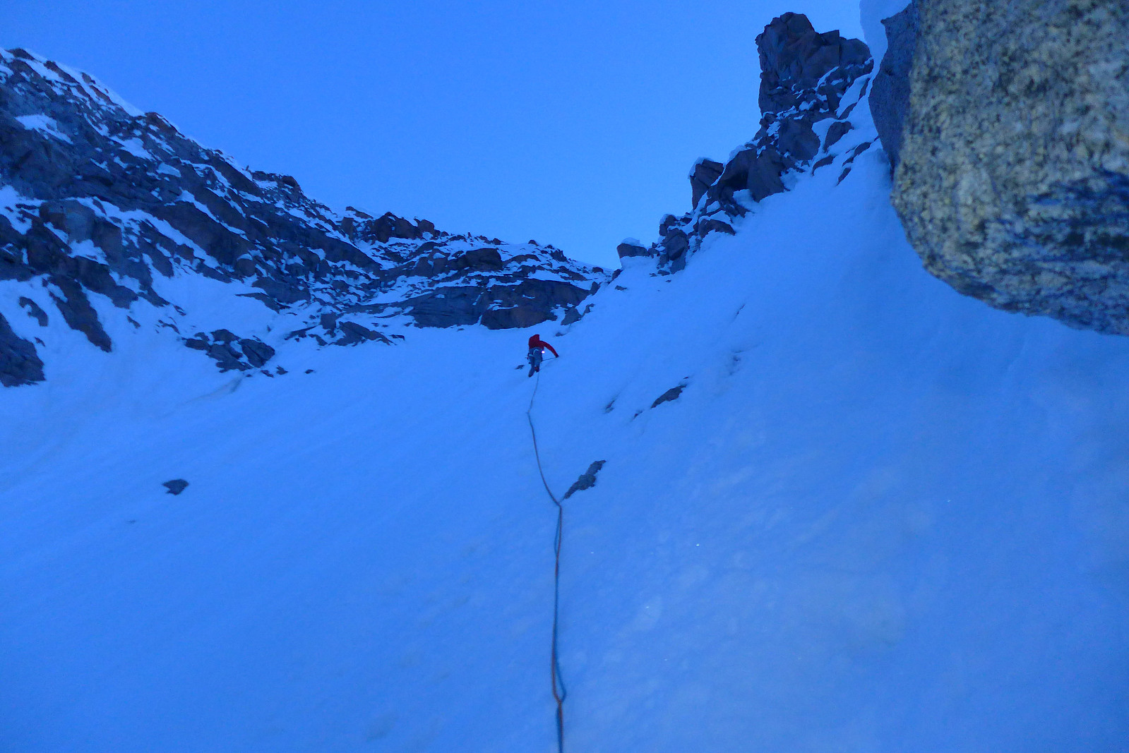 After acclimatising in the Saas valley I was originally supposed to head over to Evolene on the saturday and meet up with British mountain guide Tim Neill and climb with him for a couple of weeks again. I was really looking forward to this as it had been a few years since he’d been out in the Alps for the summer season. We had been keeping in contact during the week about potential objectives, and as things turned out it looked like there would be a weather window for doing the Whymper couloir on the Aiguille Verte on the saturday/sunday after my trip up the Lagginhorn. I had hoped to have had two good nights sleep down in the valley before embarking on another 4000er like the Verte, but as most of the routes on the Aiguille Verte are a bit tricky to get in good condition this opportunity >>>
Les Droites
- Date:
- 30.06.2022
- Characteristic:
- Alpine climbing
- Duration:
- 13:29h
- Distance:
- 10.9km
 Les Droites was a bit unlike some of the other 4000m peaks in the sense that it wasn't one that I have really wanted to do for years – but one that is on the list of the 50 principal 4000m peaks in Martin Moran’s guidebook. But it kind of fitted in nicely as a 3-day trip with Dave after a couple of days of bad weather and we’d found out that the normal route up the south ridge of the East summit was still “doable” according to a German guide who’d been there the previous week, even though conditions were very dry for the time of year and the access couloir no longer had a decent snow cover.
We headed up to the Couvercle hut, the starting point for the normal route by taking the train up to Montenvers from Chamonix, then used the telecabine to join the long series of stairs that lead >>>
Les Droites was a bit unlike some of the other 4000m peaks in the sense that it wasn't one that I have really wanted to do for years – but one that is on the list of the 50 principal 4000m peaks in Martin Moran’s guidebook. But it kind of fitted in nicely as a 3-day trip with Dave after a couple of days of bad weather and we’d found out that the normal route up the south ridge of the East summit was still “doable” according to a German guide who’d been there the previous week, even though conditions were very dry for the time of year and the access couloir no longer had a decent snow cover.
We headed up to the Couvercle hut, the starting point for the normal route by taking the train up to Montenvers from Chamonix, then used the telecabine to join the long series of stairs that lead >>>
Pointes Lachenal traverse
- Date:
- 13.05.2022
- Characteristic:
- Alpine climbing
- Duration:
- 5:21h
- Distance:
- 11.9km
 Tredje og siste dag på tur i Chamonix. Etter to dager med isklatring (i svært behagelig temperatur!) var det deilig å avslutte oppholdet med to korte ryggtraverser fra Aiguille du Midi. Begynte dagen med å krysse Col du Midi-platået for å traversere Pointes Lachenal som har tre topper - vi gikk fra øst til vest, så den første toppen var enklest og krevde ikke noe mer enn å gå opp en 40-graders snøbakke. Deretter fulgte vi ryggen over andre toppen og tok en liten rappell ned til snøeggen mellom andre og tredje toppen. Den tredje og siste toppen var mest "krevende" og begynte med en slags kaminformasjon med et kort parti med 4er klatring (fremdeles med stegjern på). Fant gode hånd- og fottak etter litt leting og det var deilig å ha stein under hendene og føttene igjen! >>>
Cosmiques Arete
- Date:
- 13.05.2022
- Characteristic:
- Alpine climbing
 Gikk over Cosmiquesryggen på vei tilbake til Aiguille du Midi etter å ha gått Pointes Lachenal traverse . Folksomt på ruta og litt kø før første rappell, men heldigvis klarte vi å passere de fleste taulagene og ikke bruke altfor mye tid på å komme oss opp til Aiguille du Midi-stasjonen :-) Det var faktisk veldig gøy å gå denne traversen igjen, 19 år etter første gang jeg gikk den i juli 2003. Hukommelsen min må være ganske dårlig, for jeg ikke husket noen ting fra den første turen, bortsett fra cruxet - en blank vegg av granitt på et par meter som nå er blitt mye "lettere" å gjøre med stegjern på da det er nesten skrapet ut skreddersydde hull til fronttaggene etter såpass mye trafikk her... Uansett, mye artigere enn å traske opp i snøen som vi gjorde dagen før!
Aiguille de Bionnassay
- Date:
- 20.07.2021
- Characteristic:
- Alpine trip
- Duration:
- 6:25h
- Distance:
- 11.7km
 The Aiguille de Bionnassay is an elegant peak lying at the western end of the Mont Blanc massif, and like the Lyskamm traverse is known for its narrow snow ridges – in particular the “standard” route up the east ridge, accessed from the Gonella hut on the Italian side of the mountain. Since most snowy routes were in excellent condition this summer it seemed like a good choice to finish off my month in the Alps, so we headed there after spending a night in Chamonix after coming back from the Ecrins. We had a somewhat delayed start because of long queues to get through the Mont Blanc tunnel into Courmayeaur, so by the time we had made it up the Val Veny road as far as we could get to La Visaille it was around midday and we still had at least 5 hours of walking ahead of us to get to the >>>
Barre des Écrins
- Date:
- 17.07.2021
- Characteristic:
- Alpine trip
- Duration:
- 10:23h
- Distance:
- 23.0km
 A new round of bad weather came after having returned to Evolene from the Bernese Oberland, and there was forecasted up to 50-60cm of new snow on some summits in the Valais. The extremely large amounts of new snow even prompted the SLF to issue an out-of-season avalanche bulletin for the following weekend, advising against going into steep snow-covered terrain until the new snow had had time to stabilise. Meanwhile, I’d been checking the weather forecast for the Barre des Ecrins since being on the drier side of the Alps there was a chance that the Ecrins would be not as badly affected by the current terrible weather. It turned out that much less precipitation was forecasted for the same days over there, and being keen to not lose my hard-won acclimatization by spending days down in the valley, >>>
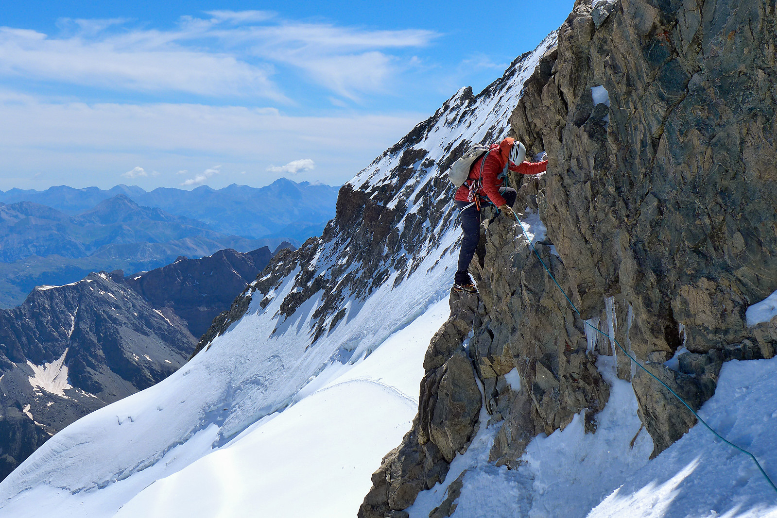
Grandes Jorasses
- Date:
- 27.07.2020
- Characteristic:
- Alpine climbing
- Duration:
- 9:48h
- Distance:
- 8.3km
 Following the brilliant first week of climbing, we had two easy days down in the valley back in Evolene which I mainly used for eating, drinking and sleeping plenty while also making plans for the second week. I’d earlier hoped that the Taschhorn-Dom traverse could be an option, but after having found out from the Swiss AlpineClub website that the Mischabel bivouac hut was closed for the season, it was obvious that this idea was not realistic – at least not this summer unfortunately. Having spent the week over in the Zermatt and Saas valleys, which I felt pretty familiar with now, I thought it would be quite nice to have a change of scenery and climb some other 4000ers in other regions of the Alps I hadn’t spent much time in. I was also quite keen to climb a “cool” mountain and so >>>

