Archive - Date
Archive - Activity
-
Climbing (43)
- Alpine climbing (31)
- Ice climbing (3)
- Mixed climbing (1)
- Sport climbing (3)
- Via ferrata (1)
-
Other trip (5)
- Expedition (5)
-
Other winter trip (5)
- Snowshoe trip (5)
-
Ski trip (441)
- Backcountry skiing (4)
- Cross-country skiing (2)
- Randonnée/Telemark (433)
-
Trip by foot (506)
- Alpine trip (47)
- Hike (195)
- Hillwalk (205)
- Jogging (4)
- Walk (55)
Peakbook-Friends


Weissmies
- Date:
- 01.09.2023
- Characteristic:
- Alpine trip
- Duration:
- 13:50h
- Distance:
- 13.3km
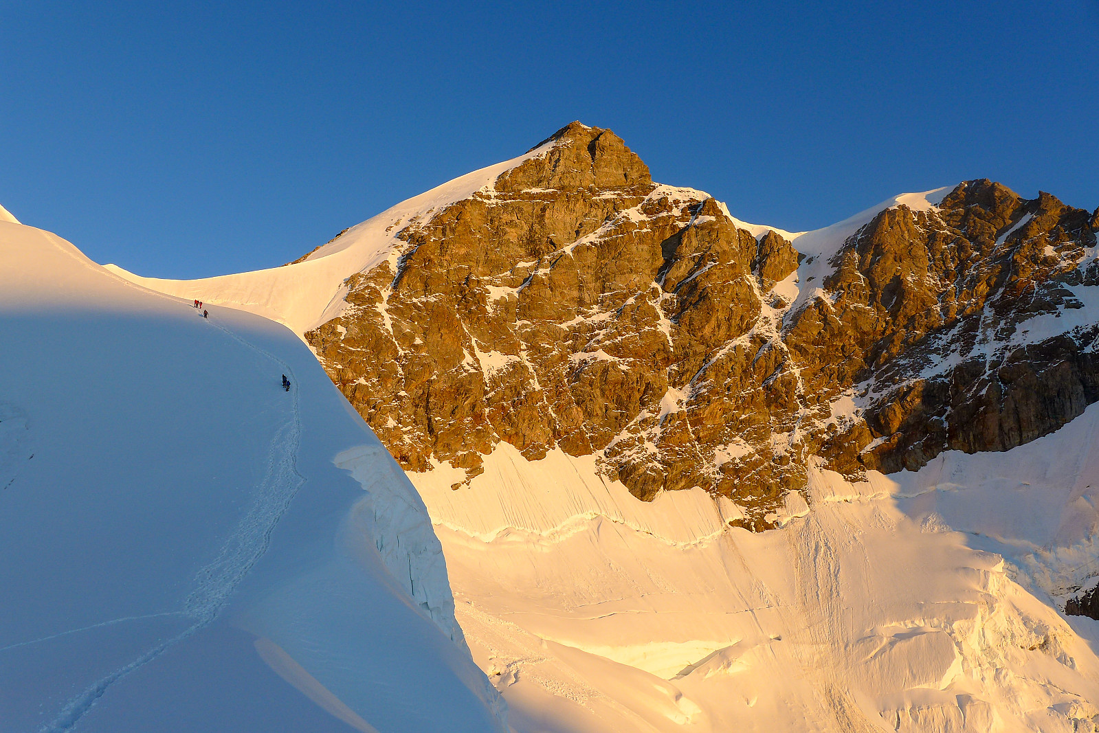
 Været i starten av uka var mye preget av nordavind, uvanlig kaldt vær og mye nedbør, som til slutt endte opp med opp mot 1m nysnø på de høyeste toppene og det snødde helt ned til Saas Grund på 1600m (!), noe som førte til at SLF utstedet et skredvarsel. Uansett, det var på en måte flaks for de 12 deltakerne i gruppe 1, meg selv inkludert - som skulle ha trening i bl.a redning fra bresprekk disse to dagene når været var på sitt dårligste. Det var også uflaks at været var såpass dårlig at vi ikke fikk komme oss opp i høyden for å trene i på en ordentlig bre. Etter treningen var noen av oss ganske gira på en tur opp sørryggen på Weissmies, en alpintur som er vanligvis ganske enkel med opp mot grad 2 klyving og ingen bre som må krysses. Jeg har gått denne ruten et par >>>
Jegihorn
- Date:
- 25.08.2023
- Characteristic:
- Hike
- Duration:
- 3:30h
- Distance:
- 5.6km
 Back in the Saas valley for the Alpine Club (UK) aspirants meet. Went up the Jegihorn to make a start in getting acclimatised (again) and stretch the legs after a long day travelling the previous day. Had a nice surprise on the summit when Jamie Holding turned up with 2 guests. He had led the trip to Ama Dablam 5 years ago and I'd not seen him since leaving base camp! Good to catch up with him before going back down.
Nordend
- Date:
- 24.06.2023
- Characteristic:
- Alpine trip
- Duration:
- 10:10h
- Distance:
- 11.0km
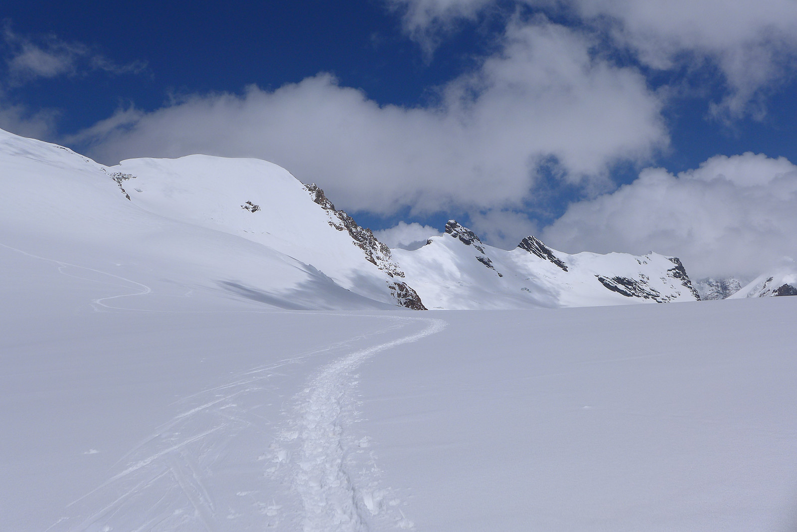
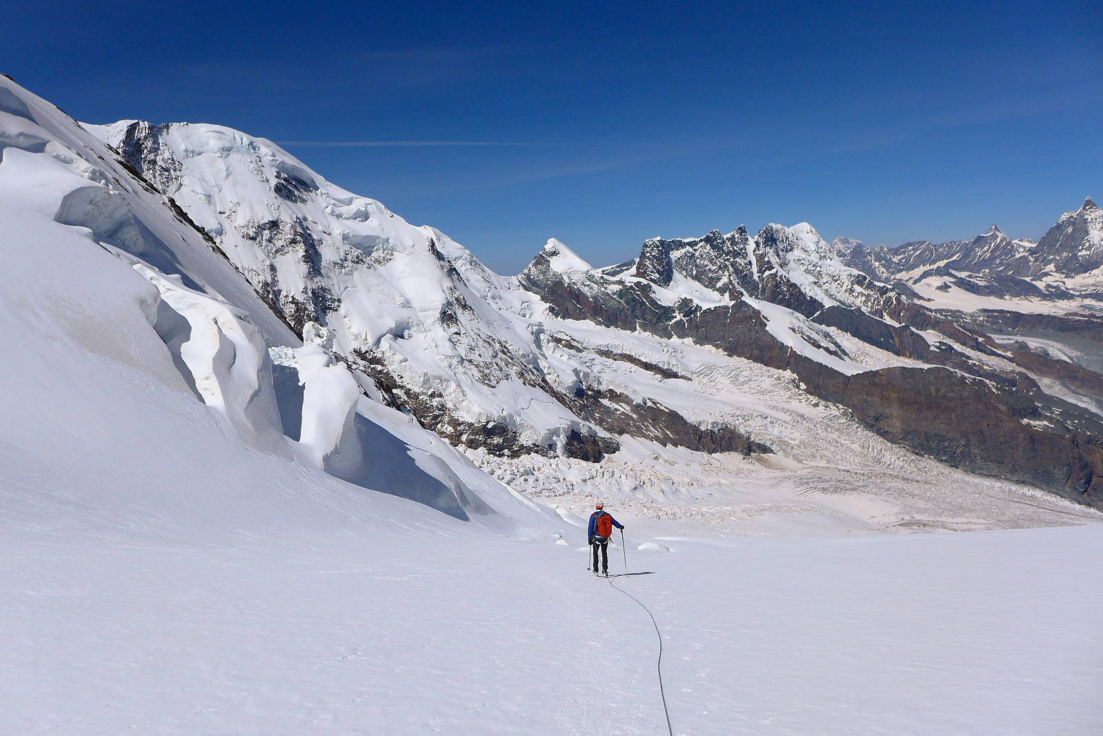 Nordend is one of the 50 major 4000m summits listed in Martin Moran’s guidebook to the 4000m peaks of the Alps, despite having a prominence of less than 100m, so it was on my to-do list for this summer even though given the choice I’d rather have done a ski-assisted ascent much like I’d done on the Dufourspitze a couple of years earlier. After almost an entire week of strong gales and a storm depositing new snow up high I’d originally wanted to use the new weather window to go and climb the Kuffner Arete on Mont Maudit, but since both the Torino and Cosmiques huts were full for friday and saturday night, we ended up heading to Nordend first since there was still many availabe beds in the Monte Rosa hut, which had literally just opened for the summer season. We drove over to Zermatt >>>
Jegihorn
- Date:
- 12.06.2023
- Characteristic:
- Hike
- Duration:
- 4:00h
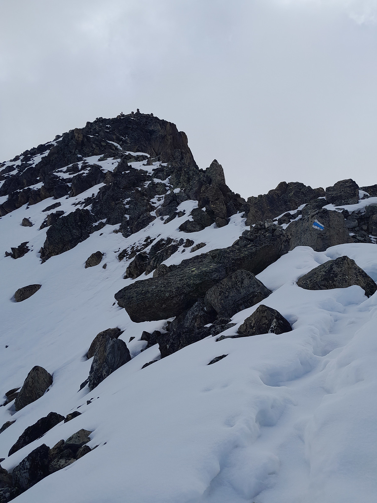 Første dag i Saas Grund etter en lang reise sørover fra Tromsø. Tok gondolen opp til Kreuzboden og gikk opp mot Jegihorn for å få meg en liten akklimatiseringstur. Var fint vær og godt å se et ordentlig snødekke på de fleste fjellene! For en gangs skyld så Lagginhorn ganske spennende ut, mesteparten av vestryggen var snødekt og det var et pent spor som strakk seg langs hele vestryggen :-) Fulgte blå/hvit skilting oppover og tok mange pauser underveis. Kroppen kjente på at den hadde blitt transportert ganske raskt fra havnivå til over 3000 moh! Det lå en del snø på ruten som gjorde det litt mer tidkrevende men den var stort sett fast and fint å gå på, ihvertfall i 10-11 tiden (var betydelig bløtere på turen ned). Angret litt på at jeg tok gåstavene opp til toppen da de >>>
Jungfrau
- Date:
- 06.07.2022
- Characteristic:
- Alpine trip
- Duration:
- 6:54h
- Distance:
- 9.6km
 After Les Droites the weather forecast for my final week in the Alps, with the exception of Monday, was supposed to be more settled, sunny and warm and it looked like the perfect opportunity to (finally) try and do the Täschhorn-Dom traverse which I’d been wanting to do for several years. Initially it seemed like a good idea to head up on the tuesday to the Mischabeljoch bivouac hut and do the traverse the following day, but after discovering the hut was fully booked for tuesday night we decided to scrap that plan. I wasn’t too sure about doing the traverse on thursday either since the forecast was showing cloudier weather so in the end I suggested to Graham that we go to the Jungfrau at the start of the week and try to do the Täschhorn-Dom traverse thursday/friday to make the most of the good weather. >>>
Weissmies
- Date:
- 25.06.2022
- Characteristic:
- Alpine trip
- Duration:
- 8:49h
- Distance:
- 14.0km
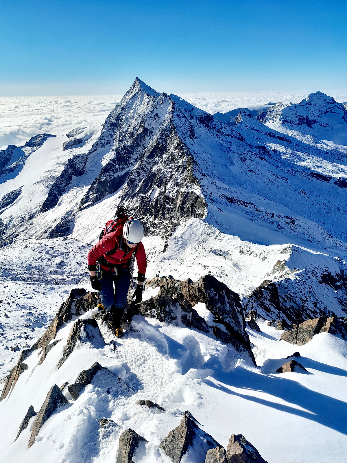
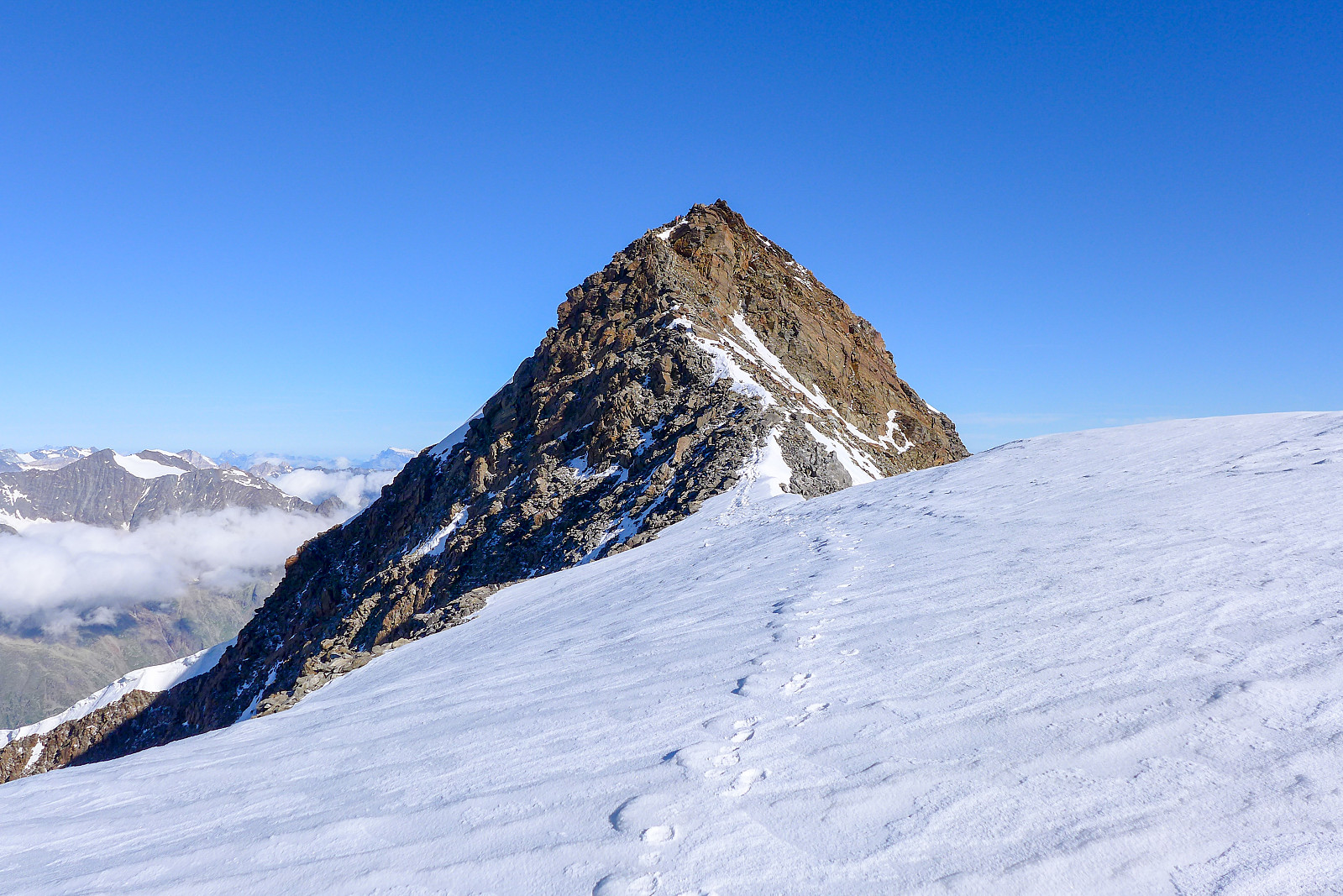 I've been wanting to do a "proper" alpine route solo for a few years and the south ridge of the Weissmies seemed to be a friendly option for a first solo route. I'd done it a couple of years earlier when it was plastered in new snow, but after last weekend's heatwave most ridges were now dry and clear of snow so it appeared to be an ideal opportunity to do it again. I booked a night at the Almageller hut and half expected to be the only British person there, but I ended up meeting quite a few other British guys there and had a much more social afternoon than expected chatting with them in the dining room.
Had breakfast at 4am the following morning and thought I would end up behind queues of other climbers on the approach to the Zwichbergenpass, but they were taking so long to get ready >>>
I've been wanting to do a "proper" alpine route solo for a few years and the south ridge of the Weissmies seemed to be a friendly option for a first solo route. I'd done it a couple of years earlier when it was plastered in new snow, but after last weekend's heatwave most ridges were now dry and clear of snow so it appeared to be an ideal opportunity to do it again. I booked a night at the Almageller hut and half expected to be the only British person there, but I ended up meeting quite a few other British guys there and had a much more social afternoon than expected chatting with them in the dining room.
Had breakfast at 4am the following morning and thought I would end up behind queues of other climbers on the approach to the Zwichbergenpass, but they were taking so long to get ready >>>
Aletschhorn
- Date:
- 27.05.2022
- Characteristic:
- Alpine climbing
- Duration:
- 13:06h
- Distance:
- 12.3km
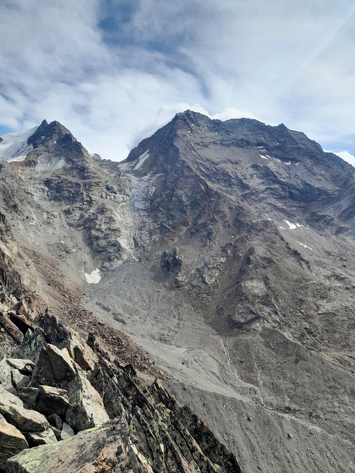
 Until now I’d only really seen the north side of the Aletschhorn, which rises more than 1000m steeply up from the Grosser Aletschfirn below and connects to the Dreieckhorn to the east of it. Still, it gives the impression that it would be a really cool mountain to climb, and moreso since most of the routes up it involve some sort of long approach. Hard-won summits are the best type :-) After having irritated one of my hip flexors while skinning up to the Vignettes hut earlier in the week, and Rachel was still suffering from painful blisters in ski boots, we were both feeling like it would be a nice change to ditch the skis and climb something in alpine boots. Hence the original idea to do a ski ascent of Nordend got binned and the idea of climbing the Aletschhorn via its southwest rib was >>>

