Archive - Date
Archive - Activity
-
Climbing (43)
- Alpine climbing (31)
- Ice climbing (3)
- Mixed climbing (1)
- Sport climbing (3)
- Via ferrata (1)
-
Other trip (5)
- Expedition (5)
-
Other winter trip (5)
- Snowshoe trip (5)
-
Ski trip (441)
- Backcountry skiing (4)
- Cross-country skiing (2)
- Randonnée/Telemark (433)
-
Trip by foot (506)
- Alpine trip (47)
- Hike (195)
- Hillwalk (205)
- Jogging (4)
- Walk (55)
Peakbook-Friends


Aiguille Blanche de Peuterey
- Date:
- 07.07.2023
- Characteristic:
- Alpine climbing
- Duration:
- 12:33h
- Distance:
- 12.0km
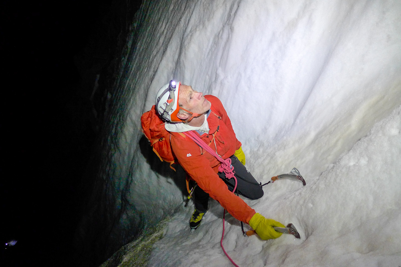
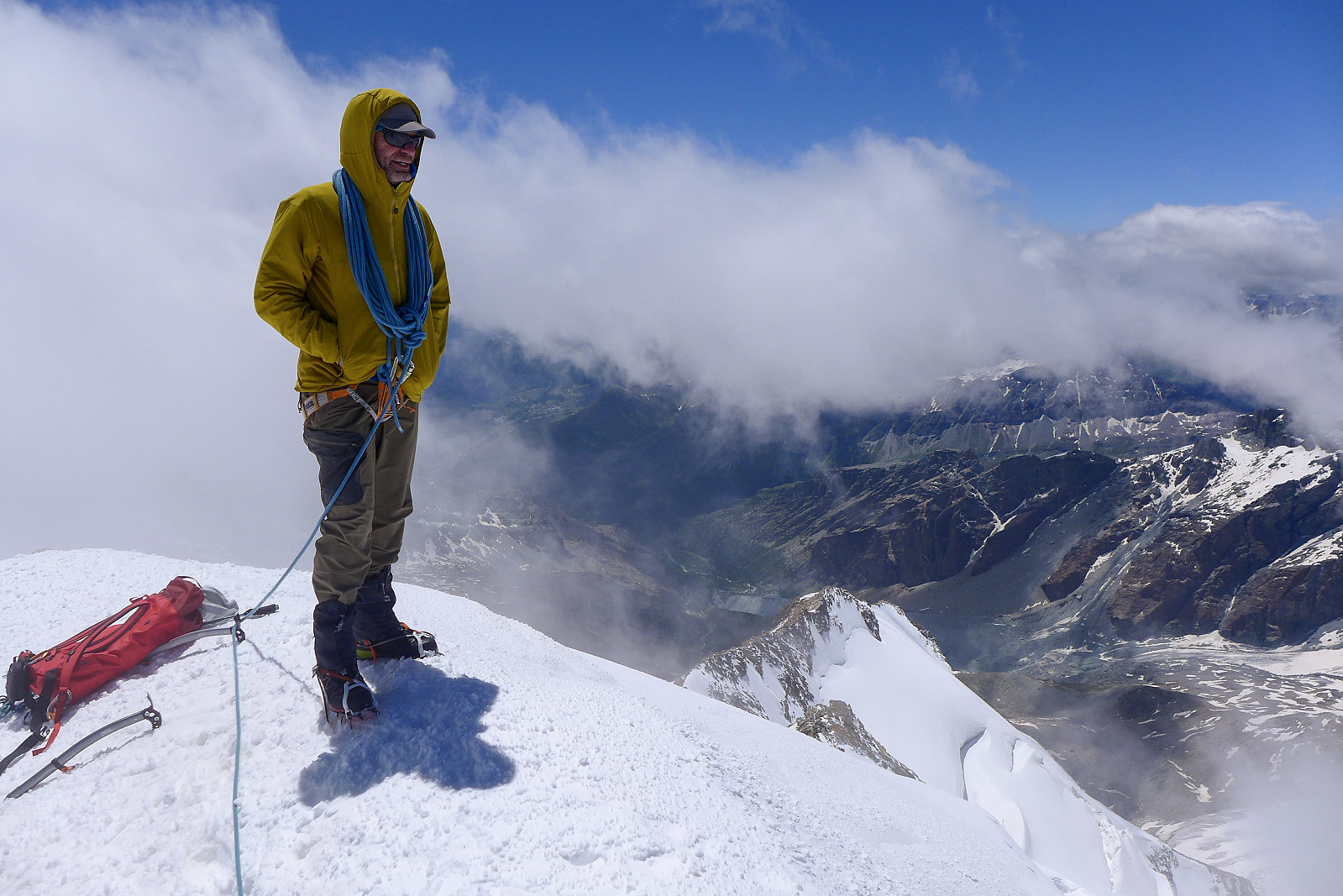
 The Aiguille Blanche de Peuterey. I remember first hearing about this peak, which is located on the italian side of Mont Blanc, around 5 years ago when Tim was telling me about the time he’d guided it with one of his colleagues. It sounded like a proper adventure just to get to it and an overall cool outing with its reputation as being one of the trickier 4000ers. As things turned out, it was also the last 4000er I had to do, so it seemed quite fitting to have saved the best until last ;-) Up until this point it felt like I’d been quite fortunate with the weather and really great snow conditions this year, and the remainder of my final holiday week looked like it would give us good enough weather for an attempt at the Aiguille Blanche. After descending the Dom we had an easy tuesday and drove >>>
Mont Maudit - Kuffner Arete
- Date:
- 26.06.2023
- Characteristic:
- Alpine climbing
- Duration:
- 12:15h
- Distance:
- 13.9km
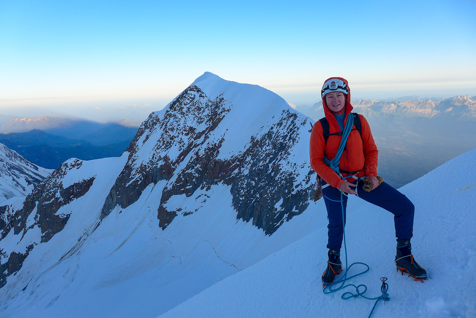
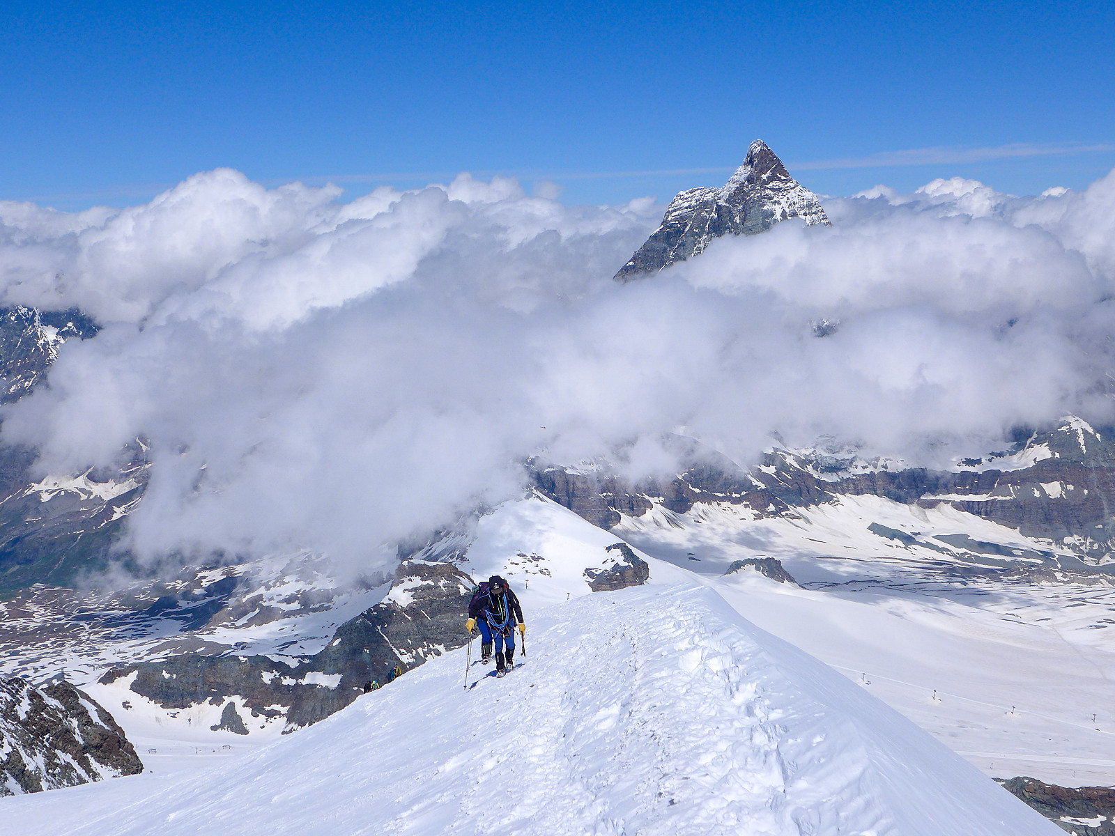
 The Kuffner ridge on Mont Maudit has been sitting on my “wishlist” for a number of years; not just because Mont Maudit is also on the 4000m list, but because of what I’d heard from other people and seen cool pictures from the route. Moreover, the route description opens with “This is one of the finest ridge climbs in the Alps, combining snow aretes with interesting mixed sections and unfolds amongst scenery of the highest order....”. After a binned attempt in June 2022 (we only got as far as Cirque Maudit after a night with no decent refreeze) I was super keen to make the most of any opportunity with good weather and snow conditions this year. Since the Col de la Fourche bivouac hut got swept down off the ridge and destroyed last summer by rockfall, our only options were to start >>>
Aiguille de Bionnassay
- Date:
- 20.07.2021
- Characteristic:
- Alpine trip
- Duration:
- 6:25h
- Distance:
- 11.7km
 The Aiguille de Bionnassay is an elegant peak lying at the western end of the Mont Blanc massif, and like the Lyskamm traverse is known for its narrow snow ridges – in particular the “standard” route up the east ridge, accessed from the Gonella hut on the Italian side of the mountain. Since most snowy routes were in excellent condition this summer it seemed like a good choice to finish off my month in the Alps, so we headed there after spending a night in Chamonix after coming back from the Ecrins. We had a somewhat delayed start because of long queues to get through the Mont Blanc tunnel into Courmayeaur, so by the time we had made it up the Val Veny road as far as we could get to La Visaille it was around midday and we still had at least 5 hours of walking ahead of us to get to the >>>
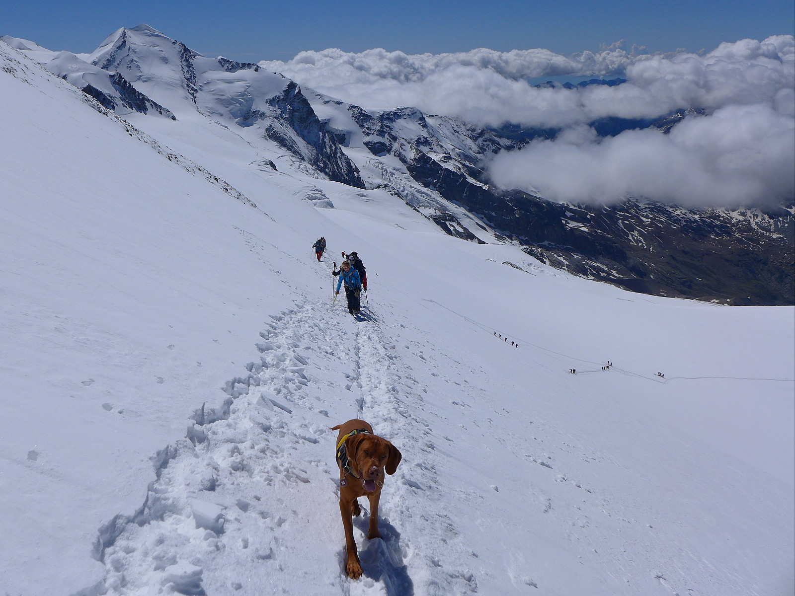
Lyskamm traverse
- Date:
- 02.07.2021
- Characteristic:
- Alpine trip
- Duration:
- 11:28h
- Distance:
- 26.7km
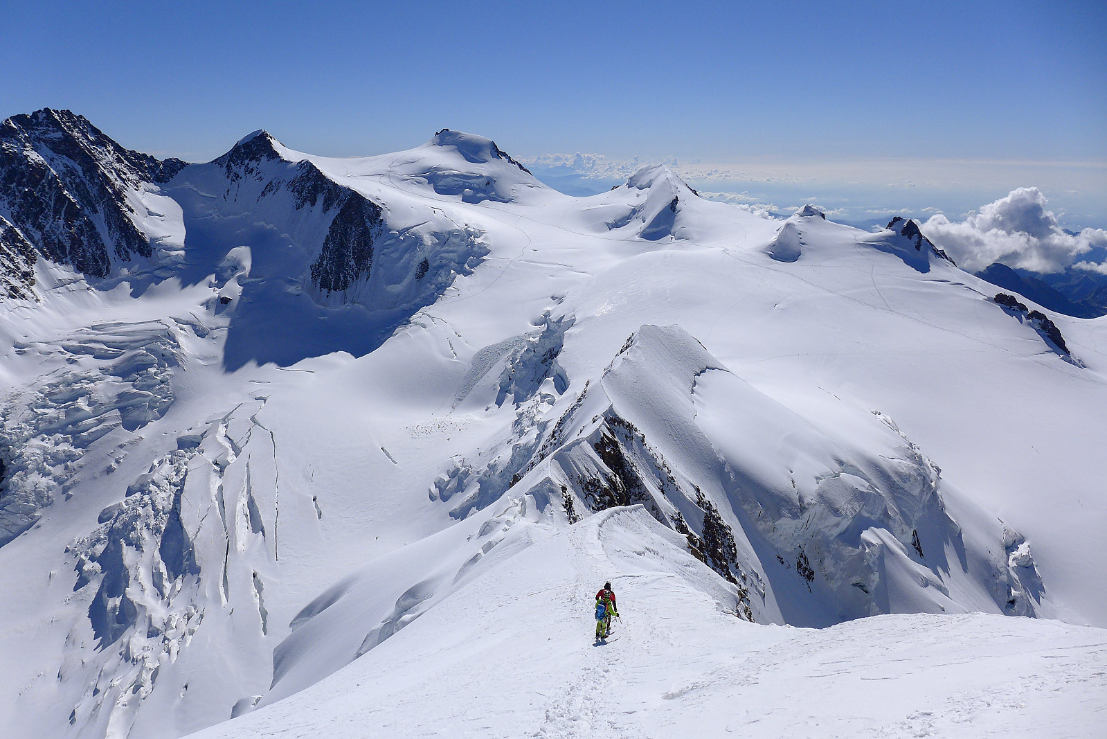 I first came to know about the traverse of Lyskamm during a trip to the Alps in July 2003. The original itinerary for the week had been to climb Castor, Pollux, Lyskamm and the Dufourspitze via the Margherita hut and Zumsteinspitze. In the end the traverse of Lyskamm never happened because the guide I was then climbing with decided it was too windy that day, and we ended up ascending Il Naso (the Nose of Lyskamm) and Vincent Pyramid instead. In hindsight I don’t think I had sufficient alpine mountaineering experience to do the traverse, which is basically a 2km narrow and exposed snow ridge so it was perhaps just a well that we didn’t do it that day. However, since then it has been high on my wishlist of routes to do in the Alps but for some reason or another there has never been the right >>>
Castor
- Date:
- 01.07.2021
- Characteristic:
- Alpine trip
- Duration:
- 4:07h
- Distance:
- 11.7km
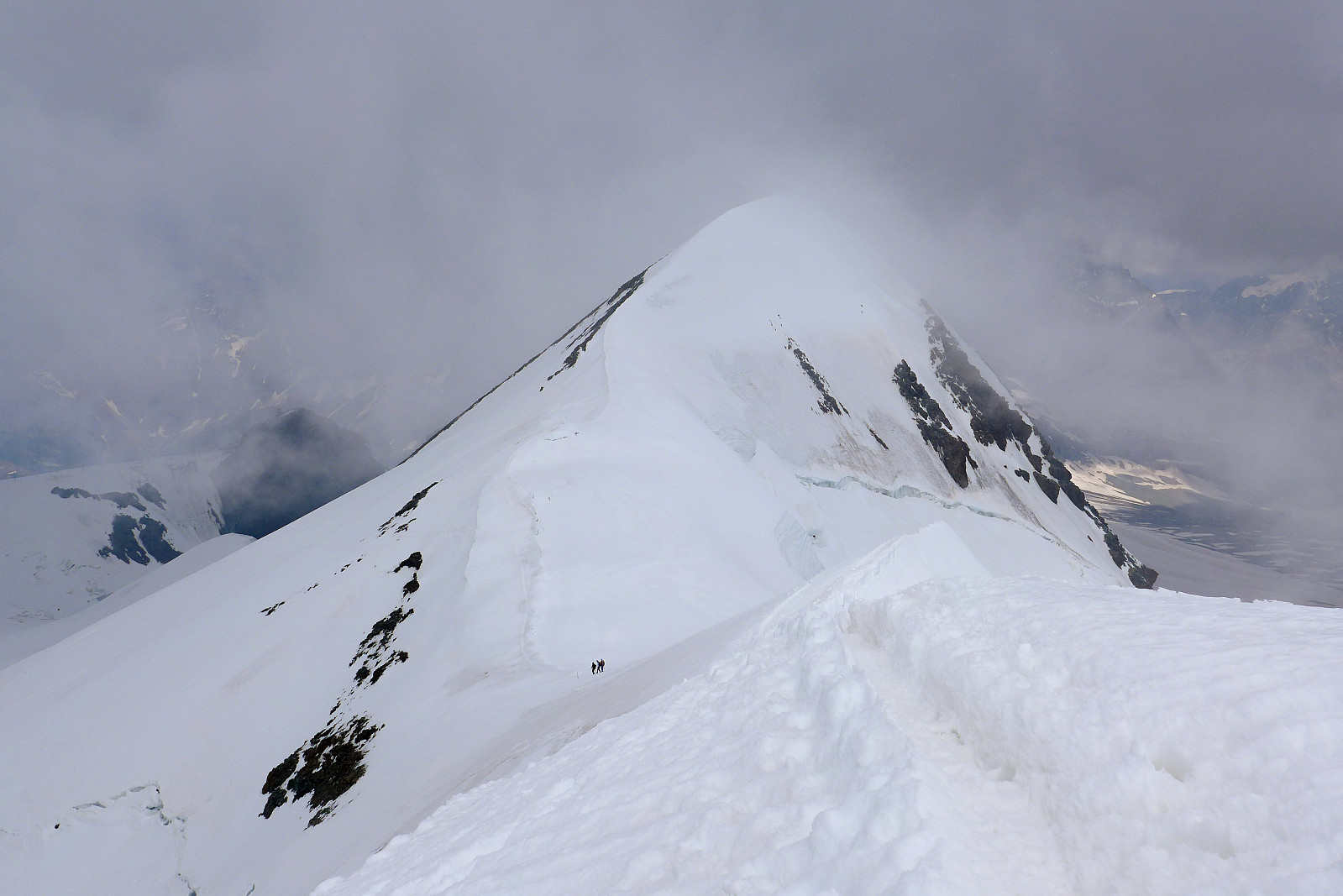
 Did a short ascent of Castor en route to the Quintino Sella hut, with the main plan being to traverse Lyskamm the next day. Didn't get fully fog-free views from the top, but still nice to re-visit this peak again after 18 years since my first time!
Breithorn x 3
- Date:
- 25.06.2021
- Characteristic:
- Hike
- Duration:
- 4:34h
- Distance:
- 11.6km
 Siste dag med akklimatisering i Zermatt. Kokvarmt på fjellet i dag!
Breithorn x 2
- Date:
- 23.06.2021
 Tenkte det hadde vært lurt å utnytte det dyre heisbillettet og godværsvinduet og gå to runder på Breithorn ;-)
Grandes Jorasses
- Date:
- 27.07.2020
- Characteristic:
- Alpine climbing
- Duration:
- 9:48h
- Distance:
- 8.3km
 Following the brilliant first week of climbing, we had two easy days down in the valley back in Evolene which I mainly used for eating, drinking and sleeping plenty while also making plans for the second week. I’d earlier hoped that the Taschhorn-Dom traverse could be an option, but after having found out from the Swiss AlpineClub website that the Mischabel bivouac hut was closed for the season, it was obvious that this idea was not realistic – at least not this summer unfortunately. Having spent the week over in the Zermatt and Saas valleys, which I felt pretty familiar with now, I thought it would be quite nice to have a change of scenery and climb some other 4000ers in other regions of the Alps I hadn’t spent much time in. I was also quite keen to climb a “cool” mountain and so >>>
Breithorn half traverse
- Date:
- 21.07.2020
- Characteristic:
- Alpine climbing
- Duration:
- 4:34h
- Distance:
- 7.5km
 After arriving back in Zermatt from the Zinalrothorn , we checked the weather forecasts again to make sure it would still be good weather for the next objectives we had planned to do. Originally the plan had been to head up to the Ayas hut, then traverse both Castor and Lyskamm the following day, spend the night up at the Margherita hut and then do both Nordend and the Dufourspitze on the thursday which was supposed to have the best weather and would have made a nice 3-day outing. Castor and Dufourspitze I had climbed previously, but not Lyskamm or Nordend, so they were still on the "to-do" list. However, since the forecast for the next 2 days were looking less optimal for a big day on exposed snow ridges, we moved onto my backup plan which was to do the Breithorn half traverse, a quick half day >>>

