Archiv - Nach Datum
Archiv - Nach Aktivität
-
Andere Tour (5)
- Expedition (5)
-
Andere Wintertour (5)
- Schneeschuhtour (5)
-
Fußtour (507)
- Bergtour (205)
- Hochtour (47)
- Jogging (4)
- Spaziergang (55)
- Wanderung (196)
-
Klettern (43)
- Alpinklettern (31)
- Eisklettern (3)
- Klettersteig (1)
- Mixed-Klettern (1)
- Sportklettern (3)
-
Skitour (449)
- Langlauf (2)
- Randonnée/Telemark (441)
- Tourenskilauf (4)
Peakbookfreunde


Mittaghorn via ferrata
- Datum:
- 26.08.2023
- Tourcharakter:
- Klettersteig
- Tourlänge:
- 4:00h
- Entfernung:
- 5,9km
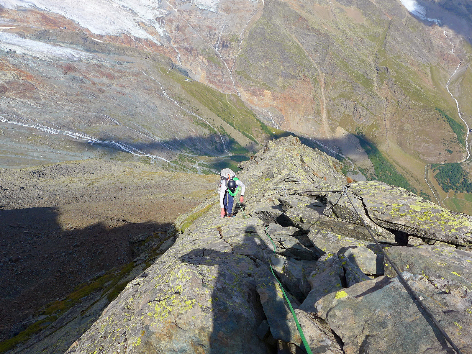 Værvarselet viste at det skulle komme dårlig vær fra rundt midt på dagen så det skulle lønne seg å utnytte den fine formiddagen. Ble kjent med en fyr, Nick, over middagen kvelden før og vi bestemte oss for å prøve en via ferrata på Mittaghorn da vi kunne komme oss opp ganske raskt ved å ta heisen opp til Morenia og gå til starten av via ferrataen derfra. Tok bussen kl7 fra Saas Grund til Saas Fee, så vi rakk heisen litt etter 0730. Tok litt under en time for å gå bortover på god sti til vestryggen på Mittaghorn hvor via ferrataen begynner. Var ganske lettgått terreng for det meste, virket litt unødvendig med kabler og sånt på det som var egentlig lett klyveterreng. Noen partier som var litt brattere og mer eksponert, men hadde jeg gått denne via ferrataen igjen ville >>>
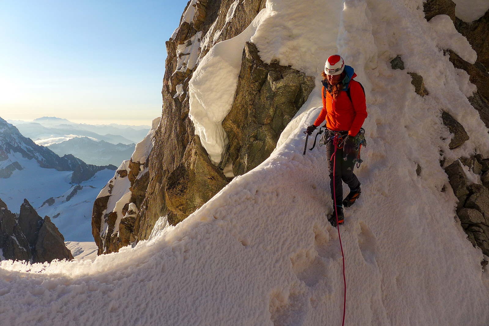
Aiguille Blanche de Peuterey
- Datum:
- 07.07.2023
- Tourcharakter:
- Alpinklettern
- Tourlänge:
- 12:33h
- Entfernung:
- 12,0km
 The Aiguille Blanche de Peuterey. I remember first hearing about this peak, which is located on the italian side of Mont Blanc, around 5 years ago when Tim was telling me about the time he’d guided it with one of his colleagues. It sounded like a proper adventure just to get to it and an overall cool outing with its reputation as being one of the trickier 4000ers. As things turned out, it was also the last 4000er I had to do, so it seemed quite fitting to have saved the best until last ;-) Up until this point it felt like I’d been quite fortunate with the weather and really great snow conditions this year, and the remainder of my final holiday week looked like it would give us good enough weather for an attempt at the Aiguille Blanche. After descending the Dom we had an easy tuesday and drove >>>
Mont Blanc du Tacul - Contamine Grisolle
- Datum:
- 29.06.2023
- Tourcharakter:
- Alpinklettern
- Tourlänge:
- 6:45h
- Entfernung:
- 7,5km
 I’d originally thought that Mont Blanc du Tacul could be easily tagged on the way back from doing the Kuffner Ridge on Mont Maudit, but we ended up binning that idea as I was pretty exhausted and couldn’t face any more unnecessary uphills than we needed to do... And since there are nicer ways to tag the summit than slogging up from the Col Maudit it seemed like a much better idea to come back with fresh legs after having a few days rest and climb one of the more interesting routes on the Triangle du Tacul. After two days rest I felt ready to climb a mountain again but by this time the stable summer weather we’d had for nearly a week was starting to break down, and so for the thursday we really only had until midday to climb the mountain and get back before the forecasted thunderstorms >>>
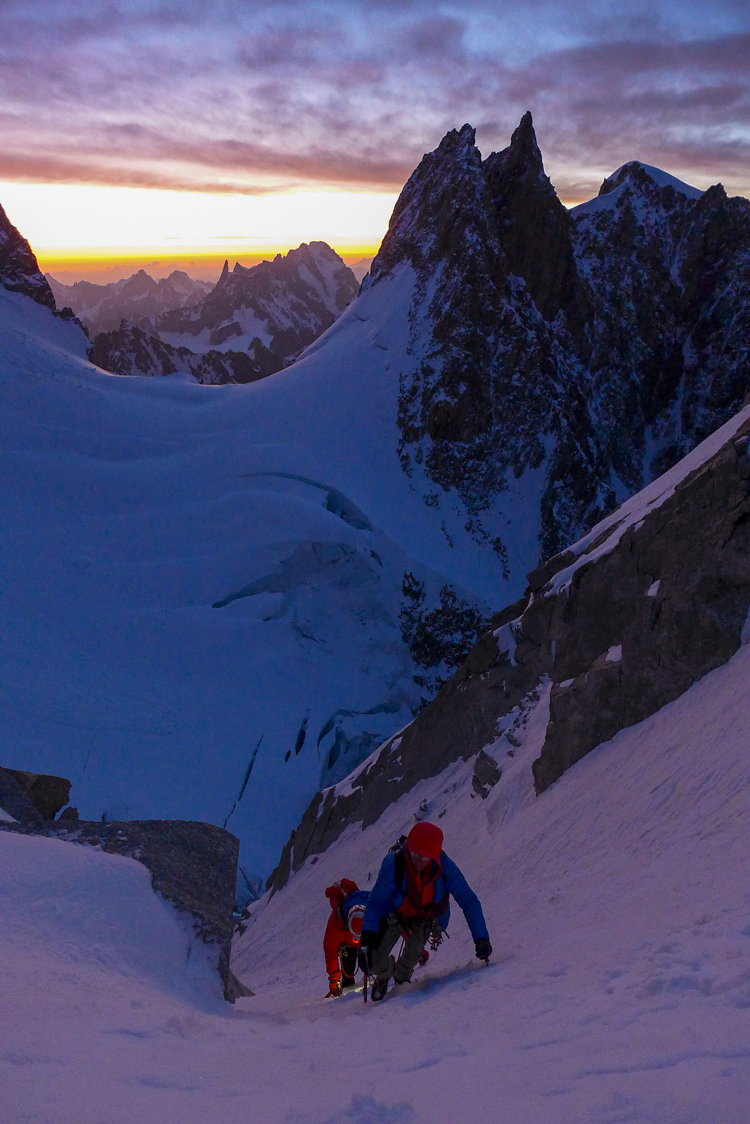
Mont Maudit - Kuffner Arete
- Datum:
- 26.06.2023
- Tourcharakter:
- Alpinklettern
- Tourlänge:
- 12:15h
- Entfernung:
- 13,9km
 The Kuffner ridge on Mont Maudit has been sitting on my “wishlist” for a number of years; not just because Mont Maudit is also on the 4000m list, but because of what I’d heard from other people and seen cool pictures from the route. Moreover, the route description opens with “This is one of the finest ridge climbs in the Alps, combining snow aretes with interesting mixed sections and unfolds amongst scenery of the highest order....”. After a binned attempt in June 2022 (we only got as far as Cirque Maudit after a night with no decent refreeze) I was super keen to make the most of any opportunity with good weather and snow conditions this year. Since the Col de la Fourche bivouac hut got swept down off the ridge and destroyed last summer by rockfall, our only options were to start >>>
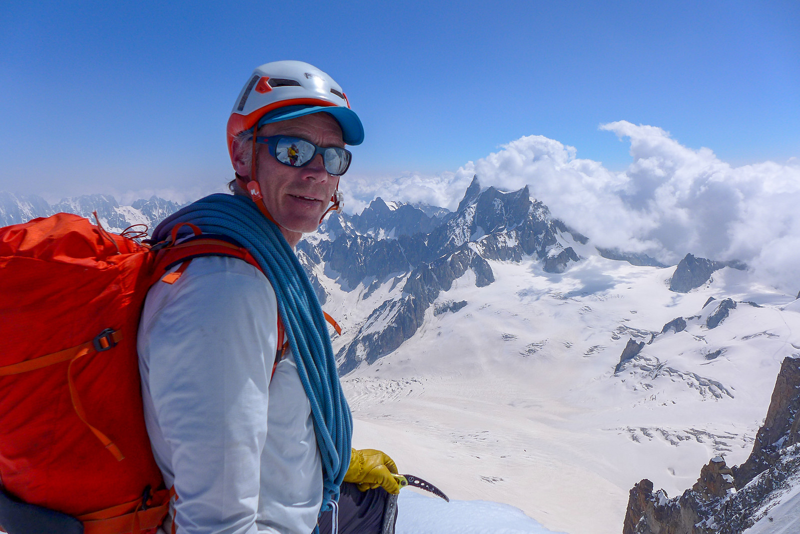
Aiguille Verte - Whymper Couloir
- Datum:
- 18.06.2023
- Tourcharakter:
- Alpinklettern
- Tourlänge:
- 11:00h
- Entfernung:
- 9,0km
 After acclimatising in the Saas valley I was originally supposed to head over to Evolene on the saturday and meet up with British mountain guide Tim Neill and climb with him for a couple of weeks again. I was really looking forward to this as it had been a few years since he’d been out in the Alps for the summer season. We had been keeping in contact during the week about potential objectives, and as things turned out it looked like there would be a weather window for doing the Whymper couloir on the Aiguille Verte on the saturday/sunday after my trip up the Lagginhorn. I had hoped to have had two good nights sleep down in the valley before embarking on another 4000er like the Verte, but as most of the routes on the Aiguille Verte are a bit tricky to get in good condition this opportunity >>>
Täschhorn
- Datum:
- 08.07.2022
- Tourcharakter:
- Alpinklettern
- Tourlänge:
- 9:35h
- Entfernung:
- 14,8km
 The final two days climbing with Graham this year were planned to be spent on the Täschhorn-Dom traverse, although when we left Evolene early on the thursday morning the weather forecast was indicating pretty strong winds up high for both days and I was a bit concerned about whether it would end up being too much wind for doing an exposed ridge traverse. We decided to stick with the plan and see how things turned out anyway. We were planning to do the traverse and descend all the way back down to the valley in one day, so a lot of food was packed both for snacks and for dinner/breakfast at the Mischabeljoch bivouac hut, which was the starting point for the south ridge of the Täschhorn. Originally we’d thought to go up to the bivouac hut by starting from Täschalp and hiking up the Weingarten >>>
Les Droites
- Datum:
- 30.06.2022
- Tourcharakter:
- Alpinklettern
- Tourlänge:
- 13:29h
- Entfernung:
- 10,9km
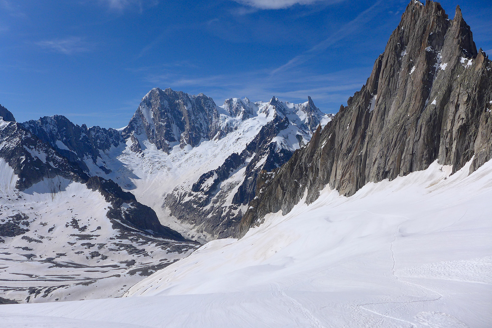
 Les Droites was a bit unlike some of the other 4000m peaks in the sense that it wasn't one that I have really wanted to do for years – but one that is on the list of the 50 principal 4000m peaks in Martin Moran’s guidebook. But it kind of fitted in nicely as a 3-day trip with Dave after a couple of days of bad weather and we’d found out that the normal route up the south ridge of the East summit was still “doable” according to a German guide who’d been there the previous week, even though conditions were very dry for the time of year and the access couloir no longer had a decent snow cover.
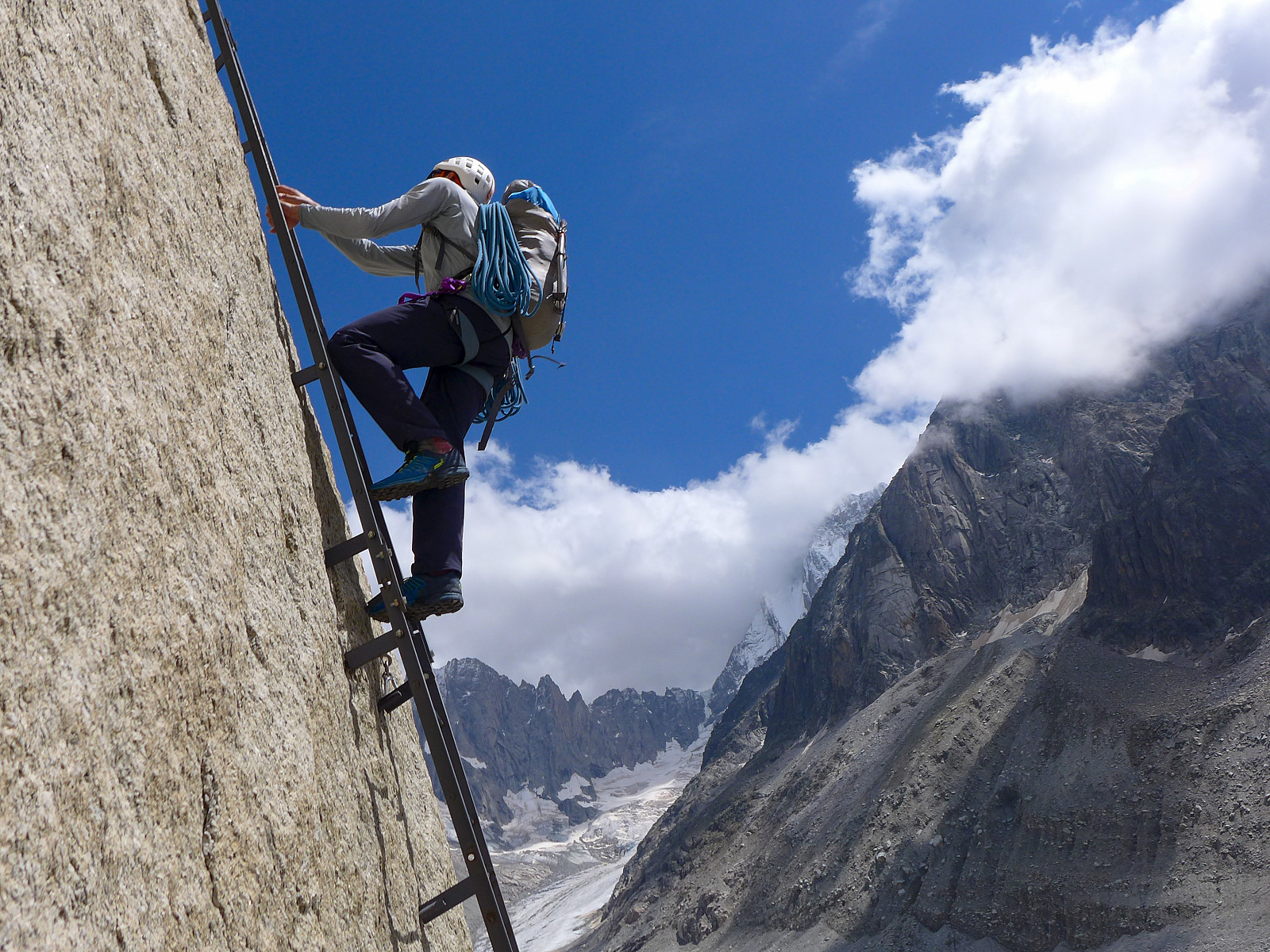
We headed up to the Couvercle hut, the starting point for the normal route by taking the train up to Montenvers from Chamonix, then used the telecabine to join the long series of stairs that lead >>>
Les Droites was a bit unlike some of the other 4000m peaks in the sense that it wasn't one that I have really wanted to do for years – but one that is on the list of the 50 principal 4000m peaks in Martin Moran’s guidebook. But it kind of fitted in nicely as a 3-day trip with Dave after a couple of days of bad weather and we’d found out that the normal route up the south ridge of the East summit was still “doable” according to a German guide who’d been there the previous week, even though conditions were very dry for the time of year and the access couloir no longer had a decent snow cover.
We headed up to the Couvercle hut, the starting point for the normal route by taking the train up to Montenvers from Chamonix, then used the telecabine to join the long series of stairs that lead >>>
Lauteraarhorn
- Datum:
- 17.06.2022
- Tourcharakter:
- Alpinklettern
- Tourlänge:
- 18:00h
- Entfernung:
- 30,0km
 The Lauteraarhorn has been sitting on my to-do list for the last few years, or basically ever since climbing the Schreckhorn but not continuing to do the traverse across to the Lauteraarhorn. Rather than going back from the Schreckhorn side, the other alternative was to approach it from the Grimsel Hospice to the east and ascend the Lauteraarhorn via its south face couloir and southeast ridge. However, with the length of the walk-in to this route being of the typical Oberland expedition type (i.e. LONG!) I’d sort of hoped that it might have ended up being an approach that I could do on skis. Of course the one year that I manage to get to the Alps with skis it turns out to be one of the driest winter/spring seasons ever, so there was basically too little snow to bother with a ski-in to the Aar bivouac >>>
Aletschhorn
- Datum:
- 27.05.2022
- Tourcharakter:
- Alpinklettern
- Tourlänge:
- 13:06h
- Entfernung:
- 12,3km
 Until now I’d only really seen the north side of the Aletschhorn, which rises more than 1000m steeply up from the Grosser Aletschfirn below and connects to the Dreieckhorn to the east of it. Still, it gives the impression that it would be a really cool mountain to climb, and moreso since most of the routes up it involve some sort of long approach. Hard-won summits are the best type :-) After having irritated one of my hip flexors while skinning up to the Vignettes hut earlier in the week, and Rachel was still suffering from painful blisters in ski boots, we were both feeling like it would be a nice change to ditch the skis and climb something in alpine boots. Hence the original idea to do a ski ascent of Nordend got binned and the idea of climbing the Aletschhorn via its southwest rib was >>>
Mönch
- Datum:
- 18.05.2022
- Tourcharakter:
- Alpinklettern
- Tourlänge:
- 9:05h
- Entfernung:
- 11,2km
 The day following our trip up the Gross Fiescherhorn was forecasted to be the sunniest day of the whole week, but we had already booked beds at the Mönchjoch hut so after a good dinner of risotto (with double helpings) and salad at the Konkordia hut we settled on a plan to skin up toward the hut and make an ascent of the Mönch via its southeast ridge on our way there the next day. The ski up to the start of the southeast ridge of the Mönch via the Jungfraufirn was expected to take some 4-5 hours, so it would be a long approach compared to the more popular way of climbing the Mönch - which usually involves taking the train up to the Jungfraujoch from Grindelwald and then spending the night at the Mönchjoch hut (a 45 minute walk from the Jungfraujoch) and doing it the day after. As a result we took another >>>

