Archive - Date
Archive - Activity
-
Climbing (43)
- Alpine climbing (31)
- Ice climbing (3)
- Mixed climbing (1)
- Sport climbing (3)
- Via ferrata (1)
-
Other trip (5)
- Expedition (5)
-
Other winter trip (5)
- Snowshoe trip (5)
-
Ski trip (449)
- Backcountry skiing (4)
- Cross-country skiing (2)
- Randonnée/Telemark (441)
-
Trip by foot (507)
- Alpine trip (47)
- Hike (196)
- Hillwalk (205)
- Jogging (4)
- Walk (55)
Peakbook-Friends


Allalinhorn - Hohlaubgrat
- Date:
- 03.09.2023
- Characteristic:
- Alpine trip
- Duration:
- 6:05h
- Distance:
- 5.8km
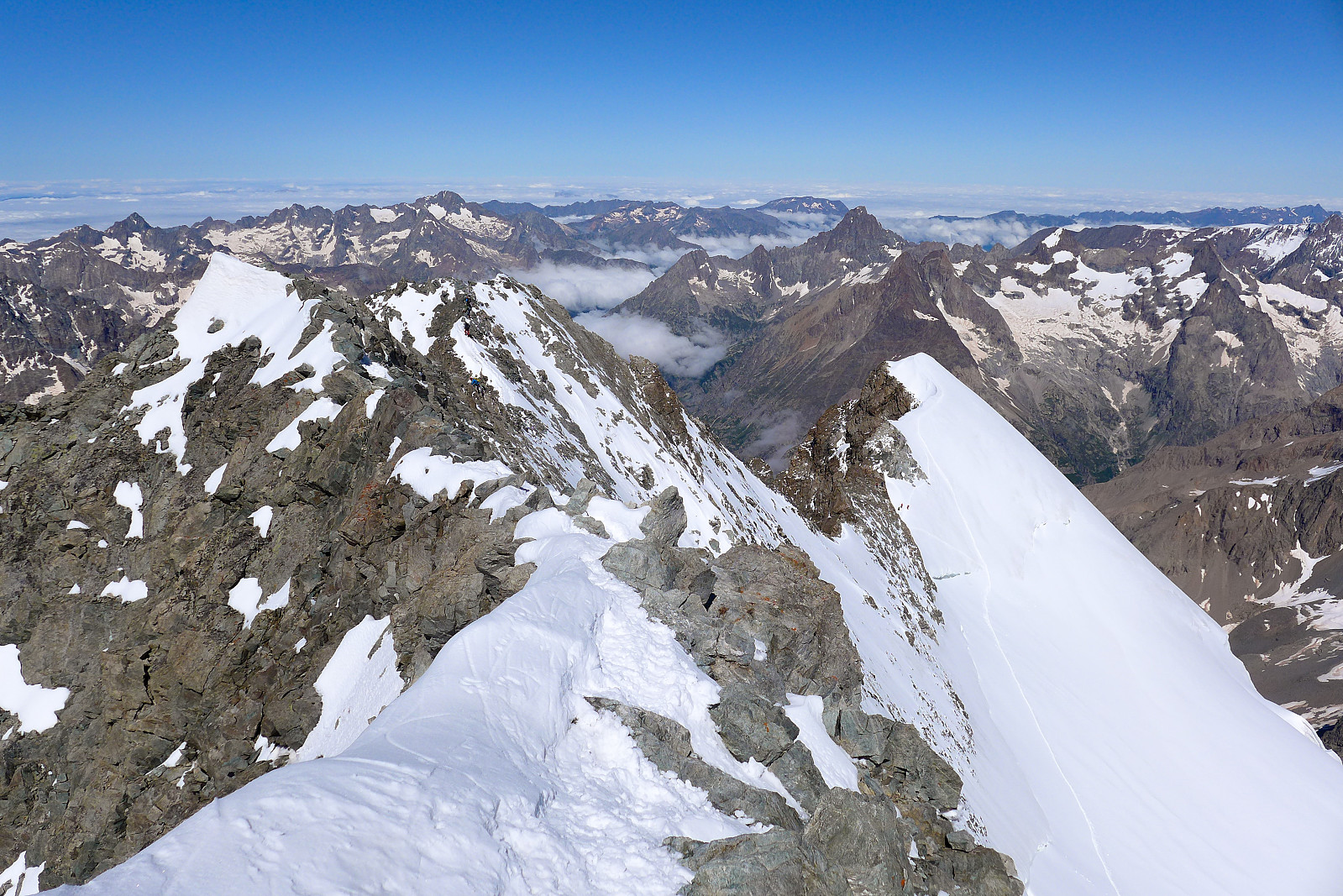
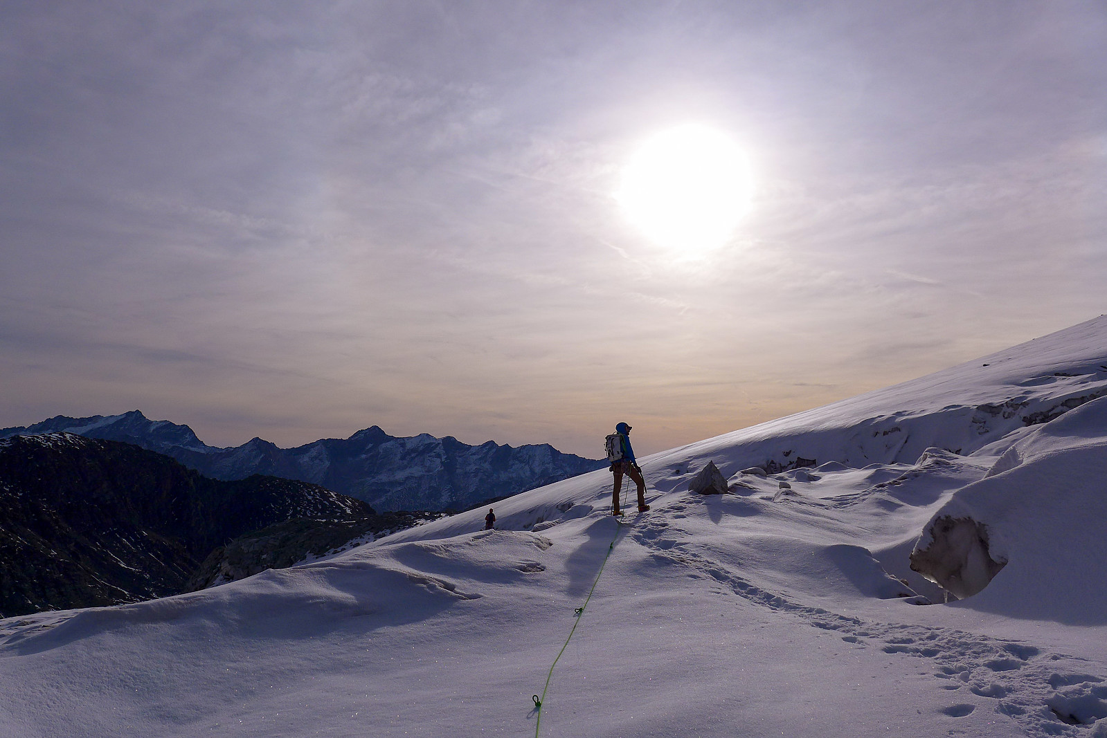 Klarte å rekke en siste fjelltur før hjemreise og det ble en chill dag på Allalinhorn via sin nordøstrygg, kjent også som Hohlaubgrat. Jeg hadde gått denne ruten før for 9 år siden med en fjellguide, i 2014 men jeg husker den som en ganske enkel tur og tenkte det kunne vært et greit turmål å prøve meg på igjen. Fikk med meg Nathan, og både Anna og Dev ble med så vi klatret som 2 taulag. Tok bussen fra Saas Almagell kl0630 på en ellers stille og fin søndagsmorgen men endte opp i kø for å ta heisen opp til Felskinn pga en invasjon av tenåringer som hadde skitrening oppe i løypene. Heldigvis tok det ikke lang tid før vi fikk plass på Mittelallalintoget og vi ble satt på Hohlaubstasjonen omtrent halvveis mellom Felskinn og Mittelallalin (man må be om å komme av her før >>>
Weissmies
- Date:
- 01.09.2023
- Characteristic:
- Alpine trip
- Duration:
- 13:50h
- Distance:
- 13.3km
 Været i starten av uka var mye preget av nordavind, uvanlig kaldt vær og mye nedbør, som til slutt endte opp med opp mot 1m nysnø på de høyeste toppene og det snødde helt ned til Saas Grund på 1600m (!), noe som førte til at SLF utstedet et skredvarsel. Uansett, det var på en måte flaks for de 12 deltakerne i gruppe 1, meg selv inkludert - som skulle ha trening i bl.a redning fra bresprekk disse to dagene når været var på sitt dårligste. Det var også uflaks at været var såpass dårlig at vi ikke fikk komme oss opp i høyden for å trene i på en ordentlig bre. Etter treningen var noen av oss ganske gira på en tur opp sørryggen på Weissmies, en alpintur som er vanligvis ganske enkel med opp mot grad 2 klyving og ingen bre som må krysses. Jeg har gått denne ruten et par >>>
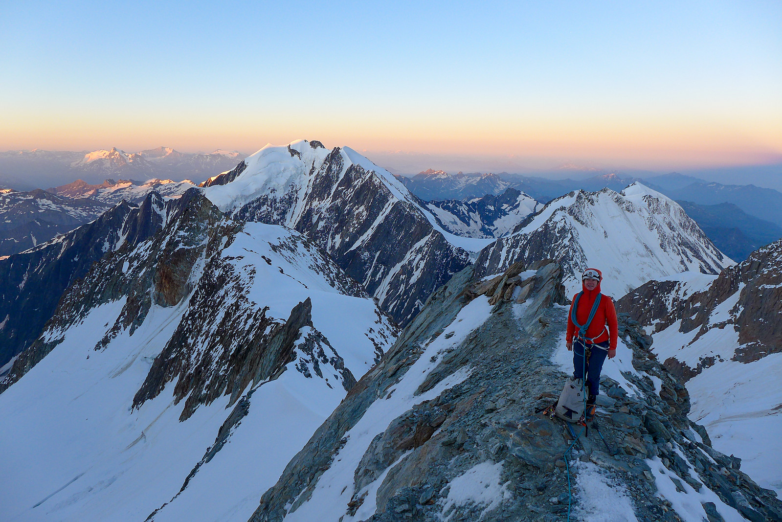
Dom
- Date:
- 03.07.2023
- Characteristic:
- Alpine trip
- Duration:
- 13:38h
- Distance:
- 16.1km
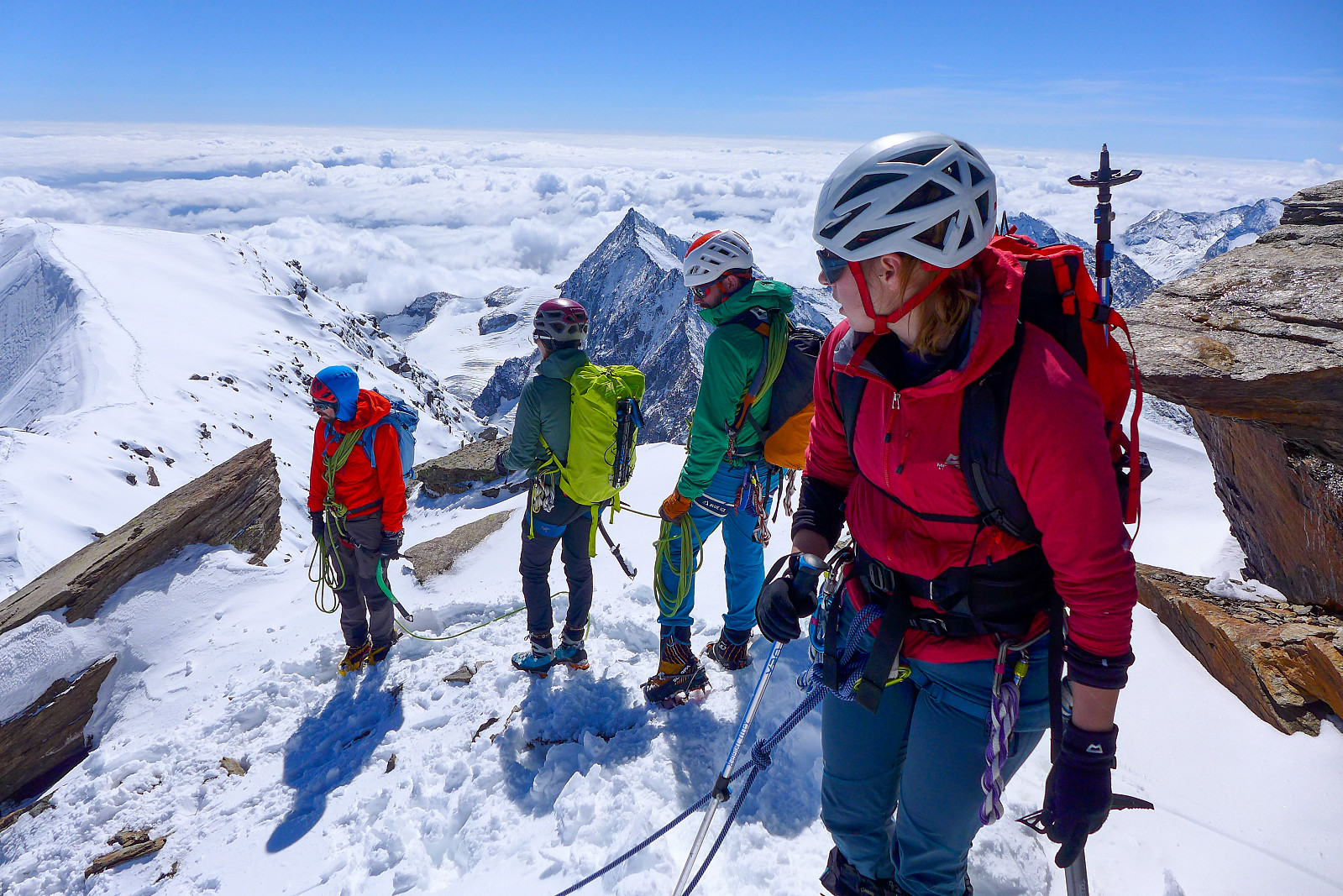
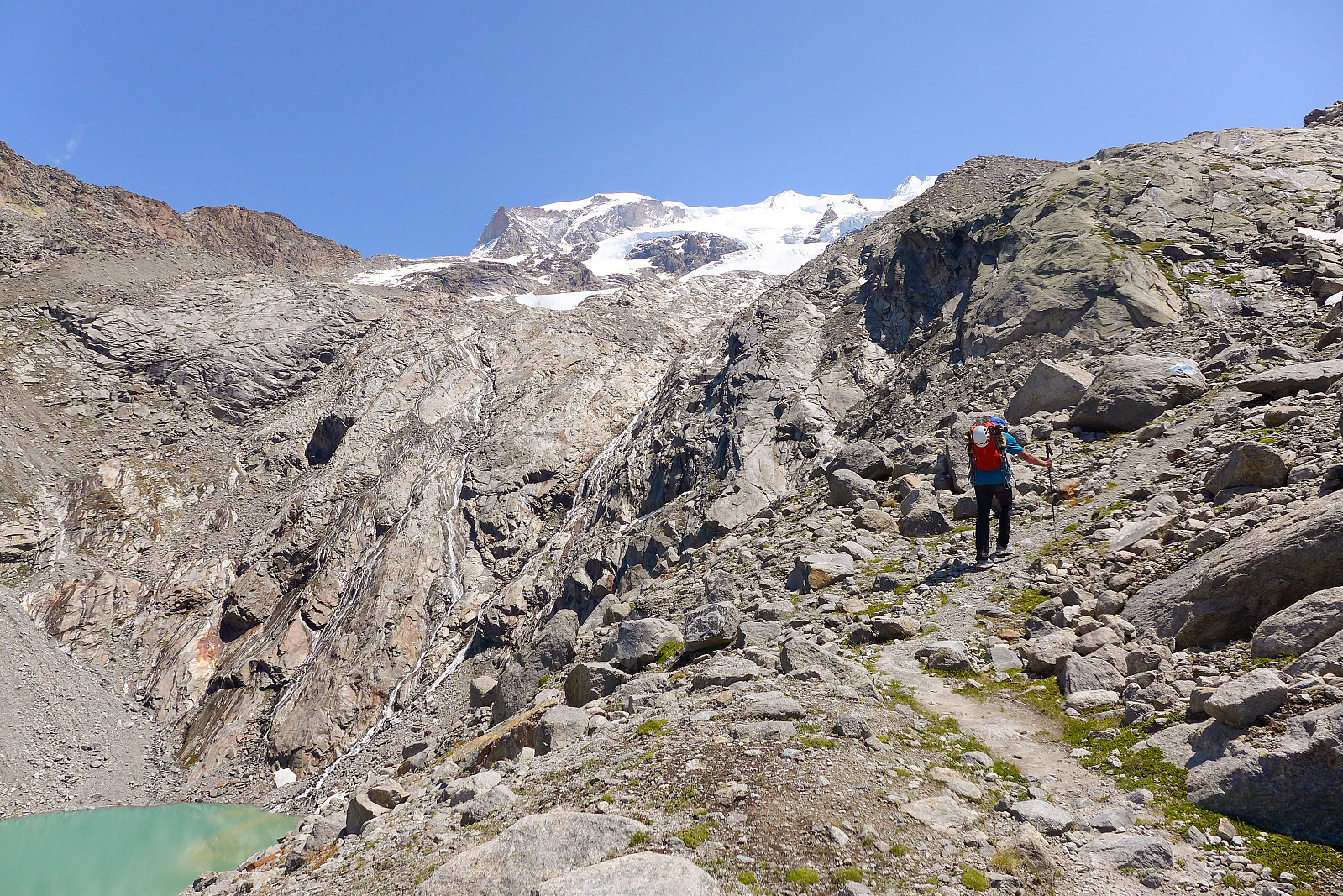
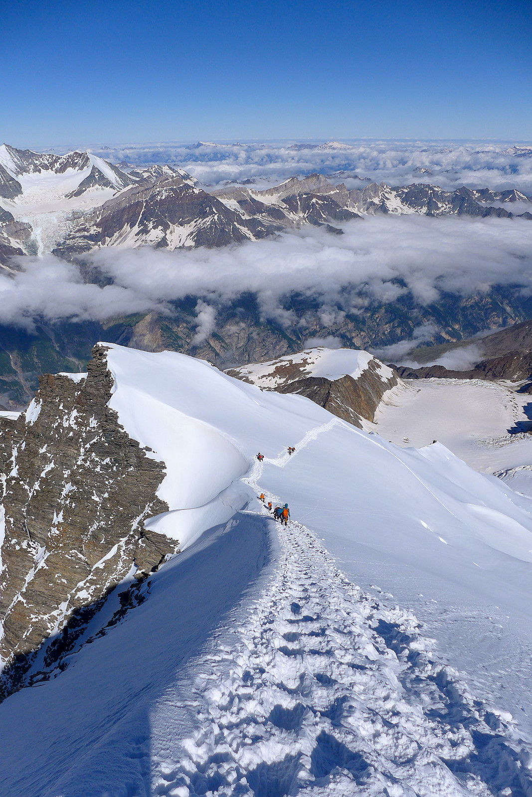 Following a couple of days of bad weather, it looked like we would be getting a couple of days of good weather again for the final week of the holiday. As I now only had two more summits to go to complete the 50 principal 4000m peaks of the Alps it was basically a toss up between the Dom and the Aiguille Blanche de Peuterey. I’d been following the weather forecast for the respective peaks rather closely and had come to the conclusion that the weather would be better further east at the start of the this final week, with apparently more sun and less wind forecasted for the Dom than on for example the Tour Ronde, which was the closest peak I could find to the Aiguille Blanche de Peuterey in the meteoblue database. I’d earlier hoped that the Taschhorn-Dom traverse would be a possibility this >>>
Nordend
- Date:
- 24.06.2023
- Characteristic:
- Alpine trip
- Duration:
- 10:10h
- Distance:
- 11.0km
 Nordend is one of the 50 major 4000m summits listed in Martin Moran’s guidebook to the 4000m peaks of the Alps, despite having a prominence of less than 100m, so it was on my to-do list for this summer even though given the choice I’d rather have done a ski-assisted ascent much like I’d done on the Dufourspitze a couple of years earlier. After almost an entire week of strong gales and a storm depositing new snow up high I’d originally wanted to use the new weather window to go and climb the Kuffner Arete on Mont Maudit, but since both the Torino and Cosmiques huts were full for friday and saturday night, we ended up heading to Nordend first since there was still many availabe beds in the Monte Rosa hut, which had literally just opened for the summer season. We drove over to Zermatt >>>
Jungfrau
- Date:
- 06.07.2022
- Characteristic:
- Alpine trip
- Duration:
- 6:54h
- Distance:
- 9.6km
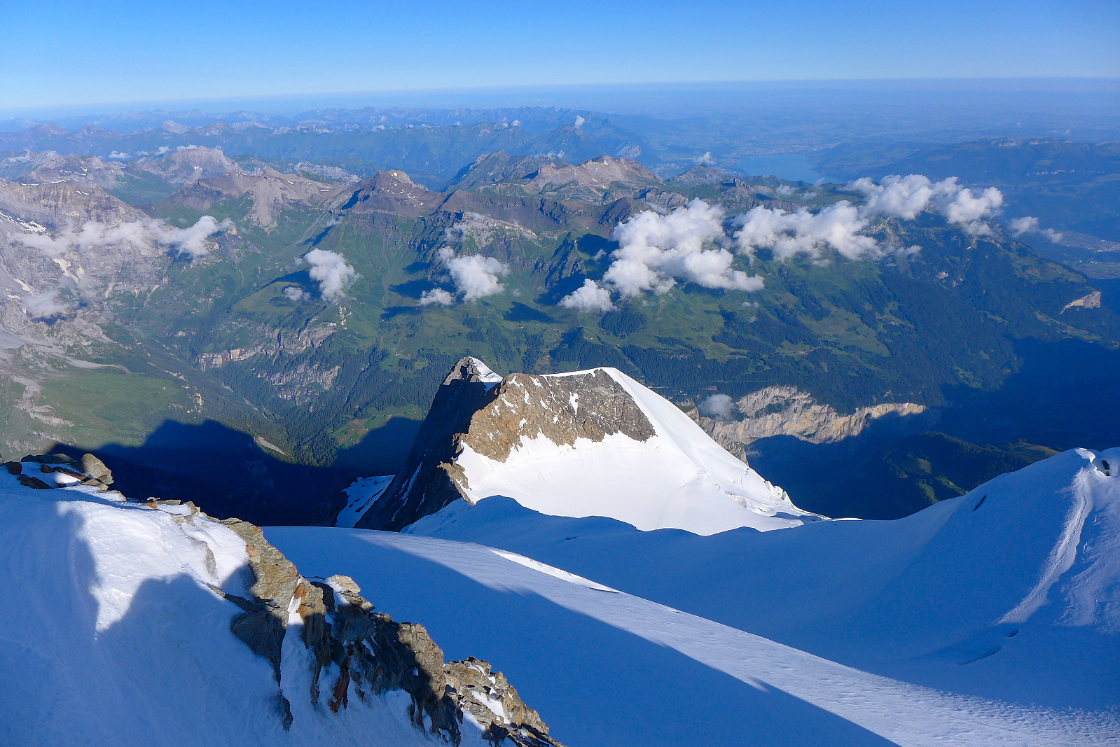 After Les Droites the weather forecast for my final week in the Alps, with the exception of Monday, was supposed to be more settled, sunny and warm and it looked like the perfect opportunity to (finally) try and do the Täschhorn-Dom traverse which I’d been wanting to do for several years. Initially it seemed like a good idea to head up on the tuesday to the Mischabeljoch bivouac hut and do the traverse the following day, but after discovering the hut was fully booked for tuesday night we decided to scrap that plan. I wasn’t too sure about doing the traverse on thursday either since the forecast was showing cloudier weather so in the end I suggested to Graham that we go to the Jungfrau at the start of the week and try to do the Täschhorn-Dom traverse thursday/friday to make the most of the good weather. >>>
Weissmies
- Date:
- 25.06.2022
- Characteristic:
- Alpine trip
- Duration:
- 8:49h
- Distance:
- 14.0km
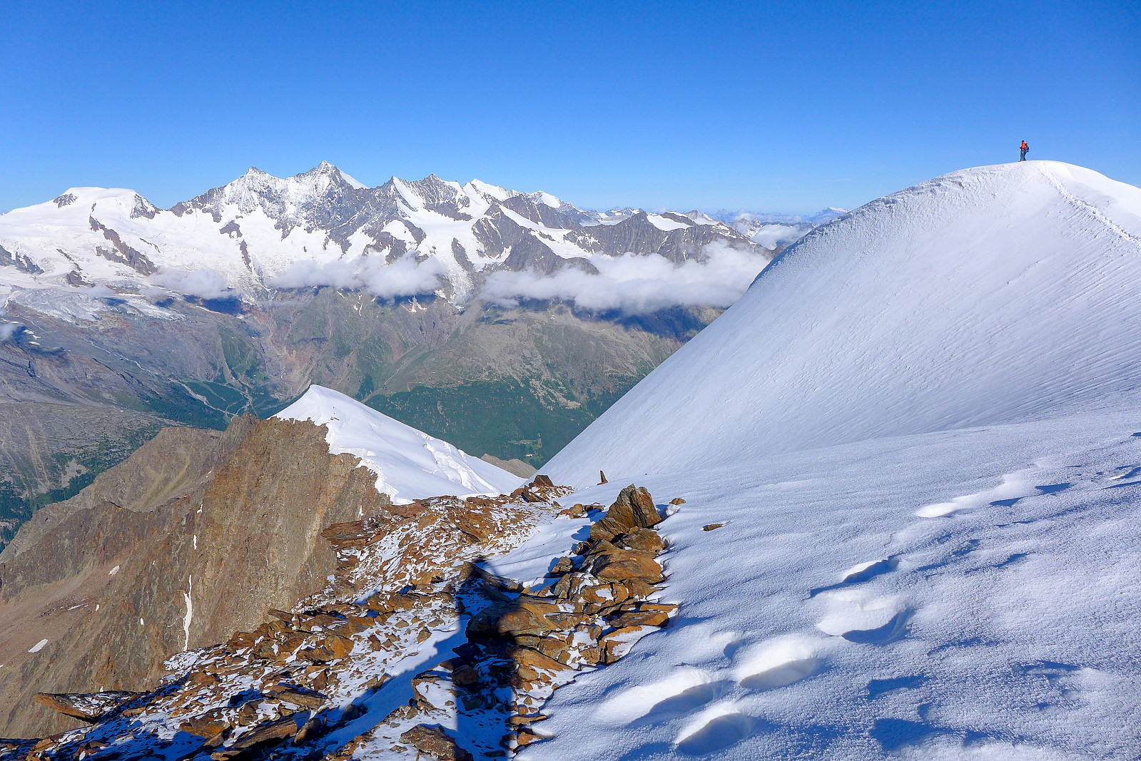 I've been wanting to do a "proper" alpine route solo for a few years and the south ridge of the Weissmies seemed to be a friendly option for a first solo route. I'd done it a couple of years earlier when it was plastered in new snow, but after last weekend's heatwave most ridges were now dry and clear of snow so it appeared to be an ideal opportunity to do it again. I booked a night at the Almageller hut and half expected to be the only British person there, but I ended up meeting quite a few other British guys there and had a much more social afternoon than expected chatting with them in the dining room.
Had breakfast at 4am the following morning and thought I would end up behind queues of other climbers on the approach to the Zwichbergenpass, but they were taking so long to get ready >>>
I've been wanting to do a "proper" alpine route solo for a few years and the south ridge of the Weissmies seemed to be a friendly option for a first solo route. I'd done it a couple of years earlier when it was plastered in new snow, but after last weekend's heatwave most ridges were now dry and clear of snow so it appeared to be an ideal opportunity to do it again. I booked a night at the Almageller hut and half expected to be the only British person there, but I ended up meeting quite a few other British guys there and had a much more social afternoon than expected chatting with them in the dining room.
Had breakfast at 4am the following morning and thought I would end up behind queues of other climbers on the approach to the Zwichbergenpass, but they were taking so long to get ready >>>
Store Lakselvtinden
- Date:
- 13.03.2022
- Characteristic:
- Alpine trip
- Duration:
- 9:50h
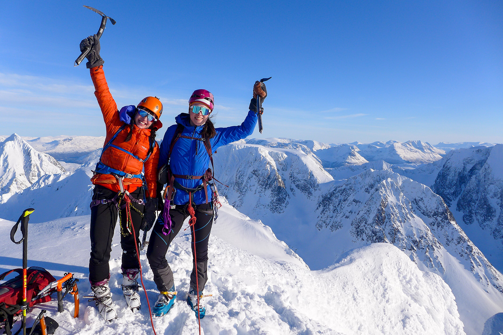 Denne turen ble sesongens desiderte høydepunkt (i Norge) for min del – og den kom litt tidlig! Etter en varm lørdag med vårskikjøring på Lille Blåmann, var det meldt fint vær med milde temperaturer på søndagen. Jeg antok at det ville bli ganske god stegjernsnø neste dag da klar himmel alltid gir en god nattefrost. Jeg hadde diskutert med Innika tidligere i uken om å gå en tur i Lyngen nok en gang siden det var stabile snøforhold og mtp føret som var forventet, virket det aller best å satse på en litt mer spennende tur der hovedfokus var å komme oss opp en kul topp og ikke bare kjøre fin snø. Så da ble Store Lakselvtinden (og evt Imbodentinden) dagens turmål. Vi begge gledet oss veldig til å komme i gang og det ble ganske tidlig avreise fra Tromsø rundt kl7. Jeg var >>>
Aiguille de Bionnassay
- Date:
- 20.07.2021
- Characteristic:
- Alpine trip
- Duration:
- 6:25h
- Distance:
- 11.7km
 The Aiguille de Bionnassay is an elegant peak lying at the western end of the Mont Blanc massif, and like the Lyskamm traverse is known for its narrow snow ridges – in particular the “standard” route up the east ridge, accessed from the Gonella hut on the Italian side of the mountain. Since most snowy routes were in excellent condition this summer it seemed like a good choice to finish off my month in the Alps, so we headed there after spending a night in Chamonix after coming back from the Ecrins. We had a somewhat delayed start because of long queues to get through the Mont Blanc tunnel into Courmayeaur, so by the time we had made it up the Val Veny road as far as we could get to La Visaille it was around midday and we still had at least 5 hours of walking ahead of us to get to the >>>
Barre des Écrins
- Date:
- 17.07.2021
- Characteristic:
- Alpine trip
- Duration:
- 10:23h
- Distance:
- 23.0km
 A new round of bad weather came after having returned to Evolene from the Bernese Oberland, and there was forecasted up to 50-60cm of new snow on some summits in the Valais. The extremely large amounts of new snow even prompted the SLF to issue an out-of-season avalanche bulletin for the following weekend, advising against going into steep snow-covered terrain until the new snow had had time to stabilise. Meanwhile, I’d been checking the weather forecast for the Barre des Ecrins since being on the drier side of the Alps there was a chance that the Ecrins would be not as badly affected by the current terrible weather. It turned out that much less precipitation was forecasted for the same days over there, and being keen to not lose my hard-won acclimatization by spending days down in the valley, >>>
Finsteraarhorn
- Date:
- 11.07.2021
- Characteristic:
- Alpine trip
- Duration:
- 7:15h
- Distance:
- 10.5km
 After having been up the Gross Grünhorn & Grunegghorn and walking over to the Finsteraarhorn hut the previous day, the plan was to climb the Finsteraarhorn via the upper southeast ridge (also referred to as the Sudroute in Martin Moran’s guidebook) as it would hopefully provide a more interesting route to the summit compared with the standard route from the Finsteraarhorn hut via the southwest flank and northwest ridge. However, since the entire southeast ridge was still looking very snowy when we checked it out from the summit of the Gross Grunhorn, we ended up changing our plans to do the standard route instead. Moreover, it seemed like there were going to be very few teams doing the normal route anyway, so there wasn’t much chance of it being too busy. Meteoblue had forecasted some early morning fog so I was expecting >>>

