Arkiv - dato
Arkiv - aktivitet
-
Annen tur (5)
- Ekspedisjon (5)
-
Annen vintertur (5)
- Trugetur (5)
- Fottur (507)
-
Klatring (43)
- Alpin klatring (31)
- Isklatring (3)
- Miksklatring (1)
- Sportsklatring (3)
- Via ferrata (1)
-
Skitur (449)
- Fjellskitur (4)
- Langrennstur (2)
- Randonnée/Telemark (441)
"Peakbookvenner"


Ullstinden
- Dato:
- 31.07.2012
- Turtype:
- Fjelltur
- Turlengde:
- 4:30t
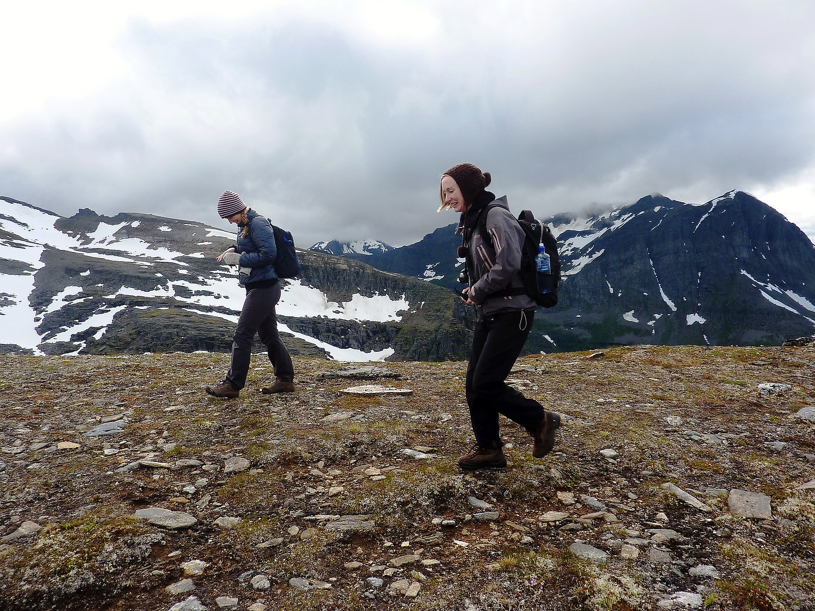
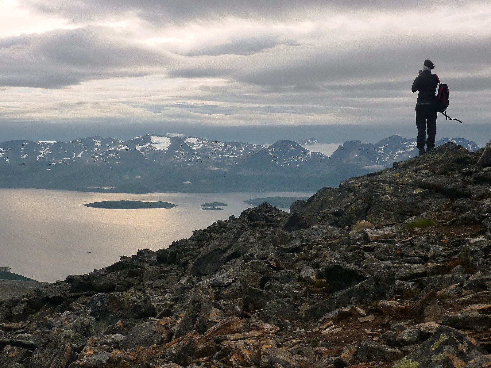 monakaup (Mona Kaupang) , one of the friends I had made from an FSG trip happened to have a whole day off - and both of us were keen to make the most of it if weather permitted. As things turned out, a load of rain was forecasted during the daytime, and rather than go out and deliberately get wet we chose to postpone a trip until the evening, when dry weather was supposed to come along. Our choice of mountain was Ullstinden, probably quite a popular winter peak and also a summer one because it is a Ti på Topp trip, although it is not the true summit of Ullstinden which is the recommended Ti på Topp route but the south-west summit. Well, it was good enough for us, and provided about 10km of walking up and down. Perfect for an evening. Depressingly though, when we met up at the Joker on Dramsveien, it was pretty wet >>>
Vasstinden
- Dato:
- 29.07.2012
- Turtype:
- Fjelltur
- Turlengde:
- 4:00t
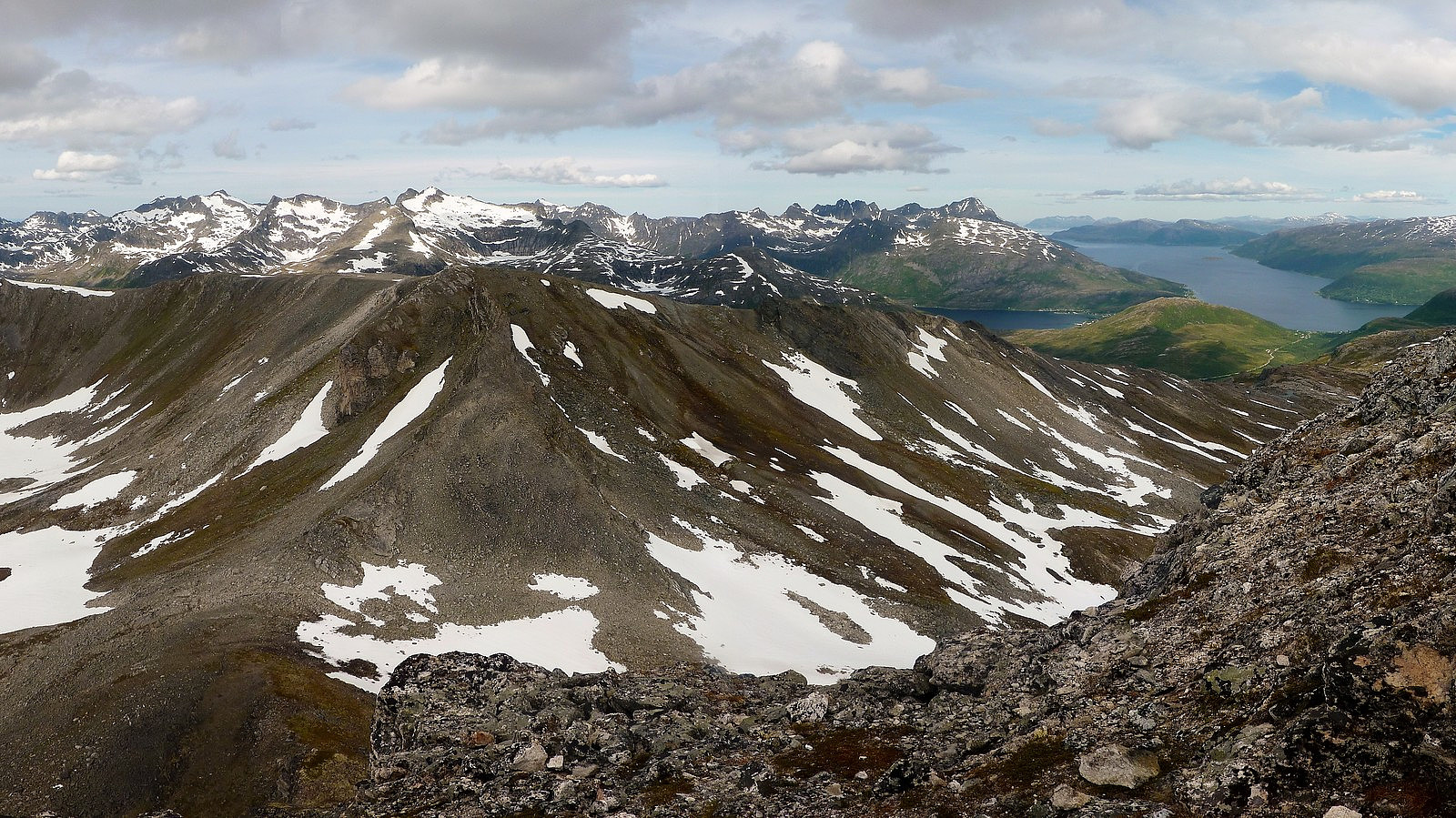
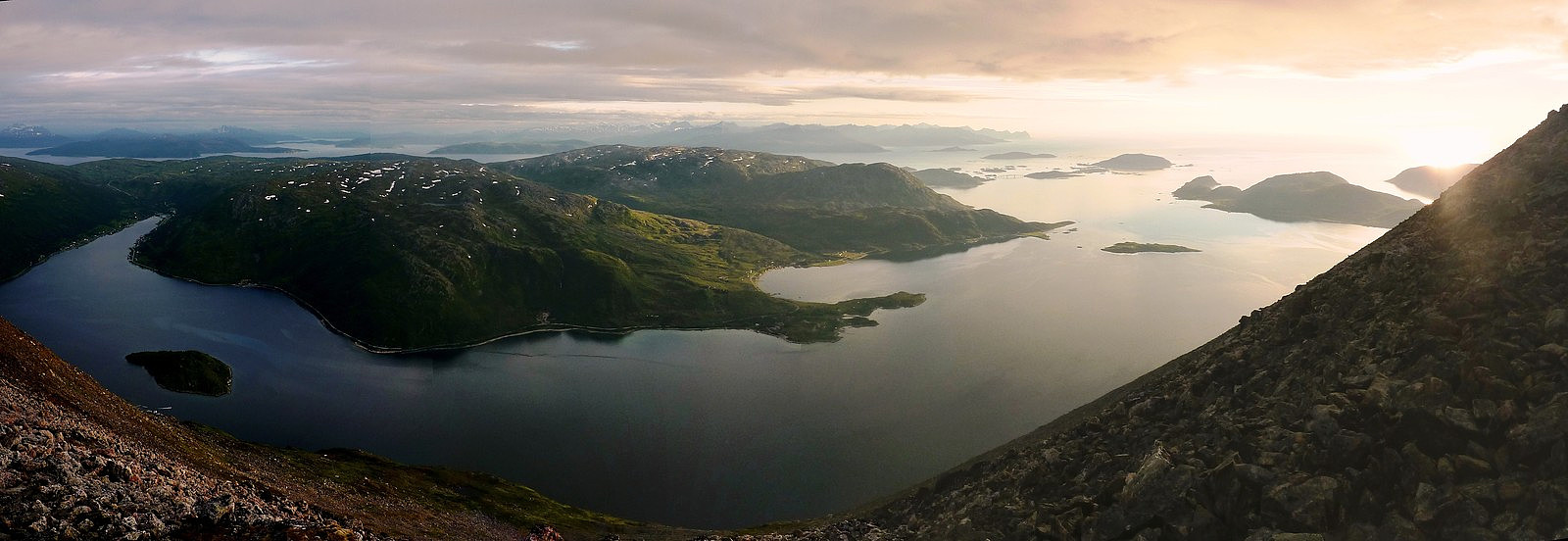 There is nothing more satisfying than spending 5 hours in warm coastal sunshine while the rest of the city is covered in fog. That's exactly how things turned out on the last Sunday afternoon in July. For everyone living on the eastern side of Tromsøya, it probably would have appeared to have been a dull and grey day. For people like me living on the western side however, I could see a huge patch of blue sky and glorious sunshine illuminating pretty much the whole of Kvaløya for the whole day (although the cloud and fog were kind of moving slowly across from east to west by evening), and it would have been such a shame not to snatch the chance to enjoy it too!
So that it how the Vasstinden plans were made. I suggested to my friend Ilona that we head out for a hike, as far west as possible >>>
There is nothing more satisfying than spending 5 hours in warm coastal sunshine while the rest of the city is covered in fog. That's exactly how things turned out on the last Sunday afternoon in July. For everyone living on the eastern side of Tromsøya, it probably would have appeared to have been a dull and grey day. For people like me living on the western side however, I could see a huge patch of blue sky and glorious sunshine illuminating pretty much the whole of Kvaløya for the whole day (although the cloud and fog were kind of moving slowly across from east to west by evening), and it would have been such a shame not to snatch the chance to enjoy it too!
So that it how the Vasstinden plans were made. I suggested to my friend Ilona that we head out for a hike, as far west as possible >>>
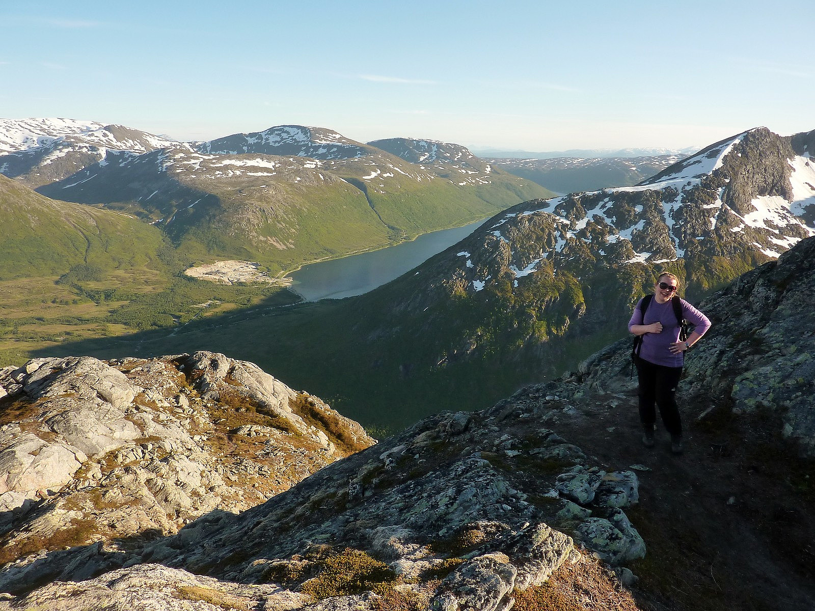
Tromsdalstinden
- Dato:
- 27.07.2012
- Turtype:
- Fjelltur
- Turlengde:
- 7:00t
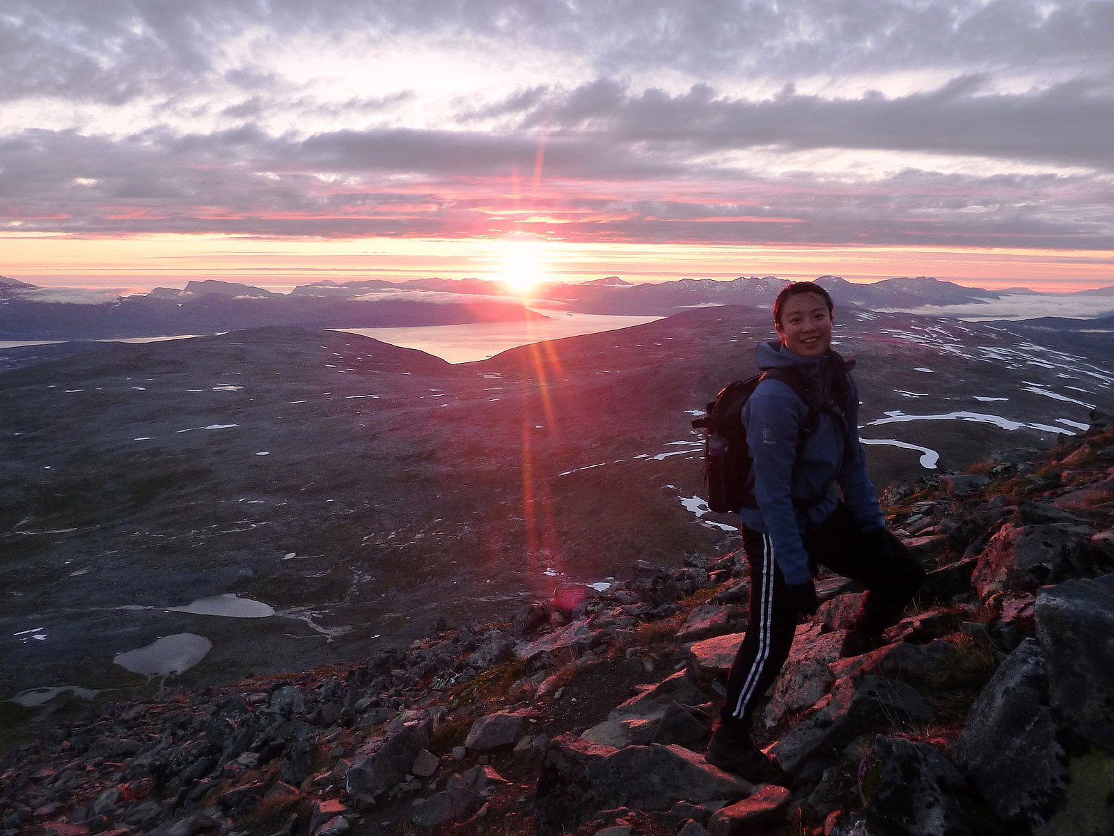 After almost 4 days of rainy weather, yet another window of hiking opportunity was forecasted for Friday evening and Saturday morning. I was sceptical of course, since the previous 'sunny' spell had not come when it had been forecasted. As things turned out, Friday was looking decidedly un-sunny until the evening...... then within about 1/2 hour the skies over Tromsø rapidly changed from overcast to clear and blue; we had a trip. My fiends Kristina and Ka Yan, who are also doing the Ti på Topp list, came up with an idea to take a night trip to Tromsdalstinden, and meet up at kl. 21 to start. Sounded quite an enticing idea to me, and I agreed. And that's how it started. At kl.21 we left the parking space in Tromsdalen and began the slightly tedious march up the forest track. It was quite a >>>
Stor-Kjølen
- Dato:
- 23.07.2012
- Turtype:
- Fjelltur
- Turlengde:
- 3:30t
 A bit of a spontaneous trip, this one. I was woken up by bright sunshine shining through my bedroom window at about 2am on the monday morning, after having had a good day with mixed weather on Bakaromntinden the previous evening.....the blue skies were not expected after yr's forecast had been quite remarkably inaccurate for the whole of the week before! So I decided at that point (still a little half asleep) that in a few short hours I would get myself back out on a hike again and enjoy the apparently nice interval of sunshine. Fortunately when I actually got out of bed properly at 6am it was still sunny, so I got by rucksack ready for a quick trip before work. Stor-Kjølen seemed like a good option. It's really easy ground, almost flat for most of the way up because the height gain is spread >>>
Bakaromntinden
- Dato:
- 22.07.2012
- Turtype:
- Fjelltur
- Turlengde:
- 5:00t
 We ended up taking a trip to Bakaromntinden, one of this year's Ti på topp in Tromso as a back-up option to the rather puzzling weather we had at the weekend. yr.no was forecasting us with some nice sunshine from Sunday afternoon to Monday morning, and it seemed like the perfect time to seize the moment and make the most of the potentially dry and bright weather after having had a whole week of grey and wet weather. Sadly, it turned out that yr lied to us. Again. Nope, Sunday afternoon and evening turned out to be a bag of mixed weather, and the ambitious plans to do a trip to Middagstinden and Bentsjordtinden were substantially reduced to just the trip to Bakaromntinden instead, which is basically a satellite peak of Middagstinden on the Malangen peninsula. The big hikes would have to wait >>>
Litje Blåmannen
- Dato:
- 13.07.2012
- Turtype:
- Fjelltur
- Turlengde:
- 5:30t
 Litje Blåmannen is something of a local monument to Tromsø, in my opinion. Every day I walk to work it is there, plonked straight in front of me and sitting quietly behind the Kvaløya bridge. This mountain has been on my to-do list for a while, simply because I see it all the time and have become a little fixated climbing the mountains I see on a regular basis. Well, today, despite being Friday 13th, seemed like the ideal day to have a go at it. With yr.no forecasting a week of continuous rain from the weekend onwards, I had decided to prioritise the topptur-ing and spend as much time in the remainder of the sunshine as possible. It was a quick drive from Hamna to Håkoybotn, about 20 minutes, and when I arrived into the car park by the ungdomshuset I was the first car there.
The great thing >>>
Litje Blåmannen is something of a local monument to Tromsø, in my opinion. Every day I walk to work it is there, plonked straight in front of me and sitting quietly behind the Kvaløya bridge. This mountain has been on my to-do list for a while, simply because I see it all the time and have become a little fixated climbing the mountains I see on a regular basis. Well, today, despite being Friday 13th, seemed like the ideal day to have a go at it. With yr.no forecasting a week of continuous rain from the weekend onwards, I had decided to prioritise the topptur-ing and spend as much time in the remainder of the sunshine as possible. It was a quick drive from Hamna to Håkoybotn, about 20 minutes, and when I arrived into the car park by the ungdomshuset I was the first car there.
The great thing >>>
Tverrfjellet
- Dato:
- 10.07.2012
- Turtype:
- Fjelltur
- Turlengde:
- 4:00t
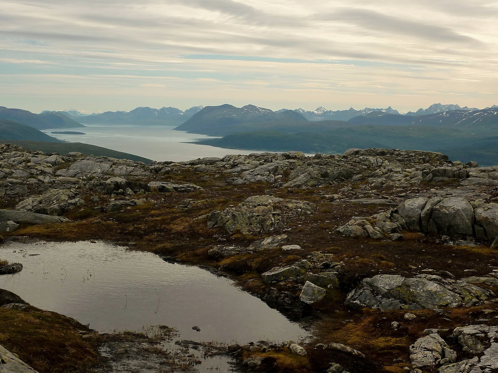
 This trip was initiated rather spontaneously during the lunch time at Nordlysobservatoriet with my friend Stine. Since it was such a nice sunny day, I was feeling extremely compelled to be outdoors and in the mountains again - but not on my own. I thought I would try my luck to interest some people to join me for an after-work trip and make a suggestion while people were in the foyer eating lunch. I wasn't all that hopeful, but to my amazement, my friend Stine actually agreed to come with me, which was extremely pleasing! So all of a sudden we had a plan to do another of the Ti på Topp trips, and I made the suggestion to go to Tverrfjellet since it was nestled right amongst the impressive string of peaks on the northern side of Kattfjord - Blåskredtinden, Middagstind, Skitntind and Storsteinnestind. >>>
Mount Kenya
- Dato:
- 01.07.2012
- Turtype:
- Fottur
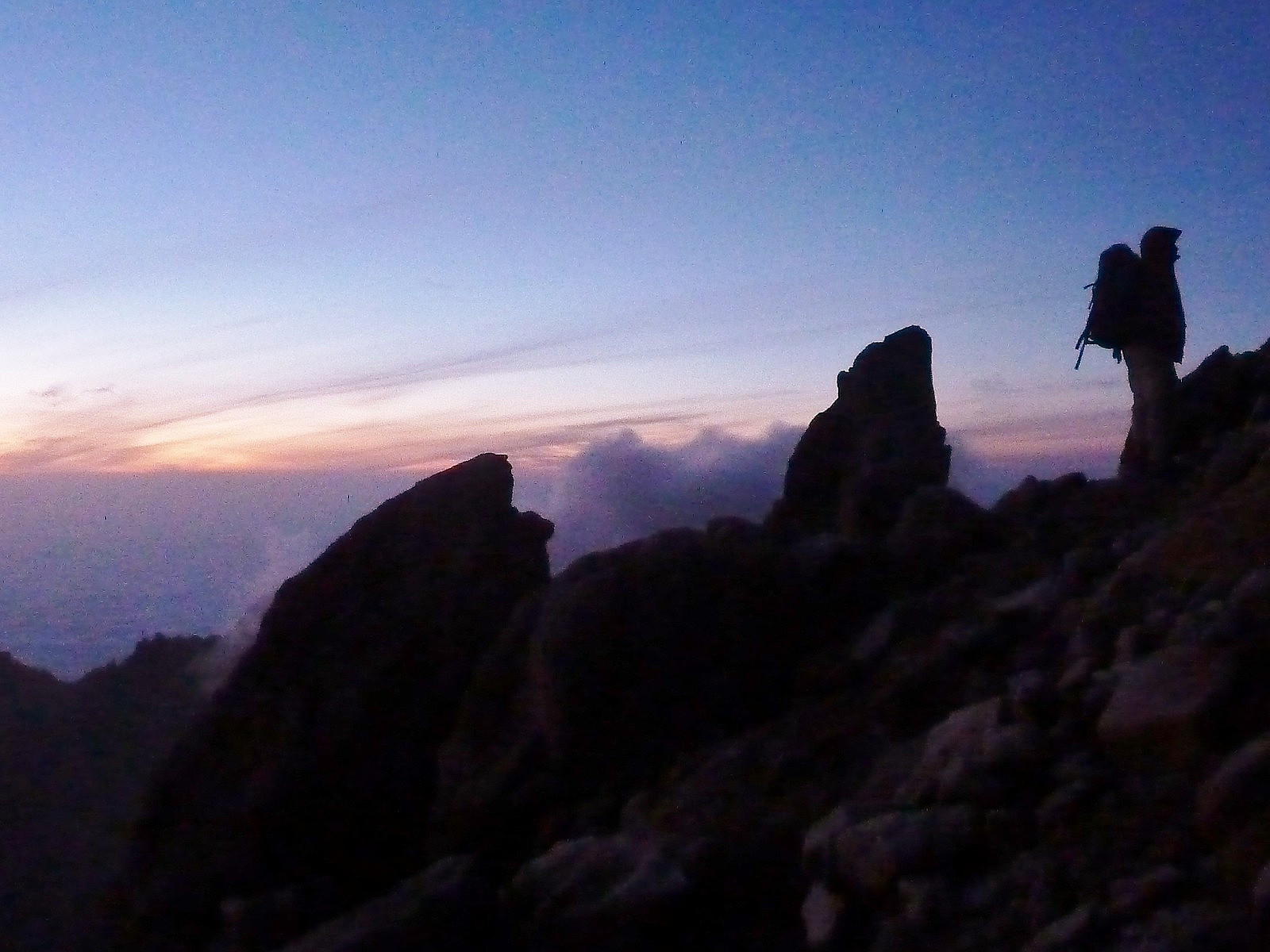 A six-day trip with friends from Norway, Germany and Iceland to Point Lenana on Mount Kenya, following the Sirimon route on the ascent and Chogoria route on the descent.
Day 1 :
Drove from Nairobi to the Sirimon park gates, a short distance from Nanyuki. Took a 3-hour walk to the Old Moses camp at 3300m where we were staying for 2 nights. Weather was pleasant with a few spots of rain but good visibility.
Day 2: Acclimatisation walk from Old Moses Camp
...To a viewpoint at 3900m looking over the Liki valley. Initially good sunny weather but it clouded over by about 9 or 10am, so we wended up having lunch at the view point in cloud and some light drizzle. Fortunately we got back to the Old Moses camp again before the really heavy downpours of rain started in the afternoon. Nice sunset just before >>>
A six-day trip with friends from Norway, Germany and Iceland to Point Lenana on Mount Kenya, following the Sirimon route on the ascent and Chogoria route on the descent.
Day 1 :
Drove from Nairobi to the Sirimon park gates, a short distance from Nanyuki. Took a 3-hour walk to the Old Moses camp at 3300m where we were staying for 2 nights. Weather was pleasant with a few spots of rain but good visibility.
Day 2: Acclimatisation walk from Old Moses Camp
...To a viewpoint at 3900m looking over the Liki valley. Initially good sunny weather but it clouded over by about 9 or 10am, so we wended up having lunch at the view point in cloud and some light drizzle. Fortunately we got back to the Old Moses camp again before the really heavy downpours of rain started in the afternoon. Nice sunset just before >>>

