Archiv - Nach Datum
Archiv - Nach Aktivität
-
Andere Tour (3)
- Kayaking (3)
-
Fahrradtour (107)
- Fahrradtour Straße (82)
- Fahrradtour gemischt (25)
-
Fahrzeugtour (9)
- Autotour (9)
-
Fußtour (1747)
- Bergtour (1034)
- Jogging (1)
- Spaziergang (52)
- Wanderung (660)
-
Skitour (109)
- Langlauf (44)
- Tourenskilauf (65)
Gesammelte Listen
-
Utvalgte topper og turmål i Bergen
(332/333)
 99%
99% -
Alle topper i Bergen
(379/386)
98%
-
Kvam ≥ 100m pf.
(41/44)
93%
-
Opptur Hordaland
(143/159)
89%
-
Voss ≥ 100m pf.
(86/98)
87%
-
Stasjoner på Bergensbanen
(28/36)
77%
-
Hordaland ≥ 100m pf.
(593/863)
68%
-
Ulvik ≥ 100m pf.
(26/38)
68%
-
Jondal ≥ 100m pf.
(15/23)
65%
-
Dagsturhyttene i Vestland
(33/61)
54%
-
Sunnhordland PF >= 100m
(100/186)
53%
-
DNT-hytter i Hordaland
(22/45)
48%
-
Hordaland: Hardanger PF>=100m
(170/359)
47%
-
Kvinnherad ≥ 100m pf.
(36/79)
45%
-
Sogndal ≥ 100m pf.
(23/81)
28%
-
DNT-hytter i Sogn og Fjordane
(8/47)
17%
-
Eidfjord ≥ 100m pf.
(6/42)
14%
-
Etne ≥ 100m pf.
(7/51)
13%
-
Ullensvang ≥ 100m pf.
(19/153)
12%
-
Opptur i Sogn og Fjordane peaks
(17/177)
9%

Bergsdalen to Evanger via Hamlagrøhornet
- Datum:
- 06.07.2024
- Tourcharakter:
- Bergtour
- Tourlänge:
- 5:24h
- Entfernung:
- 18,4km
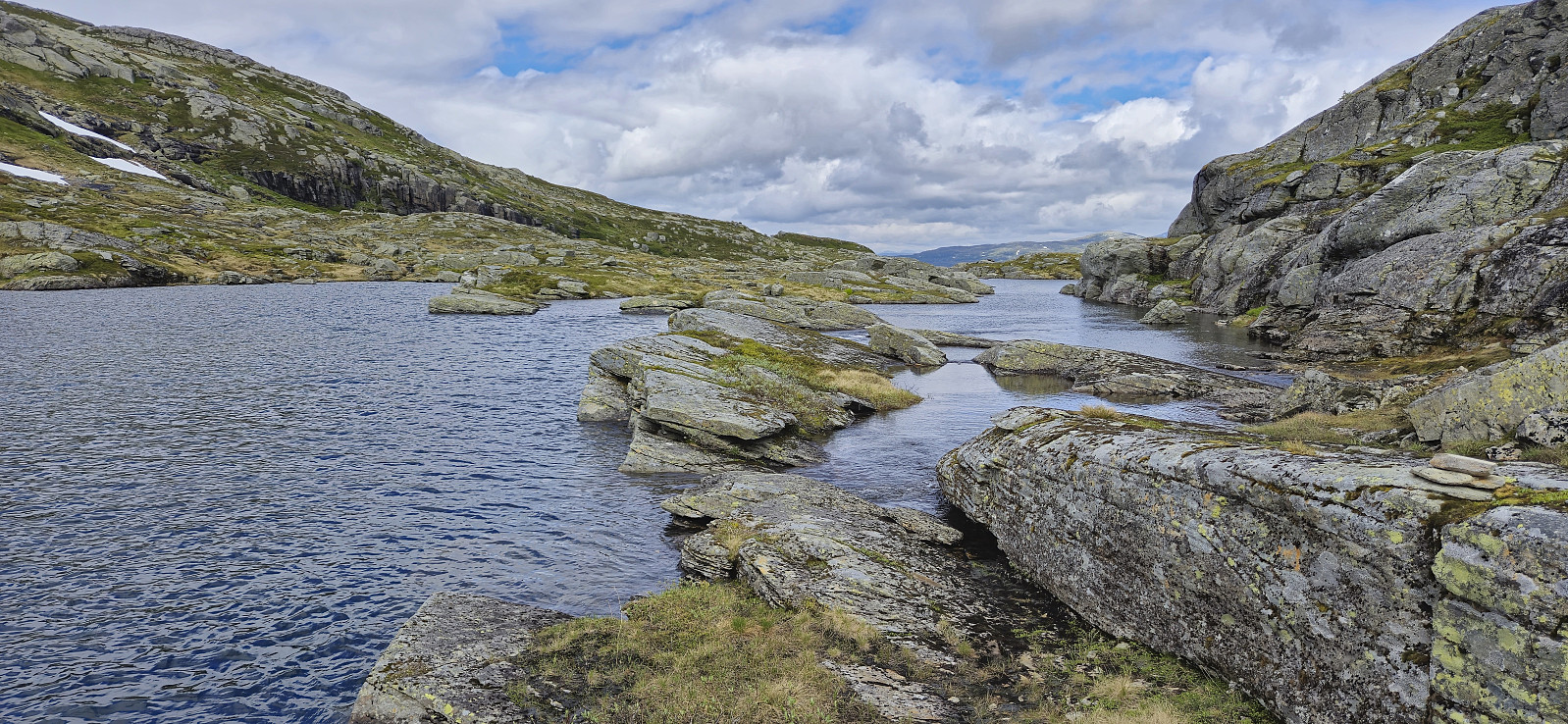
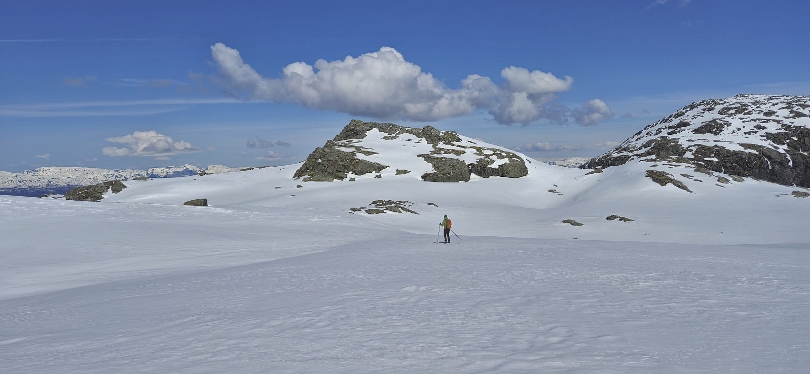
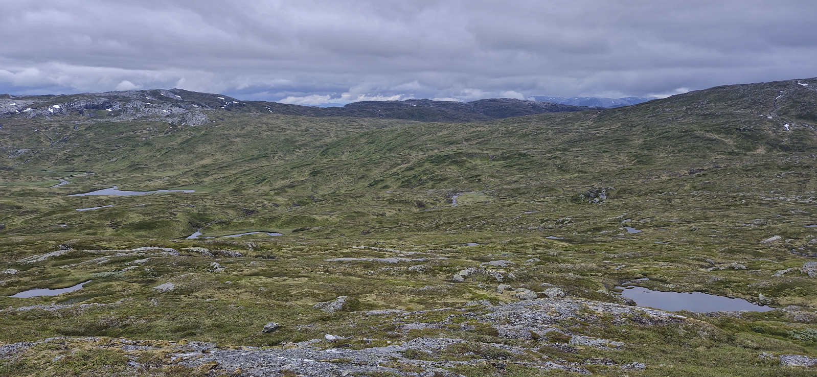 I started by taking the train to Dale and from there the bus up to Bergsdalen where I got off at the start of the gravel road to Alexander Grieghytten . After a quick look at the cabin I continued on a marked trail north towards Evanger. At the top of the pass I however turned right, left the marked trail, and headed off-trail to the summit of Hamlagrøhornet . Here I visited all of the potential highest points (the one just south of the largest cairn seems to be the real summit) before continuing northeast via Såta to Løva .
Løva stood out from the rest of the terrain but could still be easily ascended. The unusual rock formations making up the ridge seemed to be very good cairn building material, as there were at least four cairns at or near the summit. After a short lunch break, I descended the same way before heading north and >>>
I started by taking the train to Dale and from there the bus up to Bergsdalen where I got off at the start of the gravel road to Alexander Grieghytten . After a quick look at the cabin I continued on a marked trail north towards Evanger. At the top of the pass I however turned right, left the marked trail, and headed off-trail to the summit of Hamlagrøhornet . Here I visited all of the potential highest points (the one just south of the largest cairn seems to be the real summit) before continuing northeast via Såta to Løva .
Løva stood out from the rest of the terrain but could still be easily ascended. The unusual rock formations making up the ridge seemed to be very good cairn building material, as there were at least four cairns at or near the summit. After a short lunch break, I descended the same way before heading north and >>>
Karaldenuten roundtrip from Rong
- Datum:
- 30.06.2024
- Tourcharakter:
- Bergtour
- Tourlänge:
- 6:07h
- Entfernung:
- 12,5km
 Sunday hike to Karaldenuten organized by Voss Utferdslag . I started by taking the train to Voss where I met up with the others for the short carpool to Rong. Here we parked next to the road south of Rongastovo just after the road forked for Haugamoen. This was also where we met up with the local guide and after a quick overview of the hike we began our ascent along the gravel road towards Grungavatnet.
The gravel road turned into a wet trail before we arrived at the northern end of the lake for the first (and the only real) river crossing of the day. A rope had been put up to simplify the crossing and thus we all made it to the other side almost without getting wet.
A steep but relatively short section followed before the terrain turned less steep. There was a marked trail all the way to the summit, although the markers, a combination >>>
Sunday hike to Karaldenuten organized by Voss Utferdslag . I started by taking the train to Voss where I met up with the others for the short carpool to Rong. Here we parked next to the road south of Rongastovo just after the road forked for Haugamoen. This was also where we met up with the local guide and after a quick overview of the hike we began our ascent along the gravel road towards Grungavatnet.
The gravel road turned into a wet trail before we arrived at the northern end of the lake for the first (and the only real) river crossing of the day. A rope had been put up to simplify the crossing and thus we all made it to the other side almost without getting wet.
A steep but relatively short section followed before the terrain turned less steep. There was a marked trail all the way to the summit, although the markers, a combination >>>
Tvindefossen
- Datum:
- 16.06.2024
- Tourcharakter:
- Autotour
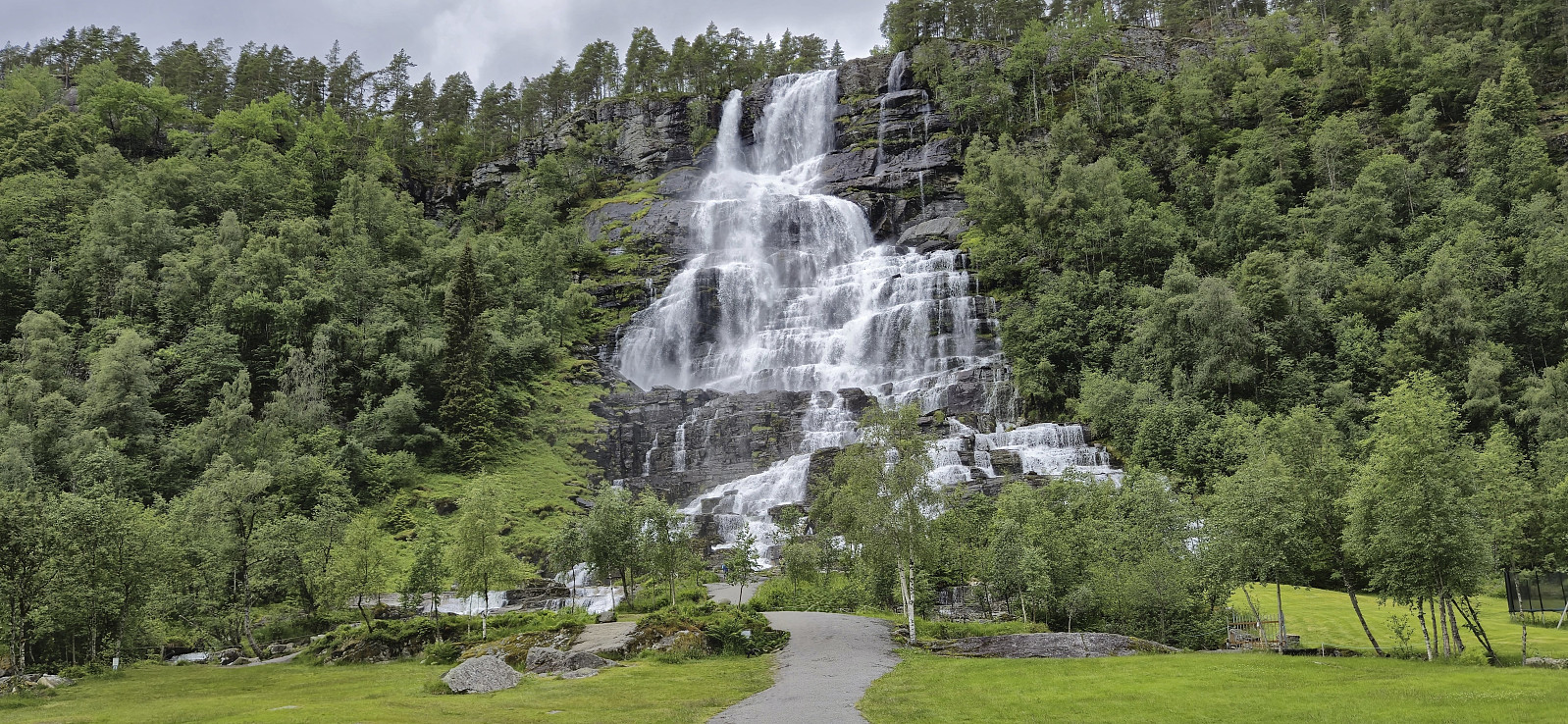 Short visit when driving home to Bergen from a weekend in Myrkdalen.
Svolefjellet from Myrkdalen
- Datum:
- 15.06.2024
- Tourcharakter:
- Bergtour
- Tourlänge:
- 5:05h
- Entfernung:
- 14,2km
 When my sister and her family drove to Voss where my youngest nephew was going to take part in Voss Cup, me and my dad wanted to first go for a hike and decided on Svolefjellet . Based on information from myrkdalen.no I had located a marked trail to Svoleset from the valley north of Svolefjellet and assumed that we would not have any issues reaching the summit from there.
After crossing the main road we followed a gravel road east to Bygdastølen where we crossed the river Kvanndølen via a bridge and continued on a newer and not yet fully set gravel road on the other side of the river. At this point we had come by two trail signs for Svoleset. The first was laying on the ground next to the gate at Bygdastølen, and the second was pointing at a trail stub that quickly came to an end just as the mentioned new gravel road started.
We were therefore >>>
When my sister and her family drove to Voss where my youngest nephew was going to take part in Voss Cup, me and my dad wanted to first go for a hike and decided on Svolefjellet . Based on information from myrkdalen.no I had located a marked trail to Svoleset from the valley north of Svolefjellet and assumed that we would not have any issues reaching the summit from there.
After crossing the main road we followed a gravel road east to Bygdastølen where we crossed the river Kvanndølen via a bridge and continued on a newer and not yet fully set gravel road on the other side of the river. At this point we had come by two trail signs for Svoleset. The first was laying on the ground next to the gate at Bygdastølen, and the second was pointing at a trail stub that quickly came to an end just as the mentioned new gravel road started.
We were therefore >>>
Myrkdalen Fjellandsby
- Datum:
- 14.06.2024
- Tourcharakter:
- Spaziergang
- Tourlänge:
- 0:42h
- Entfernung:
- 2,4km
 Short evening walk after the drive from Bergen to Myrkdalen Fjellandsby to spend the weekend at an apartment my sister had access to via HVL .
"Strafferunde" towards Hardangerjøkulen...
- Datum:
- 17.05.2024
- Tourcharakter:
- Tourenskilauf
- Tourlänge:
- 2:28h
- Entfernung:
- 10,2km
 Upon returning to Finse after completing Jøkulrunden I now had two choices: forget about the lost climbing skin and simply take the train back to Bergen or make a second ascent towards Hardangerjøkulen in an attempt to locate the skin and take the next train instead.
After a short break I decided on the latter and started my "strafferunde" across Finsevatnet. During my ascent to Appelsinhytta I asked several of the skiers coming the other way if they had seen a single orange climbing skin during their descent but none had.
Just below Appelsinhytta I spotted something in the distance that looked promising, however it turned out to be a small stuffed animal (more on than later), and my search had to continue. But not long after Appelsinhytta, shortly before the marked route takes a sharp left turn, I again spotted something in the distance >>>
Upon returning to Finse after completing Jøkulrunden I now had two choices: forget about the lost climbing skin and simply take the train back to Bergen or make a second ascent towards Hardangerjøkulen in an attempt to locate the skin and take the next train instead.
After a short break I decided on the latter and started my "strafferunde" across Finsevatnet. During my ascent to Appelsinhytta I asked several of the skiers coming the other way if they had seen a single orange climbing skin during their descent but none had.
Just below Appelsinhytta I spotted something in the distance that looked promising, however it turned out to be a small stuffed animal (more on than later), and my search had to continue. But not long after Appelsinhytta, shortly before the marked route takes a sharp left turn, I again spotted something in the distance >>>
Jøkulrunden on May 17th!
- Datum:
- 17.05.2024
- Tourcharakter:
- Tourenskilauf
- Tourlänge:
- 4:46h
- Entfernung:
- 22,5km
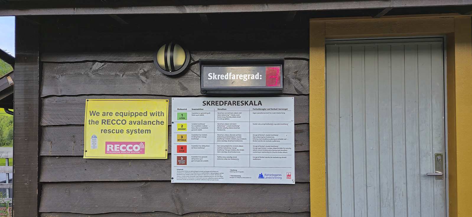
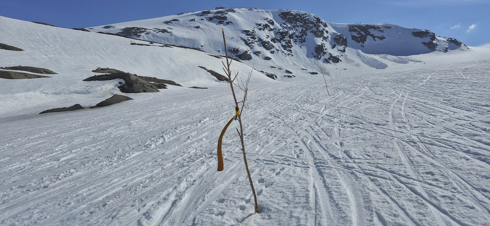
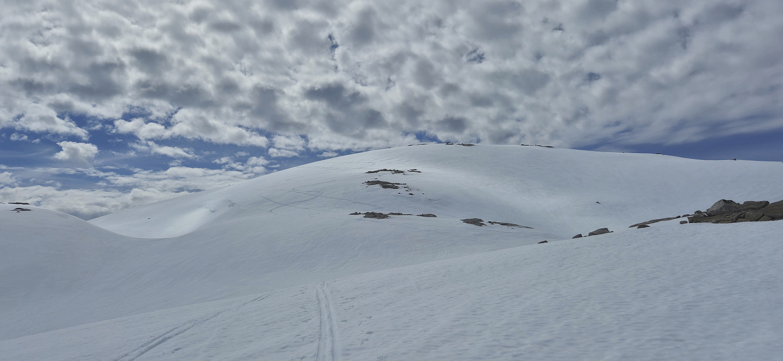
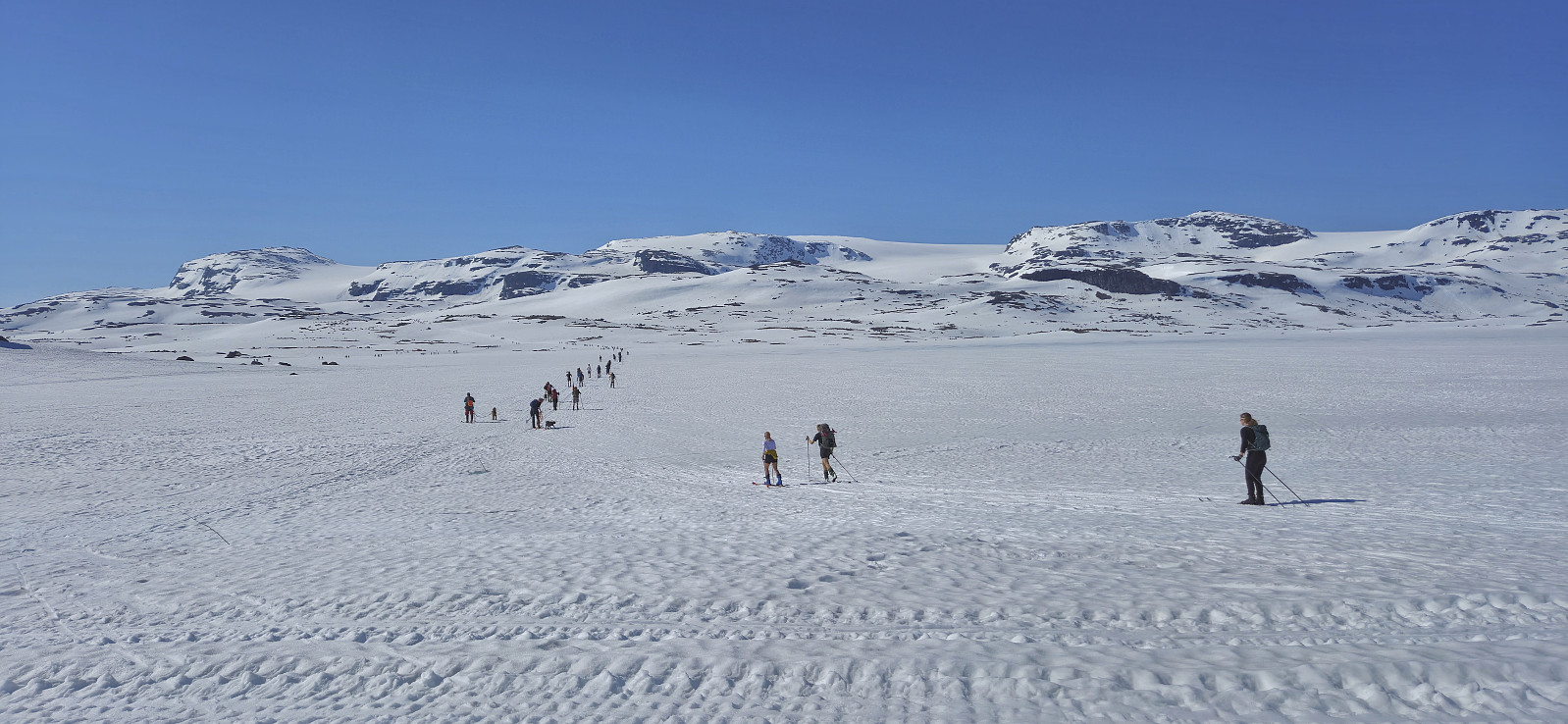 For the first time I decided to have a go at celebrating May 17th (Norway's constitution day) at Finse. I therefore took the morning train from Bergen to Finse where I was ready to start skiing shortly after the train arrived at 10:30. As expected I was far from alone and could simply follow the constant stream of skiers heading towards Hardangerjøkulen . The so-called Jøkulrunden, a roundtrip via the highest point of the glacier, is also marked with wooden sticks during the spring but these were not really needed today.
While I had started from Finse in a T-shirt, and many others were skiing in shorts, a relatively strong and cold wind resulted in a change to warmer clothing soon after passing by Appelsinhytta . For the same reason, the stops at both Jøkulhytta and the summit were cut short. Before continuing on Jøkulrunden I also >>>
For the first time I decided to have a go at celebrating May 17th (Norway's constitution day) at Finse. I therefore took the morning train from Bergen to Finse where I was ready to start skiing shortly after the train arrived at 10:30. As expected I was far from alone and could simply follow the constant stream of skiers heading towards Hardangerjøkulen . The so-called Jøkulrunden, a roundtrip via the highest point of the glacier, is also marked with wooden sticks during the spring but these were not really needed today.
While I had started from Finse in a T-shirt, and many others were skiing in shorts, a relatively strong and cold wind resulted in a change to warmer clothing soon after passing by Appelsinhytta . For the same reason, the stops at both Jøkulhytta and the summit were cut short. Before continuing on Jøkulrunden I also >>>
Onen from Austdalen
- Datum:
- 12.05.2024
- Tourcharakter:
- Tourenskilauf
- Tourlänge:
- 7:39h
- Entfernung:
- 20,7km
 For the second Sunday in a row I caught an early train to Voss to going skiing with Voss Utferdslag . This time our goal was Onen in Ulvik/Eidfjord . At 08:00 we were transported by bus from Voss to Osa and then up to Austdalen p-plass at around 760 meters above the sea level. During the summer it is possible to drive much further but today we could put on the skies only a couple hundred meters after leaving the parking lot.
We followed the road to Austdølvatnet before taking a shortcut up to Langvatnet. When walking along the dam we briefly had to take of the skis a couple of times but we after a lunch break next to the lake we could put the skis back on and begin the final ascent to the summit. The summit was reached without any issues and provided an excellent panoramic view. After a short break next to the summit cairn we returned the same way, including another >>>
For the second Sunday in a row I caught an early train to Voss to going skiing with Voss Utferdslag . This time our goal was Onen in Ulvik/Eidfjord . At 08:00 we were transported by bus from Voss to Osa and then up to Austdalen p-plass at around 760 meters above the sea level. During the summer it is possible to drive much further but today we could put on the skies only a couple hundred meters after leaving the parking lot.
We followed the road to Austdølvatnet before taking a shortcut up to Langvatnet. When walking along the dam we briefly had to take of the skis a couple of times but we after a lunch break next to the lake we could put the skis back on and begin the final ascent to the summit. The summit was reached without any issues and provided an excellent panoramic view. After a short break next to the summit cairn we returned the same way, including another >>>
Skiing from Vikafjellet to Bavallen
- Datum:
- 05.05.2024
- Tourcharakter:
- Tourenskilauf
- Tourlänge:
- 10:26h
- Entfernung:
- 34,3km
 Sunday skiing trip from Vikafjellet to Bavallen organized by the Norwegian Trekking Association , or more specifically Voss Utferdslag . I started by taking an early train to Voss where I met up with the rest of the group for the bus ride to Vikafjellet. We were dropped off at the parking lot at the start of Sendedalen and were finally ready to start skiing shortly before 09:30.
After an initial easy start along the lakes in Sendedalen we put on the climbing skins and began the ascent to Rjupeskaret followed by the first descent of the day to Murane where we had our first lunch break. From Murane we ascended towards Blåeggi where I made a short detour on my own to the summit before rejoining the rest of the group just north of Mykjedalsvatnet for the ascent to Skreieggi where we all visited the large summit cairn.
We had our second lunch break northwest of Svartenut, where we were joined by a couple >>>
Sunday skiing trip from Vikafjellet to Bavallen organized by the Norwegian Trekking Association , or more specifically Voss Utferdslag . I started by taking an early train to Voss where I met up with the rest of the group for the bus ride to Vikafjellet. We were dropped off at the parking lot at the start of Sendedalen and were finally ready to start skiing shortly before 09:30.
After an initial easy start along the lakes in Sendedalen we put on the climbing skins and began the ascent to Rjupeskaret followed by the first descent of the day to Murane where we had our first lunch break. From Murane we ascended towards Blåeggi where I made a short detour on my own to the summit before rejoining the rest of the group just north of Mykjedalsvatnet for the ascent to Skreieggi where we all visited the large summit cairn.
We had our second lunch break northwest of Svartenut, where we were joined by a couple >>>
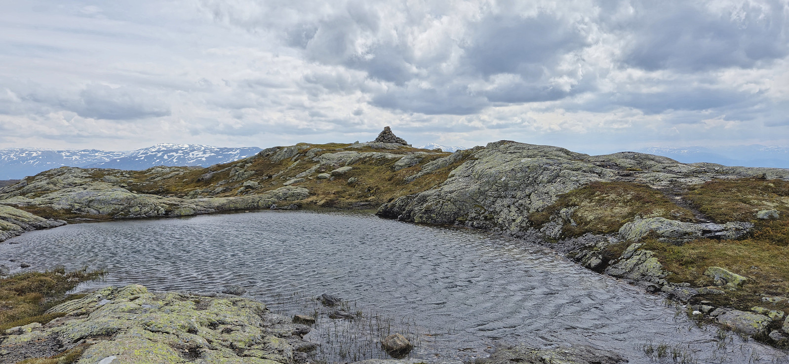
Steinafjell and Nordvest for Juklavatnet
- Datum:
- 27.04.2024
- Tourcharakter:
- Tourenskilauf
- Tourlänge:
- 4:59h
- Entfernung:
- 14,6km
 For the second weekend in a row, Petter and I returned to Jondal to go skiing. This time the plan was to drive up to FONNA Glacier Ski Resort and start our trip from there. However, due to the final part of the road up to ski resort still being covered by snow, we did not take any chances with our summer tires and instead parked at Hestadalen p-plass .
The skis came on immediately after leaving the parking lot and we made good progress up to the unnamed 1084 lake east of Svartaberget. From there we ascended steeply up Svartavassberget before the terrain levelled off as we approached the summit of Steinafjell , which we reached without any issues after roughly 1.5 hours of skiing.
From Steinafjell we wanted to make an attempt at finding a safe route to Nordvest for Juklavatnet . Both of us had in advance arrived at pretty much the same suggested route. The question was whether >>>
For the second weekend in a row, Petter and I returned to Jondal to go skiing. This time the plan was to drive up to FONNA Glacier Ski Resort and start our trip from there. However, due to the final part of the road up to ski resort still being covered by snow, we did not take any chances with our summer tires and instead parked at Hestadalen p-plass .
The skis came on immediately after leaving the parking lot and we made good progress up to the unnamed 1084 lake east of Svartaberget. From there we ascended steeply up Svartavassberget before the terrain levelled off as we approached the summit of Steinafjell , which we reached without any issues after roughly 1.5 hours of skiing.
From Steinafjell we wanted to make an attempt at finding a safe route to Nordvest for Juklavatnet . Both of us had in advance arrived at pretty much the same suggested route. The question was whether >>>
