Archive - Date
Archive - Activity
-
Bike trip (103)
- Bike trip - mixed (25)
- Bike trip - road (78)
-
Drive (8)
- Car drive (8)
-
Other trip (2)
- Kayaking (2)
-
Ski trip (109)
- Backcountry skiing (65)
- Cross-country skiing (44)
- Trip by foot (1700)
Collected lists
-
Nordhordland PF >= 100m
(217/218)
 99%
99% -
Utvalgte topper og turmål i Bergen
(324/328)
98%
-
Vaksdal ≥ 100m pf.
(59/60)
98%
-
Alle topper i Bergen
(371/382)
97%
-
Søyler (fastmerker) i Bergen
(93/100)
93%
-
Opptur Hordaland
(141/159)
88%
-
Hordaland ≥ 500m pf.
(25/30)
83%
-
Voss ≥ 100m pf.
(80/98)
81%
-
Stasjoner på Bergensbanen
(28/36)
77%
-
Kvam ≥ 100m pf.
(34/44)
77%
-
Hordaland ≥ 100m pf.
(563/863)
65%
-
Dagsturhyttene i Vestland
(33/61)
54%
-
Sunnhordland PF >= 100m
(93/186)
50%
-
Jondal ≥ 100m pf.
(11/23)
47%
-
Ulvik ≥ 100m pf.
(18/38)
47%
-
DNT-hytter i Hordaland
(21/45)
46%
-
Kvinnherad ≥ 100m pf.
(35/79)
44%
-
Hordaland: Hardanger PF>=100m
(147/359)
40%
-
Sogndal ≥ 100m pf.
(23/81)
28%
-
DNT-hytter i Sogn og Fjordane
(7/46)
15%

Vigdalstøl
- Date:
- 07.08.2020
- Characteristic:
- Hillwalk
- Duration:
- 0:42h
- Distance:
- 1.7km
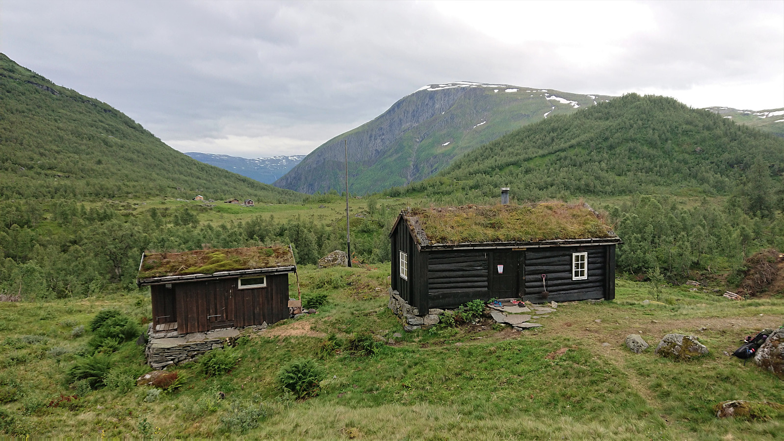 Short hike along the marked trail from the parking lot at Vårstølen to Vigdalstøl to spend the weekend there with my sister and her family, where we also took advantage of the four extra beds in Li-Hans-Fjøsen located less than 20 meters west of the main cabin.
Store and Vetle Haugmelen
- Date:
- 20.04.2019
- Characteristic:
- Backcountry skiing
- Duration:
- 7:01h
- Distance:
- 23.9km
 I was dropped off just before the locked gate at Dalåker and continued on foot along the gravel road. No snow at all until after the parking lot at Goro, and then only in shorter stretches consisting of more wet soft ice than snow. I did however put on the skis for a short time before reaching the trailhead for Store Haugmelen , but there the skis had to come off again as the start of the trail was completely void of snow. Soon there would be snow mixed in with the wet dirt, but it would take several hundred meters until I could finally put the skis back on for good, with only a couple of short stretches where walking was required.
Given the low amounts of snow, I decided to follow the summer route via Vassløysa instead of the longer ascent via the ridge from the south. This was also where all the old tracks were leading. >>>
I was dropped off just before the locked gate at Dalåker and continued on foot along the gravel road. No snow at all until after the parking lot at Goro, and then only in shorter stretches consisting of more wet soft ice than snow. I did however put on the skis for a short time before reaching the trailhead for Store Haugmelen , but there the skis had to come off again as the start of the trail was completely void of snow. Soon there would be snow mixed in with the wet dirt, but it would take several hundred meters until I could finally put the skis back on for good, with only a couple of short stretches where walking was required.
Given the low amounts of snow, I decided to follow the summer route via Vassløysa instead of the longer ascent via the ridge from the south. This was also where all the old tracks were leading. >>>
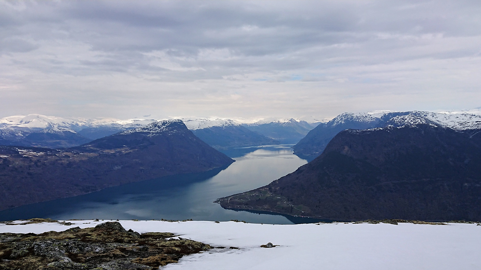
Solvornnipa from Barsnesfjorden
- Date:
- 20.05.2018
- Characteristic:
- Hillwalk
- Duration:
- 4:35h
- Distance:
- 12.0km
 Started from the private parking lot at the end of the gravel road on the south side of Barsnesfjorden. Followed the marked trail via Dal and Helgasete all the way to Solvornnipa . The trail was overall easy to follow and most of the snow was gone, except for 3-4 short stretches close to the summit. A slight haze made for slightly reduced views. After a quick lunch at the summit, I returned via the same route.
Note that the road to where the trail starts is private, i.e. no cars allowed. There are however a couple of parking spaces down by the small wharf along Barsnesfjorden just before the road turns west and starts climbing slightly towards the crossroads at Barsnes.
Started from the private parking lot at the end of the gravel road on the south side of Barsnesfjorden. Followed the marked trail via Dal and Helgasete all the way to Solvornnipa . The trail was overall easy to follow and most of the snow was gone, except for 3-4 short stretches close to the summit. A slight haze made for slightly reduced views. After a quick lunch at the summit, I returned via the same route.
Note that the road to where the trail starts is private, i.e. no cars allowed. There are however a couple of parking spaces down by the small wharf along Barsnesfjorden just before the road turns west and starts climbing slightly towards the crossroads at Barsnes.
Torstadnakken
- Date:
- 30.03.2018
- Characteristic:
- Backcountry skiing
- Duration:
- 6:27h
- Distance:
- 19.8km
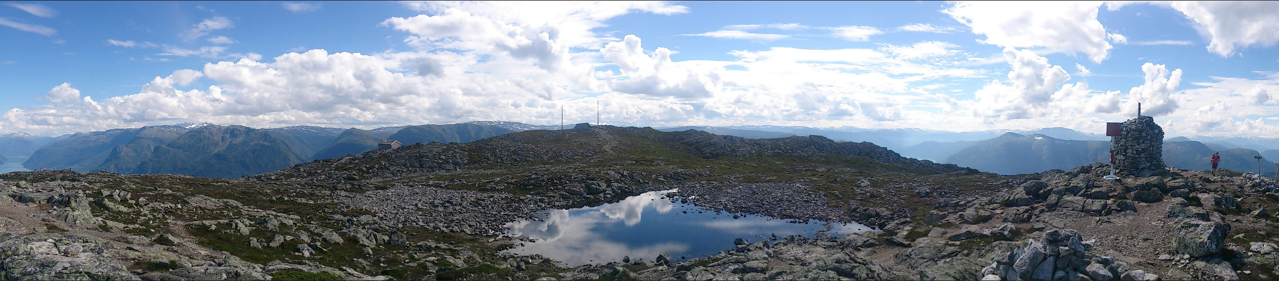
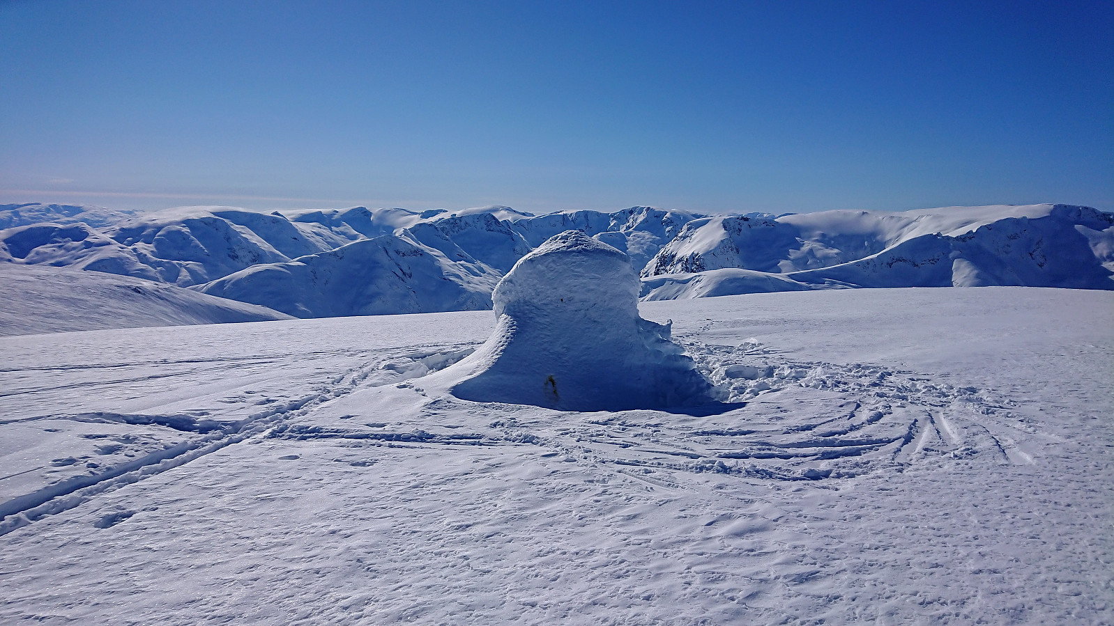 Given that the recent attempt to reach Torstadnakken had to be abandoned due to bad weather it was time for another try. This time with perfect skiing conditions: blue skies and close to no wind. (The only exception being the first stretch up from Svedal where there was more ice than snow. This did improve somewhat for the return though.)
We followed the standard route from Svedal up to Grøssete , where the views were much better than last time, and after a quick lunch we continued along the tracks of previous skiers towards Torstadnakken , enjoying the excellent views in all directions.
After visiting all of the three cairns at Torstadnakken, we quickly removed the climbing skins and started our descent, deciding to delay our break as it was now getting rather cold at the summit area. There would be more than enough continuous downhill skiing before >>>
Given that the recent attempt to reach Torstadnakken had to be abandoned due to bad weather it was time for another try. This time with perfect skiing conditions: blue skies and close to no wind. (The only exception being the first stretch up from Svedal where there was more ice than snow. This did improve somewhat for the return though.)
We followed the standard route from Svedal up to Grøssete , where the views were much better than last time, and after a quick lunch we continued along the tracks of previous skiers towards Torstadnakken , enjoying the excellent views in all directions.
After visiting all of the three cairns at Torstadnakken, we quickly removed the climbing skins and started our descent, deciding to delay our break as it was now getting rather cold at the summit area. There would be more than enough continuous downhill skiing before >>>
Skinarfjellet from Barsnesfjorden
- Date:
- 27.05.2017
- Characteristic:
- Hillwalk
- Duration:
- 6:14h
- Distance:
- 12.6km
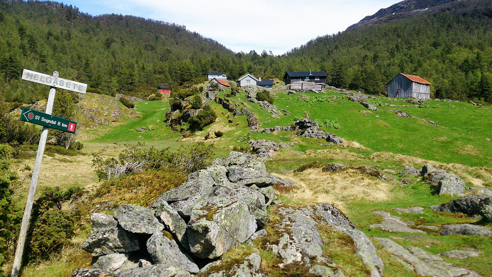 Started from the private parking lot at the end of the gravel road on the south side of Barsnesfjorden. We then followed the marked trail via Dal to Helgasete .
After a long break at Helgasete we continued northeast, first along the marked trail towards Solvornnipa and later along the marked trail towards Solvorn. When getting to the end of Hestadalen and the start of Skaret, we turned northwest and made our own way across the smaller peaks there, while enjoying all around spectacular views towards the north!
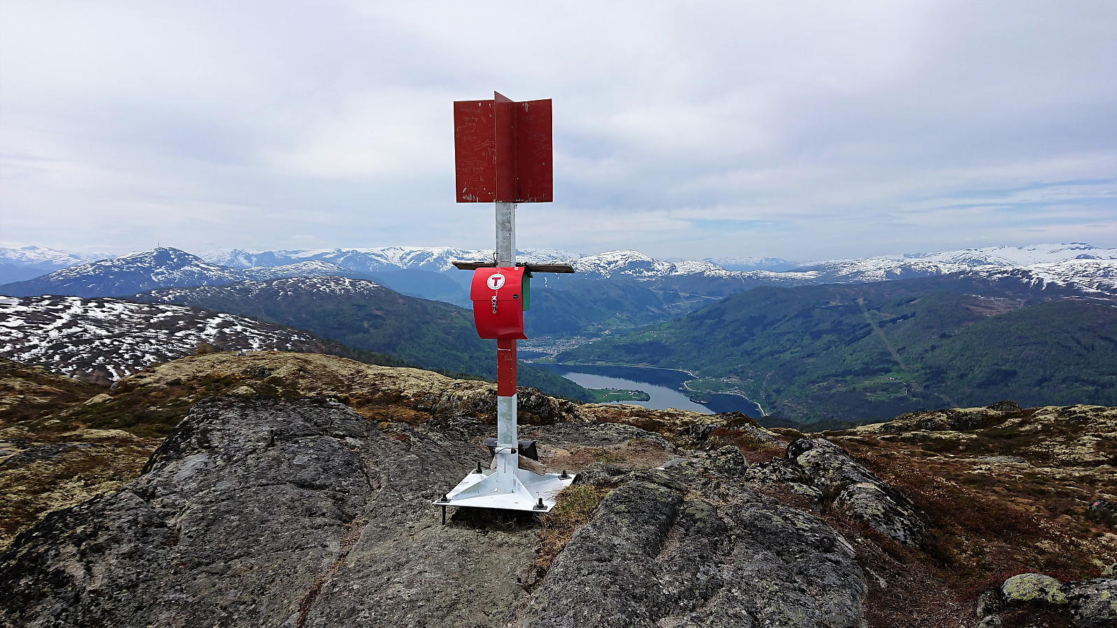
We then turned southwest and headed for the summit of Skinarfjellet , which is called Nonhaug on the sign at the summit (and Skinarfjellet/Nonshaug on the map). Here there were excellent views in all directions, as can be seen from the pictures. No clear trails to/from the summit, but some weak trails/animal tracks that could >>>
Started from the private parking lot at the end of the gravel road on the south side of Barsnesfjorden. We then followed the marked trail via Dal to Helgasete .
After a long break at Helgasete we continued northeast, first along the marked trail towards Solvornnipa and later along the marked trail towards Solvorn. When getting to the end of Hestadalen and the start of Skaret, we turned northwest and made our own way across the smaller peaks there, while enjoying all around spectacular views towards the north!
We then turned southwest and headed for the summit of Skinarfjellet , which is called Nonhaug on the sign at the summit (and Skinarfjellet/Nonshaug on the map). Here there were excellent views in all directions, as can be seen from the pictures. No clear trails to/from the summit, but some weak trails/animal tracks that could >>>
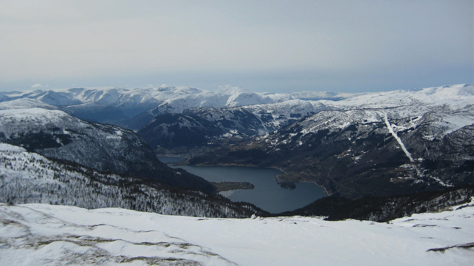
Molden
- Date:
- 24.07.2016
- Characteristic:
- Hillwalk
 A perfect summer day with 20+ degrees and almost no wind (see the picture from Barsnesfjorden taken at the start of the day). We started by driving to the parking lot at Tverbergstølen and from there following the marked tail to the summit of Molden. Perfect conditions at the top, as the picutres below should show. :)
Solvornnipa from Kaupanger
- Date:
- 04.04.2015
- Characteristic:
- Backcountry skiing
- Distance:
- 20.0km
 Skiing trip from Kaupanger, via Breidesete to Solvornnipa and back. Easter 2015.
