Arkiv - dato
Arkiv - aktivitet
-
Annen tur (3)
- Kajakkpadling (3)
- Fottur (1897)
-
Kjøretur (9)
- Biltur (9)
-
Skitur (116)
- Fjellskitur (69)
- Langrennstur (47)
-
Sykkeltur (111)
- Blandet sykling (25)
- Gatesykling (86)
Lister jeg samler etter
-
Utvalgte topper og turmål i Bergen
(349/351)
 99%
99% -
Alle topper i Bergen
(393/400)
98%
-
Voss ≥ 100m pf.
(96/98)
97%
-
Opptur Hordaland
(144/159)
90%
-
Stasjoner på Bergensbanen
(33/40)
82%
-
Ulvik ≥ 100m pf.
(30/38)
78%
-
Hordaland ≥ 100m pf.
(624/863)
72%
-
Mjølfjell PF > 100m
(21/31)
67%
-
Jondal ≥ 100m pf.
(15/23)
65%
-
Dagsturhyttene i Vestland
(36/61)
59%
-
Sunnhordland PF >= 100m
(105/186)
56%
-
Hordaland: Hardanger PF>=100m
(196/359)
54%
-
DNT-hytter i Hordaland
(23/45)
51%
-
Kvinnherad ≥ 100m pf.
(40/79)
50%
-
Eidfjord ≥ 100m pf.
(13/42)
30%
-
Sogndal ≥ 100m pf.
(23/81)
28%
-
Gulen ≥ 100m pf.
(15/54)
27%
-
Vik i Sogn ≥ 100m pf.
(10/46)
21%
-
Sogn - Sør for Sognefjorden PF>=100m
(31/159)
19%
-
DNT-hytter i Sogn og Fjordane
(8/47)
17%

Skiing at Fløyen
- Dato:
- 05.04.2018
- Turtype:
- Langrennstur
- Turlengde:
- 2:25t
- Distanse:
- 12,6km
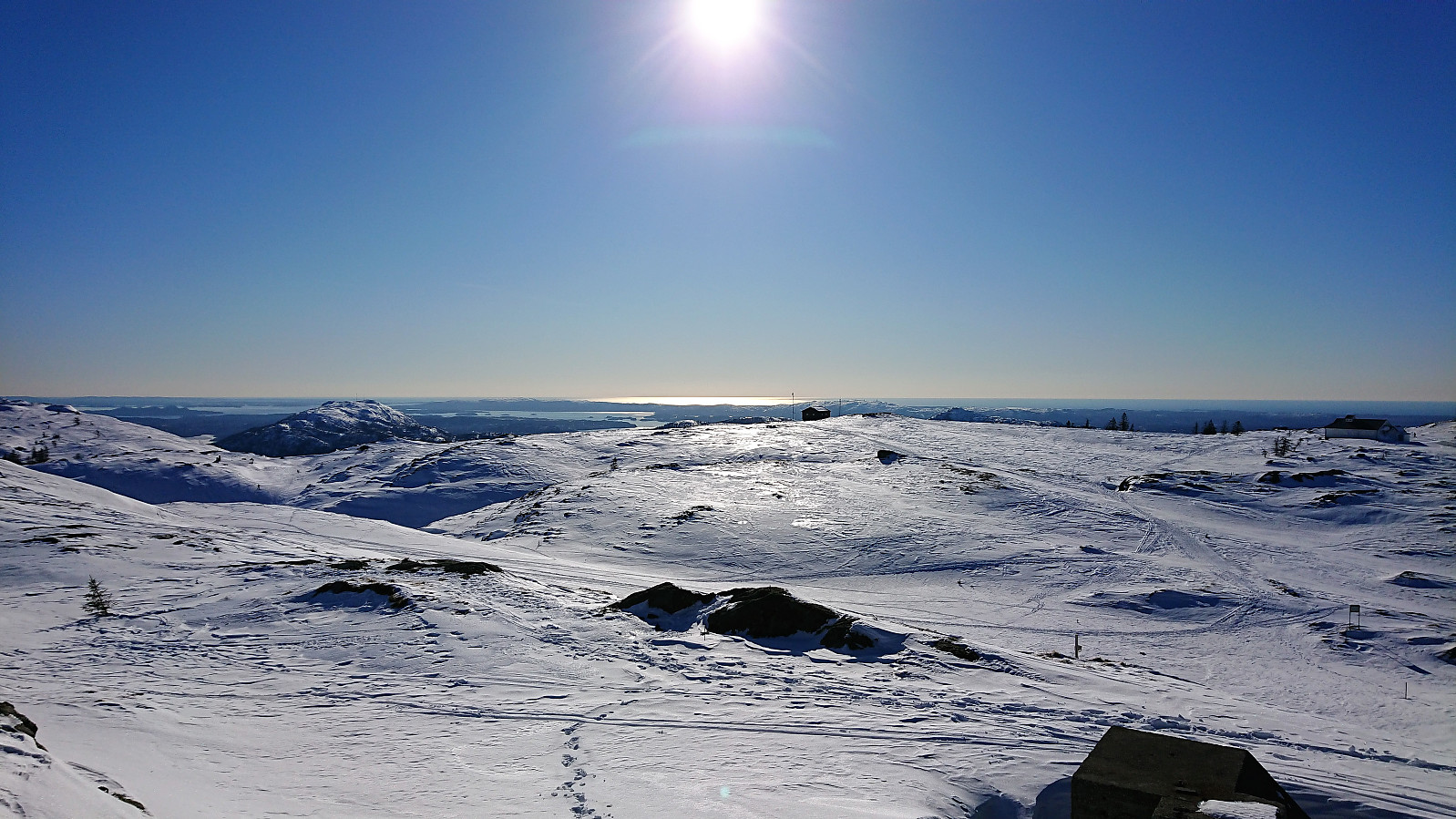
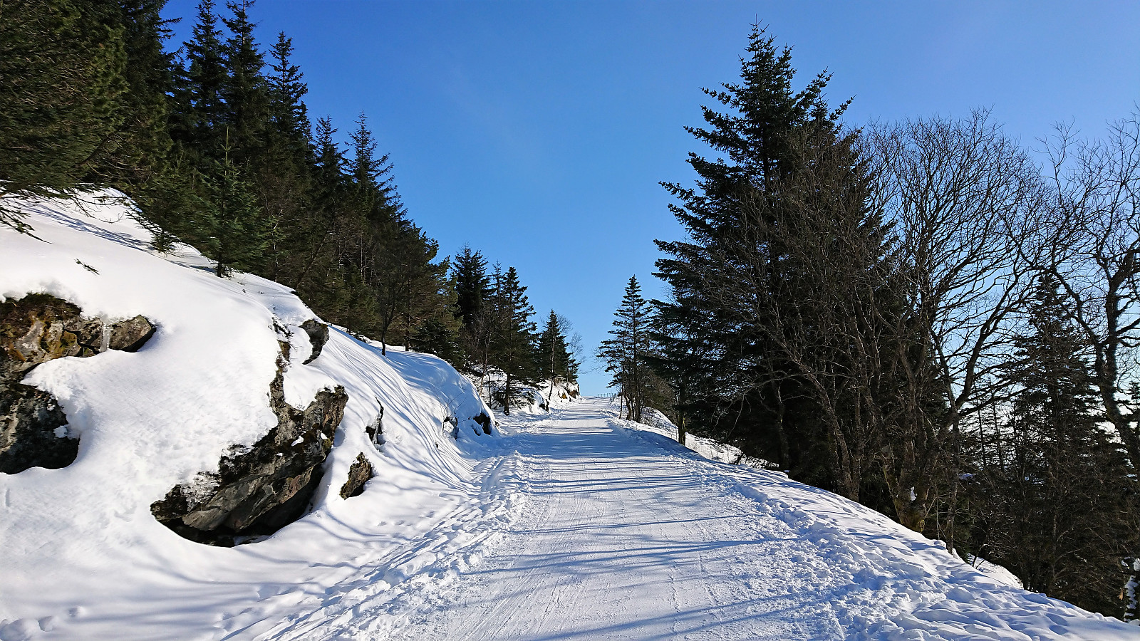
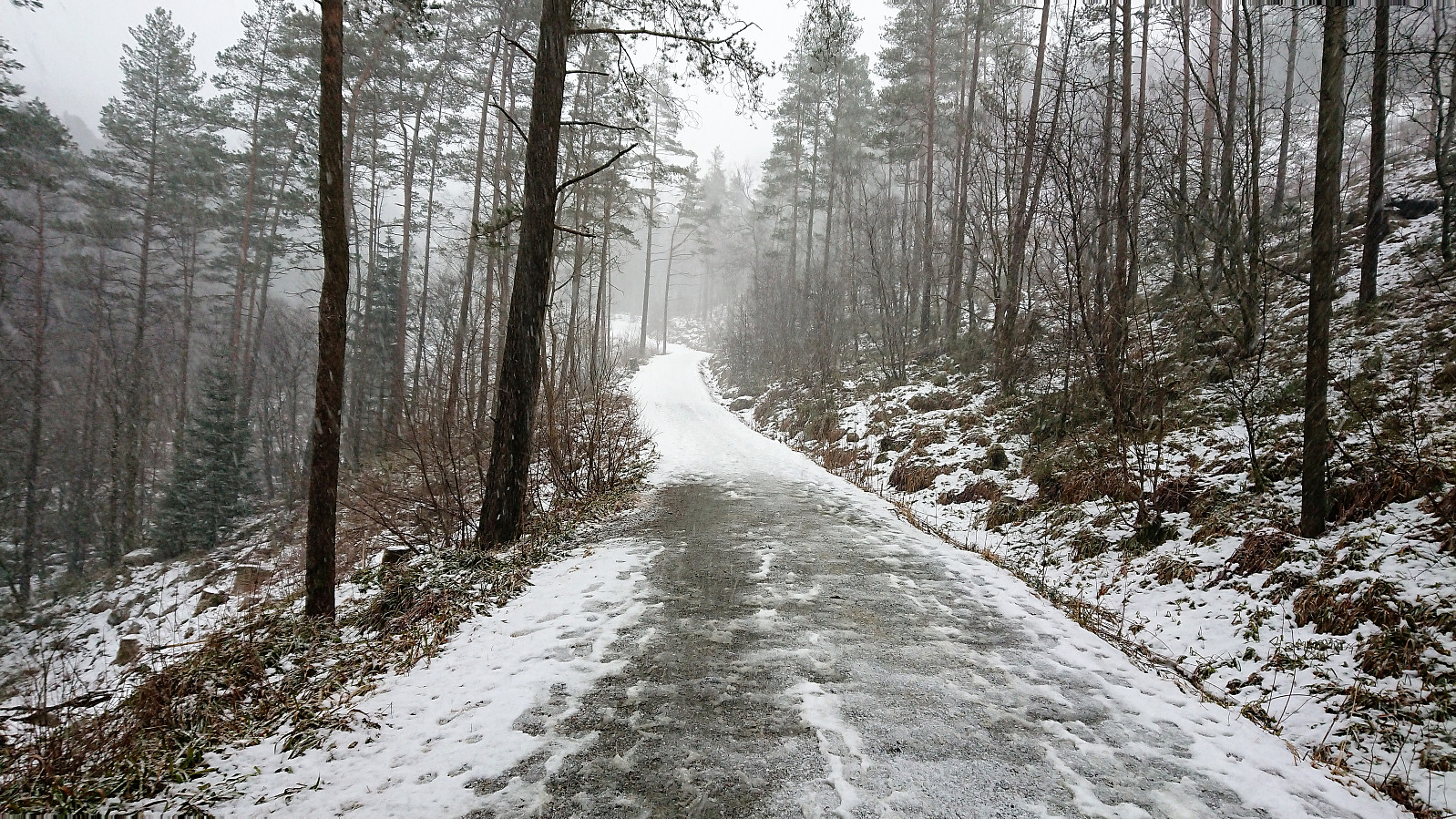 Skiing at Fløyen after work. Started in nice sunny weather but ended with wet snow from above. Lots of new snow from the night before, but most of it had melted during the day, so not the best conditions for skiing, but still an enjoyable trip.
Torstadnakken
- Dato:
- 30.03.2018
- Turtype:
- Fjellskitur
- Turlengde:
- 6:27t
- Distanse:
- 19,8km
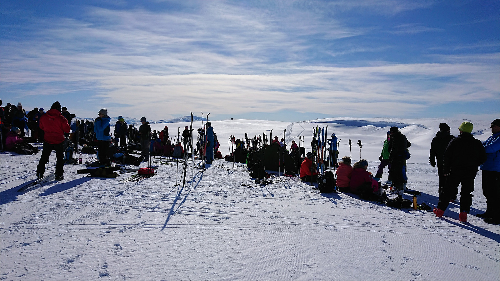
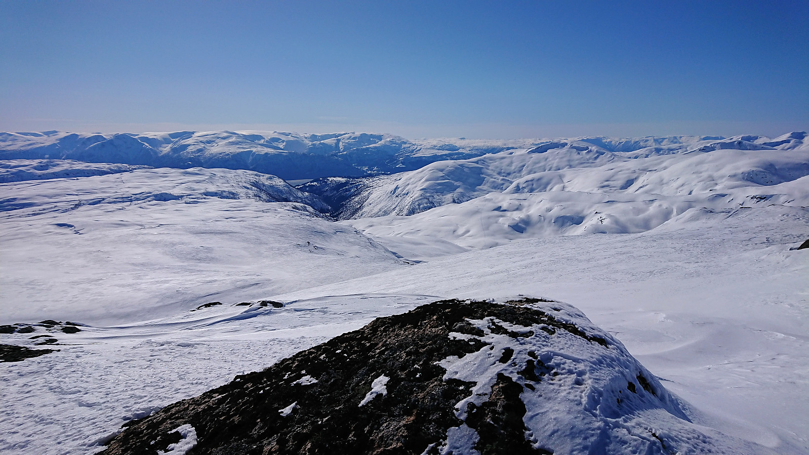
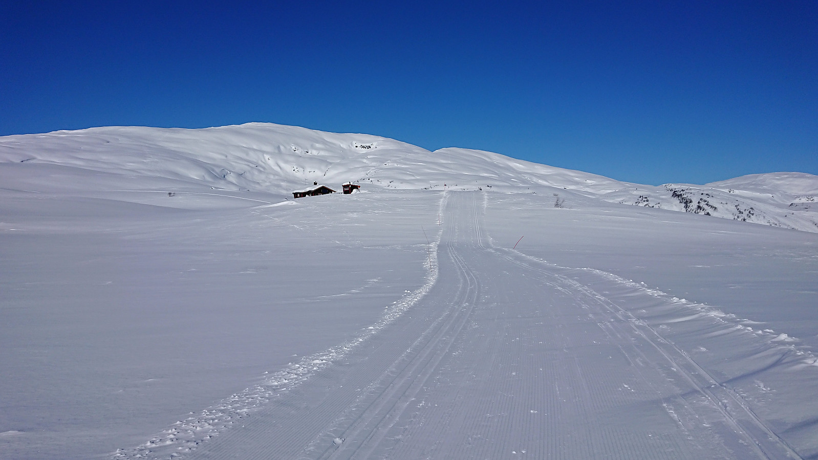
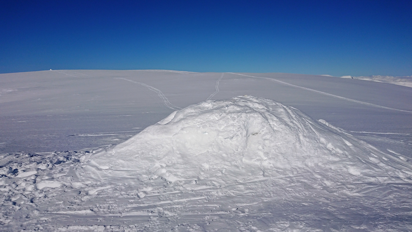 Given that the recent attempt to reach Torstadnakken had to be abandoned due to bad weather it was time for another try. This time with perfect skiing conditions: blue skies and close to no wind. (The only exception being the first stretch up from Svedal where there was more ice than snow. This did improve somewhat for the return though.)
We followed the standard route from Svedal up to Grøssete , where the views were much better than last time, and after a quick lunch we continued along the tracks of previous skiers towards Torstadnakken , enjoying the excellent views in all directions.
After visiting all of the three cairns at Torstadnakken, we quickly removed the climbing skins and started our descent, deciding to delay our break as it was now getting rather cold at the summit area. There would be more than enough continuous downhill skiing before >>>
Given that the recent attempt to reach Torstadnakken had to be abandoned due to bad weather it was time for another try. This time with perfect skiing conditions: blue skies and close to no wind. (The only exception being the first stretch up from Svedal where there was more ice than snow. This did improve somewhat for the return though.)
We followed the standard route from Svedal up to Grøssete , where the views were much better than last time, and after a quick lunch we continued along the tracks of previous skiers towards Torstadnakken , enjoying the excellent views in all directions.
After visiting all of the three cairns at Torstadnakken, we quickly removed the climbing skins and started our descent, deciding to delay our break as it was now getting rather cold at the summit area. There would be more than enough continuous downhill skiing before >>>
Britabu Easter Barbecue 2018
- Dato:
- 29.03.2018
- Turtype:
- Langrennstur
- Turlengde:
- 2:51t
- Distanse:
- 9,9km
 Visiting the traditional Easter barbecue at the Red Cross cabin Britabu .
Kambafjellet and Blåfjellet
- Dato:
- 28.03.2018
- Turtype:
- Fjellskitur
- Turlengde:
- 2:32t
- Distanse:
- 12,1km
 Started by taking the ski lift from Rindabotn and from the top followed the tracks of previous skiers across Kambafjellet towards Blåfjellet . Upon reaching the large cairn at Blåfjellet I continued east towards the real slightly taller summit. No tracks to follow here. After removing the climbing skins I made my own way down to the Red Cross cabin (called Britabu) located right next to Britastein, before following the standard skiing trail back down to Rindabotn. Overall an excellent trip that can be highly recommended!
Around Fjærlandssetvatnet
- Dato:
- 27.03.2018
- Turtype:
- Langrennstur
- Turlengde:
- 3:29t
- Distanse:
- 17,0km
 Followed the standard skiing trail from Rindabotn around Fjærlandssetvatnet. The only detour was an attempt to reach Dyrhovden , which in the end had to be abandoned due to not having enough time to find a safe ascent to the summit.
Hodlekve Lysløype
- Dato:
- 26.03.2018
- Turtype:
- Langrennstur
- Turlengde:
- 2:04t
- Distanse:
- 10,1km
 Skiing the entire 10 km track at Hodlekve Skisenter on a rather gray day. Note that only the lower 5 km has floodlights.
Grøssete
- Dato:
- 25.03.2018
- Turtype:
- Fjellskitur
- Turlengde:
- 3:55t
- Distanse:
- 6,2km
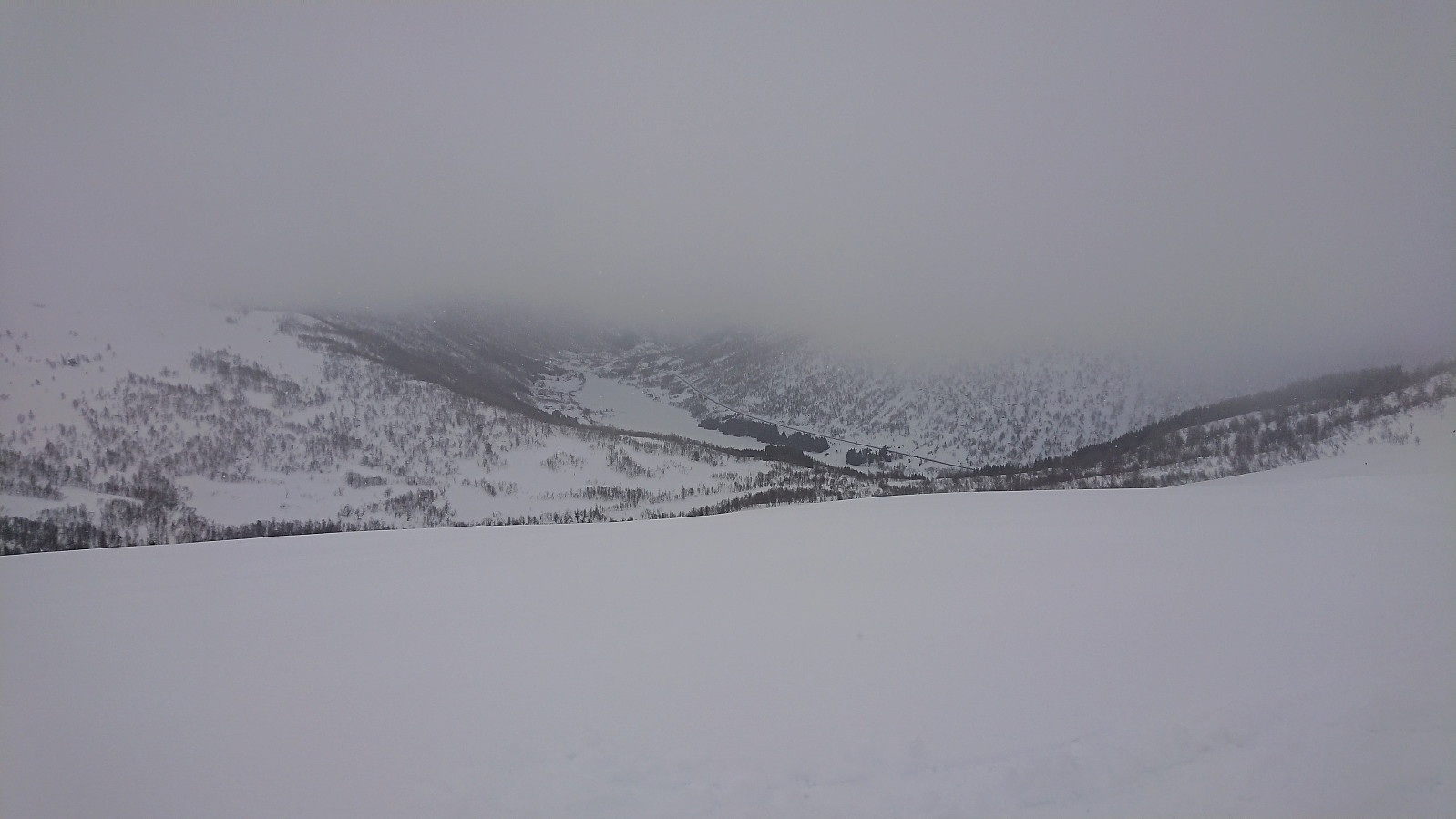 Trip organized by the Norwegian Trekking Association where the goal was to reach Torstadnakken . But due to low-hanging clouds and very poor visibility the trip had to be cut short at Grøssete . Still an enjoyable trip despite the bad weather conditions though.
Across Vidden via Grøvlevatnet and Hauggjelsvarden
- Dato:
- 17.03.2018
- Turtype:
- Fjellskitur
- Turlengde:
- 6:43t
- Distanse:
- 24,2km
 Started by taking the bus to Haukeland sykehus and following the standard route towards Ulriken . More complicated than expected as the gravel road was covered with ice (a theme that would return at the end of the hike...). It improved slightly when I left the main trail for Ulriken, put on the skis, and headed south to Grøvlevatnet, but also here there were stretches with more ice than proper snow.
The original plan had been to follow the summer trail to Turnerhytten , but it seemed like the preferred winter route is a bit further to the east, so I opted for this instead. There were plenty of traces of skiers, but this morning I only met one other skier until I got close to Hauggjelsvarden , but then there were plenty. The route itself was quite nice, with excellent views towards Gullfjellet . I should have brought my full-length climbing >>>
Started by taking the bus to Haukeland sykehus and following the standard route towards Ulriken . More complicated than expected as the gravel road was covered with ice (a theme that would return at the end of the hike...). It improved slightly when I left the main trail for Ulriken, put on the skis, and headed south to Grøvlevatnet, but also here there were stretches with more ice than proper snow.
The original plan had been to follow the summer trail to Turnerhytten , but it seemed like the preferred winter route is a bit further to the east, so I opted for this instead. There were plenty of traces of skiers, but this morning I only met one other skier until I got close to Hauggjelsvarden , but then there were plenty. The route itself was quite nice, with excellent views towards Gullfjellet . I should have brought my full-length climbing >>>
Hjortland to Lønborg
- Dato:
- 10.03.2018
- Turtype:
- Fjellskitur
- Turlengde:
- 7:12t
- Distanse:
- 22,6km
 I was dropped off at the parking lot at Hjortland and from there followed the snow-covered gravel road towards Norhytten (one can also arrive by bus to Flaktveitrinden, but then one has to carry the skis for about 2 km). The trip soon turned into backcountry skiing with only one or two tracks to follow made by earlier skiers.
As I got close to Norhytten these tracks also more or less disappeared, and so did the sun, plus it started snowing lightly, resulting in poor visibility. Still straightforward to reach Norhytten, but from there onwards to Borga it was a bit more complicated, and I had to reduce the speed to ensure that I was on the right course. Not the best views from the summit of Borga today. The visibility improved slightly for the descent, but for safety I still followed my own tracks.
I continued to Vikinghytten , via Grønetua . No tracks >>>
I was dropped off at the parking lot at Hjortland and from there followed the snow-covered gravel road towards Norhytten (one can also arrive by bus to Flaktveitrinden, but then one has to carry the skis for about 2 km). The trip soon turned into backcountry skiing with only one or two tracks to follow made by earlier skiers.
As I got close to Norhytten these tracks also more or less disappeared, and so did the sun, plus it started snowing lightly, resulting in poor visibility. Still straightforward to reach Norhytten, but from there onwards to Borga it was a bit more complicated, and I had to reduce the speed to ensure that I was on the right course. Not the best views from the summit of Borga today. The visibility improved slightly for the descent, but for safety I still followed my own tracks.
I continued to Vikinghytten , via Grønetua . No tracks >>>
Rundemanen and Kvitebjørnen
- Dato:
- 06.03.2018
- Turtype:
- Fjellskitur
- Turlengde:
- 4:09t
- Distanse:
- 15,7km
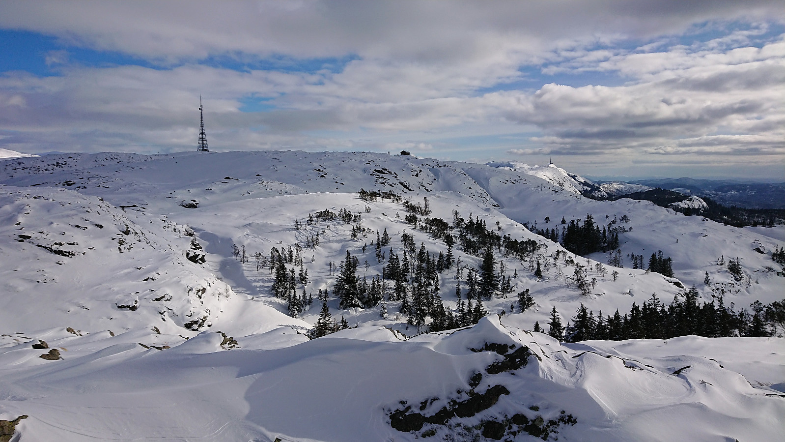
 Started from the upper station of Fløibanen and after a quick detour to Skomakerdiket I took the shortest route to Brushytten , from where I followed Blåmansveien to arrive at Rundemanen .
I continued northwest across Kvitebjørnen all the way to Dræggehytten , before turning southeast to Ankerhytten . Here I tried skiing down the shortcut to Munkebotsvatnet, but ended up having to walk the last bit due to too many trees and not enough snow. The trip was completed by putting on the skis again and following Hellemyrstien back to Lønborg.
A very nice trip in perfect winter weather: blue skies and close to no wind. And in areas where there is usually not enough snow for skiing. There could have been just a little bit more snow at times though, as then one would not have to constantly be on the lookout for rocks...
Started from the upper station of Fløibanen and after a quick detour to Skomakerdiket I took the shortest route to Brushytten , from where I followed Blåmansveien to arrive at Rundemanen .
I continued northwest across Kvitebjørnen all the way to Dræggehytten , before turning southeast to Ankerhytten . Here I tried skiing down the shortcut to Munkebotsvatnet, but ended up having to walk the last bit due to too many trees and not enough snow. The trip was completed by putting on the skis again and following Hellemyrstien back to Lønborg.
A very nice trip in perfect winter weather: blue skies and close to no wind. And in areas where there is usually not enough snow for skiing. There could have been just a little bit more snow at times though, as then one would not have to constantly be on the lookout for rocks...
