Arkiv - dato
Arkiv - aktivitet
-
Annen tur (3)
- Kajakkpadling (3)
- Fottur (1897)
-
Kjøretur (9)
- Biltur (9)
-
Skitur (116)
- Fjellskitur (69)
- Langrennstur (47)
-
Sykkeltur (111)
- Blandet sykling (25)
- Gatesykling (86)
Lister jeg samler etter
-
Utvalgte topper og turmål i Bergen
(349/351)
 99%
99% -
Alle topper i Bergen
(393/400)
98%
-
Voss ≥ 100m pf.
(96/98)
97%
-
Opptur Hordaland
(144/159)
90%
-
Stasjoner på Bergensbanen
(33/40)
82%
-
Ulvik ≥ 100m pf.
(30/38)
78%
-
Hordaland ≥ 100m pf.
(624/863)
72%
-
Mjølfjell PF > 100m
(21/31)
67%
-
Jondal ≥ 100m pf.
(15/23)
65%
-
Dagsturhyttene i Vestland
(36/61)
59%
-
Sunnhordland PF >= 100m
(105/186)
56%
-
Hordaland: Hardanger PF>=100m
(196/359)
54%
-
DNT-hytter i Hordaland
(23/45)
51%
-
Kvinnherad ≥ 100m pf.
(40/79)
50%
-
Eidfjord ≥ 100m pf.
(13/42)
30%
-
Sogndal ≥ 100m pf.
(23/81)
28%
-
Gulen ≥ 100m pf.
(15/54)
27%
-
Vik i Sogn ≥ 100m pf.
(10/46)
21%
-
Sogn - Sør for Sognefjorden PF>=100m
(31/159)
19%
-
DNT-hytter i Sogn og Fjordane
(8/47)
17%

Cycling: Myrdalsvatnet and Preståsen
- Dato:
- 18.07.2021
- Turtype:
- Blandet sykling
- Turlengde:
- 3:10t
- Distanse:
- 43,4km
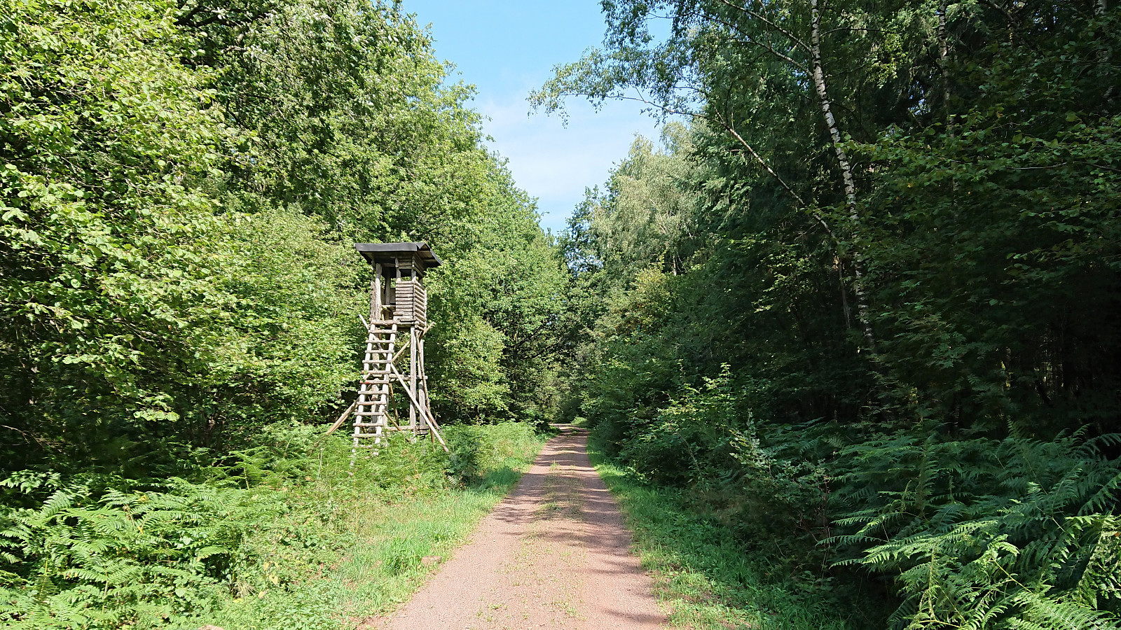
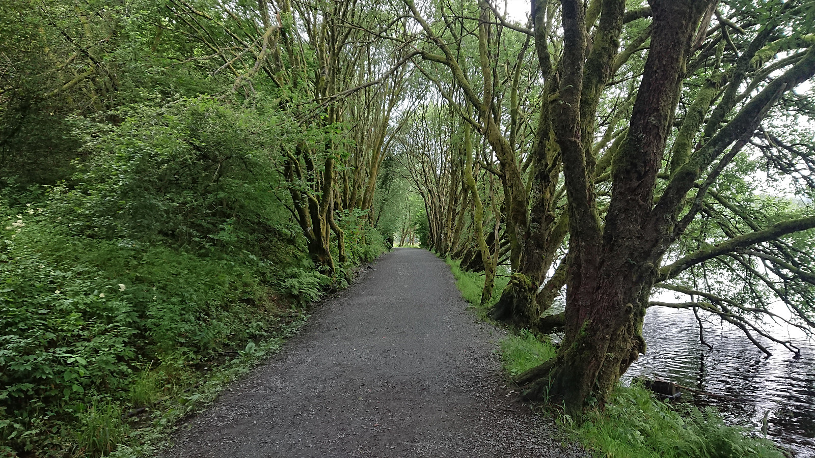 When the rain showers finally stopped, or so I thought, I cycled towards Myrdalsvatnet for a visit of Preståsen . It however started raining again as I was approaching Nesttun, but thankfully it was only light rain and soon stopped completely. The summit of Preståsen was easily reached on foot via an unmarked trail starting from the gravel road northeast of Myrdalsvatnet. Next to no views from the summit nor the trail though. I even briefly followed the trail south beyond the summit to check if there were any better views there, but this was not the case as far as I could tell. I therefore returned to my bike at the gravel road and followed it north before returning south to Myrdalsvatnet and the ride home.
Cycling: Kvernafossen
- Dato:
- 14.07.2021
- Turtype:
- Blandet sykling
- Turlengde:
- 4:19t
- Distanse:
- 54,9km
 Cycling trip with the objective of exploring a possible trail to Nedstaheia, a small hill southeast of Haukheia in Arna. The unmarked trailhead south of the summit was easily located, and after leaving my bike behind, I continued on foot along the river/waterfall called Kvernafossen . The trail was partially hidden by the low vegetation, but easy to follow. Shortly I reached the tractor road south of Krokavatnet. Here I turned right and started searching for the trail to Nedstaheia. I think I found it in the end, but it was pretty much completely hidden by the tall grasses. After a short attempt at following the hidden trail, I therefore gave up and decided to rather return on a future hike, ideally not wearing shorts as today, especially given that I was also planning on including a visit to Haukheia. Back on >>>
Cycling: Herdla from Kleppestø
- Dato:
- 10.07.2021
- Turtype:
- Blandet sykling
- Turlengde:
- 8:11t
- Distanse:
- 97,5km
 An extended cycling trip with the main objective of exploring Herdla. I started by cycling to Strandkaien and from there taking the high-speed ferry to Kleppestø. Here I turned on the GPS tracking and headed north towards Herdla, via the road to Erdal and Ask, thus avoiding the heavier traffic on the main road via Ravnanger. The road itself was also a positive surprise, as due to recent road work, I could stay off the road almost all the way to Ask, and instead use the wide sidewalk/walking and cycling path next to the road.
However, from Ask until connecting with the main road at Åsebø, there were no sidewalks, but also very limited traffic, hence this was not an issue at all. The traffic greatly increased as I turned north at Åsebø though, but when approaching Fauskanger the sidewalk/walking >>>
An extended cycling trip with the main objective of exploring Herdla. I started by cycling to Strandkaien and from there taking the high-speed ferry to Kleppestø. Here I turned on the GPS tracking and headed north towards Herdla, via the road to Erdal and Ask, thus avoiding the heavier traffic on the main road via Ravnanger. The road itself was also a positive surprise, as due to recent road work, I could stay off the road almost all the way to Ask, and instead use the wide sidewalk/walking and cycling path next to the road.
However, from Ask until connecting with the main road at Åsebø, there were no sidewalks, but also very limited traffic, hence this was not an issue at all. The traffic greatly increased as I turned north at Åsebø though, but when approaching Fauskanger the sidewalk/walking >>>
Cycling: Brushytten
- Dato:
- 07.05.2021
- Turtype:
- Blandet sykling
- Turlengde:
- 2:00t
- Distanse:
- 22,2km
 Evening cycling trip to Brushytten . Ascending via Fjellveien and Skansemyren, and descending via Sandviksfjellet and Munkebotsvatnet.
Cycling: Storakvitefjellet
- Dato:
- 01.05.2021
- Turtype:
- Blandet sykling
- Turlengde:
- 5:19t
- Distanse:
- 67,6km
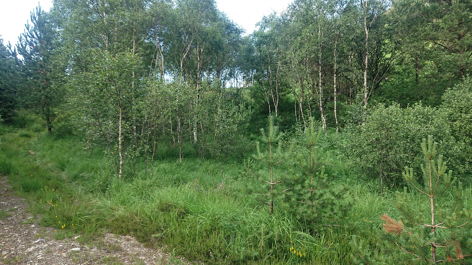
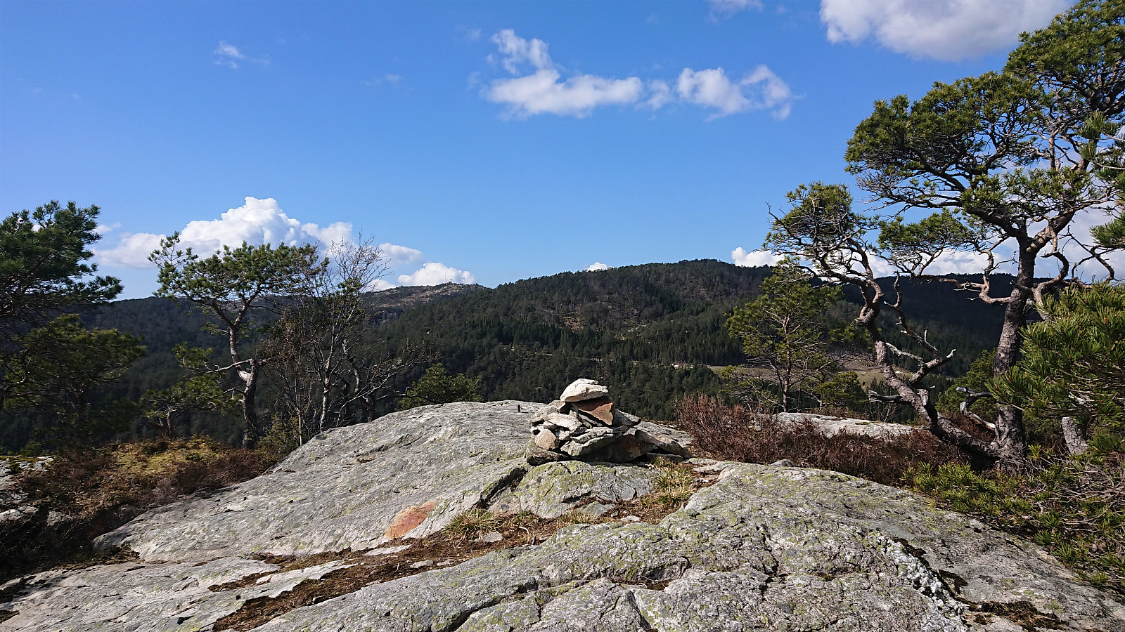 Cycling trip that also included a visit of Storakvitefjellet . Started by following the standard cycling route to Søfteland, where I turned southwest up the very steep Langedalen. Next, I passed by the ruins at Lysekloster on my way to Lysefjorden and Nordvik. Here I easily located the tractor road taking me to the unmarked trailhead for Storakvitefjellet. In order to get to the trailhead a small stream had to be crossed, but this was straightforward given multiple strategically placed rocks. At the trailhead I left the bike behind and continued towards the summit on foot.
The trail was a bit wet early on, but was overall of good quality and easy to follow. It did however disappear (or perhaps split into multiple options?) when crossing a wet area below the summit, but by then the direction was pretty obvious, and the trail shortly >>>
Cycling trip that also included a visit of Storakvitefjellet . Started by following the standard cycling route to Søfteland, where I turned southwest up the very steep Langedalen. Next, I passed by the ruins at Lysekloster on my way to Lysefjorden and Nordvik. Here I easily located the tractor road taking me to the unmarked trailhead for Storakvitefjellet. In order to get to the trailhead a small stream had to be crossed, but this was straightforward given multiple strategically placed rocks. At the trailhead I left the bike behind and continued towards the summit on foot.
The trail was a bit wet early on, but was overall of good quality and easy to follow. It did however disappear (or perhaps split into multiple options?) when crossing a wet area below the summit, but by then the direction was pretty obvious, and the trail shortly >>>
Cycling: Mindebakkentoppen
- Dato:
- 28.04.2021
- Turtype:
- Blandet sykling
- Turlengde:
- 2:39t
- Distanse:
- 29,0km
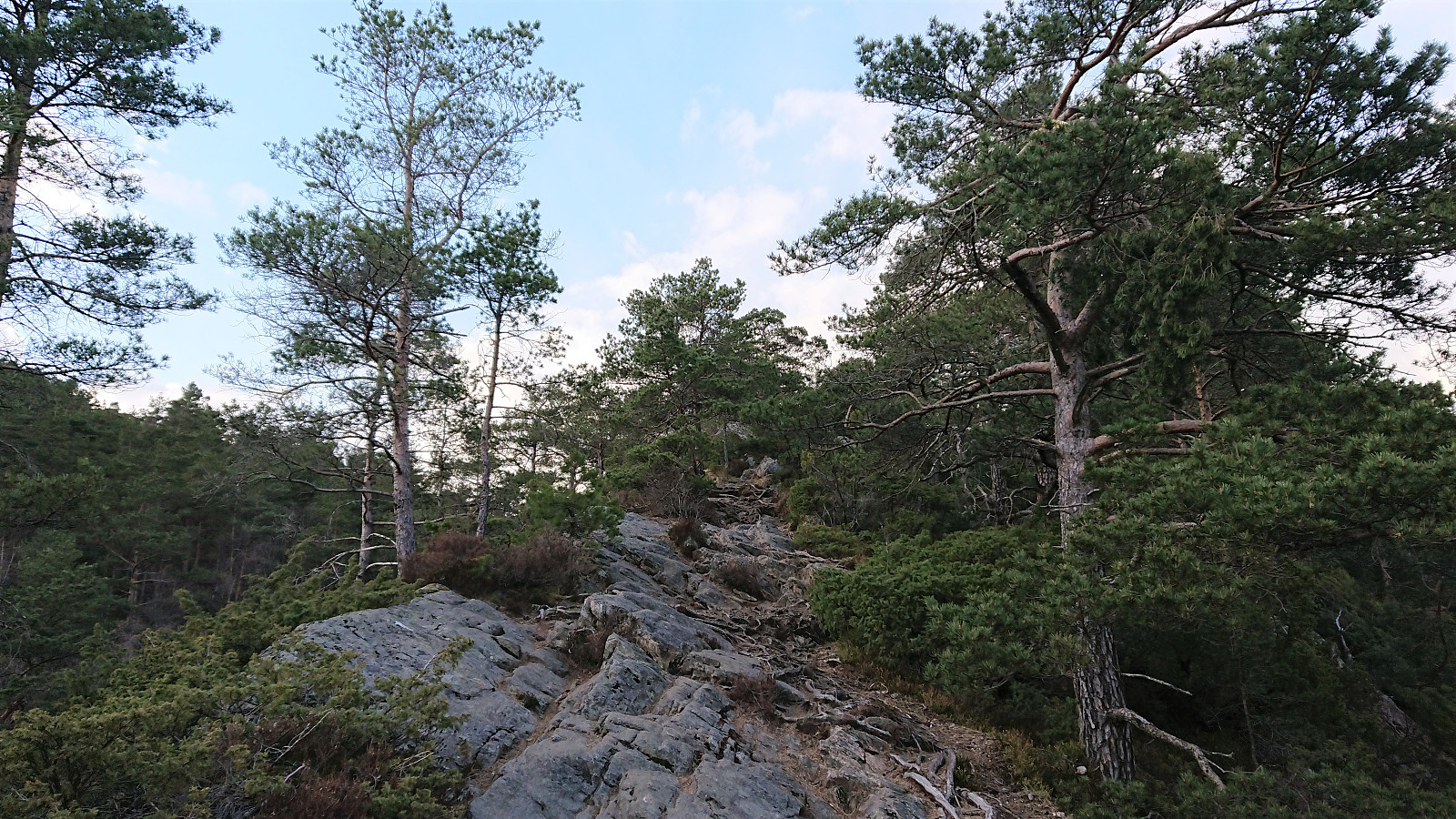 Evening cycling and hiking trip for a visit of Mindebakkentoppen . I left the bike behind at the bend in Løvstien north of Lisahaugen , from where I continued on foot along a very enjoyable trail marked for Løvstakken . The trail followed a relatively narrow pine-covered ridge which at times even requiring a bit of very light scrambling.
Shortly after passing Langatjørna, I turned east towards the summit. First along a weak trail, and later in a more direct route requiring light scrambling. Not sure if I lost the trail or if the scrambling was indeed part of the trail. At the summit ridge there was however a very clear north-south trail, indicating that my ascent route is probably not the most common option. (More on the history of Mindebakken can be found here and here .)
After a quick visit to the summit, which provided very limited views, >>>
Evening cycling and hiking trip for a visit of Mindebakkentoppen . I left the bike behind at the bend in Løvstien north of Lisahaugen , from where I continued on foot along a very enjoyable trail marked for Løvstakken . The trail followed a relatively narrow pine-covered ridge which at times even requiring a bit of very light scrambling.
Shortly after passing Langatjørna, I turned east towards the summit. First along a weak trail, and later in a more direct route requiring light scrambling. Not sure if I lost the trail or if the scrambling was indeed part of the trail. At the summit ridge there was however a very clear north-south trail, indicating that my ascent route is probably not the most common option. (More on the history of Mindebakken can be found here and here .)
After a quick visit to the summit, which provided very limited views, >>>
Cycling: Kalandsvatnet and Tereleitet
- Dato:
- 17.04.2021
- Turtype:
- Blandet sykling
- Turlengde:
- 4:36t
- Distanse:
- 62,7km
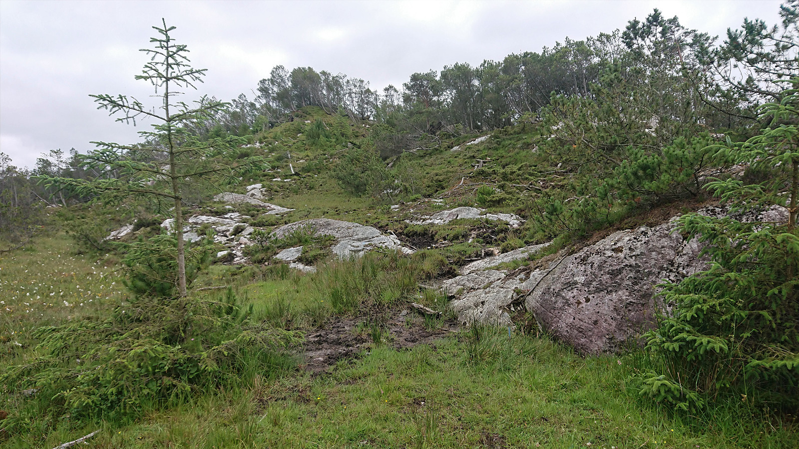
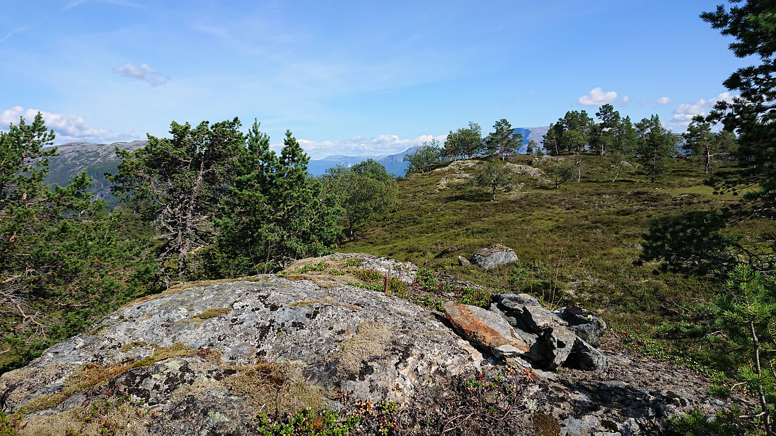
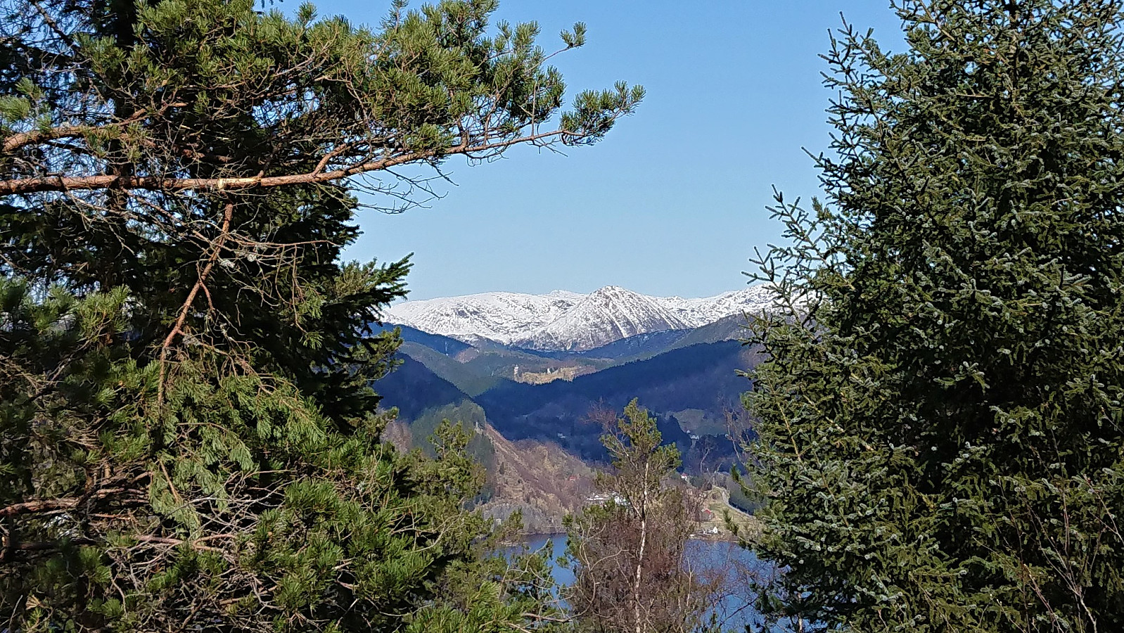 In order to spice up the standard cycling trip around Kalandsvatnet, I decided to also include a visit of Tereleitet . I stayed on the bike all the way until the crossroads in the forest/gravel road east of the summit (even though this included traversing a couple of patches of snow), and from there covered the last approximately 500 meters on foot along a marked trail. The summit provided better views than expected, with the highlight being the snow-covered Hausdalshorga (and the rest of the Gullfjellet area) in the far distance.
Cycling: Skjønhammaren and Høgafjellet
- Dato:
- 31.07.2020
- Turtype:
- Blandet sykling
- Turlengde:
- 12:07t
- Distanse:
- 106,8km
 On the last weekday of my summer holiday I decided to go for another ambitious cycling trip. Yet again starting by bringing my bike with me on the express ferry to Malkenes and following the now common route along the lovely Onarheimsfjorden. However this time the plan was to continue all the way to the southern tip of Tysnesøya and Hodnaneset, and then take the ferry to Nordhuglo.
I had perhaps underestimated the time it would take me to reach Hodnaneset though, and with a ferry to catch I had to push in order to make sure get there in time. In the end I made it with less than ten minutes to spare, and after boarding the ferry I could finally take my first real break. Which was made even longer by the ferry first heading to Jektavik (at Stord) before turning southeast for Nordhuglo.
At Nordhuglo, >>>
On the last weekday of my summer holiday I decided to go for another ambitious cycling trip. Yet again starting by bringing my bike with me on the express ferry to Malkenes and following the now common route along the lovely Onarheimsfjorden. However this time the plan was to continue all the way to the southern tip of Tysnesøya and Hodnaneset, and then take the ferry to Nordhuglo.
I had perhaps underestimated the time it would take me to reach Hodnaneset though, and with a ferry to catch I had to push in order to make sure get there in time. In the end I made it with less than ten minutes to spare, and after boarding the ferry I could finally take my first real break. Which was made even longer by the ferry first heading to Jektavik (at Stord) before turning southeast for Nordhuglo.
At Nordhuglo, >>>
Wenzelstein
- Dato:
- 28.08.2019
- Turtype:
- Blandet sykling
- Turlengde:
- 1:30t
- Distanse:
- 13,5km
 Short bike ride while at a meeting at Schloss Dagstuhl in Germany, with road quality ranging from nice forest roads to rougher tractor roads, mostly the former though. On the way to Wenzelstein I came across Eulenkreuz . The summit itself was harder to locate and unmarked, but in the end I concluded that the highest point had to be around the small water tank (says "wasserhochbehälter" on the map) 100 meters or so west of where the highest point seems to be according to the map. Limited views for most of the trip, including the summit.
Note the track is created from memory as my GPS refused to work properly.
Short bike ride while at a meeting at Schloss Dagstuhl in Germany, with road quality ranging from nice forest roads to rougher tractor roads, mostly the former though. On the way to Wenzelstein I came across Eulenkreuz . The summit itself was harder to locate and unmarked, but in the end I concluded that the highest point had to be around the small water tank (says "wasserhochbehälter" on the map) 100 meters or so west of where the highest point seems to be according to the map. Limited views for most of the trip, including the summit.
Note the track is created from memory as my GPS refused to work properly.
Cycling: Bjørnstigfjellet
- Dato:
- 02.08.2019
- Turtype:
- Blandet sykling
- Turlengde:
- 7:24t
- Distanse:
- 63,8km
 Ever since last year's attempt to cycle to Fimreite ended way too abruptly I had wanted to have another go. This time taking it very easy in the sharp turn where I had my unfortunate close encounter with the pavement last July, and thus this time making it safely down to Eide. From there the cycling was straightforward, though always seeming to include more climbing than I remember from previous visits.
From Fimreite I continued west and later east along the gravel road, passing by two gates and a sign with no driving allowed. The gravel road was of good quality and far from steep, but the climb was still tough given the constant ascent providing little to no rest. More than once I considered leaving the bike behind and continuing on foot, but decided not to, given that the bike would be greatly beneficial for my >>>
Ever since last year's attempt to cycle to Fimreite ended way too abruptly I had wanted to have another go. This time taking it very easy in the sharp turn where I had my unfortunate close encounter with the pavement last July, and thus this time making it safely down to Eide. From there the cycling was straightforward, though always seeming to include more climbing than I remember from previous visits.
From Fimreite I continued west and later east along the gravel road, passing by two gates and a sign with no driving allowed. The gravel road was of good quality and far from steep, but the climb was still tough given the constant ascent providing little to no rest. More than once I considered leaving the bike behind and continuing on foot, but decided not to, given that the bike would be greatly beneficial for my >>>
