Archive - Date
Archive - Activity
-
Bike trip (111)
- Bike trip - mixed (25)
- Bike trip - road (86)
-
Drive (9)
- Car drive (9)
-
Other trip (3)
- Kayaking (3)
-
Ski trip (116)
- Backcountry skiing (69)
- Cross-country skiing (47)
- Trip by foot (1897)
Collected lists
-
Utvalgte topper og turmål i Bergen
(349/351)
 99%
99% -
Alle topper i Bergen
(393/400)
98%
-
Voss ≥ 100m pf.
(96/98)
97%
-
Opptur Hordaland
(144/159)
90%
-
Stasjoner på Bergensbanen
(33/40)
82%
-
Ulvik ≥ 100m pf.
(30/38)
78%
-
Hordaland ≥ 100m pf.
(624/863)
72%
-
Mjølfjell PF > 100m
(21/31)
67%
-
Jondal ≥ 100m pf.
(15/23)
65%
-
Dagsturhyttene i Vestland
(36/61)
59%
-
Sunnhordland PF >= 100m
(105/186)
56%
-
Hordaland: Hardanger PF>=100m
(196/359)
54%
-
DNT-hytter i Hordaland
(23/45)
51%
-
Kvinnherad ≥ 100m pf.
(40/79)
50%
-
Eidfjord ≥ 100m pf.
(13/42)
30%
-
Sogndal ≥ 100m pf.
(23/81)
28%
-
Gulen ≥ 100m pf.
(15/54)
27%
-
Vik i Sogn ≥ 100m pf.
(10/46)
21%
-
Sogn - Sør for Sognefjorden PF>=100m
(31/159)
19%
-
DNT-hytter i Sogn og Fjordane
(8/47)
17%

Cycling: Nordåsvatnet + Grønhaugen and Ospåsen
- Date:
- 05.09.2024
- Characteristic:
- Bike trip - mixed
- Duration:
- 4:27h
- Distance:
- 47.5km
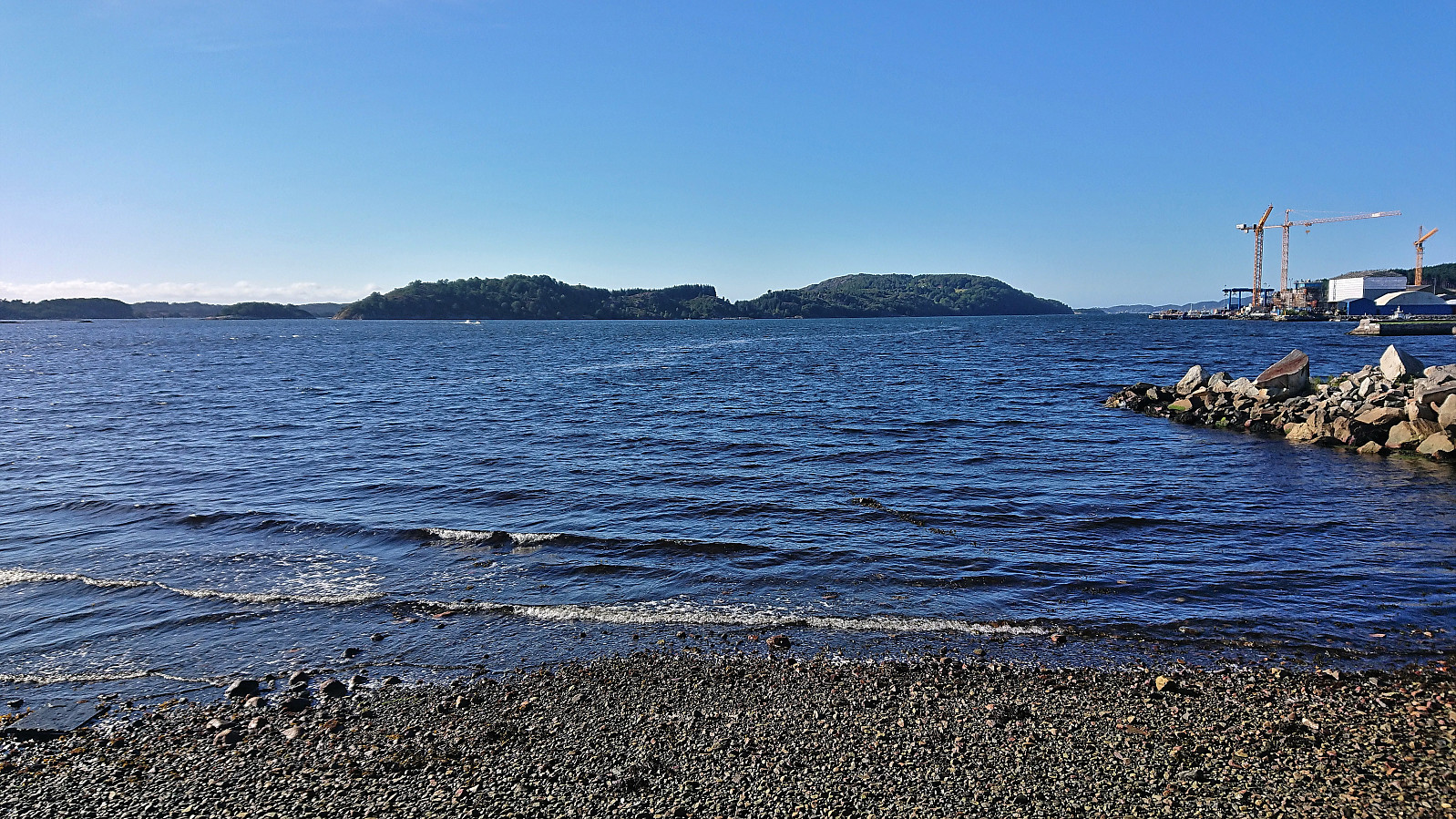
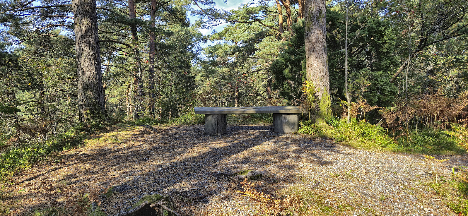 On the warmest September day in Bergen history (28.6 degrees), I took the last part of the day off for a cycling trip around Nordåsvatnet. The trip also included a minor detour to some small hills south of Indre Steinsvik ( Grønhaugen and Ospåsen). This turned out to be a very nice area with lots of narrow gravel paths (that one are not supposed to cycle on, something I only noticed when exiting the area). Not a lot of views from either of the two summits, which both had gravel paths all the way to the top, but there were wooden benches for a short rest.
Cycling: Rallarvegen and Austre Låghellerhøgdene
- Date:
- 01.09.2024
- Characteristic:
- Bike trip - mixed
- Duration:
- 4:59h
- Distance:
- 40.7km
 To take full advantage the warm and sunny weather, I decided to combine a bike ride along Rallarvegen with a visit of Austre Låghellerhøgdene . I had rented a bike in advance which I picked up at Finse after arriving by train from Bergen. Shortly, I was on the bike and cycling northwest along the overall good quality gravel road.
After passing the highest point at Rallarvegen (at 1343 meters) I descended towards Fagernut . Just before getting to the cabin, I left the bike behind for a short off-trail hike to the summit of Austre Låghellerhøgdene. The ascent was straightforward, however finding the exact summit was more tricky with three minor hills to choose from. As usual, I simply visited all of them, before descending along more or less the same route.
Back on the bike, I made a short stop outside Fagernut before continuing on the gravel road to Hallingskeid. >>>
To take full advantage the warm and sunny weather, I decided to combine a bike ride along Rallarvegen with a visit of Austre Låghellerhøgdene . I had rented a bike in advance which I picked up at Finse after arriving by train from Bergen. Shortly, I was on the bike and cycling northwest along the overall good quality gravel road.
After passing the highest point at Rallarvegen (at 1343 meters) I descended towards Fagernut . Just before getting to the cabin, I left the bike behind for a short off-trail hike to the summit of Austre Låghellerhøgdene. The ascent was straightforward, however finding the exact summit was more tricky with three minor hills to choose from. As usual, I simply visited all of them, before descending along more or less the same route.
Back on the bike, I made a short stop outside Fagernut before continuing on the gravel road to Hallingskeid. >>>
Cycling: Svartavassrinden
- Date:
- 25.05.2024
- Characteristic:
- Bike trip - mixed
- Duration:
- 5:26h
- Distance:
- 66.4km
 Due to a weather forecast with potential rain showers in the afternoon, I opted for a cycling trip to visit Svartavassrinden . I had passed by this minor peak several times but never been to the summit. After 33 km on the bike, I left it at the end of the gravel road and completed the final short off-trail distance to the summit on foot. I returned the same way for a late lunch break back at the end of the gravel road. The trip was then concluded by cycling the same route to Lønborg, where I made it home just before it started raining.
Cycling: Hordvikneset
- Date:
- 19.05.2024
- Characteristic:
- Bike trip - mixed
- Duration:
- 3:15h
- Distance:
- 40.5km
 Afternoon cycling trip with the main objective of visiting the trig marker at Hordvikneset . Upon arriving at Balane I left my bike behind and continued on foot. At first I failed to find the trailhead and ended up in a playground where my progress was quickly blocked by a fence. The proper trailhead was however located next and I could then follow a surprisingly nice trail almost all the way to the trig marker. For the final stretch a much weaker trail had to be used but in the end the marker was reached without any issues.
No views at all from the trig marker but given the nice trail I assumed there would be better views close by. I therefore returned to the main trail and followed it north to Kråkeberget (now added as its own PB-element) where I was rewarded by great views towards Norhordlandsbroen, Holsenøy, Flatøy and Knarvik. >>>
Afternoon cycling trip with the main objective of visiting the trig marker at Hordvikneset . Upon arriving at Balane I left my bike behind and continued on foot. At first I failed to find the trailhead and ended up in a playground where my progress was quickly blocked by a fence. The proper trailhead was however located next and I could then follow a surprisingly nice trail almost all the way to the trig marker. For the final stretch a much weaker trail had to be used but in the end the marker was reached without any issues.
No views at all from the trig marker but given the nice trail I assumed there would be better views close by. I therefore returned to the main trail and followed it north to Kråkeberget (now added as its own PB-element) where I was rewarded by great views towards Norhordlandsbroen, Holsenøy, Flatøy and Knarvik. >>>
Cycling: Ytstafjellet
- Date:
- 27.07.2023
- Characteristic:
- Bike trip - mixed
- Duration:
- 4:15h
- Distance:
- 52.1km
 After a week of minimal activity due to a cold, I was finally feeling a bit better and decided to test my energy level with a cycling trip to Ytstafjellet . Besides the climb from Myrdalsvatnet to Totland/Riple feeling slightly harder than normal, I made it to the top of the gravel road right next to the highest point of Ytstafjellet without any real issues. Here I left the bike and completed the final less than 60 meters to the summit on foot. No views or any other interesting features to speak of, hence I quickly returned to the bike and proceeded to follow the nice gravel roads southwest, which provided some surprisingly good views towards the south. I then turned north and reconnected with the main road and completed the trip home to Lønborg.
Cycling: Sætrafjellet and Tveitaslottet
- Date:
- 28.08.2022
- Characteristic:
- Bike trip - mixed
- Duration:
- 4:02h
- Distance:
- 40.1km
 After yesterday's long hike in Granvin , I switched to cycling with the goal of visiting one of the two remaining summits on the Fitjar ≥ 100m pf. list, namely Sætrafjellet . I started by cycling to the Bergen city center and taking the bike with me on the bus to Halhjem. This was my first experience of bringing my bike on a bus and I have to admit that I felt a bit out of place, with the added bonus of constantly being worried that the next stop would be full of passengers in more need of the space than me and my bike. Thankfully this did not happen and I arrived at Halhjem without any real issues, thus saving both loads of time and, equally important, resting my tired legs from yesterday.
From Halhjem, I got on the ferry to Sandvikvåg and 45 minutes later I was finally ready to start the real trip. I first cycled along the main road via Fitjar to south >>>
After yesterday's long hike in Granvin , I switched to cycling with the goal of visiting one of the two remaining summits on the Fitjar ≥ 100m pf. list, namely Sætrafjellet . I started by cycling to the Bergen city center and taking the bike with me on the bus to Halhjem. This was my first experience of bringing my bike on a bus and I have to admit that I felt a bit out of place, with the added bonus of constantly being worried that the next stop would be full of passengers in more need of the space than me and my bike. Thankfully this did not happen and I arrived at Halhjem without any real issues, thus saving both loads of time and, equally important, resting my tired legs from yesterday.
From Halhjem, I got on the ferry to Sandvikvåg and 45 minutes later I was finally ready to start the real trip. I first cycled along the main road via Fitjar to south >>>
Cycling: Storetveit, Fjellveien and Hellemyrstien
- Date:
- 23.07.2022
- Characteristic:
- Bike trip - mixed
- Duration:
- 3:06h
- Distance:
- 33.8km
 After spending three of the last four days hiking with Petter in various parts of Modalen, I today switched to cycling. First exploring new parts of Storetveit, before following Fjellveien and Hellemyrstien home to Lønborg.
Cycling: Smetthaugane, Småhaugene and Store Stuthaugen
- Date:
- 29.06.2022
- Characteristic:
- Bike trip - mixed
- Duration:
- 7:19h
- Distance:
- 74.4km
 Left work early to take advantage of the last part of a warm summer day for a cycling trip to Osavatnet with the goal of visiting Nordnuken , yet another minor summit on the Alle topper i Bergen list. Shortly after leaving my bike behind where the gravel-covered path ended south of the summit it however became clear that the ascent to Nordnuken did not look very inviting and was not the most compatible with shorts and t-shirt. I therefore changed my plans and instead went for a trip around Svartavatnet with short detours to the minor summits of Smetthaugane , Småhaugane and, with an additional detour via Redningshytten , Store Stuthaugen .
Each of the minor summits could easily be reached and only required short detours from the trail. The trail between Smetthaugane and Småhaugane was however quite weak and I ended up losing it when crossing the stream coming down from Glamregjelet >>>
Left work early to take advantage of the last part of a warm summer day for a cycling trip to Osavatnet with the goal of visiting Nordnuken , yet another minor summit on the Alle topper i Bergen list. Shortly after leaving my bike behind where the gravel-covered path ended south of the summit it however became clear that the ascent to Nordnuken did not look very inviting and was not the most compatible with shorts and t-shirt. I therefore changed my plans and instead went for a trip around Svartavatnet with short detours to the minor summits of Smetthaugane , Småhaugane and, with an additional detour via Redningshytten , Store Stuthaugen .
Each of the minor summits could easily be reached and only required short detours from the trail. The trail between Smetthaugane and Småhaugane was however quite weak and I ended up losing it when crossing the stream coming down from Glamregjelet >>>
Cycling: Kalandsvatnet, Tereleitet, Bjørnåsen and Hamresåta
- Date:
- 05.09.2021
- Characteristic:
- Bike trip - mixed
- Duration:
- 5:49h
- Distance:
- 64.7km
 Another cycling trip around Kalandsvatnet, this time to visit two new minor summits recently added to the Alle topper i Bergen list , namely Bjørnåsen and Hamresåta . Thanks to the recent trip report from knutsverre (Knut S. Andersen) , both Bjørnåsen and Hamresåta were now straightforward to get to via trails, and I pretty much followed in the footsteps of Knut Sverre and Astrid.
Note that while the trail for Bjørnåsen is marked, I still almost missed the trailhead, as the trail itself was pretty weak. But if you start looking to the right just before the trail reaches Ulvvatnet/Svartavatnet you should able to locate the first trail marker. I left the bike at the trailhead and followed a trail that was, at least at the moment, quite hidden by ferns and tall grasses, but it could still be followed without much difficulty and made it straightforward to reach the summit which, as >>>
Another cycling trip around Kalandsvatnet, this time to visit two new minor summits recently added to the Alle topper i Bergen list , namely Bjørnåsen and Hamresåta . Thanks to the recent trip report from knutsverre (Knut S. Andersen) , both Bjørnåsen and Hamresåta were now straightforward to get to via trails, and I pretty much followed in the footsteps of Knut Sverre and Astrid.
Note that while the trail for Bjørnåsen is marked, I still almost missed the trailhead, as the trail itself was pretty weak. But if you start looking to the right just before the trail reaches Ulvvatnet/Svartavatnet you should able to locate the first trail marker. I left the bike at the trailhead and followed a trail that was, at least at the moment, quite hidden by ferns and tall grasses, but it could still be followed without much difficulty and made it straightforward to reach the summit which, as >>>
Cycling: Hauglandsdalen and Solbakkefjellet
- Date:
- 29.08.2021
- Characteristic:
- Bike trip - mixed
- Duration:
- 7:06h
- Distance:
- 79.5km
 Sunday cycling trip with the objective of visiting Solbakkefjellet NØ , a recently added minor peak that I had passed close by before but not actually visited. My initial plan had been to cycle via Hauglandsdalen and ascend from Frotveit, but this route was blocked, twice, by a field of grazing horses. I could probably have made my way to the northern trailhead anyway, but I decided to instead head to the alternative trailhead further south.
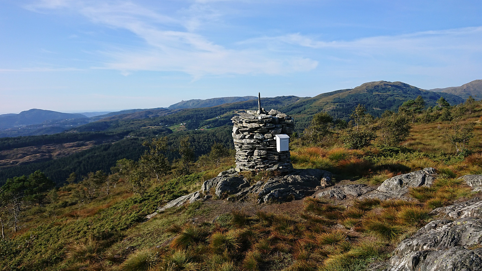
This turned out to be mistake as the gravel roads on the west side of Solbakkefjellet are clearly better suited for horseback riding than cycling, resulting in anything but a comfortable ride. But I finally left the bike behind north of the alternative trailhead and from there continued on foot to the large cairn at Solbakkefjellet, enjoying the excellent views along the way. Just before >>>
Sunday cycling trip with the objective of visiting Solbakkefjellet NØ , a recently added minor peak that I had passed close by before but not actually visited. My initial plan had been to cycle via Hauglandsdalen and ascend from Frotveit, but this route was blocked, twice, by a field of grazing horses. I could probably have made my way to the northern trailhead anyway, but I decided to instead head to the alternative trailhead further south.
This turned out to be mistake as the gravel roads on the west side of Solbakkefjellet are clearly better suited for horseback riding than cycling, resulting in anything but a comfortable ride. But I finally left the bike behind north of the alternative trailhead and from there continued on foot to the large cairn at Solbakkefjellet, enjoying the excellent views along the way. Just before >>>
