Arkiv - dato
Arkiv - aktivitet
-
Annen tur (3)
- Kajakkpadling (3)
- Fottur (1897)
-
Kjøretur (9)
- Biltur (9)
-
Skitur (116)
- Fjellskitur (69)
- Langrennstur (47)
-
Sykkeltur (111)
- Blandet sykling (25)
- Gatesykling (86)
Lister jeg samler etter
-
Utvalgte topper og turmål i Bergen
(349/351)
 99%
99% -
Alle topper i Bergen
(393/400)
98%
-
Voss ≥ 100m pf.
(96/98)
97%
-
Opptur Hordaland
(144/159)
90%
-
Stasjoner på Bergensbanen
(33/40)
82%
-
Ulvik ≥ 100m pf.
(30/38)
78%
-
Hordaland ≥ 100m pf.
(624/863)
72%
-
Mjølfjell PF > 100m
(21/31)
67%
-
Jondal ≥ 100m pf.
(15/23)
65%
-
Dagsturhyttene i Vestland
(36/61)
59%
-
Sunnhordland PF >= 100m
(105/186)
56%
-
Hordaland: Hardanger PF>=100m
(196/359)
54%
-
DNT-hytter i Hordaland
(23/45)
51%
-
Kvinnherad ≥ 100m pf.
(40/79)
50%
-
Eidfjord ≥ 100m pf.
(13/42)
30%
-
Sogndal ≥ 100m pf.
(23/81)
28%
-
Gulen ≥ 100m pf.
(15/54)
27%
-
Vik i Sogn ≥ 100m pf.
(10/46)
21%
-
Sogn - Sør for Sognefjorden PF>=100m
(31/159)
19%
-
DNT-hytter i Sogn og Fjordane
(8/47)
17%

Skiing at Fløyen
- Dato:
- 13.01.2021
- Turtype:
- Langrennstur
- Turlengde:
- 3:25t
- Distanse:
- 15,5km
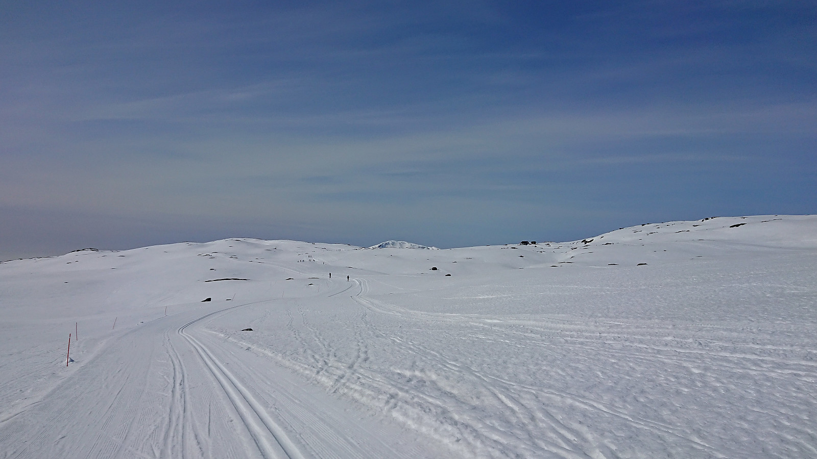
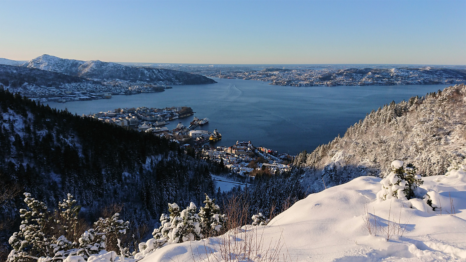 The first skiing trip of 2021! After getting all of the meetings out of the way before lunch, I took the rest of the day off to enjoy the excellent winter weather. Decided on an unusual ascent route based on carrying the skis from Munkebotn via Skredderdalen. Worked out ok, but there are clearly easier options. The skis came on at the top of Skredderdalen and stayed on until arriving at the top of Øyjorden.
Skiing: Steinskvanndalen
- Dato:
- 13.03.2020
- Turtype:
- Langrennstur
- Turlengde:
- 3:49t
- Distanse:
- 16,3km
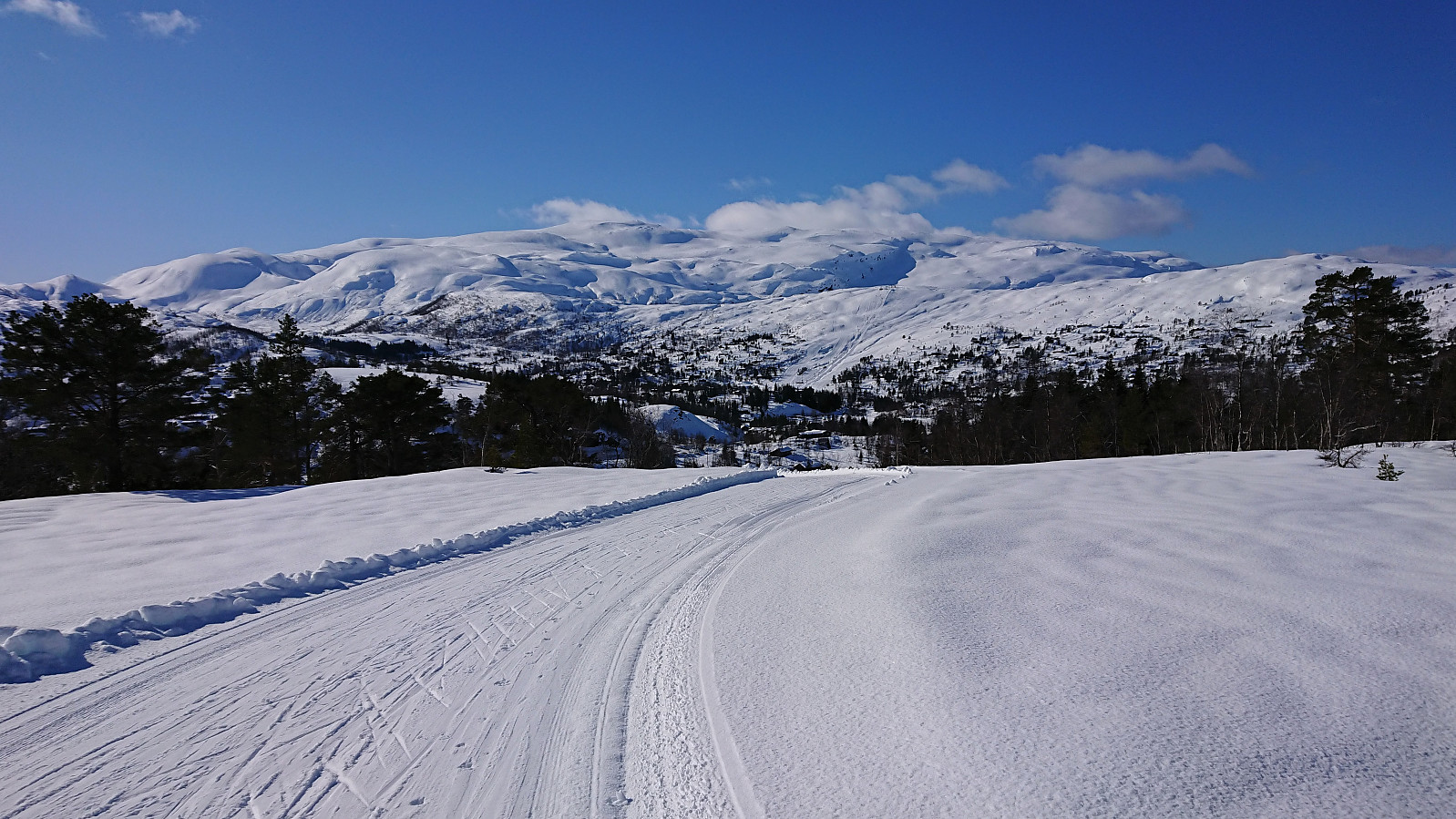 With all meetings suddenly cancelled due to the Coronavirus, I decided to instead make use of the perfect weather for a skiing trip in Steinskvanndalen, an area I had previously only visited in the summer. We parked at Løkjentunet, paid the 100 kr fee via Vipps, and from there walked a short stretch along the main road to Kvernavollen. After some initial struggles, we finally connected with the marked ski trail to Steinskvanndalen and could enjoy freshly laid ski tracks.
We continued north to Øvre Kvanndalsvatnet (the last stretch without any tracks), before turning back and reconnecting with the marked ski trail, which we then followed for a roundtrip, finally taking us back to the main road. Again, we struggled to find the best route towards the main road, first making a detour in the wrong >>>
With all meetings suddenly cancelled due to the Coronavirus, I decided to instead make use of the perfect weather for a skiing trip in Steinskvanndalen, an area I had previously only visited in the summer. We parked at Løkjentunet, paid the 100 kr fee via Vipps, and from there walked a short stretch along the main road to Kvernavollen. After some initial struggles, we finally connected with the marked ski trail to Steinskvanndalen and could enjoy freshly laid ski tracks.
We continued north to Øvre Kvanndalsvatnet (the last stretch without any tracks), before turning back and reconnecting with the marked ski trail, which we then followed for a roundtrip, finally taking us back to the main road. Again, we struggled to find the best route towards the main road, first making a detour in the wrong >>>
Fløyen and Rundemanen
- Dato:
- 28.02.2020
- Turtype:
- Langrennstur
- Turlengde:
- 4:40t
- Distanse:
- 19,9km
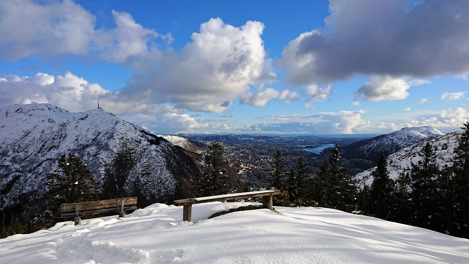
 Given the excellent winter weather, which potentially would only last for one day, I decided to take the day off and go skiing at Fløyen. More snow than expected, and I could keep the skis on all the way to the top of Øyjorden (although for the stretch along Langevatnet there were some sections with almost no snow).
The GPS decided to take a break in between Storediket and Munkebotsvatnet, i.e. I did not take the "shortcut" indicated on the map. :)
Given the excellent winter weather, which potentially would only last for one day, I decided to take the day off and go skiing at Fløyen. More snow than expected, and I could keep the skis on all the way to the top of Øyjorden (although for the stretch along Langevatnet there were some sections with almost no snow).
The GPS decided to take a break in between Storediket and Munkebotsvatnet, i.e. I did not take the "shortcut" indicated on the map. :)
Skiing at Fløyen
- Dato:
- 13.02.2020
- Turtype:
- Langrennstur
- Turlengde:
- 2:37t
- Distanse:
- 15,6km
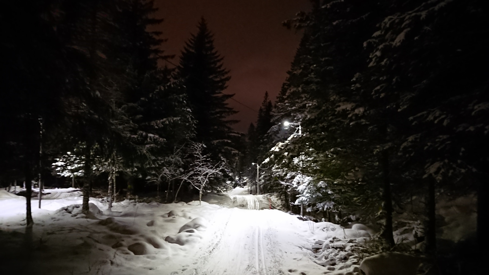
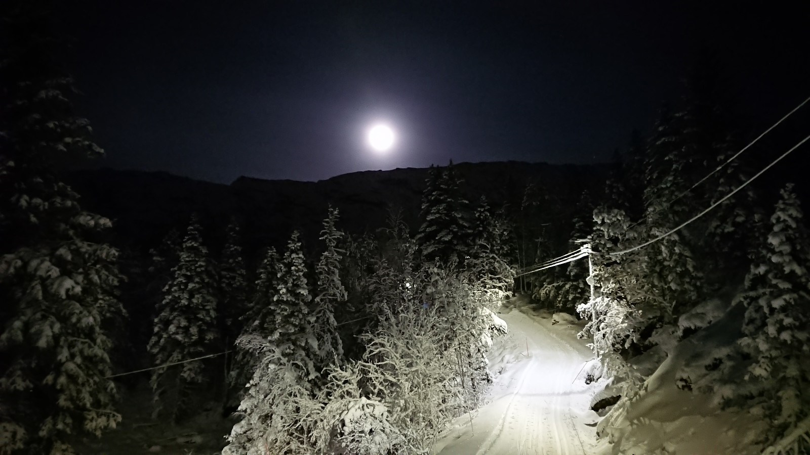
 With several reports indicating good skiing conditions at Fløyen it was finally time for my first skiing trip of 2020! I was unsure if I had made the right choice when it started raining when on the bus to Fløibanen though, but thankfully the rain turned to snow before Fløibanen reached its final destination. Decided to carry the skis up to just south of Regnhytten , and from there they stayed on until just below the small dam north of Storevatnet.
Britabu Easter Barbecue 2019 + Around Fjærlandssetvatnet
- Dato:
- 18.04.2019
- Turtype:
- Langrennstur
- Turlengde:
- 3:30t
- Distanse:
- 15,9km
 Followed the ski trail from Rindabotn via Høgehaug around Fjærlandssetvatnet with a minor shortcut on the descent. The trip also included a visit to the traditional Easter barbecue at the Red Cross cabin Britabu .
Skiing at Fløyen
- Dato:
- 24.01.2019
- Turtype:
- Langrennstur
- Turlengde:
- 2:53t
- Distanse:
- 16,6km
 More or less an exact copy of my skiing trip from Fløyen to Lønborg earlier in the week, but with a slightly longer route through "lysløypen" before turning north for Lønborg. The skiing conditions for the floodlit track had not changed much, but there was now clearly more snow outside the track. So it should soon be possible to do some proper backcountry skiing. For the descent, I made it almost to Munkebotsvatnet before removing the skis, although it would probably have been fine to continue all the way to the lake. And like on Monday, I put the skis back in Hellemyrstien, but this time I could keep them on all the way to the top of Øyjordsveien.
Skiing at Fløyen
- Dato:
- 21.01.2019
- Turtype:
- Langrennstur
- Turlengde:
- 2:53t
- Distanse:
- 14,5km
 The first skiing trip of 2019! Started from the upper station of Fløibanen and spent some time in "lysløypen" under excellent skiing conditions. I then turned on my head lamp and headed for Munkebotsvatnet, making it a bit below the smaller dam under Storevatnet, before deciding it would be safest to remove the skis and continue on foot. Probably a good decision as shortly after I spotted the first small rocks peeking out through the snow, and when getting closer to Munkebotsvatnet the snow was completely replaced by ice. I put the skis back on at Hellemyrstien though, but mainly due to being tired of carrying them, as the snow conditions there were far from optimal. But I did keep them on almost all the way to the top of Øyjordsveien without any major issues.
Skiing at Fløyen
- Dato:
- 05.04.2018
- Turtype:
- Langrennstur
- Turlengde:
- 2:25t
- Distanse:
- 12,6km
 Skiing at Fløyen after work. Started in nice sunny weather but ended with wet snow from above. Lots of new snow from the night before, but most of it had melted during the day, so not the best conditions for skiing, but still an enjoyable trip.
Britabu Easter Barbecue 2018
- Dato:
- 29.03.2018
- Turtype:
- Langrennstur
- Turlengde:
- 2:51t
- Distanse:
- 9,9km
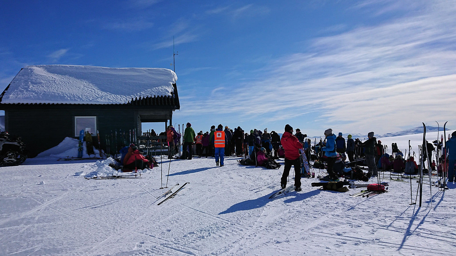 Visiting the traditional Easter barbecue at the Red Cross cabin Britabu .
Around Fjærlandssetvatnet
- Dato:
- 27.03.2018
- Turtype:
- Langrennstur
- Turlengde:
- 3:29t
- Distanse:
- 17,0km
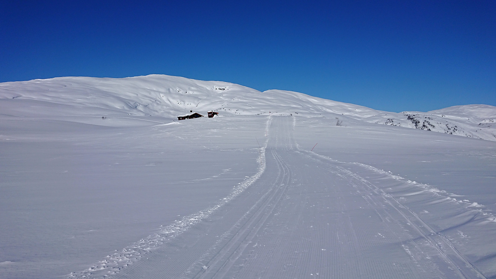 Followed the standard skiing trail from Rindabotn around Fjærlandssetvatnet. The only detour was an attempt to reach Dyrhovden , which in the end had to be abandoned due to not having enough time to find a safe ascent to the summit.
