Archive - Date
Archive - Activity
-
Bike trip (110)
- Bike trip - mixed (25)
- Bike trip - road (85)
-
Drive (9)
- Car drive (9)
-
Other trip (3)
- Kayaking (3)
-
Ski trip (116)
- Backcountry skiing (69)
- Cross-country skiing (47)
- Trip by foot (1884)
Collected lists
-
Utvalgte topper og turmål i Bergen
(348/349)
 99%
99% -
Alle topper i Bergen
(391/398)
98%
-
Voss ≥ 100m pf.
(96/98)
97%
-
Opptur Hordaland
(144/159)
90%
-
Stasjoner på Bergensbanen
(33/40)
82%
-
Ulvik ≥ 100m pf.
(28/38)
73%
-
Hordaland ≥ 100m pf.
(622/863)
72%
-
Mjølfjell PF > 100m
(21/31)
67%
-
Jondal ≥ 100m pf.
(15/23)
65%
-
Dagsturhyttene i Vestland
(36/61)
59%
-
Sunnhordland PF >= 100m
(105/186)
56%
-
Hordaland: Hardanger PF>=100m
(194/359)
54%
-
DNT-hytter i Hordaland
(23/45)
51%
-
Kvinnherad ≥ 100m pf.
(40/79)
50%
-
Eidfjord ≥ 100m pf.
(13/42)
30%
-
Sogndal ≥ 100m pf.
(23/81)
28%
-
Gulen ≥ 100m pf.
(15/54)
27%
-
Vik i Sogn ≥ 100m pf.
(10/46)
21%
-
Sogn - Sør for Sognefjorden PF>=100m
(31/159)
19%
-
DNT-hytter i Sogn og Fjordane
(8/47)
17%

Stoltzekleiven and Blåmanen
- Date:
- 28.10.2017
- Characteristic:
- Hillwalk
- Duration:
- 2:56h
- Distance:
- 11.9km
 Started from the bus stop at Munkebotn and walked up to the Fjellveien, from where I followed Stoltzekleiven up to Sandvikspilen . After a short rest, I continued to Brushytten and Blåmanen, visiting both Blåmanen Vest and Blåmanen Nord , before taking the shortcut called Formannskapsbakken down to Storediket. Perhaps not the best choice on a day where everything was wet and slippery though. The plan was to continue all the way to Lønborg, but it started raining quite heavily so I instead cut the hike short and headed for the bus stop at Gamle Bergen.
Sandviksbatteriet and Sandvikspilen
- Date:
- 23.10.2017
- Characteristic:
- Hillwalk
- Duration:
- 2:16h
- Distance:
- 8.3km
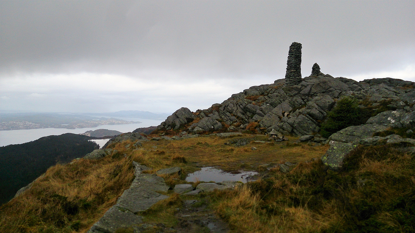
 Started from the bus stop across from Sandviken sykehus and from there followed the standard route up to Sandviksbatteriet . Next, I followed the trail along the ridge up to Sandvikspilen , with excellent views towards the west throughout. Note that the trail starts out quite steep, but flattens out about halfway to the top. The trail also requires a bit of very light climbing.
The trailhead is marked, but one has to know where to look to find the sign (see GPS tracking for details). As I was getting close to the top I noticed a new sign with a red arrow indicating that I ought to go left (east) instead of following the ridge like I'm used to doing for this hike. I followed the suggested trail for a while, but in the end decided that it was heading a too much in the wrong direction, and therefore instead returned to the unmarked >>>
Started from the bus stop across from Sandviken sykehus and from there followed the standard route up to Sandviksbatteriet . Next, I followed the trail along the ridge up to Sandvikspilen , with excellent views towards the west throughout. Note that the trail starts out quite steep, but flattens out about halfway to the top. The trail also requires a bit of very light climbing.
The trailhead is marked, but one has to know where to look to find the sign (see GPS tracking for details). As I was getting close to the top I noticed a new sign with a red arrow indicating that I ought to go left (east) instead of following the ridge like I'm used to doing for this hike. I followed the suggested trail for a while, but in the end decided that it was heading a too much in the wrong direction, and therefore instead returned to the unmarked >>>
Raunåsen and Sjøbøhaugane
- Date:
- 22.10.2017
- Characteristic:
- Hillwalk
- Duration:
- 2:51h
- Distance:
- 8.9km
 Raunåsen
Started by taking the bus to Søfteland and walking up Langedalen to arrive at the trailhead for Raunåsen located in the first bend of the road after passing the last house. The trailhead was unmarked, but the trail itself was marked with various plastic ribbons.
The trail was however quickly replaced by numerous deer tracks, which I partially followed on my way to the summit. The terrain was full of trees and a bit disorienting, hence the GPS was good to have when trying to locate the highest point. The summit provided limited views, but both Lyshornet and Lysefjorden could be spotted in-between the trees.
From the summit I followed more or less the same route back down, but included a short visit to the northeastern summit just to make sure that it was indeed the lower of the two.
Sjøbøhaugane
Upon >>>
Raunåsen
Started by taking the bus to Søfteland and walking up Langedalen to arrive at the trailhead for Raunåsen located in the first bend of the road after passing the last house. The trailhead was unmarked, but the trail itself was marked with various plastic ribbons.
The trail was however quickly replaced by numerous deer tracks, which I partially followed on my way to the summit. The terrain was full of trees and a bit disorienting, hence the GPS was good to have when trying to locate the highest point. The summit provided limited views, but both Lyshornet and Lysefjorden could be spotted in-between the trees.
From the summit I followed more or less the same route back down, but included a short visit to the northeastern summit just to make sure that it was indeed the lower of the two.
Sjøbøhaugane
Upon >>>
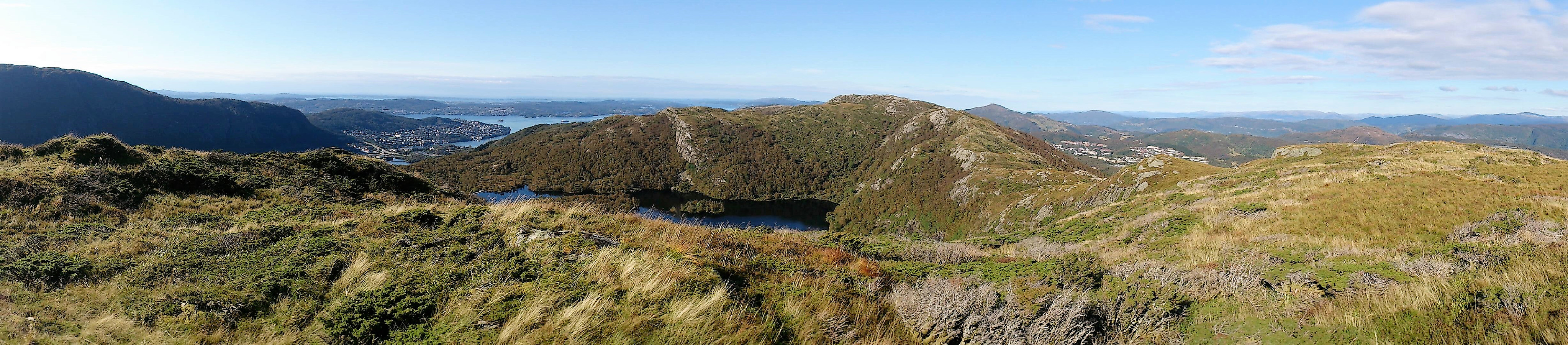
Skogafjellet and Galtåsen
- Date:
- 21.10.2017
- Characteristic:
- Hillwalk
- Duration:
- 2:49h
- Distance:
- 8.3km
 Skogafjellet
Started by taking the bus to Ulvenskiftet and walking up Ulvenvegen and Svegane to arrive at the trailhead. The trailhead was unmarked, but fairly easy to locate if one knows approximately where to look. The trail started out much better than expected and could be followed without any difficulty up to Hesthaugen.
Here the trail disappeared, but was quickly substituted by lots of deer tracks, which I partially followed when making my own way towards the summit of Skogafjellet . The terrain did not provide any real challenges, and I shortly arrived at the summit. The highest point provided limited views, but by moving slightly away from the summit I obtained nice views in several directions. Before starting the real descent I also got an excellent view towards Osøyro.
From the summit I followed >>>
Skogafjellet
Started by taking the bus to Ulvenskiftet and walking up Ulvenvegen and Svegane to arrive at the trailhead. The trailhead was unmarked, but fairly easy to locate if one knows approximately where to look. The trail started out much better than expected and could be followed without any difficulty up to Hesthaugen.
Here the trail disappeared, but was quickly substituted by lots of deer tracks, which I partially followed when making my own way towards the summit of Skogafjellet . The terrain did not provide any real challenges, and I shortly arrived at the summit. The highest point provided limited views, but by moving slightly away from the summit I obtained nice views in several directions. Before starting the real descent I also got an excellent view towards Osøyro.
From the summit I followed >>>
Høgelikampen, Vardafjellet and Ulvenfjellet
- Date:
- 14.10.2017
- Characteristic:
- Hillwalk
- Duration:
- 5:24h
- Distance:
- 21.0km
 Høgelikampen
Started by taking the bus to Ulvenskiftet and walking southwest along the roads until reaching Hovland. This was close to 5 km and took around 50 minutes. The start of the trail to Høgelikampen was clearly marked and visible from the main road.
It started out as a newly improved gravel road which later turned into an older, but still quite good, tractor road. Note that my route is perhaps not the quickest one, as it did include a small descent before starting the final climb. As I got closer to the summit I also visited a spot with a very nice southern view, which I added as a new PB element.
The summit itself provided very limited views, but the views from where the sign and the visitor register is located provided nice views north towards Lysefjorden and Krokeide.
Vardafjellet
From Høgelikampen >>>
Høgelikampen
Started by taking the bus to Ulvenskiftet and walking southwest along the roads until reaching Hovland. This was close to 5 km and took around 50 minutes. The start of the trail to Høgelikampen was clearly marked and visible from the main road.
It started out as a newly improved gravel road which later turned into an older, but still quite good, tractor road. Note that my route is perhaps not the quickest one, as it did include a small descent before starting the final climb. As I got closer to the summit I also visited a spot with a very nice southern view, which I added as a new PB element.
The summit itself provided very limited views, but the views from where the sign and the visitor register is located provided nice views north towards Lysefjorden and Krokeide.
Vardafjellet
From Høgelikampen >>>
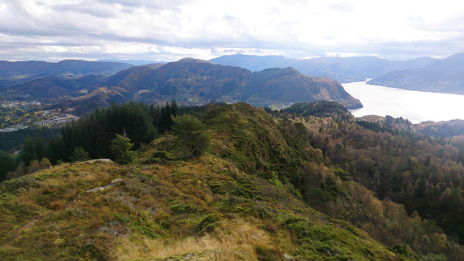
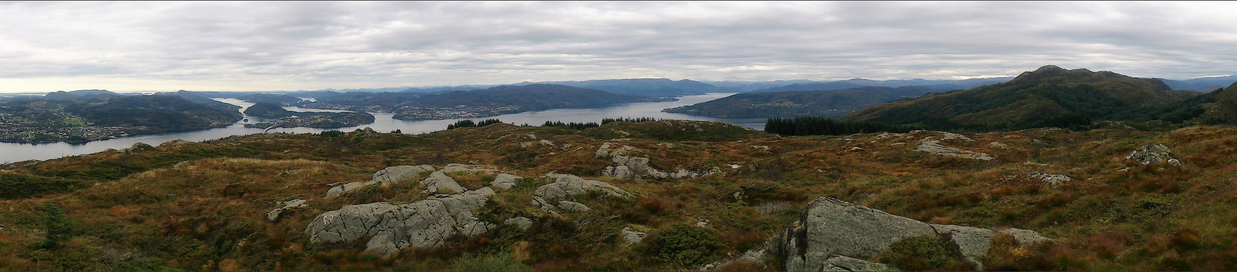
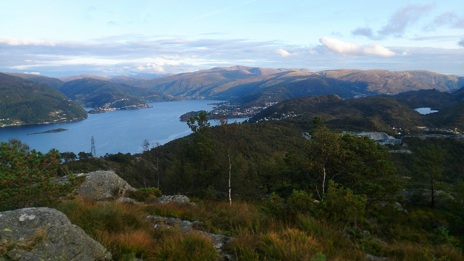
Vassberget, Kvamsfjellet, Svarthamrane and Tveitavarden
- Date:
- 08.10.2017
- Characteristic:
- Hillwalk
- Duration:
- 4:17h
- Distance:
- 11.5km
 Vassberget
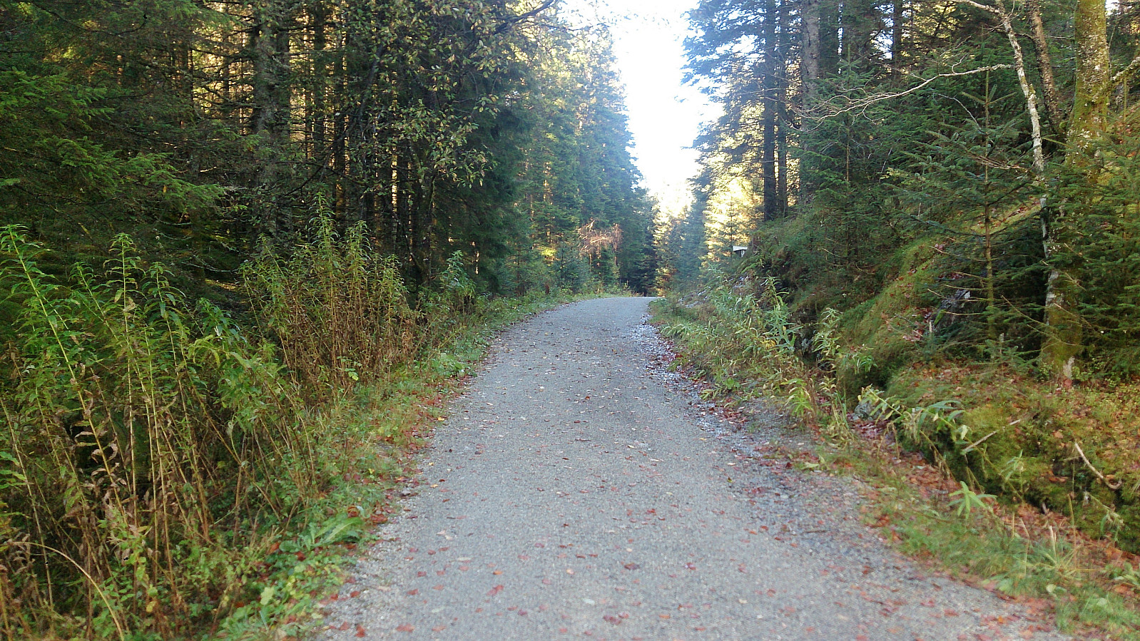
Started by taking the bus to Øvre Isdalen (to the bus stop called Åse) and from there following the unmarked gravel road northeast in the valley between Kvamsfjellet and Vassberget . My original plan was to take the trail that was supposed to start right after the small building on the right side of the road shortly after leaving the main road, but I did not manage to locate this trail, and therefore instead continued to the main trail further up the gravel road.
The trailhead was marked, but the quality of the trail was initially very wet and muddy. This improved slightly as the trail started climbing up the mountain, but there were still with lots of muddy areas, which would turn out to be the theme of the day... The views from the summit were excellent though, and I also continued a bit beyond the summit, >>>
Vassberget
Started by taking the bus to Øvre Isdalen (to the bus stop called Åse) and from there following the unmarked gravel road northeast in the valley between Kvamsfjellet and Vassberget . My original plan was to take the trail that was supposed to start right after the small building on the right side of the road shortly after leaving the main road, but I did not manage to locate this trail, and therefore instead continued to the main trail further up the gravel road.
The trailhead was marked, but the quality of the trail was initially very wet and muddy. This improved slightly as the trail started climbing up the mountain, but there were still with lots of muddy areas, which would turn out to be the theme of the day... The views from the summit were excellent though, and I also continued a bit beyond the summit, >>>
Iseggene from Valestrand
- Date:
- 01.10.2017
- Characteristic:
- Hillwalk
- Duration:
- 3:06h
- Distance:
- 10.8km
 Locating the trailhead
Started by taking the bus and ferry to Valestrand and from there following Hamrenesvegen northwest in search for the trailhead indicated on the map. However, upon reaching the location of where the trail ought to start, I could not initially see any clear trails, and had to search for a bit to finally find a potential trailhead. The get to the trailhead I had to cross a small field, and there were no indications regarding where to cross. In other words, one has to be a bit lucky to spot the start of the trail. The trick is to look for the small ridge on the other side of the field, as the trail starts more or less at the northwestern end of this ridge. See the GPS track for details.
Dalsnipa and Iseggene
As soon as the starting point was found, the trail (sometimes marked >>>
Locating the trailhead
Started by taking the bus and ferry to Valestrand and from there following Hamrenesvegen northwest in search for the trailhead indicated on the map. However, upon reaching the location of where the trail ought to start, I could not initially see any clear trails, and had to search for a bit to finally find a potential trailhead. The get to the trailhead I had to cross a small field, and there were no indications regarding where to cross. In other words, one has to be a bit lucky to spot the start of the trail. The trick is to look for the small ridge on the other side of the field, as the trail starts more or less at the northwestern end of this ridge. See the GPS track for details.
Dalsnipa and Iseggene
As soon as the starting point was found, the trail (sometimes marked >>>
Baugtveit Roundtrip
- Date:
- 24.09.2017
- Characteristic:
- Hillwalk
- Duration:
- 3:03h
- Distance:
- 8.9km
 Started by taking the bus to Støbotn and walking up to Baugtveit and the trail towards Nordgardsfjellet . I then followed the standard trail to Nordgardsfjellet, Tellevikafjellet and Høgstefjellet . On the way down from Høgstefjellet, I took a quick detour to the summit of Midtfjellet , before completing the circle and arriving at Baugtveit, from where I walked back to Støbotn and the bus back towards the city center. Overall, the trail was easy to follow, but the quality was varied, with several wet and muddy sections. But all in all, a nice hike that can be recommended.
Nukane, Storsåta, Øst for Stangelifjellet and Rundemanen
- Date:
- 23.09.2017
- Characteristic:
- Hillwalk
- Duration:
- 5:33h
- Distance:
- 19.5km
 Started by taking the bus to Hesthaugen and from there walked up to Kolåsen to locate the trailhead. (Note the sharp left in between the two buildings that is needed to find the sign and the trailhead. See GPS track for details.) I then followed the trail southeast across Nukane , Storsåta and Stangelifjellet to arrive at Vikinghytten , before turning west to Rundemanen .
From Rundemanen I headed northwest, passing by Ankerhytten on the way down to Munkebotsvatnet, before following the roads on the Eidsvåg-side of Eidsvågfjellet, ending with walking down Fagerbakken to Helleveien.
All in all, a very nice hike along overall good trails, the clear exception being the first part of the trail down from Ankerhytten, which on this day felt more like a muddy river than a trail.
Started by taking the bus to Hesthaugen and from there walked up to Kolåsen to locate the trailhead. (Note the sharp left in between the two buildings that is needed to find the sign and the trailhead. See GPS track for details.) I then followed the trail southeast across Nukane , Storsåta and Stangelifjellet to arrive at Vikinghytten , before turning west to Rundemanen .
From Rundemanen I headed northwest, passing by Ankerhytten on the way down to Munkebotsvatnet, before following the roads on the Eidsvåg-side of Eidsvågfjellet, ending with walking down Fagerbakken to Helleveien.
All in all, a very nice hike along overall good trails, the clear exception being the first part of the trail down from Ankerhytten, which on this day felt more like a muddy river than a trail.
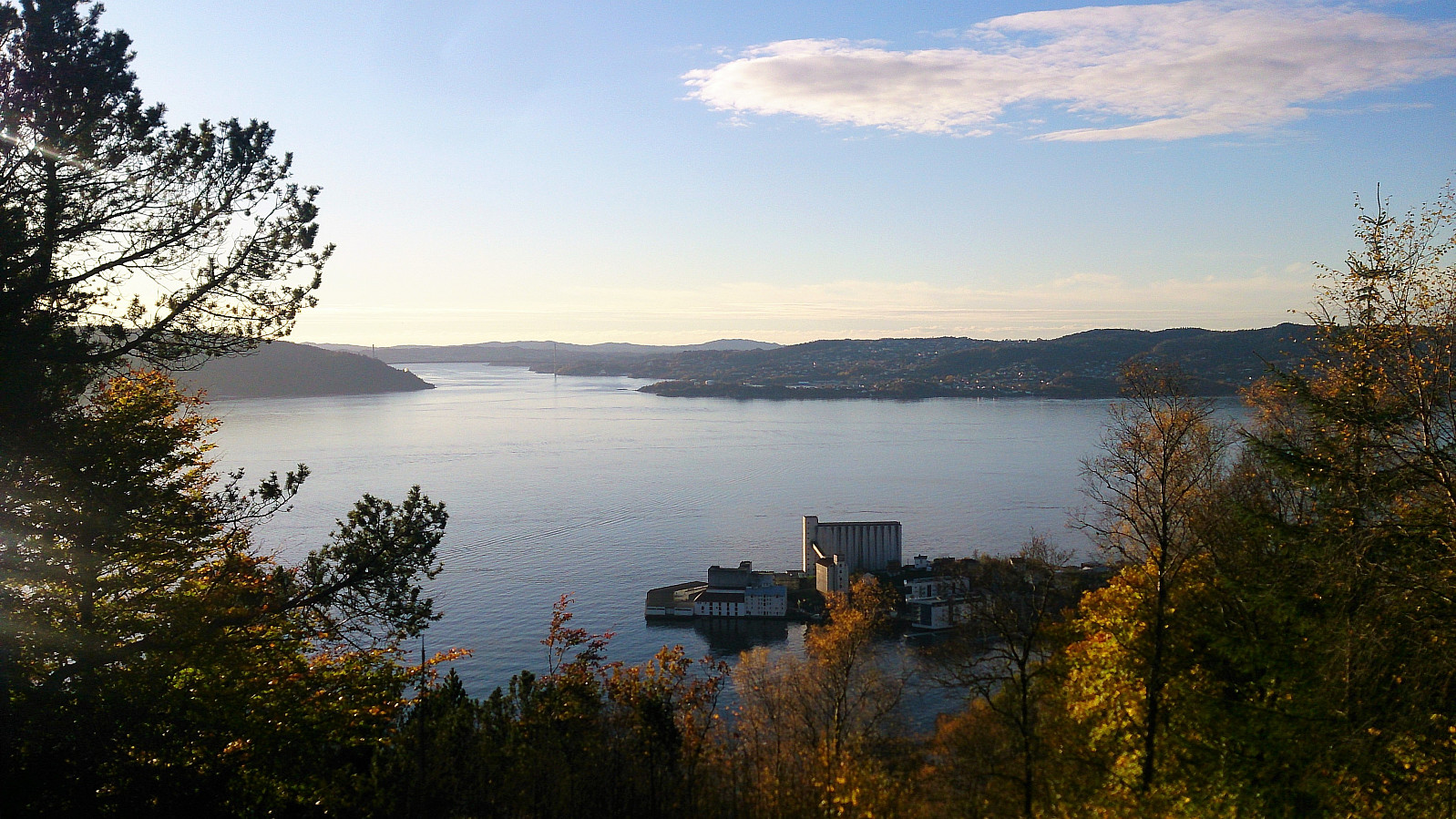
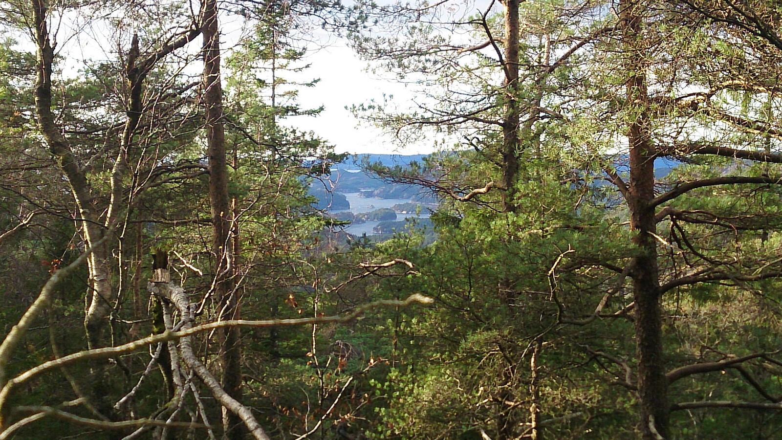
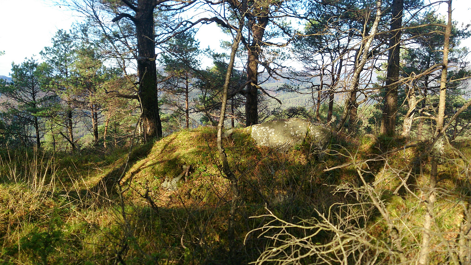
Hetlebakksåta, Breisteinsåta and Erviknipa
- Date:
- 18.09.2017
- Characteristic:
- Hillwalk
- Duration:
- 2:35h
- Distance:
- 6.8km
 Started by taking the bus to Myrsæther and walking along Breisteinsvegen, Leikvangvegen and finally Litlaskarstien to arrive at the unmarked trailhead. We then followed a nice trail through the pine forrest up to Hetlebakksåta , and also included a quick visit to Breisteinsåta before continuing down the relatively steep trail towards Erviknipa .
From Erviknipa we followed the trail south, ending up at the top of Tuftadalen, from where we followed the paved road down to Gaupåsvegen for the bus back to the city center. Overall, a nice short hike with great views along the way that can highly recommended.
Started by taking the bus to Myrsæther and walking along Breisteinsvegen, Leikvangvegen and finally Litlaskarstien to arrive at the unmarked trailhead. We then followed a nice trail through the pine forrest up to Hetlebakksåta , and also included a quick visit to Breisteinsåta before continuing down the relatively steep trail towards Erviknipa .
From Erviknipa we followed the trail south, ending up at the top of Tuftadalen, from where we followed the paved road down to Gaupåsvegen for the bus back to the city center. Overall, a nice short hike with great views along the way that can highly recommended.
