Arkiv - dato
Arkiv - aktivitet
-
Annen tur (3)
- Kajakkpadling (3)
- Fottur (1884)
-
Kjøretur (9)
- Biltur (9)
-
Skitur (116)
- Fjellskitur (69)
- Langrennstur (47)
-
Sykkeltur (110)
- Blandet sykling (25)
- Gatesykling (85)
Lister jeg samler etter
-
Utvalgte topper og turmål i Bergen
(348/349)
 99%
99% -
Alle topper i Bergen
(391/398)
98%
-
Voss ≥ 100m pf.
(96/98)
97%
-
Opptur Hordaland
(144/159)
90%
-
Stasjoner på Bergensbanen
(33/40)
82%
-
Ulvik ≥ 100m pf.
(28/38)
73%
-
Hordaland ≥ 100m pf.
(622/863)
72%
-
Mjølfjell PF > 100m
(21/31)
67%
-
Jondal ≥ 100m pf.
(15/23)
65%
-
Dagsturhyttene i Vestland
(36/61)
59%
-
Sunnhordland PF >= 100m
(105/186)
56%
-
Hordaland: Hardanger PF>=100m
(194/359)
54%
-
DNT-hytter i Hordaland
(23/45)
51%
-
Kvinnherad ≥ 100m pf.
(40/79)
50%
-
Eidfjord ≥ 100m pf.
(13/42)
30%
-
Sogndal ≥ 100m pf.
(23/81)
28%
-
Gulen ≥ 100m pf.
(15/54)
27%
-
Vik i Sogn ≥ 100m pf.
(10/46)
21%
-
Sogn - Sør for Sognefjorden PF>=100m
(31/159)
19%
-
DNT-hytter i Sogn og Fjordane
(8/47)
17%

Vedafjellet and Såtefjellet
- Dato:
- 23.09.2018
- Turtype:
- Fjelltur
- Turlengde:
- 5:31t
- Distanse:
- 18,8km
 Setevarden and Vedafjellet
Started by taking the bus (or rather, bus, train and then bus again) to Gjerstad and the bus stop called Presttun. From there I followed the road and later trail in the direction of Storavatnet. This included passing through a couple of gates before crossing the river south of Gjerstadfossen. There was an information sign at Gjerstad, and after the initial confusion of which road to pick, it was straightforward to follow the marked trail (marked with yellow paint) all the way to Litlavatnet.
I did however still manage to make two unnecessary detours. The first shortly after crossing the bridge, where I missed the trail splitting left (east) and leaving the tractor road. This one was however quickly corrected. The second detour was a slightly more costly, and occurred >>>
Setevarden and Vedafjellet
Started by taking the bus (or rather, bus, train and then bus again) to Gjerstad and the bus stop called Presttun. From there I followed the road and later trail in the direction of Storavatnet. This included passing through a couple of gates before crossing the river south of Gjerstadfossen. There was an information sign at Gjerstad, and after the initial confusion of which road to pick, it was straightforward to follow the marked trail (marked with yellow paint) all the way to Litlavatnet.
I did however still manage to make two unnecessary detours. The first shortly after crossing the bridge, where I missed the trail splitting left (east) and leaving the tractor road. This one was however quickly corrected. The second detour was a slightly more costly, and occurred >>>
Rothaugen skole, Sandviksbatteriet and Ørneberget
- Dato:
- 16.09.2018
- Turtype:
- Fjelltur
- Turlengde:
- 1:49t
- Distanse:
- 8,5km
 Local hike from Munkebotn via Rothaugen skole, Sandviksbatteriet and Ørneberget.
Bjørgafjell from Bjørgekrysset
- Dato:
- 15.09.2018
- Turtype:
- Fjelltur
- Turlengde:
- 2:14t
- Distanse:
- 12,0km
 Bjørgafjell
Started by taking the early morning bus towards Ostereidet and getting off at the bus stop called Bjørgekrysset. From there I walked north along the road toward Vassel and Æse, before following the gravel road up to Bjørgo. I started out in nice weather, but shortly before leaving the paved road it began raining heavily and did not stop until I was almost at the gate indicating the unmarked trailhead for Bjørgafjell .
From there on a rather wet tractor road could be followed almost all the way to the summit, changing into a trail toward the end. Shortly before reaching the summit, I came across the first red and blue trail marker. This marked trail continued north/northwest across the summit, but I did not have the time to investigate this option further.
Just before arriving at the summit, >>>
Bjørgafjell
Started by taking the early morning bus towards Ostereidet and getting off at the bus stop called Bjørgekrysset. From there I walked north along the road toward Vassel and Æse, before following the gravel road up to Bjørgo. I started out in nice weather, but shortly before leaving the paved road it began raining heavily and did not stop until I was almost at the gate indicating the unmarked trailhead for Bjørgafjell .
From there on a rather wet tractor road could be followed almost all the way to the summit, changing into a trail toward the end. Shortly before reaching the summit, I came across the first red and blue trail marker. This marked trail continued north/northwest across the summit, but I did not have the time to investigate this option further.
Just before arriving at the summit, >>>
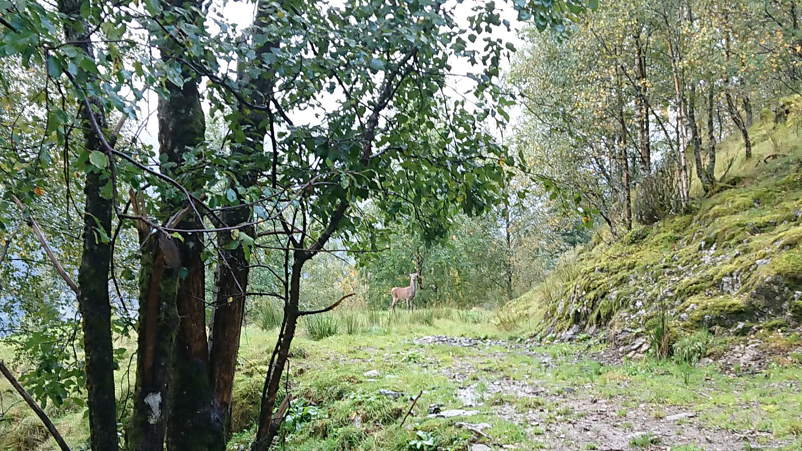
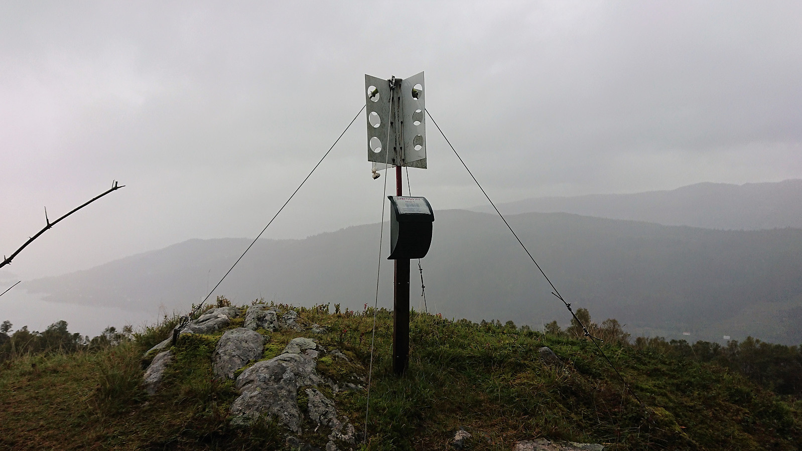
Torrfjellet
- Dato:
- 09.09.2018
- Turtype:
- Fjelltur
- Turlengde:
- 2:32t
- Distanse:
- 12,7km
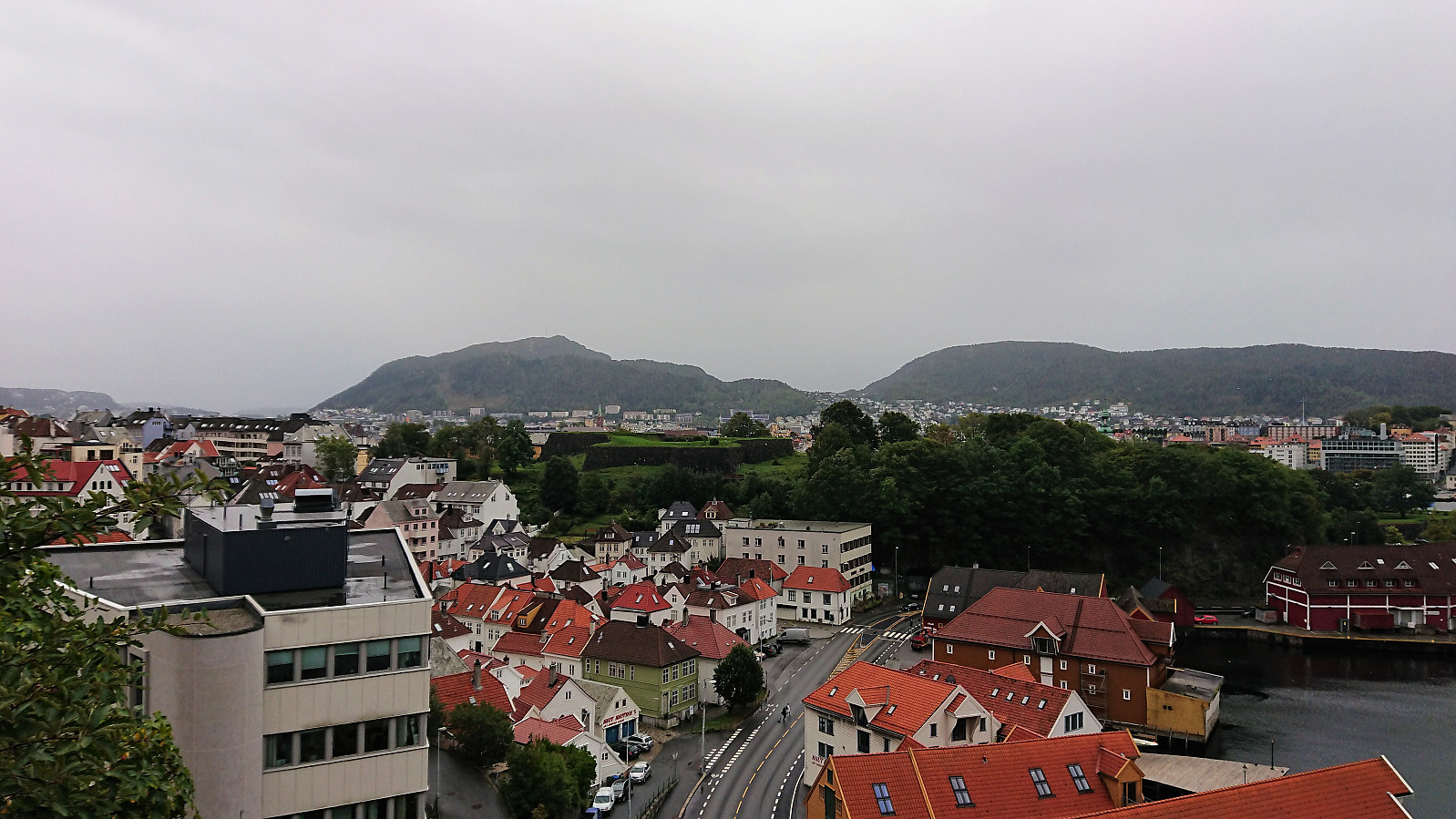
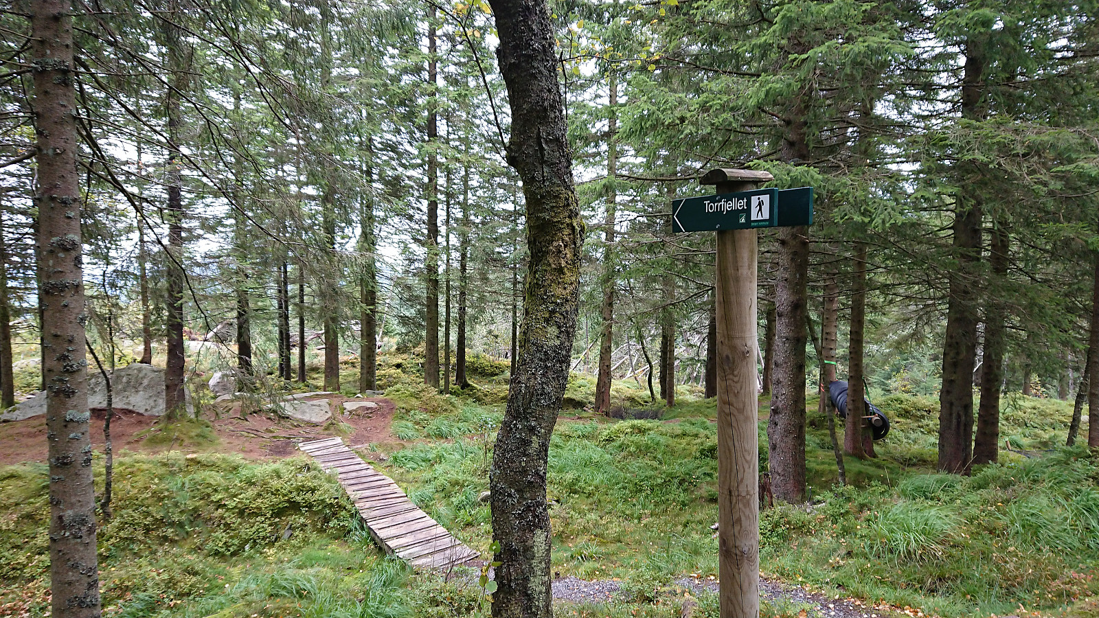 Started by making my way up from Bryggen to the upper station of Fløibanen. Here the wind started picking up and the rain did not seem far off. Instead of the planned hike, I therefore decided to rather do a quick detour to a (for me) new small peak called Torrfjellet . There are several signs indicating trails to Torrfjellet, but surprisingly none of these actually went by the summit itself.
First, I followed the marked trail from west of Torrfjellet, but soon ended up at Skomakerdiket instead. After walking north along Skomakerdiket I came across the second marked trail for Torrfjellet, but this one only led me back to the trail I had left minutes earlier. Concluding that the marked trails could not be trusted, I simply headed straight for the summit, which was less than 50 meters off at this point anyway.
Started by making my way up from Bryggen to the upper station of Fløibanen. Here the wind started picking up and the rain did not seem far off. Instead of the planned hike, I therefore decided to rather do a quick detour to a (for me) new small peak called Torrfjellet . There are several signs indicating trails to Torrfjellet, but surprisingly none of these actually went by the summit itself.
First, I followed the marked trail from west of Torrfjellet, but soon ended up at Skomakerdiket instead. After walking north along Skomakerdiket I came across the second marked trail for Torrfjellet, but this one only led me back to the trail I had left minutes earlier. Concluding that the marked trails could not be trusted, I simply headed straight for the summit, which was less than 50 meters off at this point anyway.
Gravdalsfjellet from Nipedalen
- Dato:
- 08.09.2018
- Turtype:
- Fjelltur
- Turlengde:
- 1:20t
- Distanse:
- 3,5km
 Short evening hike from the final bus stop in Nipedalen. Began with the steep trail, starting directly behind the bus stop, up to Nipetjernet. On a previous hike I had noticed an even steeper trail continuing from the northern tip of the lake heading in the direction of Gravdalsfjellet . The first stretch was even steeper than expected, requiring light climbing, and in hindsight, probably not the best trail after the recent rain shower that had occurred when I was on the bus. But thankfully the trail soon levelled off and, while still slippery, from there it was straightforward to reach the summit of Gravdalsfjellet. The trail did get a bit weak at the end though, but could also be that I made my own shortcut without realizing it.
On my ascent I had heard thunder in the far distance, but as it was now slowly >>>
Short evening hike from the final bus stop in Nipedalen. Began with the steep trail, starting directly behind the bus stop, up to Nipetjernet. On a previous hike I had noticed an even steeper trail continuing from the northern tip of the lake heading in the direction of Gravdalsfjellet . The first stretch was even steeper than expected, requiring light climbing, and in hindsight, probably not the best trail after the recent rain shower that had occurred when I was on the bus. But thankfully the trail soon levelled off and, while still slippery, from there it was straightforward to reach the summit of Gravdalsfjellet. The trail did get a bit weak at the end though, but could also be that I made my own shortcut without realizing it.
On my ascent I had heard thunder in the far distance, but as it was now slowly >>>
Austlendingen
- Dato:
- 02.09.2018
- Turtype:
- Fjelltur
- Turlengde:
- 3:47t
- Distanse:
- 8,3km
 From the parking lot for Austlendingen we crossed the main road and easily located the unmarked trailhead for Austlendingen . The trail climbed steeply up to Stegafossen where it crossed the river just above the waterfall. Not a lot of water today though, so it was straightforward to cross without getting wet.
The trail continued its steep climb upward, but also with several less steep section, until finally flattening out towards the summit. By now the wind had started to pick up, and combined with the limited views due the low-hanging clouds, we only had a quick bite before starting our descent along the same route.
In summary, a nice hike that can be recommended, although it is probably much more enjoyable on days with better weather.
From the parking lot for Austlendingen we crossed the main road and easily located the unmarked trailhead for Austlendingen . The trail climbed steeply up to Stegafossen where it crossed the river just above the waterfall. Not a lot of water today though, so it was straightforward to cross without getting wet.
The trail continued its steep climb upward, but also with several less steep section, until finally flattening out towards the summit. By now the wind had started to pick up, and combined with the limited views due the low-hanging clouds, we only had a quick bite before starting our descent along the same route.
In summary, a nice hike that can be recommended, although it is probably much more enjoyable on days with better weather.
Rispingen, Raudskredbruna, Olsnesnipa and Olsnessåta
- Dato:
- 31.08.2018
- Turtype:
- Fjelltur
- Turlengde:
- 6:14t
- Distanse:
- 15,7km
 Raudskredvarden and Rispingen
From the parking lot at Båtaleite we followed the marked trail towards Rispingen . The trail started out a bit wet, but soon greatly improved. At Raudskredvarden we enjoyed the excellent views towards Stanghelle, before continuing to Rispingen for a short lunch break.
Raudskredbruna
On the way back, we made a quick detour to Raudskredbruna , which provided nice views, but probably not essential for most hikers. No trails to Raudskredbruna as far as we could see, but the terrain was straightforward to traverse.
Olsnesnipa and Olsnessåta
After reconnecting with the trail, we followed it down towards the parking lot, until realizing that this was probably not necessary, and instead headed directly towards the trail to Olsnesnipa and Olsnessåta . In hindsight, we should probably have made this shortcut sooner.
We lost the trail briefly on our way to Olsnesnipa, >>>
Raudskredvarden and Rispingen
From the parking lot at Båtaleite we followed the marked trail towards Rispingen . The trail started out a bit wet, but soon greatly improved. At Raudskredvarden we enjoyed the excellent views towards Stanghelle, before continuing to Rispingen for a short lunch break.
Raudskredbruna
On the way back, we made a quick detour to Raudskredbruna , which provided nice views, but probably not essential for most hikers. No trails to Raudskredbruna as far as we could see, but the terrain was straightforward to traverse.
Olsnesnipa and Olsnessåta
After reconnecting with the trail, we followed it down towards the parking lot, until realizing that this was probably not necessary, and instead headed directly towards the trail to Olsnesnipa and Olsnessåta . In hindsight, we should probably have made this shortcut sooner.
We lost the trail briefly on our way to Olsnesnipa, >>>
Fløysvingene, Blåmanen, Rundemanen and Jordalsskaret
- Dato:
- 26.08.2018
- Turtype:
- Fjelltur
- Turlengde:
- 3:43t
- Distanse:
- 17,5km
 Rather traditional-looking Sunday hike via Fløysvingene, Brushytten, Blåmanen and Rundemanen, perhaps with the exception of the more unusual detour down Jordalsskaret.
Langevatnet and Munkebotsvatnet
- Dato:
- 23.08.2018
- Turtype:
- Fjelltur
- Turlengde:
- 1:49t
- Distanse:
- 8,1km
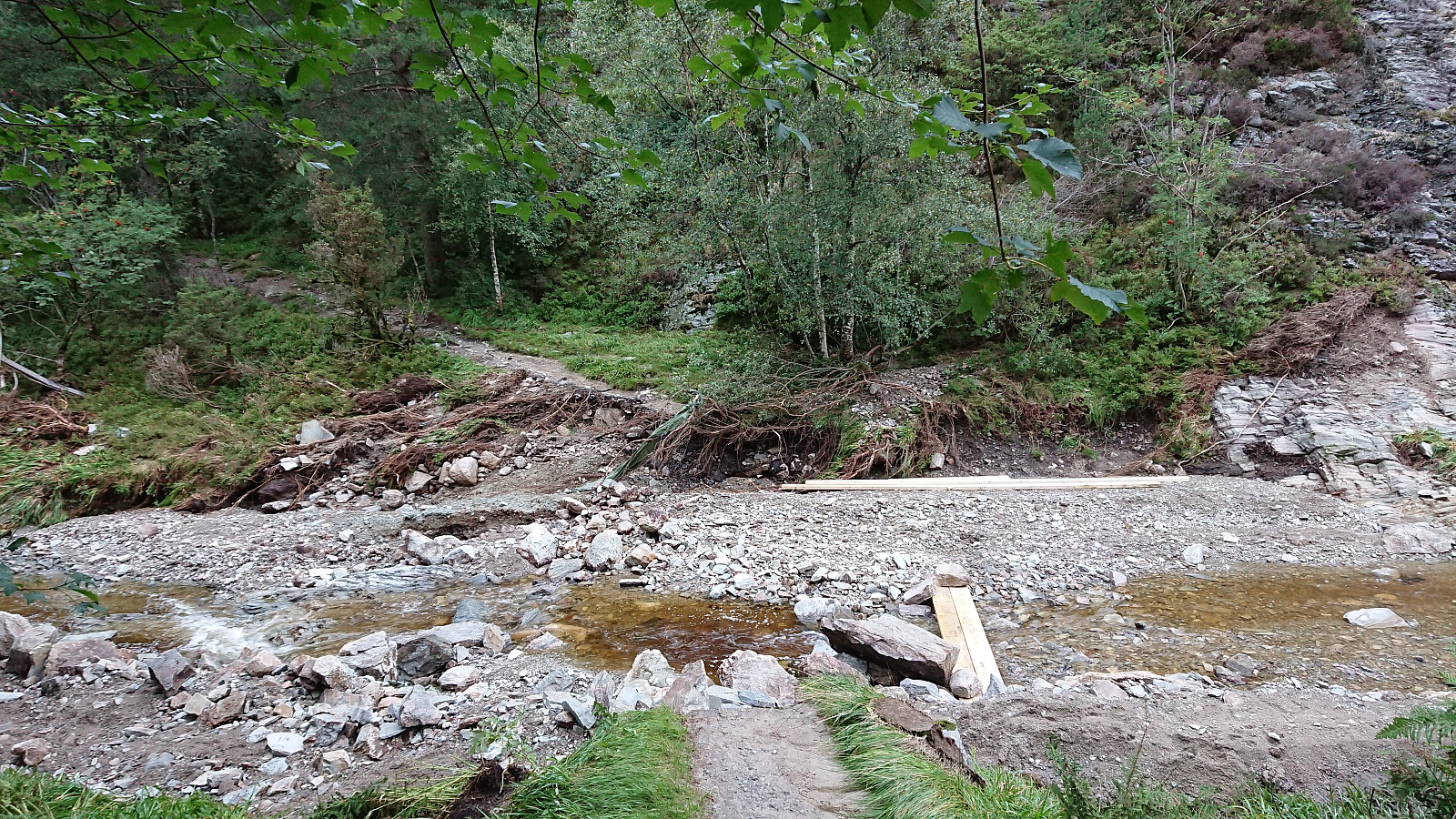 Local hike mainly to see the results of the temporary dam at Munkebotsvatnet failing the previous evening.
Ørneberget and Orretua
- Dato:
- 21.08.2018
- Turtype:
- Fjelltur
- Turlengde:
- 2:00t
- Distanse:
- 7,8km
 Local hike across Ørneberget and Orretua after work.
