Archiv - Nach Datum
Archiv - Nach Aktivität
-
Andere Tour (3)
- Kayaking (3)
-
Fahrradtour (110)
- Fahrradtour Straße (85)
- Fahrradtour gemischt (25)
-
Fahrzeugtour (9)
- Autotour (9)
-
Fußtour (1884)
- Bergtour (1114)
- Jogging (1)
- Spaziergang (59)
- Wanderung (710)
-
Skitour (116)
- Langlauf (47)
- Tourenskilauf (69)
Gesammelte Listen
-
Utvalgte topper og turmål i Bergen
(348/349)
 99%
99% -
Alle topper i Bergen
(391/398)
98%
-
Voss ≥ 100m pf.
(96/98)
97%
-
Opptur Hordaland
(144/159)
90%
-
Stasjoner på Bergensbanen
(33/40)
82%
-
Ulvik ≥ 100m pf.
(28/38)
73%
-
Hordaland ≥ 100m pf.
(622/863)
72%
-
Mjølfjell PF > 100m
(21/31)
67%
-
Jondal ≥ 100m pf.
(15/23)
65%
-
Dagsturhyttene i Vestland
(36/61)
59%
-
Sunnhordland PF >= 100m
(105/186)
56%
-
Hordaland: Hardanger PF>=100m
(194/359)
54%
-
DNT-hytter i Hordaland
(23/45)
51%
-
Kvinnherad ≥ 100m pf.
(40/79)
50%
-
Eidfjord ≥ 100m pf.
(13/42)
30%
-
Sogndal ≥ 100m pf.
(23/81)
28%
-
Gulen ≥ 100m pf.
(15/54)
27%
-
Vik i Sogn ≥ 100m pf.
(10/46)
21%
-
Sogn - Sør for Sognefjorden PF>=100m
(31/159)
19%
-
DNT-hytter i Sogn og Fjordane
(8/47)
17%

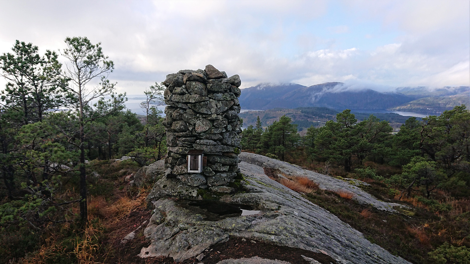
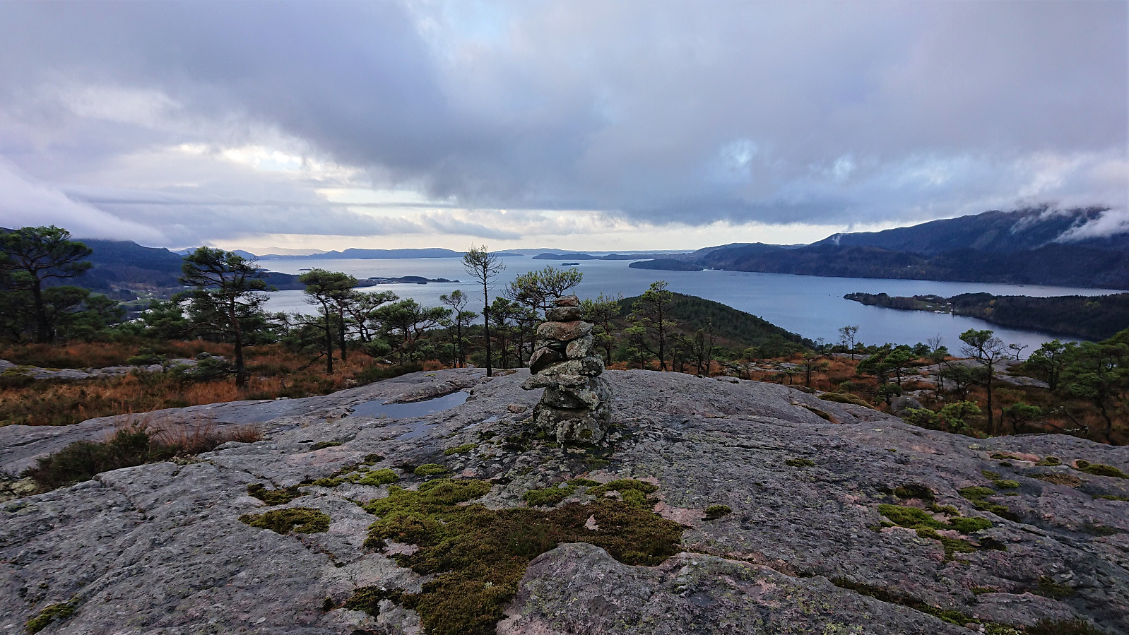
Fløyen and Rundemanen
- Datum:
- 16.11.2019
- Tourcharakter:
- Bergtour
- Tourlänge:
- 3:56h
- Entfernung:
- 18,4km
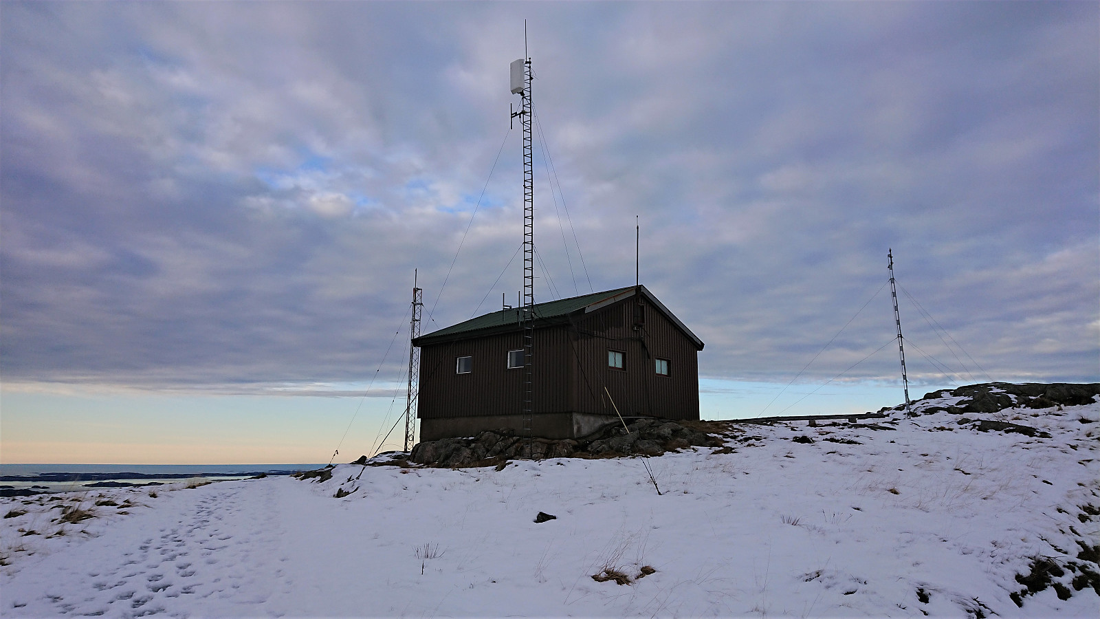 Roundtrip at Fløyen and Rundemanen to visit some of the newly added elements on the Hytter og objekter i Byfjellene list. Rather icy conditions from Brushytten up to Rundemanen, so I followed Blåmansveien on the descent which was much better. Also lots of ice from Brushytten to Grindarasten and down to the smaller dam below Storavatnet.
Andershovden, Grauaåsen and Sonvesåsen
- Datum:
- 10.11.2019
- Tourcharakter:
- Bergtour
- Tourlänge:
- 6:37h
- Entfernung:
- 30,4km
 Andershovden
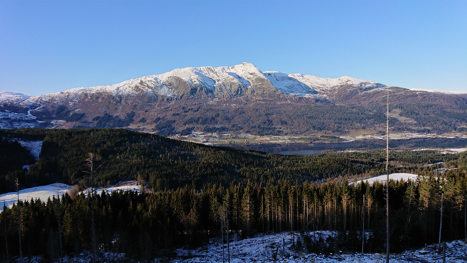
After exiting the train at Voss, I walked along the roads to Tvilde where I easily located the marked trailhead. By following the signs for Storeåsen, first along a gravel road and later a long various trail, the progress was straightforward and with some excellent views towards Lønahorgi along the way (which would turn out to be a familiar element throughout the rest of the hike).
Storeåsen itself was not marked, and I did not bother locating the summit. North of Storeåsen, where the trail connected with a gravel road, there was another information sign, from which I followed the trail towards Gudleikstreet, taking me through the Håmyrane nature reserve. (As it turned out, I could also simply have followed the gravel road north for a couple hundred meters and reconnected with the same >>>
Andershovden
After exiting the train at Voss, I walked along the roads to Tvilde where I easily located the marked trailhead. By following the signs for Storeåsen, first along a gravel road and later a long various trail, the progress was straightforward and with some excellent views towards Lønahorgi along the way (which would turn out to be a familiar element throughout the rest of the hike).
Storeåsen itself was not marked, and I did not bother locating the summit. North of Storeåsen, where the trail connected with a gravel road, there was another information sign, from which I followed the trail towards Gudleikstreet, taking me through the Håmyrane nature reserve. (As it turned out, I could also simply have followed the gravel road north for a couple hundred meters and reconnected with the same >>>
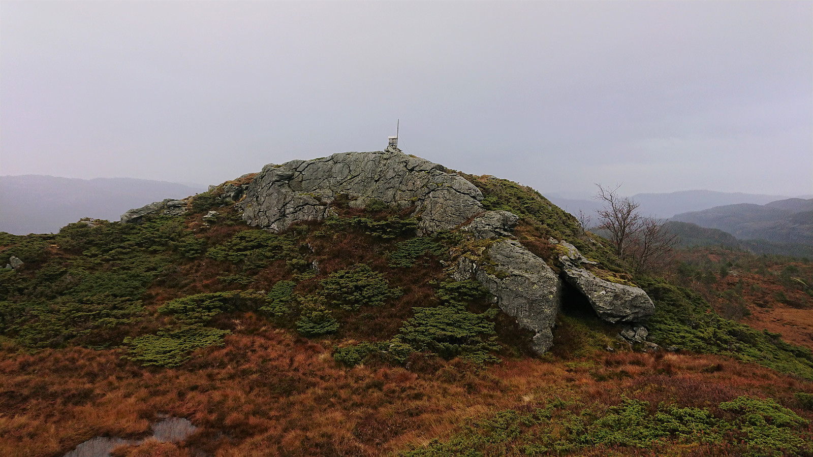
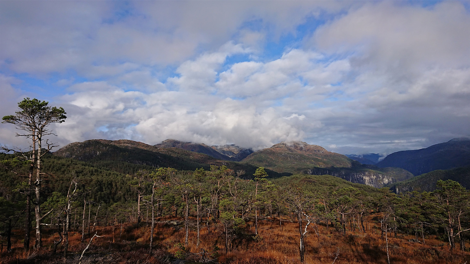
Skrott, Glynt and Geitafjellet
- Datum:
- 27.10.2019
- Tourcharakter:
- Bergtour
- Tourlänge:
- 6:49h
- Entfernung:
- 15,4km
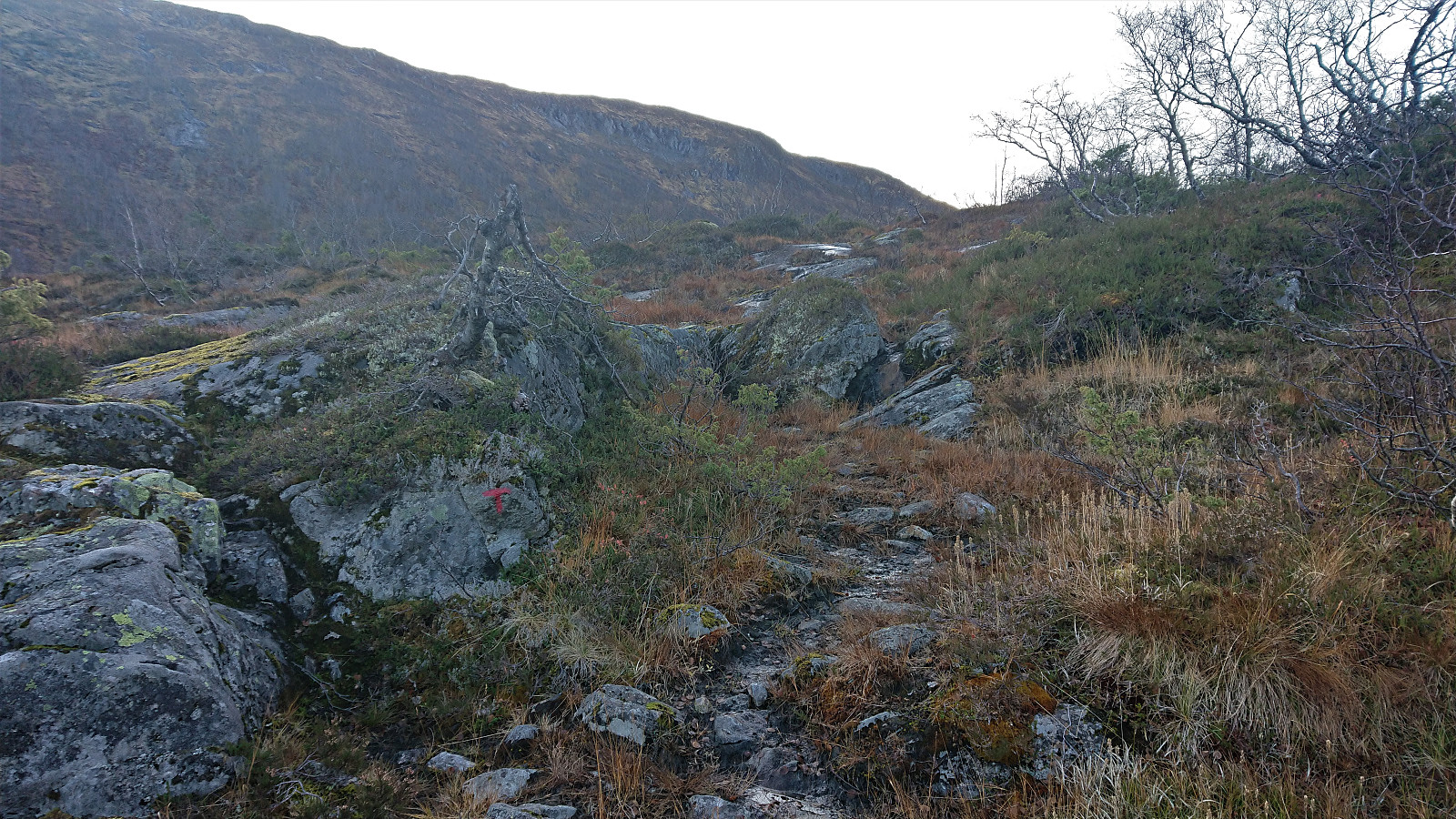
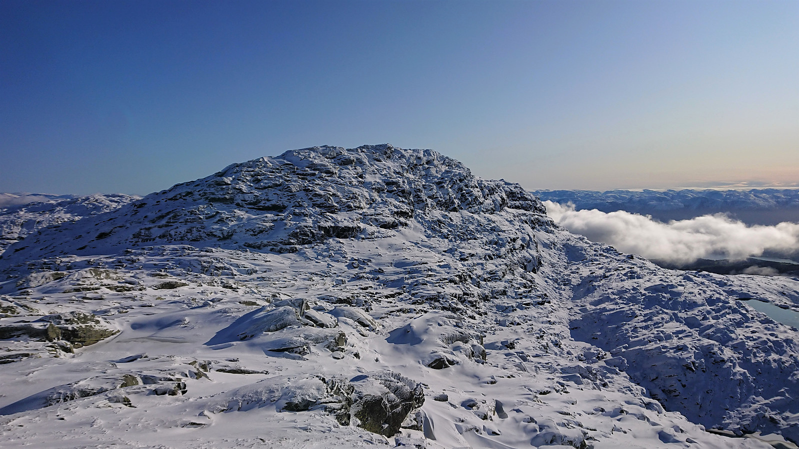 On what would turn out to be a perfect late October day for hiking, me and Endre ( Fjellsamleren (Endre Myrdal Olsen) ) drove early from Bergen to Fitjadalen, were we started our ascent from the parking lot just after nine, following the marked trail. At about 600 meters we came across the first real snow, and from there on the amount continued to increase the further up we got.
There were some partially hidden footprints in the snow, most likely from the day before, but we were the first hikers this morning, and thus had to make our own path (following the red T’s) up the mountainside. The progress was therefore slower than expected, as we kept sinking deeper and deeper into the snow.
At the cabin southwest of Skrott we left the main trail to Breidablik and instead followed the cairns towards the summit. Here there were no footprints at all, >>>
On what would turn out to be a perfect late October day for hiking, me and Endre ( Fjellsamleren (Endre Myrdal Olsen) ) drove early from Bergen to Fitjadalen, were we started our ascent from the parking lot just after nine, following the marked trail. At about 600 meters we came across the first real snow, and from there on the amount continued to increase the further up we got.
There were some partially hidden footprints in the snow, most likely from the day before, but we were the first hikers this morning, and thus had to make our own path (following the red T’s) up the mountainside. The progress was therefore slower than expected, as we kept sinking deeper and deeper into the snow.
At the cabin southwest of Skrott we left the main trail to Breidablik and instead followed the cairns towards the summit. Here there were no footprints at all, >>>
Høgehaugen
- Datum:
- 26.10.2019
- Tourcharakter:
- Bergtour
- Tourlänge:
- 1:37h
- Entfernung:
- 4,3km
 To complete our tour of small peaks along Samnanger-/Eikelandsfjorden, Endre and I had saved the worst for last: Høgehaugen . At least that seemed to be the verdict after reading reports from previous visits. We started from the standard location, i.e. the small parking lot next to Sævellavatnet on the border of Fusa and Samnanger. But where everyone else had seemed to stay north of Botnavatnet, we instead headed south, hoping that this would provide an easier route to the elusive trail west of the lake.
After walking 100 meters south along the main road, we continued west and later south/southwest on a forest road, taking us east of Botnavatnet. When the forest road forked, or at least a smaller weaker forest road headed southwest, we briefly followed in the footsteps of a running deer, and then followed >>>
To complete our tour of small peaks along Samnanger-/Eikelandsfjorden, Endre and I had saved the worst for last: Høgehaugen . At least that seemed to be the verdict after reading reports from previous visits. We started from the standard location, i.e. the small parking lot next to Sævellavatnet on the border of Fusa and Samnanger. But where everyone else had seemed to stay north of Botnavatnet, we instead headed south, hoping that this would provide an easier route to the elusive trail west of the lake.
After walking 100 meters south along the main road, we continued west and later south/southwest on a forest road, taking us east of Botnavatnet. When the forest road forked, or at least a smaller weaker forest road headed southwest, we briefly followed in the footsteps of a running deer, and then followed >>>
Hykkelsåsen
- Datum:
- 26.10.2019
- Tourcharakter:
- Bergtour
- Tourlänge:
- 0:18h
- Entfernung:
- 0,9km
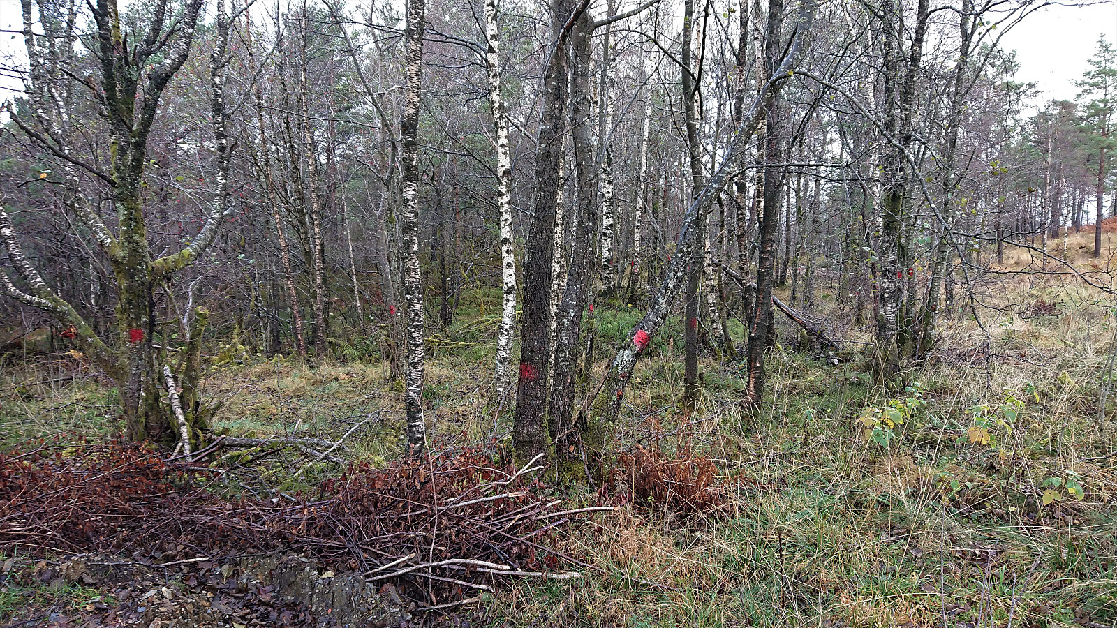 After visiting Dormannsnipen and Beljaråsen , me and Endre ( Fjellsamleren (Endre Myrdal Olsen) ) continued to Hykkelsåsen . We parked the car next to the road at Medås, after quickly discarding the option to drive up the steep and narrow gravel road towards the antenna west of the main road.
At the top of the gravel road we noticed what we first thought were red trail markers, but it soon became apparent there were simply too many of them, hence these were most likely trees marked for later being cut down for fire wood. We therefore ignored the markings and instead made our own way towards the summit, which was quickly reached, the only minor obstacle being an electric fence that could easily be traversed.
As expected, there were next to no views from the summit. There was however some sort of outdoor gym set up, with ropes to climb and bars that could be used >>>
After visiting Dormannsnipen and Beljaråsen , me and Endre ( Fjellsamleren (Endre Myrdal Olsen) ) continued to Hykkelsåsen . We parked the car next to the road at Medås, after quickly discarding the option to drive up the steep and narrow gravel road towards the antenna west of the main road.
At the top of the gravel road we noticed what we first thought were red trail markers, but it soon became apparent there were simply too many of them, hence these were most likely trees marked for later being cut down for fire wood. We therefore ignored the markings and instead made our own way towards the summit, which was quickly reached, the only minor obstacle being an electric fence that could easily be traversed.
As expected, there were next to no views from the summit. There was however some sort of outdoor gym set up, with ropes to climb and bars that could be used >>>
Beljaråsen
- Datum:
- 26.10.2019
- Tourcharakter:
- Bergtour
- Tourlänge:
- 1:00h
- Entfernung:
- 3,9km
 Given that Endre ( Fjellsamleren (Endre Myrdal Olsen) ) had not yet visited Beljaråsen , and given that we were very close after completing our hike to Dormannsnipen , he managed to convince me to join him for my second visit. This time ascending via the old tractor road east of the summit, which when ending turned into a trail that easily took us all the way to the summit. We returned along the same route, as I suggested avoiding the "shortcut" me and Helwig ( HHauser (Helwig Hauser) ) used on our previous visit: Skarsnuten, Vardafjellet, Grytefjellet and Beljaråsen .
Dormannsnipen
- Datum:
- 26.10.2019
- Tourcharakter:
- Bergtour
- Tourlänge:
- 1:10h
- Entfernung:
- 3,4km
 On a rainy Saturday morning, me and Endre ( Fjellsamleren (Endre Myrdal Olsen) ) decided to postpone our planned hike to Skrott until tomorrow and instead spend this day visiting a couple of smaller peaks along Samnanger-/Eikelandsfjorden. The first being Dormannsnipen . Upon arriving at Hafskordalen Parkering we noticed one other car, which turned out to contain a deer hunter and three kids. They were just about to go hunting in the area north of Dormannsnipen and were more than willing to show us the way, as long as we did not move too far north after visiting the summit.
We were more than happy with this arrangement and soon found ourselves following the hunters along a weak unmarked trail, with a hidden trailhead that we probably would not have found on our own. The trail was very wet and did not head straight for the summit, but it is most likely still the easiest >>>
On a rainy Saturday morning, me and Endre ( Fjellsamleren (Endre Myrdal Olsen) ) decided to postpone our planned hike to Skrott until tomorrow and instead spend this day visiting a couple of smaller peaks along Samnanger-/Eikelandsfjorden. The first being Dormannsnipen . Upon arriving at Hafskordalen Parkering we noticed one other car, which turned out to contain a deer hunter and three kids. They were just about to go hunting in the area north of Dormannsnipen and were more than willing to show us the way, as long as we did not move too far north after visiting the summit.
We were more than happy with this arrangement and soon found ourselves following the hunters along a weak unmarked trail, with a hidden trailhead that we probably would not have found on our own. The trail was very wet and did not head straight for the summit, but it is most likely still the easiest >>>
Mykkeltveitveten from Evanger (roundtrip)
- Datum:
- 20.10.2019
- Tourcharakter:
- Bergtour
- Tourlänge:
- 6:05h
- Entfernung:
- 20,5km
 Took the train to Evanger and from there walked along the gravel road up Vossedalen. The gravel road continued much longer than expected and did not come to an end until around 800 meters north of Vossedalstølen . When the road ended I realized that I had missed the start of the trail 200 meters earlier, but instead of going back I headed diagonally southwest, assuming I would connect with the trail soon enough.
A sign at the start of the hike had indicated that there should be a marked trail, but while the trail I soon came across was marked with a red T, this would be the only marker I would find. Not too long after passing Vossedalstølen the trail pretty much disappeared completely, and though I made attempts at relocating it, I could not find any traces of it.
I still more or less followed the route of >>>
Took the train to Evanger and from there walked along the gravel road up Vossedalen. The gravel road continued much longer than expected and did not come to an end until around 800 meters north of Vossedalstølen . When the road ended I realized that I had missed the start of the trail 200 meters earlier, but instead of going back I headed diagonally southwest, assuming I would connect with the trail soon enough.
A sign at the start of the hike had indicated that there should be a marked trail, but while the trail I soon came across was marked with a red T, this would be the only marker I would find. Not too long after passing Vossedalstølen the trail pretty much disappeared completely, and though I made attempts at relocating it, I could not find any traces of it.
I still more or less followed the route of >>>
Bergsfjellet
- Datum:
- 17.10.2019
- Tourcharakter:
- Bergtour
- Tourlänge:
- 3:12h
- Entfernung:
- 11,2km
 Yet another meeting ending at Solstrand, meant, as usual, yet another hike in Fusa. Today's goal being Bergsfjellet , including an attempt at making the hike into something close to a roundtrip by following this hike suggestion by Fusa kommune: https://ut.no/turforslag/1110763/bergsfjellet , albeit in the reverse order.
I started by taking the bus (and ferry) to the bus stop “Dorganeset”, and from there followed the gravel road along Lammanesheiane, quickly coming across a sign with information about the same roundtrip hike (but with one important detail that I will come back to later). The gravel road later turned into a tractor road, getting rougher the higher up I got. After around 3 km (at about 300 meters above sea level) the tractor road (or rather the tractor tracks, as there was little to no actual road left at this point) split. The road >>>
Yet another meeting ending at Solstrand, meant, as usual, yet another hike in Fusa. Today's goal being Bergsfjellet , including an attempt at making the hike into something close to a roundtrip by following this hike suggestion by Fusa kommune: https://ut.no/turforslag/1110763/bergsfjellet , albeit in the reverse order.
I started by taking the bus (and ferry) to the bus stop “Dorganeset”, and from there followed the gravel road along Lammanesheiane, quickly coming across a sign with information about the same roundtrip hike (but with one important detail that I will come back to later). The gravel road later turned into a tractor road, getting rougher the higher up I got. After around 3 km (at about 300 meters above sea level) the tractor road (or rather the tractor tracks, as there was little to no actual road left at this point) split. The road >>>
Storfjellet (Lindås)
- Datum:
- 13.10.2019
- Tourcharakter:
- Bergtour
- Tourlänge:
- 0:33h
- Entfernung:
- 1,9km
 On the way back to Bergen from our hike to Blåfjellet and Storevarden from Olsbotnen me and Fjellsamleren (Endre Myrdal Olsen) made a quick visit to the rather oddly named Storfjellet , reaching the summit only 15 minutes after leaving the car, first along an old tractor road and then off-trail in wet but easy terrain. Limited views from the summit, except for nice views towards Stussfjellet . It may however be possible to obtain better views across Romarheimsfjorden if continuing south beyond the summit, but we did not have the time to explore this possibility today, and instead quickly returned to the car, following more or less the same route as for the ascent.
