Arkiv - dato
Arkiv - aktivitet
-
Annen tur (3)
- Kajakkpadling (3)
- Fottur (1884)
-
Kjøretur (9)
- Biltur (9)
-
Skitur (116)
- Fjellskitur (69)
- Langrennstur (47)
-
Sykkeltur (110)
- Blandet sykling (25)
- Gatesykling (85)
Lister jeg samler etter
-
Utvalgte topper og turmål i Bergen
(348/349)
 99%
99% -
Alle topper i Bergen
(391/398)
98%
-
Voss ≥ 100m pf.
(96/98)
97%
-
Opptur Hordaland
(144/159)
90%
-
Stasjoner på Bergensbanen
(33/40)
82%
-
Ulvik ≥ 100m pf.
(28/38)
73%
-
Hordaland ≥ 100m pf.
(622/863)
72%
-
Mjølfjell PF > 100m
(21/31)
67%
-
Jondal ≥ 100m pf.
(15/23)
65%
-
Dagsturhyttene i Vestland
(36/61)
59%
-
Sunnhordland PF >= 100m
(105/186)
56%
-
Hordaland: Hardanger PF>=100m
(194/359)
54%
-
DNT-hytter i Hordaland
(23/45)
51%
-
Kvinnherad ≥ 100m pf.
(40/79)
50%
-
Eidfjord ≥ 100m pf.
(13/42)
30%
-
Sogndal ≥ 100m pf.
(23/81)
28%
-
Gulen ≥ 100m pf.
(15/54)
27%
-
Vik i Sogn ≥ 100m pf.
(10/46)
21%
-
Sogn - Sør for Sognefjorden PF>=100m
(31/159)
19%
-
DNT-hytter i Sogn og Fjordane
(8/47)
17%

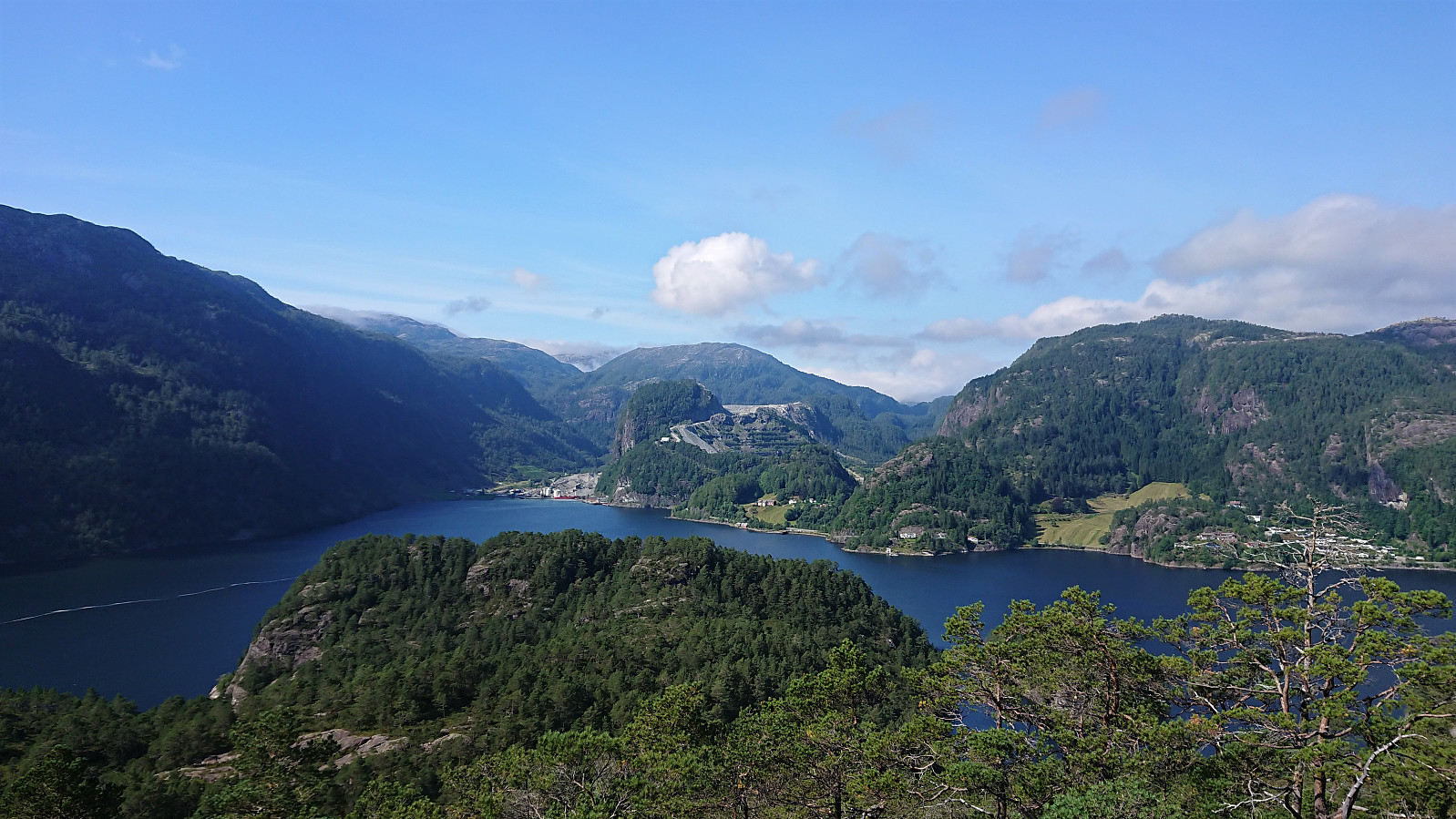
Instebotnsknolten and Sørdalsnuten from Sognevegen (E39)
- Dato:
- 30.08.2020
- Turtype:
- Fjelltur
- Turlengde:
- 6:53t
- Distanse:
- 23,7km
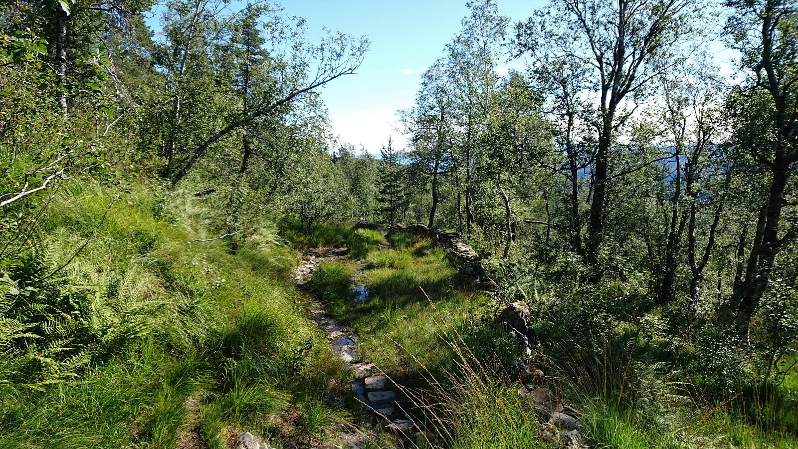
 I started by taking the bus to Dyrkollebotnen and following the paved road up to Dyrkolbotn P-plass . After passing the gate and a large herd of goats, I continued on the gravel road along Botnavatnet/Heimevatnet to the marked trailhead for Sørdalsnuten at the northern end of the lake. The first part of the trail was not of the best quality, but thankfully this improved as I reached Fossvatnet.
After passing over Langeneset the trail crossed the river via a bridge and then ascended briefly before descending into Midtbotnen where it started the climb up the valley. Upon reaching the top of Sørdalen, the trail forked and I shortly continued on the route to Sørdalsnuten before heading off-trail in the direction of Instebotnsknolten .
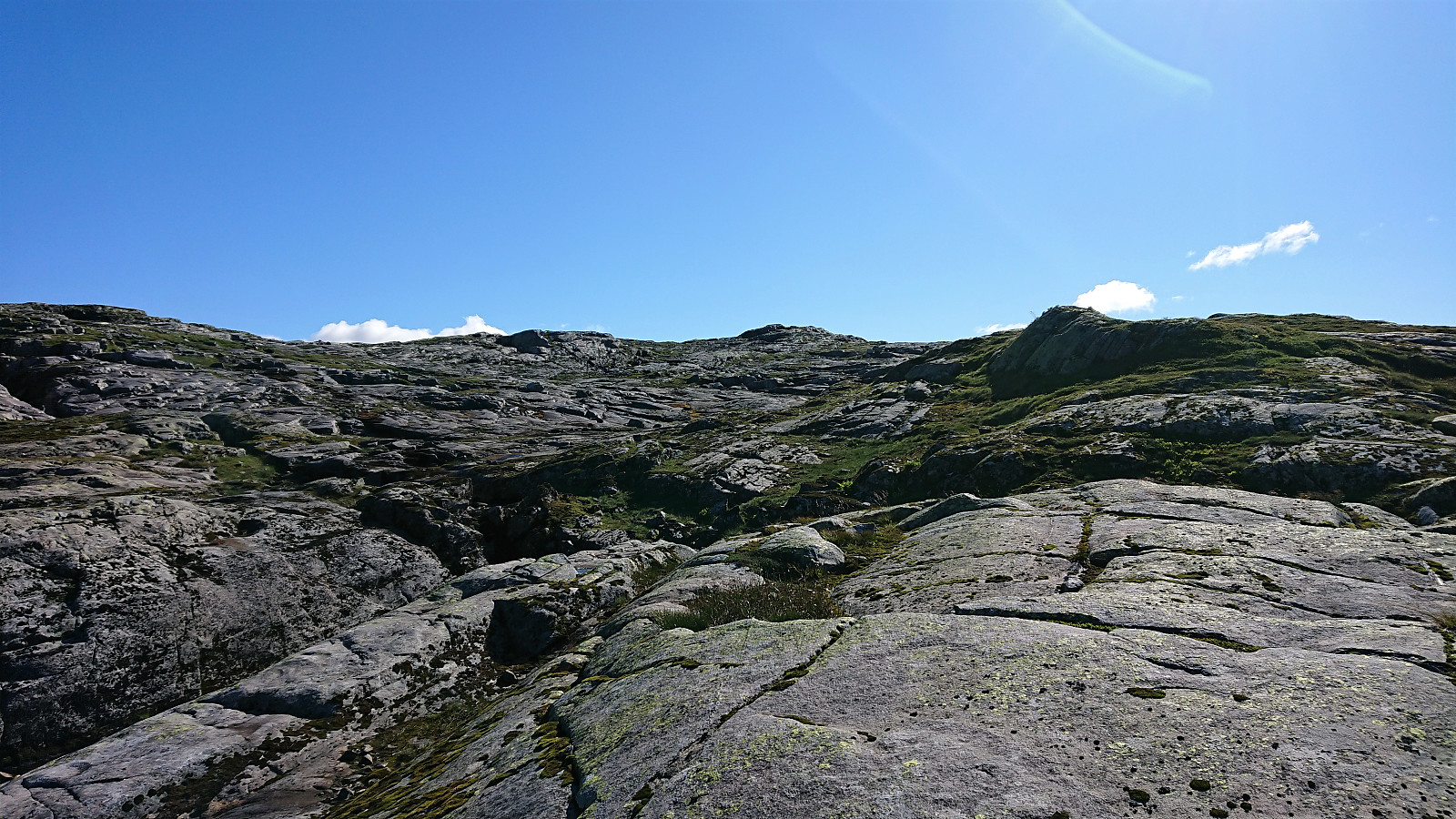
The terrain did not present any challenges and the summit of Instebotnsknolten was reached without any difficulties. >>>
I started by taking the bus to Dyrkollebotnen and following the paved road up to Dyrkolbotn P-plass . After passing the gate and a large herd of goats, I continued on the gravel road along Botnavatnet/Heimevatnet to the marked trailhead for Sørdalsnuten at the northern end of the lake. The first part of the trail was not of the best quality, but thankfully this improved as I reached Fossvatnet.
After passing over Langeneset the trail crossed the river via a bridge and then ascended briefly before descending into Midtbotnen where it started the climb up the valley. Upon reaching the top of Sørdalen, the trail forked and I shortly continued on the route to Sørdalsnuten before heading off-trail in the direction of Instebotnsknolten .
The terrain did not present any challenges and the summit of Instebotnsknolten was reached without any difficulties. >>>
Botnanuten from Furedalen
- Dato:
- 29.08.2020
- Turtype:
- Fjelltur
- Turlengde:
- 4:48t
- Distanse:
- 17,2km
 We started from a parking lot next to a cabin my sister and her family were renting for the weekend. After first walking north along the main road for a couple hundred meters, we continued on the gravel road around Kvinnhovden, before taking a wet shortcut to reach Aktiven Skiheis .
Next, the bridge across Kvennelvi was crossed and after a short stretch on a trail, we followed the gravel road at Øvre Kvernaskogen until it came to an end. Here a weak and wet trail started, that soon connected with the slightly better old trail heading to Byrkjesete. At Byrkjesete, we continued on the unmarked trail up to Storebotnen and up to Sunnvoredalvatnet.
From Sunnvoredalvatnet I continued on my own for a short off-trail detour to the summit of Botnanuten . There were some steep sections to avoid, but overall the ascent was straightforward. >>>
We started from a parking lot next to a cabin my sister and her family were renting for the weekend. After first walking north along the main road for a couple hundred meters, we continued on the gravel road around Kvinnhovden, before taking a wet shortcut to reach Aktiven Skiheis .
Next, the bridge across Kvennelvi was crossed and after a short stretch on a trail, we followed the gravel road at Øvre Kvernaskogen until it came to an end. Here a weak and wet trail started, that soon connected with the slightly better old trail heading to Byrkjesete. At Byrkjesete, we continued on the unmarked trail up to Storebotnen and up to Sunnvoredalvatnet.
From Sunnvoredalvatnet I continued on my own for a short off-trail detour to the summit of Botnanuten . There were some steep sections to avoid, but overall the ascent was straightforward. >>>
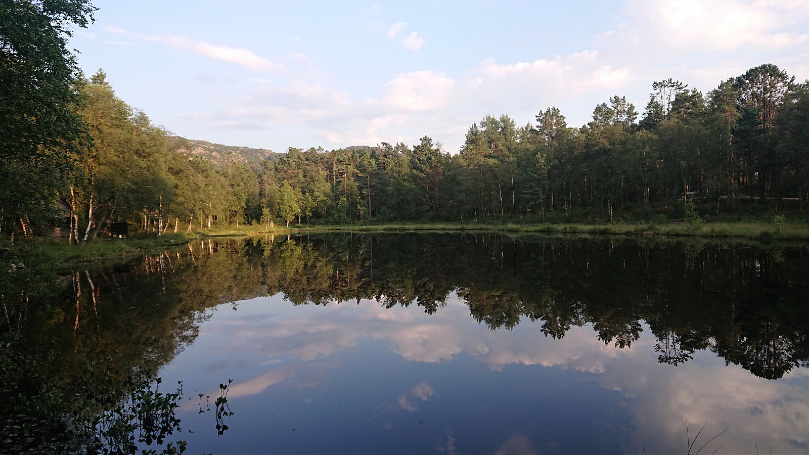
Ørneberget and Rognåsen
- Dato:
- 25.08.2020
- Turtype:
- Fjelltur
- Turlengde:
- 1:41t
- Distanse:
- 6,1km
 Local evening hike.
Sandviksfjellet
- Dato:
- 18.08.2020
- Turtype:
- Fjelltur
- Turlengde:
- 2:29t
- Distanse:
- 12,2km
 Local evening hike.
Ørneberget and Rognåsen
- Dato:
- 17.08.2020
- Turtype:
- Fjelltur
- Turlengde:
- 1:28t
- Distanse:
- 6,0km
 Short local evening hike after work.
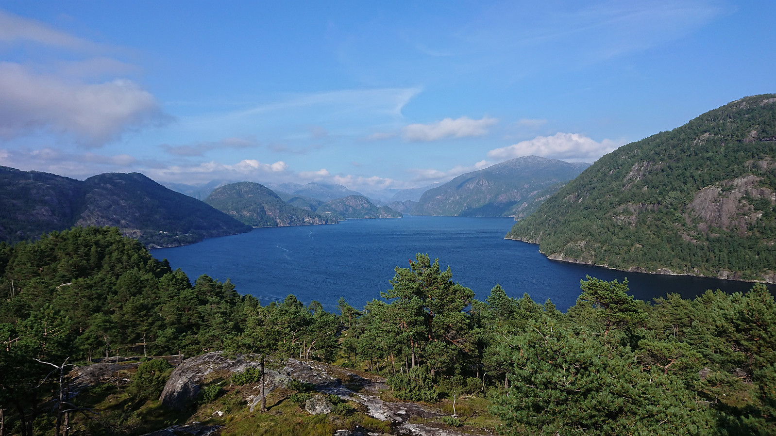
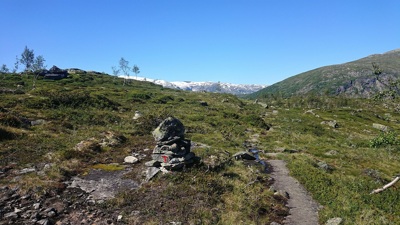
Tverrvassfjellet from Gamlesæter
- Dato:
- 16.08.2020
- Turtype:
- Fjelltur
- Turlengde:
- 7:12t
- Distanse:
- 19,0km
 On this very warm late August Sunday, I stared by taking the bus to Gamlesæter and from there walking north along the main road for about 500 meters (mainly outside of the guard rails, except for the short stretch across the bridge). Next, I followed the road up Stussdalen to the parking lot at Øvre Sætravatnet , where I shortly after met the only two people I would see for the entire hike.
After crossing the bridge in between Nedre and Øvre Sætravatnet, I continued on the unmarked northern trail towards Steinsetdalssætret , deciding to stay on the trail all the way until reaching the small lake next to the trail at 551 meters above sea level, where I took a break before continuing off-trail towards the summit of Tverrvassfjellet .
In order to avoid the steepest areas, I first headed north and later turned northwest aiming more directly for the highest point. >>>
On this very warm late August Sunday, I stared by taking the bus to Gamlesæter and from there walking north along the main road for about 500 meters (mainly outside of the guard rails, except for the short stretch across the bridge). Next, I followed the road up Stussdalen to the parking lot at Øvre Sætravatnet , where I shortly after met the only two people I would see for the entire hike.
After crossing the bridge in between Nedre and Øvre Sætravatnet, I continued on the unmarked northern trail towards Steinsetdalssætret , deciding to stay on the trail all the way until reaching the small lake next to the trail at 551 meters above sea level, where I took a break before continuing off-trail towards the summit of Tverrvassfjellet .
In order to avoid the steepest areas, I first headed north and later turned northwest aiming more directly for the highest point. >>>
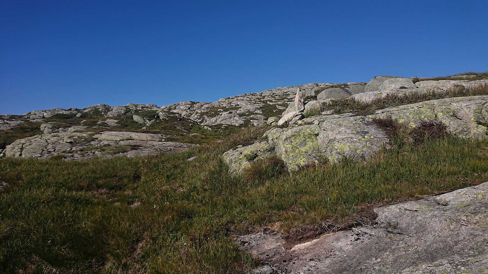
Verafjellet
- Dato:
- 14.08.2020
- Turtype:
- Fjelltur
- Turlengde:
- 1:33t
- Distanse:
- 2,8km
 After visiting the three island-summits at Paddøy and Hokøy, there was time for also including a visit to Verafjellet , another summit most easily reached by boat. I was dropped off at the private dock at Langeneset, made slightly more challenging by there already being a large boat docked there. Did not see any people though and the building 50 meters from the shore also looked rather abandoned.
Previous trip reports showed that there are no trails and indicated a key location I ought to hit on the ascent. With this in mind, I therefore used elbow (Vegard Magnussen) 's GPS-track as a rough guide, thus hitting the important key location straight on. From there the summit was relatively easy to reach, although the terrain's many ups and downs required more of a detour than I had perhaps expected.
Limited views from the summit itself. >>>
After visiting the three island-summits at Paddøy and Hokøy, there was time for also including a visit to Verafjellet , another summit most easily reached by boat. I was dropped off at the private dock at Langeneset, made slightly more challenging by there already being a large boat docked there. Did not see any people though and the building 50 meters from the shore also looked rather abandoned.
Previous trip reports showed that there are no trails and indicated a key location I ought to hit on the ascent. With this in mind, I therefore used elbow (Vegard Magnussen) 's GPS-track as a rough guide, thus hitting the important key location straight on. From there the summit was relatively easy to reach, although the terrain's many ups and downs required more of a detour than I had perhaps expected.
Limited views from the summit itself. >>>
Hokøy Nordtoppen
- Dato:
- 14.08.2020
- Turtype:
- Fjelltur
- Turlengde:
- 0:28t
- Distanse:
- 1,5km
 After the visit of Storgjelsknausen , I was picked up and transported to Liabakken for the ascent to Hokøy Nordtoppen .
Briefly borrowing the private dock made it straightforward to get ashore, from where I followed the road up to the three farm buildings indicated on the map. I did not see any people today, but there was clear evidence of recent activity and several sheep.
Just northwest of the three buildings I found a weak trail that soon turned less weak and even included what looked like old man-made steps. By following this trail I quickly arrived at the summit marked by a small antenna making an annoying high-pitched noise.
I therefore did not stay long before starting my descent, only making a quick detour to the southern tip of the summit area to check out the views from there as well.
Overall, a short easy hike, taking >>>
After the visit of Storgjelsknausen , I was picked up and transported to Liabakken for the ascent to Hokøy Nordtoppen .
Briefly borrowing the private dock made it straightforward to get ashore, from where I followed the road up to the three farm buildings indicated on the map. I did not see any people today, but there was clear evidence of recent activity and several sheep.
Just northwest of the three buildings I found a weak trail that soon turned less weak and even included what looked like old man-made steps. By following this trail I quickly arrived at the summit marked by a small antenna making an annoying high-pitched noise.
I therefore did not stay long before starting my descent, only making a quick detour to the southern tip of the summit area to check out the views from there as well.
Overall, a short easy hike, taking >>>
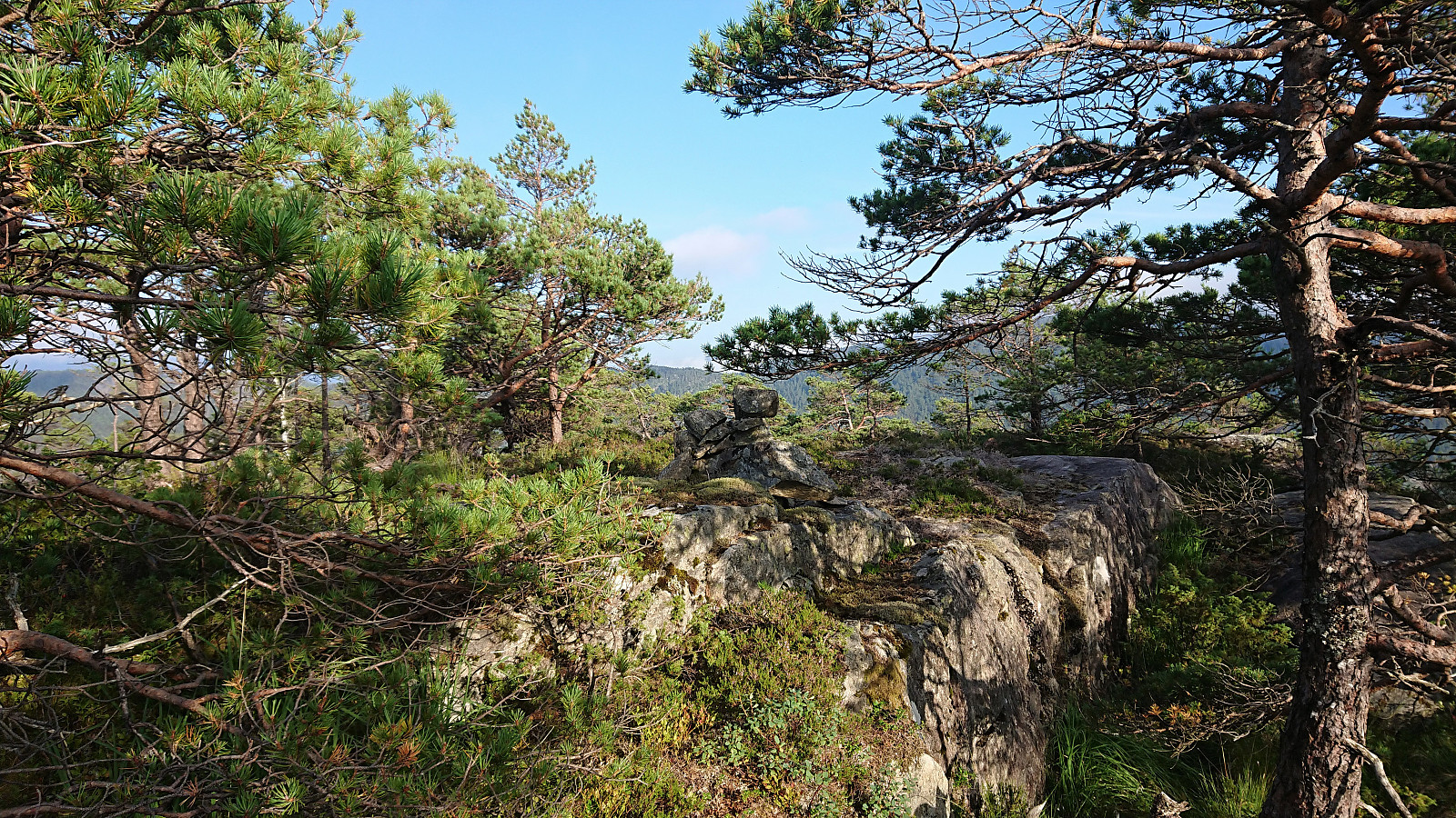
Storgjelsknausen
- Dato:
- 14.08.2020
- Turtype:
- Fjelltur
- Turlengde:
- 1:49t
- Distanse:
- 4,4km
 Part one of today's excursion to hard-to-reach island peaks in Osterfjorden. Starting from Litlebergen, it took us about 45 minutes to reach Midtsundet and Hatlehaug, in the process leaving the fog and low-handing clouds behind and replacing them with sun and blue sky.
My friend and colleague did not have much interest in joining me on my visits to these rather special-interest peaks, hence he stayed in the boat and had a go at fishing instead. The initial plan had therefore been for him to drop me off at Setervika, but this option was quickly rejected and I was instead put ashore at the private dock in front of the southern-most cabin at Hatlehaug.
This last-minute change required some minor trespassing to get behind the cabin, but it soon turned more challenging given the small vertical drop >>>
Part one of today's excursion to hard-to-reach island peaks in Osterfjorden. Starting from Litlebergen, it took us about 45 minutes to reach Midtsundet and Hatlehaug, in the process leaving the fog and low-handing clouds behind and replacing them with sun and blue sky.
My friend and colleague did not have much interest in joining me on my visits to these rather special-interest peaks, hence he stayed in the boat and had a go at fishing instead. The initial plan had therefore been for him to drop me off at Setervika, but this option was quickly rejected and I was instead put ashore at the private dock in front of the southern-most cabin at Hatlehaug.
This last-minute change required some minor trespassing to get behind the cabin, but it soon turned more challenging given the small vertical drop >>>
Fivlenosi from Vigdalstøl via Vårstølen p-plass
- Dato:
- 09.08.2020
- Turtype:
- Fjelltur
- Turlengde:
- 4:05t
- Distanse:
- 12,7km
 After a second night at Vigdalstøl , we left the cabin and returned to the parking lot at Vårstølen along the marked trail. Here we left most of our stuff in the car before following a marked trail to Fivla .
After failing to locate any trails, except from animal tracks, heading from Fivla towards Fivlenosi , me and my niece continued on our own in a more or less a straight line for the summit, only making slight detours to avoid the steepest areas.
In the end the summit was reached without any difficulties, and we could enjoy the excellent views in all directions, perhaps especially east towards Hurrungane . In the far distance we could also spot Hafslovatnet and Sogndalsfjorden.
After a short lunch break we returned along the same route to the parking lot, where the rest of the family members were already ready to start the drive back to Sogndal.
To conclude, >>>
After a second night at Vigdalstøl , we left the cabin and returned to the parking lot at Vårstølen along the marked trail. Here we left most of our stuff in the car before following a marked trail to Fivla .
After failing to locate any trails, except from animal tracks, heading from Fivla towards Fivlenosi , me and my niece continued on our own in a more or less a straight line for the summit, only making slight detours to avoid the steepest areas.
In the end the summit was reached without any difficulties, and we could enjoy the excellent views in all directions, perhaps especially east towards Hurrungane . In the far distance we could also spot Hafslovatnet and Sogndalsfjorden.
After a short lunch break we returned along the same route to the parking lot, where the rest of the family members were already ready to start the drive back to Sogndal.
To conclude, >>>
