Archiv - Nach Datum
Archiv - Nach Aktivität
-
Andere Tour (3)
- Kayaking (3)
-
Fahrradtour (110)
- Fahrradtour Straße (85)
- Fahrradtour gemischt (25)
-
Fahrzeugtour (9)
- Autotour (9)
-
Fußtour (1884)
- Bergtour (1114)
- Jogging (1)
- Spaziergang (59)
- Wanderung (710)
-
Skitour (116)
- Langlauf (47)
- Tourenskilauf (69)
Gesammelte Listen
-
Utvalgte topper og turmål i Bergen
(348/349)
 99%
99% -
Alle topper i Bergen
(391/398)
98%
-
Voss ≥ 100m pf.
(96/98)
97%
-
Opptur Hordaland
(144/159)
90%
-
Stasjoner på Bergensbanen
(33/40)
82%
-
Ulvik ≥ 100m pf.
(28/38)
73%
-
Hordaland ≥ 100m pf.
(622/863)
72%
-
Mjølfjell PF > 100m
(21/31)
67%
-
Jondal ≥ 100m pf.
(15/23)
65%
-
Dagsturhyttene i Vestland
(36/61)
59%
-
Sunnhordland PF >= 100m
(105/186)
56%
-
Hordaland: Hardanger PF>=100m
(194/359)
54%
-
DNT-hytter i Hordaland
(23/45)
51%
-
Kvinnherad ≥ 100m pf.
(40/79)
50%
-
Eidfjord ≥ 100m pf.
(13/42)
30%
-
Sogndal ≥ 100m pf.
(23/81)
28%
-
Gulen ≥ 100m pf.
(15/54)
27%
-
Vik i Sogn ≥ 100m pf.
(10/46)
21%
-
Sogn - Sør for Sognefjorden PF>=100m
(31/159)
19%
-
DNT-hytter i Sogn og Fjordane
(8/47)
17%

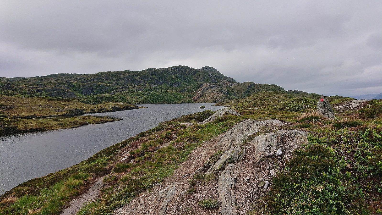
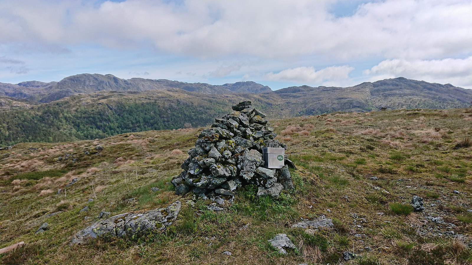
Gråfjellet, Høgabu and Bergsbukken (from Lid to Vaksdal)
- Datum:
- 01.07.2022
- Tourcharakter:
- Bergtour
- Tourlänge:
- 8:49h
- Entfernung:
- 28,3km
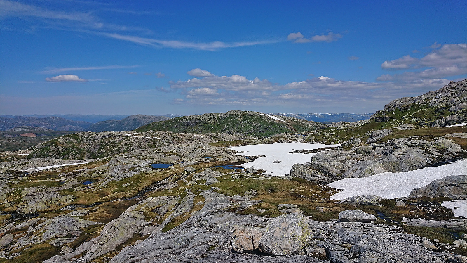 On what looked like it would be the last sunny and warm day for a while, I took the advice of the weather man on the morning radio and took the Friday off to go hiking. Started by taking the train to Dale and the bus to Bergsdalen where I got off at the bus stop called "Lid aust". This put me directly at the start of the marked trail to Høgabu which I then proceeded to follow.
For the first part of the ascent I was escorted by a squadron of buzzing flies, but thankfully they gave up their pursuit as I climbed above the tree line, partly due to a cool breeze from the southwest. On my way to Høgabu I had initially planned to ascend Gråfjellet from the northeast via Storaskaret as there is supposed to be a weak trail crossing the ridge of Gråfjellet. However, as I did not locate the start of this trail, >>>
On what looked like it would be the last sunny and warm day for a while, I took the advice of the weather man on the morning radio and took the Friday off to go hiking. Started by taking the train to Dale and the bus to Bergsdalen where I got off at the bus stop called "Lid aust". This put me directly at the start of the marked trail to Høgabu which I then proceeded to follow.
For the first part of the ascent I was escorted by a squadron of buzzing flies, but thankfully they gave up their pursuit as I climbed above the tree line, partly due to a cool breeze from the southwest. On my way to Høgabu I had initially planned to ascend Gråfjellet from the northeast via Storaskaret as there is supposed to be a weak trail crossing the ridge of Gråfjellet. However, as I did not locate the start of this trail, >>>
Ørneberget and Rognåsen
- Datum:
- 26.06.2022
- Tourcharakter:
- Bergtour
- Tourlänge:
- 1:18h
- Entfernung:
- 5,6km
 Short local hike on a very warm Sunday.
Sveindalsnuten, Blåkoll, Flatafjellet and Kiellandbu
- Datum:
- 24.06.2022
- Tourcharakter:
- Bergtour
- Tourlänge:
- 6:55h
- Entfernung:
- 20,0km
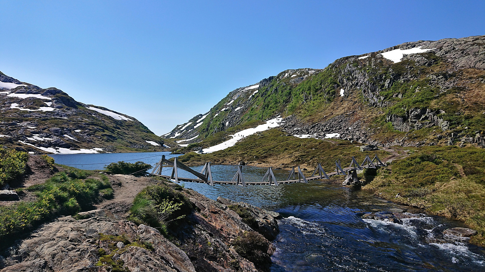 After spending all of the previous Saturday at work, it was in easy choice to take the following Friday off when the weather forecast for Bergen predicted blue skies and close to 30 degrees. Three other colleagues were quickly convinced to join and we settled on ascending to Kiellandbu from Hodnaberg, with my own goal of also visiting at least a couple of new summits in the area.
We parked next to the power station at Hodnaberg and started by following the gravel road south. After a short steep incline, we left the gravel road and continued on the marked trail to Kiellandbu, enjoying the excellent views along the river. Before reaching Nedre Kvålsdalstjørni, we decided to split into two pairs, given that it was only me and one other colleague that were interested in a slightly longer hike that also >>>
After spending all of the previous Saturday at work, it was in easy choice to take the following Friday off when the weather forecast for Bergen predicted blue skies and close to 30 degrees. Three other colleagues were quickly convinced to join and we settled on ascending to Kiellandbu from Hodnaberg, with my own goal of also visiting at least a couple of new summits in the area.
We parked next to the power station at Hodnaberg and started by following the gravel road south. After a short steep incline, we left the gravel road and continued on the marked trail to Kiellandbu, enjoying the excellent views along the river. Before reaching Nedre Kvålsdalstjørni, we decided to split into two pairs, given that it was only me and one other colleague that were interested in a slightly longer hike that also >>>
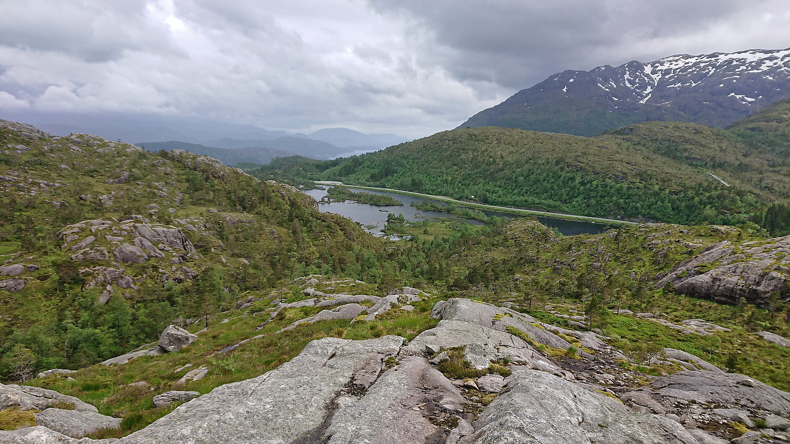
Svadfjellet and Dukefjellet from Kringla to Haugsvær
- Datum:
- 19.06.2022
- Tourcharakter:
- Bergtour
- Tourlänge:
- 6:46h
- Entfernung:
- 21,8km
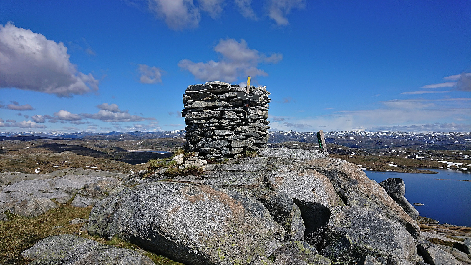 For my visit of Dukefjellet I decided to combine GeirL (Geir Lie) 's ascent from Kringla with petter (Petter Bjørstad) 's descent via Hopsdalen and of course also adding my own twist. I started by taking the bus to Kringla where the bus stop is located about 650 meters south of the trailhead. In order to reduce the walk along the main road (as there is no sidewalk), I started with a minor detour around Husevatnet. This also allowed me to inspect the alternative trailhead east of the lake, but as I did not see any trail or signs indicating a trailhead, I concluded that this trail had most likely not improved since Geir used it for his descent three years earlier.
After a short walk along the main road, where it was easy to stay out of the way of the traffic, I finally arrived at the marked trailhead. As expected, there was no mentioning of Dukefjellet, rather Svadfjellet was highlighted as the >>>
For my visit of Dukefjellet I decided to combine GeirL (Geir Lie) 's ascent from Kringla with petter (Petter Bjørstad) 's descent via Hopsdalen and of course also adding my own twist. I started by taking the bus to Kringla where the bus stop is located about 650 meters south of the trailhead. In order to reduce the walk along the main road (as there is no sidewalk), I started with a minor detour around Husevatnet. This also allowed me to inspect the alternative trailhead east of the lake, but as I did not see any trail or signs indicating a trailhead, I concluded that this trail had most likely not improved since Geir used it for his descent three years earlier.
After a short walk along the main road, where it was easy to stay out of the way of the traffic, I finally arrived at the marked trailhead. As expected, there was no mentioning of Dukefjellet, rather Svadfjellet was highlighted as the >>>
Raudnipa and Trollabotshaugen from Raunekleiv
- Datum:
- 16.06.2022
- Tourcharakter:
- Bergtour
- Tourlänge:
- 4:17h
- Entfernung:
- 15,6km
 Given that I would be spending all of Friday and Saturday indoors organizing a conference, I left work early the day before and got on a bus to Raunekleiv. The plan was to revisit Raudnipa , but this time ascending from the south via Raudvatnet and also include a visit of Trollabotshaugen , a minor summit on the Alle topper i Bergen list. After a short detour along a smaller road to avoid a tunnel, the marked trailhead was located next to Raunekleiva parkering . As a side note, check out the picture used for the PB-element for the parking lot. Note how it seems to be without an entrance. ;)
I followed the marked route to Raudvatnet - a tractor road that soon turned into a trail. The vertical meters were relatively evenly spread out, resulting in an ascent without any steep sections. At Raudvatnet, I followed the trail on the east side of the lake. This is most >>>
Given that I would be spending all of Friday and Saturday indoors organizing a conference, I left work early the day before and got on a bus to Raunekleiv. The plan was to revisit Raudnipa , but this time ascending from the south via Raudvatnet and also include a visit of Trollabotshaugen , a minor summit on the Alle topper i Bergen list. After a short detour along a smaller road to avoid a tunnel, the marked trailhead was located next to Raunekleiva parkering . As a side note, check out the picture used for the PB-element for the parking lot. Note how it seems to be without an entrance. ;)
I followed the marked route to Raudvatnet - a tractor road that soon turned into a trail. The vertical meters were relatively evenly spread out, resulting in an ascent without any steep sections. At Raudvatnet, I followed the trail on the east side of the lake. This is most >>>
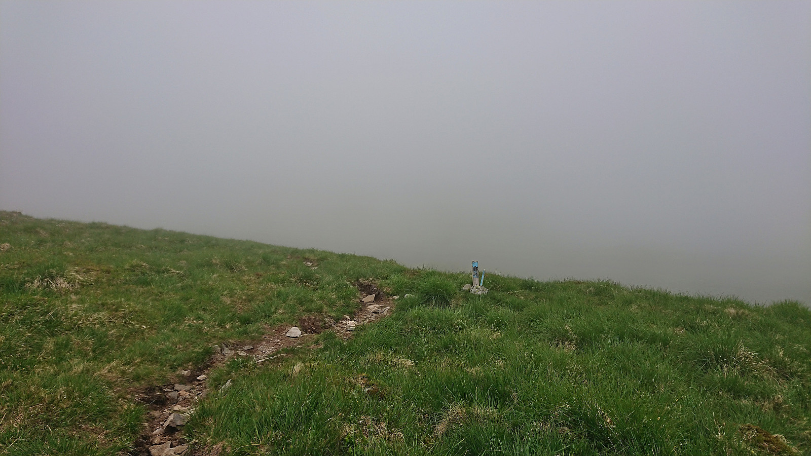
Skåpet and Svartliåsen
- Datum:
- 11.06.2022
- Tourcharakter:
- Bergtour
- Tourlänge:
- 1:38h
- Entfernung:
- 5,1km
 On a windy Saturday where the only question was when it was going to start raining, I decided to go for a relatively local peak I had not yet visited, namely Skåpet , yet another minor summit on the Alle topper i Bergen list. I started by taking the bus to Gullbotn and from there headed north along Øyjordvatnet. After crossing a wooden bridge and passing a couple of cabins I managed to follow a weak trail that took me almost all the way to the summit. Granted, the trail was not always to spot, but it was clearly a trail and not just an animal track. The summit provided much better views than expected.
I briefly considered continuing to Krånipa , but in the end returned along the same route. I figured I would also have the time for a visit of Svartliåsen though, another minor summit just east of the main road. This one was especially attractive >>>
On a windy Saturday where the only question was when it was going to start raining, I decided to go for a relatively local peak I had not yet visited, namely Skåpet , yet another minor summit on the Alle topper i Bergen list. I started by taking the bus to Gullbotn and from there headed north along Øyjordvatnet. After crossing a wooden bridge and passing a couple of cabins I managed to follow a weak trail that took me almost all the way to the summit. Granted, the trail was not always to spot, but it was clearly a trail and not just an animal track. The summit provided much better views than expected.
I briefly considered continuing to Krånipa , but in the end returned along the same route. I figured I would also have the time for a visit of Svartliåsen though, another minor summit just east of the main road. This one was especially attractive >>>
Tverrmeisa and Livarden from Bontveit to Haukeland
- Datum:
- 09.06.2022
- Tourcharakter:
- Bergtour
- Tourlänge:
- 2:47h
- Entfernung:
- 9,5km
 For once I managed to leave work around four and hopped on a bus to Kaland skole that connected with another bus to Bontveit. This provided easy access to a minor summit I had passed close by in the past but not bothered to actually visit, namely Tverrmeisa . When the gravel road ended south of the summit there was even a sign for Tverrmeisa, but it seems like the trail this sign refers to is no longer there. At least the trail I was on soon rather took me up towards Slettegga . I therefore ditched the trail and simply made my own way to the highest point of Tverrmeisa.
Much better views than expected, especially down to Haukelandsvatnet and even all the way to Arnavågen. The thickening fog did not help though, and I did not stay long before heading for the trail east of the summit and continue to Livarden . On the way >>>
For once I managed to leave work around four and hopped on a bus to Kaland skole that connected with another bus to Bontveit. This provided easy access to a minor summit I had passed close by in the past but not bothered to actually visit, namely Tverrmeisa . When the gravel road ended south of the summit there was even a sign for Tverrmeisa, but it seems like the trail this sign refers to is no longer there. At least the trail I was on soon rather took me up towards Slettegga . I therefore ditched the trail and simply made my own way to the highest point of Tverrmeisa.
Much better views than expected, especially down to Haukelandsvatnet and even all the way to Arnavågen. The thickening fog did not help though, and I did not stay long before heading for the trail east of the summit and continue to Livarden . On the way >>>
Austrefjellet and Ådneburen from Meisdalen
- Datum:
- 05.06.2022
- Tourcharakter:
- Bergtour
- Tourlänge:
- 7:21h
- Entfernung:
- 17,1km
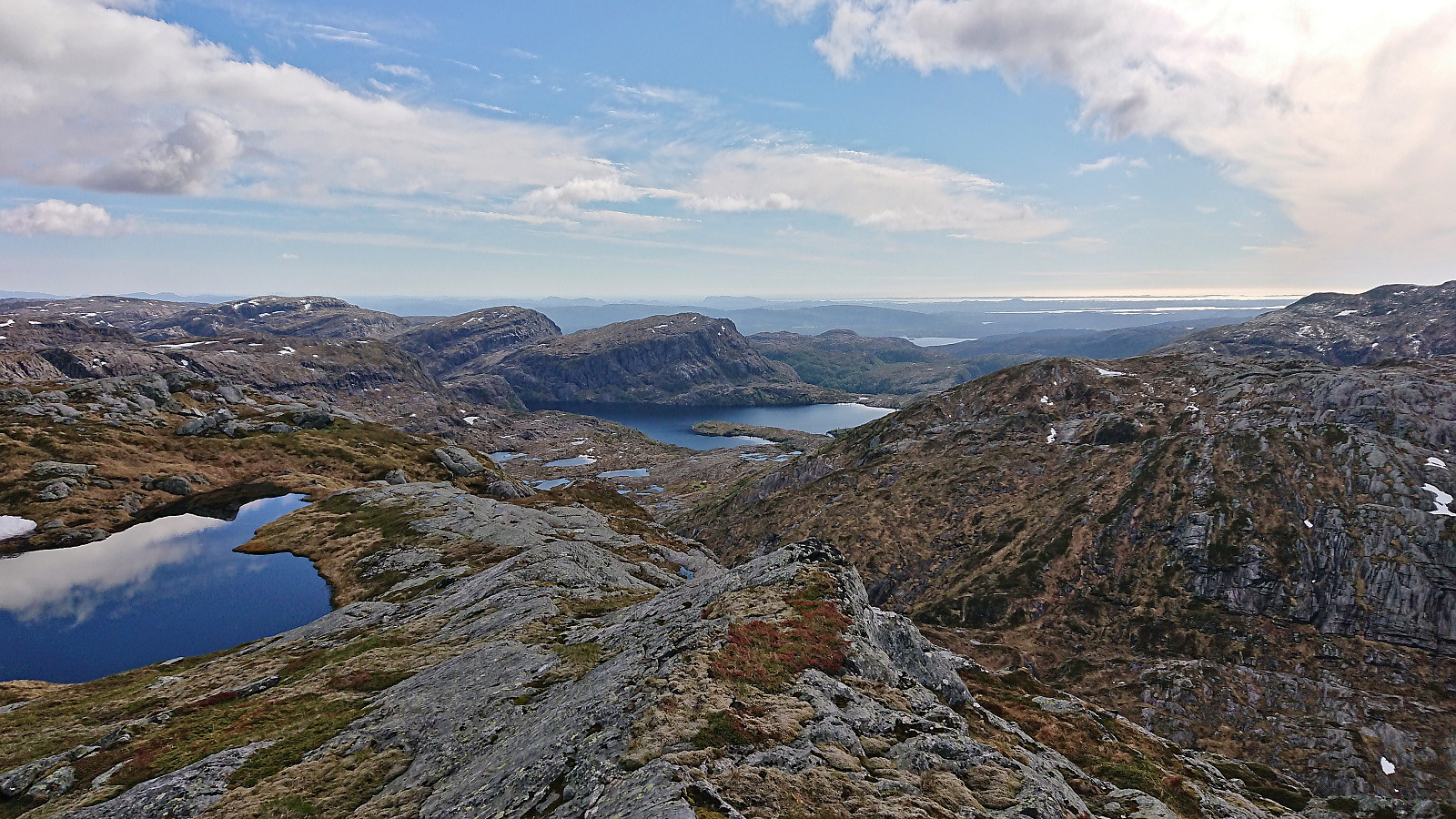 When my colleague yehiamokhtarfarag (Yehia Mokhtar Farag) asked if I wanted to go hiking, I of course said yes and suggested Austrefjellet and Ådneburen in Masfjorden as our targets, partly as both of these are hard to reach by public transportation on my own and because I thought they should provide great views.
Yehia picked me up at my place a bit after noon and we drove the around 1.5 hours to Andvika. Here we paid the 30 kr toll via Vipps and continued up the gravel road to the parking lot in Meisdalen . Walking up Meisdalen was a very nice start to the hike and we soon arrived at the marked trail for Ådneburen. We however decided to leave this one for later and instead continued southeast, still along a marked trail.
When the trail split west of Ådnekvamssetret , we left the main trail and followed a weaker trail to the unnamed lake east of Ådnekvamssetret. Here the trail soon pretty much disappeared, but >>>
When my colleague yehiamokhtarfarag (Yehia Mokhtar Farag) asked if I wanted to go hiking, I of course said yes and suggested Austrefjellet and Ådneburen in Masfjorden as our targets, partly as both of these are hard to reach by public transportation on my own and because I thought they should provide great views.
Yehia picked me up at my place a bit after noon and we drove the around 1.5 hours to Andvika. Here we paid the 30 kr toll via Vipps and continued up the gravel road to the parking lot in Meisdalen . Walking up Meisdalen was a very nice start to the hike and we soon arrived at the marked trail for Ådneburen. We however decided to leave this one for later and instead continued southeast, still along a marked trail.
When the trail split west of Ådnekvamssetret , we left the main trail and followed a weaker trail to the unnamed lake east of Ådnekvamssetret. Here the trail soon pretty much disappeared, but >>>
Sæterbøfjellet, Melsåta and Klovskardfjellet
- Datum:
- 04.06.2022
- Tourcharakter:
- Bergtour
- Tourlänge:
- 6:16h
- Entfernung:
- 21,4km
 A return to the island of Stord. The main goal today was to visit Melsåta , but partly as I need to get to a to a bus stop on the east side of the island for the bus back to Bergen, I decided to also include two summits on the Opptur Hordaland list.
I started by taking the bus and ferry to Sandvikvåg, where I instead of waiting the 20 minutes for the bus towards Fitjar, I walked the short distance to the next bus stop at Sandvikvågvegen. After a bit of sightseeing via Fitjar and west of Storavatnet, I got off the bus at Heio, the last stop before the bus returned to the main road. Upon reaching the main road myself, I quickly crossed it and continued on the smaller road up towards Sæterbø where I located the marked trailhead.
My first objective was Sæterbøfjellet , which was easily reached by following the marked trail, although >>>
A return to the island of Stord. The main goal today was to visit Melsåta , but partly as I need to get to a to a bus stop on the east side of the island for the bus back to Bergen, I decided to also include two summits on the Opptur Hordaland list.
I started by taking the bus and ferry to Sandvikvåg, where I instead of waiting the 20 minutes for the bus towards Fitjar, I walked the short distance to the next bus stop at Sandvikvågvegen. After a bit of sightseeing via Fitjar and west of Storavatnet, I got off the bus at Heio, the last stop before the bus returned to the main road. Upon reaching the main road myself, I quickly crossed it and continued on the smaller road up towards Sæterbø where I located the marked trailhead.
My first objective was Sæterbøfjellet , which was easily reached by following the marked trail, although >>>
Melstveitåsen and Økterberg from Fyksesundvegen via Berge
- Datum:
- 28.05.2022
- Tourcharakter:
- Bergtour
- Tourlänge:
- 2:47h
- Entfernung:
- 9,3km
 Earlier trip reports indicate that the summit of Melstveitåsen is a location that most hikers will probably not feel the need to visit. However, upon researching how to get to Melstveitåsen by public transport, I came across a suggested hike at ut.no promising excellent views from Økterberg , a location only 600 meters northeast of the summit, which I then of course had to add to my planned hike.
But even with this addition, and the fact that my hike had to start from the bus stop at the main road, the hike would still be quite short. I therefore decided to add a sightseeing element and arrive at the trailhead via first taking the train to Voss and from there the bus via Granvin. This provided excellent views along the way, especially the drive along the fjords, and as a bonus made it into a roundtrip.
Upon finally arriving at the bus stop >>>
Earlier trip reports indicate that the summit of Melstveitåsen is a location that most hikers will probably not feel the need to visit. However, upon researching how to get to Melstveitåsen by public transport, I came across a suggested hike at ut.no promising excellent views from Økterberg , a location only 600 meters northeast of the summit, which I then of course had to add to my planned hike.
But even with this addition, and the fact that my hike had to start from the bus stop at the main road, the hike would still be quite short. I therefore decided to add a sightseeing element and arrive at the trailhead via first taking the train to Voss and from there the bus via Granvin. This provided excellent views along the way, especially the drive along the fjords, and as a bonus made it into a roundtrip.
Upon finally arriving at the bus stop >>>
