Arkiv - dato
Arkiv - aktivitet
-
Annen tur (3)
- Kajakkpadling (3)
- Fottur (1884)
-
Kjøretur (9)
- Biltur (9)
-
Skitur (116)
- Fjellskitur (69)
- Langrennstur (47)
-
Sykkeltur (110)
- Blandet sykling (25)
- Gatesykling (85)
Lister jeg samler etter
-
Utvalgte topper og turmål i Bergen
(348/349)
 99%
99% -
Alle topper i Bergen
(391/398)
98%
-
Voss ≥ 100m pf.
(96/98)
97%
-
Opptur Hordaland
(144/159)
90%
-
Stasjoner på Bergensbanen
(33/40)
82%
-
Ulvik ≥ 100m pf.
(28/38)
73%
-
Hordaland ≥ 100m pf.
(622/863)
72%
-
Mjølfjell PF > 100m
(21/31)
67%
-
Jondal ≥ 100m pf.
(15/23)
65%
-
Dagsturhyttene i Vestland
(36/61)
59%
-
Sunnhordland PF >= 100m
(105/186)
56%
-
Hordaland: Hardanger PF>=100m
(194/359)
54%
-
DNT-hytter i Hordaland
(23/45)
51%
-
Kvinnherad ≥ 100m pf.
(40/79)
50%
-
Eidfjord ≥ 100m pf.
(13/42)
30%
-
Sogndal ≥ 100m pf.
(23/81)
28%
-
Gulen ≥ 100m pf.
(15/54)
27%
-
Vik i Sogn ≥ 100m pf.
(10/46)
21%
-
Sogn - Sør for Sognefjorden PF>=100m
(31/159)
19%
-
DNT-hytter i Sogn og Fjordane
(8/47)
17%

Hornafjellet and Nipekråni
- Dato:
- 22.07.2022
- Turtype:
- Fjelltur
- Turlengde:
- 6:57t
- Distanse:
- 15,8km
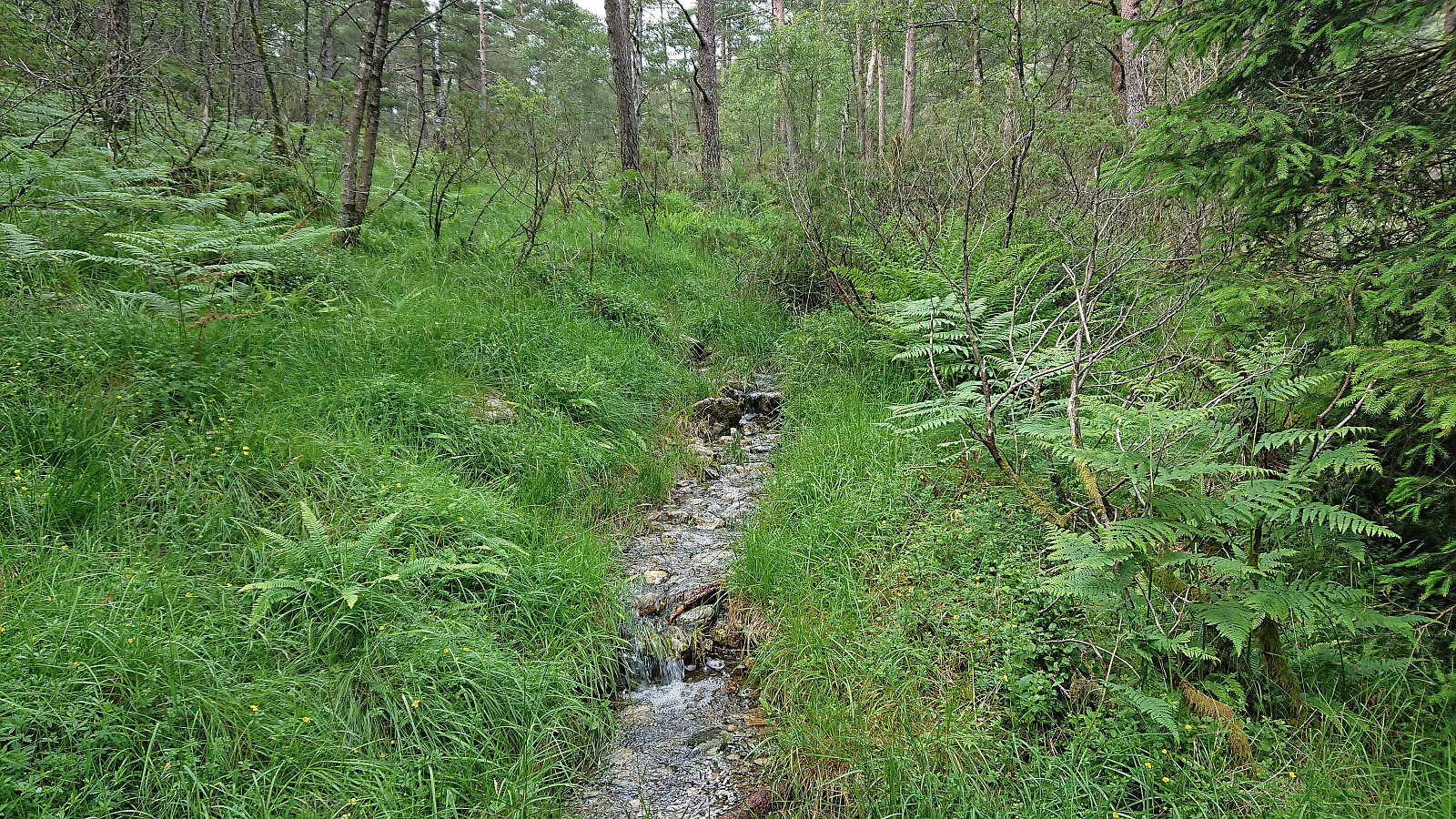
 Another day of hiking with Petter , this time using Mo as our starting point. We had initially thought to first ascend to Mostølen via the trail from Mo. But after coming across a recommendation by Nordhordland Turlag to rather use the marked trail starting from the northern end of Modalstunnelen, and describing the trail from Mo as steep and unstable, we changed our plans and went for this alternative route instead.
We parked just outside the tunnel and easily located the marked trailhead about 150 meters to the northwest. While the trailhead was indicated by a total of three different signs, the start of the trail itself was however much more modest. This would nevertheless soon improve as the trail started winding its way up the steep ascent between the trees. Further up the trail again turned weak at times, especially when crossing wet areas, but there were most >>>
Another day of hiking with Petter , this time using Mo as our starting point. We had initially thought to first ascend to Mostølen via the trail from Mo. But after coming across a recommendation by Nordhordland Turlag to rather use the marked trail starting from the northern end of Modalstunnelen, and describing the trail from Mo as steep and unstable, we changed our plans and went for this alternative route instead.
We parked just outside the tunnel and easily located the marked trailhead about 150 meters to the northwest. While the trailhead was indicated by a total of three different signs, the start of the trail itself was however much more modest. This would nevertheless soon improve as the trail started winding its way up the steep ascent between the trees. Further up the trail again turned weak at times, especially when crossing wet areas, but there were most >>>
Høganipa and Skavlabu
- Dato:
- 21.07.2022
- Turtype:
- Fjelltur
- Turlengde:
- 2:10t
- Distanse:
- 8,0km
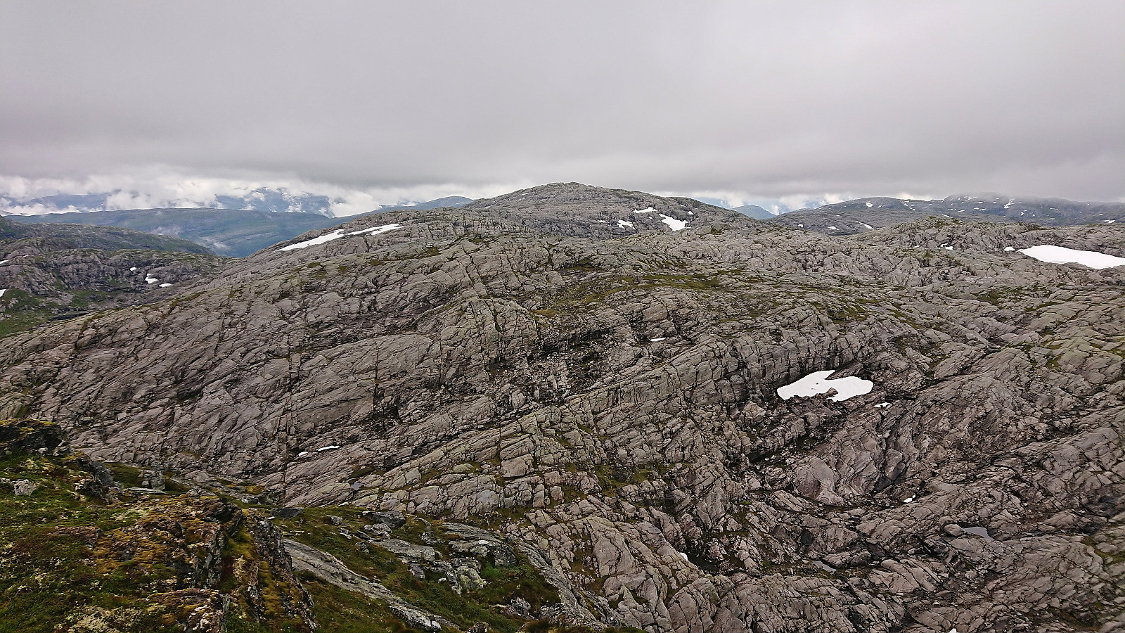
 After ascending Vetlevassegga and Torrisskarfjellet , me and Petter drove the short distance to the parking lot at Svartavatnet and from there started on the marked trail to Skavlabu . When getting to the third small lake in between the two larger 868 and 916 lakes we started looking for the trail towards the summit of Høganipa that was indicated on the map. If there were any traces of this trail they were very weak, but we would later come across small cairns that seemed to be heading in the right direction that we partially followed. In any case the terrain was easy to navigate and did not present any challenges.
Upon getting closer to the summit we connected with the marked trail to Skavlabu and could follow the red T's for the final few meters. The summit was marked by a small cairn that mainly functioned as a trail marker for the trail to Skavlabu and did not mention that it >>>
After ascending Vetlevassegga and Torrisskarfjellet , me and Petter drove the short distance to the parking lot at Svartavatnet and from there started on the marked trail to Skavlabu . When getting to the third small lake in between the two larger 868 and 916 lakes we started looking for the trail towards the summit of Høganipa that was indicated on the map. If there were any traces of this trail they were very weak, but we would later come across small cairns that seemed to be heading in the right direction that we partially followed. In any case the terrain was easy to navigate and did not present any challenges.
Upon getting closer to the summit we connected with the marked trail to Skavlabu and could follow the red T's for the final few meters. The summit was marked by a small cairn that mainly functioned as a trail marker for the trail to Skavlabu and did not mention that it >>>
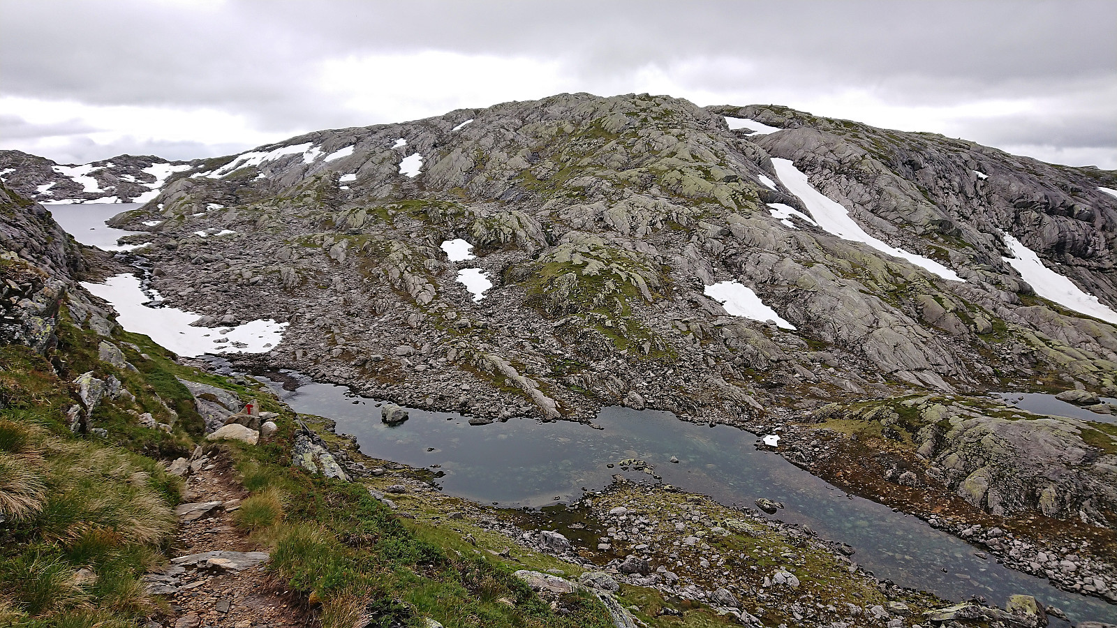
Vetlevassegga and Torrisskarfjellet
- Dato:
- 21.07.2022
- Turtype:
- Fjelltur
- Turlengde:
- 2:55t
- Distanse:
- 7,6km
 A return to Storavatnet towards the end of the long gravel road up from the south end of Masfjordtunnelen. This time, me and Petter were focusing on summits on the south side of the lake. We parked next to the road at one of the marked trailheads for Skavlabu at the southern tip of Storavatnet. Here there was room for one car. There was however lots of parking options just before this location as well.
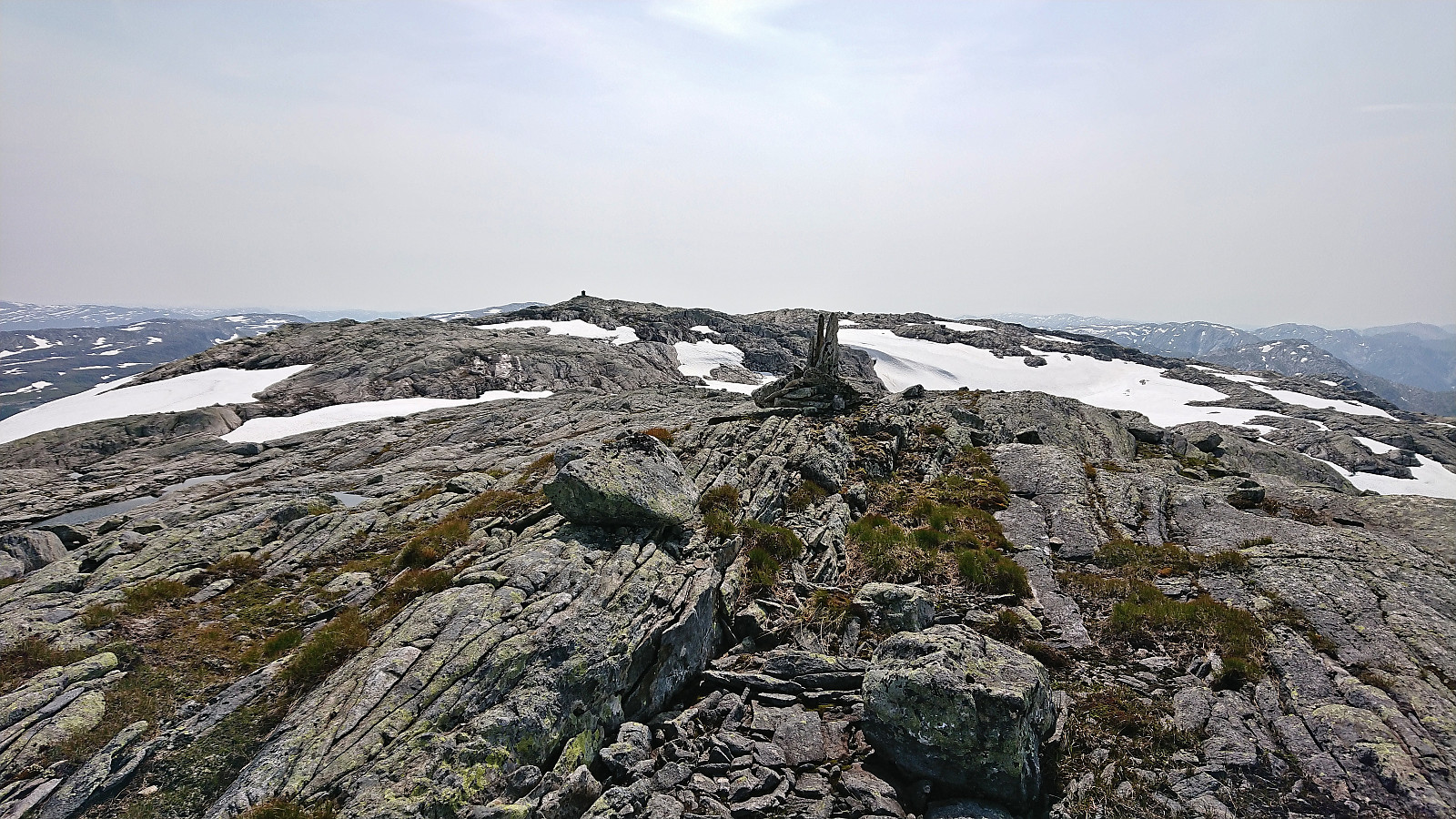
Our first goal was Vetlevassegga , hence we immediately ditched the marked trail and headed off-trail in the direction of the summit. A steep start of the day but otherwise straightforward and we soon arrived the summit without any issues. The summit area consisted of small hills of similar heights, with the northeastern one being ever so slightly higher. Nice views from the summit, although quite reduced by the low-hanging >>>
A return to Storavatnet towards the end of the long gravel road up from the south end of Masfjordtunnelen. This time, me and Petter were focusing on summits on the south side of the lake. We parked next to the road at one of the marked trailheads for Skavlabu at the southern tip of Storavatnet. Here there was room for one car. There was however lots of parking options just before this location as well.
Our first goal was Vetlevassegga , hence we immediately ditched the marked trail and headed off-trail in the direction of the summit. A steep start of the day but otherwise straightforward and we soon arrived the summit without any issues. The summit area consisted of small hills of similar heights, with the northeastern one being ever so slightly higher. Nice views from the summit, although quite reduced by the low-hanging >>>
Askjellfjellet
- Dato:
- 19.07.2022
- Turtype:
- Fjelltur
- Turlengde:
- 1:33t
- Distanse:
- 5,2km
 After our visits of Sørdalsfjellet, Hornafjellet and Gavlafjellet , Petter and I drove the short distance to Skjerjavatnet where we parked at a gravel-covered area right next to the road. Petter immediately started his ascent of Askjellfjellet while I first changed into shorts and sneakers as the until now rather unstable weather finally had decided to stay warm and sunny. We therefore followed slightly different ascent routes and did meet up until almost at the summit. In any case, it was more or less a matter of simply following the ridge until arriving at the large cairn, and with no difficult sections to speak of. After the mandatory summit pictures, we returned together along more or less the same route as I had used for my ascent, thus concluding an excellent day of hiking in Modalen with a total of four new summits added to the list of visited summits >>>
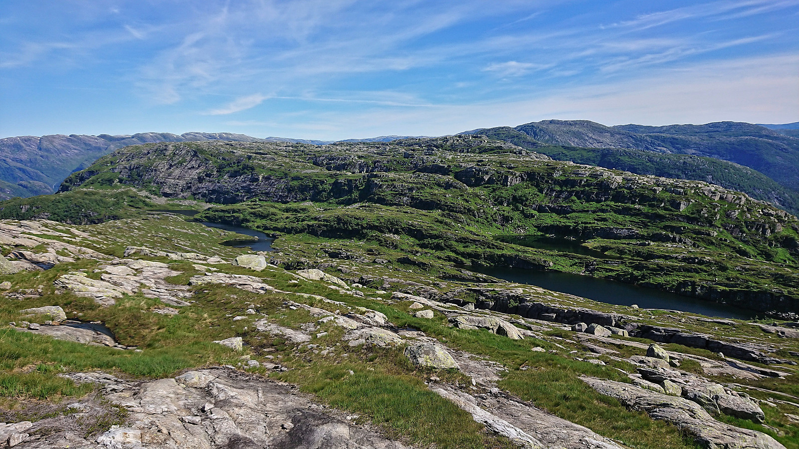
Sørdalsfjellet, Hornafjellet and Gavlafjellet
- Dato:
- 19.07.2022
- Turtype:
- Fjelltur
- Turlengde:
- 5:40t
- Distanse:
- 17,5km
 A return to Norddalen with Petter , but this time without skis and with the goal of driving as far up the gravel road as possible to secure easy access to the remaining summits in the area that we had not yet visited. We got as far as east of Gavlavatnet before coming across the first patch of snow covering the road and quickly had to conclude that this was as far as we were going to get by car. In any case, we were just above one kilometer from the start of the ridge up to Sørdalsfjellet and were overall very pleased.
After parking the car by the side of the road, we walked the short distance along the gravel road to the hairpin turn just south of Sørdalsfjellet, which was the second section of the road covered by snow, and from there started off-trail towards the summit. The terrain was easy to hike and it did >>>
A return to Norddalen with Petter , but this time without skis and with the goal of driving as far up the gravel road as possible to secure easy access to the remaining summits in the area that we had not yet visited. We got as far as east of Gavlavatnet before coming across the first patch of snow covering the road and quickly had to conclude that this was as far as we were going to get by car. In any case, we were just above one kilometer from the start of the ridge up to Sørdalsfjellet and were overall very pleased.
After parking the car by the side of the road, we walked the short distance along the gravel road to the hairpin turn just south of Sørdalsfjellet, which was the second section of the road covered by snow, and from there started off-trail towards the summit. The terrain was easy to hike and it did >>>
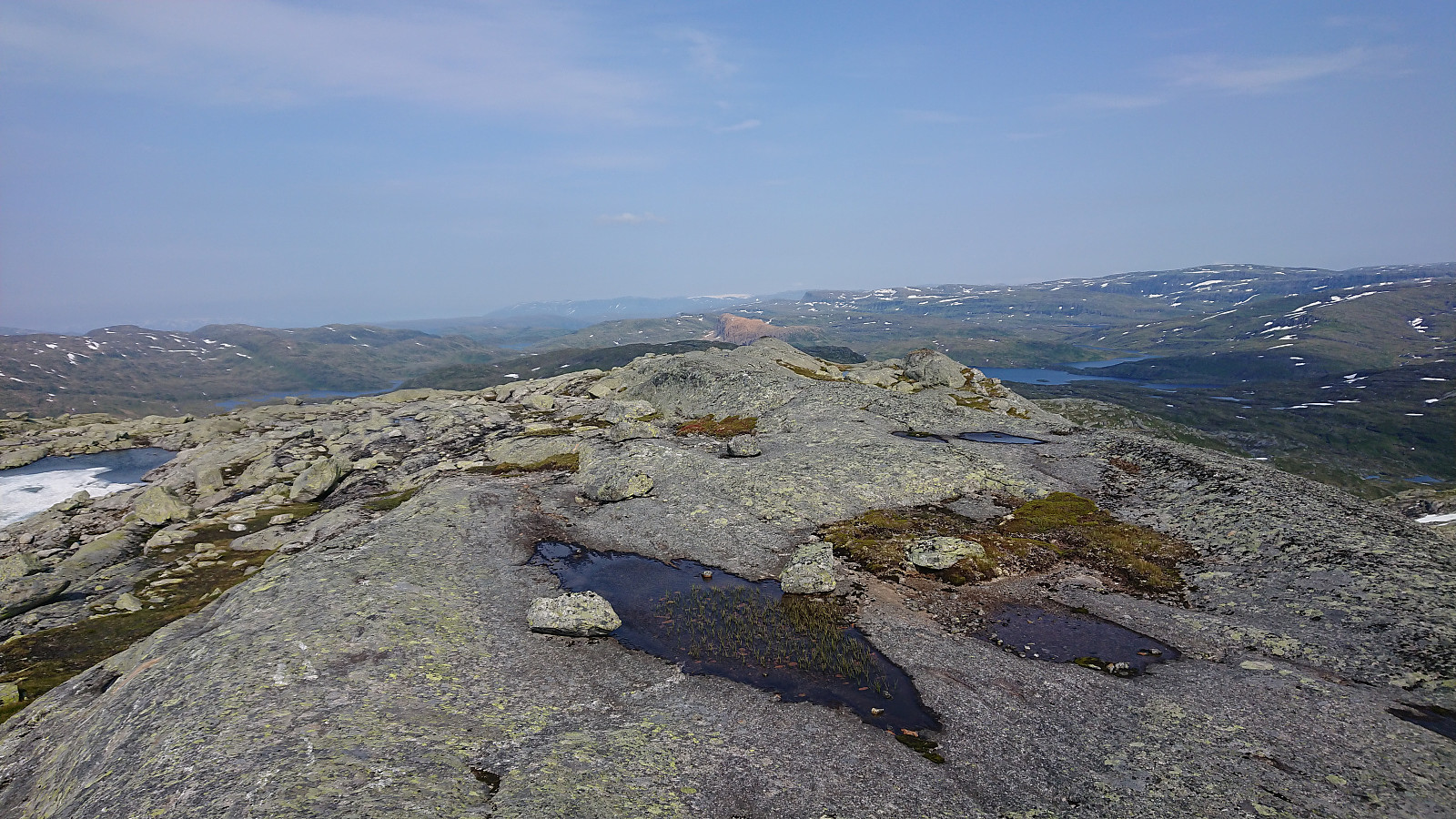
Middagshaugen and Skredfjellet
- Dato:
- 16.07.2022
- Turtype:
- Fjelltur
- Turlengde:
- 4:36t
- Distanse:
- 11,6km
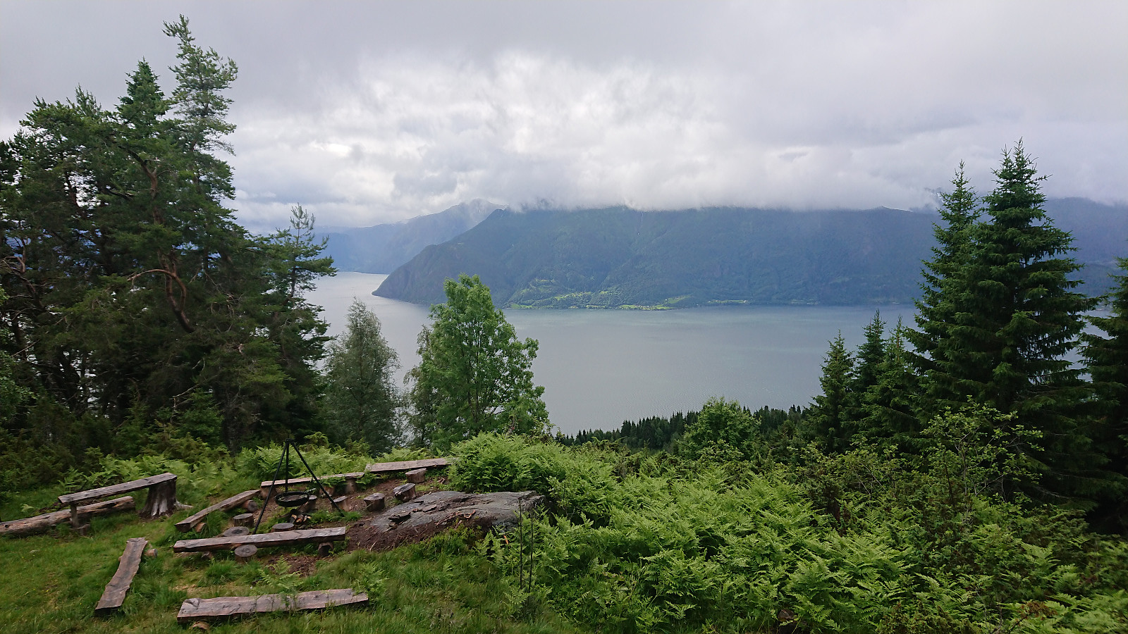
 On the last day of my stay in Sogndal this time around, we decided on Middagshaugen and Skredfjellet as our targets and drove to Berge between Frudalstunnelen and Bergstunnelen. Here we parked at the small parking lot next to the viewpoint and started on the gravel road up Bessdalen. Note that after a short initial descent there is a bridge across the motor way enabling hikers to safely get to the other side of the busy road.
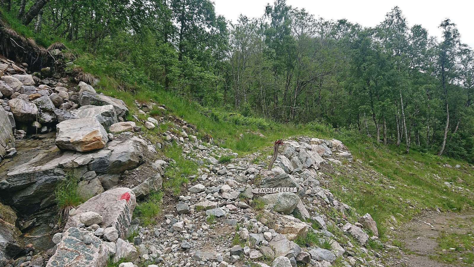
Soon we split from the gravel road at a hiking sign for Endrefjellet and followed a marked trail that would take us up to the large wet area east of the Skredfjellet ridge. Here the trail markers did continue, at least occasionally, but the trail itself was much harder to spot. The direction was however obvious and we simply headed north where we later reconnected with the marked trail.
Just before the trail >>>
On the last day of my stay in Sogndal this time around, we decided on Middagshaugen and Skredfjellet as our targets and drove to Berge between Frudalstunnelen and Bergstunnelen. Here we parked at the small parking lot next to the viewpoint and started on the gravel road up Bessdalen. Note that after a short initial descent there is a bridge across the motor way enabling hikers to safely get to the other side of the busy road.
Soon we split from the gravel road at a hiking sign for Endrefjellet and followed a marked trail that would take us up to the large wet area east of the Skredfjellet ridge. Here the trail markers did continue, at least occasionally, but the trail itself was much harder to spot. The direction was however obvious and we simply headed north where we later reconnected with the marked trail.
Just before the trail >>>
Orrabu
- Dato:
- 14.07.2022
- Turtype:
- Fjelltur
- Turlengde:
- 1:03t
- Distanse:
- 2,7km
 When picking up my niece arriving by boat at Leikanger, there was just enough time to first make a quick visit of Orrabu . We started from the parking lot at Kleppa and from there followed the marked trail all the way to the cabin. The plan had been to return via Høgehaug , but this had to be dropped in order to get to Leikanger before the boat arrived.
Hesteggi from Einehaugen/Barsnes
- Dato:
- 10.07.2022
- Turtype:
- Fjelltur
- Turlengde:
- 6:04t
- Distanse:
- 14,4km
 Today it was time for a hike that I had not done since I was a kid: ascending to the tractor road at Barsnesfjellet from Einehaugen/Barsnes via Flot . We started along the marked trail to Flot where we made a quick stop at the now marked viewpoint just west of the visitor register. After rounding the small hill to the east, we began the real ascent to the tractor road. There is a trail to Furehaugen (there was even a single red trail marker early on!), but it is now quite weak and feels more like a deer track than a trail. On the way to Furehaugen you can also look out for an arrow carved in a large tree that points the way.
At Furehaugen the trail more or less disappeared, with the many fallen trees across the trail not helping. There was however a steep trail/track that could be followed, but whether this was >>>
Today it was time for a hike that I had not done since I was a kid: ascending to the tractor road at Barsnesfjellet from Einehaugen/Barsnes via Flot . We started along the marked trail to Flot where we made a quick stop at the now marked viewpoint just west of the visitor register. After rounding the small hill to the east, we began the real ascent to the tractor road. There is a trail to Furehaugen (there was even a single red trail marker early on!), but it is now quite weak and feels more like a deer track than a trail. On the way to Furehaugen you can also look out for an arrow carved in a large tree that points the way.
At Furehaugen the trail more or less disappeared, with the many fallen trees across the trail not helping. There was however a steep trail/track that could be followed, but whether this was >>>
Tverrfjellet from Nordvik
- Dato:
- 07.07.2022
- Turtype:
- Fjelltur
- Turlengde:
- 1:33t
- Distanse:
- 3,6km
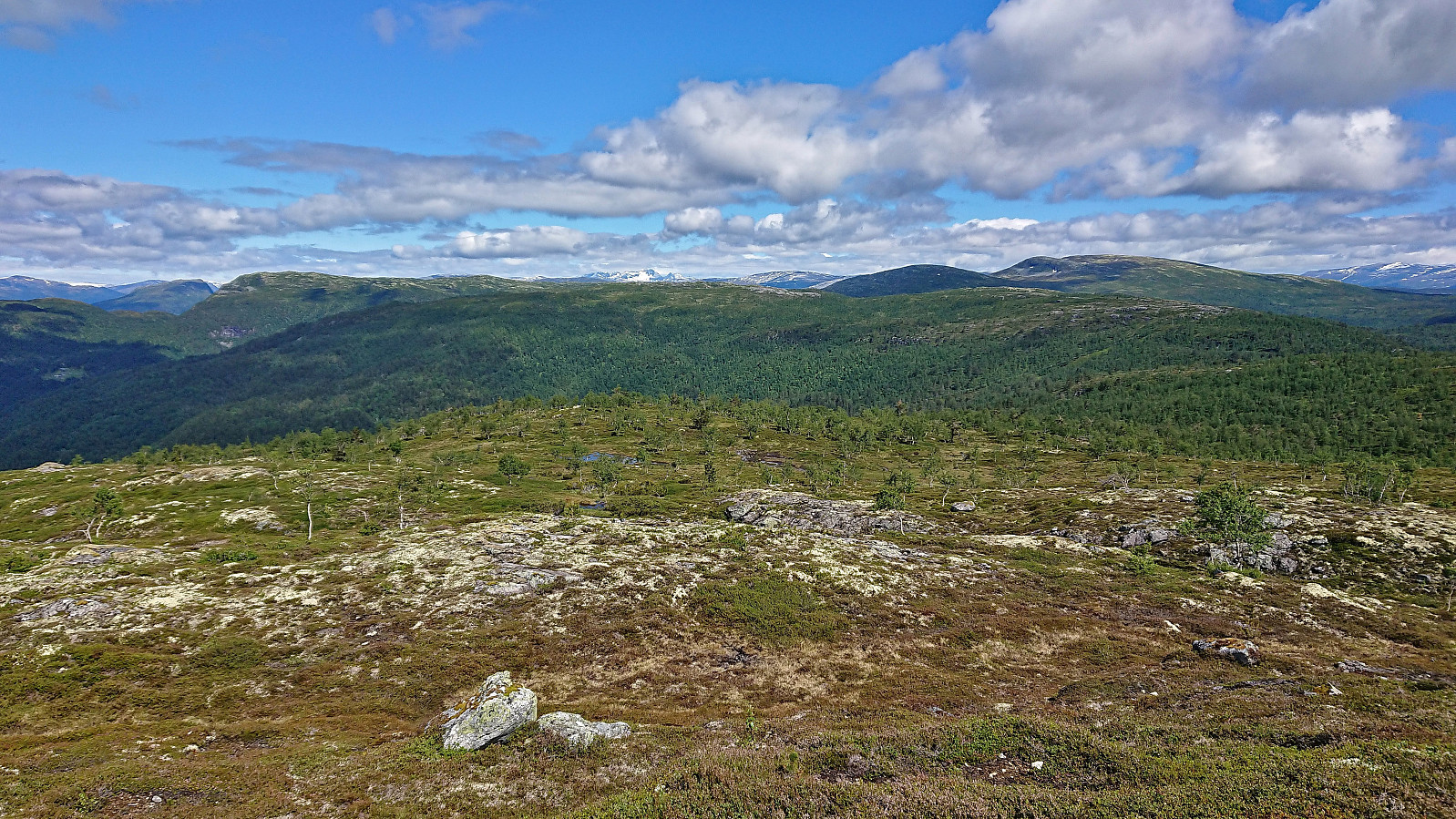
 I left work early and took the bus to Nordvik where I got off at the stop called "Nordvik nord, Bergen". After a short walk along the road I started looking for the trail up the valley in between Tverrfjellet and Høgeåsen . Thankfully I came across one of the locals and could ask for directions before it started feeling too much like trespassing, especially as I had to walk along the outskirts of his lawn to get to the trailhead.
At first the trail was easy to follow, but soon it would either be hidden by ferns or look and feel more like a small stream. I therefore left the trail behind and headed off-trail in the direction of the summit of Tverrfjellet, following various deer tracks when these seemed to head in the right direction. The summit was thus reached without any issues and provided excellent >>>
I left work early and took the bus to Nordvik where I got off at the stop called "Nordvik nord, Bergen". After a short walk along the road I started looking for the trail up the valley in between Tverrfjellet and Høgeåsen . Thankfully I came across one of the locals and could ask for directions before it started feeling too much like trespassing, especially as I had to walk along the outskirts of his lawn to get to the trailhead.
At first the trail was easy to follow, but soon it would either be hidden by ferns or look and feel more like a small stream. I therefore left the trail behind and headed off-trail in the direction of the summit of Tverrfjellet, following various deer tracks when these seemed to head in the right direction. The summit was thus reached without any issues and provided excellent >>>
Ramnaberget, Veten, Kjetilsfjellet and Hendershaugen
- Dato:
- 03.07.2022
- Turtype:
- Fjelltur
- Turlengde:
- 2:57t
- Distanse:
- 10,0km
 Afternoon trip to Korsneset to visit three minor summits on the Alle topper i Bergen list. I started by taking the bus to Krokeide and getting off at the final bus stop called "Krokeide videregående skole". From there I walked along the roads until being just east of Ramnaberget and managed to find a relatively easy off-trail ascent, partly following deer tracks. Limited views from the summit, but great views could be obtained a short distance to the southwest.
I returned along more or less the same route before following the steep trail to Veten where the usually excellent views were reduced due to a passing light rain shower. I therefore did not stay long before starting my descent, this time following the less steep southern route.
Shortly before returning to the gravel road, I made a quick detour to the summit of >>>
Afternoon trip to Korsneset to visit three minor summits on the Alle topper i Bergen list. I started by taking the bus to Krokeide and getting off at the final bus stop called "Krokeide videregående skole". From there I walked along the roads until being just east of Ramnaberget and managed to find a relatively easy off-trail ascent, partly following deer tracks. Limited views from the summit, but great views could be obtained a short distance to the southwest.
I returned along more or less the same route before following the steep trail to Veten where the usually excellent views were reduced due to a passing light rain shower. I therefore did not stay long before starting my descent, this time following the less steep southern route.
Shortly before returning to the gravel road, I made a quick detour to the summit of >>>
