Archiv - Nach Datum
Archiv - Nach Aktivität
-
Andere Tour (3)
- Kayaking (3)
-
Fahrradtour (110)
- Fahrradtour Straße (85)
- Fahrradtour gemischt (25)
-
Fahrzeugtour (9)
- Autotour (9)
-
Fußtour (1884)
- Bergtour (1114)
- Jogging (1)
- Spaziergang (59)
- Wanderung (710)
-
Skitour (116)
- Langlauf (47)
- Tourenskilauf (69)
Gesammelte Listen
-
Utvalgte topper og turmål i Bergen
(348/349)
 99%
99% -
Alle topper i Bergen
(391/398)
98%
-
Voss ≥ 100m pf.
(96/98)
97%
-
Opptur Hordaland
(144/159)
90%
-
Stasjoner på Bergensbanen
(33/40)
82%
-
Ulvik ≥ 100m pf.
(28/38)
73%
-
Hordaland ≥ 100m pf.
(622/863)
72%
-
Mjølfjell PF > 100m
(21/31)
67%
-
Jondal ≥ 100m pf.
(15/23)
65%
-
Dagsturhyttene i Vestland
(36/61)
59%
-
Sunnhordland PF >= 100m
(105/186)
56%
-
Hordaland: Hardanger PF>=100m
(194/359)
54%
-
DNT-hytter i Hordaland
(23/45)
51%
-
Kvinnherad ≥ 100m pf.
(40/79)
50%
-
Eidfjord ≥ 100m pf.
(13/42)
30%
-
Sogndal ≥ 100m pf.
(23/81)
28%
-
Gulen ≥ 100m pf.
(15/54)
27%
-
Vik i Sogn ≥ 100m pf.
(10/46)
21%
-
Sogn - Sør for Sognefjorden PF>=100m
(31/159)
19%
-
DNT-hytter i Sogn og Fjordane
(8/47)
17%

Geitanuken from Vestlandshallen
- Datum:
- 11.12.2022
- Tourcharakter:
- Bergtour
- Tourlänge:
- 1:16h
- Entfernung:
- 5,1km
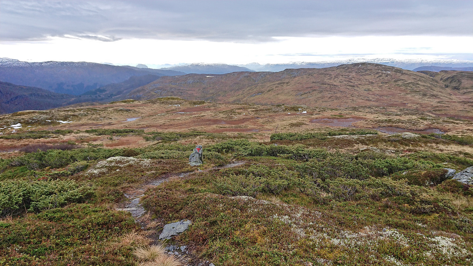
 A quick visit of Geitanuken after hitching a ride to Vestlandshallen.
Skarpefjellsnakken and Stendarskarfjellet from Kringla
- Datum:
- 04.12.2022
- Tourcharakter:
- Bergtour
- Tourlänge:
- 6:36h
- Entfernung:
- 21,3km
 I started by taking the new double-decker express bus heading for Ålesund and got off at Kringla. Here I was welcomed by the first rays of sunlight hitting the east face of Skarpefjellsnakken (or more correctly Geirsvadklumpen) as I began my walk south/southwest along the road to Kalhovda. All of the previous trip reports had ascended Skarpefjellsnakken via the parking lot at Røyrbotnen , however as I had no need for parking, I thought I would rather try the trail indicated on the map starting from Legene.
The trailhead was more or less as indicated on the map, although hidden from the road. I therefore got confused by a gate west of the buildings at Legene, but this trail very quickly came to an end. After a short off-trail search I came across the first white and red plastic trail marker. The trail itself was much less clear, and while >>>
I started by taking the new double-decker express bus heading for Ålesund and got off at Kringla. Here I was welcomed by the first rays of sunlight hitting the east face of Skarpefjellsnakken (or more correctly Geirsvadklumpen) as I began my walk south/southwest along the road to Kalhovda. All of the previous trip reports had ascended Skarpefjellsnakken via the parking lot at Røyrbotnen , however as I had no need for parking, I thought I would rather try the trail indicated on the map starting from Legene.
The trailhead was more or less as indicated on the map, although hidden from the road. I therefore got confused by a gate west of the buildings at Legene, but this trail very quickly came to an end. After a short off-trail search I came across the first white and red plastic trail marker. The trail itself was much less clear, and while >>>
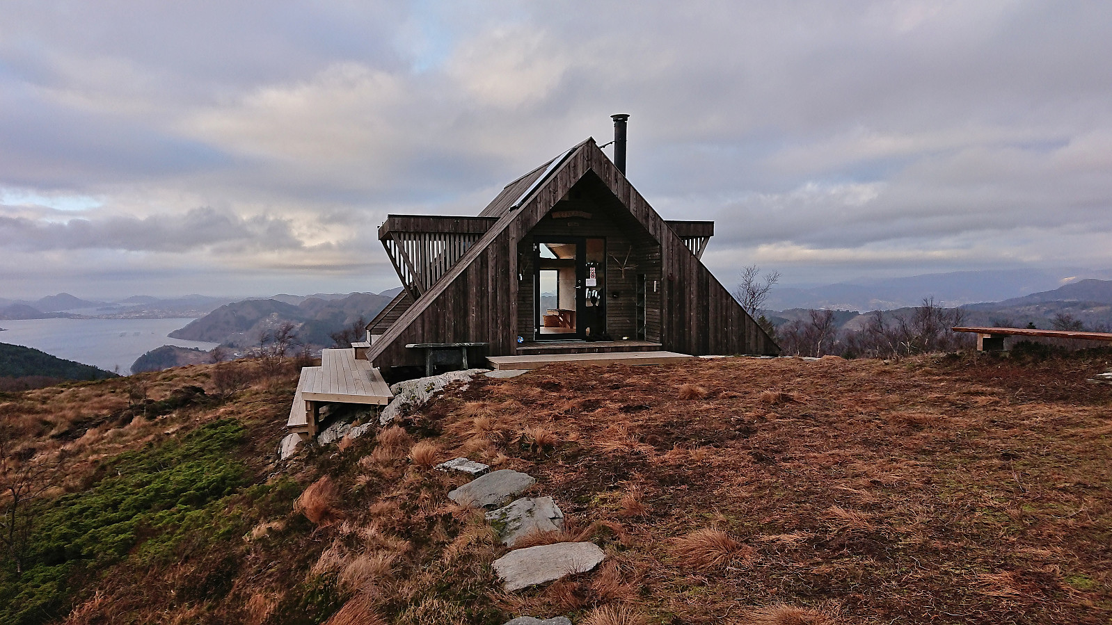
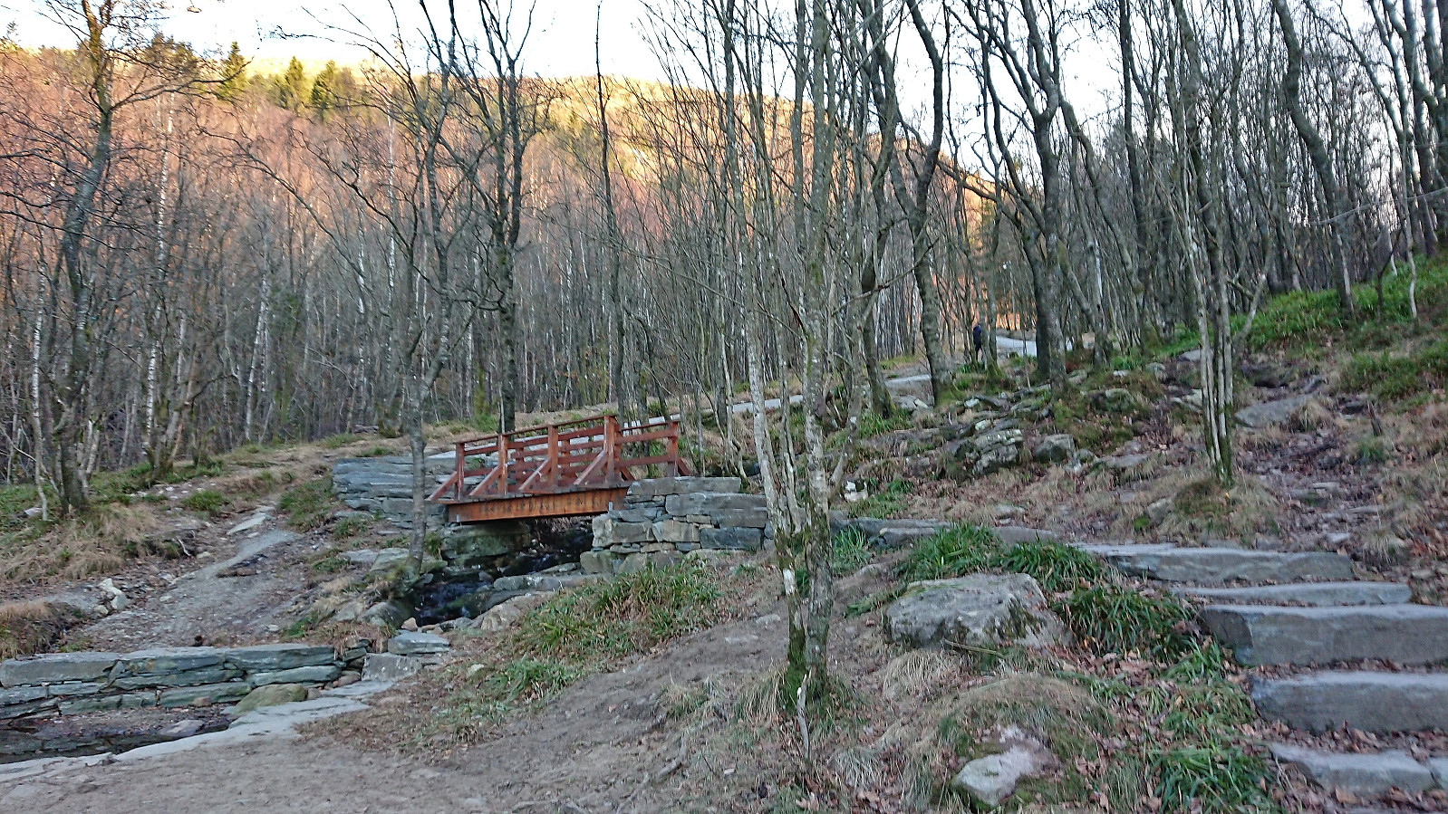
Kolhushaugen, Lyseskarfjellet and Fana kulturpark
- Datum:
- 03.12.2022
- Tourcharakter:
- Bergtour
- Tourlänge:
- 1:47h
- Entfernung:
- 5,8km
 A return to Fana to visit Kolhushaugen , a recent addition to the Alle topper i Bergen list. I had passed close by Kolhushaugen when hiking the first stage of Jubileumsstien two years earlier but had then not considered ascending this small hill. Turns out that it can be easily accessed by a minor detour from the main trail and even provided quite good views. After the visit of Kolhushaugen, I made a revisit of Lyseskarfjellet before returning along the same route. Given that I had some time to spare before the bus back to Bergen, I ended the trip by a walk through Fana kulturpark .
Erstadfjellet, Brakabu and Brakvatnet
- Datum:
- 26.11.2022
- Tourcharakter:
- Bergtour
- Tourlänge:
- 2:48h
- Entfernung:
- 11,4km
 A return to Erstadfjellet with the main objective of also visiting Brakabu , as it had not yet been built at my previous visit in 2017 . I could pretty much follow signs for Brakabu all the way from the ferry at Valestrand, first along paved roads and then on an overall good-quality trail to the summit of Erstadfjellet. Brakabu was quickly visited on the descent, before taking an alternative route down to Erstad and Brakvatnet. Even though this was just a transportation stage to get to the ferry, the winding gravel road and the nice lake made for a very enjoyable end to the hike.
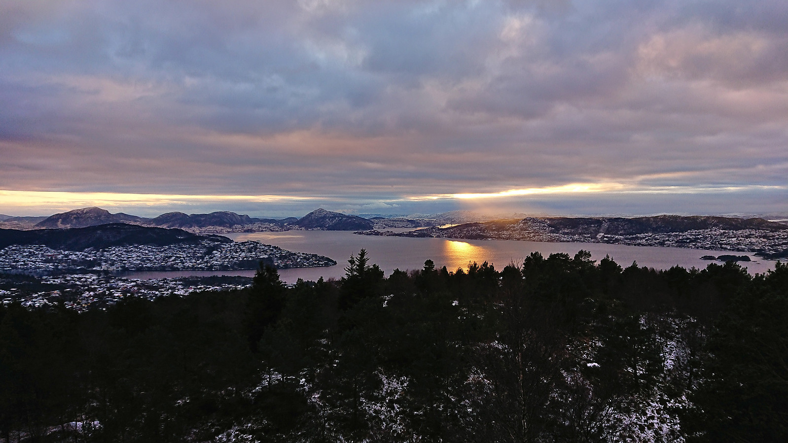
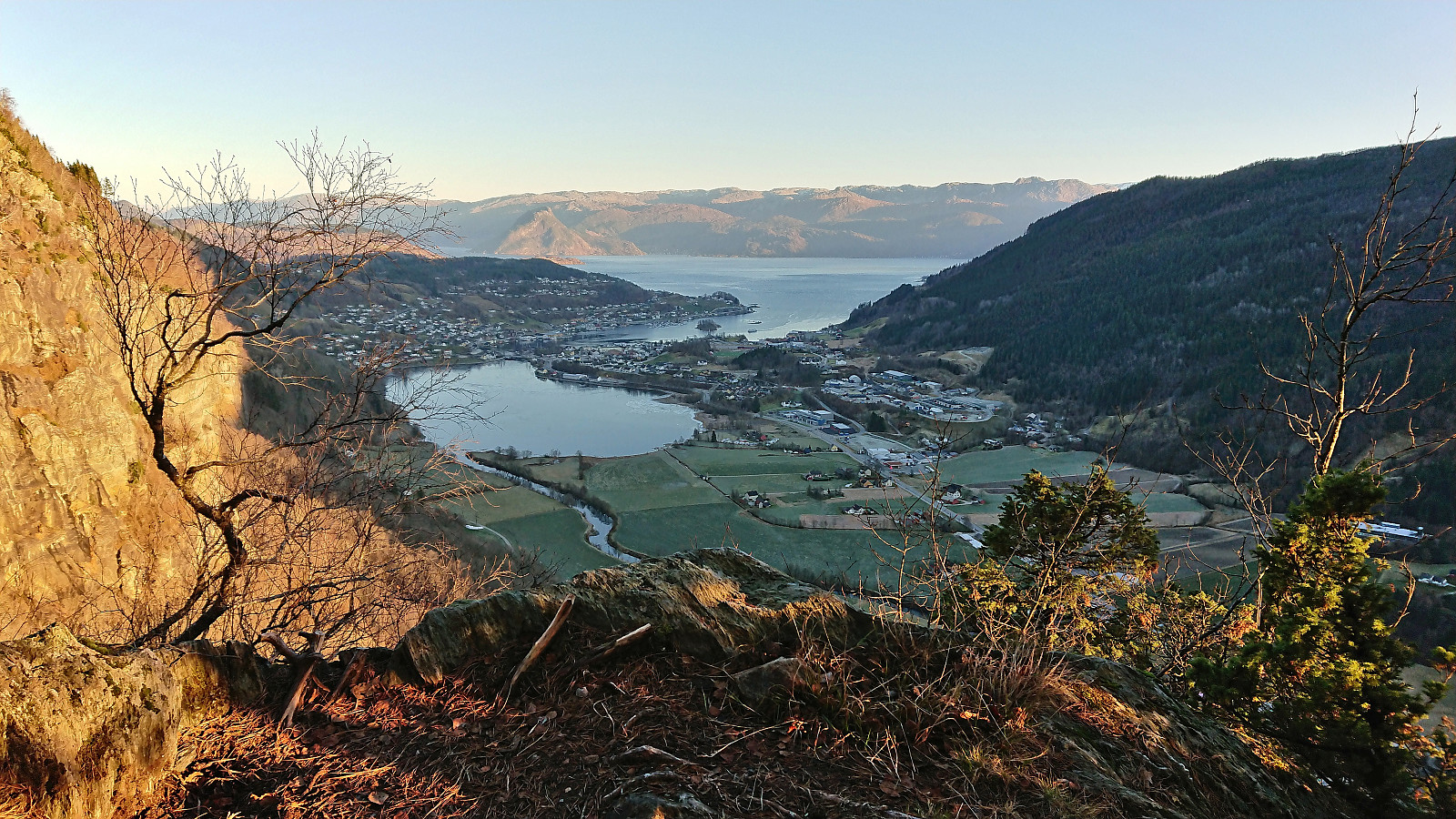
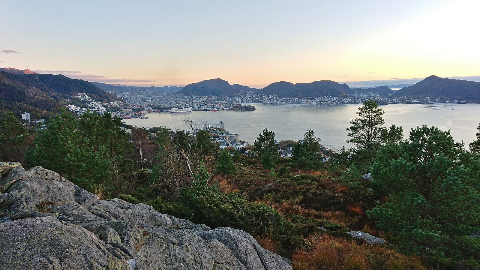
Oppstemten
- Datum:
- 23.11.2022
- Tourcharakter:
- Bergtour
- Tourlänge:
- 1:10h
- Entfernung:
- 4,6km
 An attempt to catch the sunset from the top Ulriken, however the sun cheated and hid behind clouds before setting. Hence the sun disappeared even before I started on the stone steps. I took it relatively easy and made it to the top (from the start of the gravel road at Montana) in less than 28 minutes. Since my last visit the shortcut up from Ulriksbanen, apparently called Skotbergkleiven, had been greatly improved with new stone and metal steps at the start and then a gravel road.
Torefjell from Steinsdalsfossen via Raudnos
- Datum:
- 19.11.2022
- Tourcharakter:
- Bergtour
- Tourlänge:
- 5:24h
- Entfernung:
- 15,6km
 Most, if not all, of the previous visits of Torefjell seemed to have started from Sjusete. Getting to Sjusete without a car would however require a rather boring walk along the roads up from Norheimsund. When looking for other options, I came across this suggested hike from Steinsdalsfossen to Raudnos , which also indicated that it was possible to get to Raudnos via trails from the northeast. This would only leave the short distance from the gravel road south of Alkleiv up to Forsete and I would be on the standard trail to Torefjell. The map did not indicate any trail there, but I was pretty confident that one would turn up.
With the plan decided upon, I took the bus to Øvsthus and got off at the stop named after the popular waterfall of Steinsdalsfossen . Similar to my visit of Steinsdalsfossen at the start of April , the famous walk behind the waterfall was closed due to ice, and I instead followed the paved road up towards >>>
Most, if not all, of the previous visits of Torefjell seemed to have started from Sjusete. Getting to Sjusete without a car would however require a rather boring walk along the roads up from Norheimsund. When looking for other options, I came across this suggested hike from Steinsdalsfossen to Raudnos , which also indicated that it was possible to get to Raudnos via trails from the northeast. This would only leave the short distance from the gravel road south of Alkleiv up to Forsete and I would be on the standard trail to Torefjell. The map did not indicate any trail there, but I was pretty confident that one would turn up.
With the plan decided upon, I took the bus to Øvsthus and got off at the stop named after the popular waterfall of Steinsdalsfossen . Similar to my visit of Steinsdalsfossen at the start of April , the famous walk behind the waterfall was closed due to ice, and I instead followed the paved road up towards >>>
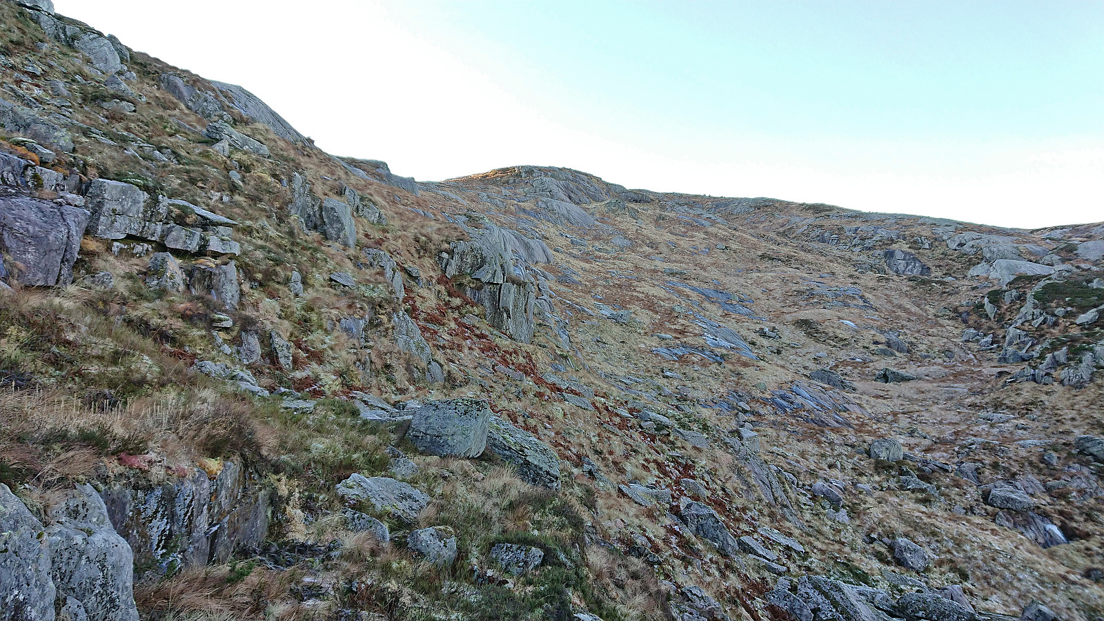
Tveitalifjellet, Emberlandsnipen and Nipaståvo
- Datum:
- 13.11.2022
- Tourcharakter:
- Bergtour
- Tourlänge:
- 4:16h
- Entfernung:
- 19,3km
 My plans to go hiking at Voss had to be changed when massive amounts of rainfall resulted in one of the largest floods in that area in modern history. In order to avoid any issues with blocked roads or cancelled trains, I therefore decided to instead head south for two new summits in Sveio.
First up was Tveitalifjellet . After getting off the bus from Bergen at Haukås terminal, I walked the short distance back along the sidewalk before taking the gravel road up to Tveita. When the road ended just east of the summit, I passed through a gate and tried to follow the red plastic trail markers, but after one marker at the gate and a second when entering between the trees, I did not spot more until the terrain levelled off after the first short steep ascent. From there on there were several additional markers, but >>>
My plans to go hiking at Voss had to be changed when massive amounts of rainfall resulted in one of the largest floods in that area in modern history. In order to avoid any issues with blocked roads or cancelled trains, I therefore decided to instead head south for two new summits in Sveio.
First up was Tveitalifjellet . After getting off the bus from Bergen at Haukås terminal, I walked the short distance back along the sidewalk before taking the gravel road up to Tveita. When the road ended just east of the summit, I passed through a gate and tried to follow the red plastic trail markers, but after one marker at the gate and a second when entering between the trees, I did not spot more until the terrain levelled off after the first short steep ascent. From there on there were several additional markers, but >>>
Kjeneset and Såta
- Datum:
- 30.10.2022
- Tourcharakter:
- Bergtour
- Tourlänge:
- 1:26h
- Entfernung:
- 5,0km
 Initial plans to spend the Sunday hiking at Voss had to be abandoned when I for once did not manage to generate the required activation energy to get up and out the door before sunrise, mainly due to suboptimal weather forecasts and overall very wet terrain.
As a replacement I went for a shorter hike later in the day at Korsneset to visit yet more minor summits on the Alle topper i Bergen list, namely Kjeneset and Såta . Two summits I had been saving for just such a gray and rainy day.
After arriving by bus, I pretty much followed in the footsteps of either Kjell51 (Kjell Øijorden) or knutsverre (Knut S. Andersen) , where the only real challenge was finding a route up the short step ascent south of the summit of Kjeneset. In the end I found a location where only a little bit of light scrambling was needed. No such issues to reach Såta, but instead there were plenty of wet and >>>
Initial plans to spend the Sunday hiking at Voss had to be abandoned when I for once did not manage to generate the required activation energy to get up and out the door before sunrise, mainly due to suboptimal weather forecasts and overall very wet terrain.
As a replacement I went for a shorter hike later in the day at Korsneset to visit yet more minor summits on the Alle topper i Bergen list, namely Kjeneset and Såta . Two summits I had been saving for just such a gray and rainy day.
After arriving by bus, I pretty much followed in the footsteps of either Kjell51 (Kjell Øijorden) or knutsverre (Knut S. Andersen) , where the only real challenge was finding a route up the short step ascent south of the summit of Kjeneset. In the end I found a location where only a little bit of light scrambling was needed. No such issues to reach Såta, but instead there were plenty of wet and >>>
Skorseteggi and Kolingseggi from Oppheimsvatnet to Kløve
- Datum:
- 22.10.2022
- Tourcharakter:
- Bergtour
- Tourlänge:
- 5:10h
- Entfernung:
- 19,0km
 I started by taking the train to Voss with the plan to continue on the bus to Framnes at the western end of Oppheimsvatnet. Due to signaling problems in the tunnel between Bergen and Arna the train ended up arriving 15 minutes late at Voss, but thankfully I still managed to catch the bus heading for Gudvangen. In fact, there were two buses as apparently the tourist season was not quite over.
After getting off the bus at Framnes, I walked back along the main road for about 200 meters (on a broad sidewalk) to cross the bridge to the south side of Oppheimsvatnet where I continued south along Langedalsvegen (the second exit to the right) until locating the marked trailhead for Lemme. The first 100 meters or so consisted of a new tractor road where the earth/mud had not quite set yet, but then changed >>>
I started by taking the train to Voss with the plan to continue on the bus to Framnes at the western end of Oppheimsvatnet. Due to signaling problems in the tunnel between Bergen and Arna the train ended up arriving 15 minutes late at Voss, but thankfully I still managed to catch the bus heading for Gudvangen. In fact, there were two buses as apparently the tourist season was not quite over.
After getting off the bus at Framnes, I walked back along the main road for about 200 meters (on a broad sidewalk) to cross the bridge to the south side of Oppheimsvatnet where I continued south along Langedalsvegen (the second exit to the right) until locating the marked trailhead for Lemme. The first 100 meters or so consisted of a new tractor road where the earth/mud had not quite set yet, but then changed >>>
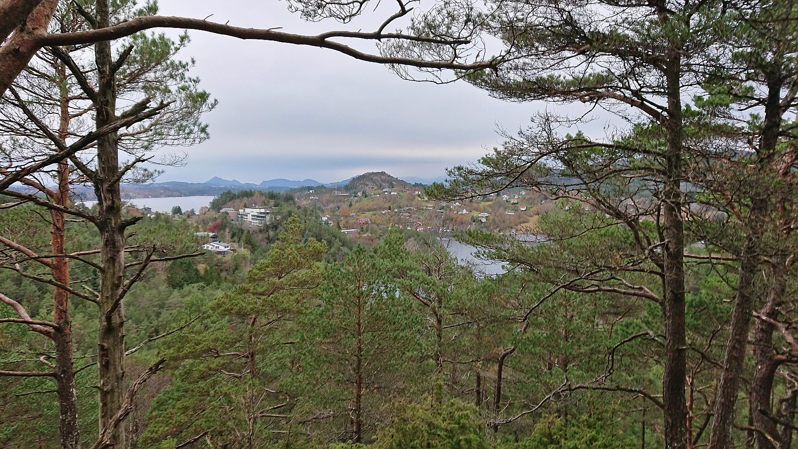
Ørneberget and Hellen festning
- Datum:
- 19.10.2022
- Tourcharakter:
- Bergtour
- Tourlänge:
- 0:56h
- Entfernung:
- 4,3km
 Another short hike trying to catch the sunset at Ørneberget. But the sun disappeared behind clouds before I made it to the summit.
