Archiv - Nach Datum
Archiv - Nach Aktivität
-
Andere Tour (3)
- Kayaking (3)
-
Fahrradtour (111)
- Fahrradtour Straße (86)
- Fahrradtour gemischt (25)
-
Fahrzeugtour (9)
- Autotour (9)
-
Fußtour (1898)
- Bergtour (1120)
- Jogging (1)
- Spaziergang (60)
- Wanderung (717)
-
Skitour (116)
- Langlauf (47)
- Tourenskilauf (69)
Gesammelte Listen
-
Utvalgte topper og turmål i Bergen
(349/351)
 99%
99% -
Alle topper i Bergen
(393/400)
98%
-
Voss ≥ 100m pf.
(96/98)
97%
-
Opptur Hordaland
(144/159)
90%
-
Stasjoner på Bergensbanen
(33/40)
82%
-
Ulvik ≥ 100m pf.
(30/38)
78%
-
Hordaland ≥ 100m pf.
(624/863)
72%
-
Mjølfjell PF > 100m
(21/31)
67%
-
Jondal ≥ 100m pf.
(15/23)
65%
-
Dagsturhyttene i Vestland
(36/61)
59%
-
Sunnhordland PF >= 100m
(105/186)
56%
-
Hordaland: Hardanger PF>=100m
(196/359)
54%
-
DNT-hytter i Hordaland
(23/45)
51%
-
Kvinnherad ≥ 100m pf.
(40/79)
50%
-
Eidfjord ≥ 100m pf.
(13/42)
30%
-
Sogndal ≥ 100m pf.
(23/81)
28%
-
Gulen ≥ 100m pf.
(15/54)
27%
-
Vik i Sogn ≥ 100m pf.
(10/46)
21%
-
Sogn - Sør for Sognefjorden PF>=100m
(31/159)
19%
-
DNT-hytter i Sogn og Fjordane
(8/47)
17%

Senafjellet from Femanger
- Datum:
- 14.04.2024
- Tourcharakter:
- Bergtour
- Tourlänge:
- 2:07h
- Entfernung:
- 4,0km
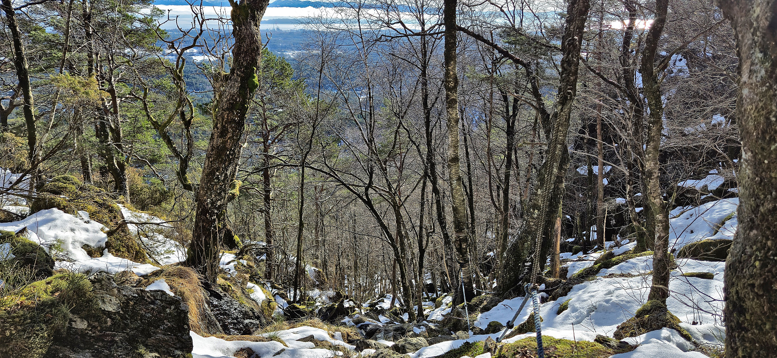
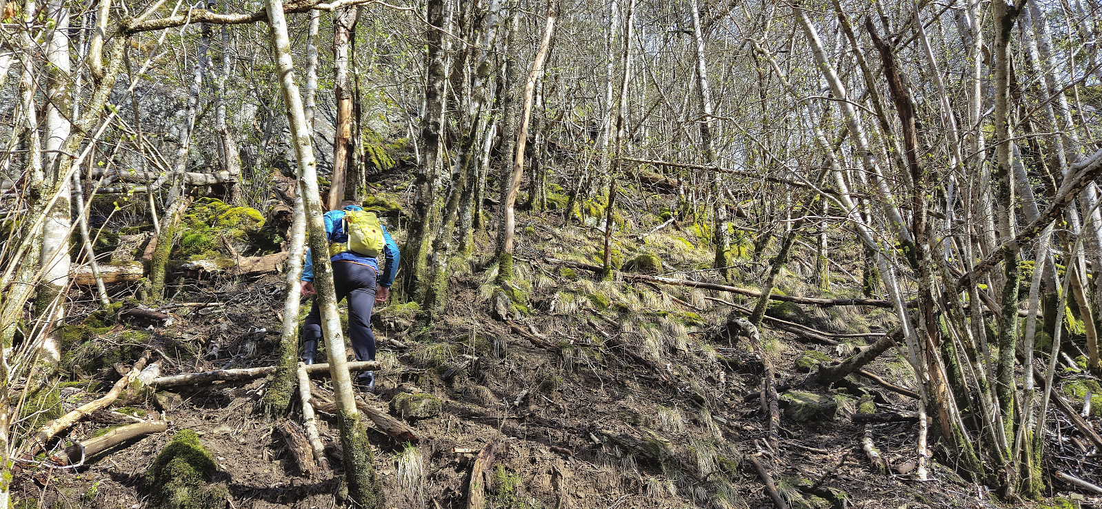 Endre picked me up at my place and together we drove south to Bjørnafjorden via Samnanger. Our first goal was Senafjellet where we, thanks to previous trip reports, easily located the small parking area just north of the small bridge at Femanger. After a short walk east we left the gravel road and began our off-trail ascent towards the summit.
The ascent started quite steep and muddy, with lots of trees to navigate around/over, but it did not take long before we were following what almost looked like a trail. It was most likely just deer tracks though, which became more obvious the higher up we got. We decided to more or less follow the narrow valley in a straight line all the way to the summit. This worked out fine and did not present any real challenges.
As we approached the summit the light rain shower that >>>
Endre picked me up at my place and together we drove south to Bjørnafjorden via Samnanger. Our first goal was Senafjellet where we, thanks to previous trip reports, easily located the small parking area just north of the small bridge at Femanger. After a short walk east we left the gravel road and began our off-trail ascent towards the summit.
The ascent started quite steep and muddy, with lots of trees to navigate around/over, but it did not take long before we were following what almost looked like a trail. It was most likely just deer tracks though, which became more obvious the higher up we got. We decided to more or less follow the narrow valley in a straight line all the way to the summit. This worked out fine and did not present any real challenges.
As we approached the summit the light rain shower that >>>
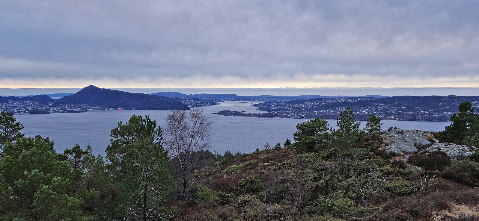
Ørneberget and Hellen festning
- Datum:
- 10.04.2024
- Tourcharakter:
- Bergtour
- Tourlänge:
- 1:04h
- Entfernung:
- 4,3km
 Short local evening hike.
Håmanen and Hellemyrstien
- Datum:
- 07.04.2024
- Tourcharakter:
- Bergtour
- Tourlänge:
- 1:21h
- Entfernung:
- 6,3km
 Short local hike on a wet and windy Sunday. Managed to avoid the rain showers though.
Blåurskampen and Kampen
- Datum:
- 06.04.2024
- Tourcharakter:
- Bergtour
- Tourlänge:
- 1:46h
- Entfernung:
- 6,5km
 Short evening hike between the rain showers with the main objective of visiting Kampen , a recent addition to the Alle topper i Bergen list . On my way there I also passed by Blåurskampen which could potentially also be added to the list, but with only deer tracks to follow and very limited views from the summit I decided to not add it as its own PB-element (update: it was later added by Helwig ). Kampen could be easily ascended from the east, and I probably should have descended that way as well, but instead decided on a shortcut northeast along the ridge. A bit steep towards the end but no real challenges. Not sure if I saved much time compared to the easier route back east though.
Ørneberget and Furukammen
- Datum:
- 05.04.2024
- Tourcharakter:
- Bergtour
- Tourlänge:
- 1:09h
- Entfernung:
- 4,3km
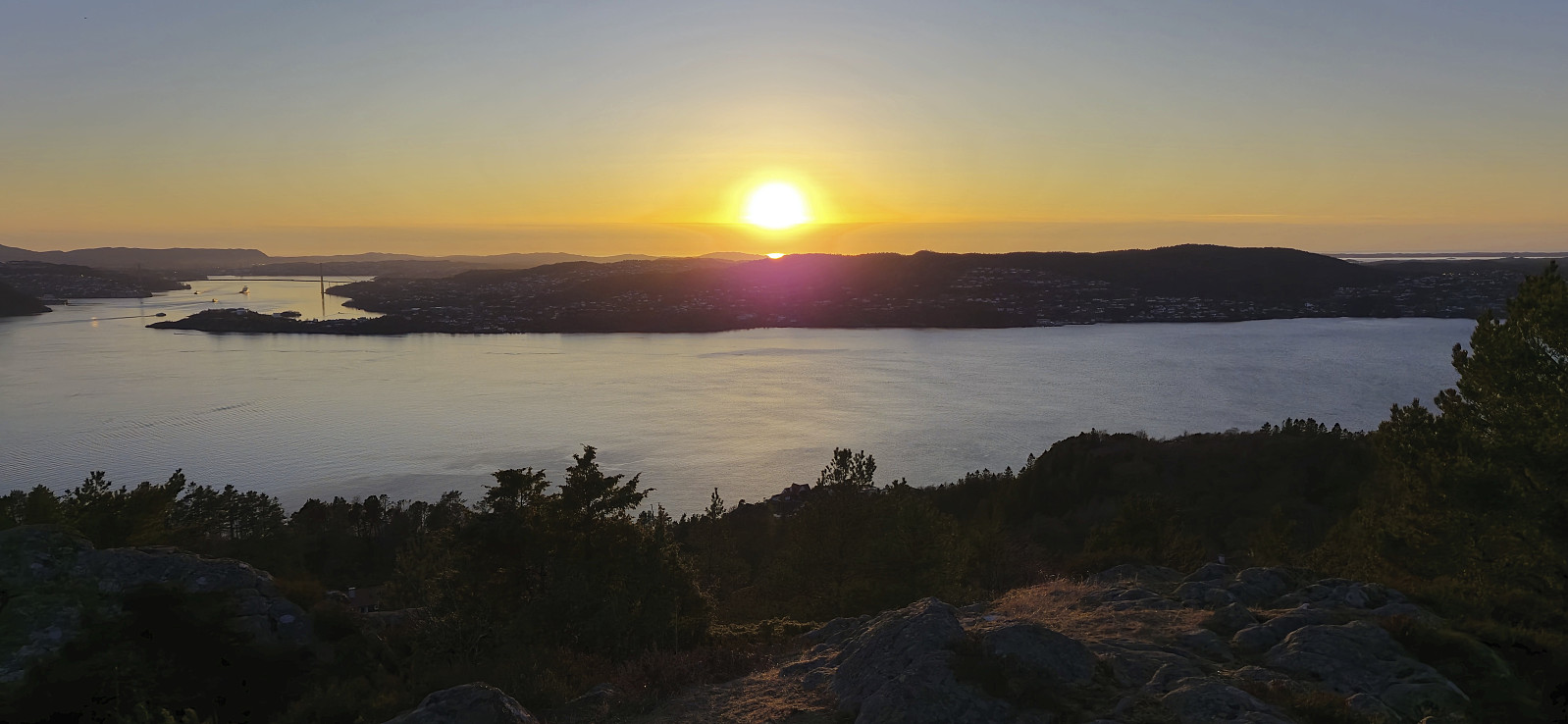
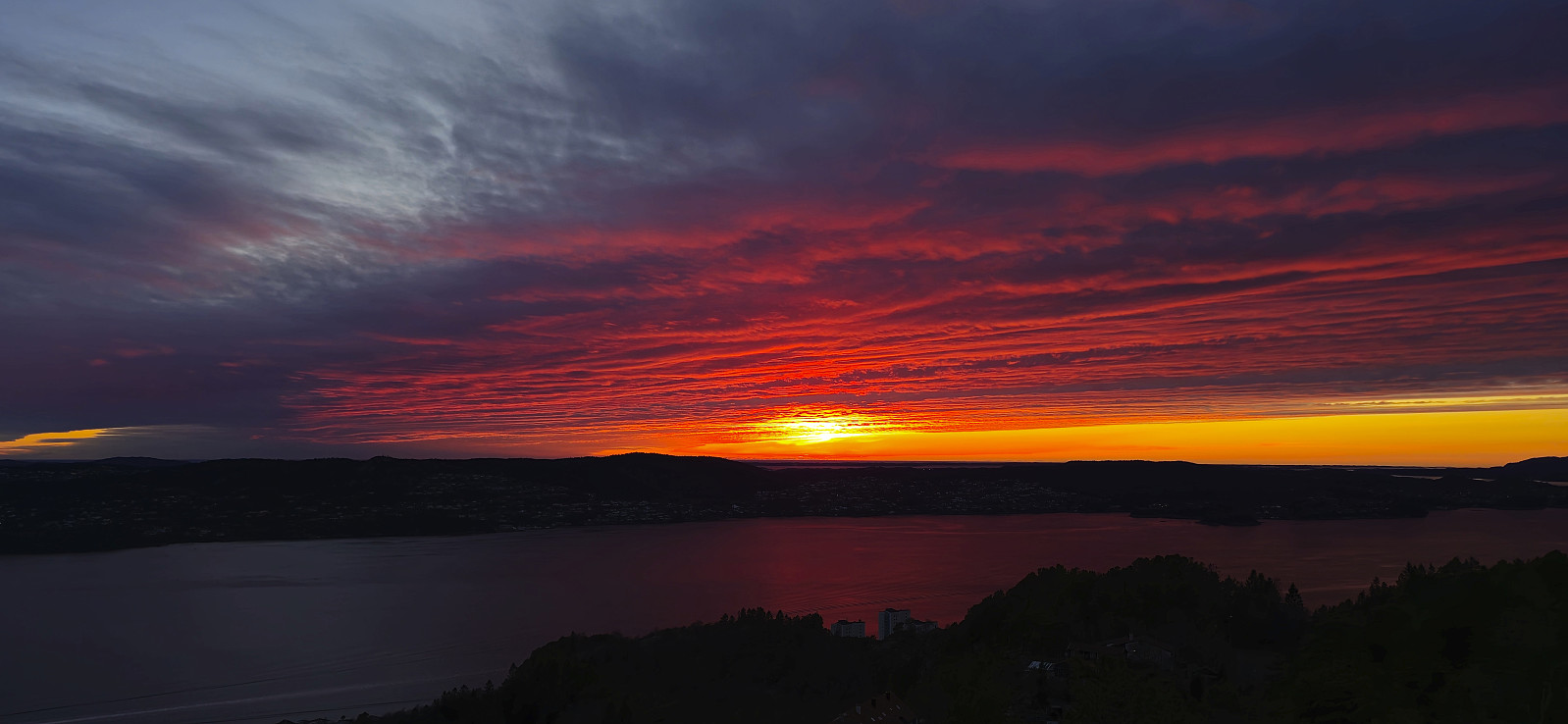 Short local evening hike to catch the sunset at Ørneberget .
Ørneberget and Hellen festning
- Datum:
- 05.03.2024
- Tourcharakter:
- Bergtour
- Tourlänge:
- 0:57h
- Entfernung:
- 4,2km
 Short local hike just before sunset.
Såta, Aurihophytta and Fedjebjørnen
- Datum:
- 03.03.2024
- Tourcharakter:
- Bergtour
- Tourlänge:
- 3:31h
- Entfernung:
- 10,4km
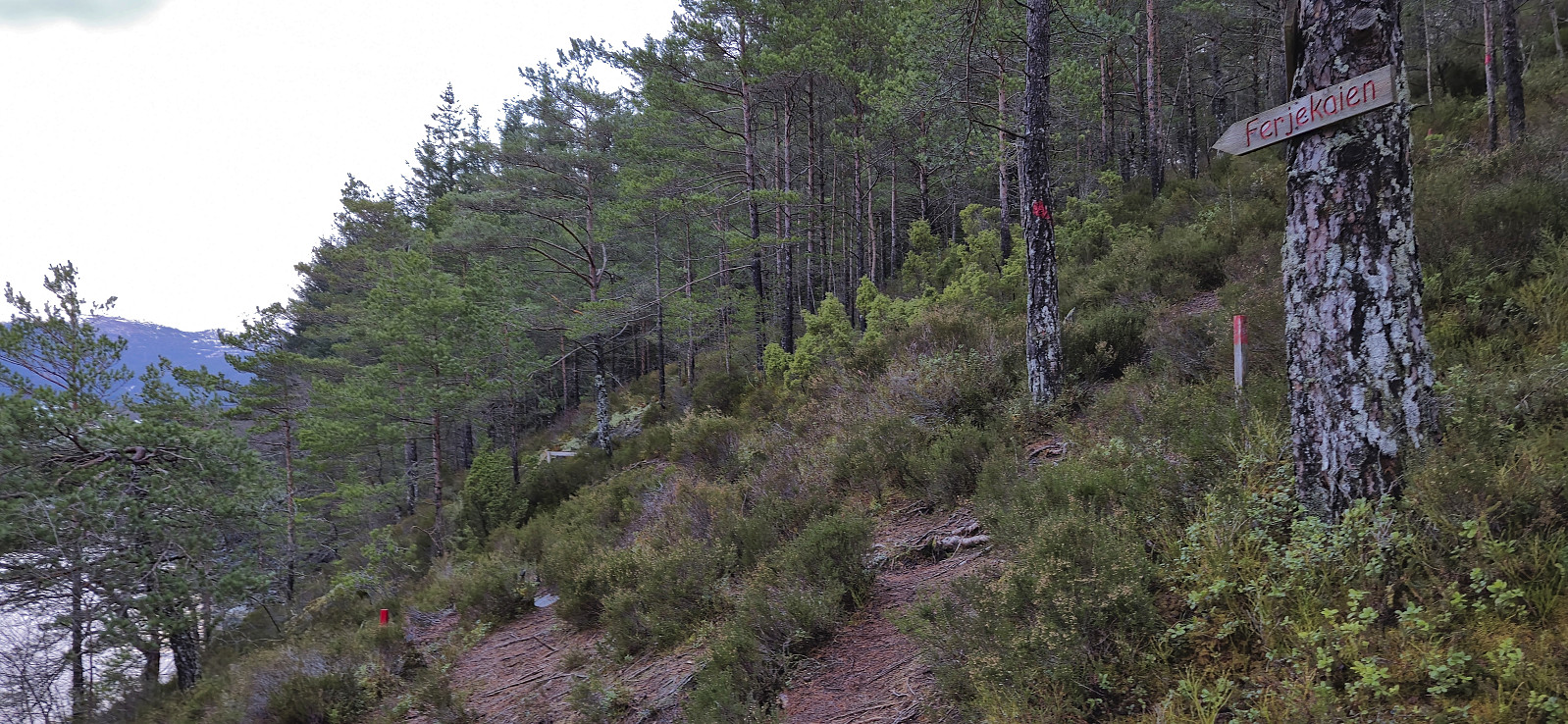
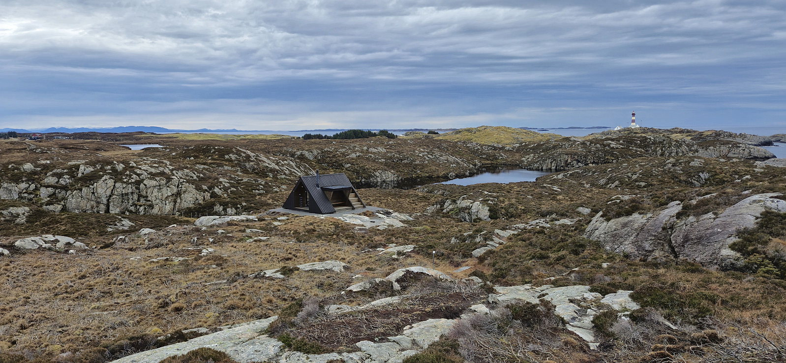 A return to Fedje with the main goal of visiting Aurihophytta , which I had not had time for during my first trip to the island back in 2021 . Decided not to repeat the very long cycling trip this time around though and instead arrived by car, which we left at Sævrøy before getting on the ferry. Minor swells but overall a smooth journey.
At Fedje, we followed the roads southwest to the marked trailhead for Aurihophytta. Here we continued on a very nice gravel-covered trail. But just as we started discussing whether it perhaps would be this easy all the way to the cabin, the marked route left the gravel and instead led us along a relatively wet trail.
We passed via Såta and continued southeast to Aurihophytta. Here we had a short lunch break before heading south to the paved road close to Hellisøy fyr . All that remained was then walking along the road back to >>>
A return to Fedje with the main goal of visiting Aurihophytta , which I had not had time for during my first trip to the island back in 2021 . Decided not to repeat the very long cycling trip this time around though and instead arrived by car, which we left at Sævrøy before getting on the ferry. Minor swells but overall a smooth journey.
At Fedje, we followed the roads southwest to the marked trailhead for Aurihophytta. Here we continued on a very nice gravel-covered trail. But just as we started discussing whether it perhaps would be this easy all the way to the cabin, the marked route left the gravel and instead led us along a relatively wet trail.
We passed via Såta and continued southeast to Aurihophytta. Here we had a short lunch break before heading south to the paved road close to Hellisøy fyr . All that remained was then walking along the road back to >>>
Vikefjell, Toraksla and Opsangerneset
- Datum:
- 25.02.2024
- Tourcharakter:
- Bergtour
- Tourlänge:
- 2:47h
- Entfernung:
- 10,1km
 Ever since Petter and I ran out of time during our visit of Halsnøy and Husnes last June, I had had plans to return to also visit Vikefjell , but this time via the express boat from Bergen. The boat took around two hours and after disembarking I followed the roads east towards the southern trailhead for Vikefjell. No sidewalks but thankfully not a lot of traffic.
The marked trailhead was easily located and I proceeded to follow an initially rather steep trail up to Søre Vikefjell where I took a short break to enjoy the excellent views. From there it was only a short distance to the highest point at Vikefjell, referred to as Nordre Vikefjell. Ok views here as well but more limited than Søre Vikefjell. I continued east along the marked trail until connecting with the gravel road in Teigadalen. Here I turned south and headed down to the main road before turning west and returning >>>
Ever since Petter and I ran out of time during our visit of Halsnøy and Husnes last June, I had had plans to return to also visit Vikefjell , but this time via the express boat from Bergen. The boat took around two hours and after disembarking I followed the roads east towards the southern trailhead for Vikefjell. No sidewalks but thankfully not a lot of traffic.
The marked trailhead was easily located and I proceeded to follow an initially rather steep trail up to Søre Vikefjell where I took a short break to enjoy the excellent views. From there it was only a short distance to the highest point at Vikefjell, referred to as Nordre Vikefjell. Ok views here as well but more limited than Søre Vikefjell. I continued east along the marked trail until connecting with the gravel road in Teigadalen. Here I turned south and headed down to the main road before turning west and returning >>>
Ørneberget and Hellen festning
- Datum:
- 21.02.2024
- Tourcharakter:
- Bergtour
- Tourlänge:
- 0:54h
- Entfernung:
- 4,0km
 Short local hike before it got dark.
Bjørnahifjellet and Utsletteslottet
- Datum:
- 17.02.2024
- Tourcharakter:
- Bergtour
- Tourlänge:
- 5:13h
- Entfernung:
- 12,6km
 A return to Stord for a visit of Bjørnahifjellet , a minor summit on the Opptur Hordaland list . I started by taking the express bus from Bergen to Leirvik where I switched to a local bus to Litlabø. After a brief exploration of some of the buildings related to the mining museum I continued on a marked route via Storsynken before leaving the mines behind and following the signs for Bjødnahiet .
Four crossings of the stream/river in Storedalen were required before getting to the marked trailhead, where only the first one was via a bridge. But thankfully the water was not very deep and there were convenient steeping stones that made it possible to cross without getting wet. More of a challenge was the snow covering the gravel road, as it was of the type that almost carried my weight but only for a second before giving way, thus resulting in a slower and tougher start >>>
A return to Stord for a visit of Bjørnahifjellet , a minor summit on the Opptur Hordaland list . I started by taking the express bus from Bergen to Leirvik where I switched to a local bus to Litlabø. After a brief exploration of some of the buildings related to the mining museum I continued on a marked route via Storsynken before leaving the mines behind and following the signs for Bjødnahiet .
Four crossings of the stream/river in Storedalen were required before getting to the marked trailhead, where only the first one was via a bridge. But thankfully the water was not very deep and there were convenient steeping stones that made it possible to cross without getting wet. More of a challenge was the snow covering the gravel road, as it was of the type that almost carried my weight but only for a second before giving way, thus resulting in a slower and tougher start >>>
