Archive - Date
Archive - Activity
-
Bike trip (108)
- Bike trip - mixed (25)
- Bike trip - road (83)
-
Drive (9)
- Car drive (9)
-
Other trip (3)
- Kayaking (3)
-
Ski trip (112)
- Backcountry skiing (66)
- Cross-country skiing (46)
- Trip by foot (1834)
Collected lists
- Utvalgte topper og turmål i Bergen
- Alle topper i Bergen
- Voss ≥ 100m pf.
- Opptur Hordaland
- Stasjoner på Bergensbanen
- Ulvik ≥ 100m pf.
- Hordaland ≥ 100m pf.
- Mjølfjell PF > 100m
- Jondal ≥ 100m pf.
- Sunnhordland PF >= 100m
- Dagsturhyttene i Vestland
- Hordaland: Hardanger PF>=100m
- DNT-hytter i Hordaland
- Kvinnherad ≥ 100m pf.
- Sogndal ≥ 100m pf.
- Vik i Sogn ≥ 100m pf.
- Gulen ≥ 100m pf.
- DNT-hytter i Sogn og Fjordane
- Eidfjord ≥ 100m pf.
- Sogn - Sør for Sognefjorden PF>=100m
Across Hellen festning
- Date:
- 21.09.2022
- Characteristic:
- Hike
- Duration:
- 0:36h
- Distance:
- 3.1km
Across Hellen festning
- Date:
- 19.09.2022
- Characteristic:
- Hike
- Duration:
- 0:43h
- Distance:
- 3.6km
Hellen festning and Furukammen
- Date:
- 14.09.2022
- Characteristic:
- Hike
- Duration:
- 2:17h
- Distance:
- 4.8km
Sandviksfjellet
- Date:
- 11.09.2022
- Characteristic:
- Hike
- Duration:
- 3:23h
- Distance:
- 13.3km
 Shorter local hike today after spending most of yesterday cycling at Tysnes .
Across Hellen festning
- Date:
- 08.09.2022
- Characteristic:
- Hike
- Duration:
- 0:36h
- Distance:
- 3.1km
Across Hellen festning
- Date:
- 01.09.2022
- Characteristic:
- Hike
- Duration:
- 0:36h
- Distance:
- 3.1km
Across Hellen festning
- Date:
- 29.08.2022
- Characteristic:
- Hike
- Duration:
- 0:30h
- Distance:
- 2.4km
Hellen festning and Furukammen
- Date:
- 24.08.2022
- Characteristic:
- Hike
- Duration:
- 0:58h
- Distance:
- 5.0km
Hellen festning and Helleneset
- Date:
- 21.08.2022
- Characteristic:
- Hike
- Duration:
- 0:49h
- Distance:
- 4.0km
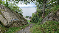 Short local Sunday hike after yesterday's long hike in Voss.
Hellen festning and Furukammen
- Date:
- 10.08.2022
- Characteristic:
- Hike
- Duration:
- 1:00h
- Distance:
- 5.0km


