Archiv - Nach Datum
Archiv - Nach Aktivität
-
Andere Tour (3)
- Kayaking (3)
-
Fahrradtour (106)
- Fahrradtour Straße (81)
- Fahrradtour gemischt (25)
-
Fahrzeugtour (9)
- Autotour (9)
-
Fußtour (1738)
- Bergtour (1029)
- Jogging (1)
- Spaziergang (52)
- Wanderung (656)
-
Skitour (109)
- Langlauf (44)
- Tourenskilauf (65)
Gesammelte Listen
-
Utvalgte topper og turmål i Bergen
(332/333)
 99%
99% -
Alle topper i Bergen
(379/386)
98%
-
Kvam ≥ 100m pf.
(41/44)
93%
-
Opptur Hordaland
(143/159)
89%
-
Voss ≥ 100m pf.
(84/98)
85%
-
Stasjoner på Bergensbanen
(28/36)
77%
-
Hordaland ≥ 100m pf.
(587/863)
68%
-
Ulvik ≥ 100m pf.
(24/38)
63%
-
Jondal ≥ 100m pf.
(13/23)
56%
-
Dagsturhyttene i Vestland
(33/61)
54%
-
Sunnhordland PF >= 100m
(99/186)
53%
-
DNT-hytter i Hordaland
(22/45)
48%
-
Hordaland: Hardanger PF>=100m
(164/359)
45%
-
Kvinnherad ≥ 100m pf.
(35/79)
44%
-
Sogndal ≥ 100m pf.
(23/81)
28%
-
DNT-hytter i Sogn og Fjordane
(8/47)
17%
-
Eidfjord ≥ 100m pf.
(6/42)
14%
-
Etne ≥ 100m pf.
(7/51)
13%
-
Ullensvang ≥ 100m pf.
(17/153)
11%
-
Opptur i Sogn og Fjordane peaks
(17/177)
9%

Bergesfjellet
- Datum:
- 28.07.2022
- Tourcharakter:
- Bergtour
- Tourlänge:
- 0:31h
- Entfernung:
- 1,5km
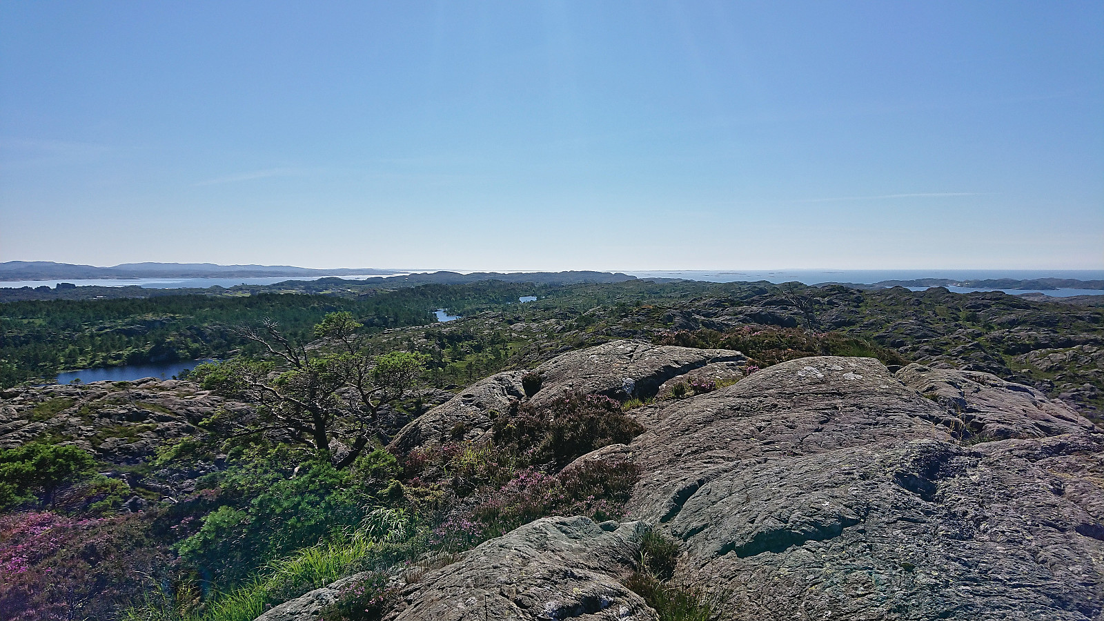
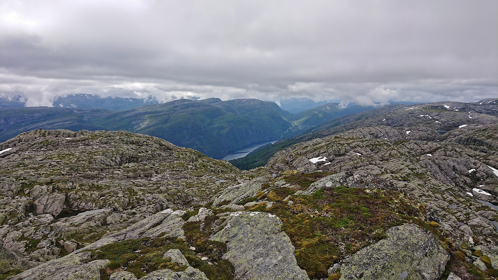
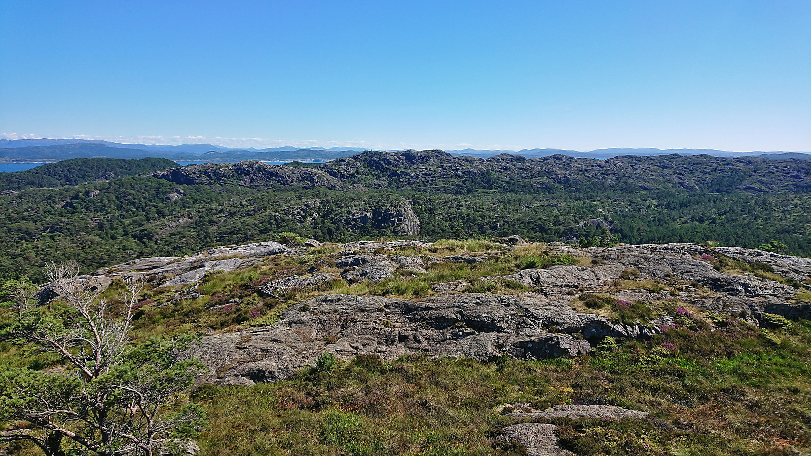 After visiting Mørkadalsfjellet and Gåsafjellet , it was now time for the final ascent of the day: Bergesfjellet . I again left my bike at the marked trailhead and followed the trail northeast. First along a low stone fence next to a field, then across the field and through a gate, before staring the steep but short ascent. Within 15 minutes I arrived at the trig marker at the summit and could briefly enjoy the excellent views before quickly starting my descent along the same route. I had a boat to catch back at Rubbestadneset after all !
Gåsafjellet from Vedvikevatnet
- Datum:
- 28.07.2022
- Tourcharakter:
- Bergtour
- Tourlänge:
- 1:11h
- Entfernung:
- 3,9km
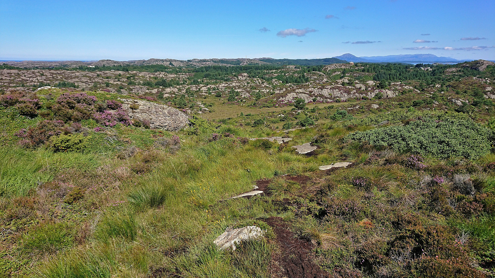
 After leaving the bike behind at the unmarked trailhead for Gåsafjellet , I continued on foot along a grass-covered tractor road taking me to northwest of Sætradalstjørna. While there had been a couple of red markers on trees next to the tractor road, the trail here first seemed to come to an end. But after a bit of searching I spotted one more red marker to the southwest and soon another would appear as well. There was even a relatively clear trail that could be followed. This would however not last long, and soon I was left finding my own way towards the summit.
Plenty of small hills at the summit area, some of them with their own small cairns, but the highest one was easy to spot. Or at least I thought so until standing on top of it and starting to wonder if the one just to the north could potentially be slightly higher? >>>
After leaving the bike behind at the unmarked trailhead for Gåsafjellet , I continued on foot along a grass-covered tractor road taking me to northwest of Sætradalstjørna. While there had been a couple of red markers on trees next to the tractor road, the trail here first seemed to come to an end. But after a bit of searching I spotted one more red marker to the southwest and soon another would appear as well. There was even a relatively clear trail that could be followed. This would however not last long, and soon I was left finding my own way towards the summit.
Plenty of small hills at the summit area, some of them with their own small cairns, but the highest one was easy to spot. Or at least I thought so until standing on top of it and starting to wonder if the one just to the north could potentially be slightly higher? >>>
Mørkadalsfjellet
- Datum:
- 28.07.2022
- Tourcharakter:
- Bergtour
- Tourlänge:
- 1:01h
- Entfernung:
- 3,7km
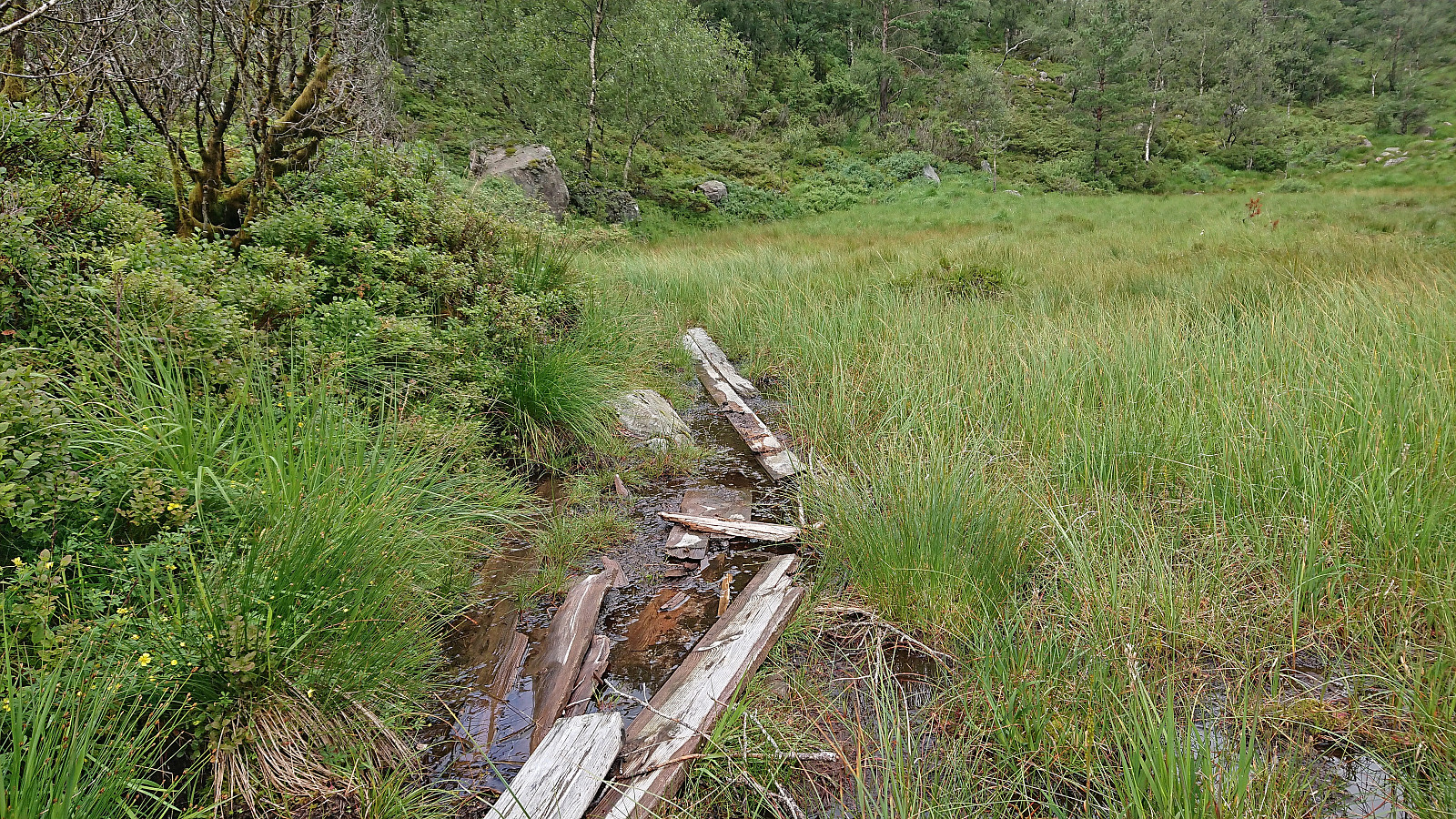
 After leaving my bike behind at the marked trailhead , I continued on foot along the trail to Mørkadalsfjellet . First a short stretch through a forest and along a stone fence, before the terrain opened up and the summit could be spotted in the distance. Plenty of wet and muddy sections along the way, but thanks to lots of wooden objects of different types and sizes covering the worst parts of the trail I managed to stay relatively dry and mud-free even though I was only wearing sneakers. The summit provided excellent panoramic views, explaining why it previously had been used as an observation station for the Norwegian coast guard. After a couple of pictures I returned along the same route.
Vardefjellet and Kalnesnuten from Mjanger
- Datum:
- 27.07.2022
- Tourcharakter:
- Bergtour
- Tourlänge:
- 4:26h
- Entfernung:
- 12,3km
 I started by taking the bus to Mjanger and got off at the stop "Mjanger, vest". After a short walk along the road in between the houses I passed through a gate and continued north on a tractor road that later turned in to a trail taking me all the way to Mjangerssetret . Here there was a trail sign for Hellebergsåta, but even though there were a couple of trail markers early on, the trail quickly disappeared and I was left finding my own way.
Before arriving at Hellebergsåta, it started to rain and the low-hanging clouds started looking more like fog. I could therefore not yet spot the main goal of the day to the northeast, namely Vardefjellet . Båthaugen could however be located and I headed there first. Note that basically every small hill in this area seemed to contain its own cairn, hence finding the right >>>
I started by taking the bus to Mjanger and got off at the stop "Mjanger, vest". After a short walk along the road in between the houses I passed through a gate and continued north on a tractor road that later turned in to a trail taking me all the way to Mjangerssetret . Here there was a trail sign for Hellebergsåta, but even though there were a couple of trail markers early on, the trail quickly disappeared and I was left finding my own way.
Before arriving at Hellebergsåta, it started to rain and the low-hanging clouds started looking more like fog. I could therefore not yet spot the main goal of the day to the northeast, namely Vardefjellet . Båthaugen could however be located and I headed there first. Note that basically every small hill in this area seemed to contain its own cairn, hence finding the right >>>
Helleneset and Hellen festning
- Datum:
- 25.07.2022
- Tourcharakter:
- Wanderung
- Tourlänge:
- 0:55h
- Entfernung:
- 4,3km
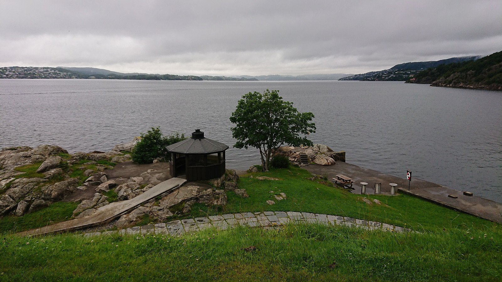 Short local hike on a gray and rainy Monday.
Across Hellen festning
- Datum:
- 24.07.2022
- Tourcharakter:
- Wanderung
- Tourlänge:
- 0:37h
- Entfernung:
- 3,2km
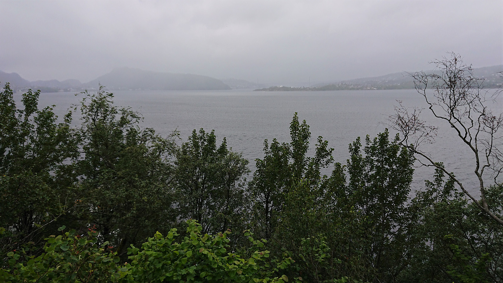 Short local hike avoiding the worst of the rain showers on a gray and wet Sunday.
Hornafjellet and Nipekråni
- Datum:
- 22.07.2022
- Tourcharakter:
- Bergtour
- Tourlänge:
- 6:57h
- Entfernung:
- 15,8km
 Another day of hiking with petter (Petter Bjørstad) , this time using Mo as our starting point. We had initially thought to first ascend to Mostølen via the trail from Mo. But after coming across a recommendation by Nordhordland Turlag to rather use the marked trail starting from the northern end of Modalstunnelen, and describing the trail from Mo as steep and unstable, we changed our plans and went for this alternative route instead.
We parked just outside the tunnel and easily located the marked trailhead about 150 meters to the northwest. While the trailhead was indicated by a total of three different signs, the start of the trail itself was however much more modest. This would nevertheless soon improve as the trail started winding its way up the steep ascent between the trees. Further up the trail again turned weak at times, especially when crossing wet areas, but there were most >>>
Another day of hiking with petter (Petter Bjørstad) , this time using Mo as our starting point. We had initially thought to first ascend to Mostølen via the trail from Mo. But after coming across a recommendation by Nordhordland Turlag to rather use the marked trail starting from the northern end of Modalstunnelen, and describing the trail from Mo as steep and unstable, we changed our plans and went for this alternative route instead.
We parked just outside the tunnel and easily located the marked trailhead about 150 meters to the northwest. While the trailhead was indicated by a total of three different signs, the start of the trail itself was however much more modest. This would nevertheless soon improve as the trail started winding its way up the steep ascent between the trees. Further up the trail again turned weak at times, especially when crossing wet areas, but there were most >>>
Høganipa and Skavlabu
- Datum:
- 21.07.2022
- Tourcharakter:
- Bergtour
- Tourlänge:
- 2:10h
- Entfernung:
- 8,0km
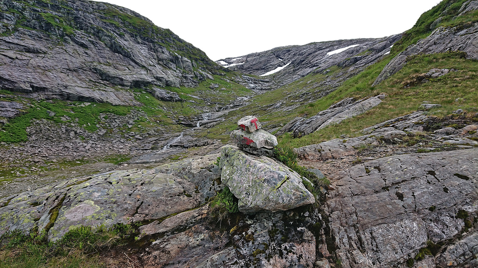 After ascending Vetlevasseggi and Torrisskarfjellet , me and petter (Petter Bjørstad) drove the short distance to the parking lot at Svartavatnet and from there started on the marked trail to Skavlabu . When getting to the third small lake in between the two larger 868 and 916 lakes we started looking for the trail towards the summit of Høganipa that was indicated on the map. If there were any traces of this trail they were very weak, but we would later come across small cairns that seemed to be heading in the right direction that we partially followed. In any case the terrain was easy to navigate and did not present any challenges.
Upon getting closer to the summit we connected with the marked trail to Skavlabu and could follow the red T's for the final few meters. The summit was marked by a small cairn that mainly functioned as a trail marker for the trail to Skavlabu and did not mention that it >>>
After ascending Vetlevasseggi and Torrisskarfjellet , me and petter (Petter Bjørstad) drove the short distance to the parking lot at Svartavatnet and from there started on the marked trail to Skavlabu . When getting to the third small lake in between the two larger 868 and 916 lakes we started looking for the trail towards the summit of Høganipa that was indicated on the map. If there were any traces of this trail they were very weak, but we would later come across small cairns that seemed to be heading in the right direction that we partially followed. In any case the terrain was easy to navigate and did not present any challenges.
Upon getting closer to the summit we connected with the marked trail to Skavlabu and could follow the red T's for the final few meters. The summit was marked by a small cairn that mainly functioned as a trail marker for the trail to Skavlabu and did not mention that it >>>
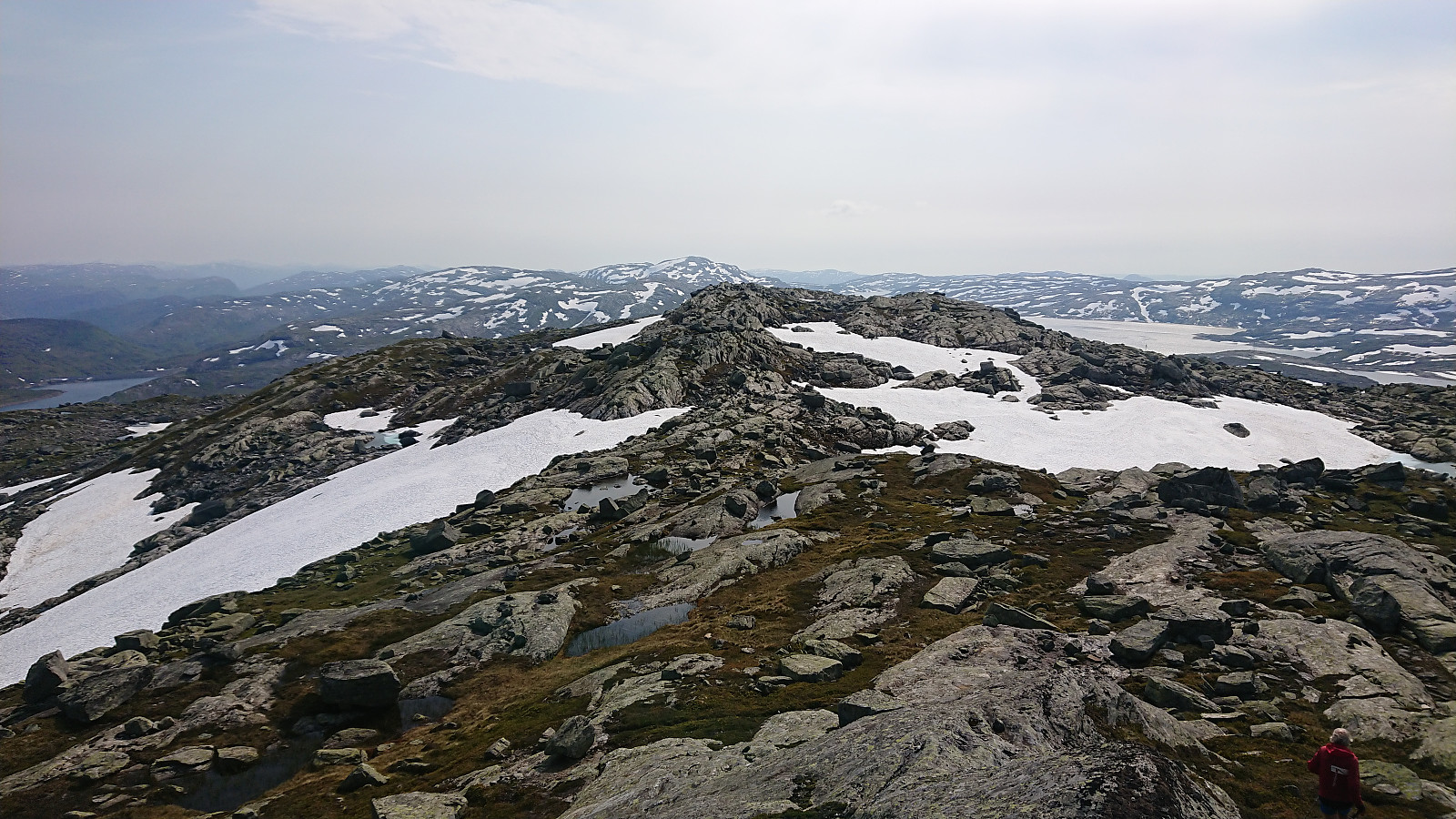
Vetlevassegga and Torrisskarfjellet
- Datum:
- 21.07.2022
- Tourcharakter:
- Bergtour
- Tourlänge:
- 2:55h
- Entfernung:
- 7,6km
 A return to Storavatnet towards the end of the long gravel road up from the south end of Masfjordtunnelen. This time, me and petter (Petter Bjørstad) were focusing on summits on the south side of the lake. We parked next to the road at one of the marked trailheads for Skavlabu at the southern tip of Storavatnet. Here there was room for one car. There was however lots of parking options just before this location as well.
Our first goal was Vetlevassegga , hence we immediately ditched the marked trail and headed off-trail in the direction of the summit. A steep start of the day but otherwise straightforward and we soon arrived the summit without any issues. The summit area consisted of small hills of similar heights, with the northeastern one being ever so slightly higher. Nice views from the summit, although quite reduced by the low-hanging >>>
A return to Storavatnet towards the end of the long gravel road up from the south end of Masfjordtunnelen. This time, me and petter (Petter Bjørstad) were focusing on summits on the south side of the lake. We parked next to the road at one of the marked trailheads for Skavlabu at the southern tip of Storavatnet. Here there was room for one car. There was however lots of parking options just before this location as well.
Our first goal was Vetlevassegga , hence we immediately ditched the marked trail and headed off-trail in the direction of the summit. A steep start of the day but otherwise straightforward and we soon arrived the summit without any issues. The summit area consisted of small hills of similar heights, with the northeastern one being ever so slightly higher. Nice views from the summit, although quite reduced by the low-hanging >>>
Askjellfjellet
- Datum:
- 19.07.2022
- Tourcharakter:
- Bergtour
- Tourlänge:
- 1:33h
- Entfernung:
- 5,2km
 After our visits of Sørdalsfjellet, Hornafjellet and Gavlafjellet , petter (Petter Bjørstad) and I drove the short distance to Skjerjavatnet where we parked at a gravel-covered area right next to the road. Petter immediately started his ascent of Askjellfjellet while I first changed into shorts and sneakers as the until now rather unstable weather finally had decided to stay warm and sunny. We therefore followed slightly different ascent routes and did meet up until almost at the summit. In any case, it was more or less a matter of simply following the ridge until arriving at the large cairn, and with no difficult sections to speak of. After the mandatory summit pictures, we returned together along more or less the same route as I had used for my ascent, thus concluding an excellent day of hiking in Modalen with a total of four new summits added to the list of visited summits >>>
