Arkiv - dato
Arkiv - aktivitet
-
Annen tur (3)
- Kajakkpadling (3)
- Fottur (1897)
-
Kjøretur (9)
- Biltur (9)
-
Skitur (116)
- Fjellskitur (69)
- Langrennstur (47)
-
Sykkeltur (111)
- Blandet sykling (25)
- Gatesykling (86)
Lister jeg samler etter
-
Utvalgte topper og turmål i Bergen
(349/351)
 99%
99% -
Alle topper i Bergen
(393/400)
98%
-
Voss ≥ 100m pf.
(96/98)
97%
-
Opptur Hordaland
(144/159)
90%
-
Stasjoner på Bergensbanen
(33/40)
82%
-
Ulvik ≥ 100m pf.
(30/38)
78%
-
Hordaland ≥ 100m pf.
(624/863)
72%
-
Mjølfjell PF > 100m
(21/31)
67%
-
Jondal ≥ 100m pf.
(15/23)
65%
-
Dagsturhyttene i Vestland
(36/61)
59%
-
Sunnhordland PF >= 100m
(105/186)
56%
-
Hordaland: Hardanger PF>=100m
(196/359)
54%
-
DNT-hytter i Hordaland
(23/45)
51%
-
Kvinnherad ≥ 100m pf.
(40/79)
50%
-
Eidfjord ≥ 100m pf.
(13/42)
30%
-
Sogndal ≥ 100m pf.
(23/81)
28%
-
Gulen ≥ 100m pf.
(15/54)
27%
-
Vik i Sogn ≥ 100m pf.
(10/46)
21%
-
Sogn - Sør for Sognefjorden PF>=100m
(31/159)
19%
-
DNT-hytter i Sogn og Fjordane
(8/47)
17%

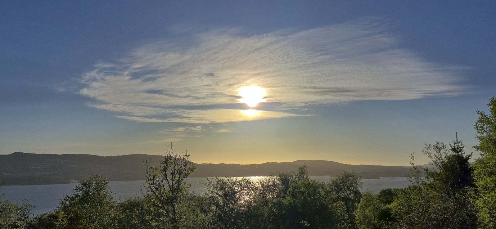
Helleneset and Hellen festning
- Dato:
- 31.05.2025
- Turtype:
- Fottur
- Turlengde:
- 1:30t
- Distanse:
- 4,6km
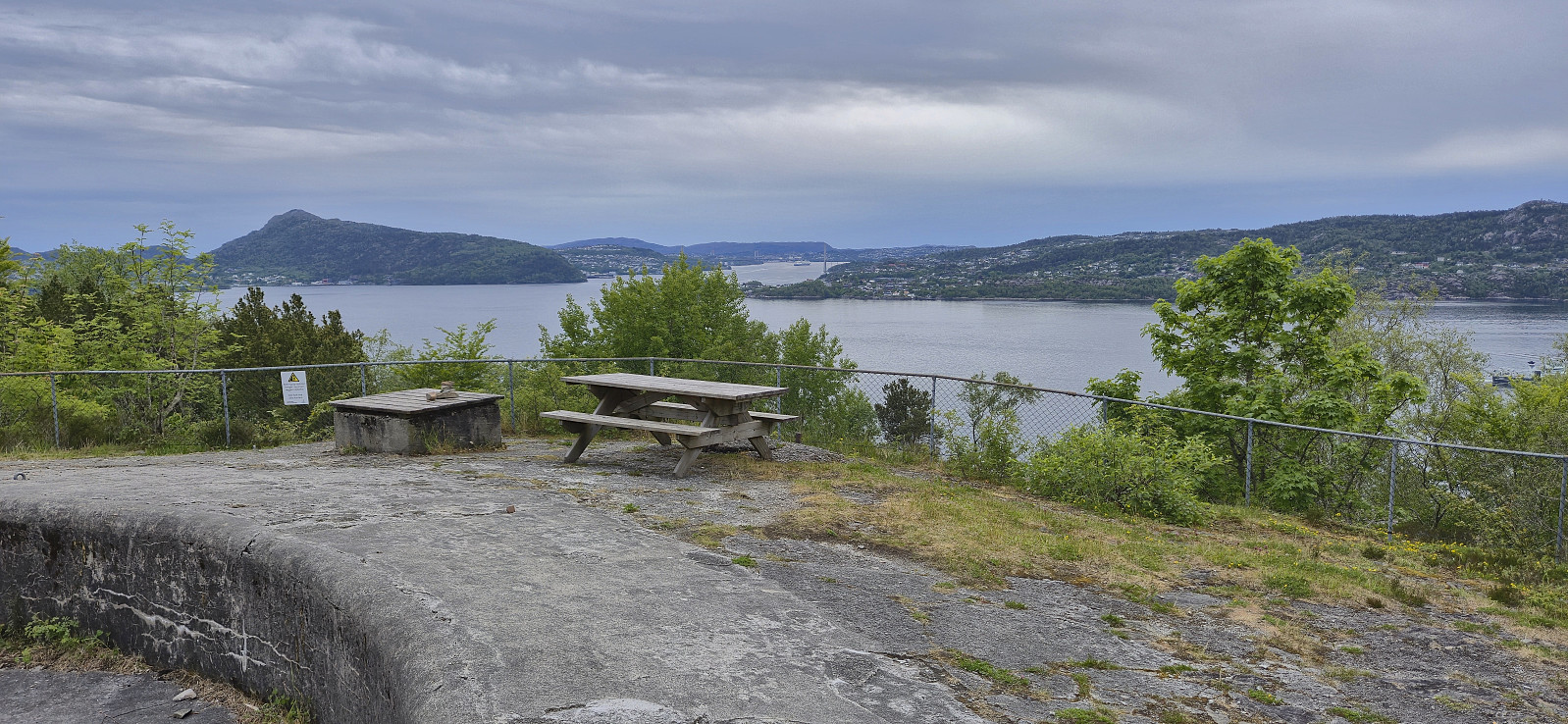 Short local Saturday hike, partly joined by my mother and my oldest nephew.
Klettenhytta, Høgehaugen, Veten and Brurahornet
- Dato:
- 30.05.2025
- Turtype:
- Fjelltur
- Turlengde:
- 7:40t
- Distanse:
- 18,7km
 On my way from Trondheim to Bergen , I woke up at Kystruten at 04:50 such that I would be ready to disembark when we arrived at Måløy at 05:45. As I was the only passenger leaving the boat at this location, I was led down to a smaller side exit. This made me feel a bit like I was part of 71 Grader Nord , although thankfully I could simply walk off the boat and not swim to the shore as the contestants sometimes have had to do. ;)
It had been too early for breakfast to be served on the boat and with the shops not opening for at least another hour, I decided to have a shorter warm up and therefore first headed for Klettenhytta . This also allowed me to get used to my rather heavy backpack before starting the upcoming longer and steeper ascents.
After crossing Måløybrua I located the marked trailhead for Klettenhytta and easily followed the relatively >>>
On my way from Trondheim to Bergen , I woke up at Kystruten at 04:50 such that I would be ready to disembark when we arrived at Måløy at 05:45. As I was the only passenger leaving the boat at this location, I was led down to a smaller side exit. This made me feel a bit like I was part of 71 Grader Nord , although thankfully I could simply walk off the boat and not swim to the shore as the contestants sometimes have had to do. ;)
It had been too early for breakfast to be served on the boat and with the shops not opening for at least another hour, I decided to have a shorter warm up and therefore first headed for Klettenhytta . This also allowed me to get used to my rather heavy backpack before starting the upcoming longer and steeper ascents.
After crossing Måløybrua I located the marked trailhead for Klettenhytta and easily followed the relatively >>>
Varden i Kristiansund
- Dato:
- 29.05.2025
- Turtype:
- Fottur
- Turlengde:
- 0:31t
- Distanse:
- 2,7km
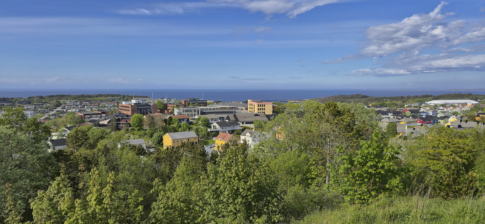 After spending an extra night in Trondheim to get the time to visit Storheia , it was time to put into motion my unusual plan of how to return to Bergen. The first part was easy enough: check out of the hotel, walk the short distance north to Pir 1, and embark on Kystruten. Here I could enjoy the scenic views as I slowly made my way south. A bit too slowly for my taste, hence I could not resist the chance to get off the boat when we had a 1 hour stop in Kristiansund.
Given the time constrains I settled on Varden i Kristiansund . From the boat I simply followed various streets up to the tower standing at the highest point, which provided an excellent 360 degrees view. Even better from the top of the tower itself. I returned the same way and got back on the boat around 15 minutes before it continued south to Molde.
After a night on the boat, I was ready >>>
After spending an extra night in Trondheim to get the time to visit Storheia , it was time to put into motion my unusual plan of how to return to Bergen. The first part was easy enough: check out of the hotel, walk the short distance north to Pir 1, and embark on Kystruten. Here I could enjoy the scenic views as I slowly made my way south. A bit too slowly for my taste, hence I could not resist the chance to get off the boat when we had a 1 hour stop in Kristiansund.
Given the time constrains I settled on Varden i Kristiansund . From the boat I simply followed various streets up to the tower standing at the highest point, which provided an excellent 360 degrees view. Even better from the top of the tower itself. I returned the same way and got back on the boat around 15 minutes before it continued south to Molde.
After a night on the boat, I was ready >>>
Storheia from Skistua
- Dato:
- 28.05.2025
- Turtype:
- Fjelltur
- Turlengde:
- 2:43t
- Distanse:
- 9,6km
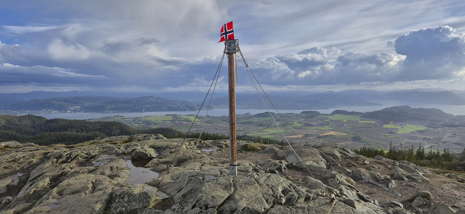 When a two-day meeting in Trondheim ended I stayed behind one more night such that I could include a short hike as well. The choice landed on Storheia and me and a colleague of mine took the bus from the city center to Skistua to begin our hike.
It however did not take long before we heard thunder rolling in the distance and we decided to find shelter from the accompanying light rain east of Vintervatnet. But after concluding that the thunder was not getting any closer, we left the shelter and continued towards the summit.
The light rain would come and go for the remainder of the hike with the occasional distant thunder but as we approached the highest point there was blue sky above us and even a bit of sunshine. After a couple of pictures we returned the same way and headed for the bus stop at Fjellseterveien, >>>
When a two-day meeting in Trondheim ended I stayed behind one more night such that I could include a short hike as well. The choice landed on Storheia and me and a colleague of mine took the bus from the city center to Skistua to begin our hike.
It however did not take long before we heard thunder rolling in the distance and we decided to find shelter from the accompanying light rain east of Vintervatnet. But after concluding that the thunder was not getting any closer, we left the shelter and continued towards the summit.
The light rain would come and go for the remainder of the hike with the occasional distant thunder but as we approached the highest point there was blue sky above us and even a bit of sunshine. After a couple of pictures we returned the same way and headed for the bus stop at Fjellseterveien, >>>
Bybrua and Nidarosdomen
- Dato:
- 27.05.2025
- Turtype:
- Spasertur
- Turlengde:
- 1:35t
- Distanse:
- 4,3km
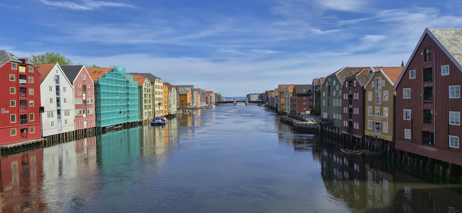 Short sightseeing trip before attending a two-day meeting in Trondheim.
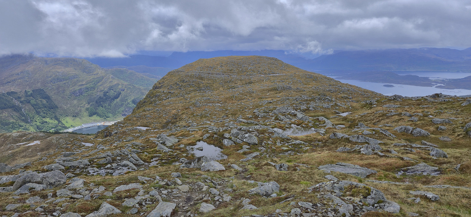
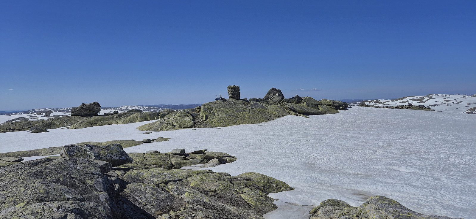
Blånipa from Krosstølen p-plass
- Dato:
- 24.05.2025
- Turtype:
- Fjelltur
- Turlengde:
- 3:32t
- Distanse:
- 10,2km
 After ascending Sørskarfjellet , Endre and I drove north to Krosstølen p-plass and from there followed the marked trail to Blånipa . The markers were however not always the easiest to spot and we had to check with the GPS on multiple occasions to ensure that we were on the right track. As we got closer to the summit the route marked with blue paint also deviated quite a bit from the trail indicated on the map.
The summit was still reached without any real difficulties and we could enjoy the excellent views, even though we saw very little of the promised sunshine. In any case, the freezing wind made for a short stop and we did not stay long before descending along the alternative trail heading southwest and then north from the summit.
The marking of the descent trail was also rather inconsistent and without a GPS it would probably have been more difficult, >>>
After ascending Sørskarfjellet , Endre and I drove north to Krosstølen p-plass and from there followed the marked trail to Blånipa . The markers were however not always the easiest to spot and we had to check with the GPS on multiple occasions to ensure that we were on the right track. As we got closer to the summit the route marked with blue paint also deviated quite a bit from the trail indicated on the map.
The summit was still reached without any real difficulties and we could enjoy the excellent views, even though we saw very little of the promised sunshine. In any case, the freezing wind made for a short stop and we did not stay long before descending along the alternative trail heading southwest and then north from the summit.
The marking of the descent trail was also rather inconsistent and without a GPS it would probably have been more difficult, >>>
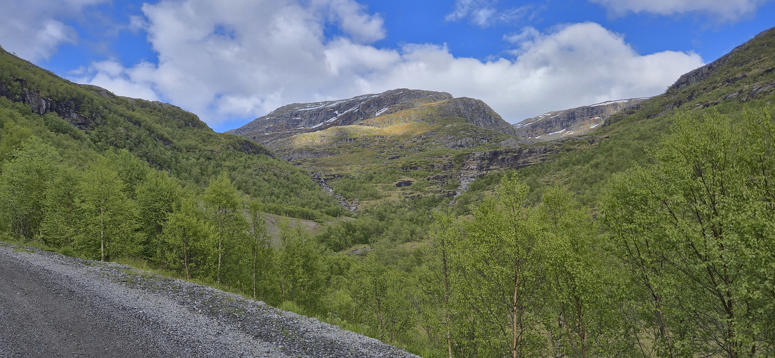
Sørskarfjellet via Tveradalsstølen
- Dato:
- 24.05.2025
- Turtype:
- Fjelltur
- Turlengde:
- 2:41t
- Distanse:
- 7,0km
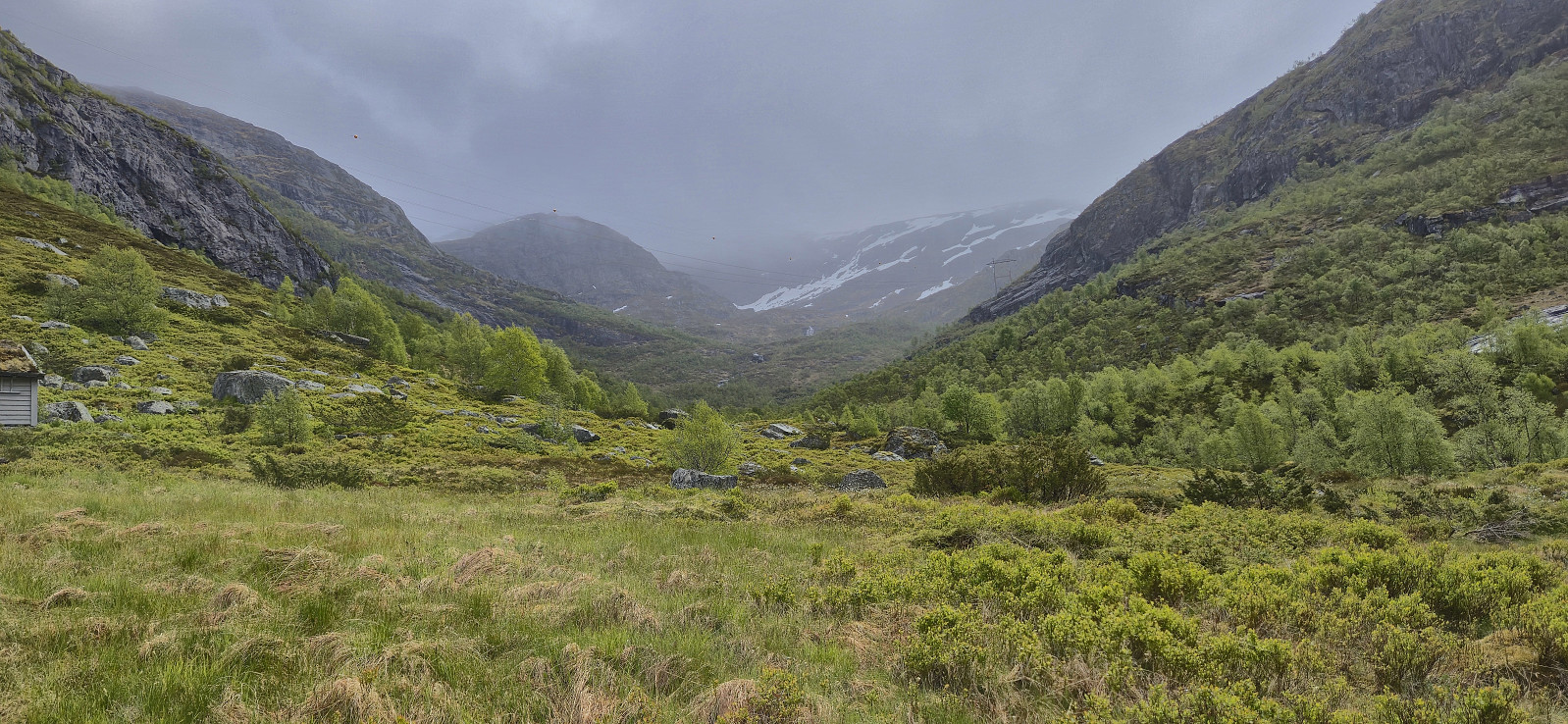 On the way home from our Friday evening hike to Noltane , Endre and I noticed that the weather forecast for the following day now suddenly looked much better. We therefore decided to have a go at the final two peaks I had left in Modalen. When Endre picked me up the morning after the weather had however changed again and during our drive to Modalen it was rather gray and we even had the occasional light rain shower.
The forecast said that the weather was going to improve later in the afternoon though, so in order to postpone the start of our real hike, we made a short stop in Romarheim on the way such that Endre could ascend Almeskila . I had already visited Almeskila back in 2019 and therefore waited in the car until Endre returned around 45 minutes later and we then continued the drive to Modalen.
Upon arriving at the small parking lot north of Sørskarfjellet the weather was not much better though and >>>
On the way home from our Friday evening hike to Noltane , Endre and I noticed that the weather forecast for the following day now suddenly looked much better. We therefore decided to have a go at the final two peaks I had left in Modalen. When Endre picked me up the morning after the weather had however changed again and during our drive to Modalen it was rather gray and we even had the occasional light rain shower.
The forecast said that the weather was going to improve later in the afternoon though, so in order to postpone the start of our real hike, we made a short stop in Romarheim on the way such that Endre could ascend Almeskila . I had already visited Almeskila back in 2019 and therefore waited in the car until Endre returned around 45 minutes later and we then continued the drive to Modalen.
Upon arriving at the small parking lot north of Sørskarfjellet the weather was not much better though and >>>
Noltane via Mælandsstølen
- Dato:
- 23.05.2025
- Turtype:
- Fjelltur
- Turlengde:
- 2:54t
- Distanse:
- 7,9km
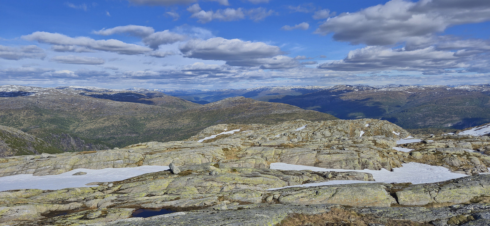 Started the weekend early to take advantage of what looked like the last day of great hiking weather for a while. Endre picked me up at my place shortly before three and together we drove to Øvstedalen north of Bolstadøyri. Here we parked at a small parking lot southwest from Mæland and started on the tractor road indicated on the map. This turned out to be a marked trail that took us all the way to Mælandsstølen .
Here the trail ended but it was straightforward to ascend the rest of the way to the summit in open terrain. On our way to the highest point we passed by Rjupetjørni and after crossing a couple of patches of snow we arrived at the unmarked summit of Noltane . After a short break to enjoy the excellent panoramic views we descended along the same route.
In summary, a great hike with excellent views that can be highly recommended. (Note that the gravel >>>
Started the weekend early to take advantage of what looked like the last day of great hiking weather for a while. Endre picked me up at my place shortly before three and together we drove to Øvstedalen north of Bolstadøyri. Here we parked at a small parking lot southwest from Mæland and started on the tractor road indicated on the map. This turned out to be a marked trail that took us all the way to Mælandsstølen .
Here the trail ended but it was straightforward to ascend the rest of the way to the summit in open terrain. On our way to the highest point we passed by Rjupetjørni and after crossing a couple of patches of snow we arrived at the unmarked summit of Noltane . After a short break to enjoy the excellent panoramic views we descended along the same route.
In summary, a great hike with excellent views that can be highly recommended. (Note that the gravel >>>
Across Hellen festning
- Dato:
- 20.05.2025
- Turtype:
- Fottur
- Turlengde:
- 0:37t
- Distanse:
- 3,1km
 Short local evening hike.
Gråsida from Nygard
- Dato:
- 18.05.2025
- Turtype:
- Fjelltur
- Turlengde:
- 6:25t
- Distanse:
- 10,6km
 A return to Modalen to ascend Gråsida . We found parking next to the bridge separating Midvatnet and Åbotnsvatnet, and from there walked the short distance along the road to the marked trailhead for Gråsida and Vardadalsbu . The start of the trail itself was however a bit unclear but we soon found the red T's and from there on it was relatively straightforward to follow the marked trail almost all the way to the summit.
As expected there were a couple of steep sections on the way but overall the trail did a great job at winding its way upwards. It is worth noting that the marked trail deviated quite a lot from the trail outlined on the map though. South of Rusta we had to cross a stream to continue on the marked trail on the other side. In order to avoid getting our shoes wet we made a minor detour before reconnecting >>>
A return to Modalen to ascend Gråsida . We found parking next to the bridge separating Midvatnet and Åbotnsvatnet, and from there walked the short distance along the road to the marked trailhead for Gråsida and Vardadalsbu . The start of the trail itself was however a bit unclear but we soon found the red T's and from there on it was relatively straightforward to follow the marked trail almost all the way to the summit.
As expected there were a couple of steep sections on the way but overall the trail did a great job at winding its way upwards. It is worth noting that the marked trail deviated quite a lot from the trail outlined on the map though. South of Rusta we had to cross a stream to continue on the marked trail on the other side. In order to avoid getting our shoes wet we made a minor detour before reconnecting >>>
