Archiv - Nach Datum
Archiv - Nach Aktivität
-
Andere Tour (3)
- Kayaking (3)
-
Fahrradtour (111)
- Fahrradtour Straße (86)
- Fahrradtour gemischt (25)
-
Fahrzeugtour (9)
- Autotour (9)
-
Fußtour (1897)
- Bergtour (1120)
- Jogging (1)
- Spaziergang (60)
- Wanderung (716)
-
Skitour (116)
- Langlauf (47)
- Tourenskilauf (69)
Gesammelte Listen
-
Utvalgte topper og turmål i Bergen
(349/351)
 99%
99% -
Alle topper i Bergen
(393/400)
98%
-
Voss ≥ 100m pf.
(96/98)
97%
-
Opptur Hordaland
(144/159)
90%
-
Stasjoner på Bergensbanen
(33/40)
82%
-
Ulvik ≥ 100m pf.
(30/38)
78%
-
Hordaland ≥ 100m pf.
(624/863)
72%
-
Mjølfjell PF > 100m
(21/31)
67%
-
Jondal ≥ 100m pf.
(15/23)
65%
-
Dagsturhyttene i Vestland
(36/61)
59%
-
Sunnhordland PF >= 100m
(105/186)
56%
-
Hordaland: Hardanger PF>=100m
(196/359)
54%
-
DNT-hytter i Hordaland
(23/45)
51%
-
Kvinnherad ≥ 100m pf.
(40/79)
50%
-
Eidfjord ≥ 100m pf.
(13/42)
30%
-
Sogndal ≥ 100m pf.
(23/81)
28%
-
Gulen ≥ 100m pf.
(15/54)
27%
-
Vik i Sogn ≥ 100m pf.
(10/46)
21%
-
Sogn - Sør for Sognefjorden PF>=100m
(31/159)
19%
-
DNT-hytter i Sogn og Fjordane
(8/47)
17%

Tvindefossen
- Datum:
- 16.06.2024
- Tourcharakter:
- Autotour
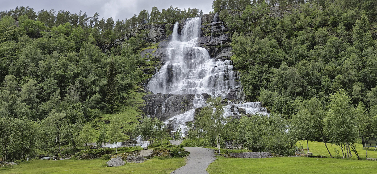 Short visit when driving home to Bergen from a weekend in Myrkdalen.
Svolefjellet from Myrkdalen
- Datum:
- 15.06.2024
- Tourcharakter:
- Bergtour
- Tourlänge:
- 5:05h
- Entfernung:
- 14,2km
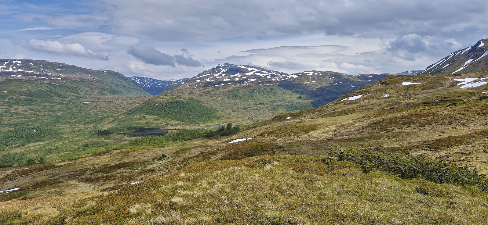 When my sister and her family drove to Voss where my youngest nephew was going to take part in Voss Cup, me and my dad wanted to first go for a hike and decided on Svolefjellet . Based on information from myrkdalen.no I had located a marked trail to Svoleset from the valley north of Svolefjellet and assumed that we would not have any issues reaching the summit from there.
After crossing the main road we followed a gravel road east to Bygdastølen where we crossed the river Kvanndølen via a bridge and continued on a newer and not yet fully set gravel road on the other side of the river. At this point we had come by two trail signs for Svoleset. The first was laying on the ground next to the gate at Bygdastølen, and the second was pointing at a trail stub that quickly came to an end just as the mentioned new gravel road started.
We were therefore >>>
When my sister and her family drove to Voss where my youngest nephew was going to take part in Voss Cup, me and my dad wanted to first go for a hike and decided on Svolefjellet . Based on information from myrkdalen.no I had located a marked trail to Svoleset from the valley north of Svolefjellet and assumed that we would not have any issues reaching the summit from there.
After crossing the main road we followed a gravel road east to Bygdastølen where we crossed the river Kvanndølen via a bridge and continued on a newer and not yet fully set gravel road on the other side of the river. At this point we had come by two trail signs for Svoleset. The first was laying on the ground next to the gate at Bygdastølen, and the second was pointing at a trail stub that quickly came to an end just as the mentioned new gravel road started.
We were therefore >>>
Myrkdalen Fjellandsby
- Datum:
- 14.06.2024
- Tourcharakter:
- Spaziergang
- Tourlänge:
- 0:42h
- Entfernung:
- 2,4km
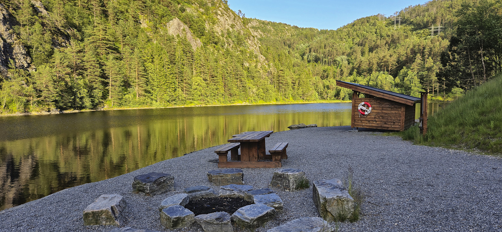
 Short evening walk after the drive from Bergen to Myrkdalen Fjellandsby to spend the weekend at an apartment my sister had access to via HVL .
Tuftalandsfjellet from Tveit
- Datum:
- 13.06.2024
- Tourcharakter:
- Wanderung
- Tourlänge:
- 0:49h
- Entfernung:
- 3,1km
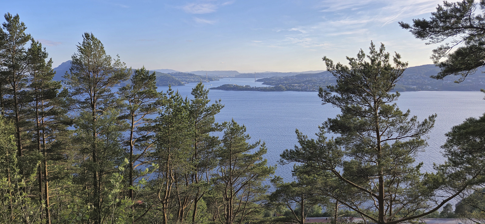
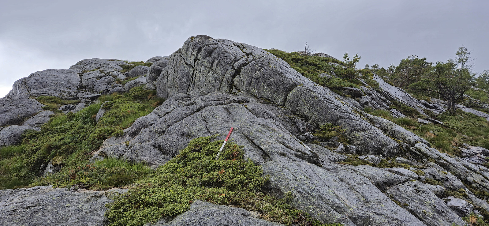
 After our successful visit of Ramnaberget , Endre and I drove the short distance north to Tveit p-plass for a visit of Tuftalandsfjellet . I had already visited Tuftalandsfjellet four years earlier , but then ascending from the south.
This time we followed a new gravel road from the northeast that would take us almost all the way to the summit, except for a short section at the end were we followed the same trail as for my previous visit. Another change was also the new Kveldsturhytta right next to the summit. A big improvement compared to my last visit.
After a short break in the cabin we returned the same way to the parking lot and drove back to Sandviksvåg for the ferry back to Bergen.
Takk for turen, Endre!
After our successful visit of Ramnaberget , Endre and I drove the short distance north to Tveit p-plass for a visit of Tuftalandsfjellet . I had already visited Tuftalandsfjellet four years earlier , but then ascending from the south.
This time we followed a new gravel road from the northeast that would take us almost all the way to the summit, except for a short section at the end were we followed the same trail as for my previous visit. Another change was also the new Kveldsturhytta right next to the summit. A big improvement compared to my last visit.
After a short break in the cabin we returned the same way to the parking lot and drove back to Sandviksvåg for the ferry back to Bergen.
Takk for turen, Endre!
Ramnaberget
- Datum:
- 13.06.2024
- Tourcharakter:
- Wanderung
- Tourlänge:
- 1:06h
- Entfernung:
- 3,8km
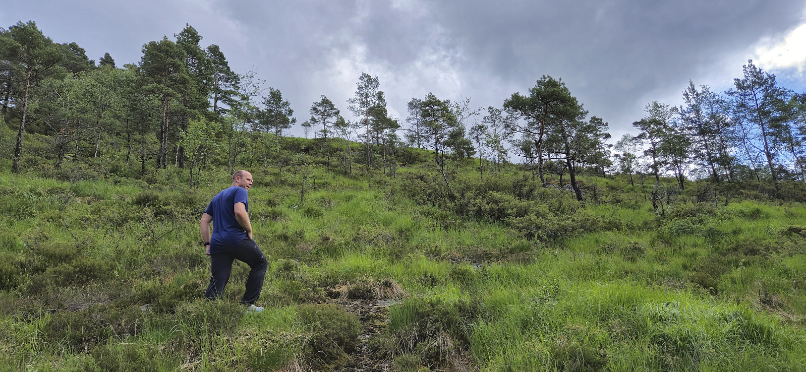
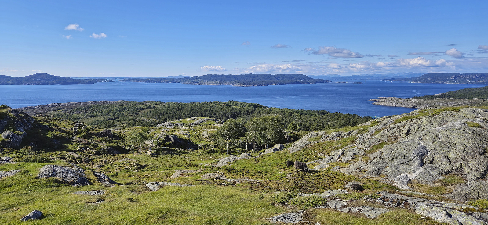 Ever since I ascended Sætrafjellet almost two years ago, Ramnaberget had been the only peak left on the Fitjar ≥ 100m pf. list , mainly due to only being accessible by boat. But based on our recent successful boat trips to Storhaugen på Seløy and Skorpo , I was confident that we should be able to find someone to transport us this time as well.
In the end it turned out that Kjell had a relative with a cabin not too far from the island of Fonno and he would be happy to transport us there with his boat. Kjell drove south to Fitjar earlier in the day to meet up with his relative, that also happened to be named Kjell, while Endre and I left Bergen after work and met up with the two Kjells in Fitjar shortly before six for the short boat ride to Fonno.
Upon arriving at the island we were dropped off at Sørfonno and from there could simply follow the roads all the way to the summit. >>>
Ever since I ascended Sætrafjellet almost two years ago, Ramnaberget had been the only peak left on the Fitjar ≥ 100m pf. list , mainly due to only being accessible by boat. But based on our recent successful boat trips to Storhaugen på Seløy and Skorpo , I was confident that we should be able to find someone to transport us this time as well.
In the end it turned out that Kjell had a relative with a cabin not too far from the island of Fonno and he would be happy to transport us there with his boat. Kjell drove south to Fitjar earlier in the day to meet up with his relative, that also happened to be named Kjell, while Endre and I left Bergen after work and met up with the two Kjells in Fitjar shortly before six for the short boat ride to Fonno.
Upon arriving at the island we were dropped off at Sørfonno and from there could simply follow the roads all the way to the summit. >>>
Hellemyrstien and Ørneberget NV
- Datum:
- 11.06.2024
- Tourcharakter:
- Wanderung
- Tourlänge:
- 1:21h
- Entfernung:
- 5,8km
 Short local evening hike.
Furukammen
- Datum:
- 10.06.2024
- Tourcharakter:
- Wanderung
- Tourlänge:
- 1:29h
- Entfernung:
- 4,2km
 Short local evening hike.
Across Hellen festning
- Datum:
- 09.06.2024
- Tourcharakter:
- Wanderung
- Tourlänge:
- 0:41h
- Entfernung:
- 3,2km
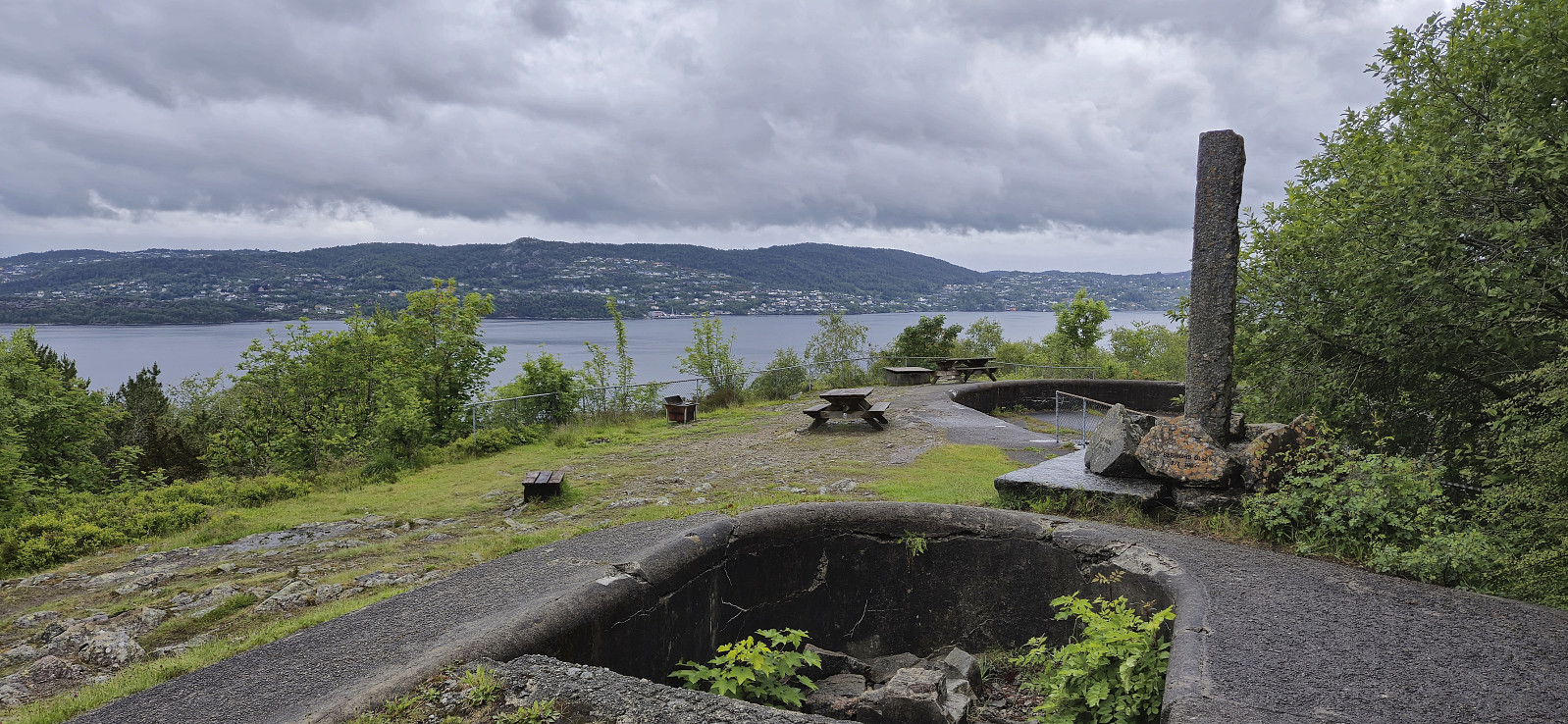 Short local Sunday hike in an opening between the rain showers.
Hatten, Snaufjellet and Dalsfjellet
- Datum:
- 08.06.2024
- Tourcharakter:
- Bergtour
- Tourlänge:
- 3:31h
- Entfernung:
- 9,1km
 During the drive south from the ascent of Merkesholten , the rain had picked up in intensity and when we parked next to Nordbygda skule we even waited a couple of minutes in the car with the hope that the conditions would improve. But in the end we could not wait all day and left the car to start the final hike of the day. As it later turned out it would not take long before the rain would stop anyway. After a short walk west along the main road we crossed the road and located the marked trailhead for Hatten . From there it was simply a matter of following the winding marked trail all the way to the summit, or rather to a vantage point just west of the summit. The summit, or maybe more correctly the summit area, as there were at least three potential highest points to choose from, was located around 50 meters to the east.
After >>>
During the drive south from the ascent of Merkesholten , the rain had picked up in intensity and when we parked next to Nordbygda skule we even waited a couple of minutes in the car with the hope that the conditions would improve. But in the end we could not wait all day and left the car to start the final hike of the day. As it later turned out it would not take long before the rain would stop anyway. After a short walk west along the main road we crossed the road and located the marked trailhead for Hatten . From there it was simply a matter of following the winding marked trail all the way to the summit, or rather to a vantage point just west of the summit. The summit, or maybe more correctly the summit area, as there were at least three potential highest points to choose from, was located around 50 meters to the east.
After >>>
Merkesholten
- Datum:
- 08.06.2024
- Tourcharakter:
- Bergtour
- Tourlänge:
- 0:42h
- Entfernung:
- 1,4km
 After the overall uninteresting ascent of Beinvedfjellet , we had one more presumably similar summit to ascend, namely Merkesholten . This would however turn out to be a much more enjoyable short hike. We parked next to the road at Byrklelandsvatnet and simply headed off-trail in the direction of the summit.
Thankfully the terrain was much more open and hiking-friendly than at Beinvedfjellet and it did not take long before we arrived at a summit which even provided relatively good views.
With dark clouds in the horizon we still did not stay long before descending along more or less the same route, and shortly after we began the drive south for our final hike of the day to Hatten, Snaufjellet and Dalsfjellet , the rain again started pouring down.
After the overall uninteresting ascent of Beinvedfjellet , we had one more presumably similar summit to ascend, namely Merkesholten . This would however turn out to be a much more enjoyable short hike. We parked next to the road at Byrklelandsvatnet and simply headed off-trail in the direction of the summit.
Thankfully the terrain was much more open and hiking-friendly than at Beinvedfjellet and it did not take long before we arrived at a summit which even provided relatively good views.
With dark clouds in the horizon we still did not stay long before descending along more or less the same route, and shortly after we began the drive south for our final hike of the day to Hatten, Snaufjellet and Dalsfjellet , the rain again started pouring down.
