Arkiv - dato
Arkiv - aktivitet
-
Annen tur (3)
- Kajakkpadling (3)
- Fottur (1897)
-
Kjøretur (9)
- Biltur (9)
-
Skitur (116)
- Fjellskitur (69)
- Langrennstur (47)
-
Sykkeltur (111)
- Blandet sykling (25)
- Gatesykling (86)
Lister jeg samler etter
-
Utvalgte topper og turmål i Bergen
(349/351)
 99%
99% -
Alle topper i Bergen
(393/400)
98%
-
Voss ≥ 100m pf.
(96/98)
97%
-
Opptur Hordaland
(144/159)
90%
-
Stasjoner på Bergensbanen
(33/40)
82%
-
Ulvik ≥ 100m pf.
(30/38)
78%
-
Hordaland ≥ 100m pf.
(624/863)
72%
-
Mjølfjell PF > 100m
(21/31)
67%
-
Jondal ≥ 100m pf.
(15/23)
65%
-
Dagsturhyttene i Vestland
(36/61)
59%
-
Sunnhordland PF >= 100m
(105/186)
56%
-
Hordaland: Hardanger PF>=100m
(196/359)
54%
-
DNT-hytter i Hordaland
(23/45)
51%
-
Kvinnherad ≥ 100m pf.
(40/79)
50%
-
Eidfjord ≥ 100m pf.
(13/42)
30%
-
Sogndal ≥ 100m pf.
(23/81)
28%
-
Gulen ≥ 100m pf.
(15/54)
27%
-
Vik i Sogn ≥ 100m pf.
(10/46)
21%
-
Sogn - Sør for Sognefjorden PF>=100m
(31/159)
19%
-
DNT-hytter i Sogn og Fjordane
(8/47)
17%

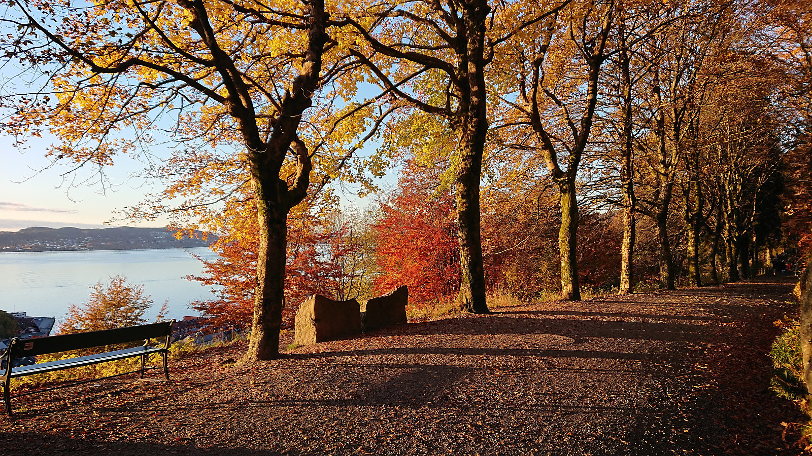
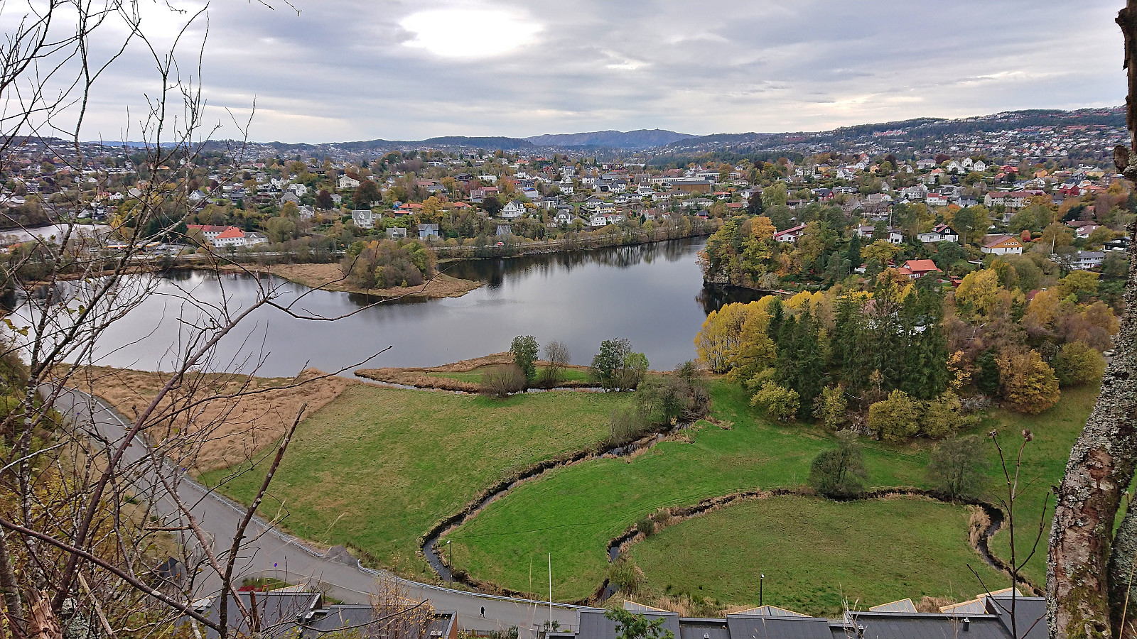
Fjellveien
- Dato:
- 31.10.2023
- Turtype:
- Spasertur
- Turlengde:
- 1:03t
- Distanse:
- 6,1km
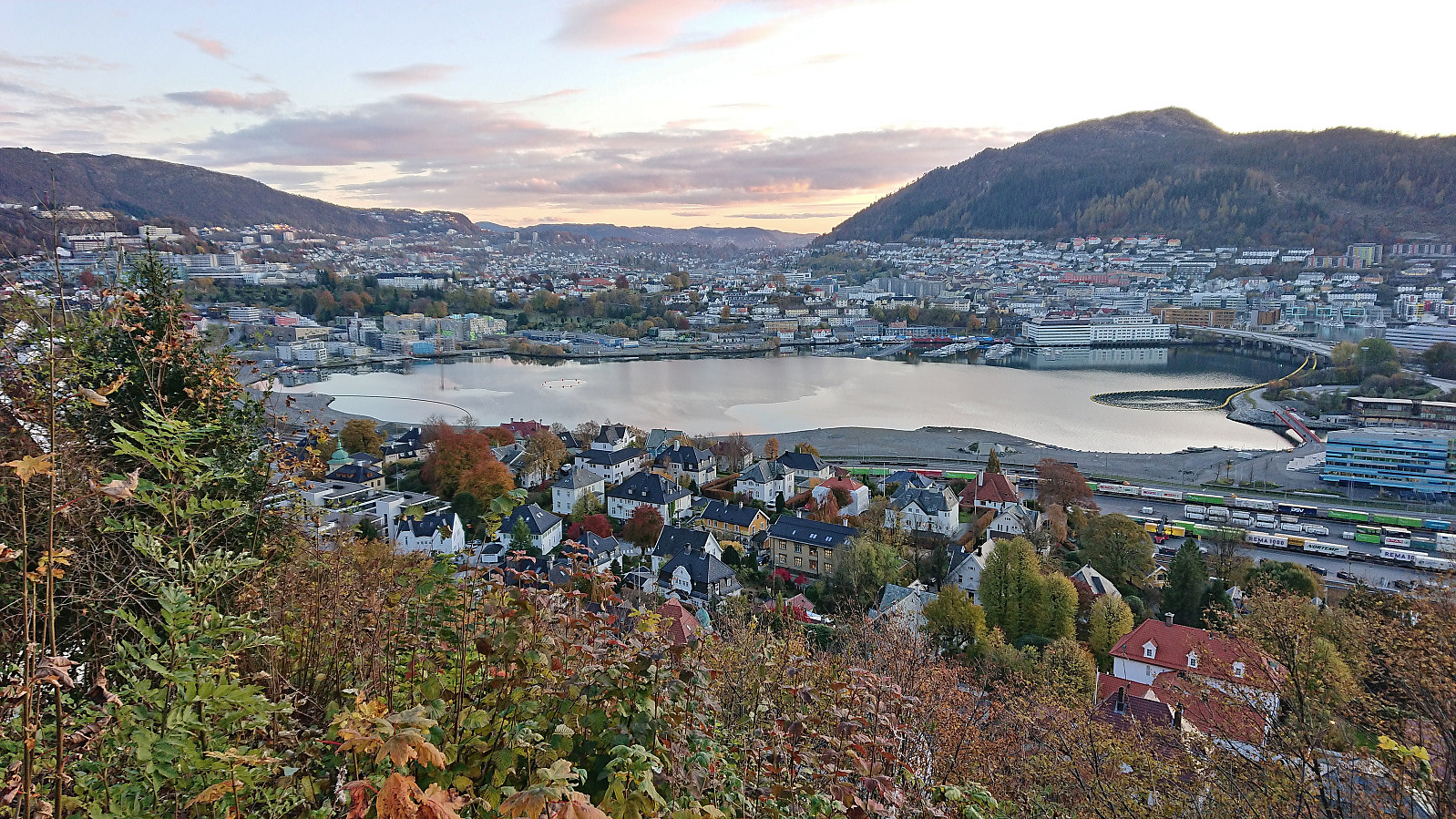 Walk on the way home from work to catch the last sunlight just around sunset. Too late for the actual sunset though.
Tempelet, Håvegen søyle and Ljosvollsvarden
- Dato:
- 29.10.2023
- Turtype:
- Fjelltur
- Turlengde:
- 3:07t
- Distanse:
- 9,8km
 A Sunday hike in perfect late October weather with the main objective of visiting the small hill called Tempelet on the eastern side of Kalandsvatnet. Tempelet could easily be ascended from the north via a route that stayed just far enough from the surrounding houses for it not to feel like trespassing. Given the limited views, the most interesting feature at the summit was a small old bunker from the second world war. I did not stay long before returning the same way.
Back at the main road I proceeded to follow it north to the unmarked start of the trail to Håvegen søyle . The trail itself was overall a bit on the weak side, however the direction was pretty obvious, and I quickly arrived at the small pass north of the ridge containing the trig marker. From here there was a weak trail along the ridge. Excellent views >>>
A Sunday hike in perfect late October weather with the main objective of visiting the small hill called Tempelet on the eastern side of Kalandsvatnet. Tempelet could easily be ascended from the north via a route that stayed just far enough from the surrounding houses for it not to feel like trespassing. Given the limited views, the most interesting feature at the summit was a small old bunker from the second world war. I did not stay long before returning the same way.
Back at the main road I proceeded to follow it north to the unmarked start of the trail to Håvegen søyle . The trail itself was overall a bit on the weak side, however the direction was pretty obvious, and I quickly arrived at the small pass north of the ridge containing the trig marker. From here there was a weak trail along the ridge. Excellent views >>>
Åsane Arena to Øvre Ervik
- Dato:
- 28.10.2023
- Turtype:
- Spasertur
- Turlengde:
- 0:55t
- Distanse:
- 4,5km
 Short walk on the way home from Åsane Arena after watching by youngest nephew participate in a gymnastics event.
Kongsberg and Kristinuten
- Dato:
- 27.10.2023
- Turtype:
- Fjelltur
- Turlengde:
- 6:29t
- Distanse:
- 19,1km
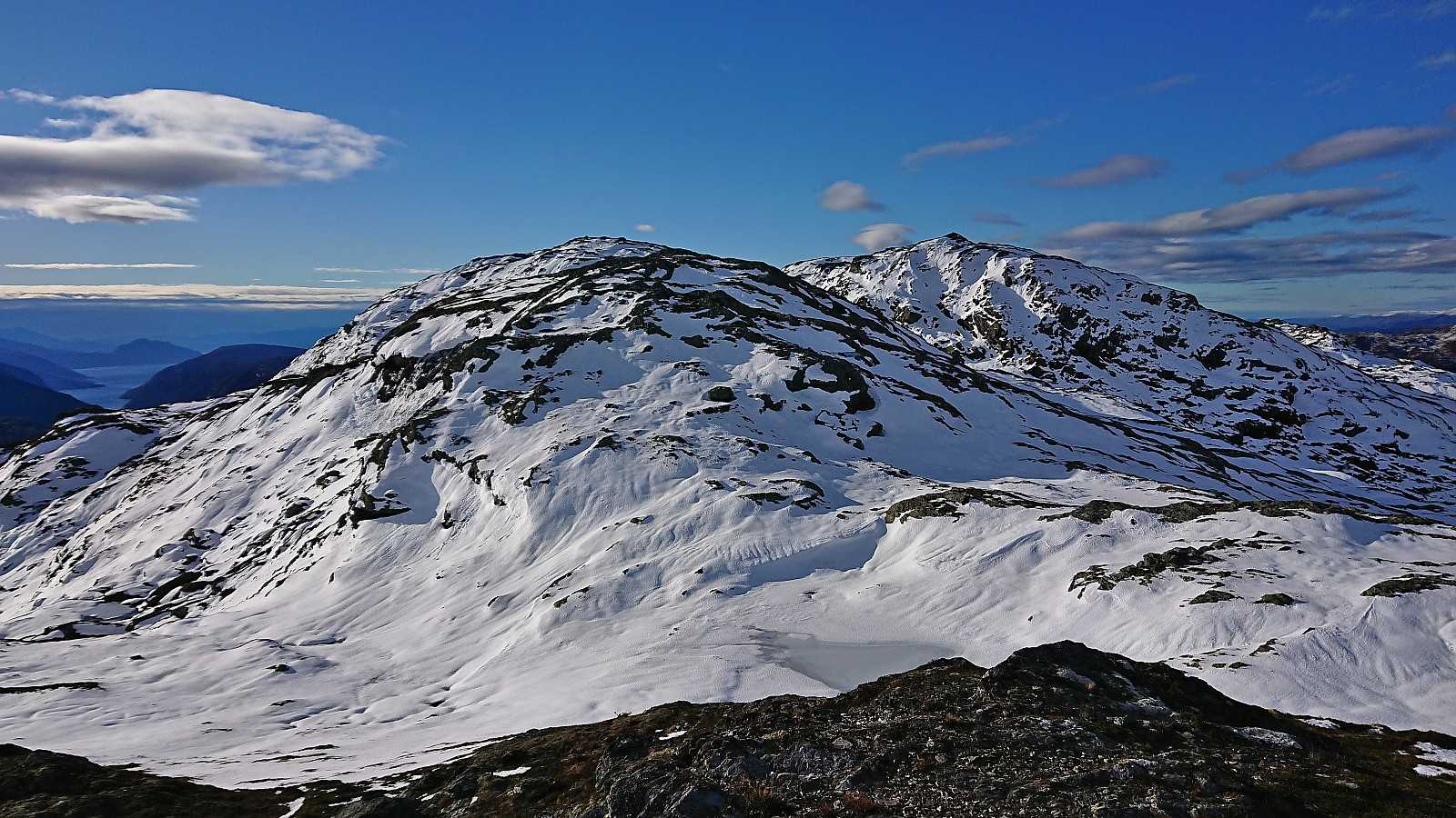
 Given the excellent Friday weather forecast, and other engagements during the upcoming weekend, I decided to take the Friday off and go hiking in Ulvik. Once more I took the train to Voss (once again with bus-for-train between Bergen and Arna). Here I switched (back) to bus and headed for Ulvik, getting off at Sølva (just two stops after where I began my hike to Kjerringafjellet and Kvasshovden the previous weekend).
The bus stop was right next to the start of the tractor road that I could pretty much follow all the way to the summit of Kongsberg . I only left the tractor road towards the very end to instead continue on an unmarked trail to a vantage point just south of the summit with spectacular views across Ulvik. From there a weaker trail could be followed to the highest point less than 150 meters further north.
Ascending Kongsberg >>>
Given the excellent Friday weather forecast, and other engagements during the upcoming weekend, I decided to take the Friday off and go hiking in Ulvik. Once more I took the train to Voss (once again with bus-for-train between Bergen and Arna). Here I switched (back) to bus and headed for Ulvik, getting off at Sølva (just two stops after where I began my hike to Kjerringafjellet and Kvasshovden the previous weekend).
The bus stop was right next to the start of the tractor road that I could pretty much follow all the way to the summit of Kongsberg . I only left the tractor road towards the very end to instead continue on an unmarked trail to a vantage point just south of the summit with spectacular views across Ulvik. From there a weaker trail could be followed to the highest point less than 150 meters further north.
Ascending Kongsberg >>>
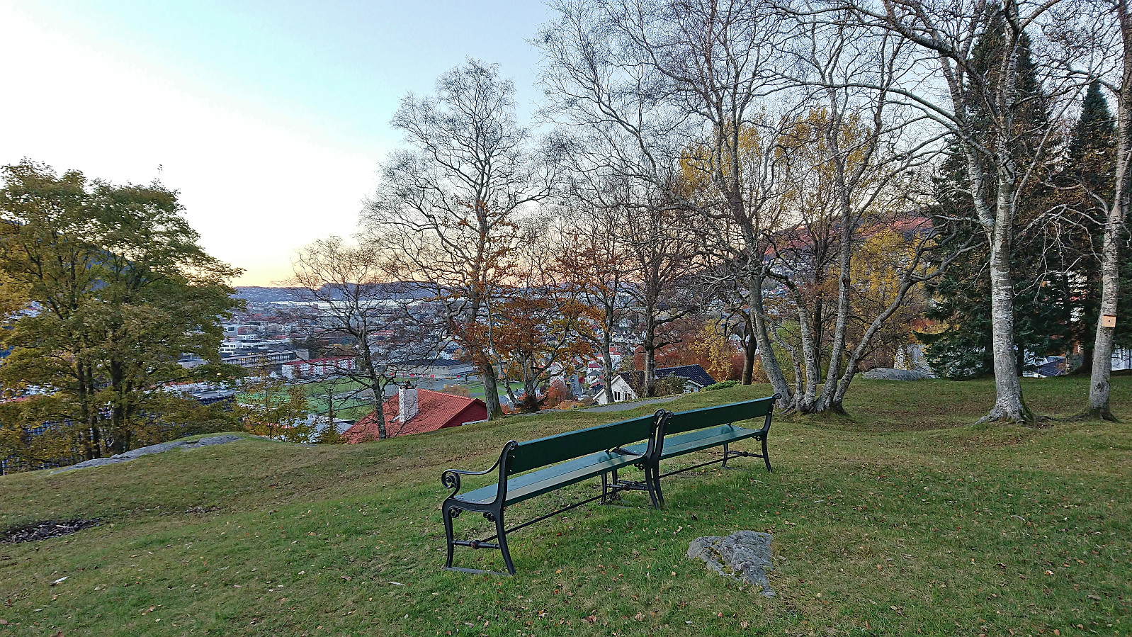
Fjellveien
- Dato:
- 26.10.2023
- Turtype:
- Spasertur
- Turlengde:
- 1:08t
- Distanse:
- 6,2km
 Walk along Fjellveien on the way home from work.
Slettebakken and Langhaugen
- Dato:
- 25.10.2023
- Turtype:
- Spasertur
- Turlengde:
- 1:14t
- Distanse:
- 6,3km
 Minor detour on the way home from work to visit the trig marker at Slettebakken .
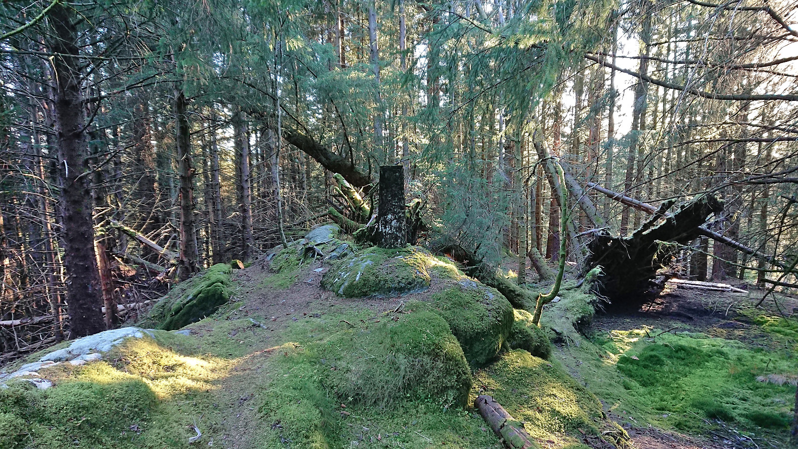
Furukammen
- Dato:
- 24.10.2023
- Turtype:
- Fottur
- Turlengde:
- 1:10t
- Distanse:
- 4,3km
 Short local evening hike after work.
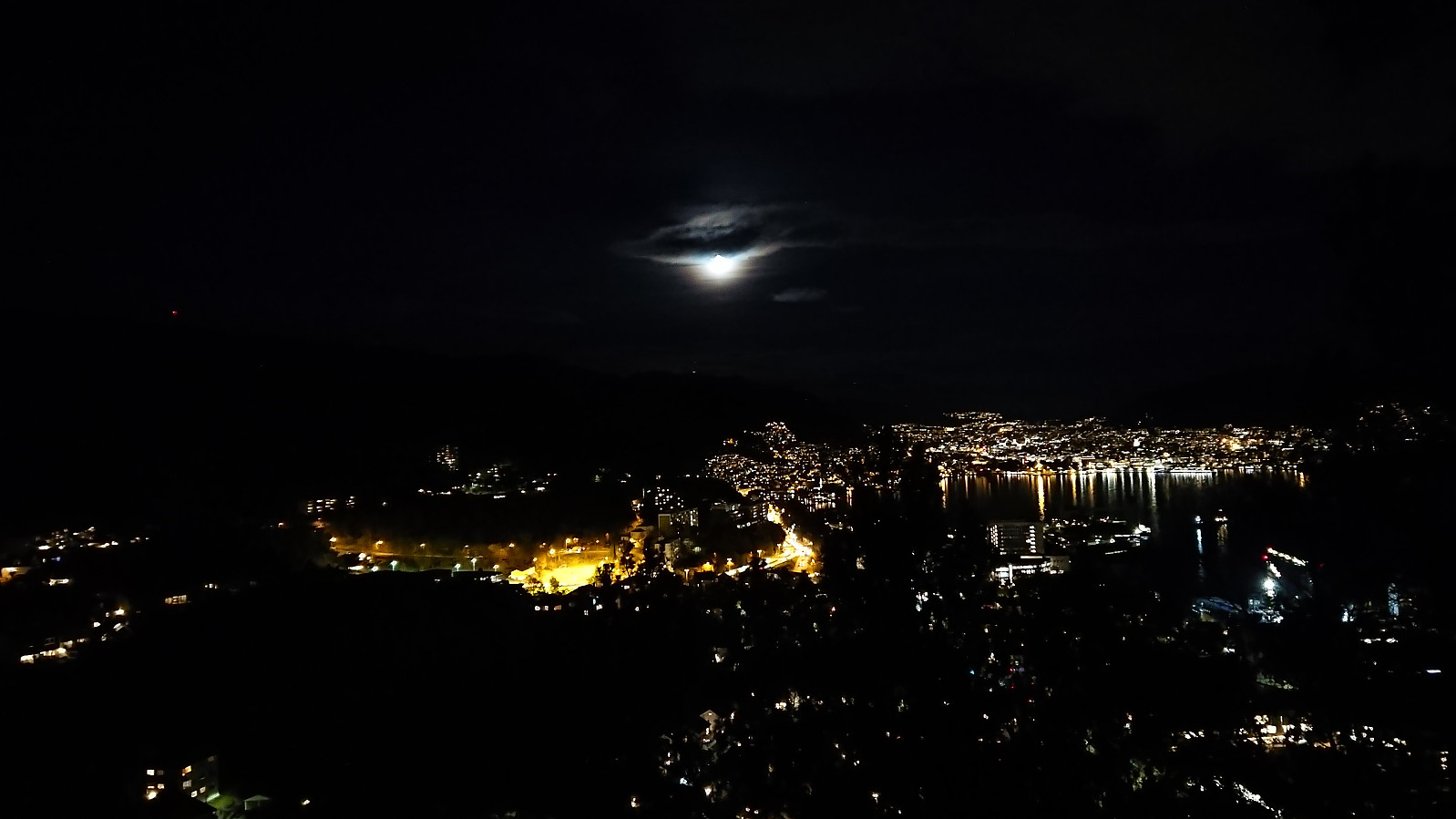
Across Hellen festning
- Dato:
- 23.10.2023
- Turtype:
- Fottur
- Turlengde:
- 0:36t
- Distanse:
- 3,1km
 Short local hike after work to catch the sunset at Hellen festning.
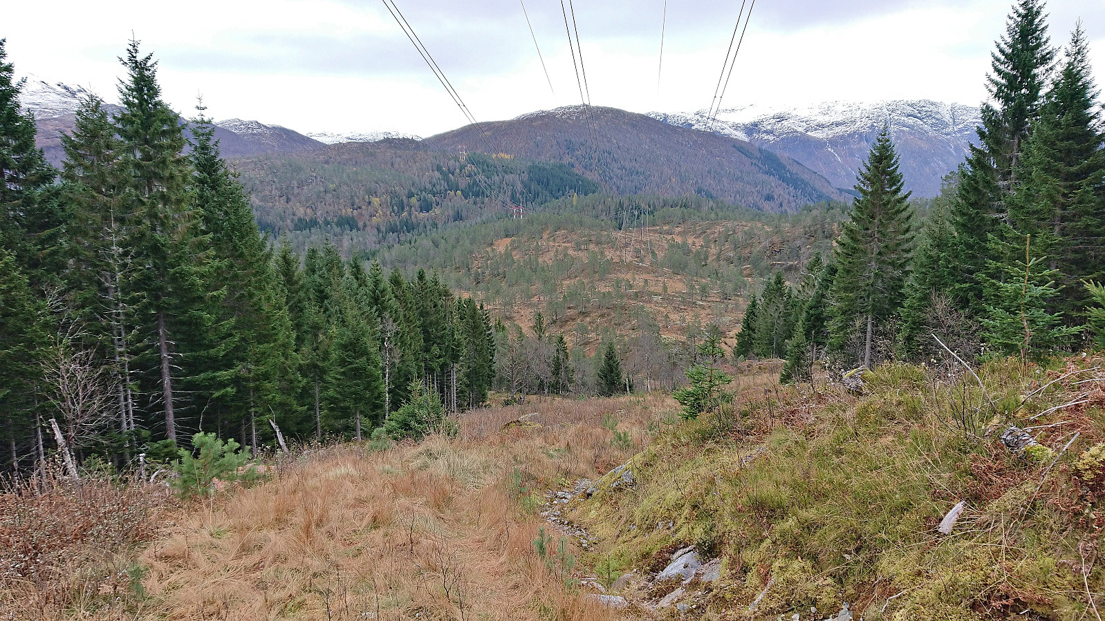
Kjerringafjellet and Kvasshovden
- Dato:
- 22.10.2023
- Turtype:
- Fjelltur
- Turlengde:
- 7:06t
- Distanse:
- 17,6km
 After several days of strong wind from the east, the weather finally improved enough to allow for proper mountain hiking. I therefore got up early Sunday morning and took the train to Voss (or to be more correct, bus-for-train to Arna and then train to Voss). Here I switched back to bus and continued in the direction of Ulvik. My plan was partially follow in the footsteps of Knut Sverre and Astrid based on their trip report from 2015 indicating a trail to Kvasshovden via Grostøl, mainly as this would save me almost 300 vertical meters compared to starting from the fjord at Ulvik.
In advance I had figured out that the closest bus stop to the wanted trailhead was called Ulsberg, which would leave less than 600 meters to the start of a tractor road I had located on the map. This was apparently not a very commonly used bus stop though. Proven by the >>>
After several days of strong wind from the east, the weather finally improved enough to allow for proper mountain hiking. I therefore got up early Sunday morning and took the train to Voss (or to be more correct, bus-for-train to Arna and then train to Voss). Here I switched back to bus and continued in the direction of Ulvik. My plan was partially follow in the footsteps of Knut Sverre and Astrid based on their trip report from 2015 indicating a trail to Kvasshovden via Grostøl, mainly as this would save me almost 300 vertical meters compared to starting from the fjord at Ulvik.
In advance I had figured out that the closest bus stop to the wanted trailhead was called Ulsberg, which would leave less than 600 meters to the start of a tractor road I had located on the map. This was apparently not a very commonly used bus stop though. Proven by the >>>
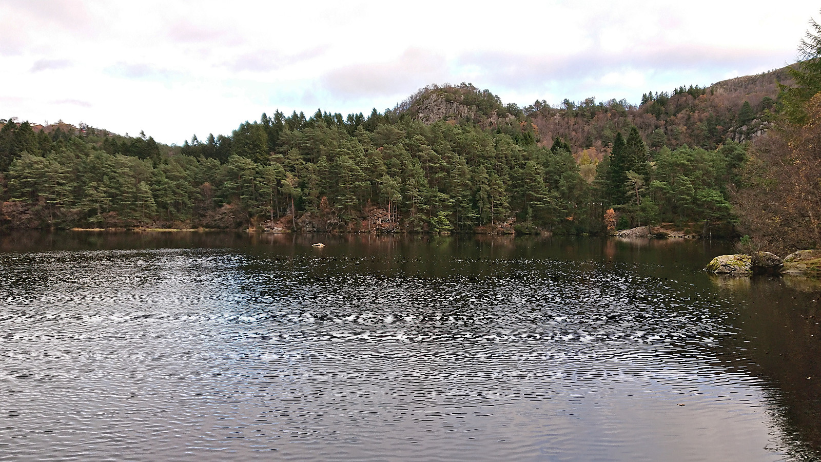
Sandbrekketoppen and Rambjørga
- Dato:
- 21.10.2023
- Turtype:
- Fottur
- Turlengde:
- 2:10t
- Distanse:
- 8,9km
 Saturday hike from Nesttun to Haukeland sykehus with the main objective of visiting the trig markers at Sandbrekketoppen and Rambjørga . Both provided great views and resulted in an overall enjoyable short trip.
