Arkiv - dato
Arkiv - aktivitet
-
Annen tur (3)
- Kajakkpadling (3)
- Fottur (1897)
-
Kjøretur (9)
- Biltur (9)
-
Skitur (116)
- Fjellskitur (69)
- Langrennstur (47)
-
Sykkeltur (111)
- Blandet sykling (25)
- Gatesykling (86)
Lister jeg samler etter
-
Utvalgte topper og turmål i Bergen
(349/351)
 99%
99% -
Alle topper i Bergen
(393/400)
98%
-
Voss ≥ 100m pf.
(96/98)
97%
-
Opptur Hordaland
(144/159)
90%
-
Stasjoner på Bergensbanen
(33/40)
82%
-
Ulvik ≥ 100m pf.
(30/38)
78%
-
Hordaland ≥ 100m pf.
(624/863)
72%
-
Mjølfjell PF > 100m
(21/31)
67%
-
Jondal ≥ 100m pf.
(15/23)
65%
-
Dagsturhyttene i Vestland
(36/61)
59%
-
Sunnhordland PF >= 100m
(105/186)
56%
-
Hordaland: Hardanger PF>=100m
(196/359)
54%
-
DNT-hytter i Hordaland
(23/45)
51%
-
Kvinnherad ≥ 100m pf.
(40/79)
50%
-
Eidfjord ≥ 100m pf.
(13/42)
30%
-
Sogndal ≥ 100m pf.
(23/81)
28%
-
Gulen ≥ 100m pf.
(15/54)
27%
-
Vik i Sogn ≥ 100m pf.
(10/46)
21%
-
Sogn - Sør for Sognefjorden PF>=100m
(31/159)
19%
-
DNT-hytter i Sogn og Fjordane
(8/47)
17%

Høgenoltane from Urdland via Remlo
- Dato:
- 01.07.2023
- Turtype:
- Fjelltur
- Turlengde:
- 4:50t
- Distanse:
- 17,0km
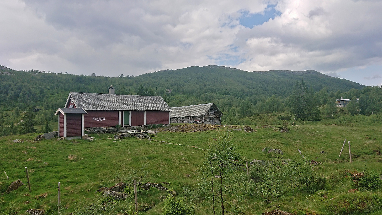 I started by taking the train to Urdland stasjon and from there followed the road west and then north up to Ospehaugen p-plass . In order to make the hike into a roundtrip I here forked right and continued north along the gravel road to Remlo where the map indicated a trail south to Fjosstølen. I struggled a bit to find the proper start of this trail, as there were a couple of fences that had to be crossed, but just as I was scouting for the best place to jump the fence I happened upon the local farmer who provided excellent pointers for where to locate the trail in question. Soon I was therefore on the so-called "buføringsvegen", i.e. the trail (at least historically) used to transfer cattle and sheep from/to the farms further down the valley.
The trail was unmarked but overall easy to follow. It however did not >>>
I started by taking the train to Urdland stasjon and from there followed the road west and then north up to Ospehaugen p-plass . In order to make the hike into a roundtrip I here forked right and continued north along the gravel road to Remlo where the map indicated a trail south to Fjosstølen. I struggled a bit to find the proper start of this trail, as there were a couple of fences that had to be crossed, but just as I was scouting for the best place to jump the fence I happened upon the local farmer who provided excellent pointers for where to locate the trail in question. Soon I was therefore on the so-called "buføringsvegen", i.e. the trail (at least historically) used to transfer cattle and sheep from/to the farms further down the valley.
The trail was unmarked but overall easy to follow. It however did not >>>
