Archive - Date
Archive - Activity
-
Bike trip (111)
- Bike trip - mixed (25)
- Bike trip - road (86)
-
Drive (9)
- Car drive (9)
-
Other trip (3)
- Kayaking (3)
-
Ski trip (116)
- Backcountry skiing (69)
- Cross-country skiing (47)
- Trip by foot (1897)
Collected lists
-
Utvalgte topper og turmål i Bergen
(349/351)
 99%
99% -
Alle topper i Bergen
(393/400)
98%
-
Voss ≥ 100m pf.
(96/98)
97%
-
Opptur Hordaland
(144/159)
90%
-
Stasjoner på Bergensbanen
(33/40)
82%
-
Ulvik ≥ 100m pf.
(30/38)
78%
-
Hordaland ≥ 100m pf.
(624/863)
72%
-
Mjølfjell PF > 100m
(21/31)
67%
-
Jondal ≥ 100m pf.
(15/23)
65%
-
Dagsturhyttene i Vestland
(36/61)
59%
-
Sunnhordland PF >= 100m
(105/186)
56%
-
Hordaland: Hardanger PF>=100m
(196/359)
54%
-
DNT-hytter i Hordaland
(23/45)
51%
-
Kvinnherad ≥ 100m pf.
(40/79)
50%
-
Eidfjord ≥ 100m pf.
(13/42)
30%
-
Sogndal ≥ 100m pf.
(23/81)
28%
-
Gulen ≥ 100m pf.
(15/54)
27%
-
Vik i Sogn ≥ 100m pf.
(10/46)
21%
-
Sogn - Sør for Sognefjorden PF>=100m
(31/159)
19%
-
DNT-hytter i Sogn og Fjordane
(8/47)
17%

Storehaug from Resaland
- Date:
- 11.07.2023
- Characteristic:
- Hillwalk
- Duration:
- 1:43h
- Distance:
- 1.8km
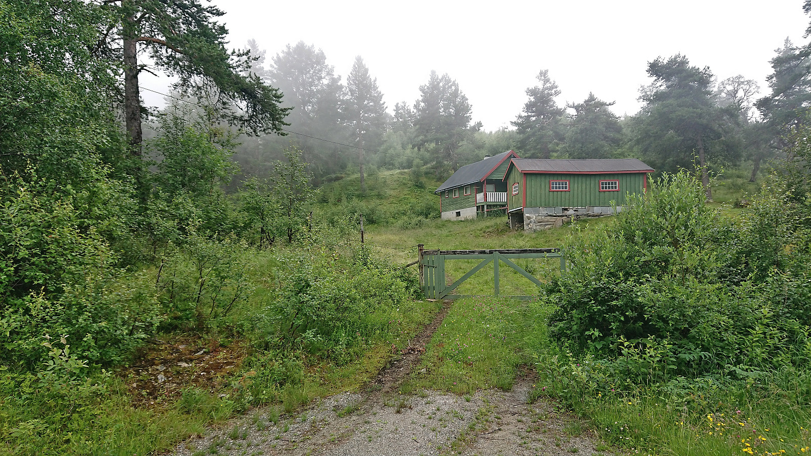 On a day with rain showers reported to start from the early afternoon, we decided to go for a couple of easy summits that also did not require lots of driving. First up was Storehaug in Luster . We parked at Resaland p-plass right next to the unmarked trailhead and followed a tractor road almost all the way to the summit. From there, the large summit cairn was easily reached via a weak unmarked trail. Limited views from the summit due to all the trees which were not made any better by the dense fog. We therefore did not stay long before returning the same way to the car.
Upon returning to the car we also made an attempt to visit the viewpoint at Feivall/Feivollfjellet but failed to find any routes that did not seem to include trespassing private property and thus gave up and instead continued to Bondehaug .
On a day with rain showers reported to start from the early afternoon, we decided to go for a couple of easy summits that also did not require lots of driving. First up was Storehaug in Luster . We parked at Resaland p-plass right next to the unmarked trailhead and followed a tractor road almost all the way to the summit. From there, the large summit cairn was easily reached via a weak unmarked trail. Limited views from the summit due to all the trees which were not made any better by the dense fog. We therefore did not stay long before returning the same way to the car.
Upon returning to the car we also made an attempt to visit the viewpoint at Feivall/Feivollfjellet but failed to find any routes that did not seem to include trespassing private property and thus gave up and instead continued to Bondehaug .
Cycling along Barsnesfjorden
- Date:
- 10.07.2023
- Characteristic:
- Bike trip - road
- Duration:
- 0:41h
- Distance:
- 4.5km
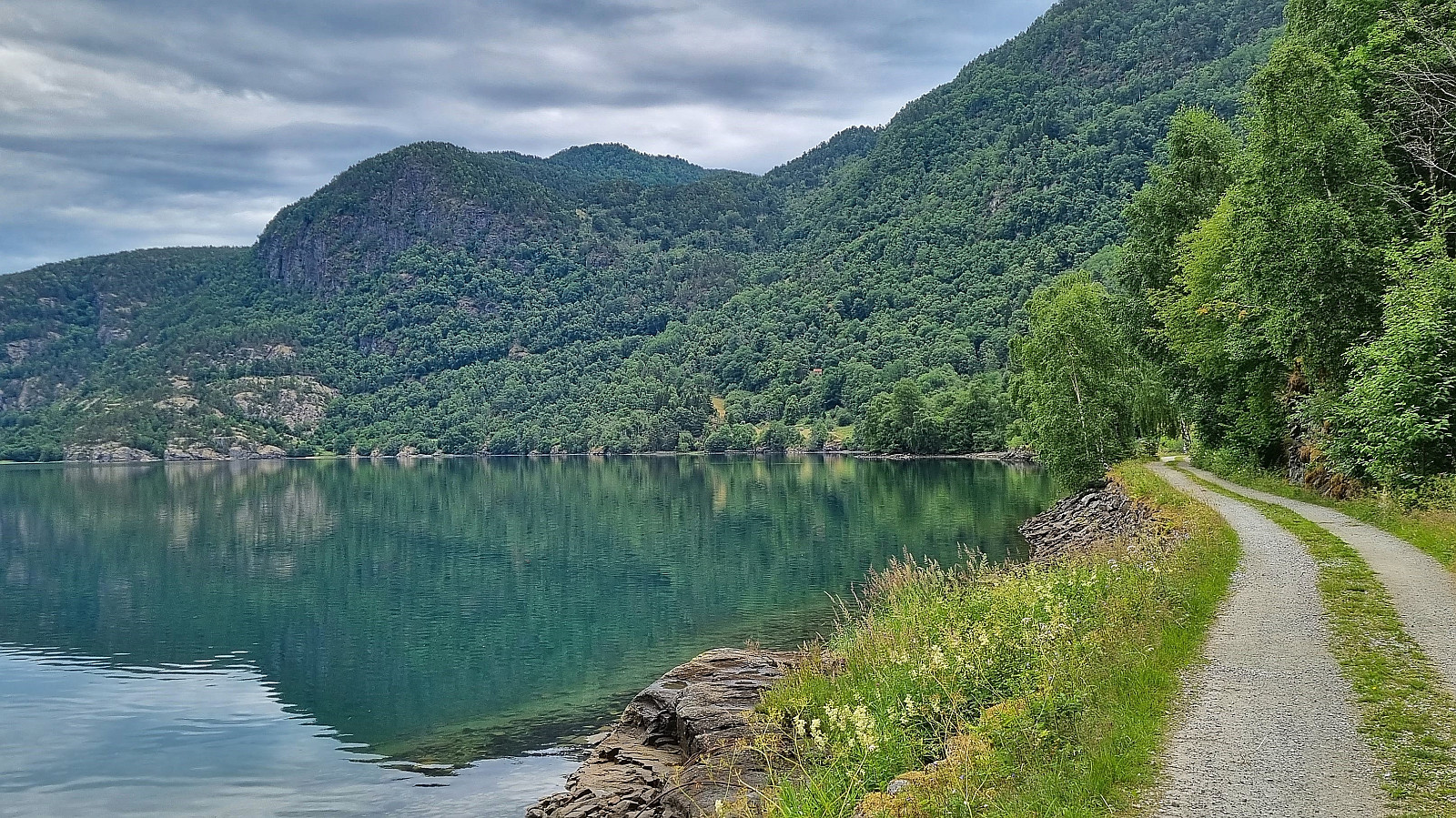 Short cycling trip along Barsnesfjorden.
(Note that the road this hike follows is private, i.e. no cars allowed. There are however a couple of parking spaces down by the small wharf along Barsnesfjorden just before the road turns west and starts climbing slightly towards the crossroads at Barsnes.)
Short cycling trip along Barsnesfjorden.
(Note that the road this hike follows is private, i.e. no cars allowed. There are however a couple of parking spaces down by the small wharf along Barsnesfjorden just before the road turns west and starts climbing slightly towards the crossroads at Barsnes.)
Cycling: Fjordstien and Stedjeberget
- Date:
- 09.07.2023
- Characteristic:
- Bike trip - road
- Duration:
- 1:37h
- Distance:
- 15.1km
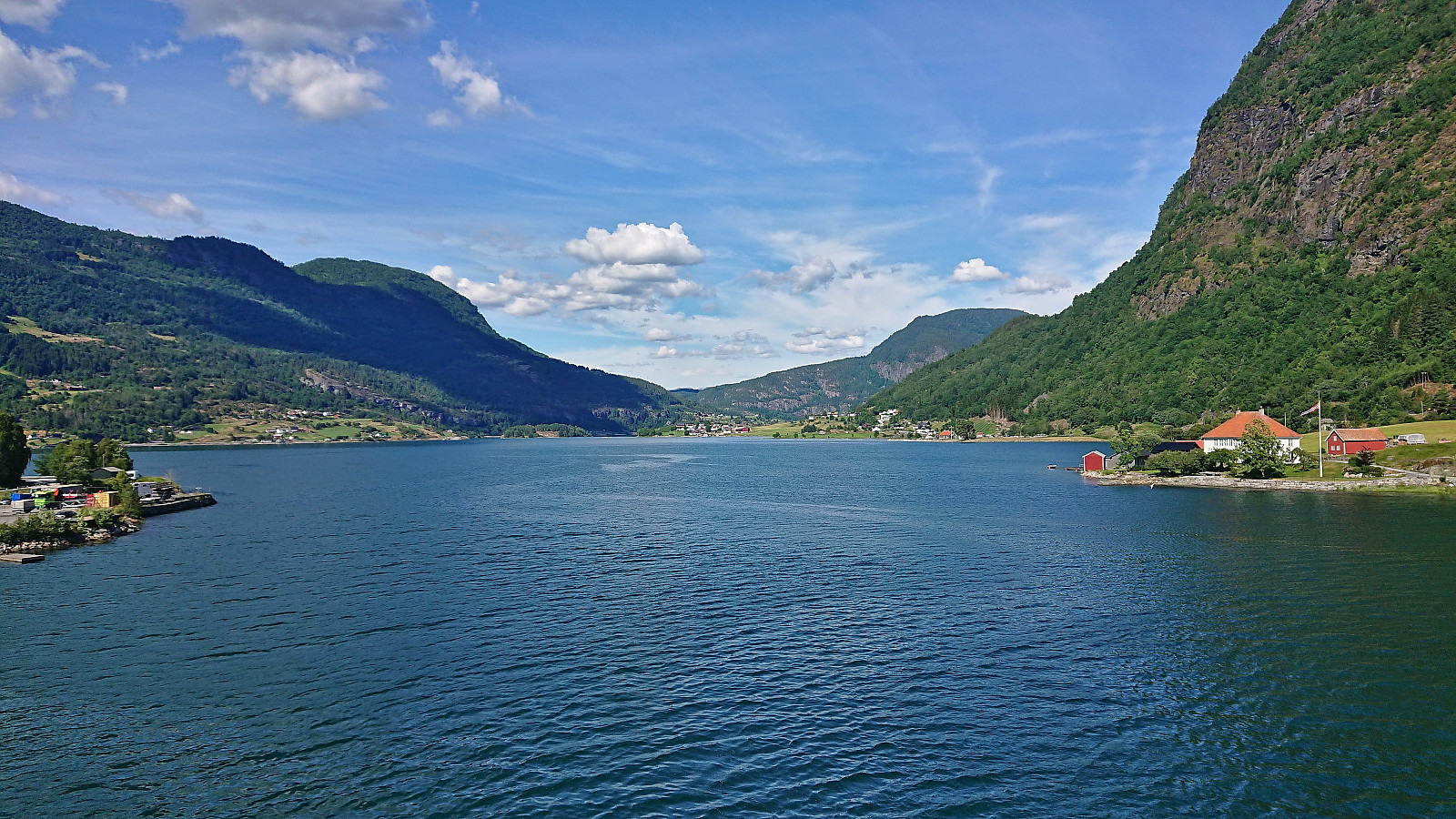 Short afternoon cycling trip along Fjordstien and out to Stedjeberget turpostkasse .
Kayaking on Barsnesfjorden
- Date:
- 09.07.2023
- Characteristic:
- Kayaking
- Duration:
- 0:40h
- Distance:
- 2.1km
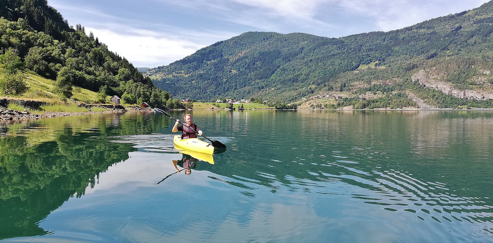 Short kayaking session on Barsnesfjorden.
(Note that the road this hike follows is private, i.e. no cars allowed. There are however a couple of parking spaces down by the small wharf along Barsnesfjorden just before the road turns west and starts climbing slightly towards the crossroads at Barsnes.)
Short kayaking session on Barsnesfjorden.
(Note that the road this hike follows is private, i.e. no cars allowed. There are however a couple of parking spaces down by the small wharf along Barsnesfjorden just before the road turns west and starts climbing slightly towards the crossroads at Barsnes.)
Barsnesfjorden
- Date:
- 09.07.2023
- Characteristic:
- Hike
- Duration:
- 3:02h
- Distance:
- 4.4km
 Hike along Barsnesfjorden including rowing and kayaking (see separate trip report for the kayaking ).
(Note that the road this hike follows is private, i.e. no cars allowed. There are however a couple of parking spaces down by the small wharf along Barsnesfjorden just before the road turns west and starts climbing slightly towards the crossroads at Barsnes.)
Hike along Barsnesfjorden including rowing and kayaking (see separate trip report for the kayaking ).
(Note that the road this hike follows is private, i.e. no cars allowed. There are however a couple of parking spaces down by the small wharf along Barsnesfjorden just before the road turns west and starts climbing slightly towards the crossroads at Barsnes.)
Eikjabu from Mollandsmarki
- Date:
- 08.07.2023
- Characteristic:
- Hillwalk
- Duration:
- 5:57h
- Distance:
- 11.0km
 Warning: While this route (mostly) follows a marked trail, the markers can be difficult to spot. The terrain is also steep with a couple of exposed sections that may not be to everyone's liking. In other words, read the report carefully.
Given its location alongside Lustrafjorden, the easiest route to Eikjabu is definitely by boat or kayak. We had however come across a suggested hiking route from Mollandsmarki that we wanted to try. Luster DNT had even organized a trip along this route earlier this year . Additional information was also gathered from an earlier post from 2019 which also included a link with more pictures and a basic map .
Unsure of whether there would be any parking at the trailhead, we decided to park at Krossen p-plass and walk from there. (As it turned out, this was unnecessary, as it would have been possible to park at or close to the trailhead.) The trailhead contained information about Stuaflåten although there was no >>>
Warning: While this route (mostly) follows a marked trail, the markers can be difficult to spot. The terrain is also steep with a couple of exposed sections that may not be to everyone's liking. In other words, read the report carefully.
Given its location alongside Lustrafjorden, the easiest route to Eikjabu is definitely by boat or kayak. We had however come across a suggested hiking route from Mollandsmarki that we wanted to try. Luster DNT had even organized a trip along this route earlier this year . Additional information was also gathered from an earlier post from 2019 which also included a link with more pictures and a basic map .
Unsure of whether there would be any parking at the trailhead, we decided to park at Krossen p-plass and walk from there. (As it turned out, this was unnecessary, as it would have been possible to park at or close to the trailhead.) The trailhead contained information about Stuaflåten although there was no >>>
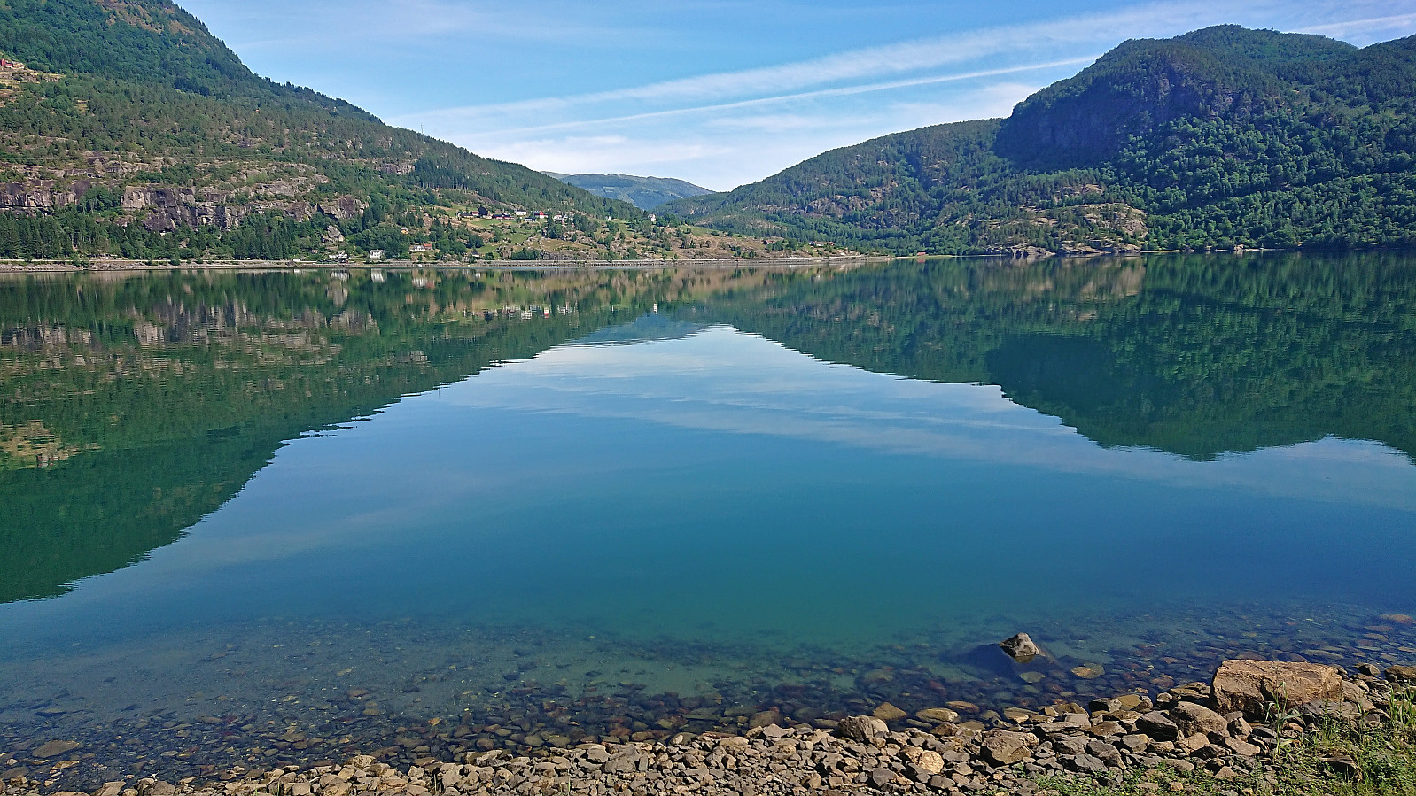
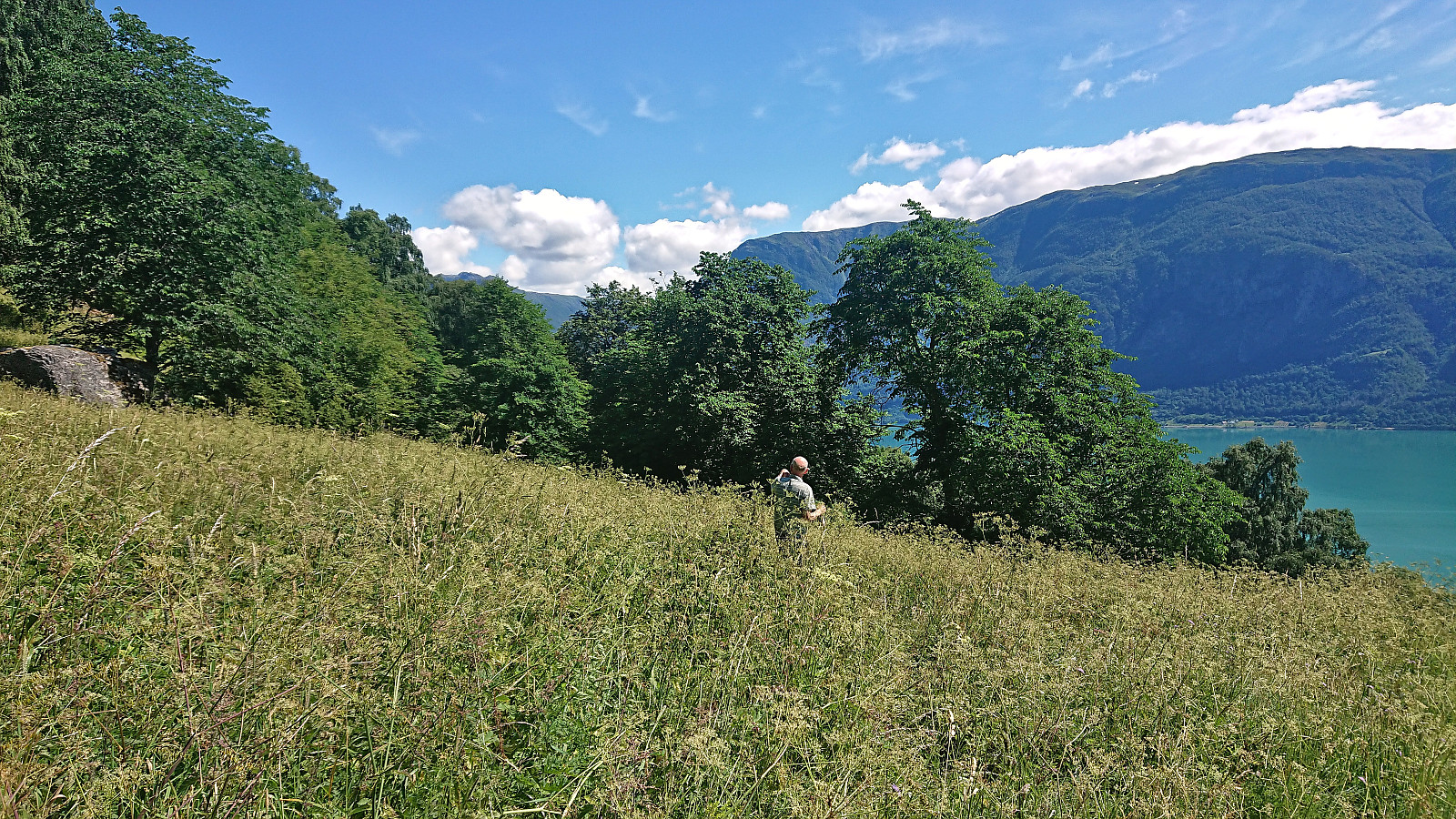
Balabu and Klukkshaug
- Date:
- 06.07.2023
- Characteristic:
- Hillwalk
- Duration:
- 1:42h
- Distance:
- 4.8km
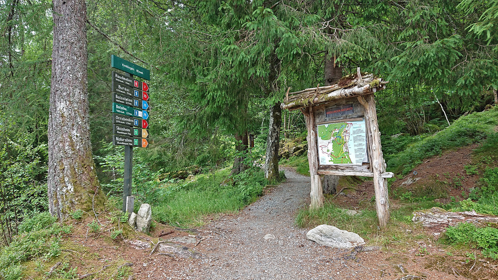 On the way from Bergen to Sogndal we made a stop at Balestrand for a visit of Balabu . Parking was found at the marked trailhead and from there we could follow a very nice marked trail all the way to the cabin. From Balabu I continued on my own along an unmarked trail to Klukkshaug but must admit that the views there did not really live up to the expectations and I did not stay long before starting my descent.
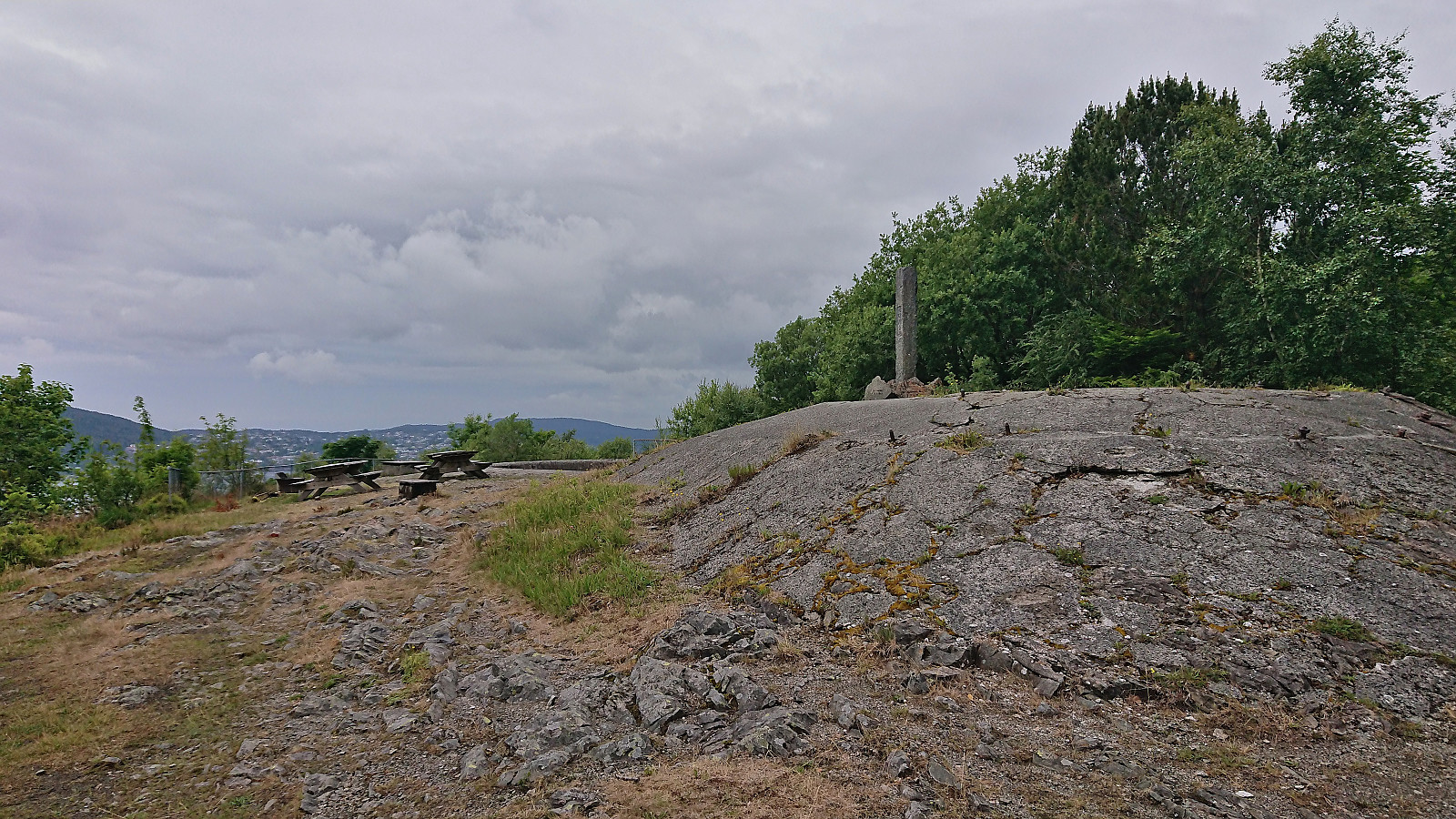
Solheim søyle
- Date:
- 05.07.2023
- Characteristic:
- Walk
- Duration:
- 0:59h
- Distance:
- 4.6km
 Detour on the way home from work to visit Solheim søyle.
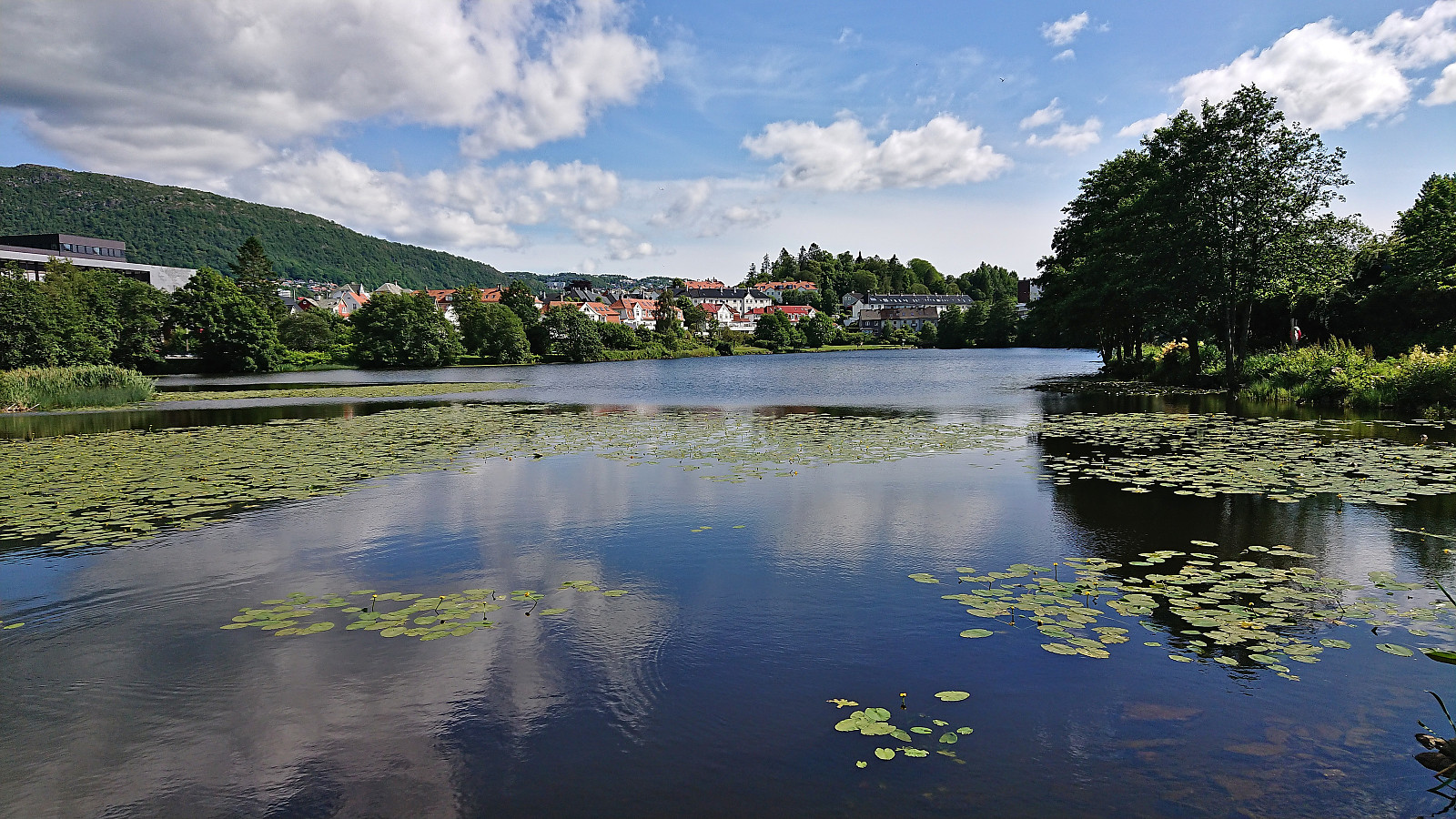
Løvstakken from Marineholmen
- Date:
- 04.07.2023
- Characteristic:
- Hillwalk
- Duration:
- 3:55h
- Distance:
- 9.6km
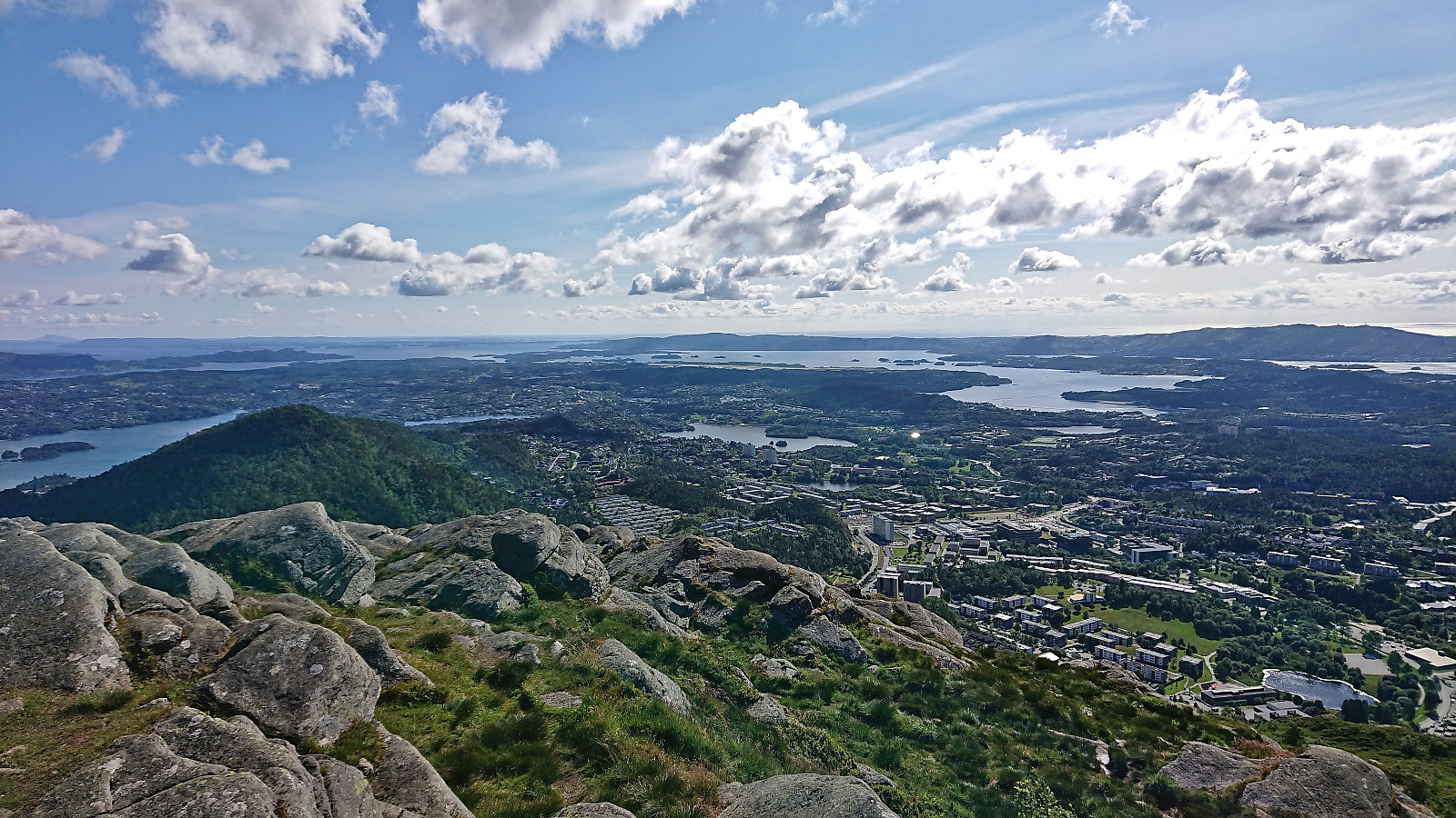 Hike to Løvstakken after work with my colleague taking part in Stolpejakten .
Across Hellen festning
- Date:
- 02.07.2023
- Characteristic:
- Hike
- Duration:
- 0:39h
- Distance:
- 3.2km
 Short local Sunday hike.
