Archiv - Nach Datum
Archiv - Nach Aktivität
-
Andere Tour (3)
- Kayaking (3)
-
Fahrradtour (111)
- Fahrradtour Straße (86)
- Fahrradtour gemischt (25)
-
Fahrzeugtour (9)
- Autotour (9)
-
Fußtour (1897)
- Bergtour (1120)
- Jogging (1)
- Spaziergang (60)
- Wanderung (716)
-
Skitour (116)
- Langlauf (47)
- Tourenskilauf (69)
Gesammelte Listen
-
Utvalgte topper og turmål i Bergen
(349/351)
 99%
99% -
Alle topper i Bergen
(393/400)
98%
-
Voss ≥ 100m pf.
(96/98)
97%
-
Opptur Hordaland
(144/159)
90%
-
Stasjoner på Bergensbanen
(33/40)
82%
-
Ulvik ≥ 100m pf.
(30/38)
78%
-
Hordaland ≥ 100m pf.
(624/863)
72%
-
Mjølfjell PF > 100m
(21/31)
67%
-
Jondal ≥ 100m pf.
(15/23)
65%
-
Dagsturhyttene i Vestland
(36/61)
59%
-
Sunnhordland PF >= 100m
(105/186)
56%
-
Hordaland: Hardanger PF>=100m
(196/359)
54%
-
DNT-hytter i Hordaland
(23/45)
51%
-
Kvinnherad ≥ 100m pf.
(40/79)
50%
-
Eidfjord ≥ 100m pf.
(13/42)
30%
-
Sogndal ≥ 100m pf.
(23/81)
28%
-
Gulen ≥ 100m pf.
(15/54)
27%
-
Vik i Sogn ≥ 100m pf.
(10/46)
21%
-
Sogn - Sør for Sognefjorden PF>=100m
(31/159)
19%
-
DNT-hytter i Sogn og Fjordane
(8/47)
17%

Litla Langafjellet søyle
- Datum:
- 20.07.2023
- Tourcharakter:
- Wanderung
- Tourlänge:
- 0:58h
- Entfernung:
- 4,1km
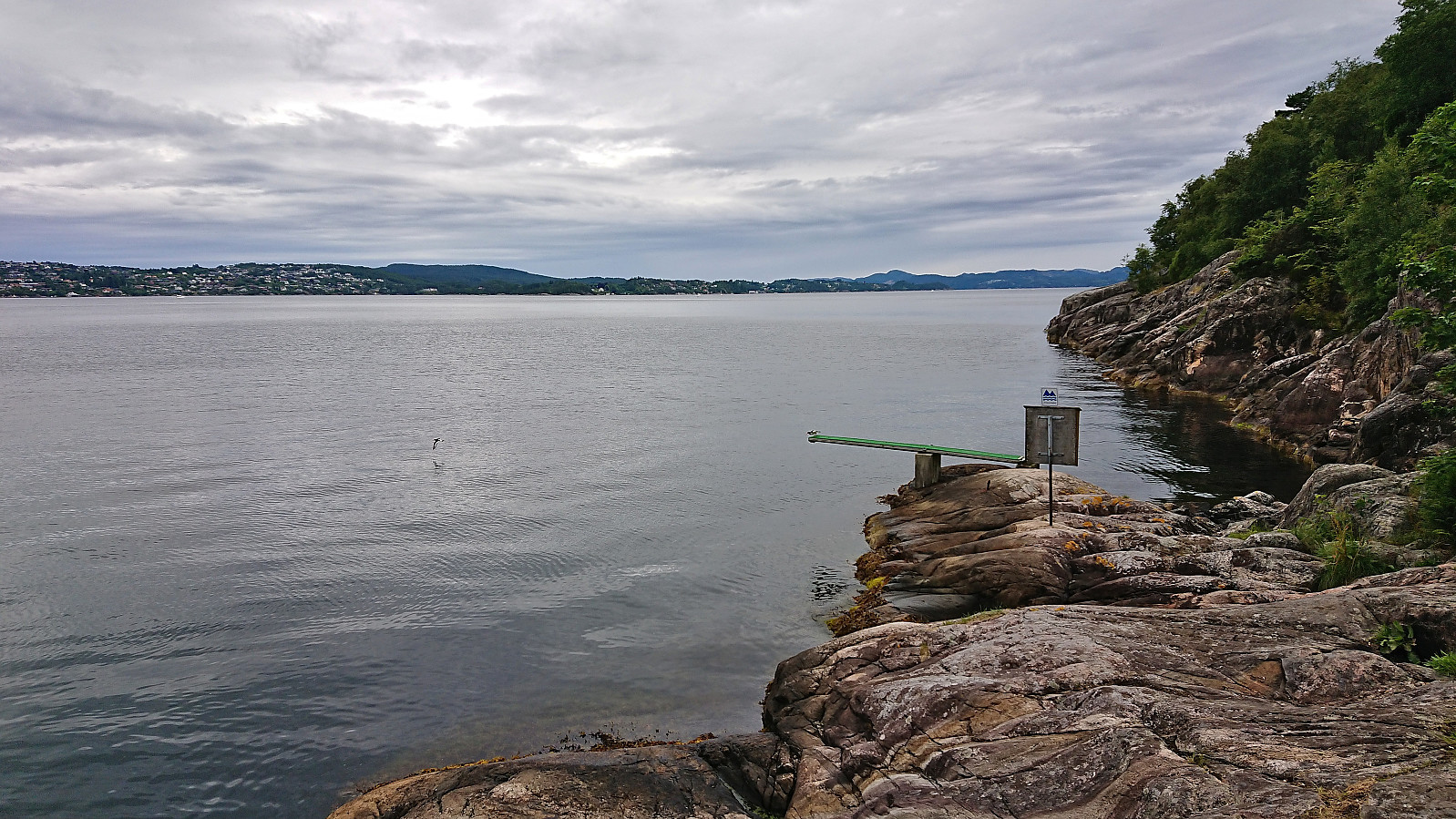
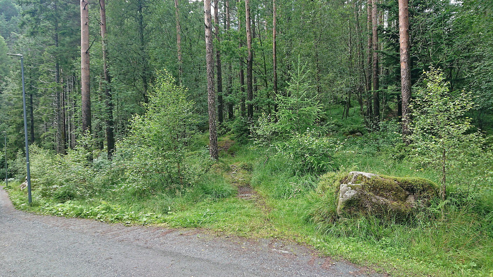 On my way home from the trip to Marietoppen I made a short stop in Fjøsanger for a visit of Litla Langafjellet søyle . It could be easily reached via a trail crossing over the small hill. Afterwards I continued northeast to Kristianborg before taking Bybanen to the Bergen city center.
Marietoppen
- Datum:
- 20.07.2023
- Tourcharakter:
- Wanderung
- Tourlänge:
- 1:08h
- Entfernung:
- 4,0km
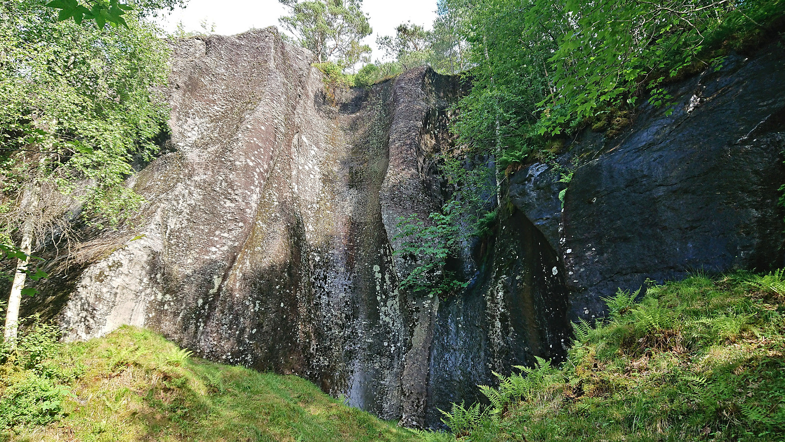
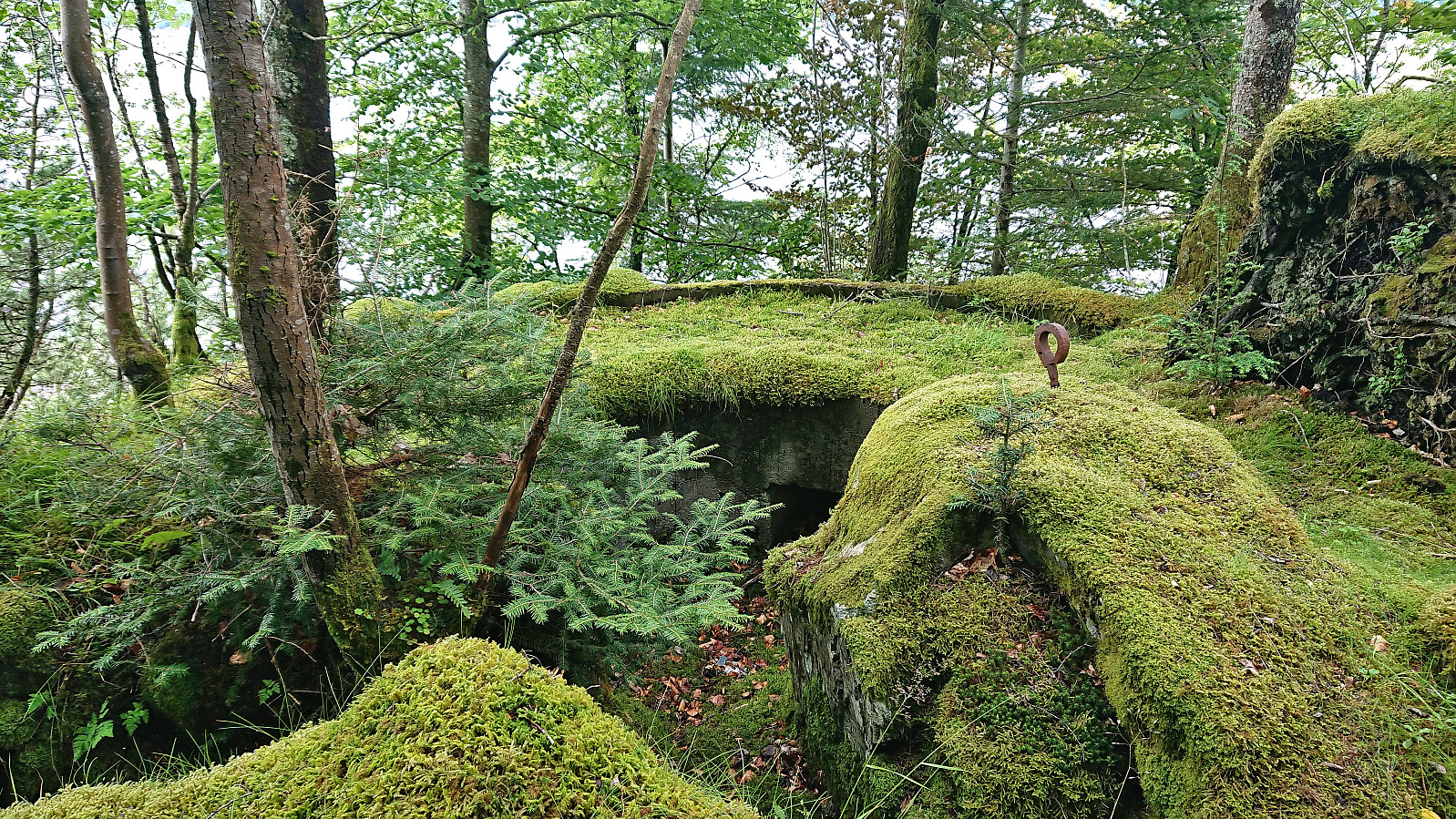 Short hike in Fana with the main objective of visiting Marietoppen . Limited views from the summit but lots of traces from World War II . The summit area could be reached from the south without any trespassing. After descending the same way I continued north along Fanafjorden.
Smøråsfjellet
- Datum:
- 17.07.2023
- Tourcharakter:
- Bergtour
- Tourlänge:
- 2:34h
- Entfernung:
- 9,1km
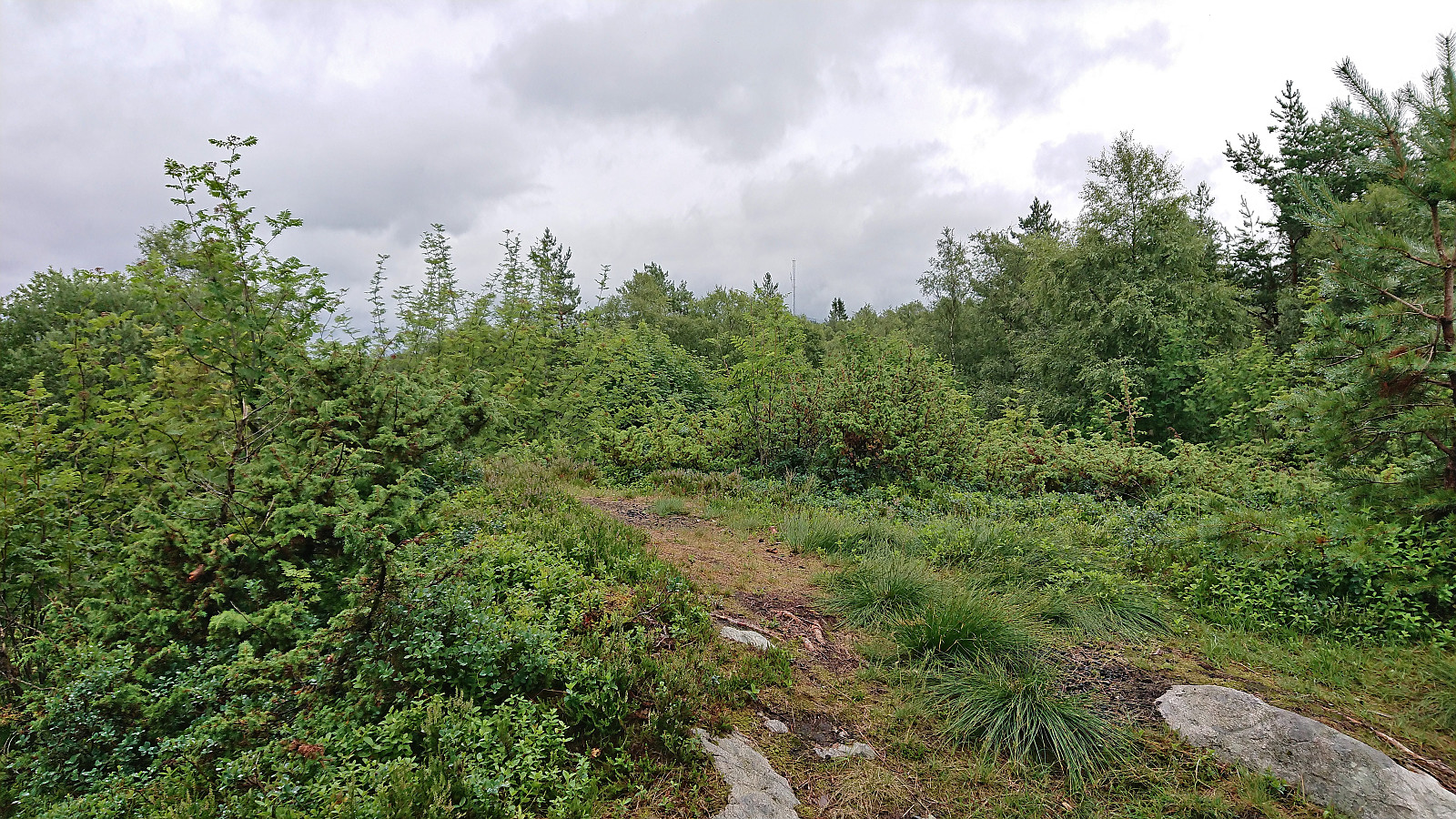 A return to Smøråsfjellet to visit Bjørnevasskletten . When in the area I also passed by Storhaugen, Litlafjellet and Revhaugen, in addition to a revisit of Hamrefjellet , just in case any of these will be added as their own PB-elements in the future. Missed the bus at Valle by a couple of minutes and ended up walking to the Bybane stop at Skjoldskiftet.
Hellemyrstien
- Datum:
- 16.07.2023
- Tourcharakter:
- Wanderung
- Tourlänge:
- 1:53h
- Entfernung:
- 4,8km
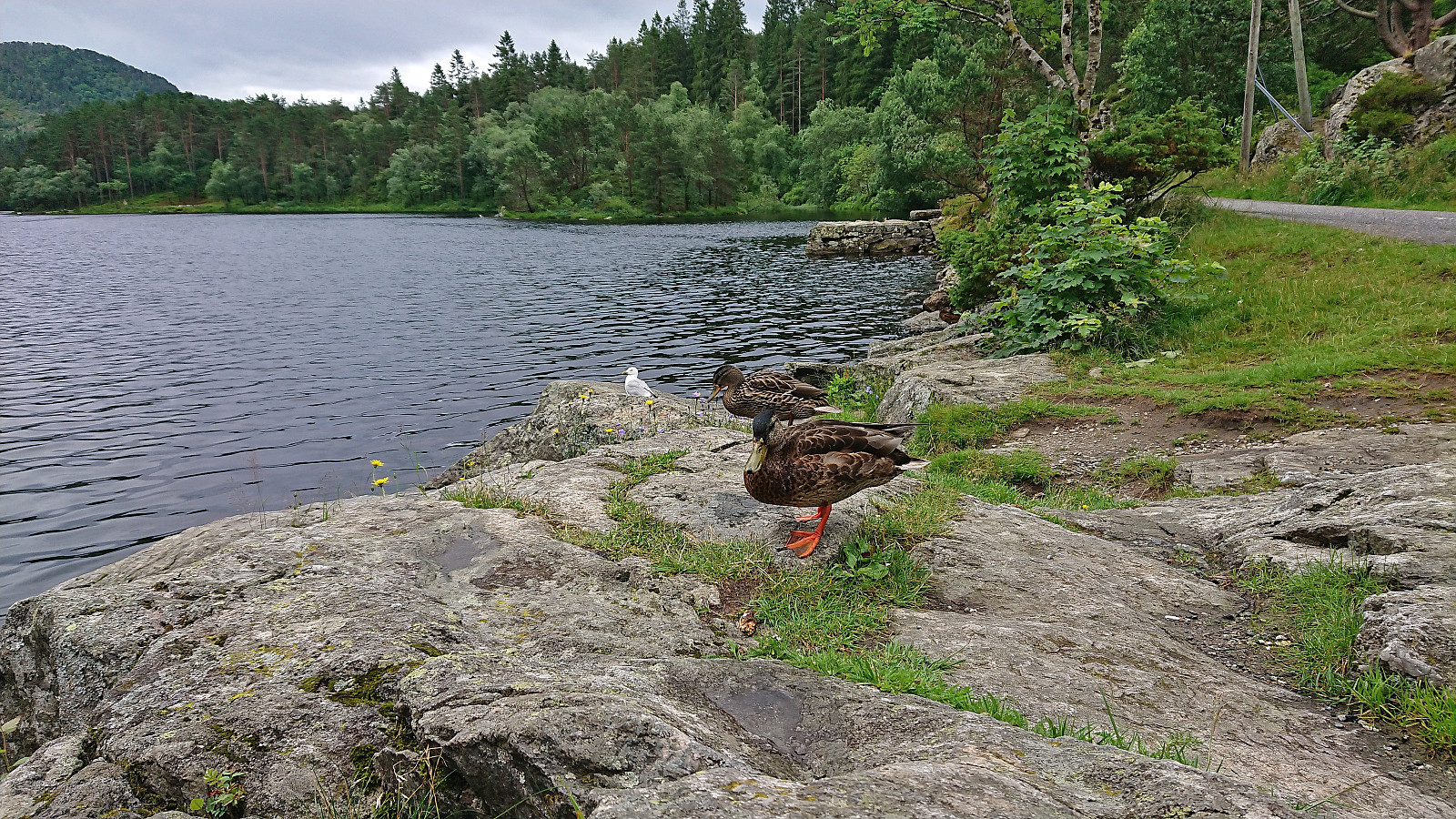 Short local hike with my oldest nephew on a gray Sunday which included a stop at Langevatnet to feed the ducks.
Furukammen and Helleveien
- Datum:
- 15.07.2023
- Tourcharakter:
- Wanderung
- Tourlänge:
- 1:26h
- Entfernung:
- 5,3km
 Short local hike before the afternoon rain showers began.
Vetlavardhytto from Eikelandsosen terminal
- Datum:
- 14.07.2023
- Tourcharakter:
- Bergtour
- Tourlänge:
- 2:08h
- Entfernung:
- 6,7km
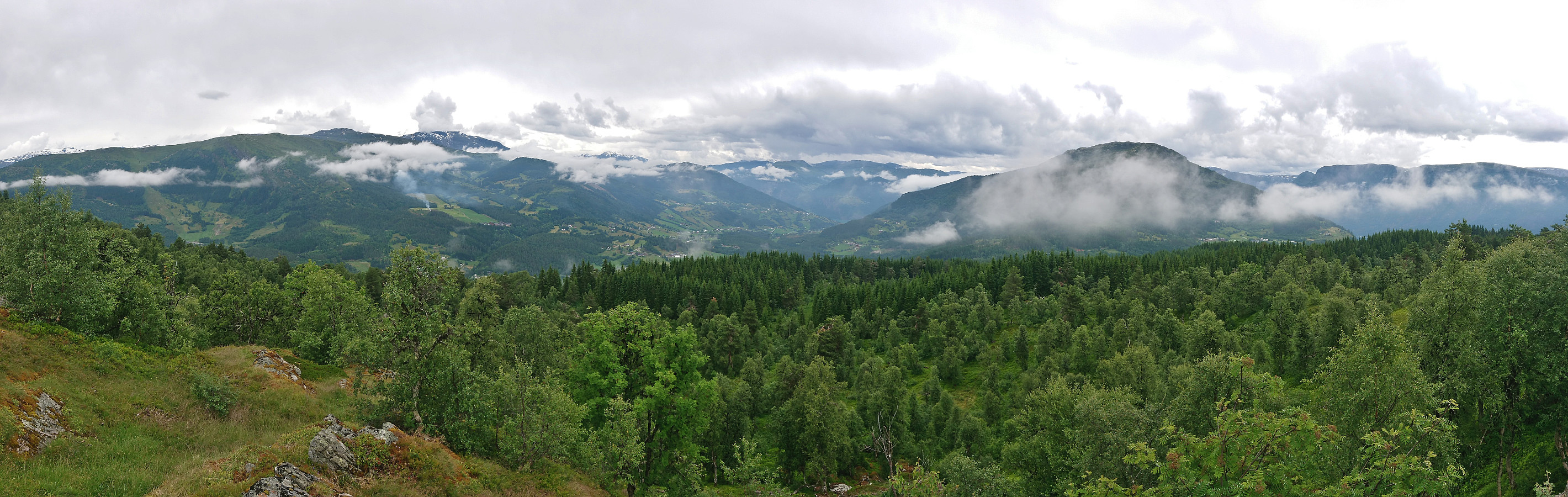
 After 4.5 hours on the boat from Sogndal to Bergen the day before, I was not really up for a long hike today. However, the nice weather had to be utilized as it seemed like it would be the last nice day in quite some time. In the end, I settled on Vetlavardhytto in Eikelandsosen . My previous attempt at visiting this cabin had been unsuccessful due to a too short bus connection at Osøyro, hence my current travelling plan added five additional minutes in Osøyro and, combined with less traffic during the summer holiday season, I made the bus to Eikelandsosen without any issues.
At Eikelandsosen I followed the roads to the marked start of the trail to Vetlavardhytto and crossed the river on a new bridge to start the ascent. The trail was marked with red paint and initially followed the river. Soon the trail markers however changed from red paint to small pieces >>>
After 4.5 hours on the boat from Sogndal to Bergen the day before, I was not really up for a long hike today. However, the nice weather had to be utilized as it seemed like it would be the last nice day in quite some time. In the end, I settled on Vetlavardhytto in Eikelandsosen . My previous attempt at visiting this cabin had been unsuccessful due to a too short bus connection at Osøyro, hence my current travelling plan added five additional minutes in Osøyro and, combined with less traffic during the summer holiday season, I made the bus to Eikelandsosen without any issues.
At Eikelandsosen I followed the roads to the marked start of the trail to Vetlavardhytto and crossed the river on a new bridge to start the ascent. The trail was marked with red paint and initially followed the river. Soon the trail markers however changed from red paint to small pieces >>>
Cycling along Barsnesfjorden
- Datum:
- 13.07.2023
- Tourcharakter:
- Fahrradtour Straße
- Tourlänge:
- 0:48h
- Entfernung:
- 4,4km
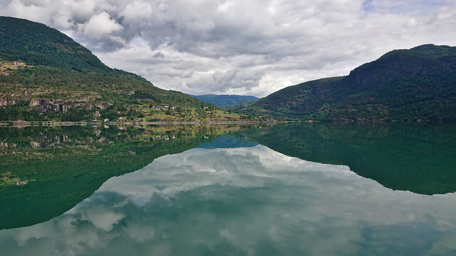 Short cycling trip along Barsnesfjorden.
(Note that the road this hike follows is private, i.e. no cars allowed. There are however a couple of parking spaces down by the small wharf along Barsnesfjorden just before the road turns west and starts climbing slightly towards the crossroads at Barsnes.)
Short cycling trip along Barsnesfjorden.
(Note that the road this hike follows is private, i.e. no cars allowed. There are however a couple of parking spaces down by the small wharf along Barsnesfjorden just before the road turns west and starts climbing slightly towards the crossroads at Barsnes.)
Kayaking around Øyna in Barsnesfjorden
- Datum:
- 12.07.2023
- Tourcharakter:
- Kayaking
- Tourlänge:
- 0:52h
- Entfernung:
- 3,1km
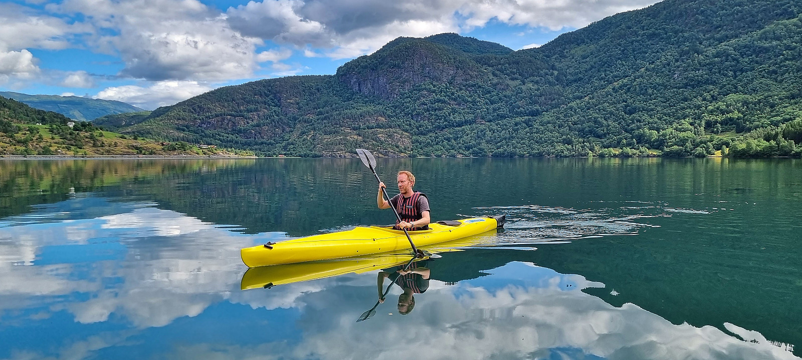 Kayaking around Øyna in Barsnesfjorden.
Barsnesfjorden
- Datum:
- 12.07.2023
- Tourcharakter:
- Wanderung
- Tourlänge:
- 1:50h
- Entfernung:
- 2,0km
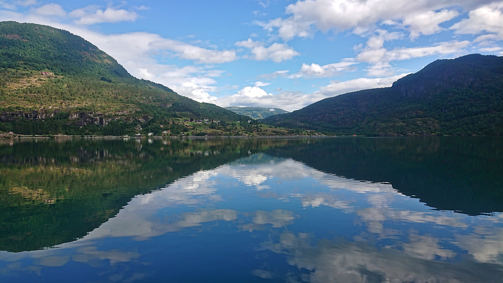 Short hike along Barsnesfjorden including a kayak trip around Øyna (see separate trip report ).
(Note that the road this hike follows is private, i.e. no cars allowed. There are however a couple of parking spaces down by the small wharf along Barsnesfjorden just before the road turns west and starts climbing slightly towards the crossroads at Barsnes.)
Short hike along Barsnesfjorden including a kayak trip around Øyna (see separate trip report ).
(Note that the road this hike follows is private, i.e. no cars allowed. There are however a couple of parking spaces down by the small wharf along Barsnesfjorden just before the road turns west and starts climbing slightly towards the crossroads at Barsnes.)
Bondehaug from Krossen
- Datum:
- 11.07.2023
- Tourcharakter:
- Jogging
- Tourlänge:
- 1:13h
- Entfernung:
- 5,8km
 After the short hike to Storehaug we drove to Krossen and parked at a smaller parking lot up a gravel side road southwest of the main parking lot. Here we had spotted a hiking sign for Bondehaug when driving back from our visit of Eikjabu and hoped this would provide a nice hike. We started on a tractor road that later turned into a marked trail which to our surprise did not follow the tractor road indicated on the map heading more directly towards the summit. Instead, it first continued southwest to Røymsstølen before turning northwest to the hill incorrectly marked as the summit of Bondehaug .
Before reaching Røymsstølen, and just before getting the great views across Lustrafjorden, my dad decided to return to the car. I therefore increased the speed and continued on my own to Bondehaug utsiktspunkt . Here there were excellent views. Well worth a visit. After a couple of pictures I continued southwest to the real summit, >>>
After the short hike to Storehaug we drove to Krossen and parked at a smaller parking lot up a gravel side road southwest of the main parking lot. Here we had spotted a hiking sign for Bondehaug when driving back from our visit of Eikjabu and hoped this would provide a nice hike. We started on a tractor road that later turned into a marked trail which to our surprise did not follow the tractor road indicated on the map heading more directly towards the summit. Instead, it first continued southwest to Røymsstølen before turning northwest to the hill incorrectly marked as the summit of Bondehaug .
Before reaching Røymsstølen, and just before getting the great views across Lustrafjorden, my dad decided to return to the car. I therefore increased the speed and continued on my own to Bondehaug utsiktspunkt . Here there were excellent views. Well worth a visit. After a couple of pictures I continued southwest to the real summit, >>>
