Arkiv - dato
Arkiv - aktivitet
-
Annen tur (3)
- Kajakkpadling (3)
- Fottur (1897)
-
Kjøretur (9)
- Biltur (9)
-
Skitur (116)
- Fjellskitur (69)
- Langrennstur (47)
-
Sykkeltur (111)
- Blandet sykling (25)
- Gatesykling (86)
Lister jeg samler etter
-
Utvalgte topper og turmål i Bergen
(349/351)
 99%
99% -
Alle topper i Bergen
(393/400)
98%
-
Voss ≥ 100m pf.
(96/98)
97%
-
Opptur Hordaland
(144/159)
90%
-
Stasjoner på Bergensbanen
(33/40)
82%
-
Ulvik ≥ 100m pf.
(30/38)
78%
-
Hordaland ≥ 100m pf.
(624/863)
72%
-
Mjølfjell PF > 100m
(21/31)
67%
-
Jondal ≥ 100m pf.
(15/23)
65%
-
Dagsturhyttene i Vestland
(36/61)
59%
-
Sunnhordland PF >= 100m
(105/186)
56%
-
Hordaland: Hardanger PF>=100m
(196/359)
54%
-
DNT-hytter i Hordaland
(23/45)
51%
-
Kvinnherad ≥ 100m pf.
(40/79)
50%
-
Eidfjord ≥ 100m pf.
(13/42)
30%
-
Sogndal ≥ 100m pf.
(23/81)
28%
-
Gulen ≥ 100m pf.
(15/54)
27%
-
Vik i Sogn ≥ 100m pf.
(10/46)
21%
-
Sogn - Sør for Sognefjorden PF>=100m
(31/159)
19%
-
DNT-hytter i Sogn og Fjordane
(8/47)
17%

Teglbu
- Dato:
- 19.11.2023
- Turtype:
- Fjelltur
- Turlengde:
- 0:33t
- Distanse:
- 2,3km
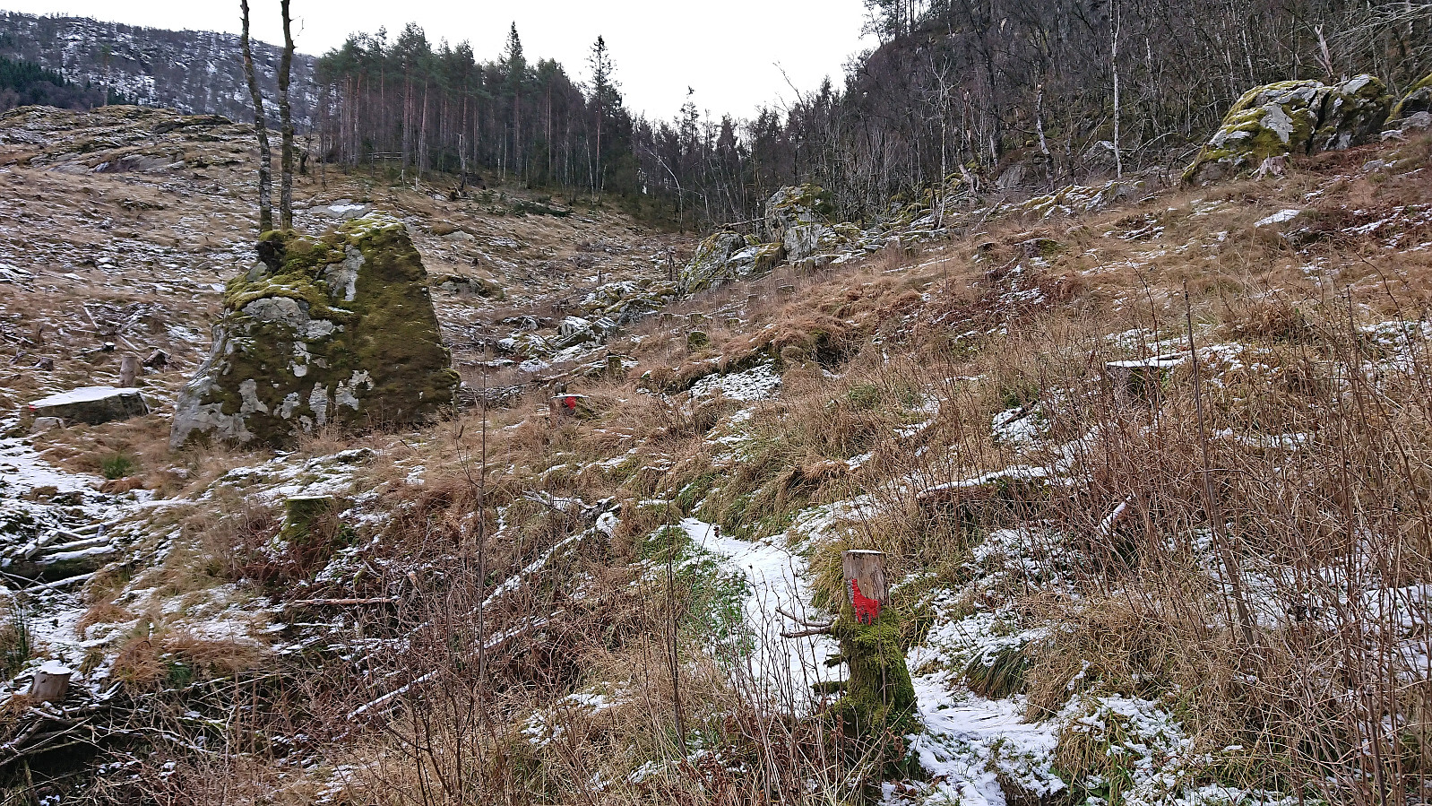 Upon completing our hike to Gaddane and Hædna , we still had plenty of time before the ferry. I therefore decided to add a visit of Teglbu . So while Petter drove directly to Jondal, I was dropped off at the marked trailhead north of Teglhaugen. From there I could easily follow the marked trail to Teglbu. Before descending, I also made sure to visit the much better vantage point just west of the cabin which provided a nice overview of Jondal.
Given that I had ferry to catch, and had to move fast, I ended up losing the marked trail at the start of the descent. Basically, I turned right (west/northwest) too quickly. And while I probably could have descended via this route as well, I concluded that I still had the time to search for the proper trail and it did not take long before I was back on track.
The proper trail was steepish >>>
Upon completing our hike to Gaddane and Hædna , we still had plenty of time before the ferry. I therefore decided to add a visit of Teglbu . So while Petter drove directly to Jondal, I was dropped off at the marked trailhead north of Teglhaugen. From there I could easily follow the marked trail to Teglbu. Before descending, I also made sure to visit the much better vantage point just west of the cabin which provided a nice overview of Jondal.
Given that I had ferry to catch, and had to move fast, I ended up losing the marked trail at the start of the descent. Basically, I turned right (west/northwest) too quickly. And while I probably could have descended via this route as well, I concluded that I still had the time to search for the proper trail and it did not take long before I was back on track.
The proper trail was steepish >>>
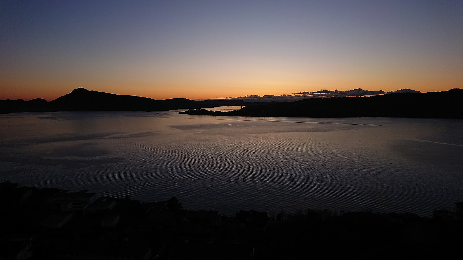
Gaddane and Hædna
- Dato:
- 19.11.2023
- Turtype:
- Fjelltur
- Turlengde:
- 2:37t
- Distanse:
- 4,7km
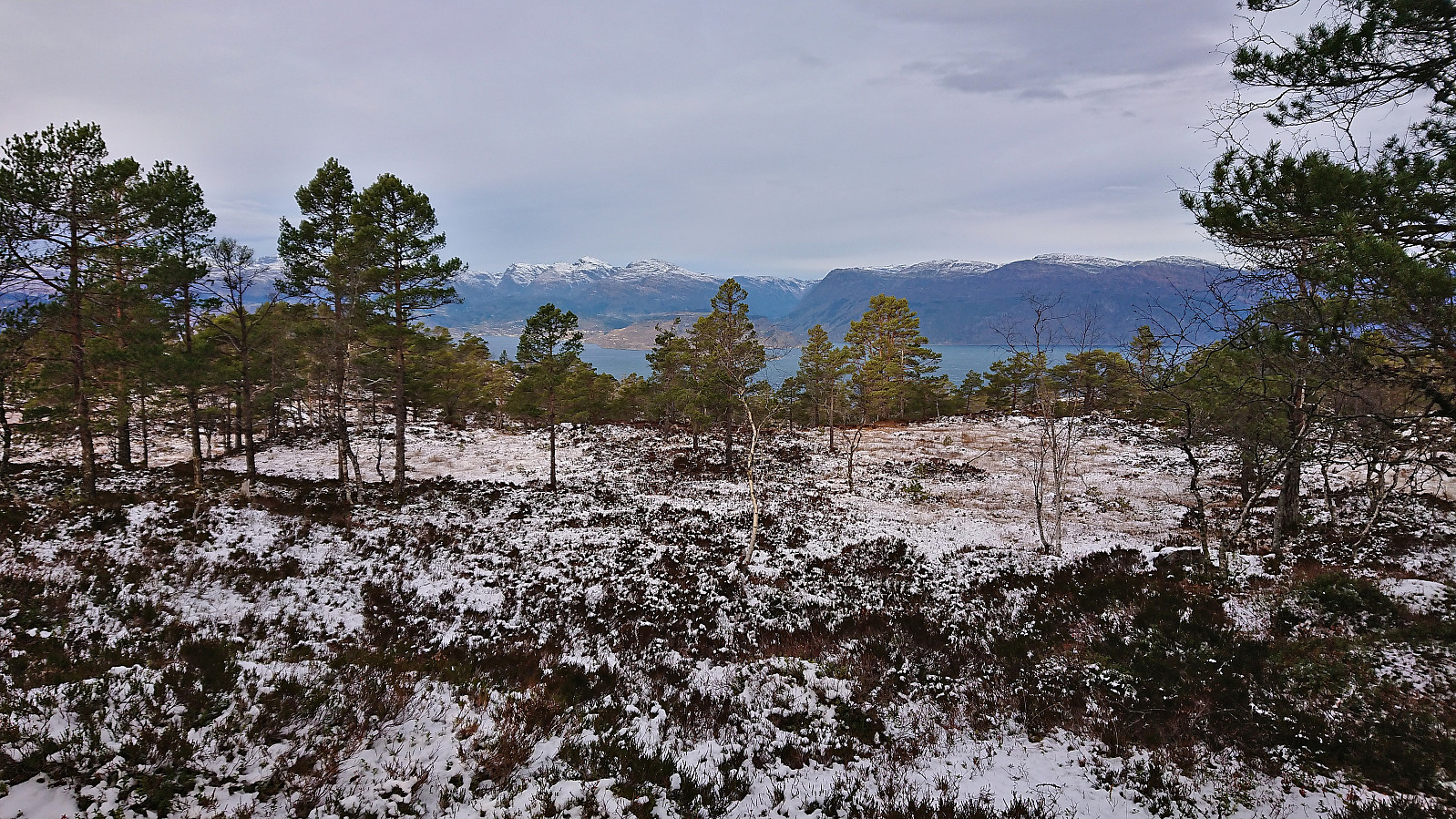 Petter picked me up at my place at 07:00 and together we drove the roughly 1.5 hours to Tørvikbygd, arriving around 20 minutes before the ferry was to depart to Jondal. After a short and windy ferry ride we followed the road east to Espeland where we turned northeast towards Vassendvatnet. This road was a toll road and we paid the 60 kr via Vipps before continuing to a parking lot at around 350 meters above sea level . As this parking lot mainly seems to be used as a starting point for skiing trips in the winter, we had it all to ourselves.
We parked the car and briefly followed the road northeast before turning north and heading off-trail in the direction of the summit of Gaddane . There was a marked trail in the valley called Djupadalen between the two summits, however as following it would result in a bit of detour we instead opted for the more direct >>>
Petter picked me up at my place at 07:00 and together we drove the roughly 1.5 hours to Tørvikbygd, arriving around 20 minutes before the ferry was to depart to Jondal. After a short and windy ferry ride we followed the road east to Espeland where we turned northeast towards Vassendvatnet. This road was a toll road and we paid the 60 kr via Vipps before continuing to a parking lot at around 350 meters above sea level . As this parking lot mainly seems to be used as a starting point for skiing trips in the winter, we had it all to ourselves.
We parked the car and briefly followed the road northeast before turning north and heading off-trail in the direction of the summit of Gaddane . There was a marked trail in the valley called Djupadalen between the two summits, however as following it would result in a bit of detour we instead opted for the more direct >>>
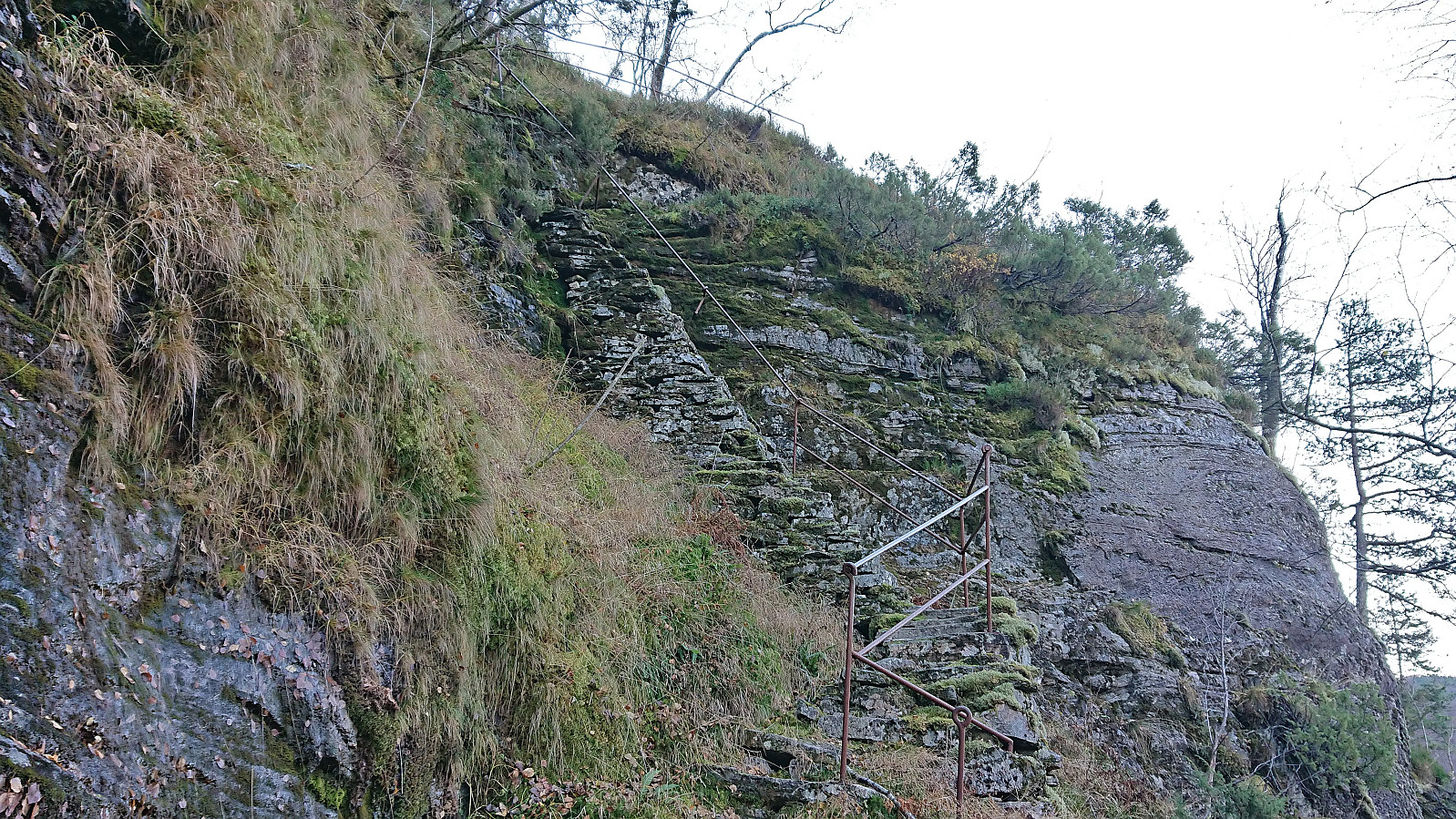
Across Hellen festning
- Dato:
- 18.11.2023
- Turtype:
- Fottur
- Turlengde:
- 0:36t
- Distanse:
- 3,1km
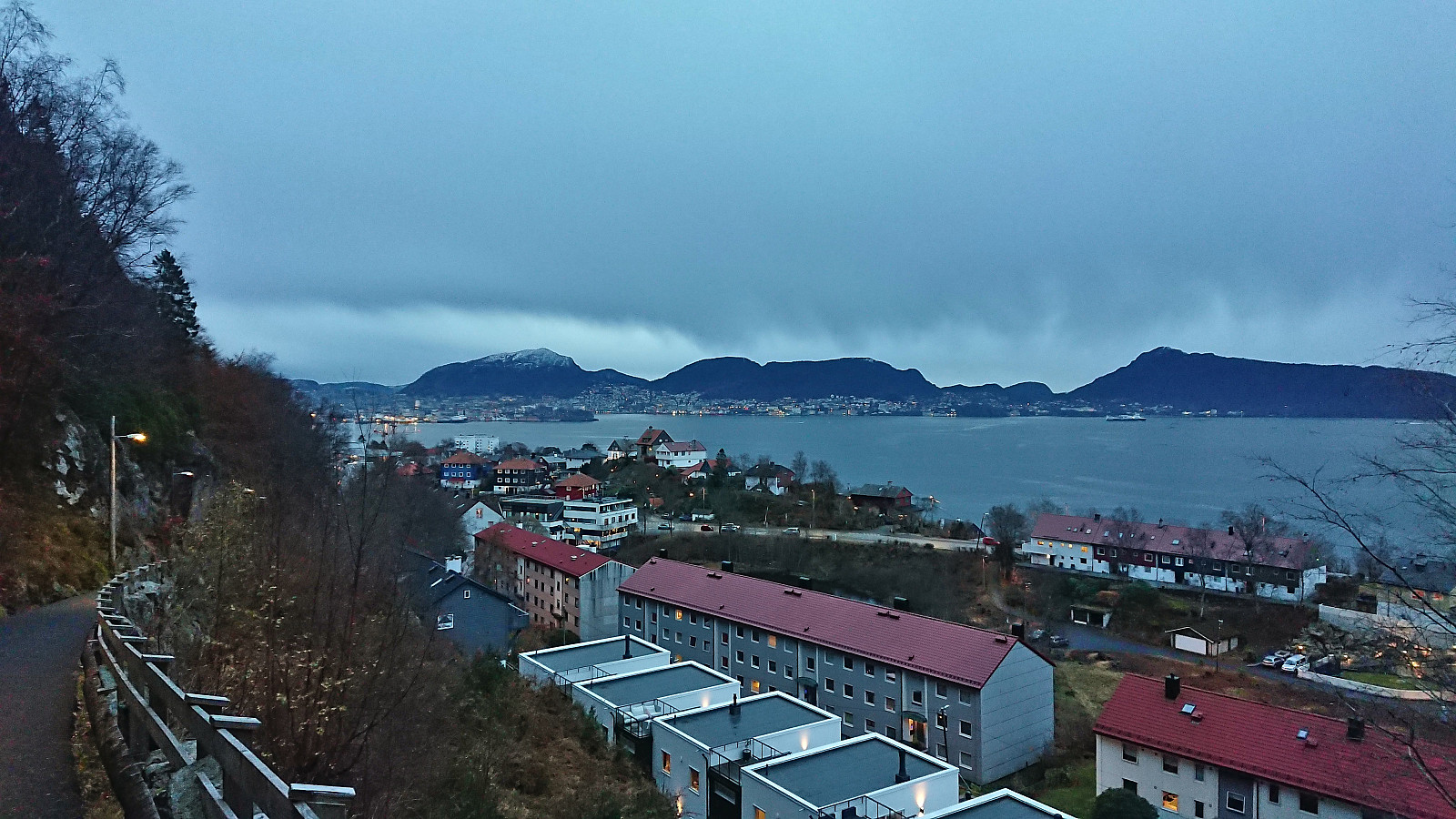 Short local Saturday hike.
Ørneberget and Furukammen
- Dato:
- 17.11.2023
- Turtype:
- Fjelltur
- Turlengde:
- 0:52t
- Distanse:
- 3,9km
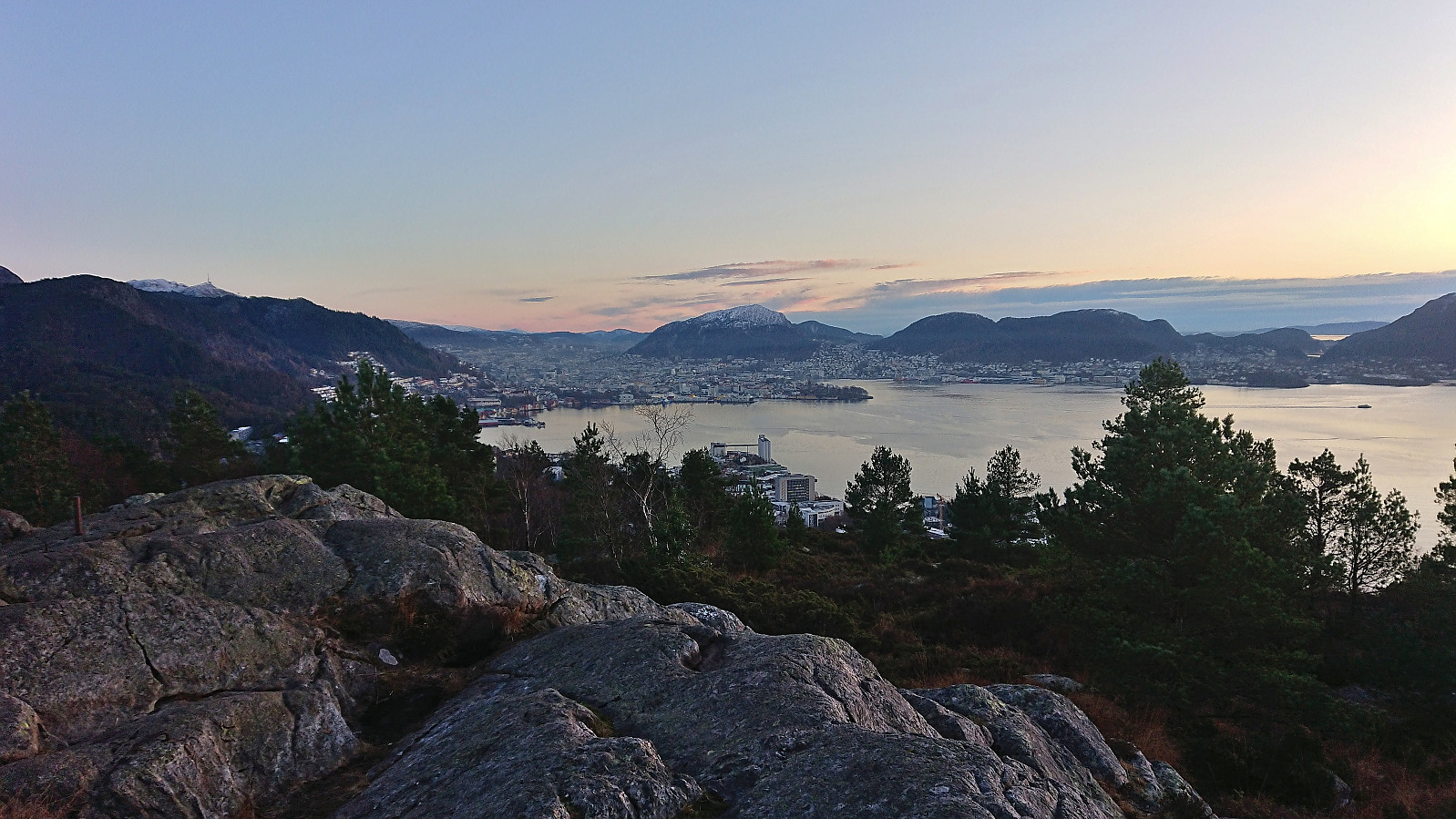 Short local hike just before sunset after a day at the home office.
Across Hellen festning
- Dato:
- 14.11.2023
- Turtype:
- Fottur
- Turlengde:
- 0:43t
- Distanse:
- 3,4km
 Short local hike just after sunset.
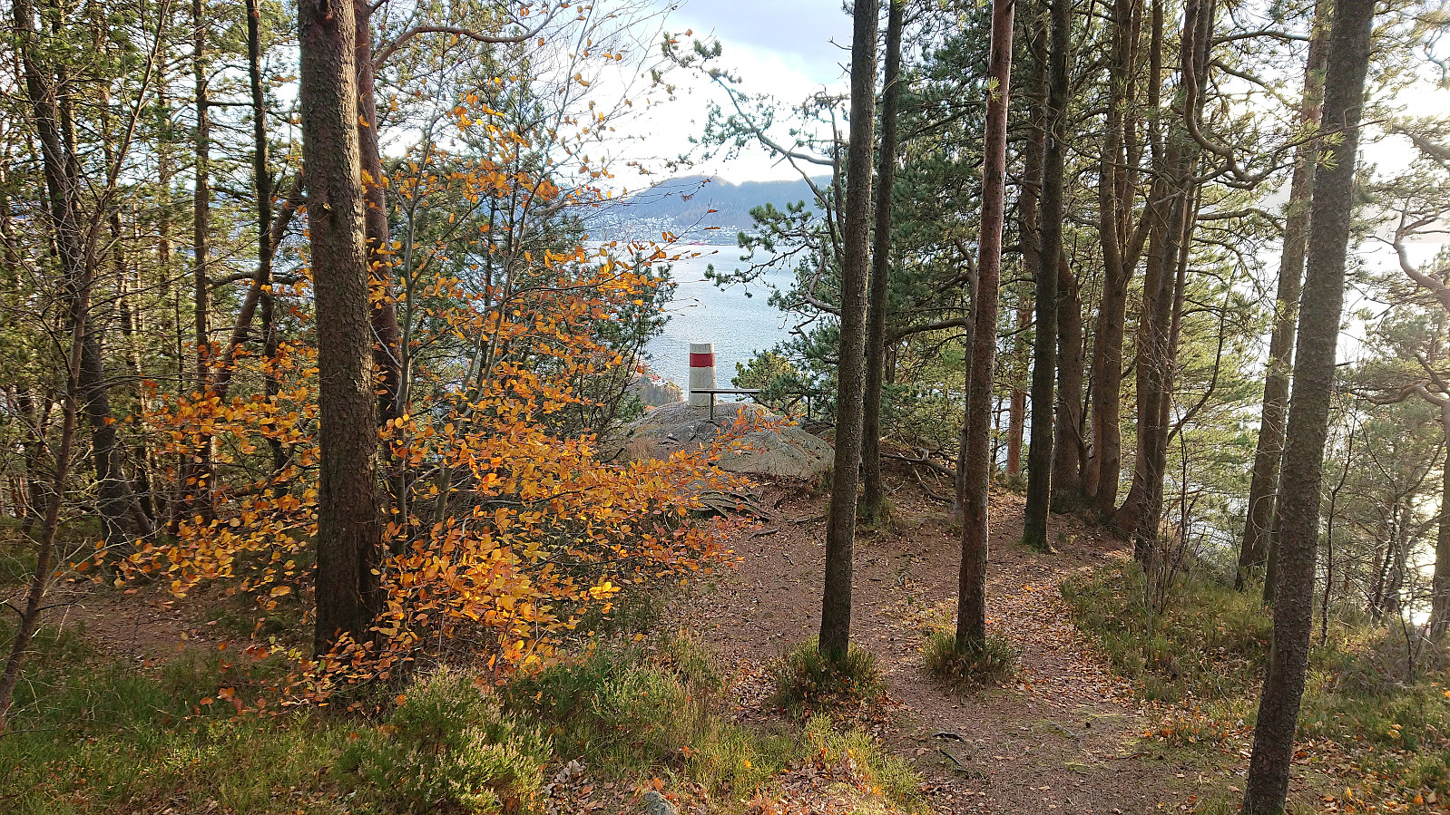
Gamle Bergen, Sandviksbatteriet and Ørneberget NV
- Dato:
- 12.11.2023
- Turtype:
- Fottur
- Turlengde:
- 1:52t
- Distanse:
- 9,3km
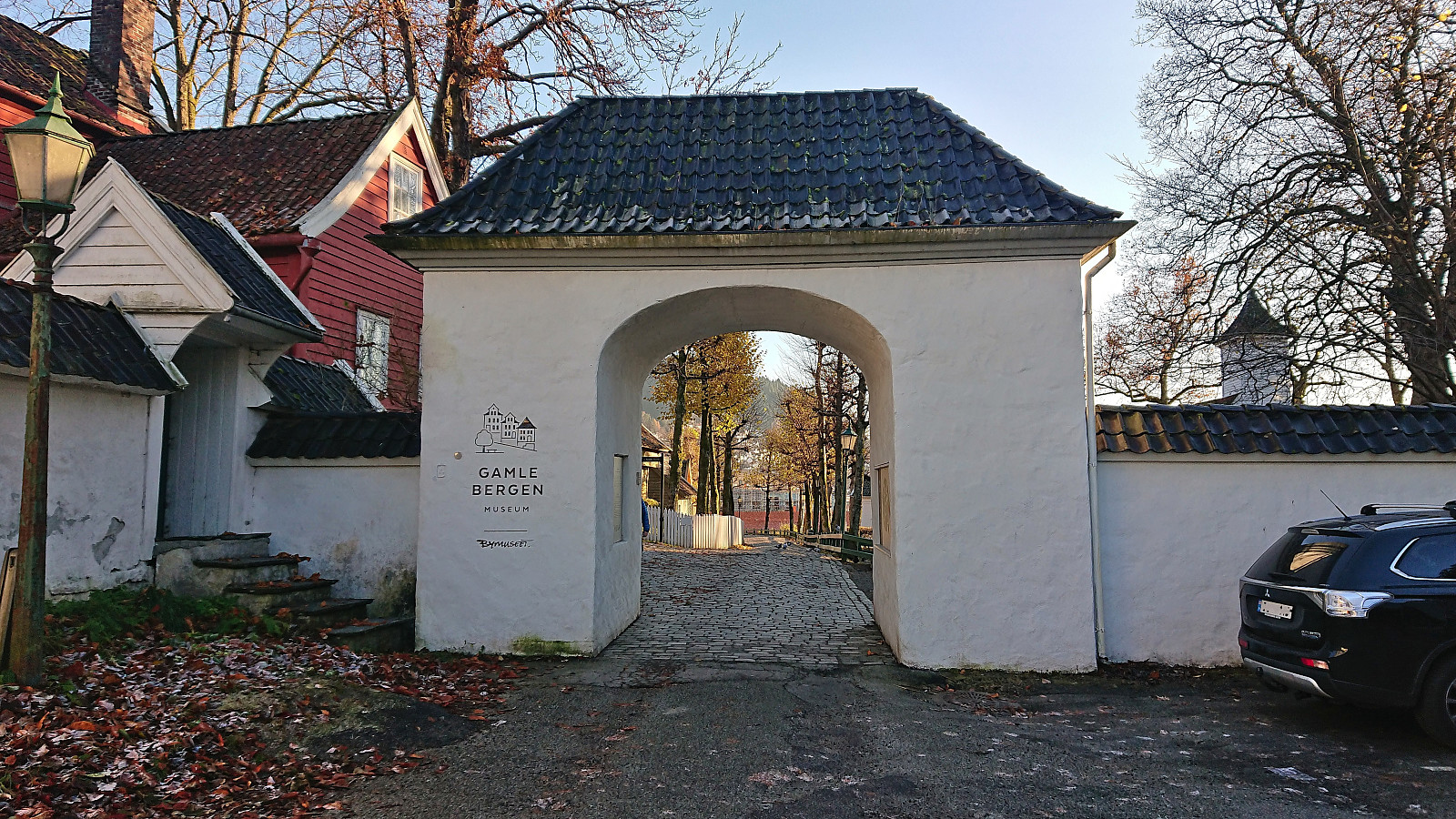 Local Sunday hike in excellent weather.
Kvamsnova from Furnestreet
- Dato:
- 11.11.2023
- Turtype:
- Fjelltur
- Turlengde:
- 5:09t
- Distanse:
- 8,6km
 Most people visiting Kvamsnova (also referred to as Kvamsnovi) seem do so as an extended detour when visiting Store Dustingen/Dystingen . This route however did not look too appealing and I was therefore more eager follow in elbow (Vegard Magnussen) 's footsteps based on his trip report indicating an easier route from Furnestreet (or Fornestræet as it is now written on the map). The only issue was that getting to Furnestreet (and back home afterwards) by public transport is not straightforward (requires first taking the train to Bolstadøyri, waiting half an hour at the station, and then taking the bus to Furnestreet). I was therefore very happy when Kjell showed an interest in joining and we could travel by car.
After leaving the car at the parking lot along the fjord (now partly occupied by the company working on Dalseidtunnelen), we crossed the main road and continued >>>
Most people visiting Kvamsnova (also referred to as Kvamsnovi) seem do so as an extended detour when visiting Store Dustingen/Dystingen . This route however did not look too appealing and I was therefore more eager follow in elbow (Vegard Magnussen) 's footsteps based on his trip report indicating an easier route from Furnestreet (or Fornestræet as it is now written on the map). The only issue was that getting to Furnestreet (and back home afterwards) by public transport is not straightforward (requires first taking the train to Bolstadøyri, waiting half an hour at the station, and then taking the bus to Furnestreet). I was therefore very happy when Kjell showed an interest in joining and we could travel by car.
After leaving the car at the parking lot along the fjord (now partly occupied by the company working on Dalseidtunnelen), we crossed the main road and continued >>>
Rognåsen and Ørneberget
- Dato:
- 08.11.2023
- Turtype:
- Fjelltur
- Turlengde:
- 2:34t
- Distanse:
- 10,8km
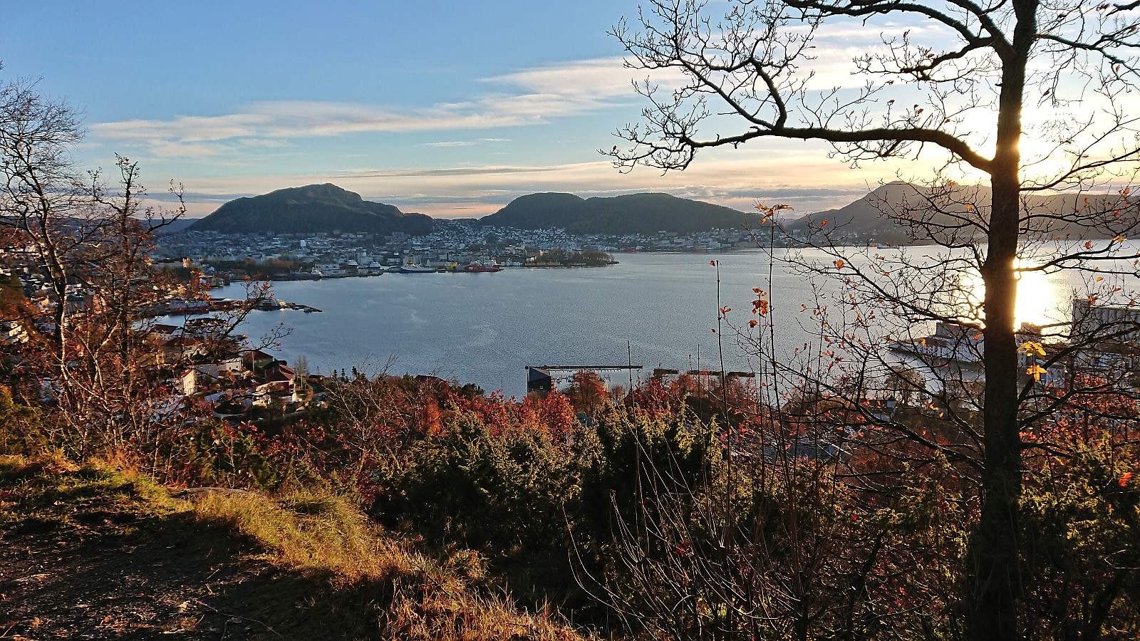 Left work early for a short hike with my colleague taking part in Stolpejakten (and concluded by walking home from Sandviken sykehus afterwards).
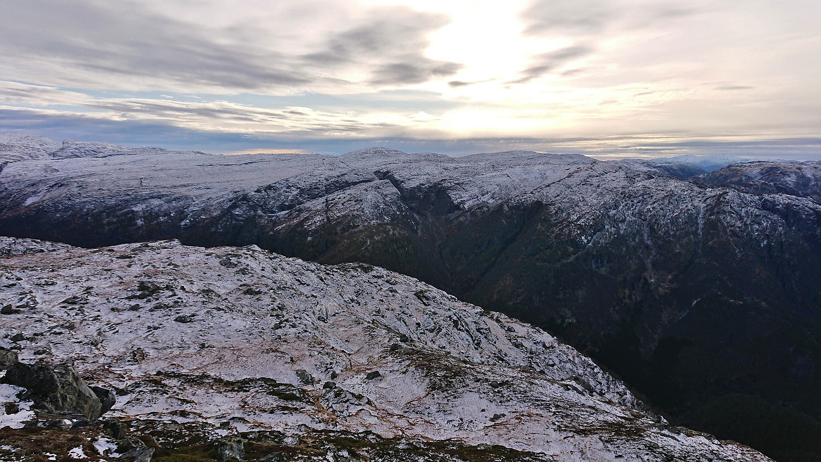
Nipa via Stegane from Matre
- Dato:
- 05.11.2023
- Turtype:
- Fjelltur
- Turlengde:
- 4:42t
- Distanse:
- 13,0km
 Warning: This hike includes a steep ascent and a potentially very dangerous dam crossing. Read the report carefully and plan accordingly!
An ascent of Nipa next to Hummelfossen in Matre had been on my list for a while but had always been postponed as it requires that the hike is preceded by an extended period with low amounts of rain. Something that is rather uncommon in this part of the country. However, after an unusually dry October, and with little to no rain for the first days of November, the conditions were finally right.
I started by taking the express bus to Matre and from there walked north and then northeast along Stordalsvegen until arriving at Hummelfossen. Here I was glad to see that my predictions were right with Hummelfossen being almost completely without water, the importance of which will be revealed shortly, >>>
Warning: This hike includes a steep ascent and a potentially very dangerous dam crossing. Read the report carefully and plan accordingly!
An ascent of Nipa next to Hummelfossen in Matre had been on my list for a while but had always been postponed as it requires that the hike is preceded by an extended period with low amounts of rain. Something that is rather uncommon in this part of the country. However, after an unusually dry October, and with little to no rain for the first days of November, the conditions were finally right.
I started by taking the express bus to Matre and from there walked north and then northeast along Stordalsvegen until arriving at Hummelfossen. Here I was glad to see that my predictions were right with Hummelfossen being almost completely without water, the importance of which will be revealed shortly, >>>
Ørneberget and Hellen festning
- Dato:
- 04.11.2023
- Turtype:
- Fjelltur
- Turlengde:
- 1:00t
- Distanse:
- 4,2km
 Short local Saturday hike.
