Archiv - Nach Datum
Archiv - Nach Aktivität
-
Andere Tour (3)
- Kayaking (3)
-
Fahrradtour (111)
- Fahrradtour Straße (86)
- Fahrradtour gemischt (25)
-
Fahrzeugtour (9)
- Autotour (9)
-
Fußtour (1897)
- Bergtour (1120)
- Jogging (1)
- Spaziergang (60)
- Wanderung (716)
-
Skitour (116)
- Langlauf (47)
- Tourenskilauf (69)
Gesammelte Listen
-
Utvalgte topper og turmål i Bergen
(349/351)
 99%
99% -
Alle topper i Bergen
(393/400)
98%
-
Voss ≥ 100m pf.
(96/98)
97%
-
Opptur Hordaland
(144/159)
90%
-
Stasjoner på Bergensbanen
(33/40)
82%
-
Ulvik ≥ 100m pf.
(30/38)
78%
-
Hordaland ≥ 100m pf.
(624/863)
72%
-
Mjølfjell PF > 100m
(21/31)
67%
-
Jondal ≥ 100m pf.
(15/23)
65%
-
Dagsturhyttene i Vestland
(36/61)
59%
-
Sunnhordland PF >= 100m
(105/186)
56%
-
Hordaland: Hardanger PF>=100m
(196/359)
54%
-
DNT-hytter i Hordaland
(23/45)
51%
-
Kvinnherad ≥ 100m pf.
(40/79)
50%
-
Eidfjord ≥ 100m pf.
(13/42)
30%
-
Sogndal ≥ 100m pf.
(23/81)
28%
-
Gulen ≥ 100m pf.
(15/54)
27%
-
Vik i Sogn ≥ 100m pf.
(10/46)
21%
-
Sogn - Sør for Sognefjorden PF>=100m
(31/159)
19%
-
DNT-hytter i Sogn og Fjordane
(8/47)
17%

Kjeneset and Såta
- Datum:
- 30.10.2022
- Tourcharakter:
- Bergtour
- Tourlänge:
- 1:26h
- Entfernung:
- 5,0km
 Initial plans to spend the Sunday hiking at Voss had to be abandoned when I for once did not manage to generate the required activation energy to get up and out the door before sunrise, mainly due to suboptimal weather forecasts and overall very wet terrain.
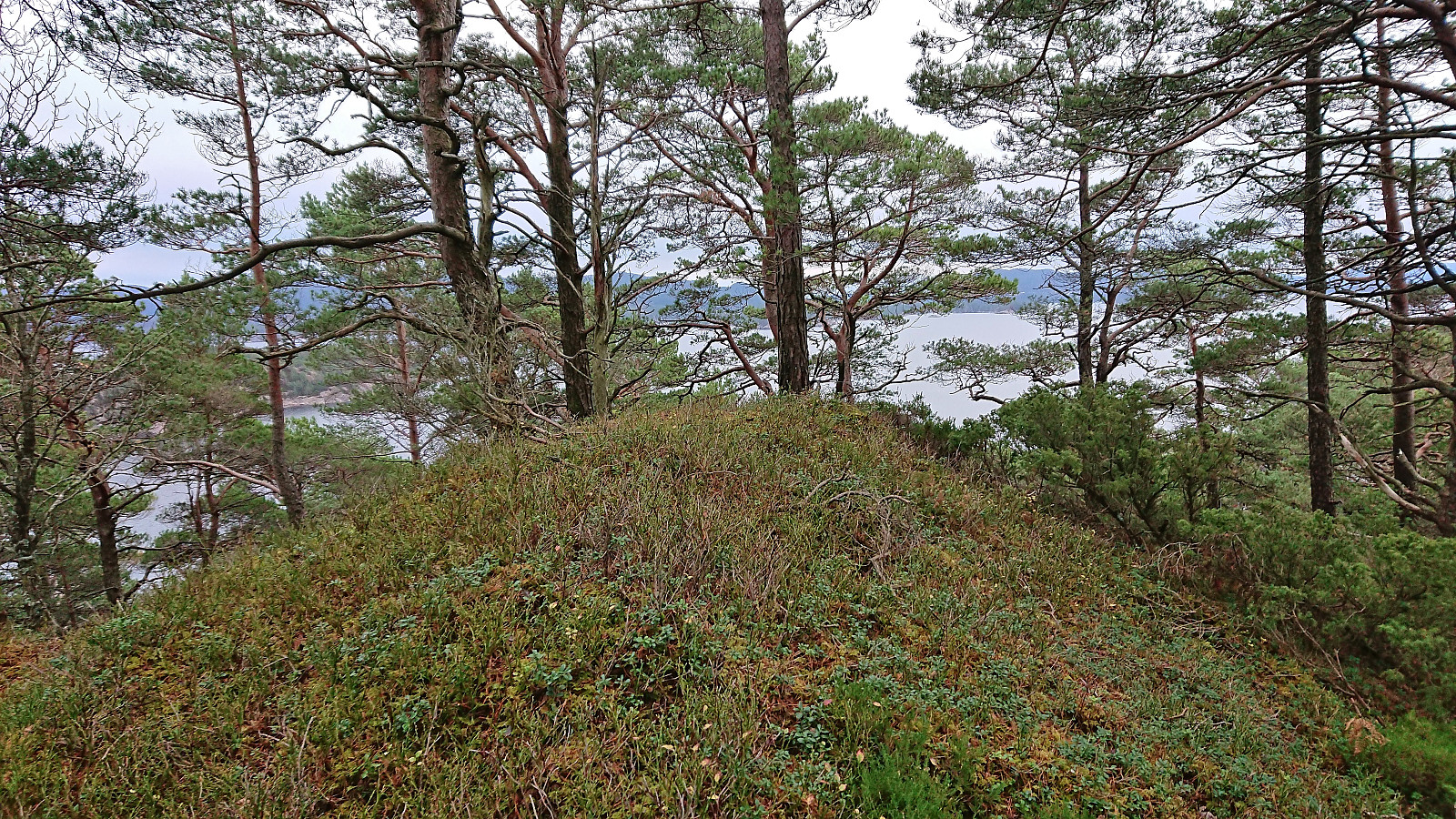
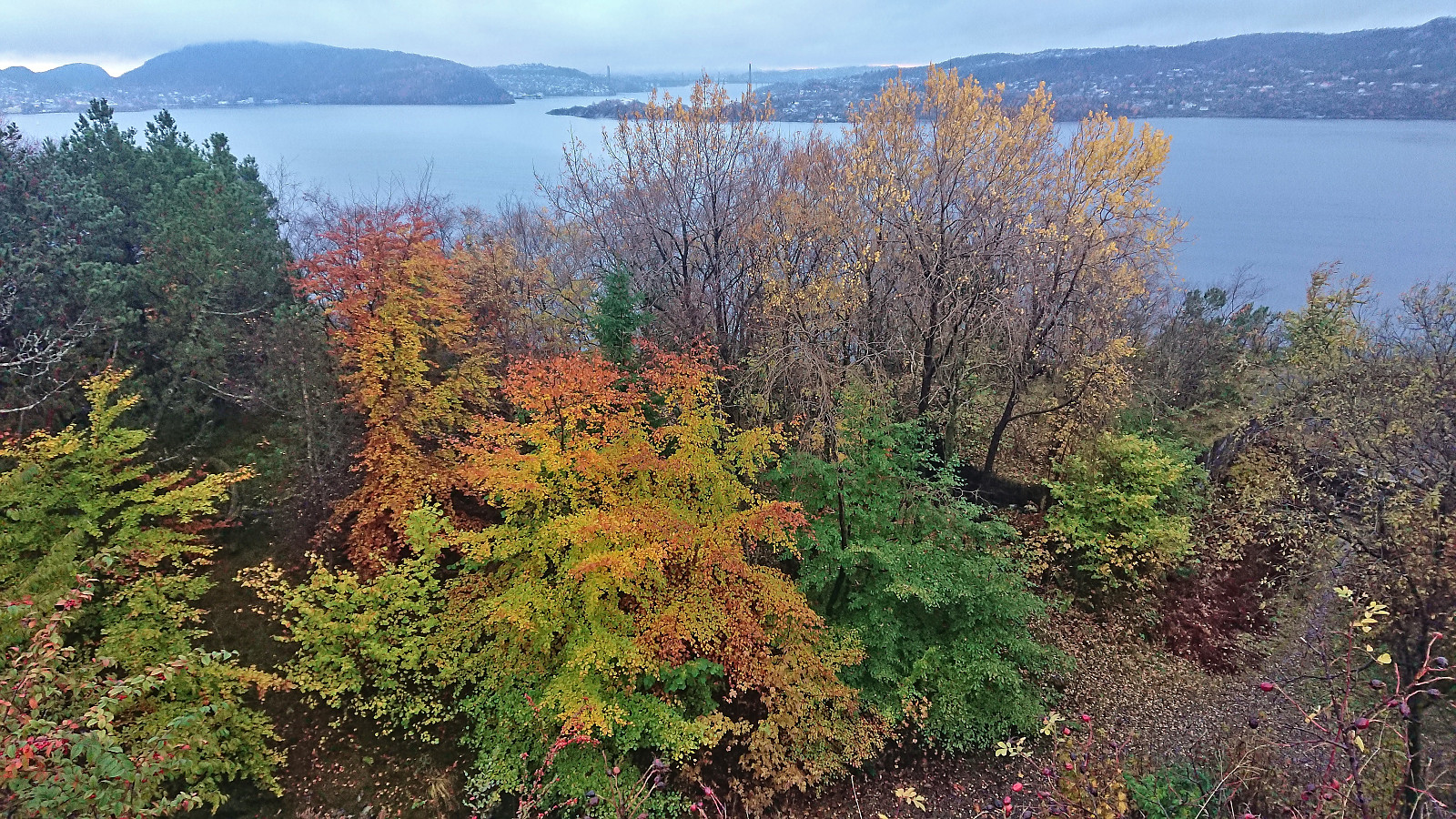
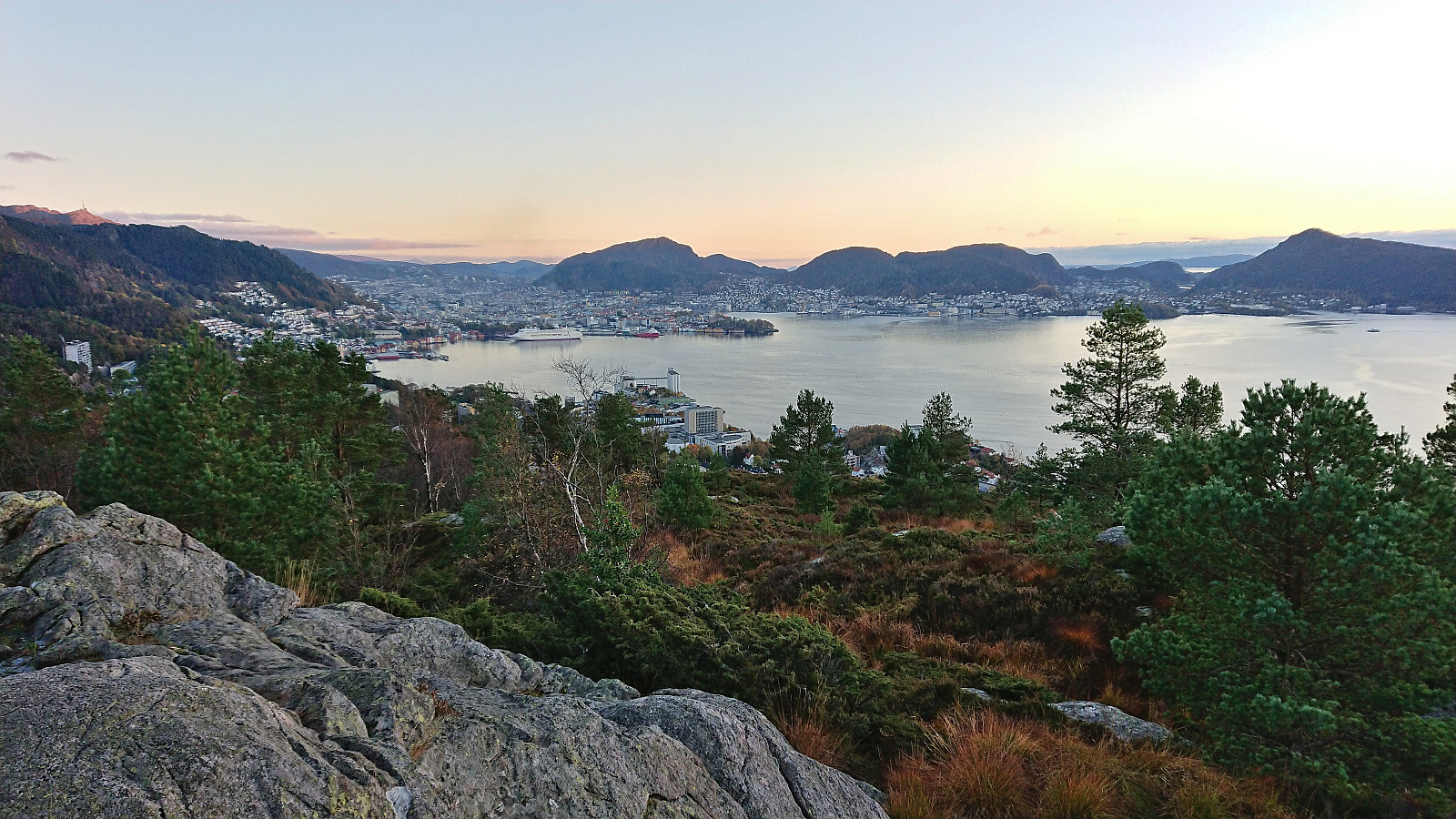
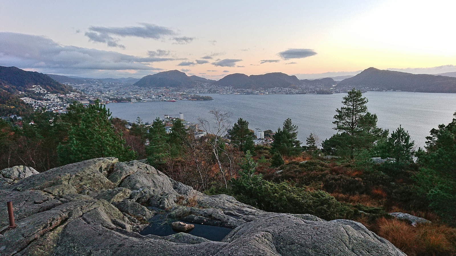
As a replacement I went for a shorter hike later in the day at Korsneset to visit yet more minor summits on the Alle topper i Bergen list, namely Kjeneset and Såta . Two summits I had been saving for just such a gray and rainy day.
After arriving by bus, I pretty much followed in the footsteps of either Kjell51 (Kjell Øijorden) or knutsverre (Knut S. Andersen) , where the only real challenge was finding a route up the short step ascent south of the summit of Kjeneset. In the end I found a location where only a little bit of light scrambling was needed. No such issues to reach Såta, but instead there were plenty of wet and >>>
Initial plans to spend the Sunday hiking at Voss had to be abandoned when I for once did not manage to generate the required activation energy to get up and out the door before sunrise, mainly due to suboptimal weather forecasts and overall very wet terrain.
As a replacement I went for a shorter hike later in the day at Korsneset to visit yet more minor summits on the Alle topper i Bergen list, namely Kjeneset and Såta . Two summits I had been saving for just such a gray and rainy day.
After arriving by bus, I pretty much followed in the footsteps of either Kjell51 (Kjell Øijorden) or knutsverre (Knut S. Andersen) , where the only real challenge was finding a route up the short step ascent south of the summit of Kjeneset. In the end I found a location where only a little bit of light scrambling was needed. No such issues to reach Såta, but instead there were plenty of wet and >>>
Across Hellen festning
- Datum:
- 23.10.2022
- Tourcharakter:
- Wanderung
- Tourlänge:
- 0:38h
- Entfernung:
- 3,2km
 Short local hike on a gray Sunday.
Skorseteggi and Kolingseggi from Oppheimsvatnet to Kløve
- Datum:
- 22.10.2022
- Tourcharakter:
- Bergtour
- Tourlänge:
- 5:10h
- Entfernung:
- 19,0km
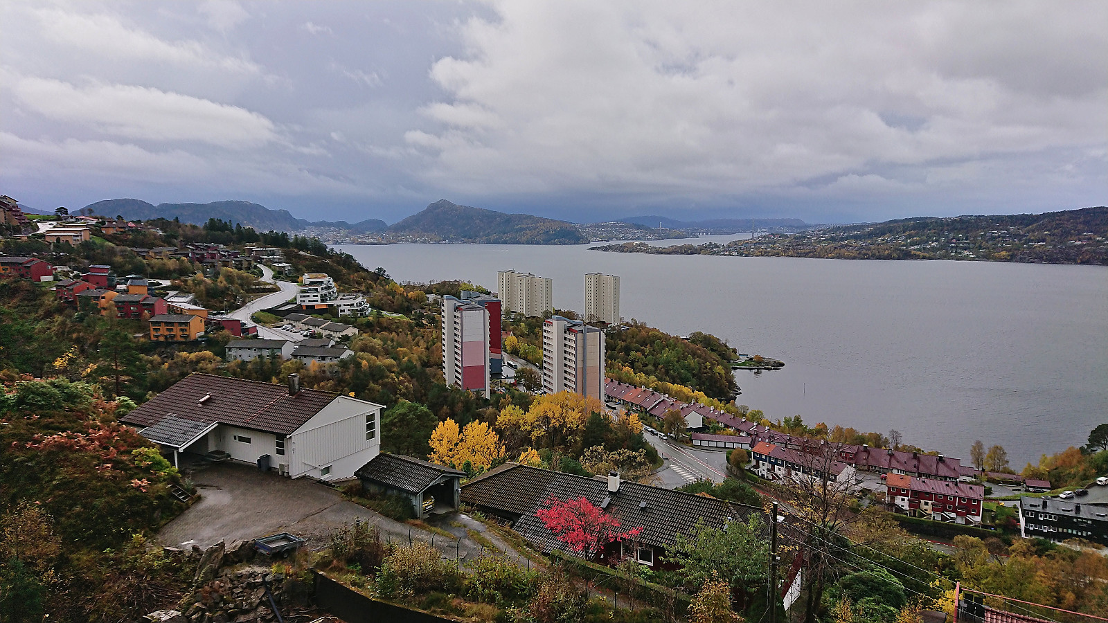
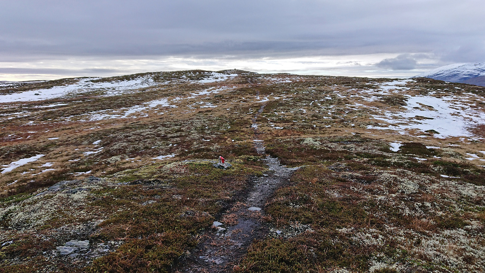 I started by taking the train to Voss with the plan to continue on the bus to Framnes at the western end of Oppheimsvatnet. Due to signaling problems in the tunnel between Bergen and Arna the train ended up arriving 15 minutes late at Voss, but thankfully I still managed to catch the bus heading for Gudvangen. In fact, there were two buses as apparently the tourist season was not quite over.
After getting off the bus at Framnes, I walked back along the main road for about 200 meters (on a broad sidewalk) to cross the bridge to the south side of Oppheimsvatnet where I continued south along Langedalsvegen (the second exit to the right) until locating the marked trailhead for Lemme. The first 100 meters or so consisted of a new tractor road where the earth/mud had not quite set yet, but then changed >>>
I started by taking the train to Voss with the plan to continue on the bus to Framnes at the western end of Oppheimsvatnet. Due to signaling problems in the tunnel between Bergen and Arna the train ended up arriving 15 minutes late at Voss, but thankfully I still managed to catch the bus heading for Gudvangen. In fact, there were two buses as apparently the tourist season was not quite over.
After getting off the bus at Framnes, I walked back along the main road for about 200 meters (on a broad sidewalk) to cross the bridge to the south side of Oppheimsvatnet where I continued south along Langedalsvegen (the second exit to the right) until locating the marked trailhead for Lemme. The first 100 meters or so consisted of a new tractor road where the earth/mud had not quite set yet, but then changed >>>
Across Hellen festning
- Datum:
- 20.10.2022
- Tourcharakter:
- Wanderung
- Tourlänge:
- 0:34h
- Entfernung:
- 3,1km
 Short local evening hike after work.
Ørneberget and Hellen festning
- Datum:
- 19.10.2022
- Tourcharakter:
- Bergtour
- Tourlänge:
- 0:56h
- Entfernung:
- 4,3km
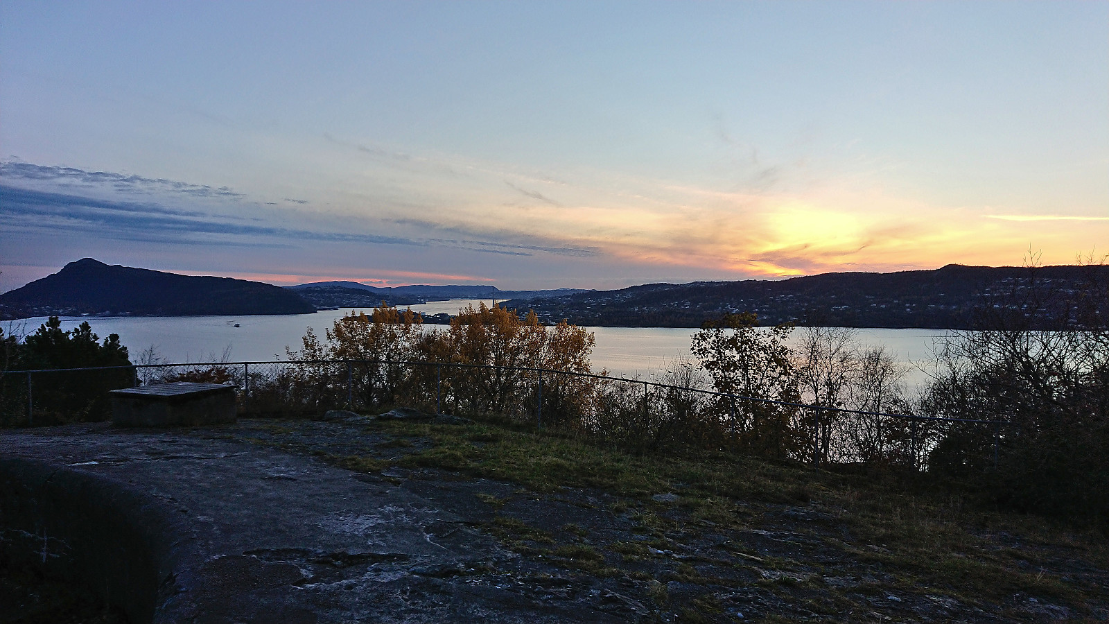
 Another short hike trying to catch the sunset at Ørneberget. But the sun disappeared behind clouds before I made it to the summit.
Ørneberget and Furukammen
- Datum:
- 18.10.2022
- Tourcharakter:
- Bergtour
- Tourlänge:
- 0:51h
- Entfernung:
- 3,9km
 Short local evening hike after work.
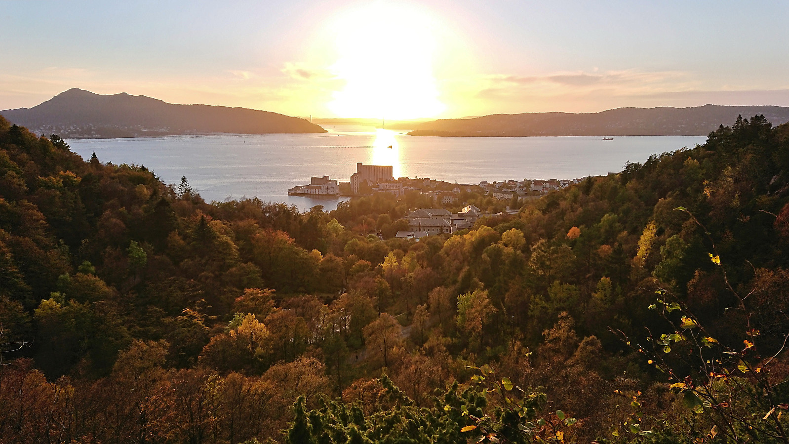
Fagerdalsfjellet
- Datum:
- 16.10.2022
- Tourcharakter:
- Bergtour
- Tourlänge:
- 0:28h
- Entfernung:
- 1,9km
 Short local Sunday hike managing to avoid most of the rain.
Slettefjellet via Eikemostølen
- Datum:
- 15.10.2022
- Tourcharakter:
- Bergtour
- Tourlänge:
- 4:53h
- Entfernung:
- 12,0km
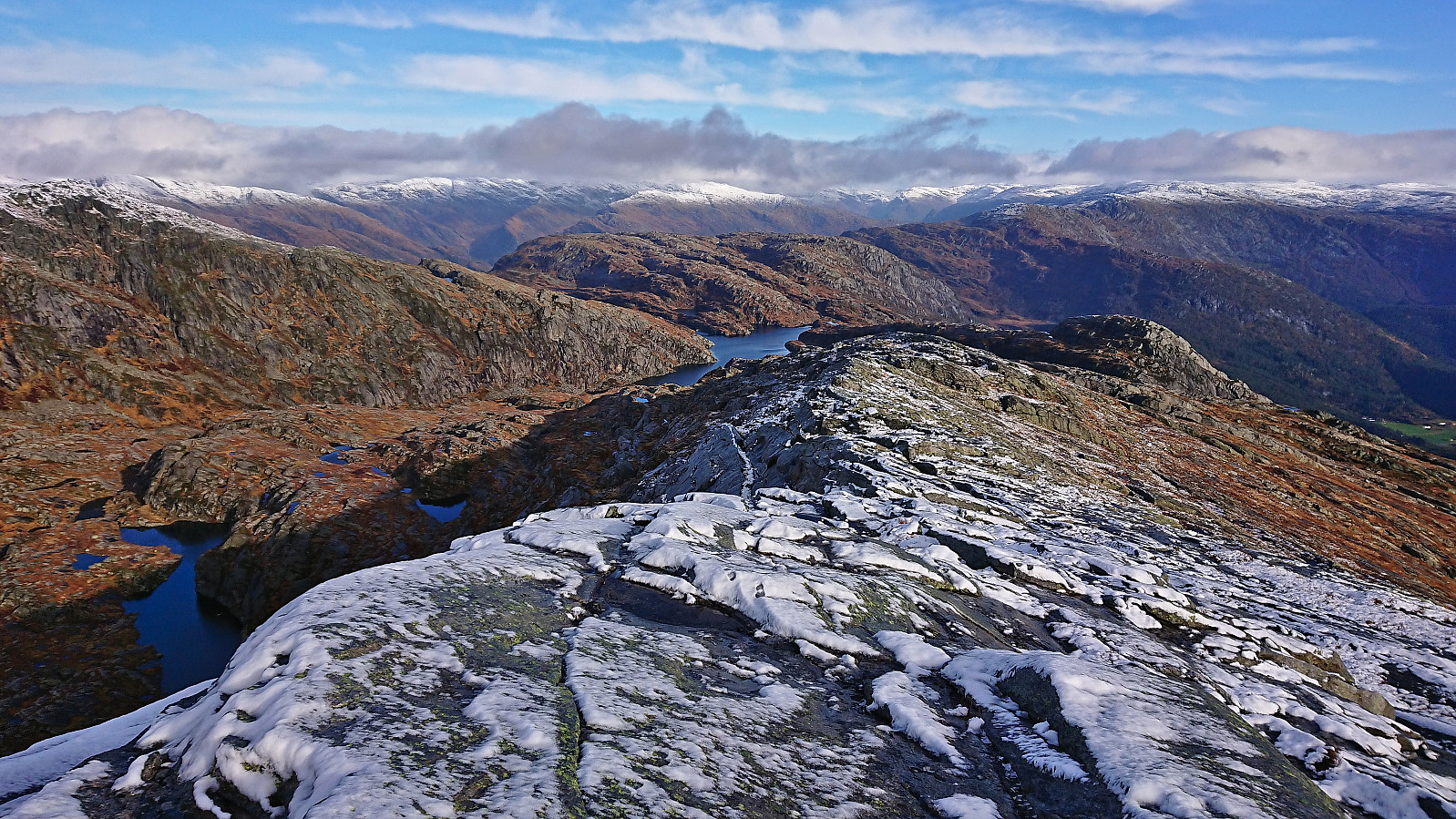 I started by taking the train to Dale and from there the bus to Eikemo. As I was the only passenger on the bus (and would be so for the return as well), I got a bit of extra service and was dropped off right at the trailhead (the official stop is just 150 meters earlier though). The start of the trail was clearly visible from the road due the many tree trunks marked with blue paint, although the sign for Eikemostølen shown in arntfla (Arnt Flatmo) 's external trip report from 2005 was now on the ground and hardly visible.
Following the marked trail made it relatively straightforward to ascend to Eikemostølen, however the trail was clearly not very frequently used and a bit weak at times before pretty much disappearing altogether just before reaching Eikemostølen. While the cabin was still standing when Arnt visited it back in 2005, the roof had now caved >>>
I started by taking the train to Dale and from there the bus to Eikemo. As I was the only passenger on the bus (and would be so for the return as well), I got a bit of extra service and was dropped off right at the trailhead (the official stop is just 150 meters earlier though). The start of the trail was clearly visible from the road due the many tree trunks marked with blue paint, although the sign for Eikemostølen shown in arntfla (Arnt Flatmo) 's external trip report from 2005 was now on the ground and hardly visible.
Following the marked trail made it relatively straightforward to ascend to Eikemostølen, however the trail was clearly not very frequently used and a bit weak at times before pretty much disappearing altogether just before reaching Eikemostølen. While the cabin was still standing when Arnt visited it back in 2005, the roof had now caved >>>
Sandviksbatteriet and Hellemyrstien
- Datum:
- 13.10.2022
- Tourcharakter:
- Wanderung
- Tourlänge:
- 1:27h
- Entfernung:
- 7,6km
 Local hike after work on one of the few sunny days so far in October.
Across Hellen festning
- Datum:
- 10.10.2022
- Tourcharakter:
- Wanderung
- Tourlänge:
- 0:36h
- Entfernung:
- 3,1km
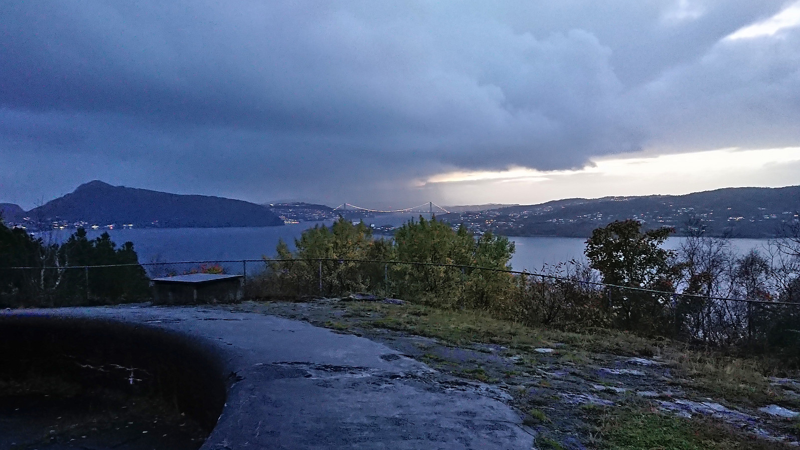 Yet another short local hike trying to recover from last week's cold/flu. This time in the evening after a day at the home office.
