Archive - Date
Archive - Activity
-
Bike trip (111)
- Bike trip - mixed (25)
- Bike trip - road (86)
-
Drive (9)
- Car drive (9)
-
Other trip (3)
- Kayaking (3)
-
Ski trip (116)
- Backcountry skiing (69)
- Cross-country skiing (47)
- Trip by foot (1897)
Collected lists
-
Utvalgte topper og turmål i Bergen
(349/351)
 99%
99% -
Alle topper i Bergen
(393/400)
98%
-
Voss ≥ 100m pf.
(96/98)
97%
-
Opptur Hordaland
(144/159)
90%
-
Stasjoner på Bergensbanen
(33/40)
82%
-
Ulvik ≥ 100m pf.
(30/38)
78%
-
Hordaland ≥ 100m pf.
(624/863)
72%
-
Mjølfjell PF > 100m
(21/31)
67%
-
Jondal ≥ 100m pf.
(15/23)
65%
-
Dagsturhyttene i Vestland
(36/61)
59%
-
Sunnhordland PF >= 100m
(105/186)
56%
-
Hordaland: Hardanger PF>=100m
(196/359)
54%
-
DNT-hytter i Hordaland
(23/45)
51%
-
Kvinnherad ≥ 100m pf.
(40/79)
50%
-
Eidfjord ≥ 100m pf.
(13/42)
30%
-
Sogndal ≥ 100m pf.
(23/81)
28%
-
Gulen ≥ 100m pf.
(15/54)
27%
-
Vik i Sogn ≥ 100m pf.
(10/46)
21%
-
Sogn - Sør for Sognefjorden PF>=100m
(31/159)
19%
-
DNT-hytter i Sogn og Fjordane
(8/47)
17%

Munkebotn and Furukammen
- Date:
- 17.06.2020
- Characteristic:
- Hike
- Duration:
- 1:49h
- Distance:
- 7.2km
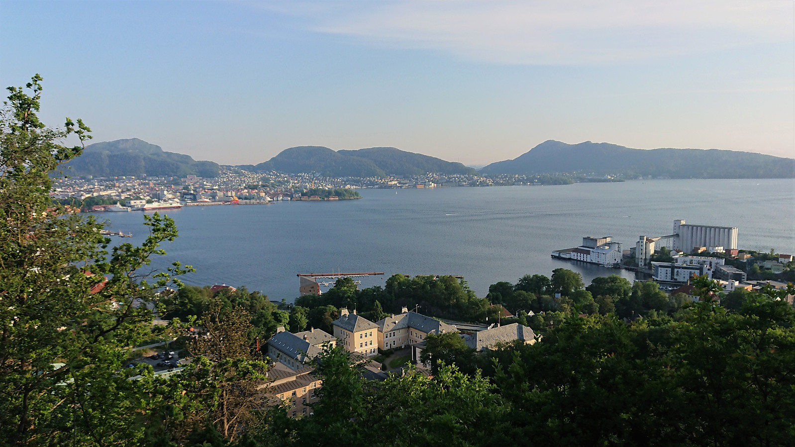 Short local evening hike.
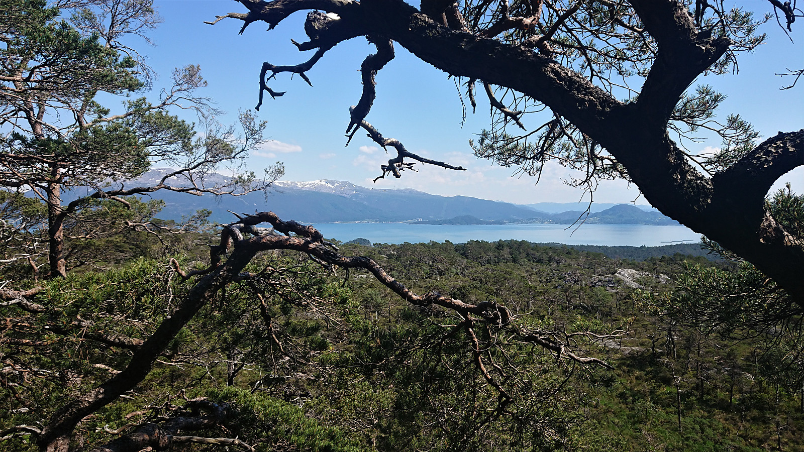
Vetlefjell
- Date:
- 16.06.2020
- Characteristic:
- Hillwalk
- Duration:
- 0:26h
- Distance:
- 1.2km
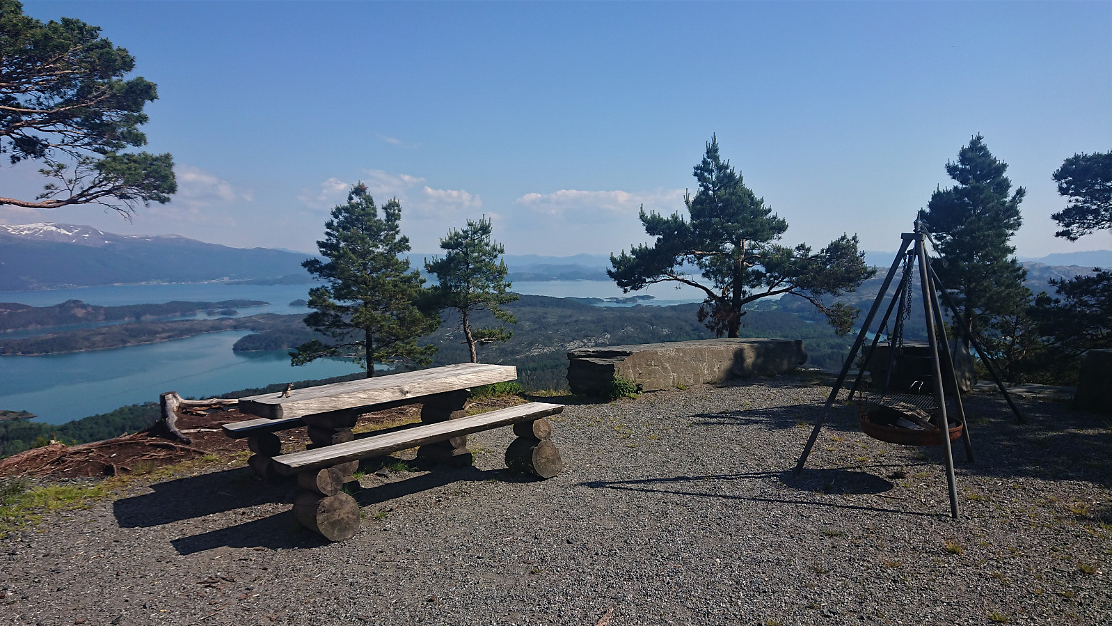
 After the very easy access to Blåbærhaugen , i.e. gravel road all the way to the summit, I had to take a moment to think about why I also had an urge to visit Vetlefjell . A summit that from the earlier trip reports was pretty much the exact opposite. Well, at least it was only a bit more than 300 meters from the gravel road to the summit.
No trails as far as I could tell, but there were the occasional deer track that could be followed. The summit was shortly reached without any real difficulties and actually provided much better views than expected. Nothing compared to the views from Hovlandsnuten earlier in the day of course, but just north of the summit the views to the north and the northeast where quite ok, and just south of the summit one had a good view down to Skorpo and could even spot Kattnakken in the distance. From the summit, >>>
After the very easy access to Blåbærhaugen , i.e. gravel road all the way to the summit, I had to take a moment to think about why I also had an urge to visit Vetlefjell . A summit that from the earlier trip reports was pretty much the exact opposite. Well, at least it was only a bit more than 300 meters from the gravel road to the summit.
No trails as far as I could tell, but there were the occasional deer track that could be followed. The summit was shortly reached without any real difficulties and actually provided much better views than expected. Nothing compared to the views from Hovlandsnuten earlier in the day of course, but just north of the summit the views to the north and the northeast where quite ok, and just south of the summit one had a good view down to Skorpo and could even spot Kattnakken in the distance. From the summit, >>>
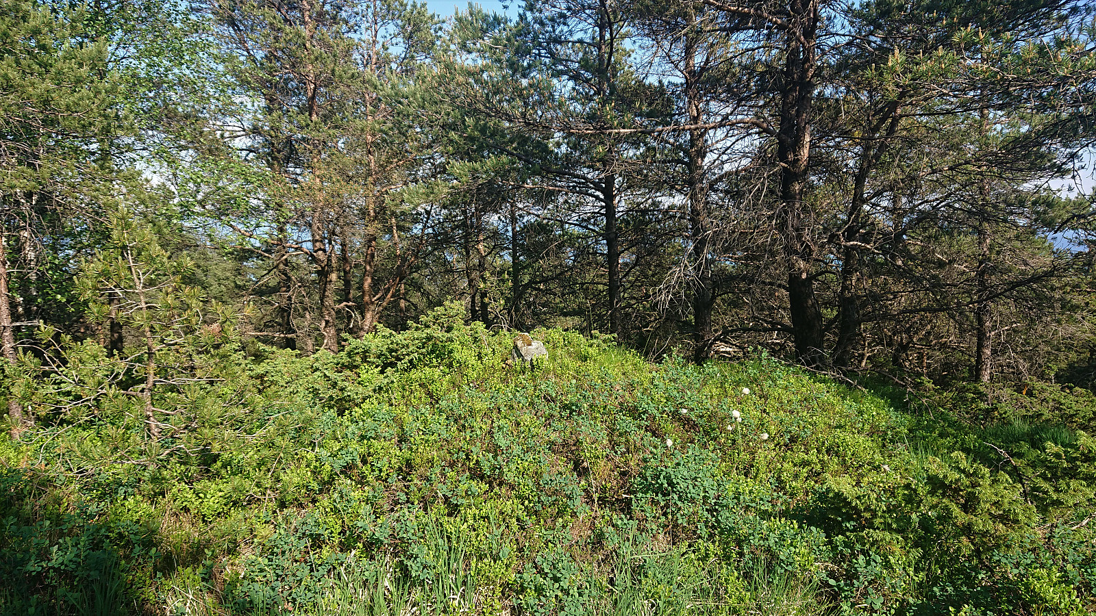
Barmehovda
- Date:
- 16.06.2020
- Characteristic:
- Hillwalk
- Duration:
- 0:34h
- Distance:
- 1.8km
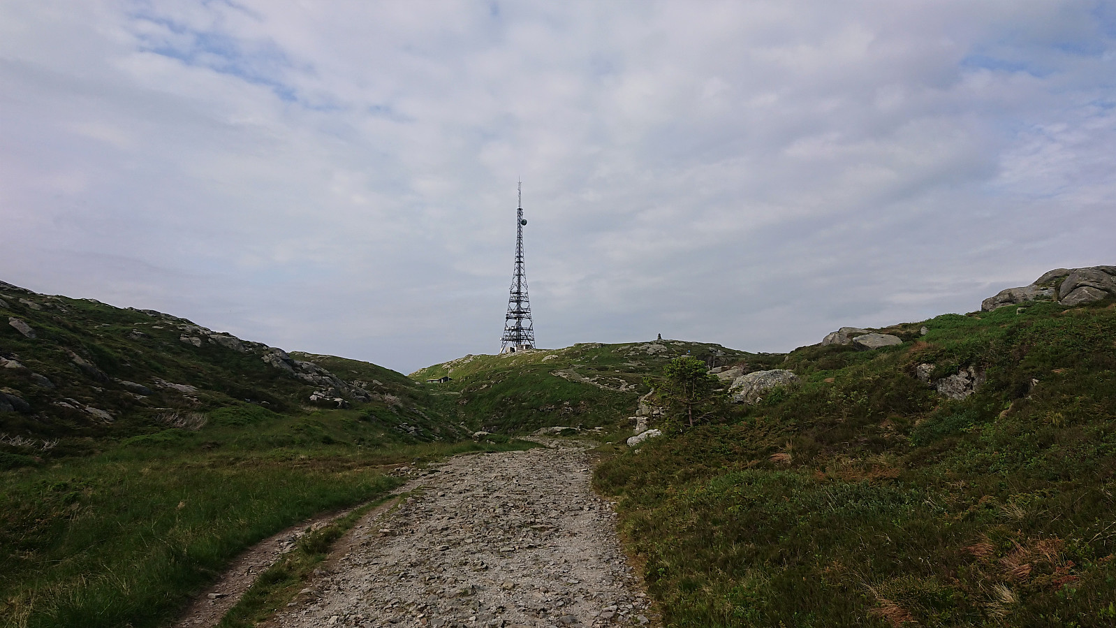
 After my visits of Hovlandsnuten and Etlådnefjellet , and the excellent views from the bike ride along Onarheimsfjorden , I arrived at the tractor road marking the trailhead for Barmehovda expecting a short but perhaps not very interesting hike. Leaving the bike behind, the tractor road made for an easy ascent to the antenna which used to be the highest point. However, after Runemb (Rune Blomberg) 's visit last year the summit had been moved about 100 meters west.
The terrain from the tractor road to the new summit was not the most inviting, but thankfully I soon found a deer track that I could more or less follow all the way to the summit. Limited views from the summit, similar to the ones from the antenna, but at least some views to the south could be obtained through the trees. From the summit, I followed the same route back to the tractor road which I then followed back to the main road.
While far from the worst summit I've visited, and >>>
After my visits of Hovlandsnuten and Etlådnefjellet , and the excellent views from the bike ride along Onarheimsfjorden , I arrived at the tractor road marking the trailhead for Barmehovda expecting a short but perhaps not very interesting hike. Leaving the bike behind, the tractor road made for an easy ascent to the antenna which used to be the highest point. However, after Runemb (Rune Blomberg) 's visit last year the summit had been moved about 100 meters west.
The terrain from the tractor road to the new summit was not the most inviting, but thankfully I soon found a deer track that I could more or less follow all the way to the summit. Limited views from the summit, similar to the ones from the antenna, but at least some views to the south could be obtained through the trees. From the summit, I followed the same route back to the tractor road which I then followed back to the main road.
While far from the worst summit I've visited, and >>>
Hovlandsnuten and Etlådnefjellet
- Date:
- 16.06.2020
- Characteristic:
- Hillwalk
- Duration:
- 3:12h
- Distance:
- 10.6km
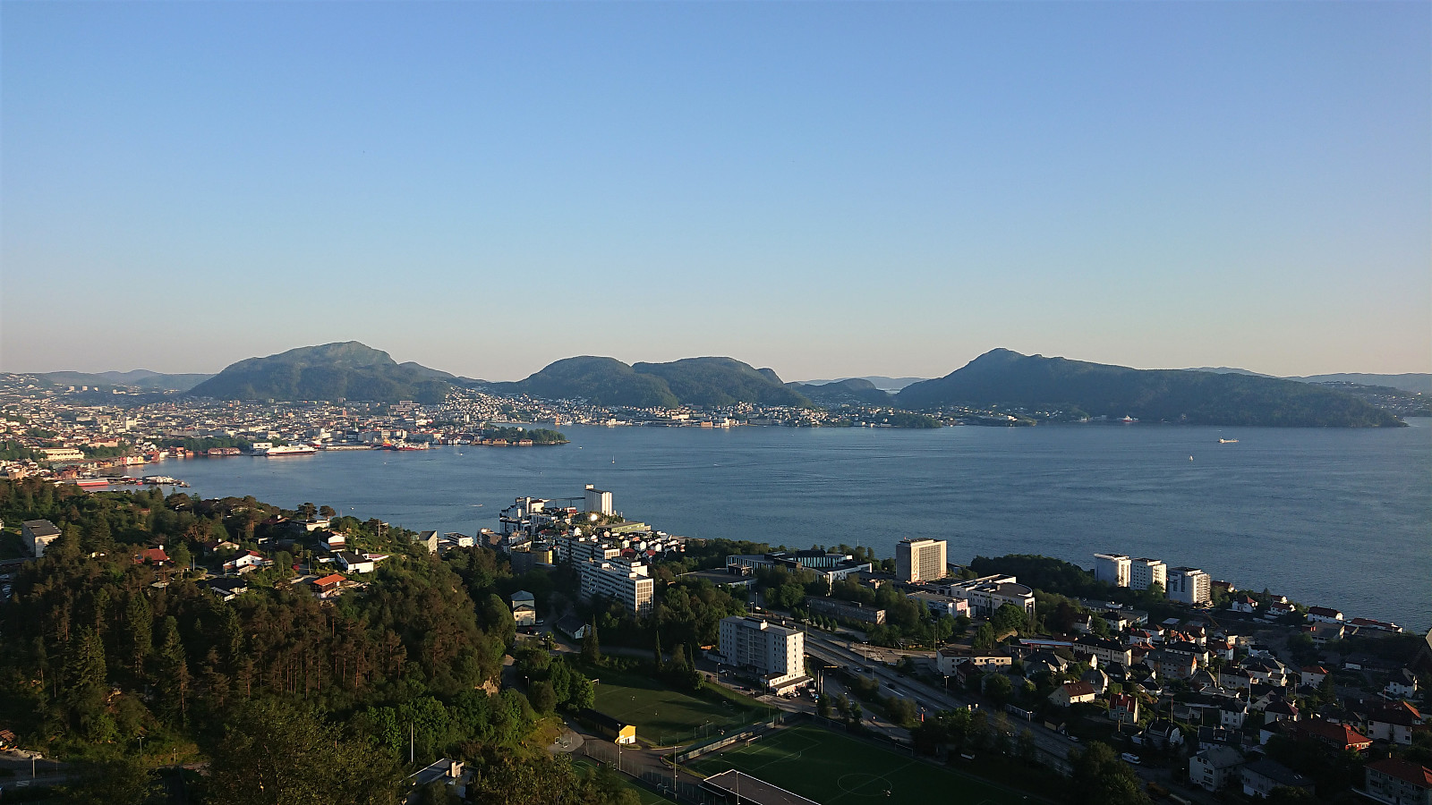
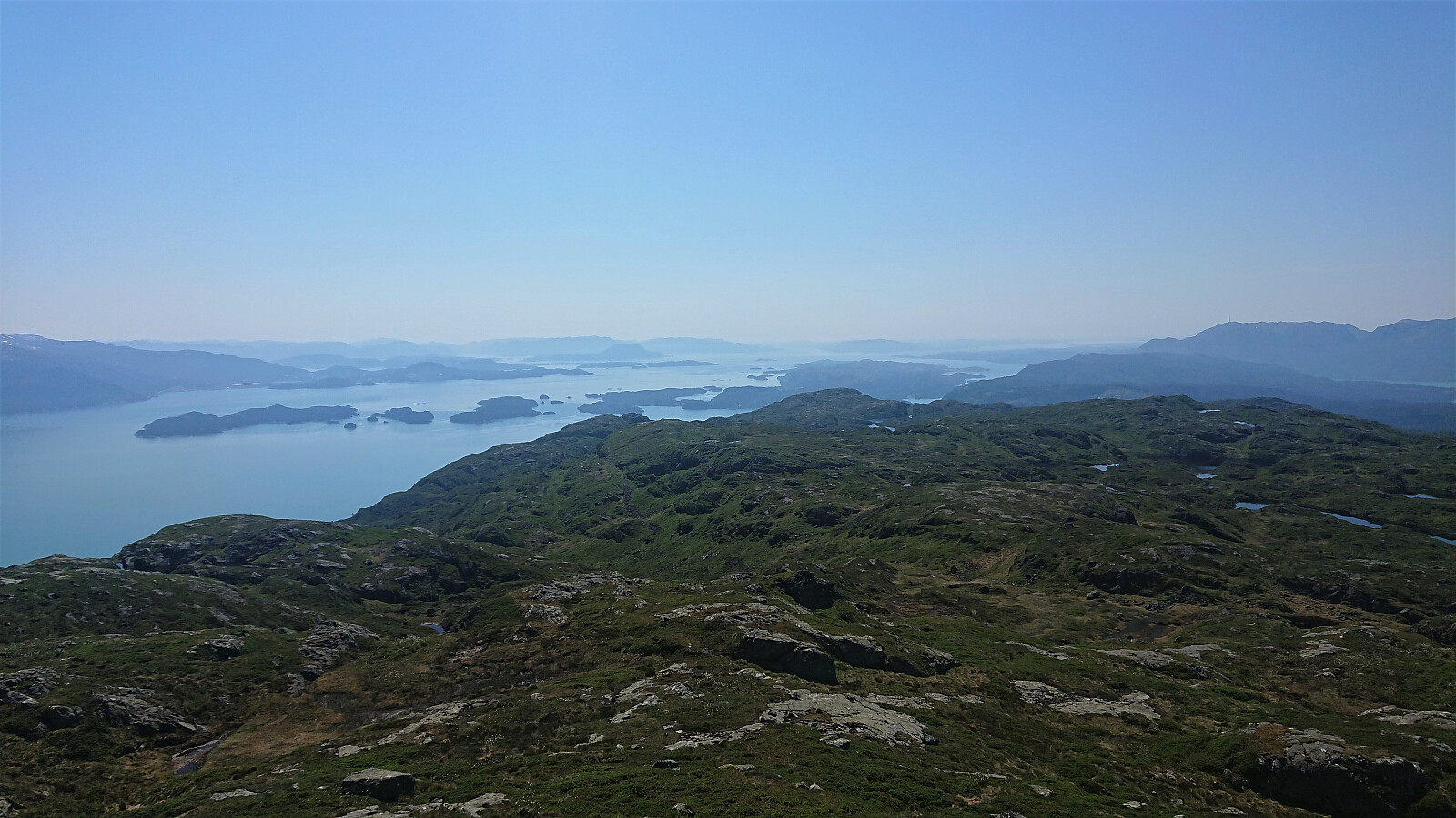 Upon arriving at Skaret , I left my bike behind and followed the rough tractor road up to Vasstøltjørna. From there I followed the marked steep trail up Sandlopeskardet, taking me all the way to Hovlandsnuten , which offered the kind of views one often sees in guidebooks trying to attract tourists to visit Norway! In other words: spectacular!
I could have enjoyed the views for the rest of the day, but I had other summits to visit and a ferry to catch. After a lunch break, I therefore continued to Etlådnefjellet , first along a trail, but it soon disappeared, and I ended up making my own way, visiting both the eastern 732 hill and the southern 737 hill, before finally heading to the summit itself.
On most other hikes, the views from Etlådnefjellet would have been a highlight, but when compared to the spectacular views from Hovlandsnuten >>>
Upon arriving at Skaret , I left my bike behind and followed the rough tractor road up to Vasstøltjørna. From there I followed the marked steep trail up Sandlopeskardet, taking me all the way to Hovlandsnuten , which offered the kind of views one often sees in guidebooks trying to attract tourists to visit Norway! In other words: spectacular!
I could have enjoyed the views for the rest of the day, but I had other summits to visit and a ferry to catch. After a lunch break, I therefore continued to Etlådnefjellet , first along a trail, but it soon disappeared, and I ended up making my own way, visiting both the eastern 732 hill and the southern 737 hill, before finally heading to the summit itself.
On most other hikes, the views from Etlådnefjellet would have been a highlight, but when compared to the spectacular views from Hovlandsnuten >>>
Cycling: Malkenes - Espevik - Våge - Lønborg
- Date:
- 16.06.2020
- Characteristic:
- Bike trip - road
- Duration:
- 12:12h
- Distance:
- 91.3km
 On yet another day of excellent warm summer weather, I decided to take the day off and carry out the second of my ambitious cycling/hiking trips to Tysnes. This time avoiding the initial 40 km bike ride to Halhjem by instead taking the express ferry from the Bergen city center to Malkenes, as this would allow me to spend more time hiking.
Upon arriving at Malkenes, I followed the now partially familiar roads to Skaret p-plass , where I left the bike behind for an excellent hike to Hovlandsnuten and Etlådnefjellet . See the separate trip report here: Hovlandsnuten and Etlådnefjellet .
When coming back down to Skaret, I did not waste any time and quickly continued south to Onarheim, basically all downhill and flat, and with some spectacular views along the way. At Onarheim I took a break for an ice cream and a soda, before continuing to Espevik and a visit of Barmehovda . See the >>>
On yet another day of excellent warm summer weather, I decided to take the day off and carry out the second of my ambitious cycling/hiking trips to Tysnes. This time avoiding the initial 40 km bike ride to Halhjem by instead taking the express ferry from the Bergen city center to Malkenes, as this would allow me to spend more time hiking.
Upon arriving at Malkenes, I followed the now partially familiar roads to Skaret p-plass , where I left the bike behind for an excellent hike to Hovlandsnuten and Etlådnefjellet . See the separate trip report here: Hovlandsnuten and Etlådnefjellet .
When coming back down to Skaret, I did not waste any time and quickly continued south to Onarheim, basically all downhill and flat, and with some spectacular views along the way. At Onarheim I took a break for an ice cream and a soda, before continuing to Espevik and a visit of Barmehovda . See the >>>
Rognåsen and Ørneberget
- Date:
- 15.06.2020
- Characteristic:
- Hillwalk
- Duration:
- 1:41h
- Distance:
- 6.6km
 Short local evening hike.
Café Knatten
- Date:
- 14.06.2020
- Characteristic:
- Hillwalk
- Duration:
- 3:51h
- Distance:
- 16.0km
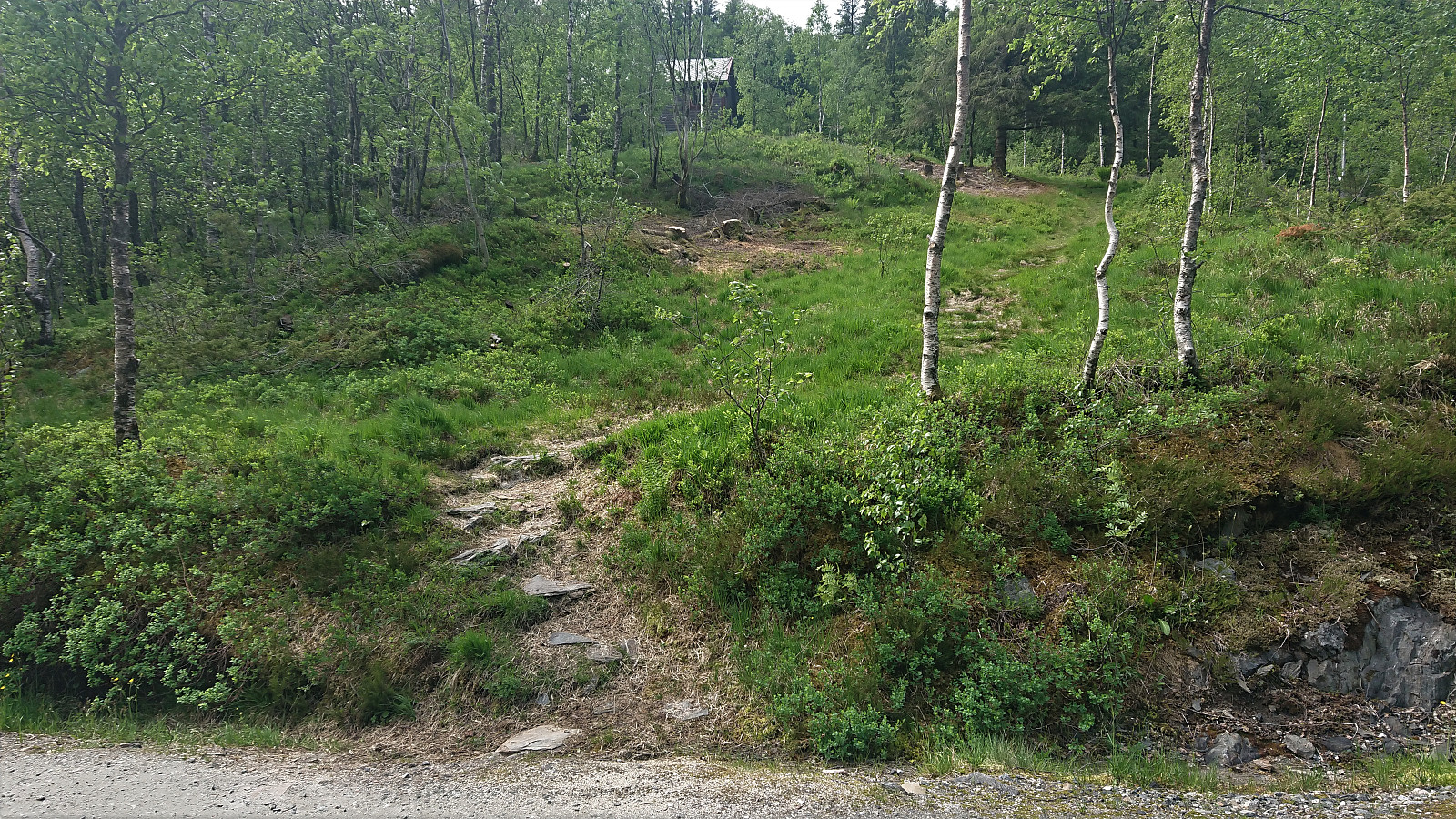
 As part of the research for locating the cabins and cabins ruins mentioned in Bergensernes Fjellverden II, I also came across a location I had passed many times before but did not know the history of, namely Café Knatten . A new visit was therefore in order to take a closer look. The views are now of course more limited than what can be seen in the old pictures , especially towards Svartediket and Hardbakkedalen, but the views to the south are still pretty much intact. For an overview of the history of Café Knatten please see this excellent article in Årstadposten .
Knuskedalsfjellet, Sædalshesten and Bjørnsnipa
- Date:
- 13.06.2020
- Characteristic:
- Hillwalk
- Duration:
- 6:49h
- Distance:
- 24.2km
 I was lucky to hitch a ride to the parking lot in Ardalen and therefore started my hike on the winding gravel road up to Herfindal. Note that while it is possible to drive further, i.e. all the way up to the parking lot at Herfindal, the narrow winding road with its limited spots for passing cars coming in the opposite direction may not be to everyone's liking.
Upon reaching Budalen the wind picked up, and even though the weather was still very warm, I had to put on my jacket in order not to get cold. The snow also started appearing, and soon it was impossible to avoid. At Vardatjørnane the trail was crossing a small stream, which during the summer can probably be done without getting wet. Today that was not an option though due to all the melting snow.
After crossing the stream, I left the >>>
I was lucky to hitch a ride to the parking lot in Ardalen and therefore started my hike on the winding gravel road up to Herfindal. Note that while it is possible to drive further, i.e. all the way up to the parking lot at Herfindal, the narrow winding road with its limited spots for passing cars coming in the opposite direction may not be to everyone's liking.
Upon reaching Budalen the wind picked up, and even though the weather was still very warm, I had to put on my jacket in order not to get cold. The snow also started appearing, and soon it was impossible to avoid. At Vardatjørnane the trail was crossing a small stream, which during the summer can probably be done without getting wet. Today that was not an option though due to all the melting snow.
After crossing the stream, I left the >>>
Ørneberget, Rognåsen and Håmanen
- Date:
- 12.06.2020
- Characteristic:
- Hillwalk
- Duration:
- 1:42h
- Distance:
- 7.2km
 Short local evening hike.
Cycling: Landås
- Date:
- 11.06.2020
- Characteristic:
- Bike trip - road
- Duration:
- 2:21h
- Distance:
- 31.2km
 Another cycling trip after work.
