Archive - Date
Archive - Activity
-
Bike trip (111)
- Bike trip - mixed (25)
- Bike trip - road (86)
-
Drive (9)
- Car drive (9)
-
Other trip (3)
- Kayaking (3)
-
Ski trip (116)
- Backcountry skiing (69)
- Cross-country skiing (47)
- Trip by foot (1897)
Collected lists
-
Utvalgte topper og turmål i Bergen
(349/351)
 99%
99% -
Alle topper i Bergen
(393/400)
98%
-
Voss ≥ 100m pf.
(96/98)
97%
-
Opptur Hordaland
(144/159)
90%
-
Stasjoner på Bergensbanen
(33/40)
82%
-
Ulvik ≥ 100m pf.
(30/38)
78%
-
Hordaland ≥ 100m pf.
(624/863)
72%
-
Mjølfjell PF > 100m
(21/31)
67%
-
Jondal ≥ 100m pf.
(15/23)
65%
-
Dagsturhyttene i Vestland
(36/61)
59%
-
Sunnhordland PF >= 100m
(105/186)
56%
-
Hordaland: Hardanger PF>=100m
(196/359)
54%
-
DNT-hytter i Hordaland
(23/45)
51%
-
Kvinnherad ≥ 100m pf.
(40/79)
50%
-
Eidfjord ≥ 100m pf.
(13/42)
30%
-
Sogndal ≥ 100m pf.
(23/81)
28%
-
Gulen ≥ 100m pf.
(15/54)
27%
-
Vik i Sogn ≥ 100m pf.
(10/46)
21%
-
Sogn - Sør for Sognefjorden PF>=100m
(31/159)
19%
-
DNT-hytter i Sogn og Fjordane
(8/47)
17%

Cycling: Tuvefjellet and Kannikenuten
- Date:
- 21.05.2020
- Characteristic:
- Bike trip - road
- Duration:
- 13:10h
- Distance:
- 117.4km
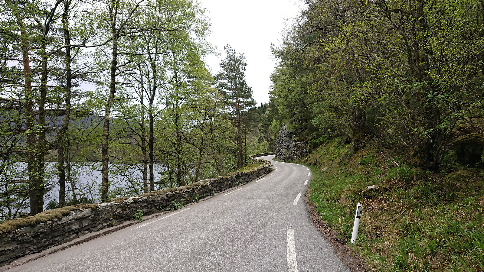 Ever since exhausting the hiking options from Våge as a starting point for my hikes at Tysnes, I had played with the idea of arriving at Våge by bike, thus opening up new possibilities. The only problem was that this would involve first having cycled the 40 km to the ferry at Halhjem, and just as important, having to cycle the 40 km back home from Halhjem at the end of the trip.
But after my recent test run to Halhjem , I concluded that, while it would definitely be a long trip, it should be possible. Having done the test run turned out to be very useful given that my start from Lønborg was slightly delayed, resulting in arriving at Halhjem just as the ferry was docking, and with less than ten minutes until departure.
Upon arriving at Våge I headed east to Lundegren and then south to Vevatne, enjoying the much >>>
Ever since exhausting the hiking options from Våge as a starting point for my hikes at Tysnes, I had played with the idea of arriving at Våge by bike, thus opening up new possibilities. The only problem was that this would involve first having cycled the 40 km to the ferry at Halhjem, and just as important, having to cycle the 40 km back home from Halhjem at the end of the trip.
But after my recent test run to Halhjem , I concluded that, while it would definitely be a long trip, it should be possible. Having done the test run turned out to be very useful given that my start from Lønborg was slightly delayed, resulting in arriving at Halhjem just as the ferry was docking, and with less than ten minutes until departure.
Upon arriving at Våge I headed east to Lundegren and then south to Vevatne, enjoying the much >>>
Across Hellen festning
- Date:
- 20.05.2020
- Characteristic:
- Hike
- Duration:
- 1:08h
- Distance:
- 4.9km
 Short local evening hike.
Cabin ruins: Løvstakken
- Date:
- 19.05.2020
- Characteristic:
- Hillwalk
- Duration:
- 3:40h
- Distance:
- 12.1km
 Yet another hike to search for old cabin ruins. This time in what was used to be called Hyttelien, an area south of Løvstakken were there once used to be numerous cabins, none of which are still standing. Once again I could benefit from knutsverre (Knut S. Andersen) 's excellent work for locating most of the ruins in the area. There were however two ruins that he had struggled to find: Helgheim and Gyldenprishytten/Akevitten . For the former, I was pretty sure I had found its location via in-depth inspection of old aerial photos, but for the latter I had not been able to find any additional information prior to the hike.
After first visiting Knut Sverre’s suggested locations for Gyldenprishytten and Helgheim (now renamed Tuft NV for Liafjellet, Løvstakken and Tuft V for Liafjellet, Løvstakken , I made a quick visit to the summit of the newly added Liafjellet , including a surprisingly steep descent, before heading towards the ruins of Fagerheim .
Upon >>>
Yet another hike to search for old cabin ruins. This time in what was used to be called Hyttelien, an area south of Løvstakken were there once used to be numerous cabins, none of which are still standing. Once again I could benefit from knutsverre (Knut S. Andersen) 's excellent work for locating most of the ruins in the area. There were however two ruins that he had struggled to find: Helgheim and Gyldenprishytten/Akevitten . For the former, I was pretty sure I had found its location via in-depth inspection of old aerial photos, but for the latter I had not been able to find any additional information prior to the hike.
After first visiting Knut Sverre’s suggested locations for Gyldenprishytten and Helgheim (now renamed Tuft NV for Liafjellet, Løvstakken and Tuft V for Liafjellet, Løvstakken , I made a quick visit to the summit of the newly added Liafjellet , including a surprisingly steep descent, before heading towards the ruins of Fagerheim .
Upon >>>
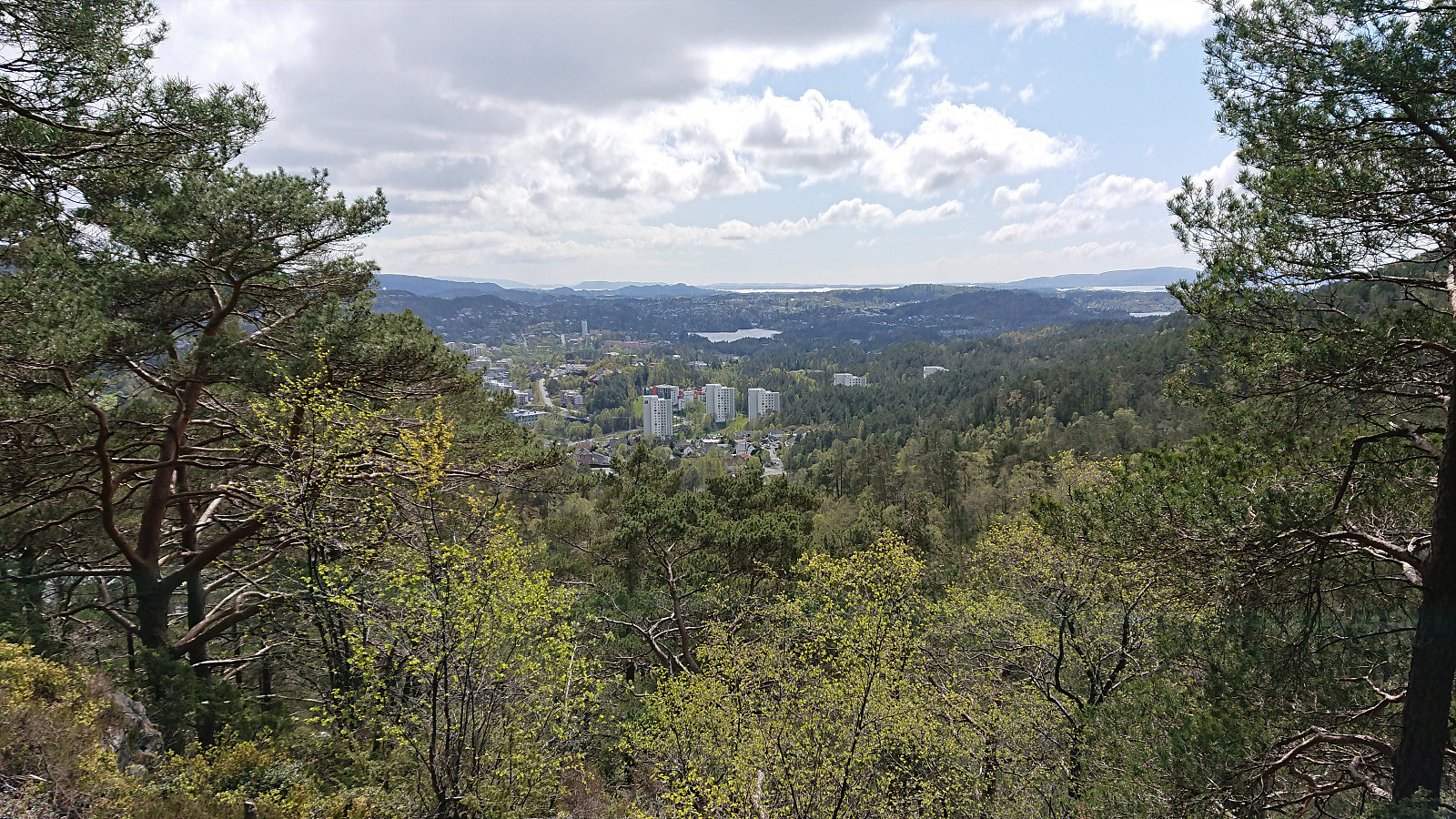
Fagerdalsfjellet, Ørneberget, Rognåsen and Håmanen
- Date:
- 17.05.2020
- Characteristic:
- Hillwalk
- Duration:
- 1:59h
- Distance:
- 8.4km
 Local afternoon hike.
Rognåsen and Ørneberget
- Date:
- 15.05.2020
- Characteristic:
- Hillwalk
- Duration:
- 1:22h
- Distance:
- 5.7km
 Short local afternoon hike.
Cabin ruins: Steinhytten
- Date:
- 14.05.2020
- Characteristic:
- Hillwalk
- Duration:
- 1:11h
- Distance:
- 4.5km
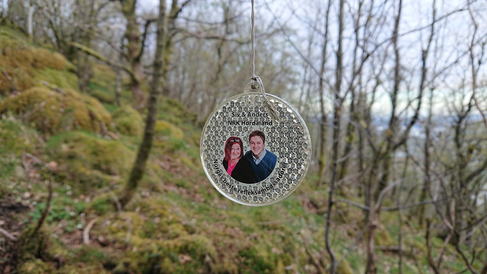 Short evening hike to visit the ruins of Steinhytten southwest of Ulriken. The cabin was easily located and only required a short detour from the trail. From the ruins I followed a weak trail north, marked with lots of small reflectors and apparently sponsored by NRK. Later I connected with the steep trail to/from Ulriken which I followed southwest down to the road.
Cabin ruins: Landåsfjellet - Part 2
- Date:
- 13.05.2020
- Characteristic:
- Hillwalk
- Duration:
- 2:26h
- Distance:
- 7.8km
 A return to Landåsfjellet to visit some of the ruins I had either skipped on my last visit or where I had been uncertain of the location. First up was Norheim , where I had an approximate location from Bergensernes Fjellverden II (BF II), which combined with the accompanying pictures enabled me to quickly locate a location that seemed to match. Only very weak traces left of the cabin itself.
Next, I moved on to Bryterhytten , again making good use of the information in BF II and easily locating the weak traces of the cabin. Limited traces here as well. The cold wind had now started to pick up, so I did not stay long, and even forgot to visit the summit of Orrehaugane , before moving on to Fjellro .
Fjellro was one of those location I was sure I had visited on my previous visit, but where I was not sure of the exact location. This time >>>
A return to Landåsfjellet to visit some of the ruins I had either skipped on my last visit or where I had been uncertain of the location. First up was Norheim , where I had an approximate location from Bergensernes Fjellverden II (BF II), which combined with the accompanying pictures enabled me to quickly locate a location that seemed to match. Only very weak traces left of the cabin itself.
Next, I moved on to Bryterhytten , again making good use of the information in BF II and easily locating the weak traces of the cabin. Limited traces here as well. The cold wind had now started to pick up, so I did not stay long, and even forgot to visit the summit of Orrehaugane , before moving on to Fjellro .
Fjellro was one of those location I was sure I had visited on my previous visit, but where I was not sure of the exact location. This time >>>
Across Hellen festning
- Date:
- 12.05.2020
- Characteristic:
- Hike
- Duration:
- 0:33h
- Distance:
- 3.1km
 Short local evening hike.
Ørneberget and Rognåsen
- Date:
- 11.05.2020
- Characteristic:
- Hillwalk
- Duration:
- 1:21h
- Distance:
- 6.3km
 Short local evening hike.
Cabin ruins: Nordnesdalen
- Date:
- 10.05.2020
- Characteristic:
- Hillwalk
- Duration:
- 3:15h
- Distance:
- 7.7km
 More visits of old cabin ruins, this time in Nordnesdalen where I could simply follow in the footsteps of knutsverre (Knut S. Andersen) . His impressive work for locating the ruins in Nordnesdalen made sure that I could find all of them without any issues. A task that otherwise would have been significantly more difficult given that the map in Bergensernes Fjellverden II clearly had its shortcoming for this particular area.
