Archive - Date
Archive - Activity
-
Bike trip (111)
- Bike trip - mixed (25)
- Bike trip - road (86)
-
Drive (9)
- Car drive (9)
-
Other trip (3)
- Kayaking (3)
-
Ski trip (116)
- Backcountry skiing (69)
- Cross-country skiing (47)
- Trip by foot (1897)
Collected lists
-
Utvalgte topper og turmål i Bergen
(349/351)
 99%
99% -
Alle topper i Bergen
(393/400)
98%
-
Voss ≥ 100m pf.
(96/98)
97%
-
Opptur Hordaland
(144/159)
90%
-
Stasjoner på Bergensbanen
(33/40)
82%
-
Ulvik ≥ 100m pf.
(30/38)
78%
-
Hordaland ≥ 100m pf.
(624/863)
72%
-
Mjølfjell PF > 100m
(21/31)
67%
-
Jondal ≥ 100m pf.
(15/23)
65%
-
Dagsturhyttene i Vestland
(36/61)
59%
-
Sunnhordland PF >= 100m
(105/186)
56%
-
Hordaland: Hardanger PF>=100m
(196/359)
54%
-
DNT-hytter i Hordaland
(23/45)
51%
-
Kvinnherad ≥ 100m pf.
(40/79)
50%
-
Eidfjord ≥ 100m pf.
(13/42)
30%
-
Sogndal ≥ 100m pf.
(23/81)
28%
-
Gulen ≥ 100m pf.
(15/54)
27%
-
Vik i Sogn ≥ 100m pf.
(10/46)
21%
-
Sogn - Sør for Sognefjorden PF>=100m
(31/159)
19%
-
DNT-hytter i Sogn og Fjordane
(8/47)
17%

Blåfjellet and Storevarden from Olsbotnen
- Date:
- 13.10.2019
- Characteristic:
- Hillwalk
- Duration:
- 3:48h
- Distance:
- 13.0km
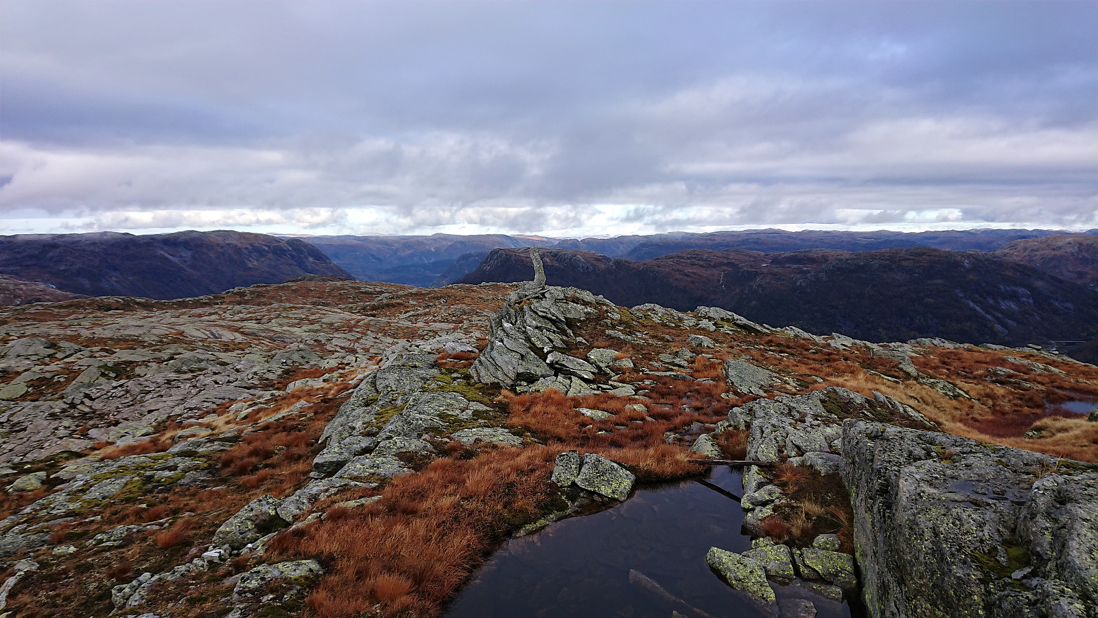 My first hike together with Endre started with us driving to Olsbotnen where we, after parking on a small parking lot/side road, were welcomed by a sign stating that "the marked trail to Stussdalen has been shut down" (Norwegian: nedlagt). I remembered seeing a similar sign in Stussdalen for the trail going in the opposite direction. But given that the sign did not say that the trail was closed, we assumed it just meant that the markings were no longer maintained, and decided to still give it a go.
After crossing the small river on an old concrete bridge, we quickly lost the trail and had to make our own way for a couple hundred meters before suddenly reconnecting with the trail. And while the trail may no longer be marked with red paint, there were still plenty of small cairns to follow >>>
My first hike together with Endre started with us driving to Olsbotnen where we, after parking on a small parking lot/side road, were welcomed by a sign stating that "the marked trail to Stussdalen has been shut down" (Norwegian: nedlagt). I remembered seeing a similar sign in Stussdalen for the trail going in the opposite direction. But given that the sign did not say that the trail was closed, we assumed it just meant that the markings were no longer maintained, and decided to still give it a go.
After crossing the small river on an old concrete bridge, we quickly lost the trail and had to make our own way for a couple hundred meters before suddenly reconnecting with the trail. And while the trail may no longer be marked with red paint, there were still plenty of small cairns to follow >>>
Gråsida, Steinhusfjellet and Stussfjellet
- Date:
- 06.10.2019
- Characteristic:
- Hillwalk
- Duration:
- 5:05h
- Distance:
- 16.4km
 A return to Stussdalen, but this time on my own and without a car, thus the hike started from the bus stop at Gamlesæter and with a walk up Stussdalen. Just before the road turns north towards the parking lot at Øvre Sætravatnet I crossed the small river and headed south, coming across some deer tracks, but mainly having to find my own way.
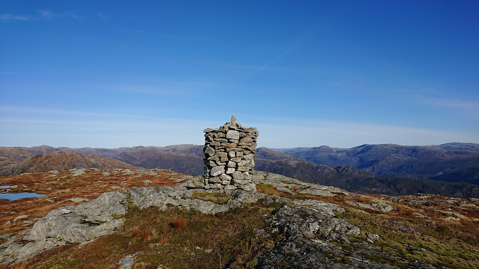
I took the advice from knutsverre (Knut S. Andersen) 's trip report and waited a bit before finally turning southwest towards the summit of Gråsida . My ascent was therefore straightforward and did not present any challenges. I still conferred with my GPS several times though, as even after leaving the trees behind the exact direction for the summit was not obvious, given the several options to choose from.
When getting closer, the summit was however clearly marked by a large cairn and the thus easy to spot. From the cairn I moved west, >>>
A return to Stussdalen, but this time on my own and without a car, thus the hike started from the bus stop at Gamlesæter and with a walk up Stussdalen. Just before the road turns north towards the parking lot at Øvre Sætravatnet I crossed the small river and headed south, coming across some deer tracks, but mainly having to find my own way.
I took the advice from knutsverre (Knut S. Andersen) 's trip report and waited a bit before finally turning southwest towards the summit of Gråsida . My ascent was therefore straightforward and did not present any challenges. I still conferred with my GPS several times though, as even after leaving the trees behind the exact direction for the summit was not obvious, given the several options to choose from.
When getting closer, the summit was however clearly marked by a large cairn and the thus easy to spot. From the cairn I moved west, >>>
Hellen festning and Furukammen
- Date:
- 05.10.2019
- Characteristic:
- Hike
- Duration:
- 0:51h
- Distance:
- 4.7km
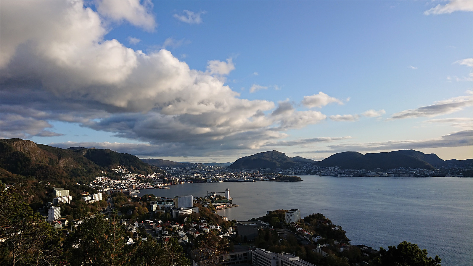 Short local hike across Hellen festning and Furukammen.
Ulriken
- Date:
- 04.10.2019
- Characteristic:
- Hillwalk
- Duration:
- 2:49h
- Distance:
- 5.8km
 Hike after work with two colleagues, including a visit to 8. mai-steinen .
Rødsfjellet/Røafjellet
- Date:
- 02.10.2019
- Characteristic:
- Hillwalk
- Duration:
- 2:57h
- Distance:
- 10.4km
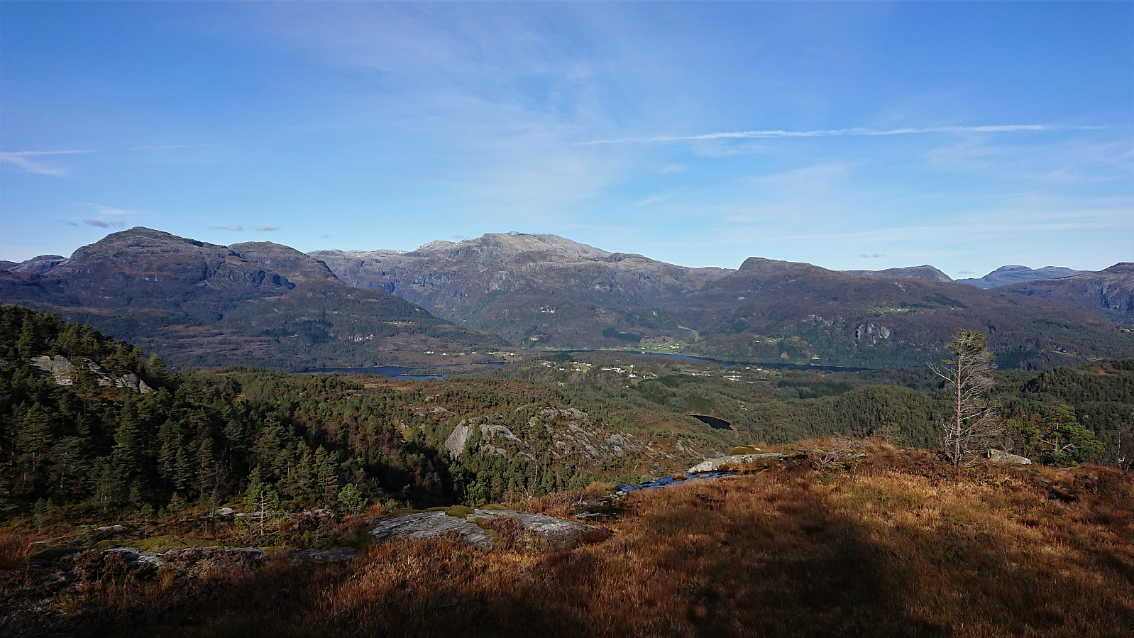 Another meeting ending at Solstrand, another hike beginning in Fusa. This time the goal was Rødsfjellet , or Røafjellet as it is called on the local signs. I first took the bus (and ferry) from the main road above Solstrand to Rødo (note that the bus stop is called Rød and not Rødo). Upon leaving the bus I had roughly three hours until the final bus back to Bergen.
After first walking along the smaller roads to Ytrerødo, thankfully easily avoiding the main road, I located the marked trailhead (there was even one or two signs earlier on as well) which also included an information sign about the hike.
I first passed through two gates before shortly leaving the tractor road for a shortcut through the forest, all clearly marked with red paint, and then reconnecting with the tractor road, until it came to >>>
Another meeting ending at Solstrand, another hike beginning in Fusa. This time the goal was Rødsfjellet , or Røafjellet as it is called on the local signs. I first took the bus (and ferry) from the main road above Solstrand to Rødo (note that the bus stop is called Rød and not Rødo). Upon leaving the bus I had roughly three hours until the final bus back to Bergen.
After first walking along the smaller roads to Ytrerødo, thankfully easily avoiding the main road, I located the marked trailhead (there was even one or two signs earlier on as well) which also included an information sign about the hike.
I first passed through two gates before shortly leaving the tractor road for a shortcut through the forest, all clearly marked with red paint, and then reconnecting with the tractor road, until it came to >>>
