Archive - Date
Archive - Activity
-
Bike trip (111)
- Bike trip - mixed (25)
- Bike trip - road (86)
-
Drive (9)
- Car drive (9)
-
Other trip (3)
- Kayaking (3)
-
Ski trip (116)
- Backcountry skiing (69)
- Cross-country skiing (47)
- Trip by foot (1897)
Collected lists
-
Utvalgte topper og turmål i Bergen
(349/351)
 99%
99% -
Alle topper i Bergen
(393/400)
98%
-
Voss ≥ 100m pf.
(96/98)
97%
-
Opptur Hordaland
(144/159)
90%
-
Stasjoner på Bergensbanen
(33/40)
82%
-
Ulvik ≥ 100m pf.
(30/38)
78%
-
Hordaland ≥ 100m pf.
(624/863)
72%
-
Mjølfjell PF > 100m
(21/31)
67%
-
Jondal ≥ 100m pf.
(15/23)
65%
-
Dagsturhyttene i Vestland
(36/61)
59%
-
Sunnhordland PF >= 100m
(105/186)
56%
-
Hordaland: Hardanger PF>=100m
(196/359)
54%
-
DNT-hytter i Hordaland
(23/45)
51%
-
Kvinnherad ≥ 100m pf.
(40/79)
50%
-
Eidfjord ≥ 100m pf.
(13/42)
30%
-
Sogndal ≥ 100m pf.
(23/81)
28%
-
Gulen ≥ 100m pf.
(15/54)
27%
-
Vik i Sogn ≥ 100m pf.
(10/46)
21%
-
Sogn - Sør for Sognefjorden PF>=100m
(31/159)
19%
-
DNT-hytter i Sogn og Fjordane
(8/47)
17%

Råsefjellet and Horga
- Date:
- 29.09.2019
- Characteristic:
- Hillwalk
- Duration:
- 7:37h
- Distance:
- 19.4km
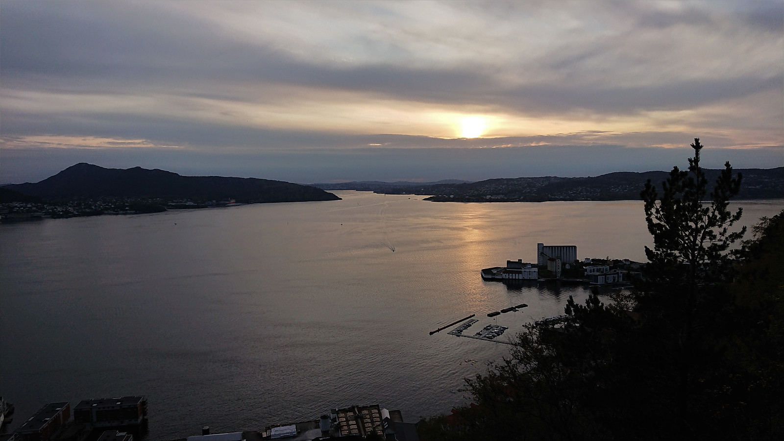
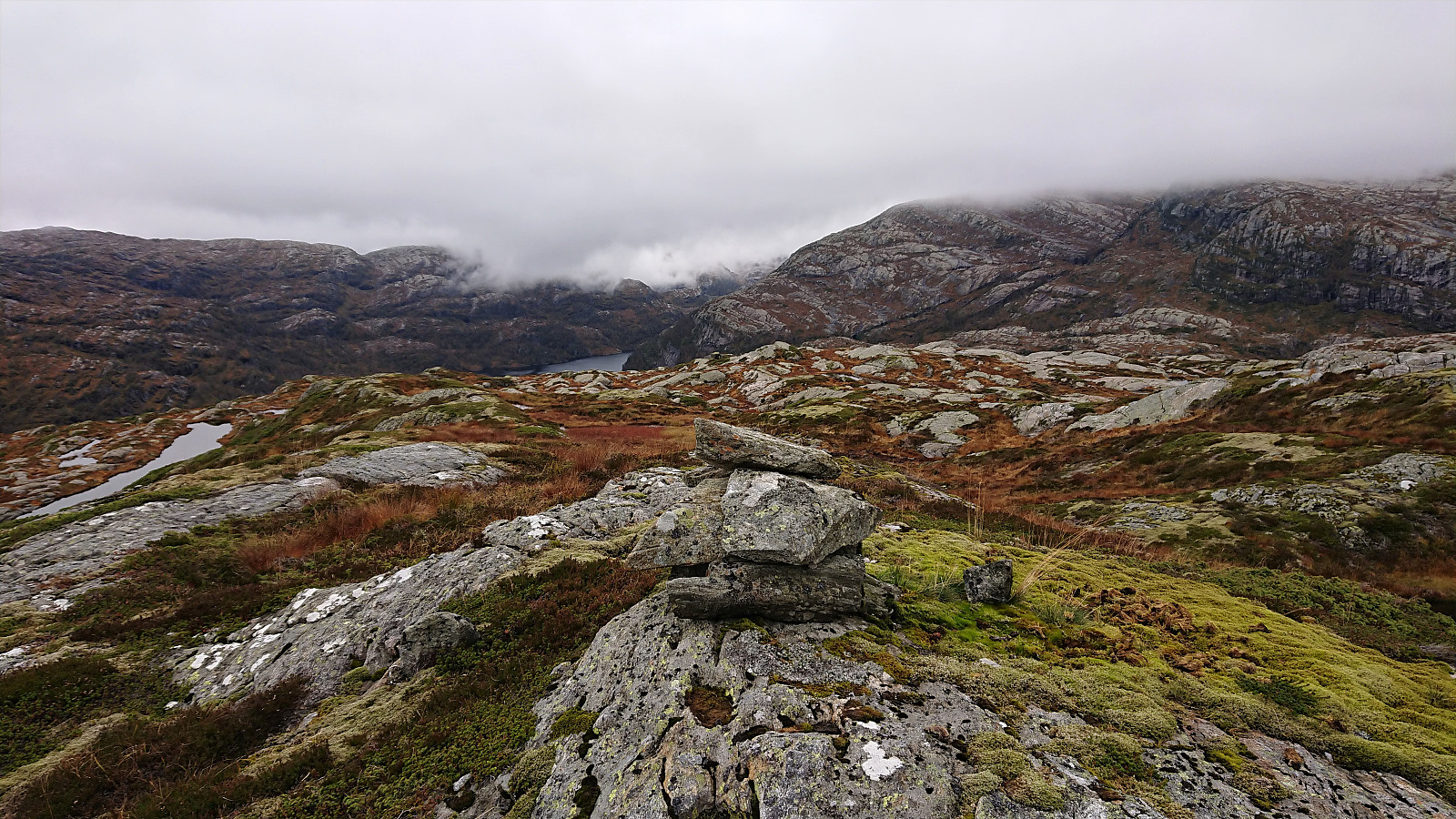 We drove from Bergen to the parking lot south of Øvre Sætravatnet, of course paying the toll of 40 kr in Stussdalen. The weather was perfect at the start of our hike, providing excellent views across the two Sætravatnet lakes. But sadly the sun soon disappeared and stayed behind the clouds for the rest of the hike. As we passed along Tverrvatnet the fog also started hiding the peaks of the surrounding mountains.
The start of the hike was poorly marked, with no signs at all from the parking lot as far as we could see. However, this changed upon reaching the eastern end of Tverrvatnet, and from there on a marked trail could easily be followed all the way to Kalvedalshytta . Paddesætret also provided a nice bridge, thus simplifying the crossing of the river.
I did leave the trail for a short detour to Råsefjellet , which turned out to be more complicated >>>
We drove from Bergen to the parking lot south of Øvre Sætravatnet, of course paying the toll of 40 kr in Stussdalen. The weather was perfect at the start of our hike, providing excellent views across the two Sætravatnet lakes. But sadly the sun soon disappeared and stayed behind the clouds for the rest of the hike. As we passed along Tverrvatnet the fog also started hiding the peaks of the surrounding mountains.
The start of the hike was poorly marked, with no signs at all from the parking lot as far as we could see. However, this changed upon reaching the eastern end of Tverrvatnet, and from there on a marked trail could easily be followed all the way to Kalvedalshytta . Paddesætret also provided a nice bridge, thus simplifying the crossing of the river.
I did leave the trail for a short detour to Råsefjellet , which turned out to be more complicated >>>
Stangelifjellet - descending via Sofusstien
- Date:
- 28.09.2019
- Characteristic:
- Hillwalk
- Duration:
- 2:56h
- Distance:
- 11.9km
 Took the bus to Ervik and followed Selvikveien until the trailhead for Setervatnet. My initial plan had been to walk around the dam and return the same way, but when ascending to Øst for Stangelifjellet I came across a trail I had not noticed before which apparently would take me down to Vinddalen. Upon reaching the summit of Øst for Stangelifjellet I therefore returned to the trail marked as Sofusstien, which turned out to be a trail marked with red paint, and although it was clear that the red paint was far from fresh, the trail itself was easy to follow.
Halfway down the trail there was also a visitor register with an explanation for the name of the trail. When the trail connected with the road I continued south to Stallane , before following the road on the south side of Jordalsvatnet on the way back to the main road.
Took the bus to Ervik and followed Selvikveien until the trailhead for Setervatnet. My initial plan had been to walk around the dam and return the same way, but when ascending to Øst for Stangelifjellet I came across a trail I had not noticed before which apparently would take me down to Vinddalen. Upon reaching the summit of Øst for Stangelifjellet I therefore returned to the trail marked as Sofusstien, which turned out to be a trail marked with red paint, and although it was clear that the red paint was far from fresh, the trail itself was easy to follow.
Halfway down the trail there was also a visitor register with an explanation for the name of the trail. When the trail connected with the road I continued south to Stallane , before following the road on the south side of Jordalsvatnet on the way back to the main road.
Ørneberget
- Date:
- 26.09.2019
- Characteristic:
- Hillwalk
- Duration:
- 1:16h
- Distance:
- 5.6km
 Short local hike after work.
Across Hellen festning
- Date:
- 25.09.2019
- Characteristic:
- Hike
- Duration:
- 0:39h
- Distance:
- 3.8km
 Short local hike after work.
Sandviksbatteriet
- Date:
- 24.09.2019
- Characteristic:
- Hillwalk
- Duration:
- 1:06h
- Distance:
- 5.7km
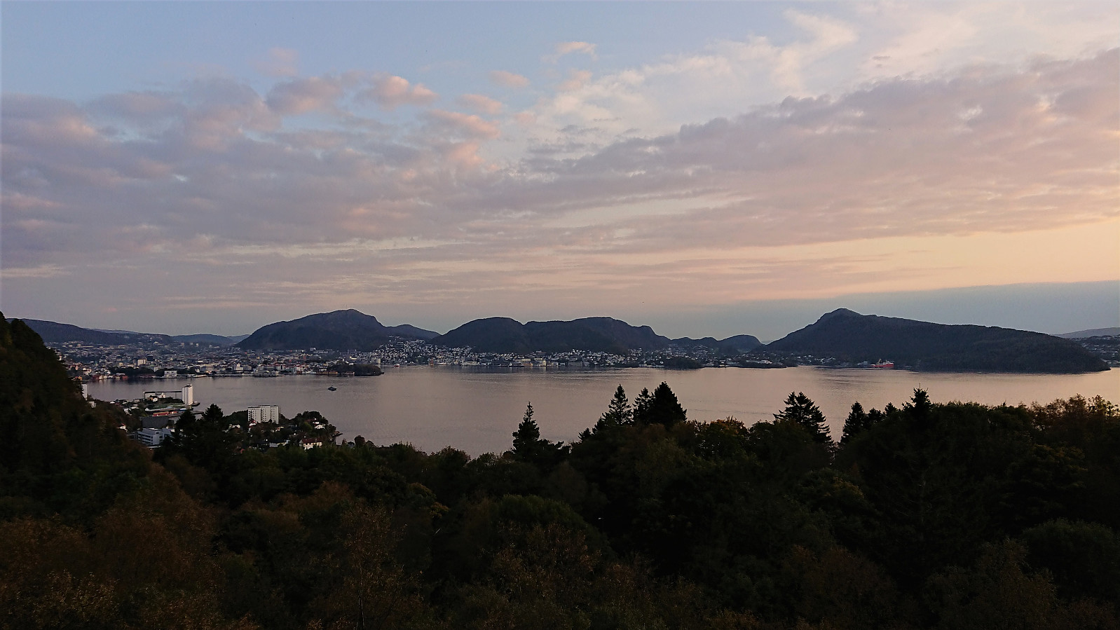
 Local hike after work testing the new Sherpa-build stone steps up from Fjellveien.
Hikletten
- Date:
- 22.09.2019
- Characteristic:
- Hillwalk
- Duration:
- 1:36h
- Distance:
- 4.1km
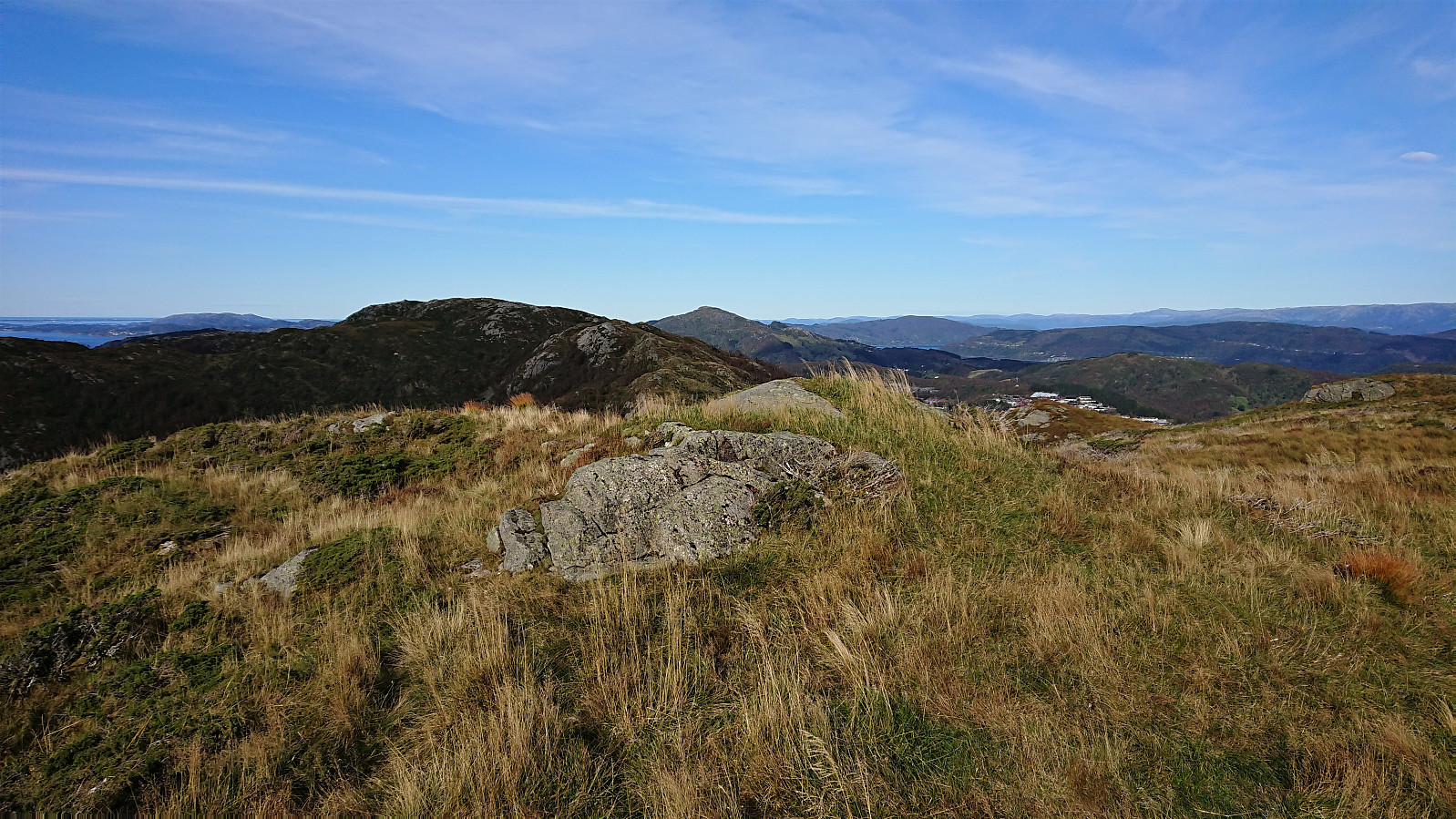
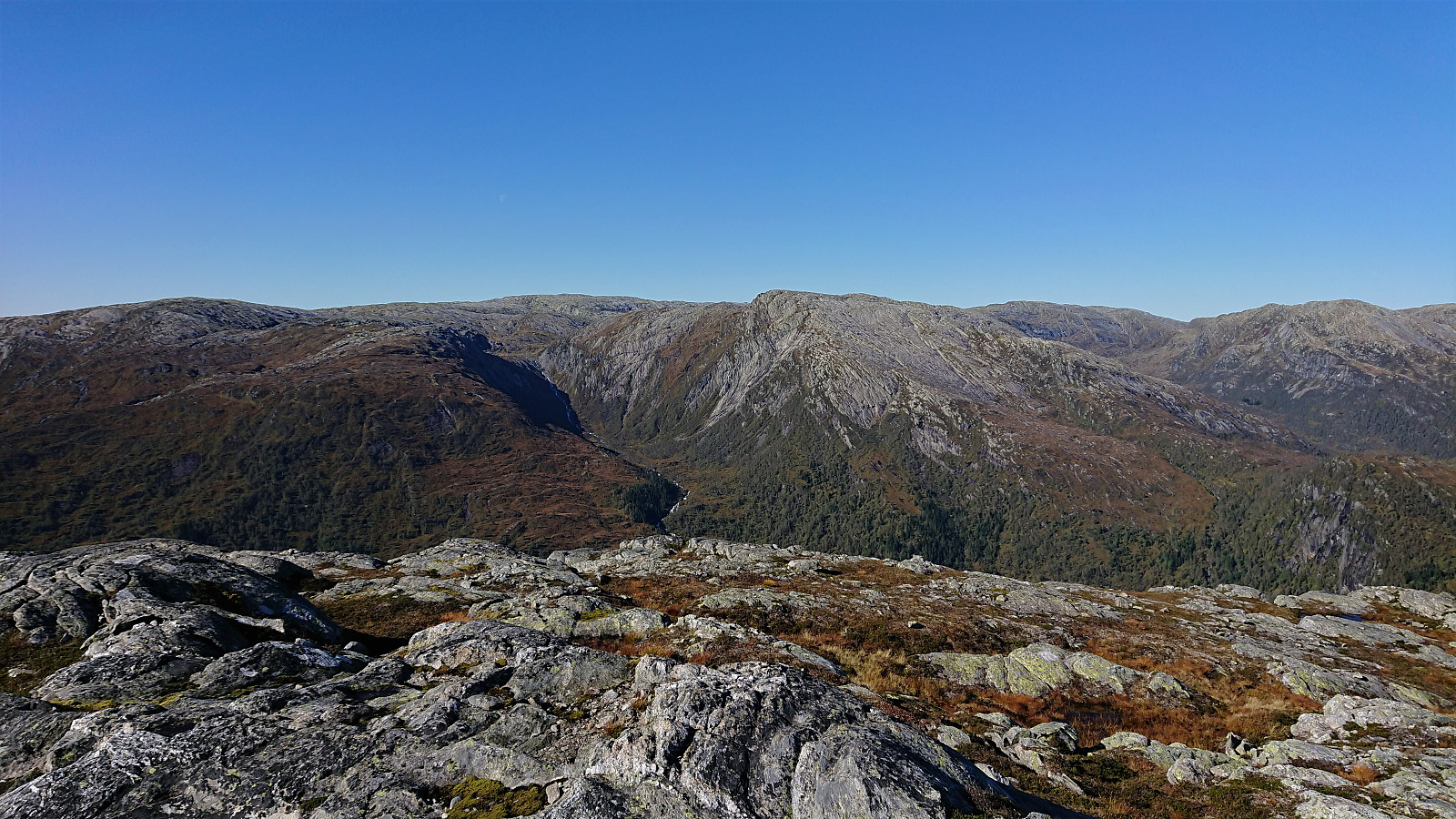
 After cycling the close to 60 km to Botnen and the marked trailhead for Hikletten (see separate trip report: Cycling: Hikletten ), I was finally ready for the main goal of the day. After leaving the bike behind, it was actually quite a relief to start hiking and get a break from cycling. The trail quality however left a lot to be desired, because while the trail was overall easy to follow, it was very wet, most notably the first half until making a U-turn towards the summit.
The first half also had rather limited views. But this all changed as soon as the trail turned southwest for the final climb to the summit, providing excellent views towards Veafjorden and Stanghelle, and later also south along the fjord in the direction of Vaksdal. The views from the summit itself were also excellent, and a great place for my lunch >>>
After cycling the close to 60 km to Botnen and the marked trailhead for Hikletten (see separate trip report: Cycling: Hikletten ), I was finally ready for the main goal of the day. After leaving the bike behind, it was actually quite a relief to start hiking and get a break from cycling. The trail quality however left a lot to be desired, because while the trail was overall easy to follow, it was very wet, most notably the first half until making a U-turn towards the summit.
The first half also had rather limited views. But this all changed as soon as the trail turned southwest for the final climb to the summit, providing excellent views towards Veafjorden and Stanghelle, and later also south along the fjord in the direction of Vaksdal. The views from the summit itself were also excellent, and a great place for my lunch >>>
Cycling: Hikletten
- Date:
- 22.09.2019
- Characteristic:
- Bike trip - road
- Duration:
- 11:50h
- Distance:
- 115.1km
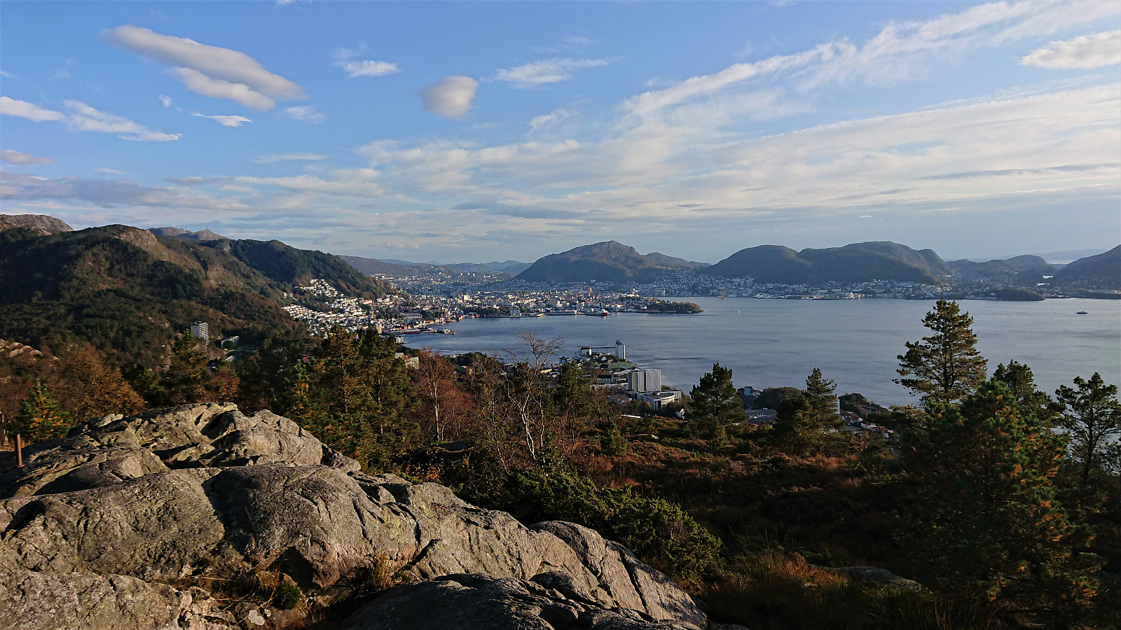
 When summer made a surprise return in late September, I decided to have a go at my ambitious plan of using the bike as my transportation for a visit to Hikletten on Osterøy. I therefore got up early Sunday morning and began the long bike ride towards Botnen just as the sun was starting to rise. Thankfully a relatively cold morning soon turned significantly warmer, and even though my legs were still tired from yesterday's hike, progress was initially good.
Bruvik was reached without any difficulties and it was now time for the main challenge of the day, i.e. the long climb up to Båtaleitet . By now my legs had started to complain slightly, I therefore mixed in short stretches of walking next to the bike for a bit of variation. But the first lunch break halfway up the climb was still very welcome and also provided >>>
When summer made a surprise return in late September, I decided to have a go at my ambitious plan of using the bike as my transportation for a visit to Hikletten on Osterøy. I therefore got up early Sunday morning and began the long bike ride towards Botnen just as the sun was starting to rise. Thankfully a relatively cold morning soon turned significantly warmer, and even though my legs were still tired from yesterday's hike, progress was initially good.
Bruvik was reached without any difficulties and it was now time for the main challenge of the day, i.e. the long climb up to Båtaleitet . By now my legs had started to complain slightly, I therefore mixed in short stretches of walking next to the bike for a bit of variation. But the first lunch break halfway up the climb was still very welcome and also provided >>>
Slåttenovi and Hatlekinni from Bolstadøyri
- Date:
- 21.09.2019
- Characteristic:
- Hillwalk
- Duration:
- 6:02h
- Distance:
- 22.0km
 Slåttenovi
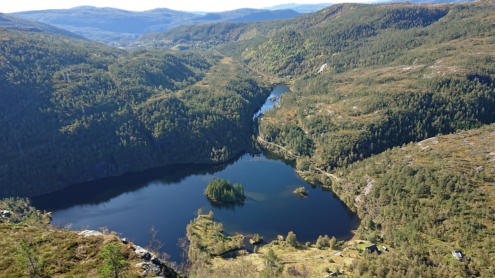
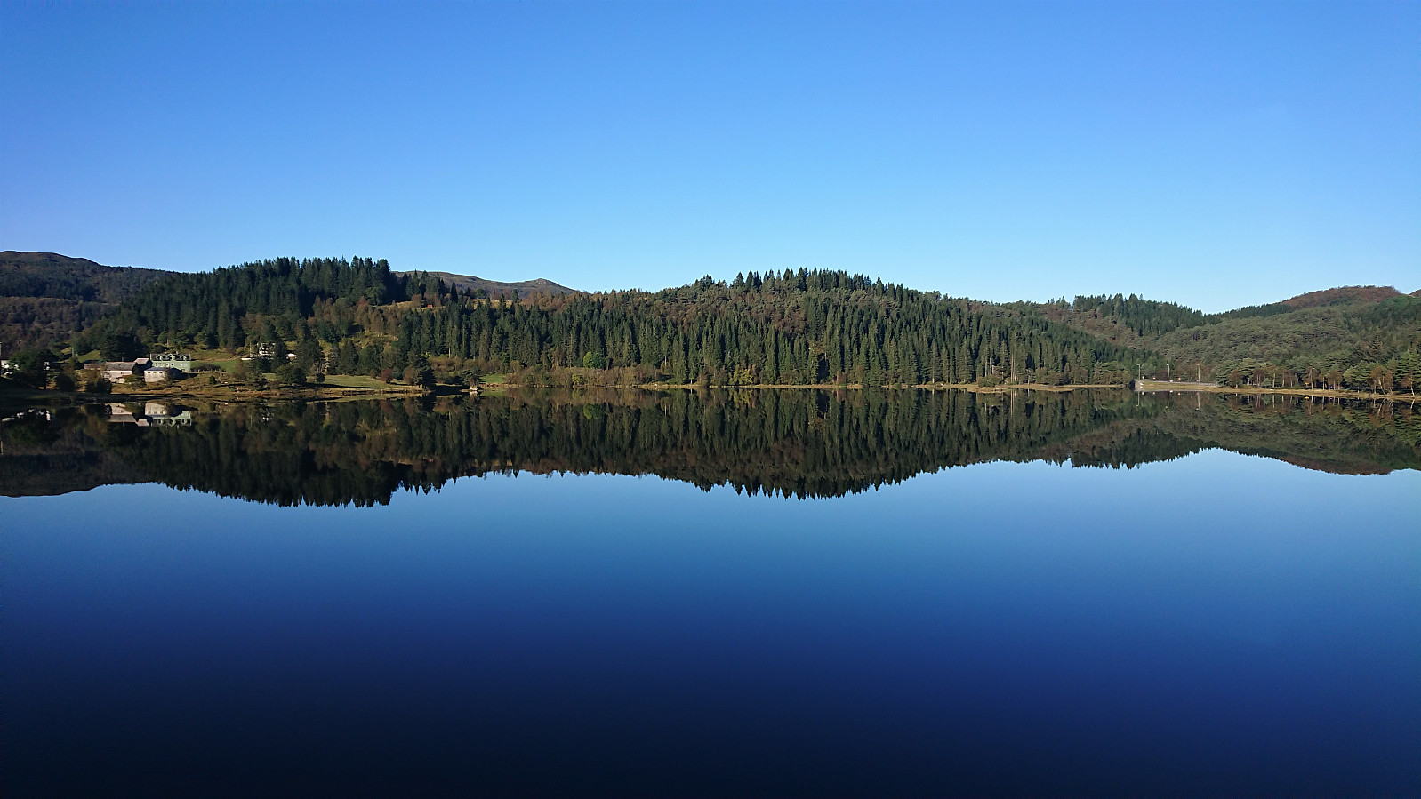
Started by taking the train to Bolstadøyri and, after crossing the river at the bridge, I walked northeast along the road, before following the gravel road towards Øvstedalen. When the winding road reached its highest point (before descending into Øvstedalen), I followed an unmarked trail southwest in the direction of Slåttenovi . The trail was pretty wet and at times rather weak, especially when crossing the wettest areas. I therefore ended up losing it a couple of times, but given that the summit was visible for most of the hike anyway, this was not really an issue.
The summit provided nice views and also included a visitor register indicating more than 100 visits so far for 2019. After a couple of pictures, I made a quick stop at the remains of the trig marker to the east, before returning >>>
Slåttenovi
Started by taking the train to Bolstadøyri and, after crossing the river at the bridge, I walked northeast along the road, before following the gravel road towards Øvstedalen. When the winding road reached its highest point (before descending into Øvstedalen), I followed an unmarked trail southwest in the direction of Slåttenovi . The trail was pretty wet and at times rather weak, especially when crossing the wettest areas. I therefore ended up losing it a couple of times, but given that the summit was visible for most of the hike anyway, this was not really an issue.
The summit provided nice views and also included a visitor register indicating more than 100 visits so far for 2019. After a couple of pictures, I made a quick stop at the remains of the trig marker to the east, before returning >>>
Hakkesetstølen
- Date:
- 15.09.2019
- Characteristic:
- Hillwalk
- Duration:
- 2:02h
- Distance:
- 5.2km
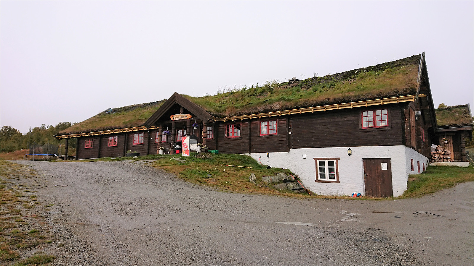 We parked at the large parking lot at the start of Hakkesetvegen and followed the gravel road all the way to Hakkesetstølen , with the rain from above (or rather from the side due to the strong winds) turning to wet snow along the way. After enjoying hot chocolates at Hakkesetstølen we followed the marked, but sometimes pretty wet, trail back towards Geilo. Upon reaching the gravel road we ditched the trail and instead followed the gravel road down to Vestlia Resort.
