Archive - Date
Archive - Activity
-
Bike trip (111)
- Bike trip - mixed (25)
- Bike trip - road (86)
-
Drive (9)
- Car drive (9)
-
Other trip (3)
- Kayaking (3)
-
Ski trip (116)
- Backcountry skiing (69)
- Cross-country skiing (47)
- Trip by foot (1897)
Collected lists
-
Utvalgte topper og turmål i Bergen
(349/351)
 99%
99% -
Alle topper i Bergen
(393/400)
98%
-
Voss ≥ 100m pf.
(96/98)
97%
-
Opptur Hordaland
(144/159)
90%
-
Stasjoner på Bergensbanen
(33/40)
82%
-
Ulvik ≥ 100m pf.
(30/38)
78%
-
Hordaland ≥ 100m pf.
(624/863)
72%
-
Mjølfjell PF > 100m
(21/31)
67%
-
Jondal ≥ 100m pf.
(15/23)
65%
-
Dagsturhyttene i Vestland
(36/61)
59%
-
Sunnhordland PF >= 100m
(105/186)
56%
-
Hordaland: Hardanger PF>=100m
(196/359)
54%
-
DNT-hytter i Hordaland
(23/45)
51%
-
Kvinnherad ≥ 100m pf.
(40/79)
50%
-
Eidfjord ≥ 100m pf.
(13/42)
30%
-
Sogndal ≥ 100m pf.
(23/81)
28%
-
Gulen ≥ 100m pf.
(15/54)
27%
-
Vik i Sogn ≥ 100m pf.
(10/46)
21%
-
Sogn - Sør for Sognefjorden PF>=100m
(31/159)
19%
-
DNT-hytter i Sogn og Fjordane
(8/47)
17%

Flatafjellet (from Fossmark to Dale)
- Date:
- 31.05.2019
- Characteristic:
- Hillwalk
- Duration:
- 5:43h
- Distance:
- 15.6km
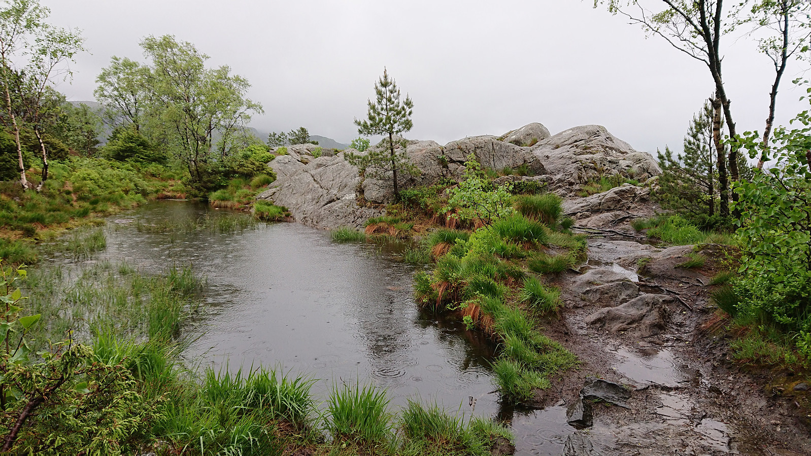
 I started by taking the bus to Fossmark, and after putting on my full raingear at the bus stop, continued another 100 meters or so along the main road to the marked trailhead. The trail was overall easy to follow as it climbed steeply up the mountainside, although very slippery due to all the rain, and within not too long I arrived at Fossmarksætra . The visibility was not the best, so I was happy to follow the fairly new trail markers onwards to Flatavasshaugen . I did lose the trail just as I was passing north of Kraksåvatnet though, but it was easily relocated.
Due to the fog, I first followed the trail to Flatavasshaugen, before (re-)turning southeast for a quick visit to the slightly higher summit of Flatafjellet . No trails in this direction that I could see, and while Flatafjellet was not as flat as its name would indicate, it >>>
I started by taking the bus to Fossmark, and after putting on my full raingear at the bus stop, continued another 100 meters or so along the main road to the marked trailhead. The trail was overall easy to follow as it climbed steeply up the mountainside, although very slippery due to all the rain, and within not too long I arrived at Fossmarksætra . The visibility was not the best, so I was happy to follow the fairly new trail markers onwards to Flatavasshaugen . I did lose the trail just as I was passing north of Kraksåvatnet though, but it was easily relocated.
Due to the fog, I first followed the trail to Flatavasshaugen, before (re-)turning southeast for a quick visit to the slightly higher summit of Flatafjellet . No trails in this direction that I could see, and while Flatafjellet was not as flat as its name would indicate, it >>>
Nonhøyen from Flaktveit
- Date:
- 30.05.2019
- Characteristic:
- Hillwalk
- Duration:
- 1:18h
- Distance:
- 5.6km
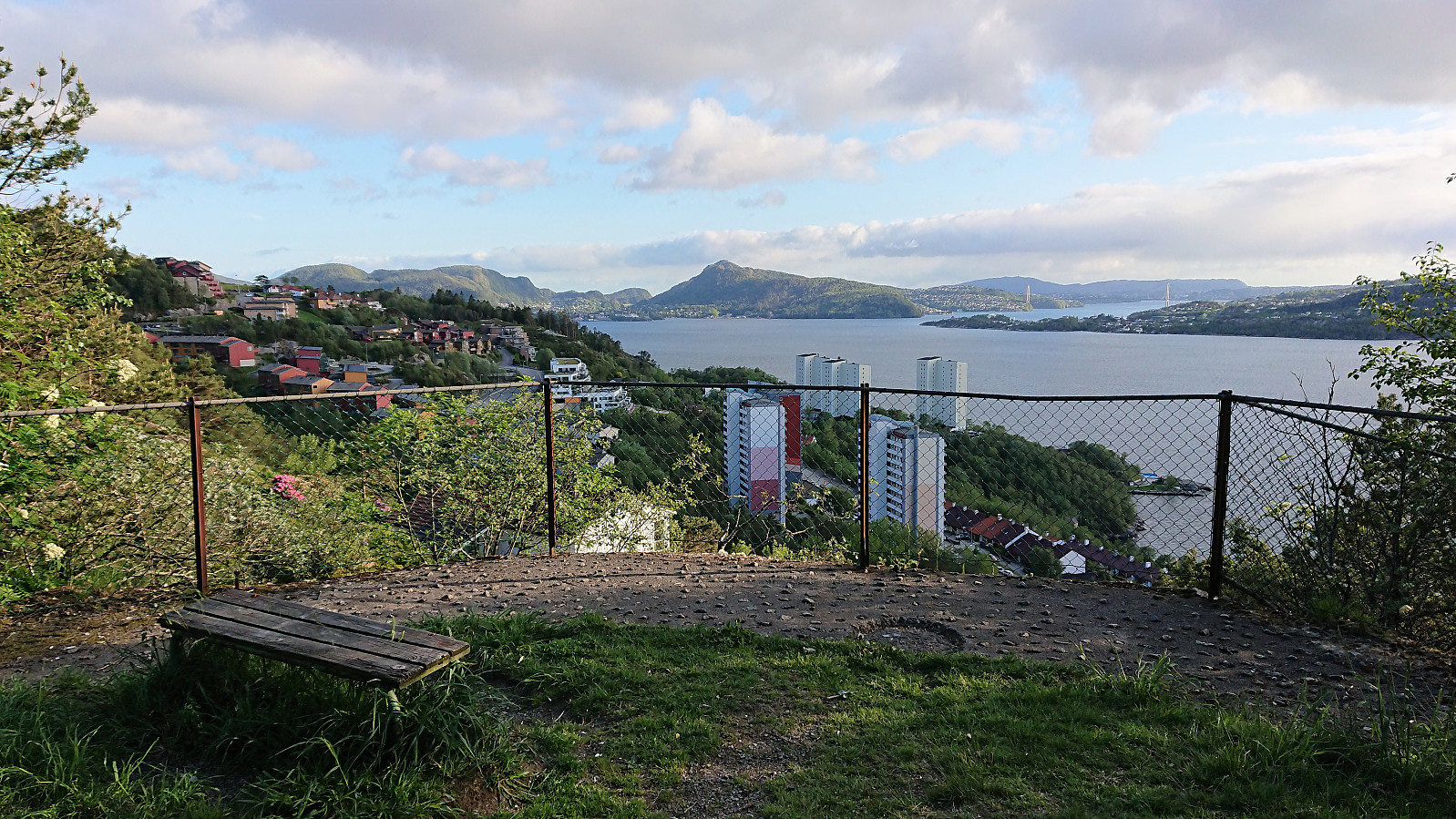
 A revisit of Nonhøyen . This time starting from the final bus stop at Flaktveit. The trailhead was unmarked but easy to locate, even though at first I was a bit unsure whether I was starting on a trail or entering someone's backyard. The trail followed the ridge and was overall easy to follow. From Nonhøyen I continued west to Jonsokhaugen, where the plan was to follow the trail indicated on the map all the way to Liavatnet. But shortly after leaving Jonsokhaugen the trail disappeared. I therefore turned back and instead followed the trail down to Liastølen. The hike was finished off by walking along the roads back to Åsane terminal for the bus home.
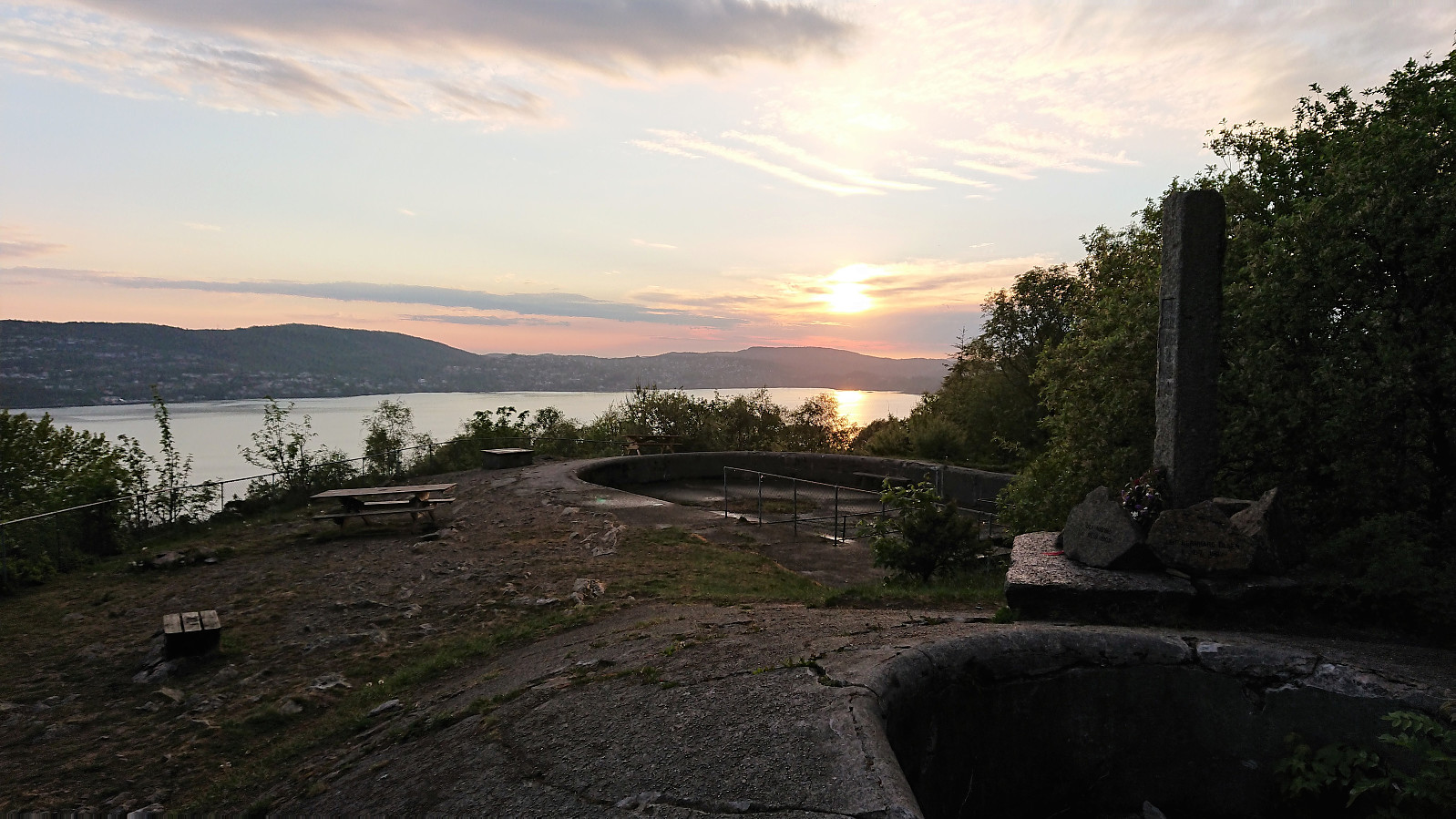
Across Hellen festning
- Date:
- 28.05.2019
- Characteristic:
- Hike
- Duration:
- 0:31h
- Distance:
- 3.1km
 Short local hike across Hellen festning.
Marineholmen to Bryggen
- Date:
- 28.05.2019
- Characteristic:
- Walk
- Duration:
- 0:32h
- Distance:
- 2.8km
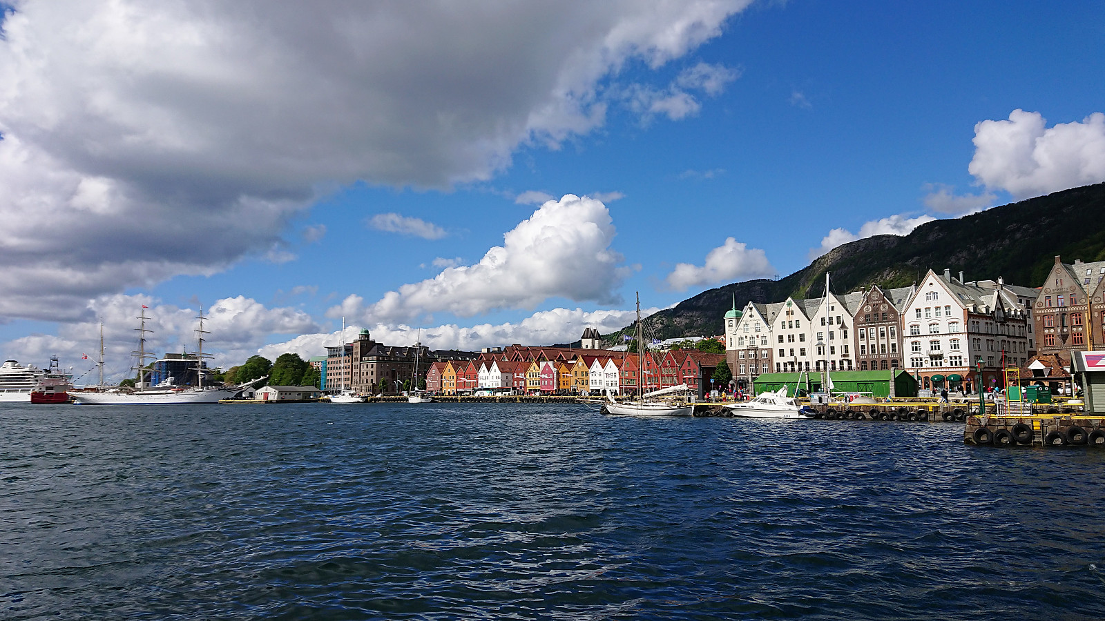 Short walk on the way home from work.
Fagerdalsfjellet
- Date:
- 27.05.2019
- Characteristic:
- Hillwalk
- Duration:
- 0:24h
- Distance:
- 1.9km
 Short local hike across Fagerdalsfjellet.
Gråfjellet roundtrip (up via Bogadalen, down via Herfindal)
- Date:
- 26.05.2019
- Characteristic:
- Hillwalk
- Duration:
- 9:13h
- Distance:
- 27.6km
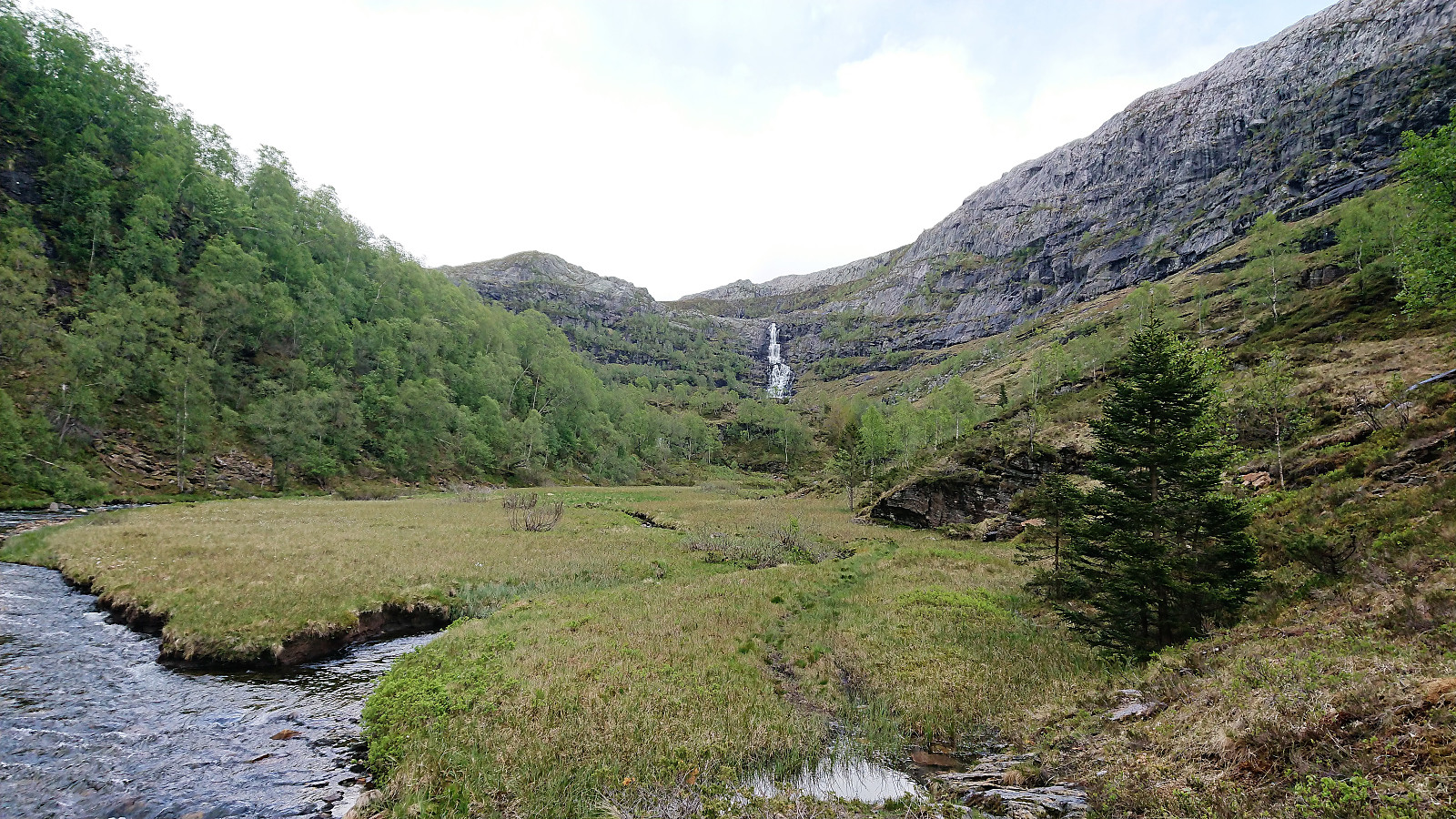 We started by taking the bus to Boge and following the steep gravel road up to Bogavatnet. From there we continued north along a trail passing by many of the very nice cabins at Bogastølen. But somewhere during our ascent to Stabben we lost the trail (or it disappeared?), and while we would still come across several small cairns, the rest of our hike to Gråfjellet was overall without any trails to follow.
After walking around Rossatjørna on the northern side, the initial progress from Krossatjørna towards the summit was straightforward. But as we got closer, the terrain turned more challenging and now mainly consisted of numerous small lakes and steep (although not very high) cliffs that had to be traversed. The nature of the terrain also made it difficult to see the best route from a distance. The >>>
We started by taking the bus to Boge and following the steep gravel road up to Bogavatnet. From there we continued north along a trail passing by many of the very nice cabins at Bogastølen. But somewhere during our ascent to Stabben we lost the trail (or it disappeared?), and while we would still come across several small cairns, the rest of our hike to Gråfjellet was overall without any trails to follow.
After walking around Rossatjørna on the northern side, the initial progress from Krossatjørna towards the summit was straightforward. But as we got closer, the terrain turned more challenging and now mainly consisted of numerous small lakes and steep (although not very high) cliffs that had to be traversed. The nature of the terrain also made it difficult to see the best route from a distance. The >>>
Across Hellen festning
- Date:
- 25.05.2019
- Characteristic:
- Hike
- Duration:
- 0:33h
- Distance:
- 3.2km
 Short local evening hike when the sun came out after an overall gray and rainy day.
Haukeland sykehus to Munkebotten
- Date:
- 24.05.2019
- Characteristic:
- Walk
- Duration:
- 1:23h
- Distance:
- 7.6km
 Another walk on the way home from work.
Ørneberget and Hellen festning
- Date:
- 23.05.2019
- Characteristic:
- Hillwalk
- Duration:
- 1:00h
- Distance:
- 4.0km
 Short local evening hike across Ørneberget and Hellen festning in constant rain.
Across Hellen festning
- Date:
- 20.05.2019
- Characteristic:
- Hike
- Duration:
- 0:33h
- Distance:
- 3.2km
 Short local evening hike across Hellen festning.
