Archiv - Nach Datum
Archiv - Nach Aktivität
-
Andere Tour (3)
- Kayaking (3)
-
Fahrradtour (111)
- Fahrradtour Straße (86)
- Fahrradtour gemischt (25)
-
Fahrzeugtour (9)
- Autotour (9)
-
Fußtour (1897)
- Bergtour (1120)
- Jogging (1)
- Spaziergang (60)
- Wanderung (716)
-
Skitour (116)
- Langlauf (47)
- Tourenskilauf (69)
Gesammelte Listen
-
Utvalgte topper og turmål i Bergen
(349/351)
 99%
99% -
Alle topper i Bergen
(393/400)
98%
-
Voss ≥ 100m pf.
(96/98)
97%
-
Opptur Hordaland
(144/159)
90%
-
Stasjoner på Bergensbanen
(33/40)
82%
-
Ulvik ≥ 100m pf.
(30/38)
78%
-
Hordaland ≥ 100m pf.
(624/863)
72%
-
Mjølfjell PF > 100m
(21/31)
67%
-
Jondal ≥ 100m pf.
(15/23)
65%
-
Dagsturhyttene i Vestland
(36/61)
59%
-
Sunnhordland PF >= 100m
(105/186)
56%
-
Hordaland: Hardanger PF>=100m
(196/359)
54%
-
DNT-hytter i Hordaland
(23/45)
51%
-
Kvinnherad ≥ 100m pf.
(40/79)
50%
-
Eidfjord ≥ 100m pf.
(13/42)
30%
-
Sogndal ≥ 100m pf.
(23/81)
28%
-
Gulen ≥ 100m pf.
(15/54)
27%
-
Vik i Sogn ≥ 100m pf.
(10/46)
21%
-
Sogn - Sør for Sognefjorden PF>=100m
(31/159)
19%
-
DNT-hytter i Sogn og Fjordane
(8/47)
17%

Across Hellen festning
- Datum:
- 13.08.2018
- Tourcharakter:
- Wanderung
- Tourlänge:
- 0:32h
- Entfernung:
- 3,2km
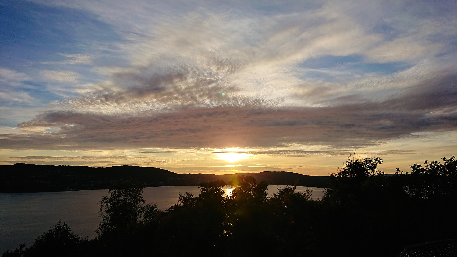 Short local evening hike across Hellen festning.
Cycling: Eidsvågsneset and Sandviksbatteriet
- Datum:
- 12.08.2018
- Tourcharakter:
- Fahrradtour Straße
- Tourlänge:
- 0:55h
- Entfernung:
- 12,9km
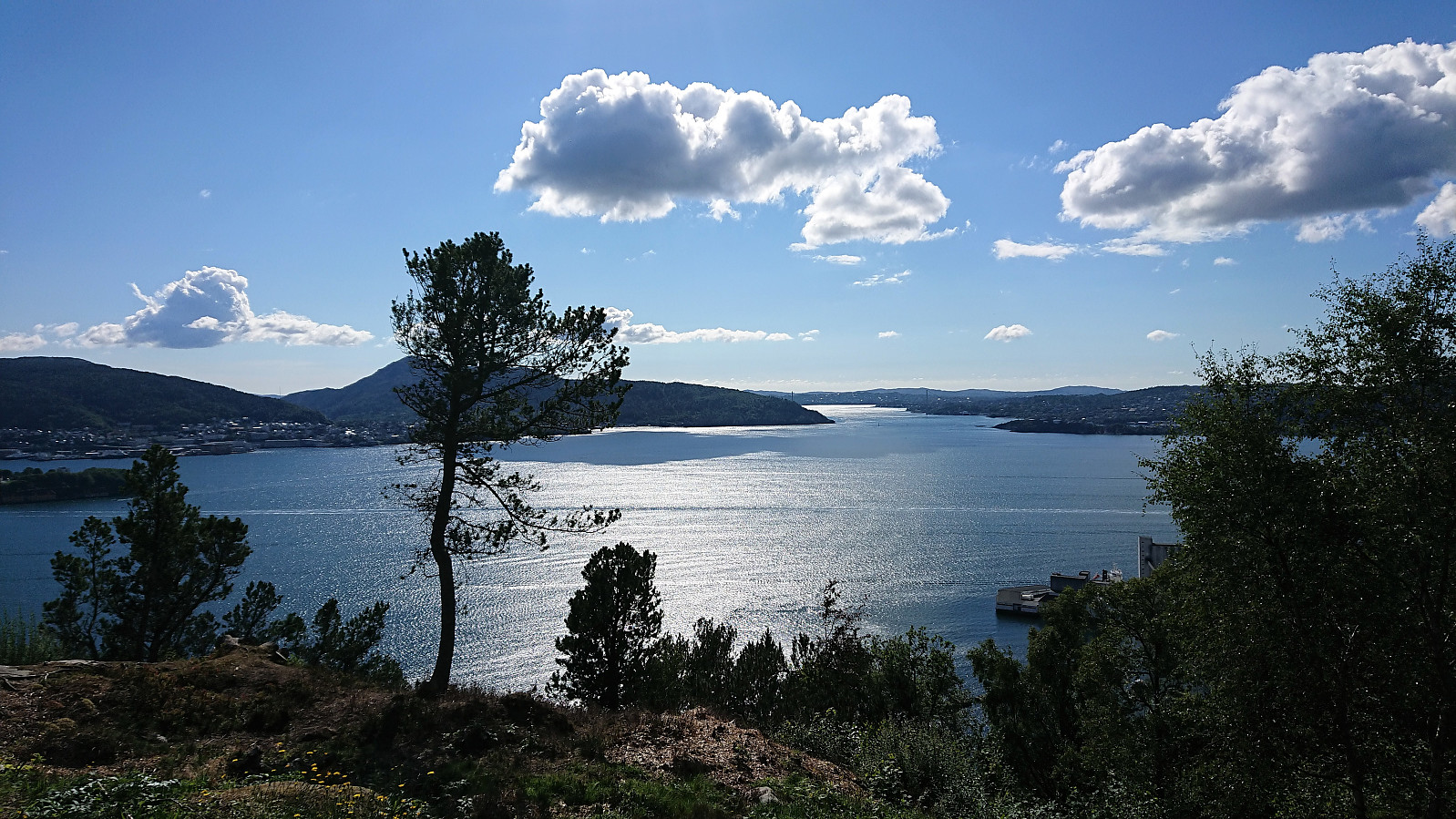 Short local bike ride to test my new cycling gloves and to see whether my recent crash made me go significantly slower in the corners when going downhill. And I did notice that I was thinking more about the possibility of slipping in the sharp bends, but hopefully this will be back to normal soon.
Kolåsfjellet, Lyngfjellet and Skausnøya
- Datum:
- 11.08.2018
- Tourcharakter:
- Bergtour
- Tourlänge:
- 3:56h
- Entfernung:
- 16,8km
 Kolåsfjellet
Started by taking the bus to Lindås and getting off at the bus stop called "Lindås senter". From there I followed what seemed like the most direct route towards Kolåsfjellet and shortly came across the first sign indicating the path to the summit. First along a gravel road and later along what I guess can be called a gravel-covered trail. Overall very easy access. The summit provided very nice views, in particular towards the north and east.
After a short break I returned to Lindås and continued southeast towards my next goal of Lyngfjellet . Thankfully it was possible to walk along the old road, where there was very limited traffic compared the new road right next to it.
Lyngfjellet and an unexpected roundtrip
From the map, ascending Lyngfjellet seemed fairly straightforward, with a road going >>>
Kolåsfjellet
Started by taking the bus to Lindås and getting off at the bus stop called "Lindås senter". From there I followed what seemed like the most direct route towards Kolåsfjellet and shortly came across the first sign indicating the path to the summit. First along a gravel road and later along what I guess can be called a gravel-covered trail. Overall very easy access. The summit provided very nice views, in particular towards the north and east.
After a short break I returned to Lindås and continued southeast towards my next goal of Lyngfjellet . Thankfully it was possible to walk along the old road, where there was very limited traffic compared the new road right next to it.
Lyngfjellet and an unexpected roundtrip
From the map, ascending Lyngfjellet seemed fairly straightforward, with a road going >>>
Stongfjellet from Lonevåg
- Datum:
- 09.08.2018
- Tourcharakter:
- Bergtour
- Tourlänge:
- 3:43h
- Entfernung:
- 14,6km
 Started by taking the bus two or three stops passed Lonevåg terminal to the bus stop referred to as both "Hatland skulesenter" and "Hatland US". From there I followed the roads southeast to locate the marked trailhead between Byrkjeland and Hovdo. The second half of this walk included a steady almost 200 meters climb spread over 2 km, reaching just below 250 meters above sea level before starting the real hike.
The trail started out wet and muddy. The fact that started raining did not help much either. However, within not too long the quality of the trail improved as it started to climb more steeply, and halfway up the mountain it thankfully also stopped raining. (The rain would return on the descent, but less intense). Not long after I passed by two small cabins and soon >>>
Started by taking the bus two or three stops passed Lonevåg terminal to the bus stop referred to as both "Hatland skulesenter" and "Hatland US". From there I followed the roads southeast to locate the marked trailhead between Byrkjeland and Hovdo. The second half of this walk included a steady almost 200 meters climb spread over 2 km, reaching just below 250 meters above sea level before starting the real hike.
The trail started out wet and muddy. The fact that started raining did not help much either. However, within not too long the quality of the trail improved as it started to climb more steeply, and halfway up the mountain it thankfully also stopped raining. (The rain would return on the descent, but less intense). Not long after I passed by two small cabins and soon >>>
Totlandsfjellet/Ørnakulten from Eknes
- Datum:
- 08.08.2018
- Tourcharakter:
- Bergtour
- Tourlänge:
- 1:24h
- Entfernung:
- 5,0km
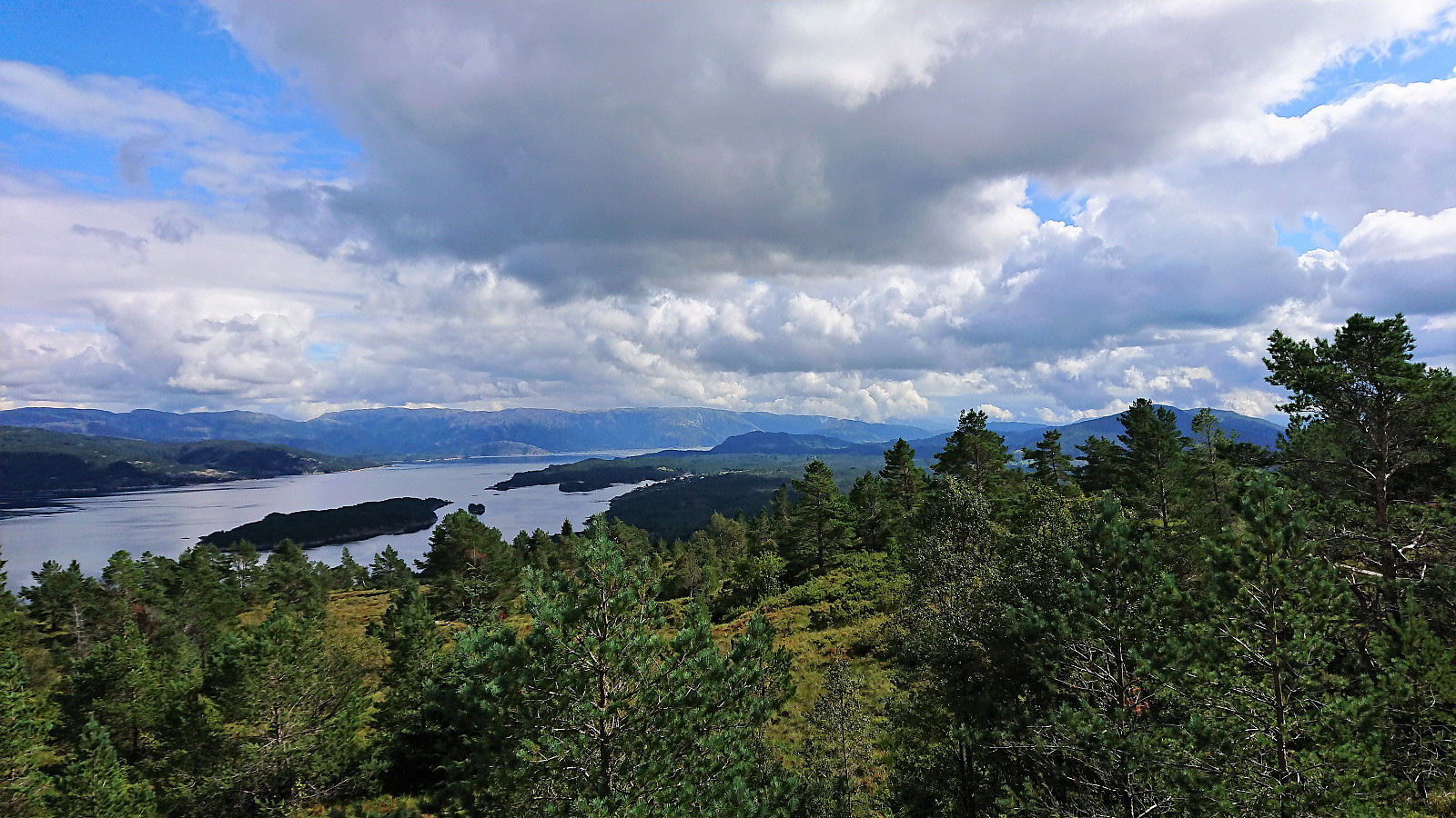
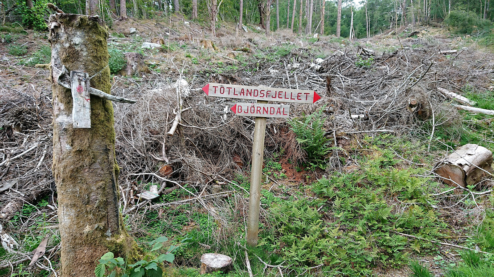 Started by taking the bus to Eknes and the bus stop called "Eknes, butikken". Did not see any traces of the store the name of the bus stop referred to though. It should also be mentioned that the bus from Knarvik to Eknes follows all the minor roads and crosses multiple bridges with room for only one vehicle at the time. Hence progress was very slow. On the other hand, plenty of time for sightseeing.
From the bus stop I walked up to the main road where I, after crossing the road, arrived at the marked trailhead for Totlandsfjellet/Ørnakulten . The trail was then easily followed all the way to the summit. Clearly lots of work had gone into the making of this trail, with numerous (almost too many?) small wooden bridges to step on.
The visitor register was located inside a small cabin which also had its own lookout >>>
Started by taking the bus to Eknes and the bus stop called "Eknes, butikken". Did not see any traces of the store the name of the bus stop referred to though. It should also be mentioned that the bus from Knarvik to Eknes follows all the minor roads and crosses multiple bridges with room for only one vehicle at the time. Hence progress was very slow. On the other hand, plenty of time for sightseeing.
From the bus stop I walked up to the main road where I, after crossing the road, arrived at the marked trailhead for Totlandsfjellet/Ørnakulten . The trail was then easily followed all the way to the summit. Clearly lots of work had gone into the making of this trail, with numerous (almost too many?) small wooden bridges to step on.
The visitor register was located inside a small cabin which also had its own lookout >>>
Geitanuken from Morvik
- Datum:
- 07.08.2018
- Tourcharakter:
- Bergtour
- Tourlänge:
- 3:00h
- Entfernung:
- 12,5km
 Change of plans...
My initial plan to go hiking to new peaks in Lindås had to be abandoned as the bus to Knarvik never showed up at Handelshøyskolen. I therefore jumped on the next bus heading to Åsane and came up with the alternative plan of instead ascending Geitanuken from the south/southwest, as the map showed a trail there that I had not yet tried.
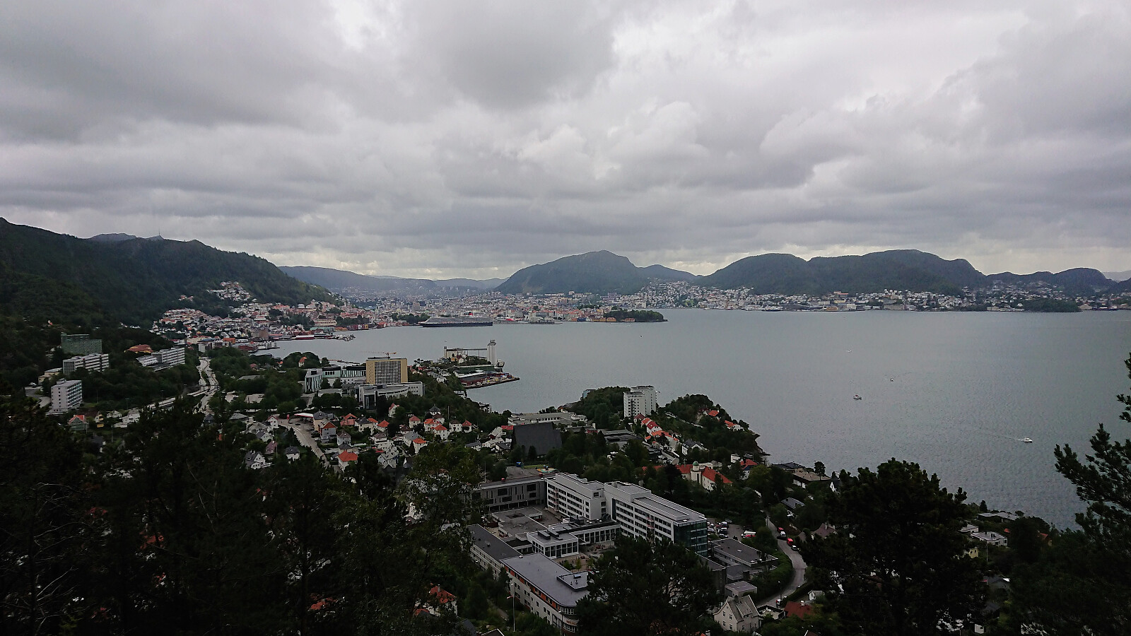
Geitanuken
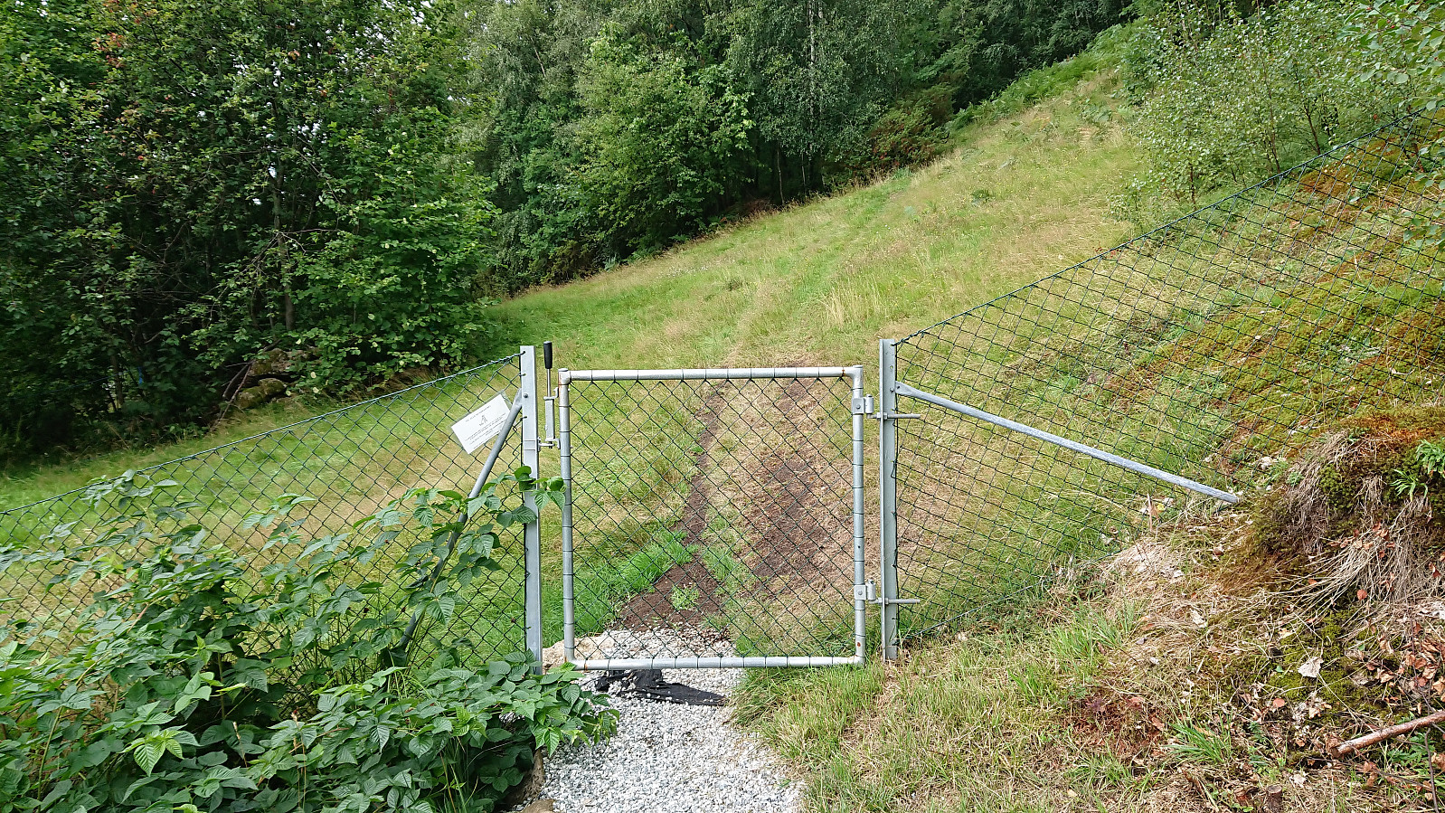
Left the bus at Viddalen and followed Farbotslia east towards where the start of a trail was indicated on the map. Did not find a marked trailhead, but just west of Morvikbotn 258 I came across a small gate and what looked like a potential trail on the other side. Shortly after passing through the gate the trail started climbing, at times relatively steeply, there were even a couple of ropes, although these were most often not really needed.
Change of plans...
My initial plan to go hiking to new peaks in Lindås had to be abandoned as the bus to Knarvik never showed up at Handelshøyskolen. I therefore jumped on the next bus heading to Åsane and came up with the alternative plan of instead ascending Geitanuken from the south/southwest, as the map showed a trail there that I had not yet tried.
Geitanuken
Left the bus at Viddalen and followed Farbotslia east towards where the start of a trail was indicated on the map. Did not find a marked trailhead, but just west of Morvikbotn 258 I came across a small gate and what looked like a potential trail on the other side. Shortly after passing through the gate the trail started climbing, at times relatively steeply, there were even a couple of ropes, although these were most often not really needed.
Furukammen and Hellen festning
- Datum:
- 05.08.2018
- Tourcharakter:
- Wanderung
- Tourlänge:
- 0:37h
- Entfernung:
- 3,2km
 Local hike that had to be cut short due to rain.
Bjedlastølen
- Datum:
- 03.08.2018
- Tourcharakter:
- Bergtour
- Tourlänge:
- 3:19h
- Entfernung:
- 14,2km
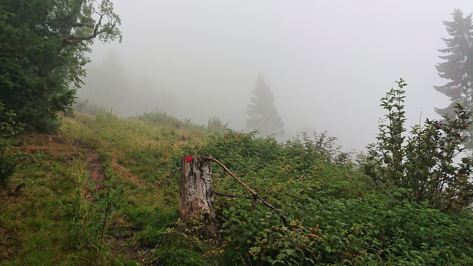 Rain and fog meant that heading for a new summit would be a bit of a waste this evening. I therefore decided on a visit to Bjedlastølen instead. I started from Fjøra and from there walked along the roads to Bjella, where I easily located the marked trailhead. I then passed by multiple gates on the way up to Bjedlastølen. First on a tractor road and later on a rather wet trail.
The positive surprise was the endless amounts of wild raspberries! Just before reaching Bjedlastølen I was also surprised by several cows appearing in the fog. None of them seemed to pay me any attention though. From Bjedlastølen I could also spot 2-3 horses in the distance and on the decent I came across numerus sheep.
Shortly after leaving Bjedlastølen a new sign appeared. Or rather two signs: Åberge 2.4 and 2.9 km. I chose >>>
Rain and fog meant that heading for a new summit would be a bit of a waste this evening. I therefore decided on a visit to Bjedlastølen instead. I started from Fjøra and from there walked along the roads to Bjella, where I easily located the marked trailhead. I then passed by multiple gates on the way up to Bjedlastølen. First on a tractor road and later on a rather wet trail.
The positive surprise was the endless amounts of wild raspberries! Just before reaching Bjedlastølen I was also surprised by several cows appearing in the fog. None of them seemed to pay me any attention though. From Bjedlastølen I could also spot 2-3 horses in the distance and on the decent I came across numerus sheep.
Shortly after leaving Bjedlastølen a new sign appeared. Or rather two signs: Åberge 2.4 and 2.9 km. I chose >>>
Barsnesfjorden
- Datum:
- 02.08.2018
- Tourcharakter:
- Wanderung
- Tourlänge:
- 0:46h
- Entfernung:
- 3,8km
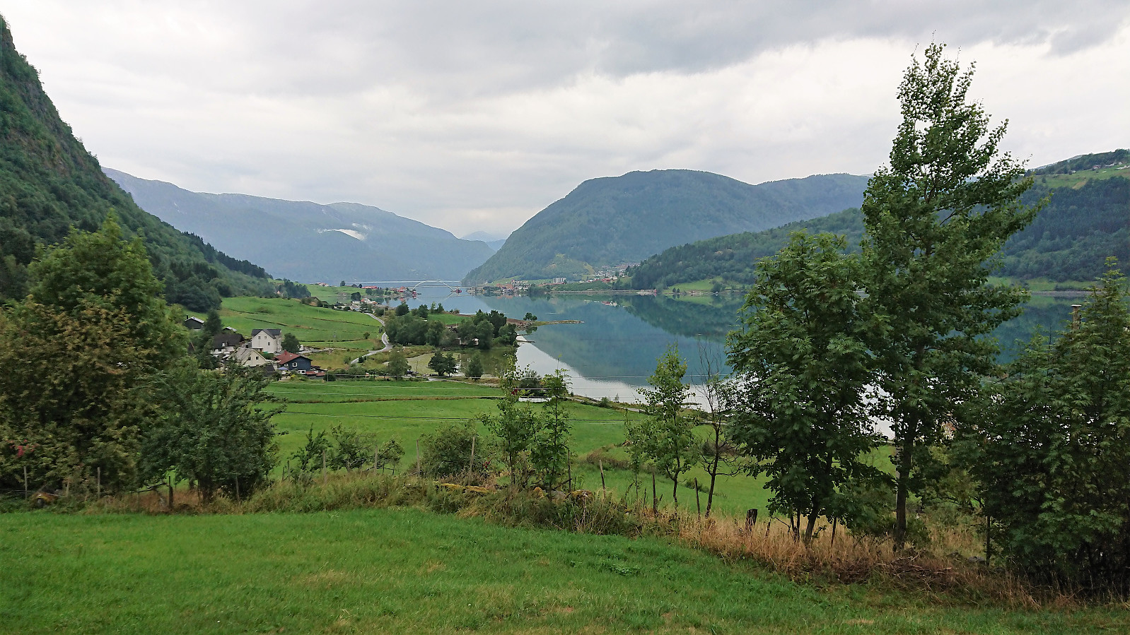 Another short walk along Barsnesfjorden.
(Note that the road this hike follows is private, i.e. no cars allowed. There are however a couple of parking spaces down by the small wharf along Barsnesfjorden just before the road turns west and starts climbing slightly towards the crossroads at Barsnes.)
Another short walk along Barsnesfjorden.
(Note that the road this hike follows is private, i.e. no cars allowed. There are however a couple of parking spaces down by the small wharf along Barsnesfjorden just before the road turns west and starts climbing slightly towards the crossroads at Barsnes.)
Lusaskard from Øvstedalen
- Datum:
- 01.08.2018
- Tourcharakter:
- Bergtour
- Tourlänge:
- 4:05h
- Entfernung:
- 15,5km
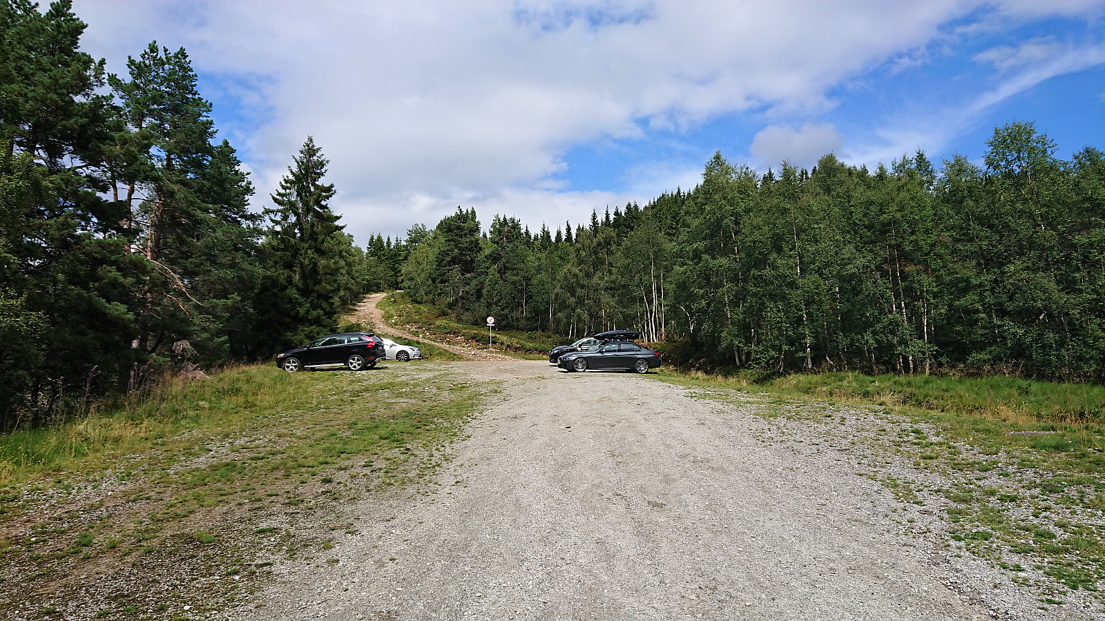 After our previous recent visit to Øvstedalen we had studied the map and located another potential parking lot further up the valley. This time we therefore paid the toll (30 kr for one day) just next to the lower parking lot and then continued northwest up Gardselvegen. At the first crossroads we went right and then through a gate before turning north up a relatively steep hill to arrive at the parking lot indicated on the map .
The parking lot provided a marked trailhead for Fjærlandsete (and more), clearly indicating that we were on the right track (unlike for our previous attempt). No signs for Lusaskard yet, but these would show up later. The trail was easy to follow, but did contain its fair share of wet areas until reaching Furesete.
Upon reaching Kalvavatnet I left the rest of my party behind for blueberry picking and continued on my own towards Lusaskard. Again the >>>
After our previous recent visit to Øvstedalen we had studied the map and located another potential parking lot further up the valley. This time we therefore paid the toll (30 kr for one day) just next to the lower parking lot and then continued northwest up Gardselvegen. At the first crossroads we went right and then through a gate before turning north up a relatively steep hill to arrive at the parking lot indicated on the map .
The parking lot provided a marked trailhead for Fjærlandsete (and more), clearly indicating that we were on the right track (unlike for our previous attempt). No signs for Lusaskard yet, but these would show up later. The trail was easy to follow, but did contain its fair share of wet areas until reaching Furesete.
Upon reaching Kalvavatnet I left the rest of my party behind for blueberry picking and continued on my own towards Lusaskard. Again the >>>
