Archiv - Nach Datum
Archiv - Nach Aktivität
-
Andere Tour (3)
- Kayaking (3)
-
Fahrradtour (111)
- Fahrradtour Straße (86)
- Fahrradtour gemischt (25)
-
Fahrzeugtour (9)
- Autotour (9)
-
Fußtour (1897)
- Bergtour (1120)
- Jogging (1)
- Spaziergang (60)
- Wanderung (716)
-
Skitour (116)
- Langlauf (47)
- Tourenskilauf (69)
Gesammelte Listen
-
Utvalgte topper og turmål i Bergen
(349/351)
 99%
99% -
Alle topper i Bergen
(393/400)
98%
-
Voss ≥ 100m pf.
(96/98)
97%
-
Opptur Hordaland
(144/159)
90%
-
Stasjoner på Bergensbanen
(33/40)
82%
-
Ulvik ≥ 100m pf.
(30/38)
78%
-
Hordaland ≥ 100m pf.
(624/863)
72%
-
Mjølfjell PF > 100m
(21/31)
67%
-
Jondal ≥ 100m pf.
(15/23)
65%
-
Dagsturhyttene i Vestland
(36/61)
59%
-
Sunnhordland PF >= 100m
(105/186)
56%
-
Hordaland: Hardanger PF>=100m
(196/359)
54%
-
DNT-hytter i Hordaland
(23/45)
51%
-
Kvinnherad ≥ 100m pf.
(40/79)
50%
-
Eidfjord ≥ 100m pf.
(13/42)
30%
-
Sogndal ≥ 100m pf.
(23/81)
28%
-
Gulen ≥ 100m pf.
(15/54)
27%
-
Vik i Sogn ≥ 100m pf.
(10/46)
21%
-
Sogn - Sør for Sognefjorden PF>=100m
(31/159)
19%
-
DNT-hytter i Sogn og Fjordane
(8/47)
17%

Across Vidden
- Datum:
- 27.02.2018
- Tourcharakter:
- Tourenskilauf
- Tourlänge:
- 5:23h
- Entfernung:
- 21,4km
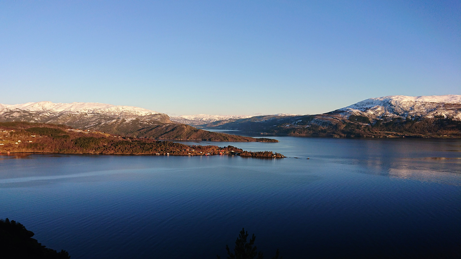
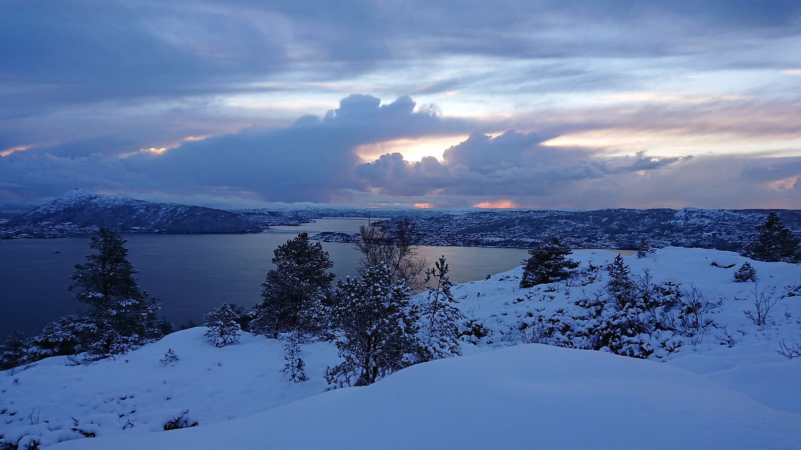
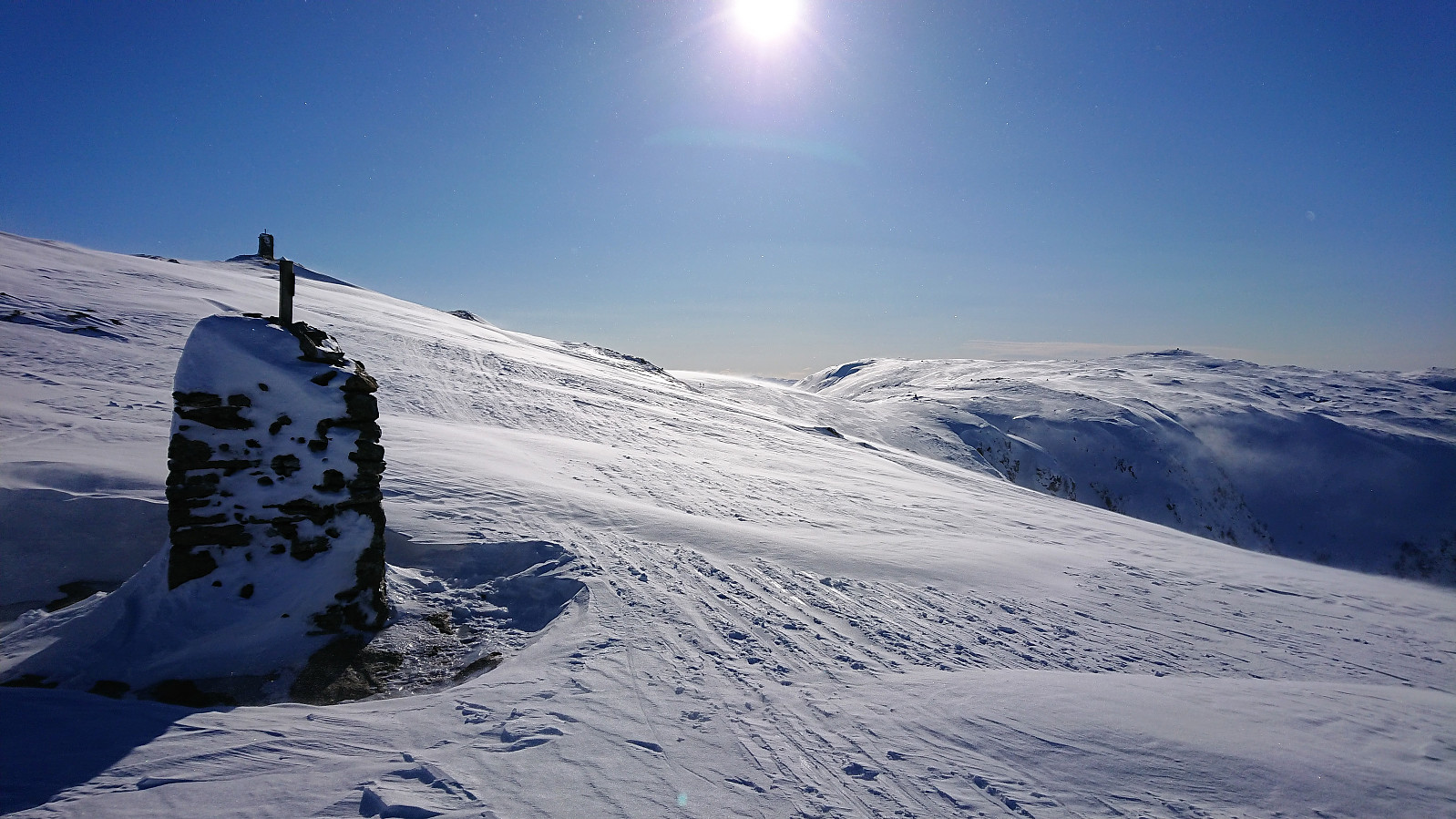 Very nice winter weather in downtown Bergen, but as Ulriksbanen approached the upper station we started to see (and feel) the strong winds. (Some fellow skiers even decided to take the cable car back down again.) Luckily we could prepare the skis inside before exiting into the very strong southeastern winds. However, besides the strong winds the conditions were close to perfect, and in the small pockets where we could stay out of the wind it was easy to forget the cold wind and enjoy the views. We followed the standard winter route across Vidden, and after turning north, and later northwest, the wind was no longer a major factor.
After a short lunch break in Hyttelien, we continued to Rundemanen and from there followed Blåmansveien on the way down to Brushytten . At Rundemanen the strong winds could again be felt, but as >>>
Very nice winter weather in downtown Bergen, but as Ulriksbanen approached the upper station we started to see (and feel) the strong winds. (Some fellow skiers even decided to take the cable car back down again.) Luckily we could prepare the skis inside before exiting into the very strong southeastern winds. However, besides the strong winds the conditions were close to perfect, and in the small pockets where we could stay out of the wind it was easy to forget the cold wind and enjoy the views. We followed the standard winter route across Vidden, and after turning north, and later northwest, the wind was no longer a major factor.
After a short lunch break in Hyttelien, we continued to Rundemanen and from there followed Blåmansveien on the way down to Brushytten . At Rundemanen the strong winds could again be felt, but as >>>
Gullfjelltoppen and Kofta
- Datum:
- 25.02.2018
- Tourcharakter:
- Tourenskilauf
- Tourlänge:
- 7:12h
- Entfernung:
- 22,1km
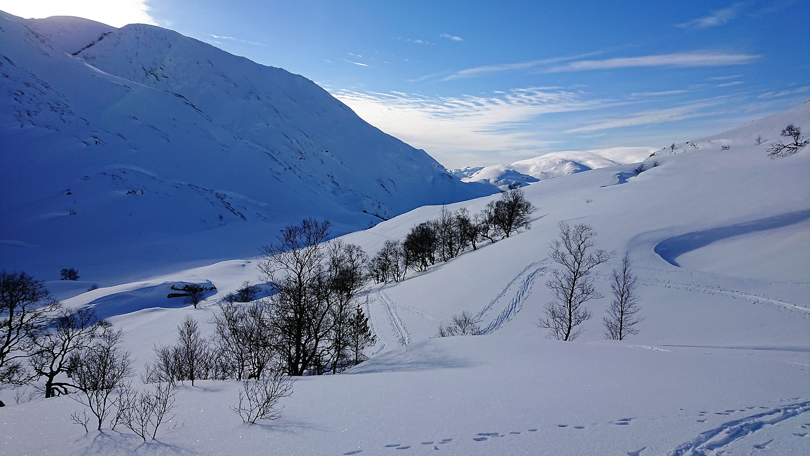 Trip organized by the Norwegian Trekking Association . We started from the parking lot at Osavatnet on a beautiful and sunny winter day and followed the winter route up Tjørndalen towards Gullfjelltoppen . As we got close to Gullfjellhalsen a relatively dense fog started to appear, however after a short lunch break it cleared enough to continue to Gullfjelltoppen where the views were only partially limited by the fog.
But soon after leaving Gullfjelltoppen the fog reappeared, now even denser than before, and both maps and GPS had to be heavily conferred in order to find the route towards Kofta . In the end we did arrive at the summit of Kofta, although the fog resulted in extremely limited views. We therefore did not stay long and quickly returned the same way.
The initial plan had been to also visit Søre Gullfjelltoppen and Sydpolen , but this was rejected due to the dense fog, and we instead >>>
Trip organized by the Norwegian Trekking Association . We started from the parking lot at Osavatnet on a beautiful and sunny winter day and followed the winter route up Tjørndalen towards Gullfjelltoppen . As we got close to Gullfjellhalsen a relatively dense fog started to appear, however after a short lunch break it cleared enough to continue to Gullfjelltoppen where the views were only partially limited by the fog.
But soon after leaving Gullfjelltoppen the fog reappeared, now even denser than before, and both maps and GPS had to be heavily conferred in order to find the route towards Kofta . In the end we did arrive at the summit of Kofta, although the fog resulted in extremely limited views. We therefore did not stay long and quickly returned the same way.
The initial plan had been to also visit Søre Gullfjelltoppen and Sydpolen , but this was rejected due to the dense fog, and we instead >>>
Lyngbø to Lauvåsen
- Datum:
- 24.02.2018
- Tourcharakter:
- Bergtour
- Tourlänge:
- 2:25h
- Entfernung:
- 5,9km
 My initial plan for the day had to be changed due to a missed connecting bus at Lyngbø. I decided to instead try a new route up to Lyngbønipa and across Eikelifjellet , and walked up to the start of Nipedalen to locate the start of the trail up the valley in between Lyngbønipa and Gravdalsfjellet (in between Nipedalen 74 and 76). The trailhead was unmarked, but a sign with "Tursti" showed up later.
The trail itself was today hidden under the snow, but I was lucky enough to have 2-3 sets of footprints to follow. Although this ascent towards Lyngbønipa is not as steep as the one starting from the top of Nipedalen, it was still relatively hard, especially due to the deep snow, but the terrain did flatten out well before reaching Nipetjørnet.
No footprints towards the summit of Lyngbønipa, so for this stretch I had to make >>>
My initial plan for the day had to be changed due to a missed connecting bus at Lyngbø. I decided to instead try a new route up to Lyngbønipa and across Eikelifjellet , and walked up to the start of Nipedalen to locate the start of the trail up the valley in between Lyngbønipa and Gravdalsfjellet (in between Nipedalen 74 and 76). The trailhead was unmarked, but a sign with "Tursti" showed up later.
The trail itself was today hidden under the snow, but I was lucky enough to have 2-3 sets of footprints to follow. Although this ascent towards Lyngbønipa is not as steep as the one starting from the top of Nipedalen, it was still relatively hard, especially due to the deep snow, but the terrain did flatten out well before reaching Nipetjørnet.
No footprints towards the summit of Lyngbønipa, so for this stretch I had to make >>>
Skiing at Fløyen
- Datum:
- 22.02.2018
- Tourcharakter:
- Langlauf
- Tourlänge:
- 1:53h
- Entfernung:
- 4,5km
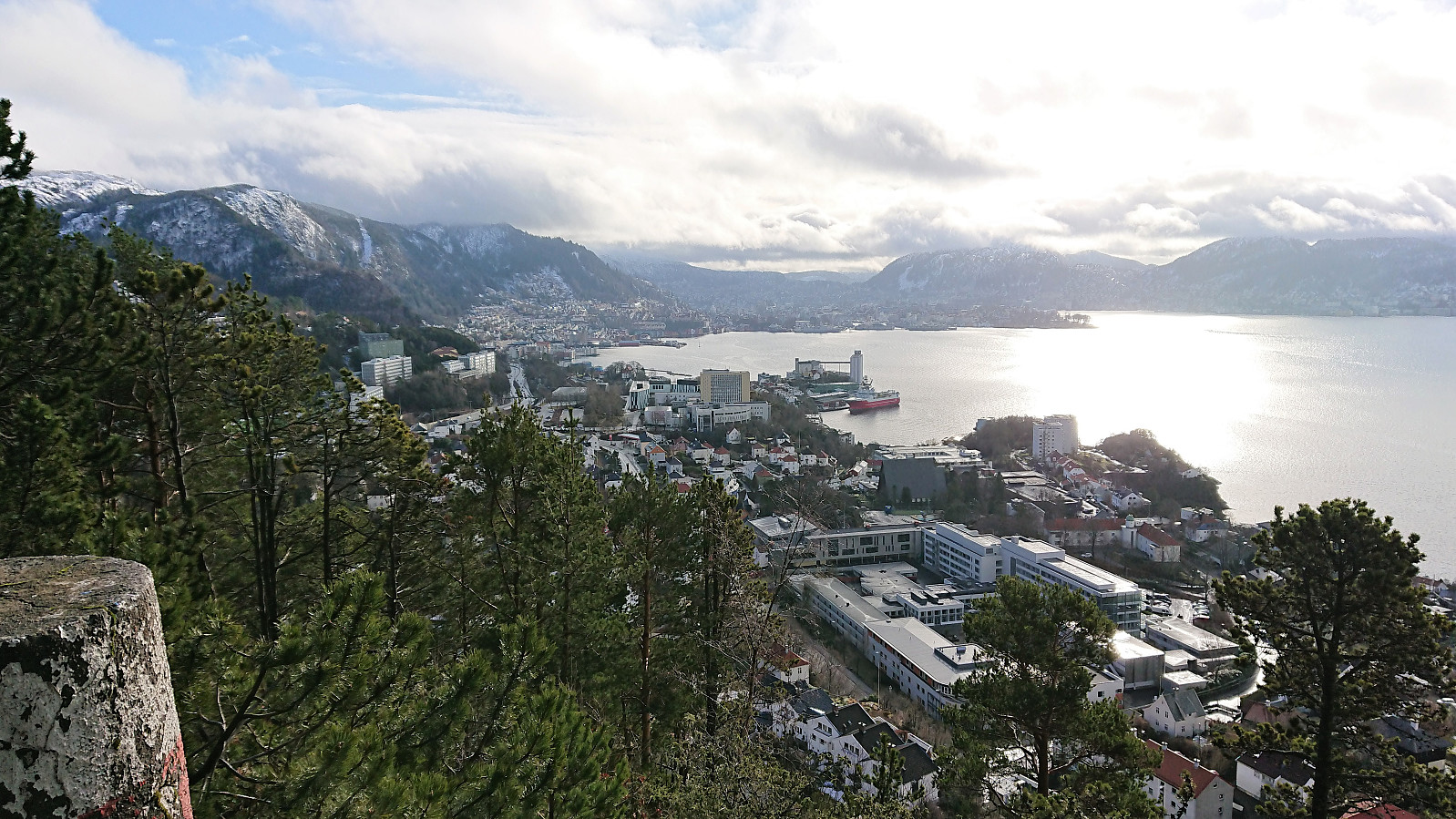
 Short skiing trip with coworkers from the upper station of Fløibanen to Aasebu and back. Note that one my coworkers had never skied before, which should be kept in mind when looking at the time spent. ;)
Storåsen in Os
- Datum:
- 19.02.2018
- Tourcharakter:
- Bergtour
- Tourlänge:
- 1:40h
- Entfernung:
- 5,5km
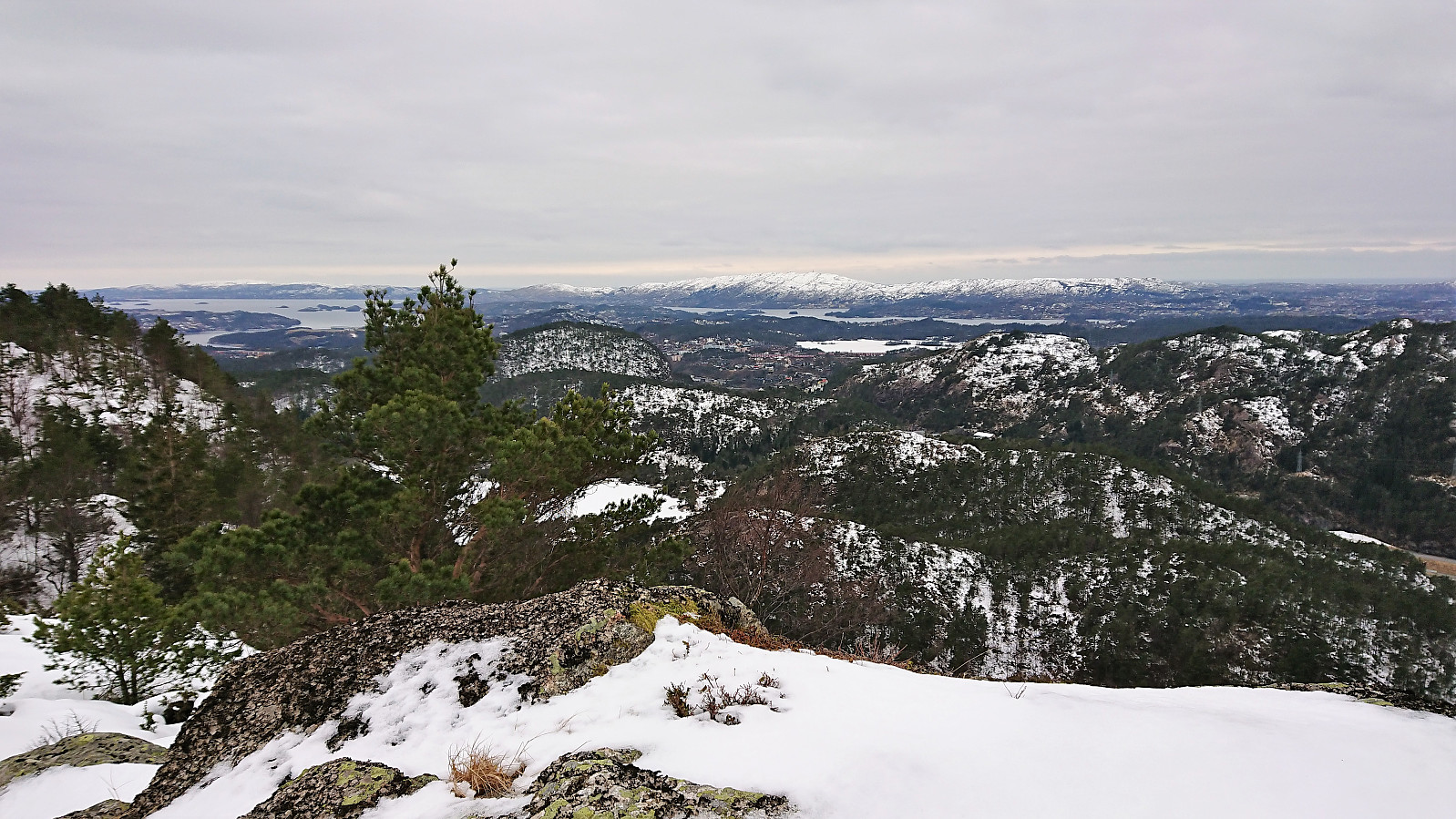
 Started by taking the bus to Tveit and from there following the paved road east to Lia, where I turned north and quickly found a sign indicating the newly marked trail to Rød, a trail that was also supposed to pass very close by today's goal: Storåsen .
The initial gravel road turned into a tractor road as soon as I passed the last houses, and to my surprise the road then started to head downwards until finally turning north before coming to an end. Here the real trail started, which was also indicated by a small sign. Today the trail was partly hidden under the snow, and it split a couple of times, but overall it was fairly easy to follow.
The trail went over the smaller hill to the south of Storåsen before starting the final ascent towards the summit. As far as I could see, the marked trail did not >>>
Started by taking the bus to Tveit and from there following the paved road east to Lia, where I turned north and quickly found a sign indicating the newly marked trail to Rød, a trail that was also supposed to pass very close by today's goal: Storåsen .
The initial gravel road turned into a tractor road as soon as I passed the last houses, and to my surprise the road then started to head downwards until finally turning north before coming to an end. Here the real trail started, which was also indicated by a small sign. Today the trail was partly hidden under the snow, and it split a couple of times, but overall it was fairly easy to follow.
The trail went over the smaller hill to the south of Storåsen before starting the final ascent towards the summit. As far as I could see, the marked trail did not >>>
Hellen festning and Furukammen
- Datum:
- 18.02.2018
- Tourcharakter:
- Wanderung
- Tourlänge:
- 1:34h
- Entfernung:
- 7,6km
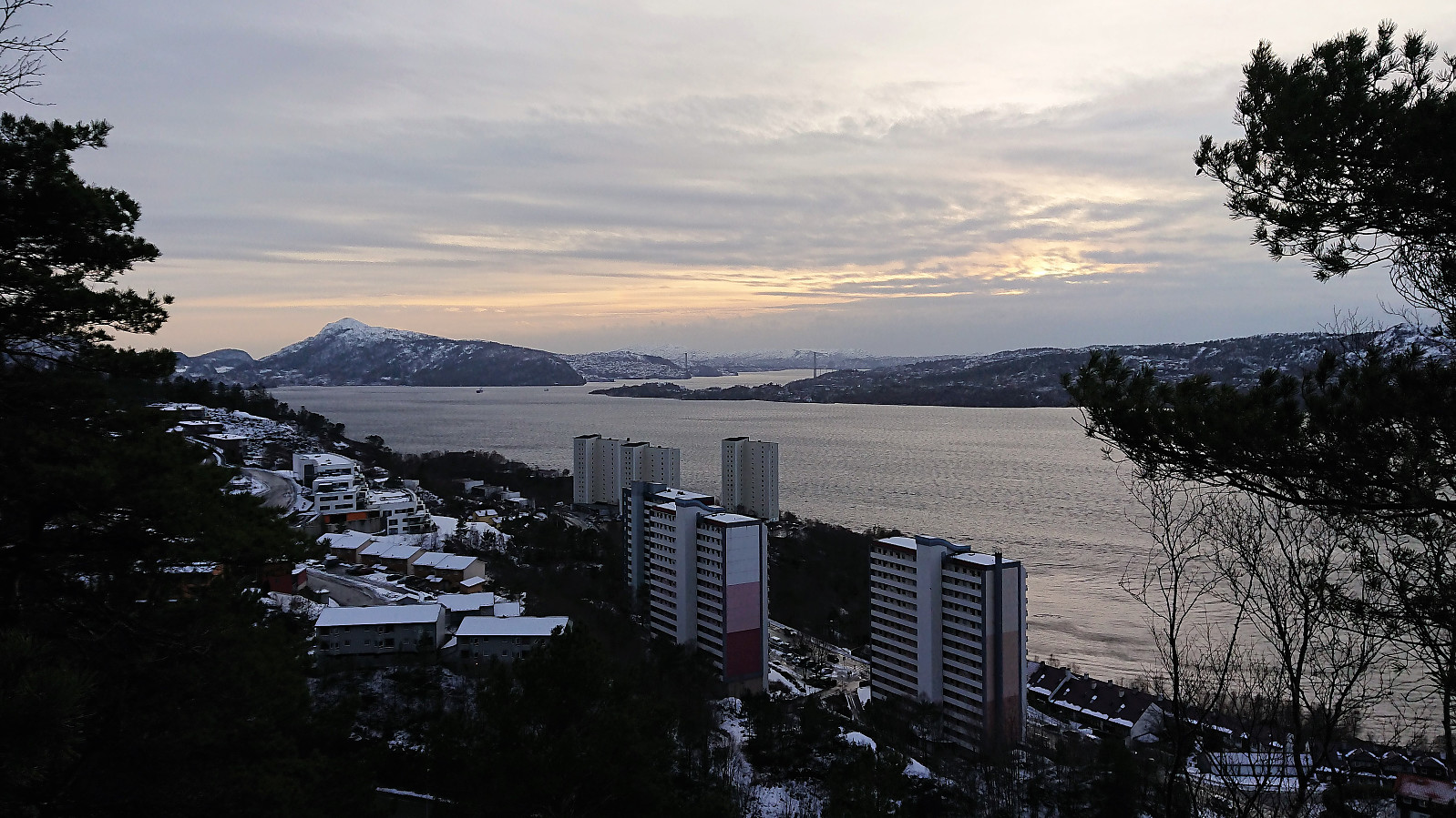
 Very unstable weather today, everything from partly cloudy and sunny to relatively heavy rain/snow. I therefore ended up with a short local hike, which started in the sun and ended in wet snow from above, resulting in taking the bus the last stretch in order to not get too wet...
Husfjellet and Hjortåsen
- Datum:
- 17.02.2018
- Tourcharakter:
- Bergtour
- Tourlänge:
- 3:40h
- Entfernung:
- 15,2km
 Husfjellet
Started by taking the bus to Sørstrøno (bus stop called Sørstrøno sør) and from there followed the very nice gravel road in the direction of Husfjellet . The plan was to ascend along the ridge from the east. I did not assume that there would be any trails, so I was rather surprised when noticing a plastic trail marker in the trees to my right, clearly noticeable from the road (you have to be looking for it though). The trail itself was less clear, and I quickly lost it, before finding it again after a short steep ascent.
The marked trail however did not seem to head towards the summit, but rather continue south of the ridge, probably to reconnect with the gravel road that comes down on the west side of Husfjellet. After following it for a while, I therefore finally left the trail and headed >>>
Husfjellet
Started by taking the bus to Sørstrøno (bus stop called Sørstrøno sør) and from there followed the very nice gravel road in the direction of Husfjellet . The plan was to ascend along the ridge from the east. I did not assume that there would be any trails, so I was rather surprised when noticing a plastic trail marker in the trees to my right, clearly noticeable from the road (you have to be looking for it though). The trail itself was less clear, and I quickly lost it, before finding it again after a short steep ascent.
The marked trail however did not seem to head towards the summit, but rather continue south of the ridge, probably to reconnect with the gravel road that comes down on the west side of Husfjellet. After following it for a while, I therefore finally left the trail and headed >>>
Fagerdalsfjellet
- Datum:
- 14.02.2018
- Tourcharakter:
- Bergtour
- Tourlänge:
- 0:52h
- Entfernung:
- 3,8km
 Short local hike across Fagerdalsfjellet after work.
Ørneberget
- Datum:
- 12.02.2018
- Tourcharakter:
- Bergtour
- Tourlänge:
- 1:26h
- Entfernung:
- 6,5km
 Short local hike across Ørneberget after work.
Hellemyrstien, Gamle Bergen and Hellen festning
- Datum:
- 11.02.2018
- Tourcharakter:
- Wanderung
- Tourlänge:
- 3:24h
- Entfernung:
- 14,0km
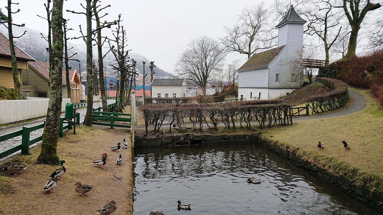 Local hike in the snow today, with explorations of Gamle Bergen and the surrounding area and passing by Hellen festning on the way home.
