Arkiv - dato
Arkiv - aktivitet
-
Annen tur (3)
- Kajakkpadling (3)
- Fottur (1897)
-
Kjøretur (9)
- Biltur (9)
-
Skitur (116)
- Fjellskitur (69)
- Langrennstur (47)
-
Sykkeltur (111)
- Blandet sykling (25)
- Gatesykling (86)
Lister jeg samler etter
-
Utvalgte topper og turmål i Bergen
(349/351)
 99%
99% -
Alle topper i Bergen
(393/400)
98%
-
Voss ≥ 100m pf.
(96/98)
97%
-
Opptur Hordaland
(144/159)
90%
-
Stasjoner på Bergensbanen
(33/40)
82%
-
Ulvik ≥ 100m pf.
(30/38)
78%
-
Hordaland ≥ 100m pf.
(624/863)
72%
-
Mjølfjell PF > 100m
(21/31)
67%
-
Jondal ≥ 100m pf.
(15/23)
65%
-
Dagsturhyttene i Vestland
(36/61)
59%
-
Sunnhordland PF >= 100m
(105/186)
56%
-
Hordaland: Hardanger PF>=100m
(196/359)
54%
-
DNT-hytter i Hordaland
(23/45)
51%
-
Kvinnherad ≥ 100m pf.
(40/79)
50%
-
Eidfjord ≥ 100m pf.
(13/42)
30%
-
Sogndal ≥ 100m pf.
(23/81)
28%
-
Gulen ≥ 100m pf.
(15/54)
27%
-
Vik i Sogn ≥ 100m pf.
(10/46)
21%
-
Sogn - Sør for Sognefjorden PF>=100m
(31/159)
19%
-
DNT-hytter i Sogn og Fjordane
(8/47)
17%

Fjellhytten
- Dato:
- 07.10.2017
- Turtype:
- Fottur
 Started from Vetrlidsallmenningen and followed the roads to Skomakerdiket were we took the shortcut to Søre Midtfjellet and Fjellhytten . From Fjellhytten we passed Brushytten on the way down to Munkebotn, before finally ending up in Lønborg.
No GPS-tracking as I for once forgot to start the tracking, probably due to hiking in very familiar territory and thus not really needing the GPS. ;)
Started from Vetrlidsallmenningen and followed the roads to Skomakerdiket were we took the shortcut to Søre Midtfjellet and Fjellhytten . From Fjellhytten we passed Brushytten on the way down to Munkebotn, before finally ending up in Lønborg.
No GPS-tracking as I for once forgot to start the tracking, probably due to hiking in very familiar territory and thus not really needing the GPS. ;)
Hellen festning (Peakbook vs. Norgeskart - Part 1)
- Dato:
- 04.10.2017
- Turtype:
- Fottur
- Distanse:
- 3,2km
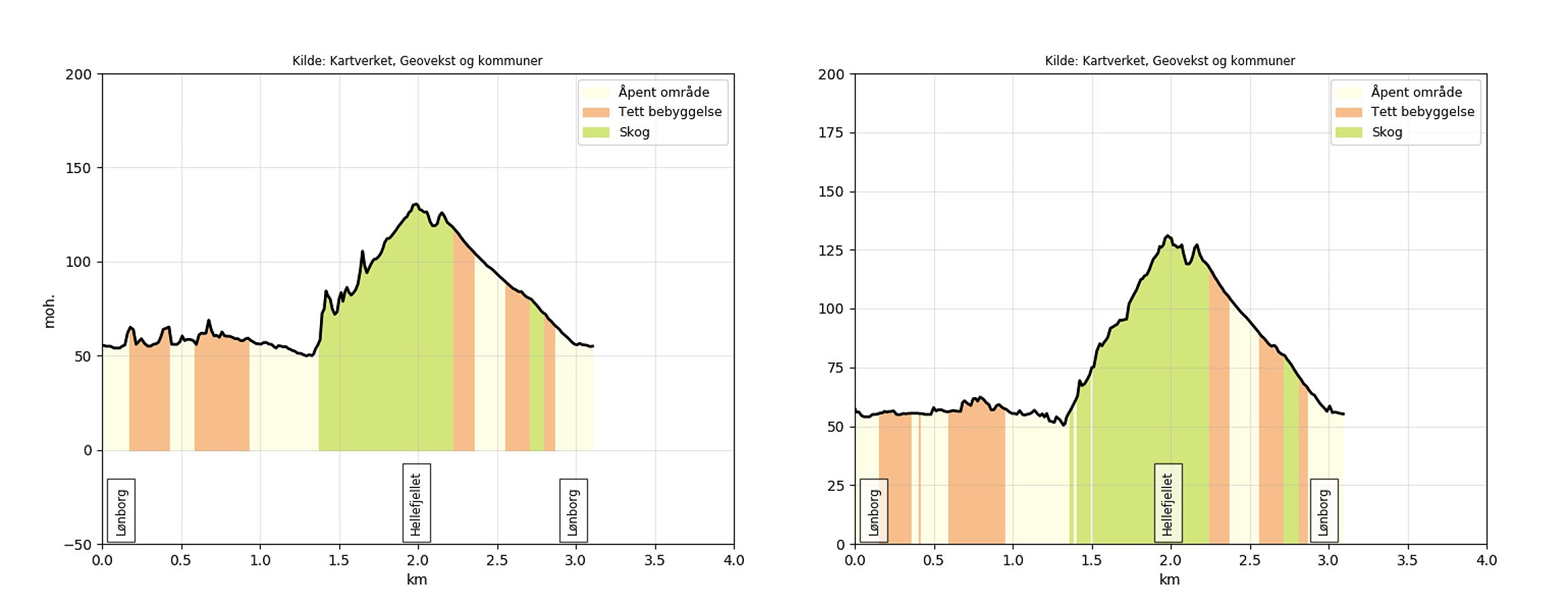 Short hike to test the use of the Peakbook app for GPS tracking. Specifically, to compare the altitude measurements of the two apps.
For a comparison against a very similar hike using the Norgeskart app see: Hellen Festning .
Peakbook app settings:
geoid correction turned on tracking accuracy set to maximum movement recognition turned off Norgeskart app settings:
update interval set to 2 seconds minimum distance between updates set to 2 meters height correction and smoothing of tracks turned on As a general observation, the results from the Peakbook app seems to be more accurate when it comes to altitude, resulting in a more correct measurement of the total number of vertical meters (261 for the Norgeskart app vs. 106 for the Peakbook app). However, the GPS tracking from the Norgeskart app has significantly >>>
Short hike to test the use of the Peakbook app for GPS tracking. Specifically, to compare the altitude measurements of the two apps.
For a comparison against a very similar hike using the Norgeskart app see: Hellen Festning .
Peakbook app settings:
geoid correction turned on tracking accuracy set to maximum movement recognition turned off Norgeskart app settings:
update interval set to 2 seconds minimum distance between updates set to 2 meters height correction and smoothing of tracks turned on As a general observation, the results from the Peakbook app seems to be more accurate when it comes to altitude, resulting in a more correct measurement of the total number of vertical meters (261 for the Norgeskart app vs. 106 for the Peakbook app). However, the GPS tracking from the Norgeskart app has significantly >>>
Iseggene from Valestrand
- Dato:
- 01.10.2017
- Turtype:
- Fjelltur
- Turlengde:
- 3:06t
- Distanse:
- 10,8km
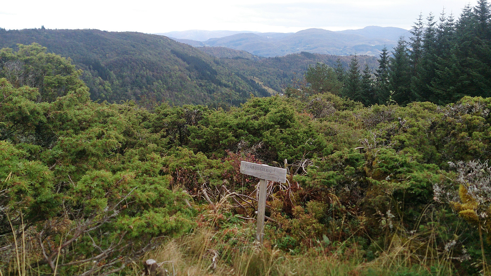 Locating the trailhead
Started by taking the bus and ferry to Valestrand and from there following Hamrenesvegen northwest in search for the trailhead indicated on the map. However, upon reaching the location of where the trail ought to start, I could not initially see any clear trails, and had to search for a bit to finally find a potential trailhead. The get to the trailhead I had to cross a small field, and there were no indications regarding where to cross. In other words, one has to be a bit lucky to spot the start of the trail. The trick is to look for the small ridge on the other side of the field, as the trail starts more or less at the northwestern end of this ridge. See the GPS track for details.
Dalsnipa and Iseggene
As soon as the starting point was found, the trail (sometimes marked >>>
Locating the trailhead
Started by taking the bus and ferry to Valestrand and from there following Hamrenesvegen northwest in search for the trailhead indicated on the map. However, upon reaching the location of where the trail ought to start, I could not initially see any clear trails, and had to search for a bit to finally find a potential trailhead. The get to the trailhead I had to cross a small field, and there were no indications regarding where to cross. In other words, one has to be a bit lucky to spot the start of the trail. The trick is to look for the small ridge on the other side of the field, as the trail starts more or less at the northwestern end of this ridge. See the GPS track for details.
Dalsnipa and Iseggene
As soon as the starting point was found, the trail (sometimes marked >>>
