Archiv - Nach Datum
Archiv - Nach Aktivität
-
Andere Tour (3)
- Kayaking (3)
-
Fahrradtour (111)
- Fahrradtour Straße (86)
- Fahrradtour gemischt (25)
-
Fahrzeugtour (9)
- Autotour (9)
-
Fußtour (1897)
- Bergtour (1120)
- Jogging (1)
- Spaziergang (60)
- Wanderung (716)
-
Skitour (116)
- Langlauf (47)
- Tourenskilauf (69)
Gesammelte Listen
-
Utvalgte topper og turmål i Bergen
(349/351)
 99%
99% -
Alle topper i Bergen
(393/400)
98%
-
Voss ≥ 100m pf.
(96/98)
97%
-
Opptur Hordaland
(144/159)
90%
-
Stasjoner på Bergensbanen
(33/40)
82%
-
Ulvik ≥ 100m pf.
(30/38)
78%
-
Hordaland ≥ 100m pf.
(624/863)
72%
-
Mjølfjell PF > 100m
(21/31)
67%
-
Jondal ≥ 100m pf.
(15/23)
65%
-
Dagsturhyttene i Vestland
(36/61)
59%
-
Sunnhordland PF >= 100m
(105/186)
56%
-
Hordaland: Hardanger PF>=100m
(196/359)
54%
-
DNT-hytter i Hordaland
(23/45)
51%
-
Kvinnherad ≥ 100m pf.
(40/79)
50%
-
Eidfjord ≥ 100m pf.
(13/42)
30%
-
Sogndal ≥ 100m pf.
(23/81)
28%
-
Gulen ≥ 100m pf.
(15/54)
27%
-
Vik i Sogn ≥ 100m pf.
(10/46)
21%
-
Sogn - Sør for Sognefjorden PF>=100m
(31/159)
19%
-
DNT-hytter i Sogn og Fjordane
(8/47)
17%

Sauafjellet from Hausdalen
- Datum:
- 29.10.2017
- Tourcharakter:
- Bergtour
- Tourlänge:
- 4:20h
- Entfernung:
- 14,2km
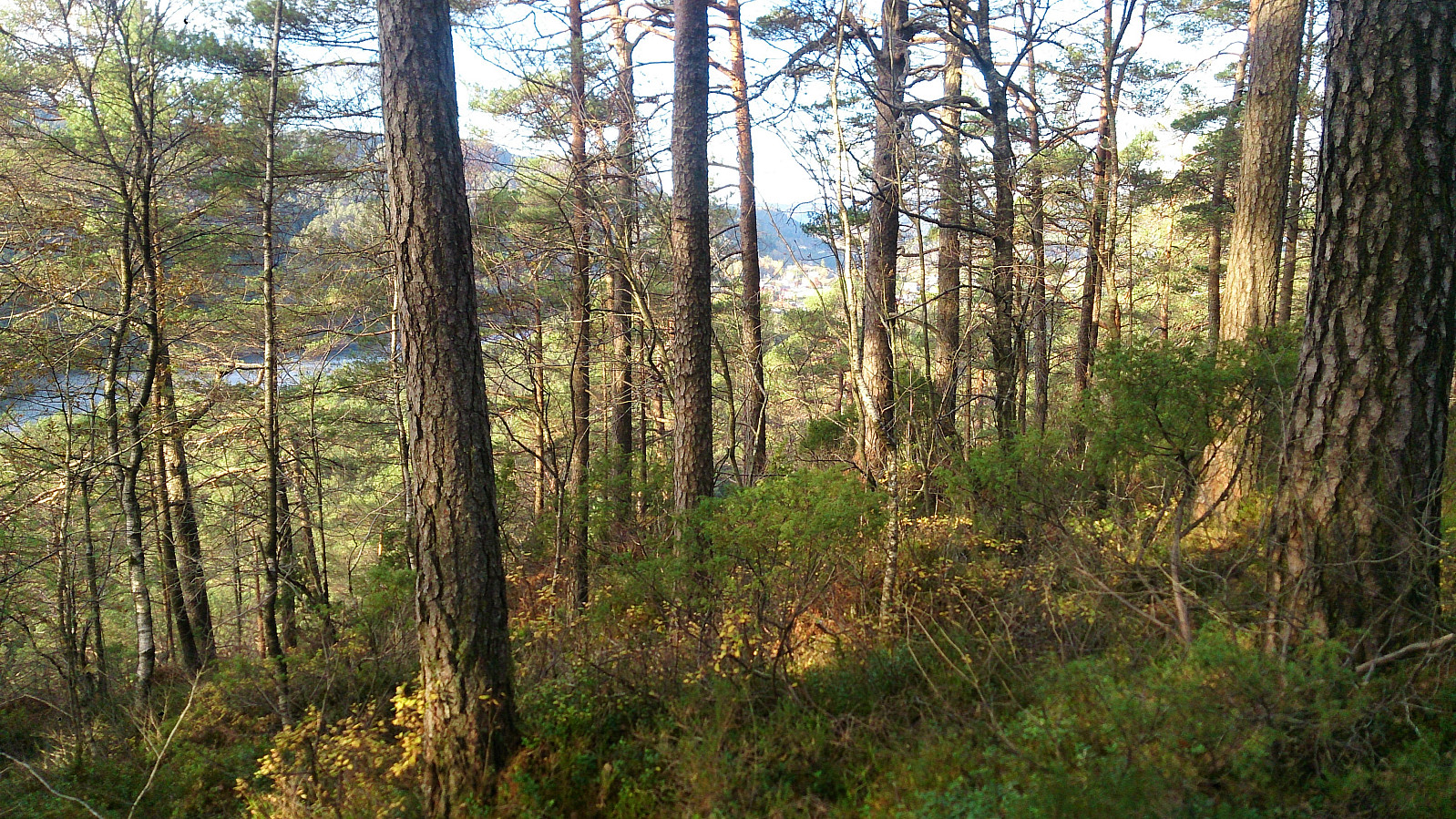
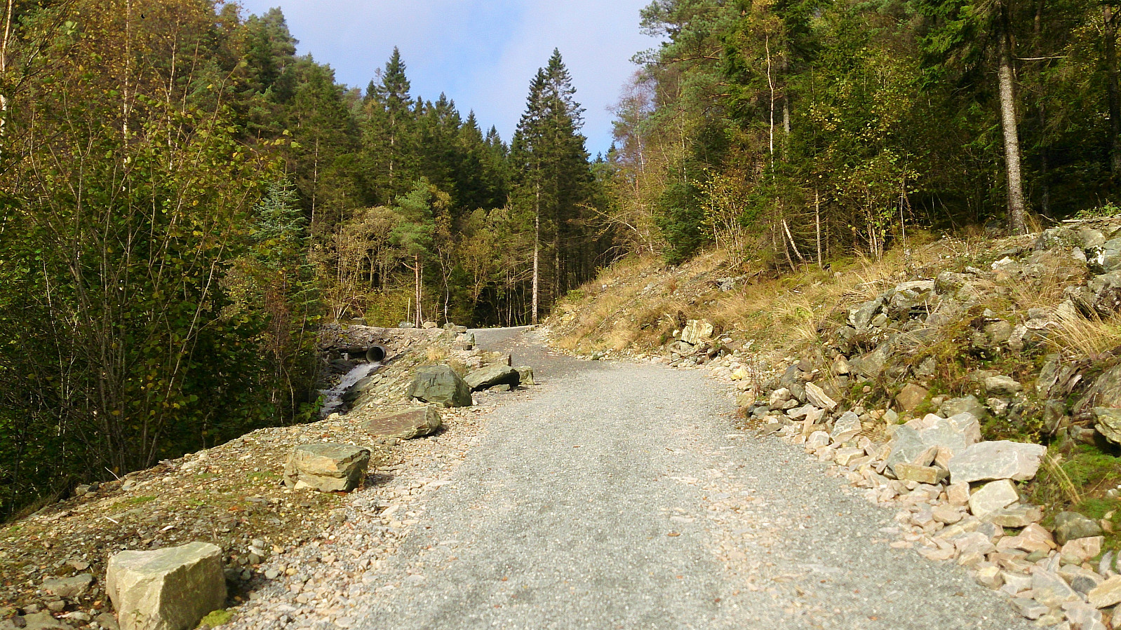
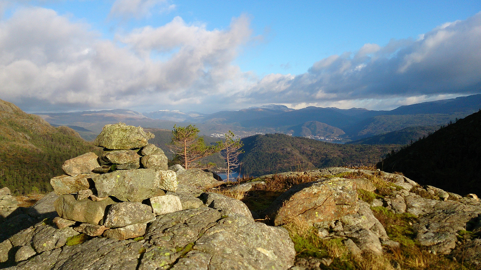 Started from the parking lot at Hausdalen and followed the gravel road up to Stora Brekkevatnet. Here we started looking for a trail towards Sauafjellet . We did not find any clear trailhead, but shortly after leaving the gravel road we came across a trail that was even sometimes marked with white ribbons and numerous small cairns. The trail got rather weak at times, and we lost it on several occasions, but the terrain made it easy to make progress towards the summit even without the trail.
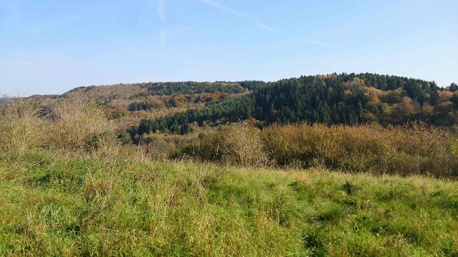
The summit itself was hidden when ascending, hence when we thought we had reached the summit we had only reached the smaller hill southwest of the summit, and only here did we see the large cairn. At the cairn the views were spectacular in all directions. Highly recommended! However, we did not stay too long as the wind was gathering speed, >>>
Started from the parking lot at Hausdalen and followed the gravel road up to Stora Brekkevatnet. Here we started looking for a trail towards Sauafjellet . We did not find any clear trailhead, but shortly after leaving the gravel road we came across a trail that was even sometimes marked with white ribbons and numerous small cairns. The trail got rather weak at times, and we lost it on several occasions, but the terrain made it easy to make progress towards the summit even without the trail.
The summit itself was hidden when ascending, hence when we thought we had reached the summit we had only reached the smaller hill southwest of the summit, and only here did we see the large cairn. At the cairn the views were spectacular in all directions. Highly recommended! However, we did not stay too long as the wind was gathering speed, >>>
Stoltzekleiven and Blåmanen
- Datum:
- 28.10.2017
- Tourcharakter:
- Bergtour
- Tourlänge:
- 2:56h
- Entfernung:
- 11,9km
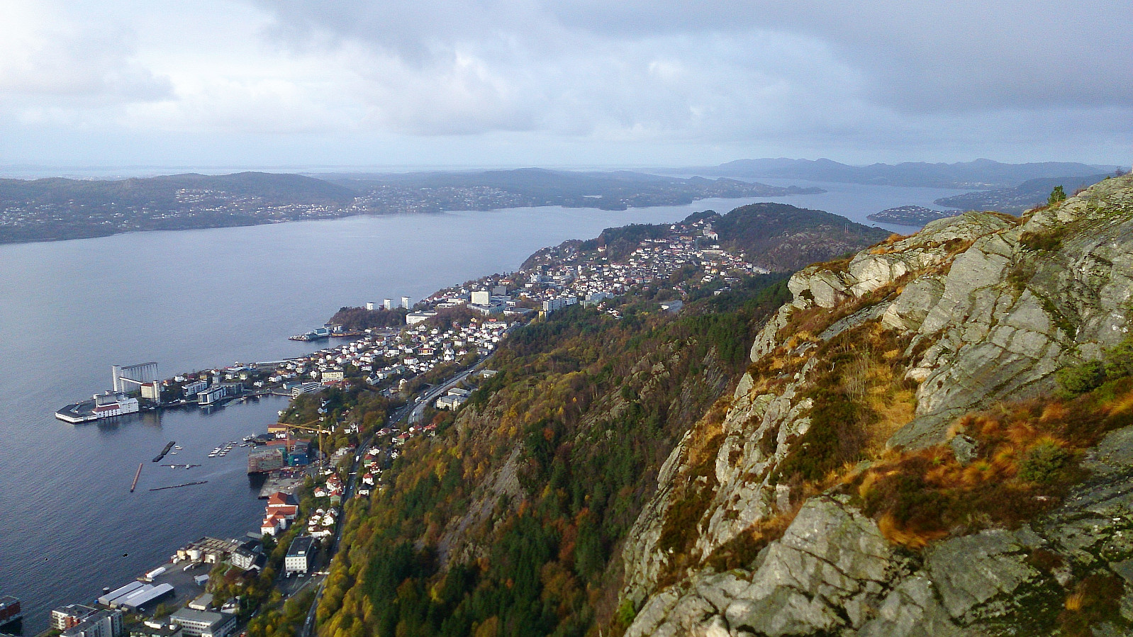 Started from the bus stop at Munkebotn and walked up to the Fjellveien, from where I followed Stoltzekleiven up to Sandvikspilen . After a short rest, I continued to Brushytten and Blåmanen, visiting both Blåmanen Vest and Blåmanen Nord , before taking the shortcut called Formannskapsbakken down to Storediket. Perhaps not the best choice on a day where everything was wet and slippery though. The plan was to continue all the way to Lønborg, but it started raining quite heavily so I instead cut the hike short and headed for the bus stop at Gamle Bergen.
Sandviksbatteriet and Sandvikspilen
- Datum:
- 23.10.2017
- Tourcharakter:
- Bergtour
- Tourlänge:
- 2:16h
- Entfernung:
- 8,3km
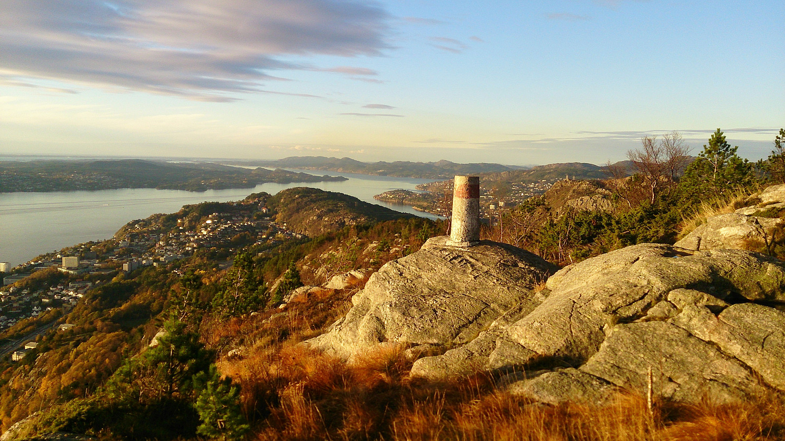 Started from the bus stop across from Sandviken sykehus and from there followed the standard route up to Sandviksbatteriet . Next, I followed the trail along the ridge up to Sandvikspilen , with excellent views towards the west throughout. Note that the trail starts out quite steep, but flattens out about halfway to the top. The trail also requires a bit of very light climbing.
The trailhead is marked, but one has to know where to look to find the sign (see GPS tracking for details). As I was getting close to the top I noticed a new sign with a red arrow indicating that I ought to go left (east) instead of following the ridge like I'm used to doing for this hike. I followed the suggested trail for a while, but in the end decided that it was heading a too much in the wrong direction, and therefore instead returned to the unmarked >>>
Started from the bus stop across from Sandviken sykehus and from there followed the standard route up to Sandviksbatteriet . Next, I followed the trail along the ridge up to Sandvikspilen , with excellent views towards the west throughout. Note that the trail starts out quite steep, but flattens out about halfway to the top. The trail also requires a bit of very light climbing.
The trailhead is marked, but one has to know where to look to find the sign (see GPS tracking for details). As I was getting close to the top I noticed a new sign with a red arrow indicating that I ought to go left (east) instead of following the ridge like I'm used to doing for this hike. I followed the suggested trail for a while, but in the end decided that it was heading a too much in the wrong direction, and therefore instead returned to the unmarked >>>
Raunåsen and Sjøbøhaugane
- Datum:
- 22.10.2017
- Tourcharakter:
- Bergtour
- Tourlänge:
- 2:51h
- Entfernung:
- 8,9km
 Raunåsen
Started by taking the bus to Søfteland and walking up Langedalen to arrive at the trailhead for Raunåsen located in the first bend of the road after passing the last house. The trailhead was unmarked, but the trail itself was marked with various plastic ribbons.
The trail was however quickly replaced by numerous deer tracks, which I partially followed on my way to the summit. The terrain was full of trees and a bit disorienting, hence the GPS was good to have when trying to locate the highest point. The summit provided limited views, but both Lyshornet and Lysefjorden could be spotted in-between the trees.
From the summit I followed more or less the same route back down, but included a short visit to the northeastern summit just to make sure that it was indeed the lower of the two.
Sjøbøhaugane
Upon >>>
Raunåsen
Started by taking the bus to Søfteland and walking up Langedalen to arrive at the trailhead for Raunåsen located in the first bend of the road after passing the last house. The trailhead was unmarked, but the trail itself was marked with various plastic ribbons.
The trail was however quickly replaced by numerous deer tracks, which I partially followed on my way to the summit. The terrain was full of trees and a bit disorienting, hence the GPS was good to have when trying to locate the highest point. The summit provided limited views, but both Lyshornet and Lysefjorden could be spotted in-between the trees.
From the summit I followed more or less the same route back down, but included a short visit to the northeastern summit just to make sure that it was indeed the lower of the two.
Sjøbøhaugane
Upon >>>
Skogafjellet and Galtåsen
- Datum:
- 21.10.2017
- Tourcharakter:
- Bergtour
- Tourlänge:
- 2:49h
- Entfernung:
- 8,3km
 Skogafjellet
Started by taking the bus to Ulvenskiftet and walking up Ulvenvegen and Svegane to arrive at the trailhead. The trailhead was unmarked, but fairly easy to locate if one knows approximately where to look. The trail started out much better than expected and could be followed without any difficulty up to Hesthaugen.
Here the trail disappeared, but was quickly substituted by lots of deer tracks, which I partially followed when making my own way towards the summit of Skogafjellet . The terrain did not provide any real challenges, and I shortly arrived at the summit. The highest point provided limited views, but by moving slightly away from the summit I obtained nice views in several directions. Before starting the real descent I also got an excellent view towards Osøyro.
From the summit I followed >>>
Skogafjellet
Started by taking the bus to Ulvenskiftet and walking up Ulvenvegen and Svegane to arrive at the trailhead. The trailhead was unmarked, but fairly easy to locate if one knows approximately where to look. The trail started out much better than expected and could be followed without any difficulty up to Hesthaugen.
Here the trail disappeared, but was quickly substituted by lots of deer tracks, which I partially followed when making my own way towards the summit of Skogafjellet . The terrain did not provide any real challenges, and I shortly arrived at the summit. The highest point provided limited views, but by moving slightly away from the summit I obtained nice views in several directions. Before starting the real descent I also got an excellent view towards Osøyro.
From the summit I followed >>>
Cycling: Dilsberg
- Datum:
- 19.10.2017
- Tourcharakter:
- Fahrradtour gemischt
- Tourlänge:
- 1:11h
 Another bike ride from Schloss Dagstuhl across Dilsberg, but this time continuing across the peak, ending up at Rathen, before following the main roads back to Schloss Dagstuhl. Beautiful with all the red leaves covering the tracks. Highly recommended!
GPS refused to communicate, hence no GPS tracking.
Another bike ride from Schloss Dagstuhl across Dilsberg, but this time continuing across the peak, ending up at Rathen, before following the main roads back to Schloss Dagstuhl. Beautiful with all the red leaves covering the tracks. Highly recommended!
GPS refused to communicate, hence no GPS tracking.
Cycling: Dilsberg
- Datum:
- 17.10.2017
- Tourcharakter:
- Fahrradtour gemischt
- Tourlänge:
- 1:00h
 Short cycling trip from Schloss Dagstuhl up to Dilsberg. Tractor road all the way to the top, but of very varying quality. The fact that there were more roads than the ones indicated on the map in the PB app also did not help. ;)
GPS refused to communicate, hence no GPS tracking.
Short cycling trip from Schloss Dagstuhl up to Dilsberg. Tractor road all the way to the top, but of very varying quality. The fact that there were more roads than the ones indicated on the map in the PB app also did not help. ;)
GPS refused to communicate, hence no GPS tracking.
Burg Dagstuhl
- Datum:
- 16.10.2017
- Tourcharakter:
- Spaziergang
- Tourlänge:
- 0:15h
 Short walk from Schloss Dagstuhl up to Burg Dagstuhl.
Høgelikampen, Vardafjellet and Ulvenfjellet
- Datum:
- 14.10.2017
- Tourcharakter:
- Bergtour
- Tourlänge:
- 5:24h
- Entfernung:
- 21,0km
 Høgelikampen
Started by taking the bus to Ulvenskiftet and walking southwest along the roads until reaching Hovland. This was close to 5 km and took around 50 minutes. The start of the trail to Høgelikampen was clearly marked and visible from the main road.
It started out as a newly improved gravel road which later turned into an older, but still quite good, tractor road. Note that my route is perhaps not the quickest one, as it did include a small descent before starting the final climb. As I got closer to the summit I also visited a spot with a very nice southern view, which I added as a new PB element.
The summit itself provided very limited views, but the views from where the sign and the visitor register is located provided nice views north towards Lysefjorden and Krokeide.
Vardafjellet
From Høgelikampen >>>
Høgelikampen
Started by taking the bus to Ulvenskiftet and walking southwest along the roads until reaching Hovland. This was close to 5 km and took around 50 minutes. The start of the trail to Høgelikampen was clearly marked and visible from the main road.
It started out as a newly improved gravel road which later turned into an older, but still quite good, tractor road. Note that my route is perhaps not the quickest one, as it did include a small descent before starting the final climb. As I got closer to the summit I also visited a spot with a very nice southern view, which I added as a new PB element.
The summit itself provided very limited views, but the views from where the sign and the visitor register is located provided nice views north towards Lysefjorden and Krokeide.
Vardafjellet
From Høgelikampen >>>
Vassberget, Kvamsfjellet, Svarthamrane and Tveitavarden
- Datum:
- 08.10.2017
- Tourcharakter:
- Bergtour
- Tourlänge:
- 4:17h
- Entfernung:
- 11,5km
 Vassberget
Started by taking the bus to Øvre Isdalen (to the bus stop called Åse) and from there following the unmarked gravel road northeast in the valley between Kvamsfjellet and Vassberget . My original plan was to take the trail that was supposed to start right after the small building on the right side of the road shortly after leaving the main road, but I did not manage to locate this trail, and therefore instead continued to the main trail further up the gravel road.
The trailhead was marked, but the quality of the trail was initially very wet and muddy. This improved slightly as the trail started climbing up the mountain, but there were still with lots of muddy areas, which would turn out to be the theme of the day... The views from the summit were excellent though, and I also continued a bit beyond the summit, >>>
Vassberget
Started by taking the bus to Øvre Isdalen (to the bus stop called Åse) and from there following the unmarked gravel road northeast in the valley between Kvamsfjellet and Vassberget . My original plan was to take the trail that was supposed to start right after the small building on the right side of the road shortly after leaving the main road, but I did not manage to locate this trail, and therefore instead continued to the main trail further up the gravel road.
The trailhead was marked, but the quality of the trail was initially very wet and muddy. This improved slightly as the trail started climbing up the mountain, but there were still with lots of muddy areas, which would turn out to be the theme of the day... The views from the summit were excellent though, and I also continued a bit beyond the summit, >>>
