Arkiv - dato
Arkiv - aktivitet
-
Annen tur (3)
- Kajakkpadling (3)
- Fottur (1836)
-
Kjøretur (9)
- Biltur (9)
-
Skitur (112)
- Fjellskitur (66)
- Langrennstur (46)
-
Sykkeltur (108)
- Blandet sykling (25)
- Gatesykling (83)
Lister jeg samler etter
- Utvalgte topper og turmål i Bergen
- Alle topper i Bergen
- Voss ≥ 100m pf.
- Opptur Hordaland
- Stasjoner på Bergensbanen
- Ulvik ≥ 100m pf.
- Hordaland ≥ 100m pf.
- Mjølfjell PF > 100m
- Jondal ≥ 100m pf.
- Sunnhordland PF >= 100m
- Dagsturhyttene i Vestland
- Hordaland: Hardanger PF>=100m
- DNT-hytter i Hordaland
- Kvinnherad ≥ 100m pf.
- Sogndal ≥ 100m pf.
- Vik i Sogn ≥ 100m pf.
- Gulen ≥ 100m pf.
- DNT-hytter i Sogn og Fjordane
- Eidfjord ≥ 100m pf.
- Sogn - Sør for Sognefjorden PF>=100m
Cycling: Ulriken Roundtrip
- Dato:
- 12.08.2017
- Turtype:
- Gatesykling
- Turlengde:
- 3:14t
- Distanse:
- 50,9km
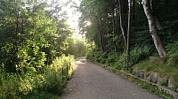
 Started from Lønborg following the marked cycling trail to Åsane around Eidsvågneset. Continued south to Gaupås/Haugland, along Kvamsvegen to Lono, and Hardangervegen towards Midtun, before turning north to Landås and taking Fjellveien to Munkebotn, and finally ending up where I started.
A roundtrip that can be recommended as it mainly follows roads with limited traffic or designated cycling lines/sidewalks. The exception is the stretch along Grimevatnet, where one has to cycle on a road with heavy traffic, i.e. rush hours should be avoided.
Cycling: Salhus Roundtrip
- Dato:
- 09.08.2017
- Turtype:
- Gatesykling
- Turlengde:
- 2:26t
- Distanse:
- 37,5km
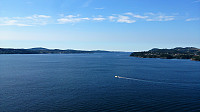
 Started from Lønborg following the marked cycling trail to Åsane around Eidsvågneset and onwards to Nordhordalandsbroen. Here I turned back, following the marked trail around Salhus taking me to Åsane terminal, before finally returning to the starting point.
A route that can be highly recommended as it mainly follows roads with limited traffic or designated cycling lines/sidewalks. Rush hours should still be avoided though, especially around Salhus.
Togga
- Dato:
- 05.08.2017
- Turtype:
- Fjelltur
- Turlengde:
- 2:38t
- Distanse:
- 5,0km
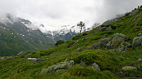
 Started from the large parking lot at Gunvordalen and followed the marked trail to the summit. The trail was slightly steeper than expected, but did not contain any difficult sections. However, we had to be a bit careful on the way down as it had started raining and the trail got quite slippery.
Sadly the rain was also accompanied with quite dense fog, resulting in next to no views from the summit. Clearly a hike to repeat in better weather.
Søre Gråbrørne
- Dato:
- 01.08.2017
- Turtype:
- Fjelltur
- Turlengde:
- 3:06t
- Distanse:
- 11,7km
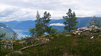
 We started from the Amlaholten parking lot and from there followed the marked gravel road to Svartahol, before continuing on trails towards Søre Gråbrørne . The trails did not completely match what was indicated on the map, but it was fairly easy to arrive at the gravel road going over Turrlifjellet. We crossed the gravel road and continued on the unmarked trail towards Søre Gråbrørne. The summit itself provided limited views, but by continuing north along the trail we arrived at a cairn for some truly spectacular views! From the cairn we doubled back to the gravel road, which we then followed around Turrlifjellet until reconnecting with the first gravel road at Svartaholsbakkane and finally back to the parking lot.
Overall, a great hike with spectacular views that can be highly recommended!


