Arkiv - dato
Arkiv - aktivitet
-
Annen tur (3)
- Kajakkpadling (3)
- Fottur (1897)
-
Kjøretur (9)
- Biltur (9)
-
Skitur (116)
- Fjellskitur (69)
- Langrennstur (47)
-
Sykkeltur (111)
- Blandet sykling (25)
- Gatesykling (86)
Lister jeg samler etter
-
Utvalgte topper og turmål i Bergen
(349/351)
 99%
99% -
Alle topper i Bergen
(393/400)
98%
-
Voss ≥ 100m pf.
(96/98)
97%
-
Opptur Hordaland
(144/159)
90%
-
Stasjoner på Bergensbanen
(33/40)
82%
-
Ulvik ≥ 100m pf.
(30/38)
78%
-
Hordaland ≥ 100m pf.
(624/863)
72%
-
Mjølfjell PF > 100m
(21/31)
67%
-
Jondal ≥ 100m pf.
(15/23)
65%
-
Dagsturhyttene i Vestland
(36/61)
59%
-
Sunnhordland PF >= 100m
(105/186)
56%
-
Hordaland: Hardanger PF>=100m
(196/359)
54%
-
DNT-hytter i Hordaland
(23/45)
51%
-
Kvinnherad ≥ 100m pf.
(40/79)
50%
-
Eidfjord ≥ 100m pf.
(13/42)
30%
-
Sogndal ≥ 100m pf.
(23/81)
28%
-
Gulen ≥ 100m pf.
(15/54)
27%
-
Vik i Sogn ≥ 100m pf.
(10/46)
21%
-
Sogn - Sør for Sognefjorden PF>=100m
(31/159)
19%
-
DNT-hytter i Sogn og Fjordane
(8/47)
17%

England to Åberge
- Dato:
- 30.07.2017
- Turtype:
- Fjelltur
- Turlengde:
- 4:57t
- Distanse:
- 12,6km
 Englandshovden
Started from England and followed the gravel road up to Ølnesstølen before making my own way towards Englandshovden . Tried to follow various trails that were indicated on the map, but these all more or less disappeared or turned into animal tracks. The summit itself provided limited views, but the surrounding area was very nice and the views were better when moving away from the summit.
Vetle Hovden
From the top of Englandshovden I continued south to connect with the trail towards Imesdal, which could then easily be followed down to Imesdal and onwards to Vetle Hovden . No trail to the summit of Vetle Hovden, but it was straightforward to arrive at the summit. Again the views from the summit itself were limited (though not as limited as from Englandshovden). I therefore headed southeast for 100 meters or >>>
Englandshovden
Started from England and followed the gravel road up to Ølnesstølen before making my own way towards Englandshovden . Tried to follow various trails that were indicated on the map, but these all more or less disappeared or turned into animal tracks. The summit itself provided limited views, but the surrounding area was very nice and the views were better when moving away from the summit.
Vetle Hovden
From the top of Englandshovden I continued south to connect with the trail towards Imesdal, which could then easily be followed down to Imesdal and onwards to Vetle Hovden . No trail to the summit of Vetle Hovden, but it was straightforward to arrive at the summit. Again the views from the summit itself were limited (though not as limited as from Englandshovden). I therefore headed southeast for 100 meters or >>>
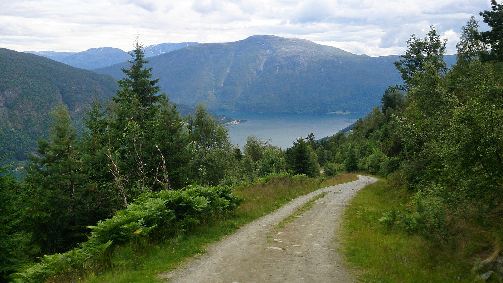
Kongevegen - from Barsnesfjorden to Hafslovatnet
- Dato:
- 29.07.2017
- Turtype:
- Fottur
- Turlengde:
- 3:24t
- Distanse:
- 9,4km
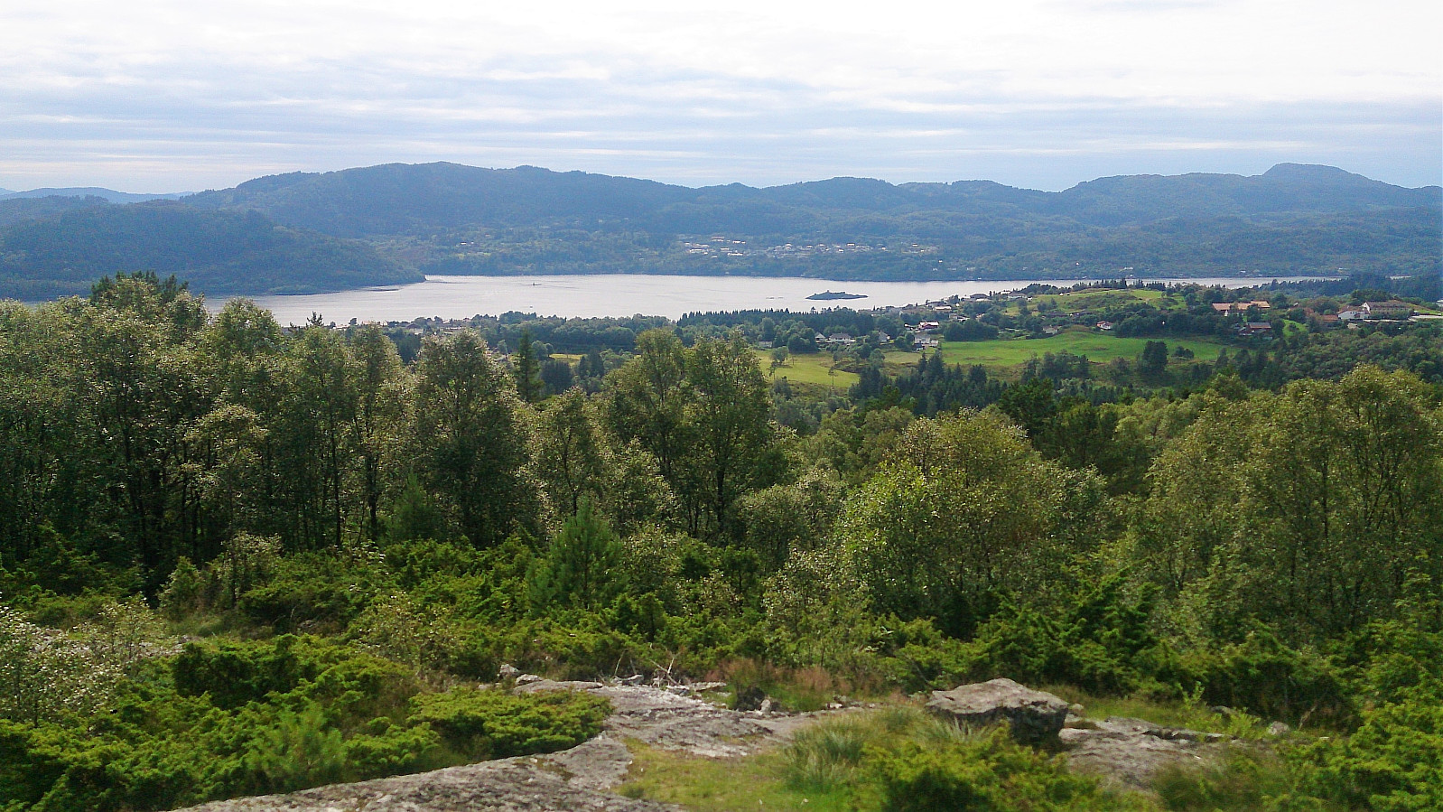
 We found a parking spot by Årøyelvi and from there walked back to the bridge crossing the river. From three followed the marked trail to Okleviki until we could see Hafslovatnet, before taking the same trail back to the car, with the exception of a quick detour to Orrabruhaugen (no trails).
Not the most exciting hike, but not too bad either. The best part was perhaps the walk along the river at the start of the hike. Too bad the rest of the river runs inside the mountain as it is now used for generating electricity.
We found a parking spot by Årøyelvi and from there walked back to the bridge crossing the river. From three followed the marked trail to Okleviki until we could see Hafslovatnet, before taking the same trail back to the car, with the exception of a quick detour to Orrabruhaugen (no trails).
Not the most exciting hike, but not too bad either. The best part was perhaps the walk along the river at the start of the hike. Too bad the rest of the river runs inside the mountain as it is now used for generating electricity.
Slakkafjellet
- Dato:
- 27.07.2017
- Turtype:
- Fjelltur
- Turlengde:
- 2:27t
- Distanse:
- 7,3km
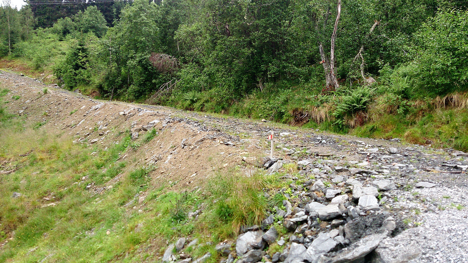 The hike started from Fv 212/Asbjørnhaugen and followed the marked trail all the way to the summit of Slakkafjellet . The trail partly followed the gravel road, but mainly took shortcuts until finally leaving the road behind when heading for the summit.
The trail was easy to follow, but the last stretch towards the summit had several wet areas, and the fact that it had been raining earlier in the day did not help. The views from the summit were better than expected, with nice views in all directions.
From the summit I tried to follow a trail southeast towards the gravel road, but I quickly lost the trail, and decided to instead head back to the same trail I had used on the ascent. Upon reaching the gravel road, I mainly followed it back down to the start of the hike, instead of taking the shortcuts.
Overall, >>>
The hike started from Fv 212/Asbjørnhaugen and followed the marked trail all the way to the summit of Slakkafjellet . The trail partly followed the gravel road, but mainly took shortcuts until finally leaving the road behind when heading for the summit.
The trail was easy to follow, but the last stretch towards the summit had several wet areas, and the fact that it had been raining earlier in the day did not help. The views from the summit were better than expected, with nice views in all directions.
From the summit I tried to follow a trail southeast towards the gravel road, but I quickly lost the trail, and decided to instead head back to the same trail I had used on the ascent. Upon reaching the gravel road, I mainly followed it back down to the start of the hike, instead of taking the shortcuts.
Overall, >>>
Skriki from Øvstedalen
- Dato:
- 25.07.2017
- Turtype:
- Fjelltur
- Turlengde:
- 4:25t
- Distanse:
- 9,9km
 Started from the nice big parking lot in Øvstedalen . The trailhead was not marked, but was easily located by walking back to the previous bend in the road where there was a second much smaller parking lot, and from there following the trail. A sign soon appeared indicating that we were on the right track. From this point the trail was marked and easy to follow (with one important exception that we will come back to).
The relatively steep trail passed by several small cabins at Kinn, before winding its way up towards Skriksvatnet. The trail passed by Skriksvatnet on the eastern side, but it was clear that this part of the trail was not as heavily used as the preceding parts, and shortly the trail more or less disappeared.
We were now directly west of Skriki and considered taking the straight route to the summit, but decided that this >>>
Started from the nice big parking lot in Øvstedalen . The trailhead was not marked, but was easily located by walking back to the previous bend in the road where there was a second much smaller parking lot, and from there following the trail. A sign soon appeared indicating that we were on the right track. From this point the trail was marked and easy to follow (with one important exception that we will come back to).
The relatively steep trail passed by several small cabins at Kinn, before winding its way up towards Skriksvatnet. The trail passed by Skriksvatnet on the eastern side, but it was clear that this part of the trail was not as heavily used as the preceding parts, and shortly the trail more or less disappeared.
We were now directly west of Skriki and considered taking the straight route to the summit, but decided that this >>>
Skogsøytua
- Dato:
- 23.07.2017
- Turtype:
- Fottur
- Turlengde:
- 1:11t
- Distanse:
- 4,6km
 We parked by the side of the road right before the bridge crossing Langholmsundet and from there followed the northern route to Skogsøytua . After a short stop enjoying the nice views at the summit, we followed the southern route back to the car.
Turøyvarden and Jurfedthaugen
- Dato:
- 23.07.2017
- Turtype:
- Fottur
- Turlengde:
- 2:12t
- Distanse:
- 9,3km
 Turøyvarden
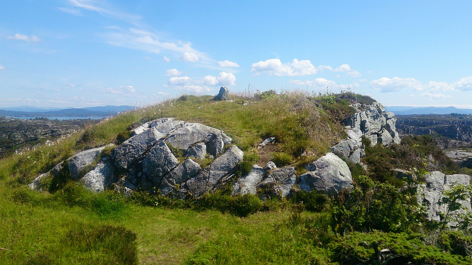
The hike stared from the bus stop at Knappen. From there we followed Toftøyvegen south and later Turøyvegen west, until reaching the trail to Turøyvarden . After only a couple of minutes along the trail we arrived at the impressively large cairn, for very nice views in all directions.
Jurfedthaugen
We then doubled back until finding the trail towards Jurfedthaugen , which we followed all the way to the summit. Also here the views were very nice, particularly towards the west. We then continued north along the trail until reaching Bølgekraftvegen, which we followed east to Toftøyvegen, before finally arriving back where we started.
Turøyvarden
The hike stared from the bus stop at Knappen. From there we followed Toftøyvegen south and later Turøyvegen west, until reaching the trail to Turøyvarden . After only a couple of minutes along the trail we arrived at the impressively large cairn, for very nice views in all directions.
Jurfedthaugen
We then doubled back until finding the trail towards Jurfedthaugen , which we followed all the way to the summit. Also here the views were very nice, particularly towards the west. We then continued north along the trail until reaching Bølgekraftvegen, which we followed east to Toftøyvegen, before finally arriving back where we started.
Tveitavarden and Indregardsfjellet
- Dato:
- 22.07.2017
- Turtype:
- Fjelltur
- Turlengde:
- 2:30t
- Distanse:
- 7,3km
 Tveitavarden
Started by taking the bus to Isdal (bus stop called "Isdal øvre") and walking north along Lindåsvegen until locating the tractor road indicating the start of the trail. The tractor road itself was not marked, but after only a couple of meters a sign with Tveitavarden showed up.
The tractor road quickly turned into a trail which could be easily followed all the way to the summit. It was however clear that the trail was not very heavily used and it did include several wet areas. From the summit there were good views towards the west, although an even better view could have been obtained if it was not for all the trees.
Indregardsfjellet
From Tveitavarden, I followed the same trail back to Lindåsvegen, which I then crossed and immediately arrived at start of the trail to Indregardsfjellet . Despite the >>>
Tveitavarden
Started by taking the bus to Isdal (bus stop called "Isdal øvre") and walking north along Lindåsvegen until locating the tractor road indicating the start of the trail. The tractor road itself was not marked, but after only a couple of meters a sign with Tveitavarden showed up.
The tractor road quickly turned into a trail which could be easily followed all the way to the summit. It was however clear that the trail was not very heavily used and it did include several wet areas. From the summit there were good views towards the west, although an even better view could have been obtained if it was not for all the trees.
Indregardsfjellet
From Tveitavarden, I followed the same trail back to Lindåsvegen, which I then crossed and immediately arrived at start of the trail to Indregardsfjellet . Despite the >>>
Hausdalen to Espeland via Søre Gullfjelltoppen
- Dato:
- 19.07.2017
- Turtype:
- Fjelltur
- Turlengde:
- 5:52t
- Distanse:
- 19,3km
 Locating the trailhead
Started by taking the bus to "Hausdalen snuplass" and continuing up the very nice gravel road through Brekkedalen, where I located a small cairn indicating the start of the unmarked trail towards Sydpolen and Søre Gullfjelltoppen .
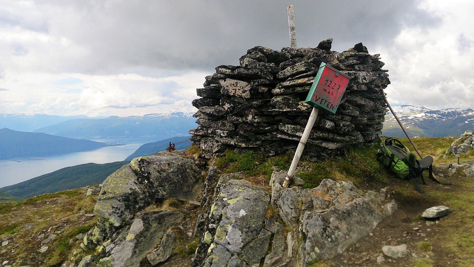
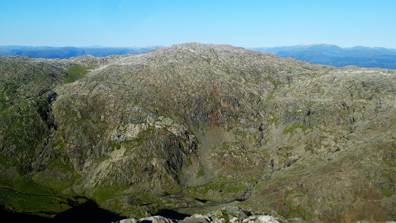
Sydpolen - 730 meter continuous ascent!
The trail was easy to follow as it winded its way up between the pine trees. It quickly turned quite steep though, and when the trail left the trees behind, the trail could get a bit weak at times, but it was relatively easy to relocate when lost. Note that the height difference from the trailhead to the cairn at the top, known as Sydpolen, is around 730 meters, with limited rest along the way with regards to the terrain. Sydpolen provided spectacular views in all direction. Definitely worth the long climb! Especially nice >>>
Locating the trailhead
Started by taking the bus to "Hausdalen snuplass" and continuing up the very nice gravel road through Brekkedalen, where I located a small cairn indicating the start of the unmarked trail towards Sydpolen and Søre Gullfjelltoppen .
Sydpolen - 730 meter continuous ascent!
The trail was easy to follow as it winded its way up between the pine trees. It quickly turned quite steep though, and when the trail left the trees behind, the trail could get a bit weak at times, but it was relatively easy to relocate when lost. Note that the height difference from the trailhead to the cairn at the top, known as Sydpolen, is around 730 meters, with limited rest along the way with regards to the terrain. Sydpolen provided spectacular views in all direction. Definitely worth the long climb! Especially nice >>>
Hjartåsfjellet (the extended version...)
- Dato:
- 15.07.2017
- Turtype:
- Fjelltur
- Turlengde:
- 3:42t
- Distanse:
- 15,8km
 The trail head
Started by taking the bus to Hjartås (bus stop "Frank Mohn Hjertås") and walking up to the car park on the east side of the factory building. The trail started at the northern end of the parking lot, with the first part being a gravel road. When the gravel road ended I located the start of the trail without much difficulty. The trail did include some wet areas, but various strategically placed wooden objects made sure that one could easily make progress without getting wet.
Ramusfjellet
I then followed the marked trail north until reaching an intersection at the western base of Ramusfjellet . Here I initially started right (east), but while there was a trail, I quickly figured out that it would not take me up to Ramusfjellet. I therefore turned back and tried left (west) instead, >>>
The trail head
Started by taking the bus to Hjartås (bus stop "Frank Mohn Hjertås") and walking up to the car park on the east side of the factory building. The trail started at the northern end of the parking lot, with the first part being a gravel road. When the gravel road ended I located the start of the trail without much difficulty. The trail did include some wet areas, but various strategically placed wooden objects made sure that one could easily make progress without getting wet.
Ramusfjellet
I then followed the marked trail north until reaching an intersection at the western base of Ramusfjellet . Here I initially started right (east), but while there was a trail, I quickly figured out that it would not take me up to Ramusfjellet. I therefore turned back and tried left (west) instead, >>>
Solbakkefjellet from Kalandseidet
- Dato:
- 14.07.2017
- Turtype:
- Fjelltur
- Turlengde:
- 4:18t
- Distanse:
- 12,8km
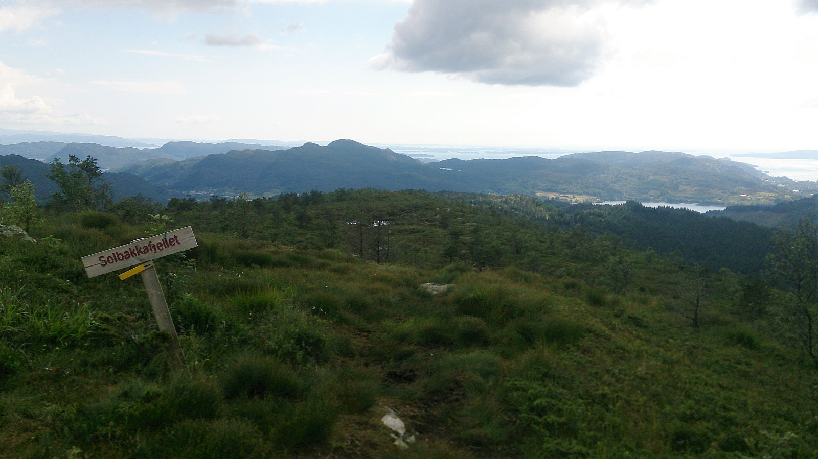 The plan for the day was to take the bus to Hausdal and hike up to Søre Gullfjelltoppen , but it soon became clear that the corresponding bus from Kalandseidet was not showing up or had already left. As an alternative we decided on Solbakkefjellet . We followed one of the marked trails to the summit, and then doubled back to end up at Kaland for the bus back to the city center.
For a longer version of the same hike see Solbakkefjellet from Kalandseidet .
The plan for the day was to take the bus to Hausdal and hike up to Søre Gullfjelltoppen , but it soon became clear that the corresponding bus from Kalandseidet was not showing up or had already left. As an alternative we decided on Solbakkefjellet . We followed one of the marked trails to the summit, and then doubled back to end up at Kaland for the bus back to the city center.
For a longer version of the same hike see Solbakkefjellet from Kalandseidet .
