Archiv - Nach Datum
Archiv - Nach Aktivität
-
Andere Tour (3)
- Kayaking (3)
-
Fahrradtour (108)
- Fahrradtour Straße (83)
- Fahrradtour gemischt (25)
-
Fahrzeugtour (9)
- Autotour (9)
-
Fußtour (1834)
- Bergtour (1087)
- Jogging (1)
- Spaziergang (55)
- Wanderung (691)
-
Skitour (112)
- Langlauf (46)
- Tourenskilauf (66)
Gesammelte Listen
- Utvalgte topper og turmål i Bergen
- Alle topper i Bergen
- Voss ≥ 100m pf.
- Opptur Hordaland
- Stasjoner på Bergensbanen
- Ulvik ≥ 100m pf.
- Hordaland ≥ 100m pf.
- Mjølfjell PF > 100m
- Jondal ≥ 100m pf.
- Sunnhordland PF >= 100m
- Dagsturhyttene i Vestland
- Hordaland: Hardanger PF>=100m
- DNT-hytter i Hordaland
- Kvinnherad ≥ 100m pf.
- Sogndal ≥ 100m pf.
- Vik i Sogn ≥ 100m pf.
- Gulen ≥ 100m pf.
- DNT-hytter i Sogn og Fjordane
- Eidfjord ≥ 100m pf.
- Sogn - Sør for Sognefjorden PF>=100m
Helldalsåsen
- Datum:
- 08.06.2017
- Tourcharakter:
- Bergtour
- Tourlänge:
- 0:49h
- Entfernung:
- 1,7km
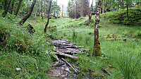
 Started by taking the bus to "Helldal skule" and locating the start of the trail towards Helldalsåsen . The quality of the trail was quite good at the start and I quickly arrived at the small plateau south of the summit, just above the houses at Helldalsneset. Here the trail stopped, and I had to start making my own way towards the summit.
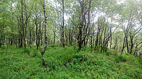
The progress was at first rather slow, as it mainly consisted of going under/over/around trees that were crisscrossing the path, leftovers from both recent and older storms. This cleared up a bit after a while, but increased again when approaching the summit, which was actually the most difficult section to traverse.
The summit provided limited views, but due to the power lines crossing over the summit there was at least a bit of open space. However, the trees >>>
Sveåsen and Lauvåsen from Kalandseidet
- Datum:
- 05.06.2017
- Tourcharakter:
- Bergtour
- Tourlänge:
- 3:37h
- Entfernung:
- 12,0km
 Started by taking the bus to Kalandseidet and walking west along Kismulvegen until Kismulstølen. Here I followed the road south until a crossroads where I took a right and then left, entering a very nice gravel road. At both of these crossroads there were hiking signs towards Tereleitet . I continued south towards Svartavatnet, where the road turned west and then north, and started looking for trails to Sveåsen .
A sign with "Merket sti til Sveåsen" (i.e. "Marked trail to Sveåsen") soon appeared on my left-hand side, and I decided to follow this one. The trail started south on the east side of Sveåsen, before finally turning north and approaching Sveåsen from the south. Note that even though the trail was marked, it was of pretty low quality and very muddy at times, especially the section >>>
Herlandsfjellet and Bjørndalshovden to Storoksla
- Datum:
- 03.06.2017
- Tourcharakter:
- Bergtour
- Tourlänge:
- 5:42h
- Entfernung:
- 17,8km
 From Espeland to Osavatnet
Started by taking the bus to Espelandshallen and walking up Moldamyrane and later Gullfjellsvegen to Osavatnet. The distance was about 5 km and took around one hour, and even though this was merely a requirement to get to the start of the actual hike, it was nicer than expected and can be recommended as an alternative way of getting to Osavatnet if you do not have a car.
Herdalsfjellet
Next, I located the trail towards Herlandsfjellet . It starts close to the northern end of Osavatnet, right behind the red cabin on the left-hand side before arriving at the parking lot. The start of the trail was not marked, and a bit weak at the beginning, but due to the red cabin it is still very easy to locate. According to the map, the trail would only take me up to around 500 meters, but as expected >>>


